|
Sun | Mon | Tue | Wed | Thu | Fri | Sat |
|---|
August | 1 | 2 - Caledon Hills End-to-End & Fall Trail Audit
7:45 AM-3:00 PM 09/02/2025 https://hikes.brucetrail.org/event/caledon-hills-end-to-end-fall-trail-audit/2025-09-02/ 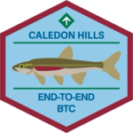 This is a Multi-Day HikeYou are signing up for the following dates:
2025-09-02, 2025-09-03, 2025-09-04 Click here for more information or to register Hosting Club: Caledon Hills
Category: End-to-End
Location (Google Maps): Meet at BTC parking on the east side of the 5th Line EHS, just south of Hockley Road, 43.993572, -80.014057. Directions: From Hwy #10 head east on Hockley Road for 9.4 km. Turn right onto 5 Line E/5th Line EHS. Drive for 90 m. The parking lot is on the left. Shuttle to Mono Community Centre Parking Lot, 44.026195, -80.071516 Hike Leader(s): Sandy Green Click here to contact Hike Leader(s) Pace: Brisk – 4 to 5 km/hour
Terrain: Strenuous – hilly with steep climbs and some poor footing
Distance: 21.5 kilometres Description
Earn the new Redside Dace End-to-End badge in three hikes. This series follows the Club’s Fall Colour’s E2E plan, with a couple of distance modifications. The hikes provide an opportunity to audit and prepare the Trail before the Thanksgiving event. Bring gardening pruners if you have them. Periodically, the group will quickly trim back overgrown vegetation. Pack sufficient water and snacks to boost your energy. Hike 1 – Hike southbound from Mono Community Centre south to km 51.7/Access to Hemlock Ridge ST. Distance: approximately 21.5 km Hike 2 – Hike northbound from km 0.0/Creditview Road to approx km 26/Mountainview Road. Distance: approximately 26 km Hike 3 – Hike northbound from km 26/Mountainview Road to km 51.7/Access to Hemlock Ridge ST. Distance: approximately 26 km Up-to-date details will be provided to participants closer to the dates due to a trail reroute in the Mountainview Road area in the spring.
- Mono Cliffs, Map 19
9:30 AM-2:30 PM 09/02/2025 https://hikes.brucetrail.org/event/mono-cliffs-map-19-2/2025-09-02/ Click here for more information or to register Hosting Club: Caledon Hills
Category: Tuesday Hikers
Location (Google Maps): Mono Community Centre Parking, 200 m south of Mono Centre. Free in the gravel surface lot. do not park on the paved surface.
Driving direction: From Highway 410 go north, continue on Highway 10, pass through Orangeville, continue to Mono Centre Rd. (8), turn right, road will merge with 2nd Line EHS north, parking on the right just before Mono Centre. Hike Leader(s): Mohammad Shafiq Click here to contact Hike Leader(s) Pace: Medium – 3 to 4 km/hour
Terrain: Moderate – some hills and/or some poor footing
Distance: 12 – 13 km Description
Will hike main Bruce Trail, South Outlier, Walter Tovell, McCarston’s Lake and Lookout Side Trails.
Bring water, snack, bug spray and sun protection. Poles recommended.
| 3 | 4 | 5 | 6 |
7 - The Hurricane Hazel Hike
8:30 AM-11:45 AM 09/07/2025 https://hikes.brucetrail.org/event/the-hurricane-hazel-hike/2025-09-07/ Click here for more information or to register Hosting Club: Caledon Hills
Category: General
Location (Google Maps): Meet at the parking lot at Raymore Park, GPS 43.696716, -79.515087. We will car pool from there. Hike Leader(s): Dan Revington Click here to contact Hike Leader(s) Pace: Medium – 3 to 4 km/hour
Terrain: Moderate – some hills and/or some poor footing
Distance: Approximately 8 km Description
Hurricane Hazel, Canada’s “Storm of the Century”, struck in October 1954. The flooding caused widespread destruction and loss of life. Areas along the Humber River were particularly hard hit. We will follow the Humber River Recreational Trail in Weston, and hear how Hurricane Hazel turned the usually placid Humber into a raging torrent that swept away bridges, cars, houses, and people. Bring water and a snack. Sturdy footwear is required. Some sections will be rocky, some in the bush, and some on paved surfaces. No dogs please.
| 8 | 9 - Devils Pulpit; Bruce Trail Map 14
9:30 AM-2:00 PM 09/09/2025 https://hikes.brucetrail.org/event/devils-pulpit-bruce-trail-map-14/2025-09-09/ Click here for more information or to register Hosting Club: Caledon Hills
Category: Tuesday Hikers
Location (Google Maps): Going north on Highway 410 that becomes Highway 10, turn left on King Road (9), right on Mississauga Rd., right on The Grange Sideroad to the intersection with Creditview Road for parking. You may choose a different route depending upon where driving from. Consider carpooling as parking is limited. Hike Leader(s): Mohammad Shafiq Click here to contact Hike Leader(s) Pace: Medium – 3 to 4 km/hour
Terrain: Strenuous – hilly with steep climbs and some poor footing
Distance: 6-7 km Description
Will hike Devils Pulpit and Ring Kiln Side Trails, including a walk around impressive ruins of lime kiln.
Although it’s a relatively short walk, going down Devils Pulpit and climbing up will make for the distance.
Bring hydration drink and snack, poles are strongly recommended.
After hike, optional refreshment stop at nearby Higher Ground cafe in Belfountain.
| 10 | 11 | 12 | 13 - Car Hike: Scotsdale Farm
9:00 AM-2:30 PM 09/13/2025 https://hikes.brucetrail.org/event/car-hike-scotsdale-farm-14/2025-09-13/ Click here for more information or to register Hosting Club: Caledon Hills
Category: General
Location (Google Maps): Scotsdale Farm, Map 13. Directions; from Highway 401, head north on Trafalgar Road past Georgetown. Trafalgar briefly merges with Highway 7 for about 3 km before separating to the right at the village of Silver Creek. At the stop light in Silver Creek, continue north on Trafalgar Road for about 1 km to the entrance of Scotsdale Farm on your right. Drive in about half a kilometre to reach the parking area. Hike Leader(s): Dylan “Lana” Hubbard Click here to contact Hike Leader(s) Pace: Medium – 3 to 4 km/hour
Terrain: Moderate – some hills and/or some poor footing
Distance: 14 km Description
Join us for a loop hike along the main Bruce Trail and its scenic side trails, including the stunning Great Esker Side Trail. Please dress appropriately for the weather, bring plenty of water, and pack some snacks. Note that parts of the trail are rocky, so poles are highly recommended. We are committed to fostering an inclusive and welcoming environment. This hike is an LGBTQ+ safe space, and everyone is encouraged to join us!
|
14 | 15 | 16 | 17 | 18 | 19 | 20 - Challenge Hike: 5th Ln EHS to Mono Community Centre
9:00 AM-3:45 AM 09/20/2025 https://hikes.brucetrail.org/event/car-hike-fifth-line-ehs-to-mono-community-centre/2025-09-20/ Click here for more information or to register Hosting Club: Caledon Hills
Category: General
Location (Google Maps): Hockley Rd. and 5th Line EHS, north of km 51.8 on the east side of 5th Line EHS, just south of the Hockley Rd. (NOT THE MAIN HOCKLEY VALLEY PP PARKING) Hike Leader(s): Dylan Hubbard Click here to contact Hike Leader(s) Pace: Brisk – 4 to 5 km/hour, Fast – 5+ km/hour
Terrain: Strenuous – hilly with steep climbs and some poor footing
Distance: 21 km Description
🚐 Shuttle Required 🚐 Are you looking for a challenge? Training for an end-to-end, or just love a bit of self-inflicted suffering? You’ve come to the right place. To prep for fall and winter hiking season, I’ll be posting more intense hikes—this one will push you. We’ll cover 21 km at a fast pace, starting from 5th Line EHS, through Hockley Valley, and finishing at Mono Community Centre. Expect steep climbs and rolling hills. ⚠️ This is a brutal hike. Please be honest about your abilities—there are no drop-out points. Once we start, you’ll need to keep up. We’ll need drivers to help with shuttling: from Mono CC down to 5th Line EHS, and then back for vehicle pickup. Start time is 9:00 AM SHARP. Unless the forecast is over -50°C, this hike goes—rain or shine. Looking forward to suffering with you. 😈
- Saturday Shorts: Glen Haffy
10:30 AM-12:30 PM 09/20/2025 https://hikes.brucetrail.org/event/saturday-shorts-glen-haffy-5/2025-09-20/  Click here for more information or to register Hosting Club: Caledon Hills
Category: General
Location (Google Maps): Meet at the roadside parking on Coolihans Sideroad, km 35.0 Map 17, near where the Trail crosses the road. This is just west of the intersection of Glen Haffy Road and Coolihans Sideroad (even though the GPS coordinates are showing just to the east). It is best to aim for arriving around 10:15, so we can start hiking as close to 10:30 am as possible. Thanks! Hike Leader(s): Elizabeth Ganong Click here to contact Hike Leader(s) Pace: Leisurely – 3 km/hour or less
Terrain: Moderate – some hills and/or some poor footing
Distance: Approximately 6 km Description
Looking to get out on a Saturday but not give up your whole day? This Glen Haffy hike might be the one for you! We’ll hike the main Bruce Trail and conservation trails to make an approximately 6 km route. The pace will be a relaxed one, so you can enjoy the sights and sounds of fall in the forest. Consider the following in your preparations: a hat, a jacket, insect repellent, sunscreen, hiking boots/shoes, poles. You are encouraged to bring water and a snack as there will be a short break. No dogs please. You can expect a reminder/update message one or two days before the hike.
|
21 | 22 - Heather & Steve’s 3rd Annual Fall Cairn to Cairn – Sydenham section
7:45 AM 09/22/2025 https://hikes.brucetrail.org/event/heather-steves-3rd-annual-fall-cairn-to-cairn-sydenham-section/2025-09-22/  Hike open to BTC Members only. This is a Multi-Day HikeYou are signing up for the following dates and times:
2025-09-22 at 07:45
2025-09-23 at
2025-09-24 at
2025-09-25 at
2025-09-29 at
2025-09-30 at
2025-10-01 at
2025-10-02 at Click here for more information or to register Hosting Club: Caledon Hills, Sydenham
Category: End-to-End
Location (Google Maps): Roadside parking – east of km 148.5 (Map 34) on Graham’s Hill Rd. Hike Leader(s): Heather Murch Click here to contact Hike Leader(s) Pace: Brisk – 4 to 5 km/hour
Terrain: Strenuous – hilly with steep climbs and some poor footing
Distance: 23.2 km Description
We’ve had so much fun completing the Bruce Trail in the Fall of 2023 and again in 2024, that we’ve decided to do it again! This hike series covers the Sydenham section; 168 km over 8 days. Note that hikers have alternative dates if they wish – choose 29 Sept or 7 Oct for Hike #5 and 2nd or 8th Oct for Hike #8. The first options give hikers the week of Oct 6th off. The second options give some rest days for those participating in Sydenham’s official Club E2E. We will meet each morning at 7:45 and be ready to shuttle at 8:00. Hikers will take turns shuttling and taking drivers to their cars each day. Any parking costs will be shared among hikers. Hikers should wear layered clothing, hiking boots, poles, hat, sunscreen, bug spray, rain gear and bring plenty of water, snacks and lunch. We will hike rain or shine. Full itinerary will be emailed to hikers the week before the first hike.
- Caledon Hills Completion Hikes
9:30 AM-12:30 PM 09/22/2025 https://hikes.brucetrail.org/event/caledon-hills-completion-hikes/2025-09-22/ Hike open to BTC Members only. Click here for more information or to register Hosting Club: Caledon Hills
Category: General
Location (Google Maps): Roadside parking on the west side of 2nd Line EHS. Caledon Hills section near Glen Cross/Hockley Valley. Hike Leader(s): Mel Thornley Click here to contact Hike Leader(s) Pace: Medium – 3 to 4 km/hour
Terrain: Moderate – some hills and/or some poor footing
Distance: 9 km Description
Relatively easy hike, some hills and roots, but well worth the drive! We’ll stop for a short lunch. Bring snacks, water, good hiking shoes/boots and poles are always recommended. This will be a car hike, we’ll meet at roadside parking on the west side of 2nd Line EHS and car pool to the beginning of the hike, which is at the east side of the Fifth Line EHS just south of Hockley Road.
- Novice Hikers – Fall Series of 10 Hikes in Dufferin, Hike 1
10:00 AM-1:00 PM 09/22/2025 https://hikes.brucetrail.org/event/novice-hikers-fall-series-of-10-hikes-in-dufferin-hike-1/2025-09-22/ Click here for more information or to register Hosting Club: Caledon Hills
Category: Introductory
Location (Google Maps): Meet at Mono Centre parking, gravel area. Map 19 Hike Leader(s): Nancy Mooney Click here to contact Hike Leader(s) Pace: Leisurely – 3 km/hour or less, Medium – 3 to 4 km/hour
Terrain: Easy – mostly flat and usually good footing, Moderate – some hills and/or some poor footing
Distance: 6.5 km Description
This is the first of a series of 10 hikes for people new to hiking and will be a loop through Mono Cliffs Provincial Park. Hikes will be offered Mondays and Thursdays and we will be earning the Dufferin 60 in 60 badge for completing all ten hikes. You need to register for each hike. Distances will range from 6.5 – 8.5 km. It is encouraged to wear closed-toed comfortable shoes or hiking boots and to bring a hat, sun screen, bug spray, rain poncho, snacks, and water.
| 23 | 24 | 25 | 26  Hockley Valley Loops Hockley Valley Loops 8:30 AM-3:00 PM 09/26/2025 https://hikes.brucetrail.org/event/hockley-valley-loops/2025-09-26/ Click here for more information or to register Hosting Club: Iroquoia, Caledon Hills
Category: General Hike
Location (Google Maps): Parking lot on east side of 3rd line EHS, with access to Glen Cross Side Trail Hike Leader(s): Pati Greenwood, Jeff Dowsett Click here to contact Hike Leader(s) Pace: Medium – 3 to 4 km/hr
Terrain: Strenuous – Hilly with steep climbs and some poor footing
Distance: 14 km Description
We will hike a loop including the main trail and BT side trails in the Hockley Valley. Footing will be mostly good but there will be a number of steep hills to climb and descend. Bring a snack and plenty of water. Insect repellent is recommended. Wear sturdy footwear and clothing appropriate to conditions. Please arrive by 8:15 am as we will leave promptly at 8:30AM.
| 27 |
28 | 29 - Novice Hikers – Fall Series of 10 hikes in Dufferin, Hike 3
10:00 AM-1:30 PM 09/29/2025 https://hikes.brucetrail.org/event/novice-hikers-fall-series-of-10-hikes-in-dufferin-hike-3/2025-09-29/ Click here for more information or to register Hosting Club: Caledon Hills
Category: Introductory
Location (Google Maps): Meet at km 28.3, BTC parking area on 1st Line E. Map 20 Hike Leader(s): Nancy Mooney Click here to contact Hike Leader(s) Pace: Leisurely – 3 km/hour or less, Medium – 3 to 4 km/hour
Terrain: Easy – mostly flat and usually good footing, Moderate – some hills and/or some poor footing
Distance: 6.4 km shuttle hike Description
This is the third hike in the 10 hike series and takes us through a pine plantation, along the road to Whitfield and a lengthy descent to Kilgorie.
| 30 - The National Day for Truth and Reconciliation, Orange Shirt Day
9:00 AM-11:00 AM 09/30/2025 https://hikes.brucetrail.org/event/the-national-day-for-truth-and-reconciliation-orange-shirt-day/2025-09-30/ Click here for more information or to register Hosting Club: Caledon Hills
Category: General
Location (Google Maps): Albion Hills Conservation Park. Meet up at Chalet parking lot, follow clear signage ~5minutes from gatehouse entry. Hike Leader(s): GG Click here to contact Hike Leader(s) Pace: Medium – 3 to 4 km/hour
Terrain: Moderate – some hills and/or some poor footing
Distance: 8km Description
Orange Shirt Day is a time for reflection, learning, and remembrance. It invites Canadians to confront the legacy of residential schools and engage in meaningful conversations about reconciliation. Let’s join together for a hike as we share and learn from each other about reconciliation. I’ll share what I have learned on my journey of learning while we explore the medicine garden, community gardens and a depending on team interest a visit to a Caledon historical site. There will be a raffle of a book by one of my favourite Indigenous authors at the end of the formal hike 🙂 A park pass can be obtained on site or through https://trca.ca/parks/albion-hills-conservation-area/?utm_medium=organic&utm_source=GMBlisting&utm_campaign=AlbionHills#albfees We will meet at 9AM at Chalet parking lot. Please be on time. There are restrooms at the chalet and throughout the park, and we will decide as a team our path to the medicine garden and back. Please wear your orange shirt if you have one, and if you don’t and wish to get one: https://orangeshirtday.org/merchandise/ and/or local vendors including Mark’s warehouse/Cdn Tire.
  Dufferin Hi-Land Club Stained Glass Badge in series of 6 hikes Dufferin Hi-Land Club Stained Glass Badge in series of 6 hikes 10:00 AM-2:30 PM 09/30/2025 https://hikes.brucetrail.org/event/dufferin-hi-land-club-stained-glass-badge-in-series-of-5-hikes/2025-09-30/ Hike open to BTC Members only. This is a Multi-Day HikeYou are signing up for the following dates:
2025-09-30, 2025-10-07, 2025-10-14, 2025-10-21, 2025-10-28, 2025-11-04 Click here for more information or to register Hosting Club: Toronto, Caledon Hills
Category: Car Hike
Location (Google Maps): First of this series will be starting at Lavender Cemetery parking area. Km 54.9 . 550m east of Lavender Hill Rd. Mulmur-Nottawasaga Town line. Parking on north side of the road. Hike Leader(s): Lynn McFerran Click here to contact Hike Leader(s) Pace: Moderate (3-4 km/hr)
Terrain: Level 2 (Intermediate – some hills and uneven surfaces, rocks and roots underfoot), Variable
Distance: 8-11km each hike Description
The fall is a lovely time to hike this section. The trees will be turning colour and there will be fungi and mushrooms along the trail. The plan is to get this series of hikes completed before the snow flies. There will be 6 hikes all on consecutive Tuesdays starting September 30 , through October, finishing November 4th. All hikes are less than 10km.
This is a slow to moderate paced hike series. There is some challenging terrain and road work too. The hikes with be completed north to south where best suited for the hikers. There will be a car shuffle each week.
The location of the meeting place for the first hike is listed here. The following hike meeting points will be emailed to all registered hikers.
Please come prepared for any kind of weather. Bring water lunch and snacks.
| October | October | October | October |