|
Sun | Mon | Tue | Wed | Thu | Fri | Sat |
|---|
September | September | September | 1 | 2 | 3 | 4 |
5 - Forest Bathing Opportunity, with a dash of history!
9:00 AM-11:30 AM 10/05/2025 https://hikes.brucetrail.org/event/forest-bathing-opportunity-with-a-dash-of-history/2025-10-05/ Click here for more information or to register Hosting Club: Caledon Hills
Category: Nature Walks
Location (Google Maps): This loop hike departs from Riverside Woods, 713377 First Line, EHS, Mono. (BTC Ref Guide Map 18). From Highway 10, take Hockley Valley Rd. east. Turn right on to the 5 Side Road, go past the Fairground, and then left or north on the First Line to the parking lot. (Do NOT attempt to drive south on the First Line directly from the Hockley Valley Rd. – it is not safely passable.) Hike Leader(s): Janice McClelland Click here to contact Hike Leader(s) Pace: Leisurely – 3 km/hour or less
Terrain: Moderate – some hills and/or some poor footing
Distance: 4.2 km Description
This Forest Bathing hike is part of Bruce Trail Day activities, organized by the Caledon Hills Bruce Trail Club. We will be the first hike of the day, as we quietly head into the forest to absorb the sights & sounds of nature. Hike leader will share info on forest bathing and also some local history.
| 6 | 7 - North of Limehouse – new trails
9:30 AM-2:00 AM 10/07/2025 https://hikes.brucetrail.org/event/north-of-limehouse-new-trails/2025-10-07/ Click here for more information or to register Hosting Club: Caledon Hills
Category: Tuesday Hikers
Location (Google Maps): Meet at roadside parking on Fourth Line Map 12, km 17.4. From Trafalgar Rd. near Stewarttown drive west on 15 Sideroad for 5 km then turn right on Fourth Line. Drive north 3 km to roadside parking where the Main Trail crosses the road. Hike Leader(s): Peter Leeney Click here to contact Hike Leader(s) Pace: Medium – 3 to 4 km/hour
Terrain: Easy – mostly flat and usually good footing
Distance: 11 km Description
We will do a short car shuttle to roadside parking on Fifth Line at the new Beeney Creek Side Trail then hike back on new Main and side trails north of Limehouse and then through Hole-in-the Wall back to Fourth Line.
| 8 | 9 - Novice Hikers – Fall Series of 10 Hikes in Dufferin, Hike 6
10:00 AM-1:30 PM 10/09/2025 https://hikes.brucetrail.org/event/novice-hikers-fall-series-of-10-hikes-in-dufferin-hike-6/2025-10-09/ Click here for more information or to register Hosting Club: Caledon Hills
Category: Introductory
Location (Google Maps): Meet at BTC Parking Area northeast of km 8.9 off of 2nd Line EHS at the beginning of the Splitrock Trail. Map 19 Hike Leader(s): Nancy Mooney Click here to contact Hike Leader(s) Pace: Leisurely – 3 km/hour or less, Medium – 3 to 4 km/hour
Terrain: Easy – mostly flat and usually good footing, Moderate – some hills and/or some poor footing
Distance: 7.5 km loop Description
This is the sixth hike in the Dufferin fall series and will explore Splitrock Narrows crevice and McCarston’s Lake.
| 10 | 11  Fall Colours Three-day Club End-to-End Fall Colours Three-day Club End-to-End 8:00 AM-4:00 PM 10/11/2025 https://hikes.brucetrail.org/event/fall-colours-three-day-club-end-to-end/2025-10-11/  This is a Multi-Day HikeYou are signing up for the following dates:
2025-10-11, 2025-10-12, 2025-10-13 Click here for more information or to register Hosting Club: Caledon Hills
Category: End-to-End
Location (Google Maps): On Saturday, meet at the Fung Loy Kok Taoist Tai Chi-International Centre
248305 Side Road 5, Mono, ON L9W 6C3, 43.975421, -79.989252.
From Airport Road, turn east onto Side Road 5. Drive 270 metres to the entrance of the International Centre on the left. Enter the driveway and head straight for approximately 50 metres. Parking is in a field on the right.
Note: The buildings and facilities of the International Centre are off-limits to participants during this Bruce Trail event. Hike Leader(s): Sandy Green Click here to contact Hike Leader(s) Pace: Brisk – 4 to 5 km/hour
Terrain: Strenuous – hilly with steep climbs and some poor footing
Distance: 27.0 kilometres Description
Experience the spectacular fall colours while completing the 72.4 kilometres of the Caledon Hills section of Trail over the Thanksgiving long weekend. Bus shuttles for the three days and a beautiful finisher’s commemorative badge are included in the registration fee. Refreshments and beverages will be served at checkpoints every 7 – 11 kilometres. Participants are expected to hike at a minimum pace of 4 km/hr. Description: The buses leave at 8:00 a.m. sharp, each day. Please plan to arrive at least 20 – 30 minutes before the departure time. On Saturday, meet at the Fung Loy Kok Taoist Tai Chi-International Centre, 248305 Side Road 5, Mono, ON L9W 6C3, 43.975421, -79.989252. From Airport Road, turn east onto Side Road 5. Drive 270 metres to the entrance of the International Centre on the left. Enter the driveway and head straight for approximately 50 metres. Parking is in a field on the right. The bus will take participants to the northern end of the Caledon Hills section, at County Rd. 8. The group will then hike southbound, back to the International Centre. Checkpoints are located 11.3 km, 18.2 km (Cut-off Time: 1:30 pm), and 26.9 km into the hike. On Sunday, meet at km 20.8, the north/east corner of Escarpment Side Road and Heart Lake Road. Park on the north side of Escarpment Side Road, well off of the road, 43.859911, -79.947606. The bus will take hikers to km 0.0 on Creditview Road. Participants will then hike northbound back to the meeting place on Escarpment Side Road. Checkpoints are located 9.5 km (Cut-off Time: 11:15 am) and 20.8 km into the hike. On Monday, meet at the Fung Loy Kok Taoist Tai Chi-International Centre. The bus will take participants to Escarpment Side Road and Heart Lake Road. Everyone will then hike northbound back to the International Centre. Checkpoints are located 10.7 km, 18.4 km (Cut-off Time: 1:30 pm), and 25.1 km into the hike. For further details visit caledonbrucetrail.ca.
|
12 | 13 | 14 - Caledon Hills Fundraising E2E in 8 Hikes
9:00 AM-1:30 AM 10/14/2025 https://hikes.brucetrail.org/event/caledon-hills-fundraising-e2e-in-8-hikes/2025-10-14/ 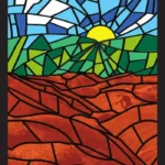 Hike open to BTC Members only. This is a Multi-Day HikeYou are signing up for the following dates and times:
2025-10-14 at 09:00
2025-10-15 at 09:00
2025-10-16 at 09:00
2025-10-17 at 09:00
2025-10-21 at 09:00
2025-10-22 at 09:00
2025-10-23 at 09:00
2025-10-24 at 09:00 Click here for more information or to register Hosting Club: Caledon Hills
Category: End-to-End
Location (Google Maps): For the first hike, meet at the Hockley Road Parking Area, east of km 61.1. Please aim to arrive for 9 am, so we can begin shuttling north to the Mono Community Centre parking lot at 9:15 am. Hikers will be notified by email about the remaining seven hikes. Hike Leader(s): Elizabeth Ganong Click here to contact Hike Leader(s) Pace: Leisurely – 3 km/hour or less, Medium – 3 to 4 km/hour
Terrain: Moderate – some hills and/or some poor footing
Distance: Approximately 11.3 km Description
This series of hikes starts at the north end of the Caledon section and heads south. By dividing the section into eight hikes, the average hike is about 10 km, but of course the distance varies due to available parking. The intent of this offering is to provide an opportunity for hikers to attain the beautiful stained glass end-to-end badge and to enjoy their time out on the Trail at a more relaxed pace. An added bonus is that funds are raised to support the BTC! By registering, you are signing up for eight hikes on the following dates: Oct 14, Oct 15, Oct 16, Oct 17, Oct 21, Oct 22, Oct 23, and Oct 24 To qualify for the badge, you need to complete all eight hikes with our group. If you miss a hike, you can make it up on your own by the end of Oct 2025 and still qualify. When making individual requests, keep in mind that everyone supporting you on your hiking journey is a volunteer. Please be prepared to help with shuttling hikers at the beginning and at the end of each hike. Thanks in advance to Jennie for taking on the role of sweep for this series. Consider the following in your preparations: sunscreen, a hat, a jacket, insect repellent, hiking boots/shoes, poles, water, and a lunch/snack. No dogs please. For the first hike, we will meet at the Hockley Road Parking Area, east of km 61.1. Then, we will shuttle north to the Mono Community Centre parking lot and hike south. Hikers will receive information about upcoming hikes through emails.
- Fall Colours in Beaver Valley
10:00 AM-3:00 PM 10/14/2025 https://hikes.brucetrail.org/event/fall-colours-in-beaver-valley/2025-10-14/  Click here for more information or to register Hosting Club: Caledon Hills
Category: Tuesday Hikers
Location (Google Maps): Beaver Valley Lookout: on the west side of Grey Rd. 13 Hike Leader(s): Barbara Euler Click here to contact Hike Leader(s) Pace: Medium – 3 to 4 km/hour
Terrain: Moderate – some hills and/or some poor footing
Distance: 12 km Description
The Beaver Valley Bruce Trail Club has completed a major reroute of the main Bruce Trail onto the newly secured Eagle’s Summit Nature Reserve and created a new East Mountain Side Trail to make a beautiful loop with the main Trail. They have also created a network of side trails on the property to showcase its many features and to provide direct access to the parking area. We will combine the main loop with another at Old Baldy.
Most of the trail is along the top of the escarpment with great views.
A leisurely hike to enjoy fantastic views of the fall colours at their peak. Bring your cameras, a mid-morning snack, a packed lunch and lots of water.
| 15 | 16 - Novice Hikers – Fall Series of 10 Hikes in Dufferin, Hike 7
10:00 AM-1:30 PM 10/16/2025 https://hikes.brucetrail.org/event/novice-hikers-fall-series-of-10-hikes-in-dufferin-hike-7/2025-10-16/ Click here for more information or to register Hosting Club: Caledon Hills
Category: Introductory
Location (Google Maps): Meet at roadside parking, km 2.2 on 2nd Line EHS north of 20 Sideroad. Do Not Block Entrances. Map 19 Hike Leader(s): Nancy Mooney Click here to contact Hike Leader(s) Pace: Leisurely – 3 km/hour or less, Medium – 3 to 4 km/hour
Terrain: Easy – mostly flat and usually good footing, Moderate – some hills and/or some poor footing
Distance: 7.2 km loop Description
On our seventh hike in the fall Dufferin series we go back to Mono Cliffs Provincial Park and explore some side trails.
| 17 | 18 -
 Caledon Stained Glass E2E in 4 (2 weekends) Caledon Stained Glass E2E in 4 (2 weekends) 8:30 AM-2:30 AM 10/18/2025 https://hikes.brucetrail.org/event/caledon-stained-glass-e2e-in-4-2-weekends/2025-10-18/  This is a Multi-Day HikeYou are signing up for the following dates:
2025-10-18, 2025-10-19, 2025-10-25, 2025-10-26 Click here for more information or to register Hosting Club: Iroquoia, Caledon Hills
Category: Stained Glass Badge End to End Fundraiser Hike
Location (Google Maps): Various, going from south to north, to be shared either at earlier of hike being full, October 12, or upon request. Hike Leader(s): Freddy Wang Click here to contact Hike Leader(s) Pace: Brisk – 4 to 5 km/hr
Terrain: Strenuous – Hilly with steep climbs and some poor footing
Distance: 18-20 km per day Description
This is a special series of 4 hikes to complete the Caledon Hills section of the Bruce Trail over two weekends. There is an accomplishment badge included in the registration fee – which was designed by Joe Borges. It depicts the Cheltenham Badlands, which we will visit on the hike. The fee goes towards supporting the Caledon Hills Bruce Trail Club, which in turn supports the mission of the Bruce Trail Conservancy, which is: “Preserving a ribbon of wilderness, for everyone, forever.” For this E2E in 4, we will be following the main trail northbound starting near Cheltenham Badlands and finishing in Mono. Please note that you are signing up for the entire series of four hikes as a Group Hike. This series is geared to experienced hikers with the expectation of a 4.0 to 5.0 km/hr pace maintained over the hike distances below. This hike is intended to be at a Brisk pace and through some hilly sections. Please be honest about your degree of physical fitness prior to registration. It is a group hike so it is important you are able to keep pace with the person in front of you. Hikers will be expected to wear proper hiking footwear and layered clothing. Sufficient snacks, water, and hiking poles are recommended. There will be a brief lunch break each day. This series will require car shuttling, so you must be willing to drive and be a passenger. A maximum of 1 of the 4 hikes can be self-completed as a result of scheduling challenges. You must still complete the distance you have missed. If you miss more than one but still complete the distances on your own, you may apply for the Caledon Hills Club’s regular End to End badge. Please note there are no refunds.
- Forest Gathering for Heather
10:00 AM-1:00 PM 10/18/2025 https://hikes.brucetrail.org/event/forest-gathering-for-heather/2025-10-18/  Click here for more information or to register Hosting Club: Caledon Hills
Category: General
Location (Google Maps): Meet at 933445 Airport Road.
Hockleycrest Farm is 4.4 km north of Mono Mills. Hike Leader(s): Sandra Green Click here to contact Hike Leader(s) Pace: Leisurely – 3 km/hour or less
Terrain: Moderate – some hills and/or some poor footing
Distance: 4.0 kilometres Description
You are invited to gather in nature to honour the beautiful life of our friend Heather Murch, dedicated Caledon Hills Trail Maintenance Director, Trail Captain, Hike Leader, “Lover of Nature and All.”
|
19 - Car Hike: Boyne Valley Provincial Park!
8:30 AM-2:30 PM 10/19/2025 https://hikes.brucetrail.org/event/car-hike-boyne-valley-provincial-park-5/2025-10-19/ Click here for more information or to register Hosting Club: Caledon Hills
Category: General
Location (Google Maps): Boyne Valley Provincial Park, Map 20 of the BTC Trail Guide. County Rd. 19 (Prince of Wales Rd.) Parking Area – west of km 15.2 – approximately 80 metres south of the Prince of Wales Side Trail. Hike Leader(s): Dylan “Lana” Hubbard Click here to contact Hike Leader(s) Pace: Brisk – 4 to 5 km/hour
Terrain: Strenuous – hilly with steep climbs and some poor footing
Distance: 15-17 km Description
Join us for an invigorating hike starting from the parking lot on Prince of Wales Rd. We’ll explore the Prince of Wales Side Trail, Primrose Loop Side Trail, main trail, and Boyne Valley Side Trail, looping back via the main trail and Prince of Wales Side Trail. Along the way, we’ll hike up the short side trail to Murphy’s Pinnacle, where you’ll be rewarded with a stunning view of the surrounding landscape – great for Instagram! Bring lunch, plenty of water, and hiking poles if you use them, as the trail is hilly. Dress for the weather. PACE IS BRISK This hike is a 2SLGBTQIA+ friendly space. Everyone is welcome to join us for this adventure and enjoy the beauty of the trails together.
| 20 - Novice Hikers – Fall Series of 10 Hikes in Dufferin, Hike 8
10:00 AM-2:00 PM 10/20/2025 https://hikes.brucetrail.org/event/novice-hikers-fall-series-of-10-hikes-in-dufferin-hike-9/2025-10-20/ Click here for more information or to register Hosting Club: Caledon Hills
Category: Introductory
Location (Google Maps): Meet at km 17.6 roadside parking on Centre Road, south of 5 Sideroad. Map 20 Hike Leader(s): Nancy Mooney Click here to contact Hike Leader(s) Pace: Leisurely – 3 km/hour or less, Medium – 3 to 4 km/hour
Terrain: Easy – mostly flat and usually good footing, Moderate – some hills and/or some poor footing
Distance: 8.5 km loop Description
This is the ninth hike of our Dufferin fall series and is the longest one which has us hiking around Boyne Valley Provincial Park.
| 21 | 22 | 23 | 24 | 25 - Film Fundraiser Fun Hike
10:00 AM-11:30 AM 10/25/2025 https://hikes.brucetrail.org/event/film-fundraiser-fun-hike/2025-10-25/ Click here for more information or to register Hosting Club: Caledon Hills
Category: General
Location (Google Maps): Meet at Parking Lot just behind Guelph Fire Station, at Riverside Park.
74 Speedvale Ave. E.,
Guelph, Ontario Hike Leader(s): Ralph Shapiro Click here to contact Hike Leader(s) Pace: Medium – 3 to 4 km/hour
Terrain: Easy – mostly flat and usually good footing
Distance: 5-6 kilometers Description
Picturesque hike along the Speed River through Riverside Park toward Guelph Lake and back.
|
26 - Car Hike: Scotsdale Farm
9:00 AM-2:30 PM 10/26/2025 https://hikes.brucetrail.org/event/car-hike-scotsdale-farm-16/2025-10-26/ Click here for more information or to register Hosting Club: Caledon Hills
Category: General
Location (Google Maps): Scotsdale Farm, Map 13. Directions; from Highway 401, head north on Trafalgar Road past Georgetown. Trafalgar briefly merges with Highway 7 for about 3 km before separating to the right at the village of Silver Creek. At the stop light in Silver Creek, continue north on Trafalgar Road for about 1 km to the entrance of Scotsdale Farm on your right. Drive in about half a kilometre to reach the parking area. Hike Leader(s): Dylan “Lana” Hubbard Click here to contact Hike Leader(s) Pace: Medium – 3 to 4 km/hour
Terrain: Moderate – some hills and/or some poor footing
Distance: 14 km Description
Join us for a loop hike along the main Bruce Trail and its scenic side trails, including the stunning Great Esker Side Trail. Please dress appropriately for the weather, bring plenty of water, and pack some snacks. Note that parts of the trail are rocky, so poles are highly recommended. We are committed to fostering an inclusive and welcoming environment. This hike is an LGBTQ+ safe space, and everyone is encouraged to join us!
 10:00 Witch of Cave Spring Hike 10:00 Witch of Cave Spring Hike 10:00 AM-12:30 PM 10/26/2025 https://hikes.brucetrail.org/event/1000-witch-of-cave-spring-hike/2025-10-26/  Click here for more information or to register Hosting Club: Niagara, Caledon Hills
Category: In and Out
Location (Google Maps): Parking lot Quarry Road Beamsville Hike Leader(s): Angela Lytle Click here to contact Hike Leader(s) Pace: Medium
Terrain: Moderate
Distance: 5 km Description
Enjoy a beautiful hike through the autumn woods and learn about local historical and mystical lore while searching for the Witch of Cave Spring. Complete this guided hike and count it towards the Screaming Tunnel Badge, more info on the badge requirements is here: https://niagarabrucetrail.club/badges/ Wearing a witch hat, while not required, is highly recommended! Details: This hike loops from Quarry Rd in Beamsville (limited parking, carpool if possible) along the Bruce Trail to Cave Spring Conservation area and back. Note: The path to Cave Spring runs along the escarpment edge and is quite rocky and has some hills. We can adjust the pace but be prepared for some rocky, uneven footing and clambering up and down. We recommend using hiking poles and wearing good hiking shoes is a must. Carry water and dress for changeable weather. We will stop along the way at sites of interest and loop back to the car park on Quarry Rd. The loop is around 5 km. Please arrive by 9:50 to check in with the hike leader for departure at 10.
| 27 - Walk and Talk Rocks: Mono Cliffs
9:30 AM-2:00 PM 10/27/2025 https://hikes.brucetrail.org/event/walk-and-talk-rocks-mono-cliffs-3/2025-10-27/  Click here for more information or to register Hosting Club: Caledon Hills
Category: General
Location (Google Maps): Meet at the parking lot at Mono Community Centre. The centre is located at 754483 Mono Centre Rd. Please park in the gravel surface lot. Please aim to arrive at 9:15 am, so we can begin the hike at 9:30 am. Hike Leader(s): Elizabeth Ganong Click here to contact Hike Leader(s) Pace: Leisurely – 3 km/hour or less, Medium – 3 to 4 km/hour
Terrain: Moderate – some hills and/or some poor footing
Distance: Approximately 9.5 km Description
Let’s rock it out and explore the geology of Mono Cliffs. We’ll hike mainly at a leisurely pace over the approximately 9.5 km route as we cover many of the highlights of Mono Cliffs Provincial Park. Dr. Kathy Wallace will provide an introductory-level look at the geology of the park that welcomes your curiosity. Plan on a lunch break at a spectacular look-out, a total time out around four or four and a half hours, and having your way of engaging with the trail expanded. This interactive hike was created for a small group. Things to consider as you prepare for the hike: sunscreen, a hat, insect repellent, hiking shoes/boots, poles, water, snack/lunch. No dogs please.
- Novice Hikers – Fall Series of 10 Hikes in Dufferin, Hike 10
10:00 AM-1:30 PM 10/27/2025 https://hikes.brucetrail.org/event/novice-hikers-fall-series-of-10-hikes-in-dufferin-hike-10/2025-10-27/ Click here for more information or to register Hosting Club: Caledon Hills
Category: Introductory
Location (Google Maps): Meet at BTC parking area at km 53.1 on the south side of 30 Sideroad 100 m east of the Bruce Trail. Map 21 Hike Leader(s): Nancy Mooney Click here to contact Hike Leader(s) Pace: Leisurely – 3 km/hour or less, Medium – 3 to 4 km/hour
Terrain: Easy – mostly flat and usually good footing, Moderate – some hills and/or some poor footing
Distance: 6.4 km shuttle Description
A leisurely last hike to enjoy the fall colours and a snack after!
| 28 - Heather & Steve’s 3rd Annual Fall Cairn to Cairn – Blue Mountains section
7:45 AM 10/28/2025 https://hikes.brucetrail.org/event/heather-steves-3rd-annual-fall-cairn-to-cairn-blue-mountains-section/2025-10-28/  Hike open to BTC Members only. This is a Multi-Day HikeYou are signing up for the following dates and times:
2025-10-28 at 07:45
2025-10-29 at
2025-10-30 at Click here for more information or to register Hosting Club: Caledon Hills, Blue Mountains
Category: End-to-End
Location (Google Maps): Parking area – north of km 46.8 (Map 23), found 380 m north of the main trail crossing on Pretty River Rd. (Capacity 15 cars) Hike Leader(s): Heather Murch Click here to contact Hike Leader(s) Pace: Brisk – 4 to 5 km/hour
Terrain: Strenuous – hilly with steep climbs and some poor footing
Distance: 25.4 km Description
This hike series covers the Blue Mountains section; 69 km over 3 days. We will meet each morning at 7:45 and be ready to shuttle at 8:00. Hikers will take turns shuttling and taking drivers to their cars each day. Any parking costs will be shared among hikers. Hikers should wear layered clothing, hiking boots, poles, hat, sunscreen, bug spray, rain gear and bring plenty of water, snacks and lunch. We will hike rain or shine. Full itinerary will be emailed to hikers the week before the first hike.
- Halton Regional Forest
9:30 AM-2:30 PM 10/28/2025 https://hikes.brucetrail.org/event/halton-regional-forest-2/2025-10-28/ Click here for more information or to register Hosting Club: Caledon Hills
Category: Tuesday Hikers
Location (Google Maps): Parking at:10 Side Road and 4th Line Nassagaweya (trail entrance to Halton Regional Forest).
From Highway 401 West, turn right (north) on Guelph Line, right on 10 Side Rd. The road bends northwards and becomes 4th Line Nassagaweya; roadside parking at the bend. Hike Leader(s): Mohammad Shafiq Click here to contact Hike Leader(s) Pace: Medium – 3 to 4 km/hour
Terrain: Moderate – some hills and/or some poor footing
Distance: 12 km Description
Will hike trails in Halton Regional Forest and Hilton Falls Conservation Area; beautiful trails are relatively flat with some rocky parts. Snack break at Hilton Falls, possibly around fire pit.
Bring water and snack. Poles are recommended.
Hike leader cell phone: 416-566-0503 (note that reception in hiking area is usually poor, leave a message for a return call).
| 29 | 30 | 31  Caledon in 5 End-to-End Hike Series – Hike #1 Caledon in 5 End-to-End Hike Series – Hike #1 8:30 AM-2:30 PM 10/31/2025 https://hikes.brucetrail.org/event/caledon-in-5-end-to-end-hike-series-hike-1/2025-10-31/ Click here for more information or to register Hosting Club: Iroquoia, Caledon Hills
Category: General Hike
Location (Google Maps): Meeting Place: Roadside Parking – shoulder of Willoughby Road and Escarpment Sideroad Hike Leader(s): Pati Greenwood, Jeff Dowsett Click here to contact Hike Leader(s) Pace: Medium – 3 to 4 km/hr
Terrain: Dependent on Conditions, Moderate – Some hills and/or some poor footing
Distance: 16 km Description
This is an end-to-end hiking series to complete the Caledon section of the Bruce Trail in 5 hikes. The hikes will be undertaken at a medium pace of approximately 4 km/hour for approximately 15 kms each hike. Please consider your fitness level before registering; this is a group hike, and everyone is expected to keep pace with the person in front of them for the duration of the hike. The weather can be changeable at this time of year, so dress in layers for any possibility. There here are many steep and hilly segments in this section of the Bruce Trail so the hikes will require considerable stamina. Wear hiking boots and bring hiking poles. Bring a snack, plenty of water and other hydration as needed. We will be travelling from south to north over the course of the End-to-End. The series will require car shuffles, and everyone will be expected to participate as drivers. Today’s hike, the first of the series, is 16 km in length. Please plan to arrive at the meeting place by 8:15 am as we will start the car shuffle at 8:30 am sharp. Further details will be provided to registered hikers a few days prior to the hike.
| November |