|
Sun | Mon | Tue | Wed | Thu | Fri | Sat |
|---|
July | July | July | July | 1 | 2 | 3 - Hockley Valley Challenge
8:30 AM-2:30 PM 08/03/2024 https://hikes.brucetrail.org/event/hockley-valley-challenge/2024-08-03/ Click here for more information or to register Hosting Club: Caledon Hills
Category: General
Location (Google Maps): Hockley Valley Nature Preserve, Map 18. To reach the meeting point, drive north on Hwy 10 from Orangeville and turn right onto Hockley Road. Continue approximately 5 km east until you see the parking area on your left, directly across the road from the Black Birch restaurant. Hike Leader(s): Dylan “Lana” Hubbard Click here to contact Hike Leader(s) Pace: Brisk – 4 to 5 km/hour
Terrain: Strenuous – hilly with steep climbs and some poor footing
Distance: 18 km Description
Ready for a serious workout and some scenic sweat? Join us at Hockley Valley, one of the hilliest sections of the Bruce Trail and the crown jewel of the Caledon Hills BTC. This hike will be at a brisk pace, so please honestly assess your hiking abilities, this one is a killer. Come prepared with at least two liters of water, snacks, lunch, bug spray, sunscreen, electrolytes, and hiking poles if you use them. Wear appropriate clothing and footwear, and beware of the tick population this year – they’re having a boom! I highly recommend dressing like a fashionable mummy with a light long-sleeve shirt and pants. This is also a loop hike – no shuttling required! Please note that this is a 2SLGBTQIA+ friendly hike. Everyone is welcome. And after we’ve conquered the hills, feel free to join me at the Black Birch restaurant for some well-deserved refreshments!
|
4 | 5 - Toronto E2E (shuttle)
8:30 AM-1:30 PM 08/05/2024 https://hikes.brucetrail.org/event/toronto-e2e-shuttle/2024-08-05/ This is a Multi-Day HikeYou are signing up for the following dates and times:
2024-08-05 at 08:30
2024-08-12 at 08:30
2024-08-19 at 08:30 Click here for more information or to register Hosting Club: Toronto, Caledon Hills
Category: End-to-End
Location (Google Maps): Meet at Fourth Line (where the trail crosses) (Bruce Trail Ref. Guide km 17.4)
Shuttle to Hilton Falls (paid parking) Hike Leader(s): Heather Murch Click here to contact Hike Leader(s) Pace: Brisk – 4 to 5 km/hour
Terrain: Moderate – some hills and/or some poor footing
Distance: 17.6 km Description
You are signing up for 3 hikes. Please arrive at the meeting point ready to shuttle by 8:30. We will shuttle south and hike north. Everyone will need to shuttle; have your vehicle ready to take 4 people if possible. Come prepared for… Hiking! You must wear hiking shoes/boots. Consider bringing hiking poles for uneven terrain. Heat: At least 2L of water; a sun hat. Rain: A raincoat/poncho and a love of the outdoors, no matter the weather. Bugs: Bug spray or a bug hat/shirt. Poison Ivy: Long sleeves; long pants. An appetite: Bring a snack; we’ll take a short break along the way. Although I have hiked the full Bruce Trail a few times, this is my first official hike series as a leader, so, Welcome! 🙂 5 Aug. 17.6 km Meet at Fourth Line (where the trail crosses) (guide 17.4)
43.615163, -79.975157 Shuttle to Hilton Falls (paid parking)
43.505705, -79.961589 12 Aug. 16.9 km
Meet at
8th Line & 27 Sideroad (Guide approx. km 34.3)
43.686276, -79.975578 Shuttle to:
Fourth Line (where the trail crosses)
43.615163, -79.975157 19 Aug (total 16 km)
1. 2.5 km
Meet at:
Boston Mills Road (Guide 48 km)
43.750866, -79.951452 Modified shuttle to Creditview Road
43.767739, -79.942929 2. 13.5 km Shuttle to:
8th Line & 27 Sideroad (Guide approx. km 34.3)
43.686276, -79.975578
| 6 - Founders’ Footpath Finalist “A”
9:30 AM-1:00 PM 08/06/2024 https://hikes.brucetrail.org/event/founders-footpath-finalist-a/2024-08-06/  Click here for more information or to register Hosting Club: Caledon Hills
Category: General
Location (Google Maps): Park at BTC 7th Line Parking Lot located 200 metres from km 43.3 off the 7th Line immediately east of Airport Road, 43.960477, -79.979773. Driving Directions:
From Airport Road/Peel Regional Road 7, turn east onto 7 Line E/7th Line EHS. Parking is on the right side. (North of Mono Mills) Hike Leader(s): Sandy Green Click here to contact Hike Leader(s) Pace: Medium – 3 to 4 km/hour
Terrain: Moderate – some hills and/or some poor footing
Distance: 10 kilometres Description
HIKE CANCELLED DUE TO HEAVY RAIN IN THE FORECAST. The Founders’ Footpath is a Bruce Trail Conservancy initiative to mark the upcoming 60th Anniversary of the founding of the Bruce Trail. Help the CHBTC select a section of the trail that best exemplifies the founders’ intentions. Explore Finalist A: Main Trail km 42.5 – 47.5 and Darcy’s Side Trail 0.5 km; south of 7th Line to north of 5 Sideroad; BTC Protected Areas: Humber Heights, Twin Waters Nature Reserve, Mathilda’s Way, Dr. Philip Gosling Nature Reserve, Tall Timbers, Scarlett, and Moule Easement. Bring snacks and your choice of hydration. Sturdy footwear is highly recommended. This hike can be logged towards earning the 60 for the 60th Anniversary badge.
| 7 | 8 - Caledon Hills End-to-End Hike 5 of 6
9:15 AM-2:00 PM 08/08/2024 https://hikes.brucetrail.org/event/caledon-hills-end-to-end-hike-5-of-6/2024-08-08/ Click here for more information or to register Hosting Club: Caledon Hills
Category: End-to-End
Location (Google Maps): Meet at Creditview Rd. north of the Grange Sideroad on the Devils Pulpit Side Trail, southwest of km 5.2. Shuttle to start at Escarpment Sideroad. Hike Leader(s): Nancy Mooney Click here to contact Hike Leader(s) Pace: Medium – 3 to 4 km/hour
Terrain: Easy – mostly flat and usually good footing, Moderate – some hills and/or some poor footing
Distance: 15.9 – 5.2 + 1.3 of side trail = 12.0 km total Description
This is the fifth hike of the series and follows the recent trail changes around the Forks of the Credit area.
| 9 | 10 - Car Hike: Mono Cliffs Provincial Park!
8:30 AM-1:30 PM 08/10/2024 https://hikes.brucetrail.org/event/car-hike-mono-cliffs-provincial-park-2/2024-08-10/ Click here for more information or to register Hosting Club: Caledon Hills
Category: General
Location (Google Maps): Mono Cliffs Provincial Park, Map 19. To reach the meeting place, drive north on Hwy 10 past Orangeville. Continue to Mono Centre Road (crossroad name is Camilla). Turn right and follow this road into Mono Centre. The Community Centre parking lot is on your right, about 200 meters before you reach the crossroads. Hike Leader(s): Dylan “Lana” Hubbard Click here to contact Hike Leader(s) Pace: Brisk – 4 to 5 km/hour
Terrain: Moderate – some hills and/or some poor footing
Distance: 16 km Description
Join us for a delightful loop hike through the Provincial Park, featuring the scenic Splitrock and Ralph Tremills Side Trails. This route is mostly flat with a few small hills at the start, making it an easy and enjoyable hike for everyone. Hiking boots are recommended for comfort and safety. For those who prefer a shorter adventure, there is an option to complete an 8 km hike. After the hike, everyone is invited to join me at the Hockley Resort for some well-deserved refreshments. Directions
To reach the meeting place, drive north on Hwy 10 past Orangeville. Continue to Mono Centre Road (crossroad name is Camilla). Turn right and follow this road into Mono Centre. The Community Centre parking lot is on your right, about 200 meters before you reach the crossroads. This hike is a 2SLGBTQIA+ friendly space. Everyone is welcome to join, enjoy the trail, and share in the beauty of the Provincial Park!
- Founders’ Footpath Finalists – A, B, & C
8:30 AM-4:00 PM 08/10/2024 https://hikes.brucetrail.org/event/founders-footpath-finalists-a-b-c/2024-08-10/  Click here for more information or to register Hosting Club: Caledon Hills
Category: General
Location (Google Maps): Finalist A – Park at BTC 7th Line Parking Lot located 200 metres from km 43.3 off the 7th Line immediately east of Airport Road, 43.960477, -79.979773. Driving Directions:
From Airport Road/Peel Regional Road 7, turn east onto 7 Line E/7th Line EHS. Parking is on the right side. (North of Mono Mills) Finalist B – Park at BTC parking lot on the east side of the 5th Line EHS, just south of Hockley Road, 43.993572, -80.014057. Driving Directions:
From the 7th Line EHS parking lot return to Airport Road. Turn right and continue to Hockley Road. Turn left and proceed to 5th Line EHS. Turn south/left onto 5th Line EHS. The parking lot is on the left in 100 metres. Finalist C: Park at BTC Parking Lot, 713377 1st Line EHS, Mono, 43.959916, -80.070494. Driving Directions:
From the 5th Line EHS parking lot return to Hockley Road. Turn left and proceed to 3rd Line EHS. Turn left and continue to 5 Sideroad. Turn right onto Side Road 5 for 1.5 kilometres. Turn right onto 1st Line EHS for approximately 1 kilometre. Continue straight into the parking lot. Hike Leader(s): Sandy Green Click here to contact Hike Leader(s) Pace: Medium – 3 to 4 km/hour
Terrain: Strenuous – hilly with steep climbs and some poor footing
Distance: 21.5 kilometres Description
The Founders’ Footpath is a Bruce Trail Conservancy initiative to mark the upcoming 60th Anniversary of the founding of the Bruce Trail. Help the CHBTC select a section of the trail that best exemplifies the founders’ intentions. This hiking adventure explores the three finalist footpaths. Hike all three or join the hikes that most interest you. Contact Sandy for approximate meetup times. Finalist A: Main Trail km 42.5 – 47.5 and Darcy’s Side Trail 0.5 km; South of 7th Line to north of 5 Sideroad; BTC Protected Areas: Humber Heights, Twin Waters Nature Reserve, Mathilda’s Way, Dr. Philip Gosling Nature Reserve, Tall Timbers, Scarlett, and Moule Easement. Upon completion, the group will drive to Finalist B: Main Trail km 48.9 – 52.1, Hemlock Ridge Side Trail 0.61 km, and Glacier Valley Side Trail 0.58 km; Airport Road to 5th Line EHS Parking Lot; BTC Protected Areas: Cedar Highlands, Galbraith, and Hemlock Ridges. Next, will be Finalist C: Goodyear Memorial Side Trail 2.2 km, Rushing Rivers Side Trail 0.2 km, and Upland Side Trail 1.2 km; BTC Protected Areas: The Akela and Scouters Heather and Ross Hamlin at Riverside Woods Nature Reserve, and Rushing River Nature Reserve. Bring snacks and your choice of hydration. Sturdy footwear is highly recommended. These hikes can be logged towards earning the 60 for the 60th Anniversary badge.
|
11 - Car Hike: Hockley Valley!
8:30 AM-2:30 PM 08/11/2024 https://hikes.brucetrail.org/event/car-hike-hockley-valley-6/2024-08-11/ Click here for more information or to register Hosting Club: Caledon Hills
Category: General
Location (Google Maps): Hockley Valley Nature Reserve, Map 18. To reach the meeting point, drive north on Hwy 10 from Orangeville and turn right onto Hockley Road. Continue approximately 5 km east until you see the parking area on your left, directly across the road from the Black Birch restaurant. Hike Leader(s): Dylan “Lana” Hubbard Click here to contact Hike Leader(s) Pace: Medium – 3 to 4 km/hour
Terrain: Strenuous – hilly with steep climbs and some poor footing
Distance: 14 km Description
Join us for a 14 km hike through the Nature Reserve, known for being one of the most challenging and hilly sections of the Bruce Trail. Get ready for a workout, After the hike, those interested are welcome to join me at the Hockley Valley Resort for refreshments. We are committed to providing an inclusive and welcoming environment. This hike is an 2SLGBTQIA+ safe space, and everyone is welcome to join us!
| 12 | 13 - Island Lake, Orangeville
9:30 AM-2:00 PM 08/13/2024 https://hikes.brucetrail.org/event/island-lake-orangeville-2/2024-08-13/ Click here for more information or to register Hosting Club: Caledon Hills
Category: Tuesday Hikers
Location (Google Maps): Meet at Vicki Barron Lakeside Trail Parking.
After driving through Orangeville traffic lights on Highway 10, turn right on Hockley Rd., keep straight on SIderoad 5, turn right on Hurontario Street and proceed to the end for the car parking. Hike Leader(s): Mohammad Shafiq Click here to contact Hike Leader(s) Pace: Medium – 3 to 4 km/hour
Terrain: Easy – mostly flat and usually good footing
Distance: 10 – 11 km Description
Will hike around Island Lake, may take few diversions into the side trails for a total of 10-11 km, completing a loop around the lake. Will be watching for birds, other wild life in the lake and enjoy the summer season.
There may be an optional refreshment stop after the hike at a local eatery.
Bring sunscreen, bug spray, two litres of water and your choice of snack for the break.
| 14 | 15 - Caledon Hills End-to-End Hike 6 of 6
9:15 AM-12:30 PM 08/15/2024 https://hikes.brucetrail.org/event/caledon-hills-end-to-end-hike-6-of-6/2024-08-15/ Click here for more information or to register Hosting Club: Caledon Hills
Category: End-to-End
Location (Google Maps): Meet at Boston Mills Road, southwest of km 48.4 in the Toronto Section. Shuttle to start on Creditview Road. Hike Leader(s): Nancy Mooney Click here to contact Hike Leader(s) Pace: Medium – 3 to 4 km/hour
Terrain: Easy – mostly flat and usually good footing, Moderate – some hills and/or some poor footing
Distance: 5.2 – 0.0 + 1.3 of Side Trail + 2.4 of Toronto = 8.9 km total Description
This is the last hike of the series and takes us through the Cheltenham Badlands before reaching the Spirit Tree Cidery!
| 16 | 17 - Car Hike: Hockley Valley Challenge #2 – CANCELLED
8:30 AM-1:30 PM 08/17/2024 https://hikes.brucetrail.org/event/hockley-valley-challenge-2/2024-08-17/ Click here for more information or to register Hosting Club: Caledon Hills
Category: General
Location (Google Maps): Hockley Valley Nature Reserve, Map 18. To reach the meeting point, drive north on Hwy 10 from Orangeville and turn right onto Hockley Road. Continue approximately 5 km east until you see the parking area on your left, directly across the road from the Black Birch restaurant. Hike Leader(s): Dylan “Lana” Hubbard Click here to contact Hike Leader(s) Pace: Brisk – 4 to 5 km/hour
Terrain: Strenuous – hilly with steep climbs and some poor footing
Distance: 18 km Description
THIS HIKE HAS BEEN CANCELLED DUE TO BAD WEATHER – PLEASE DO NOT REGISTER!!
Ready for a serious workout and some scenic sweat? Join us at Hockley Valley, one of the hilliest sections of the Bruce Trail and the crown jewel of the Caledon Hills BTC. This hike will be at a brisk pace, so please honestly assess your hiking abilities, this one is a killer. Come prepared with at least two liters of water, snacks, lunch, bug spray, sunscreen, electrolytes, and hiking poles if you use them. Wear appropriate clothing and footwear, and beware of the tick population this year – they’re having a boom! I highly recommend dressing like a fashionable mummy with a light long-sleeve shirt and pants. This is also a loop hike – no shuttling required! Please note that this is a 2SLGBTQIA+ friendly hike. Everyone is welcome. And after we’ve conquered the hills, feel free to join me at the Black Birch restaurant for some well-deserved refreshments!
|
18 - Car Hike: Boyne Valley Provincial Park! – CANCELLED
8:30 AM-1:30 PM 08/18/2024 https://hikes.brucetrail.org/event/car-hike-boyne-valley-provincial-park/2024-08-18/ Hike open to BTC Members only. Click here for more information or to register Hosting Club: Caledon Hills
Category: General
Location (Google Maps): Boyne Valley Provincial Park, Map 20 of the BTC Trail Guide. County Rd. 19 (Prince of Wales Rd.) Parking Area – west of km 15.2 – approximately 80 metres south of the Prince of Wales Side Trail. Hike Leader(s): Dylan “Lana” Hubbard Click here to contact Hike Leader(s) Pace: Brisk – 4 to 5 km/hour
Terrain: Strenuous – hilly with steep climbs and some poor footing
Distance: 17 km Description
Join us for an invigorating hike starting from the parking lot on Prince of Wales Rd. We’ll explore the Prince of Wales Side Trail, Primrose Loop Side Trail, main trail, and Boyne Valley Side Trail, looping back via the main trail and Prince of Wales Side Trail. Along the way, we’ll hike up the short side trail to Murphy’s Pinnacle, where you’ll be rewarded with a stunning view of the surrounding landscape – great for Instagram! Bring lunch, plenty of water, and hiking poles if you use them, as the trail is hilly. Dress for the weather and note that this hike will happen rain or shine! This hike is a 2SLGBTQIA+ friendly space. Everyone is welcome to join us for this adventure and enjoy the beauty of the trails together. Directions: Boyne Valley Provincial Park, Map 20 of the BTC Trail Guide. County Rd. 19 (Prince of Wales Rd. ) Parking Area – west of km 15.2 – approximately 80 metres south of the Prince of Wales side Trail.
| 19 | 20 - City View Park, Burlington, Map 9.
9:30 AM-2:00 PM 08/20/2024 https://hikes.brucetrail.org/event/city-view-park-burlington-map-9-2/2024-08-20/ Click here for more information or to register Hosting Club: Caledon Hills
Category: Tuesday Hikers
Location (Google Maps): City View Park, Burlington.
From Highway 403 going west, turn right on Brant Street, left on Dundas Street, left on Kerns Rd., take second turn left into City View Park to the parking lot. Hike Leader(s): Mohammad Shafiq Click here to contact Hike Leader(s) Pace: Medium – 3 to 4 km/hour
Terrain: Moderate – some hills and/or some poor footing
Distance: 11 km Description
From City View Park will connect with main Bruce Trail and hike to Smokey Hollow waterfall, also hike Kings ST and Eric Best ST on the way. After snack break will trace back our steps and return to parking.
It’s an opportunity to get back to hiking after well deserved summer break and reconnect with fellow hikers.
Bring water, snack for refreshment break at Smokey Hollow.
Poles are recommended.
| 21 | 22 | 23 | 24 |
25 | 26 | 27 - 60 for the 60th Anniversary Badge Hike Series – #7 of 10
9:30 AM-11:30 AM 08/27/2024 https://hikes.brucetrail.org/event/60-for-the-60th-anniversary-badge-hike-series-7-of-10/2024-08-27/ Click here for more information or to register Hosting Club: Caledon Hills
Category: General
Location (Google Maps): Roadside parking along the southwest shoulder of the Willoughby Rd. and Escarpment Sideroad intersection; km 15.9, Map 15. Hike Leader(s): Joyce Redford 416-988-8753 Click here to contact Hike Leader(s) Pace: Leisurely – 3 km/hour or less
Terrain: Moderate – some hills and/or some poor footing
Distance: 6 km Description
Join Joyce, Louise, and Marilyn on this 2 hour, 6 km hike which is the 7th in the series of hikes for the new “60 for the 60th Anniversary” badge. We will hike west toward Puckering Lane and back. Hike one, a few, or all 10 hikes. Join any hike and make up the rest on your own as long as a record is kept of their hikes to submit on completion to obtain their badge. Participants who complete all 10 hikes will be eligible to purchase the “60 for the 60th” badge.
Bring poles, and hydration.
- Founders’ Footpath Finalists “B & C”
9:30 AM-1:30 AM 08/27/2024 https://hikes.brucetrail.org/event/founders-footpath-finalists-b-c/2024-08-27/  Click here for more information or to register Hosting Club: Caledon Hills
Category: General
Location (Google Maps): Finalist B: Park at BTC parking lot on the east side of the 5th Line EHS, just south of Hockley Road, 43.993572, -80.014057 Driving Directions:
From ON-10 turn east onto Hockley Road/Dufferin County Road 7. Drive for 9.5 kilometres. Turn south/right onto 5 Line E/5th Line EHS. The parking lot is on the left in 100 metres. Finalist C: Park at BTC Parking Lot, 713377 1st Line EHS, Mono, 43.959916, -80.070494. Driving Directions:
From the 5th Line EHS parking lot return to Hockley Road. Turn left and proceed to 3rd Line EHS. Turn left and continue to 5 Sideroad. Turn right onto Side Road 5 for 1.5 kilometres. Turn right onto 1st Line EHS for approximately 1 kilometre. Continue straight into the parking lot. Hike Leader(s): Sandy Green Click here to contact Hike Leader(s) Pace: Medium – 3 to 4 km/hour
Terrain: Strenuous – hilly with steep climbs and some poor footing
Distance: 11.5 km Description
The Founders’ Footpath is a Bruce Trail Conservancy initiative to mark the upcoming 60th Anniversary of the founding of the Bruce Trail. Help the CHBTC select a section of the trail that best exemplifies the founders’ intentions. Explore Finalist B: Main Trail km 48.9 – 52.1, Hemlock Ridge Side Trail 0.61 km, and Glacier Valley Side Trail 0.58 km; Airport Road to 5th Line EHS Parking Lot; BTC Protected Areas: Cedar Highlands, Galbraith, and Hemlock Ridges. Once complete, the group will drive to Finalist C: Goodyear Memorial Side Trail 2.2 km, Rushing Rivers Side Trail 0.2 km, and Upland Side Trail 1.2 km; BTC Protected Areas: The Akela and Scouters Heather and Ross Hamlin at Riverside Woods Nature Reserve, and Rushing River Nature Reserve. Bring snacks and your choice of hydration. Sturdy footwear is highly recommended. These hikes can be logged towards earning the 60 for the 60th Anniversary badge.
| 28 | 29 - Walk and Talk Rocks
9:00 AM-1:00 AM 08/29/2024 https://hikes.brucetrail.org/event/walk-and-talk-rocks/2024-08-29/  Click here for more information or to register Hosting Club: Caledon Hills
Category: General
Location (Google Maps): Meet at 9 am at the parking lot at Mono Community Centre. Hike Leader(s): Elizabeth Ganong Click here to contact Hike Leader(s) Pace: Leisurely – 3 km/hour or less
Terrain: Moderate – some hills and/or some poor footing
Distance: Approximately 9.5 km Description
Let’s rock it out and explore the geology of Mono Cliffs. We’ll hike mainly at a leisurely pace over the approximately 9.5 km route as we cover many of the highlights of Mono Cliffs Provincial Park. Dr. Kathy Wallace will provide an introductory-level look at the geology of the park that welcomes your curiosity. Plan on a lunch break at a spectacular look-out, a total time out just under 4 hours, and having your way of engaging with the trail expanded. This interactive hike was created for a small group, so we apologize in advance if there is more interest than spaces. In consideration of this, the hike may be repeated in September or October. No dogs please.
| 30 - Loop Hike #4 – Hockley Crest
8:30 AM-1:30 AM 08/30/2024 https://hikes.brucetrail.org/event/loop-hike-4-hockley-crest/2024-08-30/ 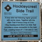 Click here for more information or to register Hosting Club: Iroquoia, Caledon Hills
Category: General Hike
Location (Google Maps): Parking Lot on Mono 5 Sideroad, on the north side where the Trail crosses. Hike Leader(s): Pati Greenwood, Jeff Dowsett Click here to contact Hike Leader(s) Pace: Medium – 3 to 4 km/hr
Terrain: Strenuous – Hilly with steep climbs and some poor footing
Distance: 14 KM Description
We will follow the main BT and take in several side trails to make a 14 KM hike with several loops. There will be a few steep climbs. Bring plenty of water and a snack. Please arrive by 8:15 am as we will leave promptly at 8:30 am.
| 31 - Lana’s Challenge Series: Hockley Valley Loop 1/3
8:30 AM-3:30 PM 08/31/2024 https://hikes.brucetrail.org/event/lanas-challenge-series-hockley-valley-loop/2024-08-31/ Click here for more information or to register Hosting Club: Caledon Hills
Category: General
Location (Google Maps): Hockley Valley Nature Reserve, Map 18. To reach the meeting point, drive north on Hwy 10 from Orangeville and turn right onto Hockley Road. Continue approximately 5 km east until you see the parking area on your left, directly across the road from the Black Birch restaurant. Hike Leader(s): Dylan “Lana” Hubbard Click here to contact Hike Leader(s) Pace: Brisk – 4 to 5 km/hour
Terrain: Strenuous – hilly with steep climbs and some poor footing
Distance: 25 km Description
Join us for an epic adventure through one of the hilliest sections of the Bruce Trail. We’ll park at Hockley Valley Provincial Park on Hockley Rd. and hike north, sticking to the main trail through the park. The route includes Dunby Rd., 3rd Line, and 15 Sideroad, leading us through the scenic Anderson Tract. Continuing south, we’ll return to Hockley Rd. and back to the parking lot via the main trail. This is a seriously difficult hike—be honest about your fitness level. No dropouts! We are committed to providing an inclusive and welcoming environment. This hike is an 2SLGBTQ+ safe space, and everyone is welcome to join us! Please bring 3L of water, lunch, lots of snacks and smiles. 🙂 PS, this hike will happen rain or shine, and yes! this is a car hike! (no shuttling required)
|