|
Sun | Mon | Tue | Wed | Thu | Fri | Sat |
|---|
1 | 2 | 3 - Biodiversity Spring Nature Walk Series – Pools, Ponds, and Peepers
9:30 AM-12:30 PM 05/03/2022 https://hikes.brucetrail.org/event/biodiversity-spring-nature-walk-series-pools-ponds-and-peepers/2022-05-03/ 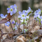 Click here for more information or to register Hosting Club: Caledon Hills
Category: Nature Walks
Location (Google Maps): Roadside parking at Boston Mills Road just west of the Mississauga Road intersection. Note: Driveway is private property. From Hwy 10 take Boston Mills Road west for 6 kilometres.
Or take Mississauga Road north from King Street for about 3 kilometres. Turn left at Boston Mills Road and drive for about 400 metres. Hike Leader(s): Doris Harper and Richard Smythe Click here to contact Hike Leader(s) Pace: Leisurely – 3 km/hour or less
Terrain: Moderate – some hills and/or some poor footing
Distance: 6 kilometres Description
The pace of this loop walk will be slow at times with numerous stops to observe spring ephemerals, listen to bird songs, and take photos. Bring your binoculars, camera, and cellphone. Apps like Merlin, Seek, and iNaturalist will help identify flora and fauna along the route.
- Silver Creek
9:30 AM-2:30 PM 05/03/2022 https://hikes.brucetrail.org/event/silver-creek-4/2022-05-03/ Click here for more information or to register Hosting Club: Caledon Hills
Category: Tuesday Hikers
Location (Google Maps): Parking at Fallbrook Trail / Sideroad 27 (where the Bruce Trail crosses Fallbrook Trail). Do not park near school.
Driving directions: From Highway 401, north on Trafalgar Road, it will connect with Highway 7 – turn left, after about 4 km, turning right on Trafalgar Road (branching out), turn right on Sideroad 27, it will cross 8th line, continue on Sideroad 27. At T junction with Fallbrook Trail, turn right and park roadside. Hike Leader(s): Mohammad Shafiq Click here to contact Hike Leader(s) Pace: Medium – 3 to 4 km/hour
Terrain: Moderate – some hills and/or some poor footing
Distance: 13 km Description
Will hike Main Bruce Trail and side trails in Silver Creek area, Great Esker, Bennett Heritage, Maureen Smith and Roberts. Drop out possible at 11 km.
– bring water and snack
– poles recommended
– insect repellent will be useful
| 4 | 5 - Peninsula End-to-End Hike 1 of 13
9:30 AM-1:00 PM 05/05/2022 https://hikes.brucetrail.org/event/peninsula-end-to-end-hike-1-of-13/2022-05-05/ Click here for more information or to register Hosting Club: Caledon Hills
Category: End-to-End
Location (Google Maps): Meet at Little Cove Rd. parking area at km 158.9. Shuttle to Tobermory, meet at the Cairn. Hike Leader(s): Nancy Mooney Click here to contact Hike Leader(s) Pace: Medium – 3 to 4 km/hour
Terrain: Moderate – some hills and/or some poor footing
Distance: 8.1 km Description
This is hike 1 of a series of 13. Hike will include observation tower, views over Georgian Bay, natural arch overhang and limestone grotto. Recommended to bring: water, snacks, sunscreen, bug spray, rain poncho, hiking poles (encouraged not required), and closed toe hiking footwear.
| 6 | 7 |
8 | 9 | 10 - Biodiversity Spring Nature Walk Series – Griffith Ravine Ramble and Songbird Stroll
9:30 AM-12:30 PM 05/10/2022 https://hikes.brucetrail.org/event/biodiversity-spring-nature-walk-series-griffith-ravine-ramble-and-songbird-stroll/2022-05-10/ 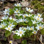 Click here for more information or to register Hosting Club: Caledon Hills
Category: Nature Walks
Location (Google Maps): Roadside parking on 4th Line EHS at the entrance to the Peter Beecham Side Trail. Take Side Road 5 west from Airport Road to 4th Line E, turn right and go about 1.4 kilometres to roadside parking on the west side at the curve.
Or, take the 4th Line E north from Hockley Road. Go up the hill and around the big curve. Hike Leader(s): Ralph Shapiro, Franca DeAngelis, and Richard Smythe Click here to contact Hike Leader(s) Pace: Leisurely – 3 km/hour or less
Terrain: Moderate – some hills and/or some poor footing
Distance: 4.5 kilometres Description
Two nature walks are planned for this day. The first loop walk will take place on the Griffith Ravine Side Trail, the second on the Songbird Side Trail. Both walks will be slow at times with numerous stops to observe the spring ephemerals, listen to bird songs, and take photos. Bring your binoculars, camera, and cellphone. Apps like Merlin, Seek, and iNaturalist will help identify flora and fauna along the route. The Songbird Side Trail is about a 15 minutes (15 kilometres) drive from the Griffith Ravine walk. Parking for this second walk is on the west side of 17808 Airport Road, just south of Finnerty Side Road and north of Escarpment Side Road. (43.905776, -79.915541)
- Boyne Valley Provincial Park
9:30 AM-1:30 PM 05/10/2022 https://hikes.brucetrail.org/event/boyne-valley-provincial-park-2/2022-05-10/ Hike open to BTC Members only. Click here for more information or to register Hosting Club: Caledon Hills
Category: Tuesday Hikers
Location (Google Maps): BT Guide Map 20. Dufferin Hi-Land Section.
Drive north from Orangeville on Hwy 10 to Primrose, the junction of Hwys 10 & 89. Continue straight ahead on Prince of Wales Rd., (County Rd. 19), about 1 km to BT parking lot on the right. Hike Leader(s): Susan Atkinson Click here to contact Hike Leader(s) Pace: Medium – 3 to 4 km/hour
Terrain: Moderate – some hills and/or some poor footing
Distance: 11 km Description
We will tour the Boyne Valley Provincial Park, via the main trail, the Primrose Loop and Boyne Valley Side Trails to form a loop. Those that want, can also hike the short distance up to Murphy’s Pinnacle for a 360 degree view. Some hills and/or some poor footing. Bring water and snacks/lunch. No dogs please. If you need to cancel on day before, or day of hike, please text leader’s cell 519-831-9474.
| 11 | 12 - Peninsula End-to-End Hike 2 of 13
9:15 AM-3:30 PM 05/12/2022 https://hikes.brucetrail.org/event/peninsula-end-to-end-hike-2-of-13/2022-05-12/ Click here for more information or to register Hosting Club: Caledon Hills
Category: End-to-End
Location (Google Maps): Meet at Head of Trails parking south of km 146.5, (Bruce Peninsula National Park). Parking arrangements will be made ahead. Shuttle to parking at Little Cove Rd. Hike Leader(s): Nancy Mooney Click here to contact Hike Leader(s) Pace: Medium – 3 to 4 km/hour
Terrain: Moderate – some hills and/or some poor footing, Strenuous – hilly with steep climbs and some poor footing
Distance: Map 42 km 158.9 – km 146.5 12.4 km + 900 m to parking Description
This is the second hike in the E2E series and includes Sinkhole Side Trail, Overhanging Point, Lord Hunt’s Tunnel, boulder beaches, The Grotto, Natural Arch, Indian Head Cove, and Halfway Rock Point. End time is an estimate as there is so much to explore.
| 13 | 14 |
15 | 16 | 17 - Biodiversity Spring Nature Walk Series – Bird Songs and Wildflowers
9:30 AM-12:30 PM 05/17/2022 https://hikes.brucetrail.org/event/biodiversity-spring-nature-walk-series-bird-songs-and-wildflowers/2022-05-17/ 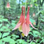 Click here for more information or to register Hosting Club: Caledon Hills
Category: Nature Walks
Location (Google Maps): Bruce Trail parking on the east side of the 5th Line EHS, just south of Hockley Road. From Airport Road head west on Hockley Road, then turn left onto 5th Line EHS (5 Line E). Drive 100 metres. Hike Leader(s): Gary Hall Click here to contact Hike Leader(s) Pace: Leisurely – 3 km/hour or less
Terrain: Moderate – some hills and/or some poor footing
Distance: 2.5 km Description
This loop walk will take place on the BTC’s beautiful Hemlock Ridges property. This is a good time of year to observe migrating birds before the leaves come out. We’ll stop regularly to listen to birds and admire spring flowers. Bring binoculars and your cellphone. Apps like Merlin, Seek, and iNaturalist can help in identification of flora and fauna along the route.
- Forks of the Credit
9:30 AM-2:30 PM 05/17/2022 https://hikes.brucetrail.org/event/forks-of-the-credit-13/2022-05-17/ Click here for more information or to register Hosting Club: Caledon Hills
Category: Tuesday Hikers
Location (Google Maps): Mississauga Rd. intersection with Elora-Cataract Trailway.
Driving directions: From Highway 401, north on Mississauga Rd., pass through Belfountain village, after crossing Cataract Rd. and at Elora-Cataract Trail-way crossing, park on either side of the road. Hike Leader(s): Mohammad Shafiq Click here to contact Hike Leader(s) Pace: Medium – 3 to 4 km/hour
Terrain: Moderate – some hills and/or some poor footing
Distance: 13 km Description
Will enter Forks of the Credit Conservation Area using the Elora-Cataract Trailway and hike main Bruce Trail, Mill Pond, Cataract and Dorothy Medhurst Side Trails and parts of conservation trails. Lunch break at a lovely spot on the Credit River, arguably one of the best spots on the river.
Bring your own bug spray and hand sanitizer.
Bring 2 litres of water and snack; poles are recommended.
- Two Loops and Lunch in Beaver Valley
10:30 AM-3:00 PM 05/17/2022 https://hikes.brucetrail.org/event/two-loops-and-lunch-in-beaver-valley-2/2022-05-17/ Click here for more information or to register Hosting Club: Caledon Hills
Category: Tuesday Hikers
Location (Google Maps): Km 13.7 on Map 24. From Shelburne, take Rd. 124 north. Turn left on Grey Rd. 4, then right on Grey Rd. 2. In Ravenna, turn right on Rd. 119, then left to dead end of 6th Line. Hike Leader(s): Barbara Euler Click here to contact Hike Leader(s) Pace: Medium – 3 to 4 km/hour
Terrain: Moderate – some hills and/or some poor footing
Distance: 14 km Description
We will hike a loop using the Main Trail and the Margaret Paull Side Trail through forest and fields featuring small flowerpots formed by an ancient seas and some waterfalls. Then we will drive into Ravenna where we can pick up the famous Country Market sandwiches (or bring your own lunch if you prefer). We’ll drive to the Loree Forest to have our lunch and hike a loop with beautiful views over Georgian Bay.
| 18 | 19 - Peninsula End-to-End Hike 3 of 13
9:15 AM-12:00 PM 05/19/2022 https://hikes.brucetrail.org/event/peninsula-end-to-end-hike-3-of-13/2022-05-19/ Click here for more information or to register Hosting Club: Caledon Hills
Category: End-to-End
Location (Google Maps): Meet at Halfway Dump Side Trail, south of km 142.0. Accessible via Hwy 6 and Emmett Lake Rd. Shuttle to Head of Trails parking. Hike Leader(s): Nancy Mooney Click here to contact Hike Leader(s) Pace: Medium – 3 to 4 km/hour
Terrain: Moderate – some hills and/or some poor footing, Strenuous – hilly with steep climbs and some poor footing
Distance: Map 41 km 146.5 – km 142.0 4.5 km + 2 km to and from parking Description
This third hike of the E2E series is short but includes some of the most rugged parts of the Bruce Trail. Lunch opportunity in Tobermory.
| 20 | 21 |
22 | 23 | 24 - Noisy River Provincial Nature Reserve
9:30 AM-2:30 PM 05/24/2022 https://hikes.brucetrail.org/event/noisy-river-provincial-nature-reserve-2/2022-05-24/ Click here for more information or to register Hosting Club: Caledon Hills
Category: Tuesday Hikers
Location (Google Maps): Noisy River Nature Reserve, Blue Mountain Section, Lavender. Road side parking at km 55.7 (Map 21 BT Reference Guide Ed. 30) on Mulmur- Nottawasaga Townline, 550 meters east of Lavender Hill Rd. at the cemetery. Hike Leader(s): Doris Harper Click here to contact Hike Leader(s) Pace: Medium – 3 to 4 km/hour
Terrain: Moderate – some hills and/or some poor footing
Distance: 14 km Description
From the roadside parking at Lavender Cemetery, we will hike north to the Noisy River Provincial Nature Reserve and return. We will hike through the small village of Lavender which is the division line between the Dufferin Hi-Lands and Blue Mountains Bruce Trail sections. We then enter the Nature Reserve and follow the trail as it wanders in and out of woods and pasture to the escarpment edge and scenic lookout. The trail continues through mature forest to County Rd. 9 where we will turn around and return to the parking area. Bring water, snacks, lunch, poles if desired, sunscreen, insect repellent. Pub stop in Creemore post hike.
- Biodiversity Spring Nature Walk Series – Wildflowers PLUS Discovery Walk
9:30 AM-12:30 PM 05/24/2022 https://hikes.brucetrail.org/event/biodiversity-spring-nature-walk-series-wildflowers-plus-discovery-walk/2022-05-24/ 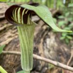 Click here for more information or to register Hosting Club: Caledon Hills
Category: Nature Walks
Location (Google Maps): Parking Lot on Mono 5 Sideroad on the north side of the road where the trail crosses. From Airport Road, turn east on 5 Sideroad. Drive for 600 metres. Hike Leader(s): Susan Atkinson and Sandy Green Click here to contact Hike Leader(s) Pace: Leisurely – 3 km/hour or less
Terrain: Easy – mostly flat and usually good footing
Distance: 5 kilometres Description
Pique your curiosity about the awakening forest in the Hockleycrest area. Bring your binoculars and cellphone. Apps like Merlin, Seek, and iNaturalist will help identify flora and fauna along the route.
| 25 | 26 - Peninsula End-to-End Hike 4 of 13
9:15 AM-3:30 PM 05/26/2022 https://hikes.brucetrail.org/event/peninsula-end-to-end-hike-4-of-13/2022-05-26/ Click here for more information or to register Hosting Club: Caledon Hills
Category: End-to-End
Location (Google Maps): Meet at Crane Lake Rd. (km 127.9) parking at the National Park Gate. Park well away from farm and park gates. Shuttle to Halfway Dump Side Trail parking. Hike Leader(s): Nancy Mooney Click here to contact Hike Leader(s) Pace: Medium – 3 to 4 km/hour
Terrain: Moderate – some hills and/or some poor footing, Strenuous – hilly with steep climbs and some poor footing
Distance: Map 41 km 142.0 – km 127.9 14.1 km + 900 m from parking Description
This fourth hike of the E2E series includes part of the most challenging section of the Bruce Trail through Bruce Peninsula National Park with views over Georgian Bay at Loaf Rock.
| 27 | 28 |
29 | 30 | 31 - Biodiversity Spring Nature Walk Series – The Living Forest
9:30 AM-12:30 PM 05/31/2022 https://hikes.brucetrail.org/event/biodiversity-spring-nature-walk-series-the-living-forest/2022-05-31/ 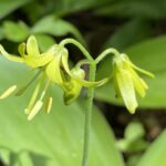 Click here for more information or to register Hosting Club: Caledon Hills
Category: Nature Walks
Location (Google Maps): Bruce Trail parking on the east side of the 5th Line EHS, just south of Hockley Road. From Hockley Road, turn south onto 5th Line EHS Mono. Drive for 100 metres to the parking lot on the east side. Hike Leader(s): Gary Hall and Mark Whitcombe Click here to contact Hike Leader(s) Pace: Leisurely – 3 km/hour or less
Terrain: Moderate – some hills and/or some poor footing
Distance: 2.5 kilometres Description
We will walk slowly, observing carefully all the scales we can. We’ll look closely at the whole forest. We’ll look backwards in time and also look forwards. Ecology is the study of connections and those are what we’ll tease through. We’ll become more familiar with the “number seven” position of the botanist, than the “exclamation mark” stance of the birder. Magnifiers will be more useful than binoculars.
- Terra Cotta
9:30 AM-2:30 PM 05/31/2022 https://hikes.brucetrail.org/event/terra-cotta-6/2022-05-31/ Click here for more information or to register Hosting Club: Caledon Hills
Category: Tuesday Hikers
Location (Google Maps): Map 14. Parking at Boston Mills Rd., just west of its intersection with Mississauga Rd.
Driving directions: From Highway 410 north, continue on Highway 10, left on King Street, right on Mississauga Rd., left on Boston Mills Rd. to parking at the dead end. Hike Leader(s): Mohammad Shafiq Click here to contact Hike Leader(s) Pace: Medium – 3 to 4 km/hour
Terrain: Moderate – some hills and/or some poor footing
Distance: 15 km Description
Will hike the main Bruce Trail, Terra Cotta Side Trail and Rockside Side Trail, a complete round trip through Terra Cotta Conservation area.
Bring water, snack. Poles are recommended. Hand sanitizer and bug spray are useful.
- Trout Hollow Loop
10:00 AM-3:00 PM 05/31/2022 https://hikes.brucetrail.org/event/trout-hollow-loop-2/2022-05-31/ Click here for more information or to register Hosting Club: Caledon Hills
Category: Tuesday Hikers
Location (Google Maps): Beautiful Joe Park in Meaford. From Hwy 26, follow prominent signs. Hike Leader(s): Barbara Euler Click here to contact Hike Leader(s) Pace: Medium – 3 to 4 km/hour
Terrain: Moderate – some hills and/or some poor footing
Distance: 12 km Description
We’ll start by wandering around a bit in Beautiful Joe Park – you might want to Google the background story. Our hike is along the Bighead River. We’ll begin by going south on the west side of the river, mostly high above it (some interesting historic sites along the way), and then return on the east side closer to the shore. The sound of flowing water will accompany us throughout the hike. Bring lunch and water. Pub stop in Meaford after.
| June | June | June | June |


