|
Sun | Mon | Tue | Wed | Thu | Fri | Sat |
|---|
September | September | September | September | 1 | 2 | 3 - Beaver Valley Geology Hikes Badge Series 4/8 Fox Ridge – McCluskey’s Rock
9:00 AM 10/03/2026 https://hikes.brucetrail.org/event/beaver-valley-geology-hikes-badge-series-4-8/2026-10-03/ Click here for more information or to register Hosting Club: Blue Mountains
Category: Organized Hike
Location (Google Maps): Tim Horton’s, First Street, Collingwood Hike Leader(s): Annette Sandberg Click here to contact Hike Leader(s) Pace: Medium – 3 to 4 km/hr
Terrain: Moderate – Some hills and/or some poor footing
Distance: 8.5 km Description
Fox Ridge and McClusky’s Rock: Badland at Stop 4 (Pages 72/73) Queenston Shale is the bottom-most layer of the Niagara Escarpment. Where vegetation is removed, the shale appears as a “badland”. The brick-red shale has long been excavated along the Niagara Escarpment to make bricks.
See Hike #1 – August 26 for series description
|
4 - Fifth Annual Music Hike and Bruce Trail Day
9:30 AM-4:00 AM 10/04/2026 https://hikes.brucetrail.org/event/fifth-annual-music-hike-and-bruce-trail-day/2026-10-04/ Click here for more information or to register Hosting Club: Blue Mountains
Category: Organized Hike
Location (Google Maps): Nottawasaga Bluffs, 8861 Sideroad 15/16 Nottawasaga, Singhampton Hike Leader(s): Rob Johnston Click here to contact Hike Leader(s) Pace: Leisurely – 3 km/hr. or less
Terrain: Moderate – Some hills and/or some poor footing Description
Join us for the Fifth Annual Music Hike and Bruce Trail Day, a unique celebration where music meets nature. Musicians will be scattered throughout the scenic wilderness, serenading hikers as they explore breathtaking forest trails and lookouts. A Passport To Nature Hike! Collect stickers! Win badges! Detailed information here: https://bmbtc.org/2026-bruce-trail-day-music-hike-sun-oct4/
| 5 | 6 - Hockley Valley Provincial Nature Reserve, Glen Cross/Cam Snell Loop Trails
9:30 AM 10/06/2026 https://hikes.brucetrail.org/event/hockley-valley-provincial-nature-reserve-glen-cross-cam-snell-loop-trails-3/2026-10-06/ 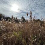 Click here for more information or to register Hosting Club: Blue Mountains Location (Google Maps): The Glen Cross Side Trail parking lot on 3rd Line EHS, 1.1 km’s north of Hockley Rd. Hike Leader(s): Gordon Sheppard Click here to contact Hike Leader(s) Pace: Leisurely – 3 km/hr. or less
Terrain: Moderate – Some hills and/or some poor footing
Distance: 7km Description
This hike is a bit further afield but is definitely worth the 1 hour drive to the trailhead. The Glen Cross and Cam Snell side trails are two loop trails located in the Hockley Valley Provincial Nature Reserve. The Reserve was established to protect one of the most unique geological areas along the entire Niagara Escarpment. Here the Escarpment and the western end of the Oak Ridges Moraine meet, creating one of Ontario’s most scenic and ecologically important landscapes. The Reserve is also in the Headwaters area where the two river branches that are the source of the Nottawasaga River join on their journey north. This area is unique in the way it combines glacial topography, mature forests, hydrology, and biodiversity. That combination makes it one of the Niagara Escarpment’s most ecologically valuable and rewarding places to explore. This will be a leisurely paced 2.5 hour hike to enjoy everything the area has to offer. There are some steep but short climbs and descents but footing is generally good. Although there could be some slippery areas if it’s been raining in which case hiking poles would be advised. Please make certain to bring water and snacks. For those that wish, we can organize an optional stop on the drive home at the Mono Centre Brewing Co. to slake our thirst.
| 7 - Apple Pie Trail Hike
8:30 AM-12:00 PM 10/07/2026 https://hikes.brucetrail.org/event/apple-pie-trail-hike/2026-10-07/ 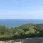 Click here for more information or to register Hosting Club: Blue Mountains
Category: Organized Hike
Location (Google Maps): Large parking lot behind Tim Hortons First Street Collingwood Hike Leader(s): Claire Pearson Click here to contact Hike Leader(s) Pace: Medium – 3 to 4 km/hr
Terrain: Easy – Mostly flat and usually good footing, Moderate – Some hills and/or some poor footing
Distance: 5.3km Description
We will meet at 8:30am in the large parking lot behind Tim Hortons on First Street Collingwood. At 8:45am, we will carpool up Grey Road 119, turning right on 4th Line, and then left on 21st Sideroad. We will park in the paid parking spots at Loree Forest and complete the Len Gertler Memorial Forest Loop. This trail takes you through a gorgeous woodland to a scenic viewpoint of Georgian Bay. After the hike, we will make our way to one of the Farmer’s Markets in the area where we will have the opportunity to purchase apples, pies, and other baked goods.
| 8 | 9 | 10 |
11 | 12 | 13 | 14 - Sydenham E2E in 8 Hike #3
8:30 AM-3:30 AM 10/14/2026 https://hikes.brucetrail.org/event/sydenham-e2e-in-8-hike-3/2026-10-14/ 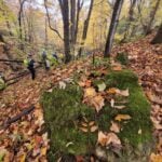 Click here for more information or to register Hosting Club: Blue Mountains, Sydenham
Category: End-to-End
Location (Google Maps): Irish Block Rd 450m north of Hwy 26. Hike Leader(s): Rob Johnston Click here to contact Hike Leader(s) Pace: Brisk – 4 to 5 km/hr
Terrain: Moderate – Some hills and/or some poor footing
Distance: 22.9 Description
Sydenham Hike 3 of 8: Woodford to Irish Block Rd. Distance: 22.9Km. Meet-Up point: Irish Block Rd 450m north of Hwy 26. GPS: 44.592378, -80.793566 This is an End-to-End of the Sydenham section of the Bruce Trail in 8 hikes. Hike distances vary between 17Km and 23.5Km. Register for each hike you plan to attend. The first hike starts at Blantyre and we proceed roughly northwest along the trail ending in Wiarton. The hikes are on consecutive days, mostly Mon/Tues. This is a strenuous hike for experienced hikers. We will be walking at a pace of 4.5-5Km per hour and hikers will need to keep up. The terrain is typical Bruce Trail: hilly with uneven, rocky footing. Hiking boots are required and hiking poles are recommended. Bring plenty of fluids and a lunch. This hike series will involve car shuttles and every hiker is expected to participate as drivers. Plan to arrive at the meeting place by 8:15am, as we will start the car shuttle to the hike starting point at 8:30am sharp. Further details will be provided to registered hikers a few days prior to the hike. Going to be fun! Hike dates are: Mon/Tues 21/22 Sept 2026 Wed/Thurs 14/15 Oct 2026 Mon/Tues 19/20 Oct 2026 Mon/Tues 26/27 Oct 2026
- Beaver Valley Geology Hike Badge #5/8 Waterfall on Stew Hilts Side Trail
9:00 AM 10/14/2026 https://hikes.brucetrail.org/event/beaver-valley-geology-hike-badge-5-8-waterfall-on-stew-hilts-side-trail/2026-10-14/ Click here for more information or to register Hosting Club: Blue Mountains
Category: Organized Hike
Location (Google Maps): Tim Horton’s, First Street, Collingwood Hike Leader(s): Annette Sandberg Click here to contact Hike Leader(s) Pace: Leisurely – 3 km/hr. or less
Terrain: Moderate – Some hills and/or some poor footing
Distance: 3.2 km Description
Falling Waters: Waterfall on Stew Hilts Side Trail at Stop 3 (Page 86) At the lovely waterfall on the Stew Hilts Side Trail water trickles over the hard Manitoulin Dolostone layer and falls onto the soft Queenston Shale.
| 15 - Sydenham E2E in 8 Hike #4
8:30 AM-3:30 AM 10/15/2026 https://hikes.brucetrail.org/event/sydenham-e2e-in-8-hike-4/2026-10-15/  Click here for more information or to register Hosting Club: Blue Mountains, Sydenham
Category: End-to-End
Location (Google Maps): Centennial Tower Parking Lot on west side Hwy 6/10 south of Superior St. Hike Leader(s): Rob Johnston Click here to contact Hike Leader(s) Pace: Brisk – 4 to 5 km/hr
Terrain: Moderate – Some hills and/or some poor footing
Distance: 18.9 Description
Sydenham Hike 4 of 8: Irish Block Rd. To 9th Ave East/Centennial Tower. Distance: 18.9Km. Meet-Up point: Centennial Tower Parking Lot on west side Hwy 6/10 south of Superior St. GPS: 44.556780, -80.925504 This is an End-to-End of the Sydenham section of the Bruce Trail in 8 hikes. Hike distances vary between 17Km and 23.5Km. Register for each hike you plan to attend. The first hike starts at Blantyre and we proceed roughly northwest along the trail ending in Wiarton. The hikes are on consecutive days, mostly Mon/Tues. This is a strenuous hike for experienced hikers. We will be walking at a pace of 4.5-5Km per hour and hikers will need to keep up. The terrain is typical Bruce Trail: hilly with uneven, rocky footing. Hiking boots are required and hiking poles are recommended. Bring plenty of fluids and a lunch. This hike series will involve car shuttles and every hiker is expected to participate as drivers. Plan to arrive at the meeting place by 8:15am, as we will start the car shuttle to the hike starting point at 8:30am sharp. Further details will be provided to registered hikers a few days prior to the hike. Going to be fun! Hike dates are: Mon/Tues 21/22 Sept 2026 Wed/Thurs 14/15 Oct 2026 Mon/Tues 19/20 Oct 2026 Mon/Tues 26/27 Oct 2026
| 16 | 17 - Six Pack Of Blue – Hike 6 of 6
8:15 AM-3:00 AM 10/17/2026 https://hikes.brucetrail.org/event/six-pack-of-blue-hike-6-of-6/2026-10-17/ Click here for more information or to register Hosting Club: Blue Mountains
Category: End-to-End
Location (Google Maps): Tim Horton, First Street, Collingwood Hike Leader(s): Rob Johnston Click here to contact Hike Leader(s) Pace: Medium – 3 to 4 km/hr
Terrain: Moderate – Some hills and/or some poor footing
Distance: 13.2 Description
Please join us for the Six Pack Of Blue! This is an End-to-End of the Blue Mountains section of the Bruce Trail completed in 6 hikes – see below for dates. You can do as many of the six hikes as you wish. Hike distances in this six-hike series range from 8 km to 14.6 km. This is the final hike of the series Hike #6. The route is from Petun CA Parking Lot to Maple Lane in Swiss Meadows, covering approximately 13.2 km. The pace will be 3–4 km/hour, and all hikers must be able to maintain this speed. The terrain is hilly with uneven, rocky footing. Sturdy hiking footwear is required, and hiking poles are recommended. Please bring water and a snack. Due to limited parking at trailheads, this hike will involve a car shuttle. All hikers are expected to carpool and share the associated costs. Arrive at the meeting location by 8:15 a.m. The car shuttle will depart promptly at 8:30 a.m. Further details will be provided to registered hikers a few days before the hike. Please refer to each individual hike date as outlined below for specific details of that hike. Register for each hike you plan to attend. The hikes are on the following dates: 20 June 2026 27 June 2026 12 Sept 2026 19 Sept 2026 26 Sept 2026 17 Oct 2026
|
18 | 19 - Sydenham E2E in 8 Hike #5
8:30 AM-3:30 AM 10/19/2026 https://hikes.brucetrail.org/event/sydenham-e2e-in-8-hike-5/2026-10-19/  Click here for more information or to register Hosting Club: Blue Mountains, Sydenham
Category: End-to-End
Location (Google Maps): Roadside parking at end of Young’s Rd. Hike Leader(s): Rob Johnston Click here to contact Hike Leader(s) Pace: Brisk – 4 to 5 km/hr
Terrain: Moderate – Some hills and/or some poor footing
Distance: 16.7 Description
Sydenham Hike 5 of 8: 9th Ave East/Centennial Tower to Young’s Drive. Distance: 16.7Km. Meet-Up point: Roadside parking at end of Young’s Rd. GPS: 44.568125, -80.976715 This is an End-to-End of the Sydenham section of the Bruce Trail in 8 hikes. Hike distances vary between 17Km and 23.5Km. Register for each hike you plan to attend. The first hike starts at Blantyre and we proceed roughly northwest along the trail ending in Wiarton. The hikes are on consecutive days, mostly Mon/Tues. This is a strenuous hike for experienced hikers. We will be walking at a pace of 4.5-5Km per hour and hikers will need to keep up. The terrain is typical Bruce Trail: hilly with uneven, rocky footing. Hiking boots are required and hiking poles are recommended. Bring plenty of fluids and a lunch. This hike series will involve car shuttles and every hiker is expected to participate as drivers. Plan to arrive at the meeting place by 8:15am, as we will start the car shuttle to the hike starting point at 8:30am sharp. Further details will be provided to registered hikers a few days prior to the hike. Going to be fun! Hike dates are: Mon/Tues 21/22 Sept 2026 Wed/Thurs 14/15 Oct 2026 Mon/Tues 19/20 Oct 2026 Mon/Tues 26/27 Oct 2026
| 20 - Sydenham E2E in 8 Hike #6
8:30 AM-3:30 AM 10/20/2026 https://hikes.brucetrail.org/event/sydenham-e2e-in-8-hike-6/2026-10-20/  Click here for more information or to register Hosting Club: Blue Mountains, Sydenham
Category: End-to-End
Location (Google Maps): Bruce Trail parking lot on Lindenwood Rd. Hike Leader(s): Rob Johnston Click here to contact Hike Leader(s) Pace: Brisk – 4 to 5 km/hr
Terrain: Moderate – Some hills and/or some poor footing
Distance: 22.4 Description
Sydenham Hike 6 of 8: Young’s Drive, Owen Sound to Lindenwood Rd. Distance: 22.4Km. Meet-Up point: Bruce Trail parking lot on Lindenwood Rd. GPS: 44.685276, -80.995970 This is an End-to-End of the Sydenham section of the Bruce Trail in 8 hikes. Hike distances vary between 17Km and 23.5Km. Register for each hike you plan to attend. The first hike starts at Blantyre and we proceed roughly northwest along the trail ending in Wiarton. The hikes are on consecutive days, mostly Mon/Tues. This is a strenuous hike for experienced hikers. We will be walking at a pace of 4.5-5Km per hour and hikers will need to keep up. The terrain is typical Bruce Trail: hilly with uneven, rocky footing. Hiking boots are required and hiking poles are recommended. Bring plenty of fluids and a lunch. This hike series will involve car shuttles and every hiker is expected to participate as drivers. Plan to arrive at the meeting place by 8:15am, as we will start the car shuttle to the hike starting point at 8:30am sharp. Further details will be provided to registered hikers a few days prior to the hike. Going to be fun! Hike dates are: Mon/Tues 21/22 Sept 2026 Wed/Thurs 14/15 Oct 2026 Mon/Tues 19/20 Oct 2026 Mon/Tues 26/27 Oct 2026
| 21 | 22 | 23 | 24 - Autumn Escarpment Magic – Blue Mountains Fall Colour Hike
8:45 AM-4:30 PM 10/24/2026 https://hikes.brucetrail.org/event/autumn-escarpment-magic-blue-mountains-fall-colour-hike/2026-10-24/  Click here for more information or to register Hosting Club: Iroquoia, Blue Mountains
Category: Good Companions
Location (Google Maps): Meeting point at Parking lot located 380 m north of the main trail crossing the Pretty River Rd. (capacity 40 ) no fees, Coordinates: 44.430927- 80.275390 Close to Intersection of Blue Mountains Clearview Townline with Pretty River Rd. Hike Leader(s): Corina Seceleanu Click here to contact Hike Leader(s) Pace: Medium – 3 to 4 km/hr
Terrain: Strenuous – Hilly with steep climbs and some poor footing
Distance: 16- 17Km Description
Hi everyone, I’m excited to share the details for our late‑October hike — a perfect time to enjoy the fall colors. This will be a beautiful, energizing day in the Blue Mountains area, exploring both side trails and the main Bruce Trail. This is approx. 16-17 km loop hike. We’ll pass through the Petun Conservation Area, continue toward Osler Bluffs, and then take on one of the most iconic routes in the region — the Three Stage Trail. This rolling path winds through ups and downs and leads us to the highest point on the entire Bruce Trail at 540 metres, a true highlight of the day, the Hike is a go, rain or shine. This hike is designed for enjoyment: time to take photos, breathe in the forest energy, and appreciate the beauty of the place. The fall colors in this area are spectacular. A quick note on effort: from the parking lot to the top, the elevation gain is incremental but steady. It comes in stages, so while it requires some effort, it’s very manageable with a comfortable pace. To help ensure a safe and enjoyable day for all, please bring: - Lunch and snacks – enough to keep you fueled throughout the day (2 L of water/ electrolytes)
- Appropriate layers – we’ll be out for approximately 7 hours, so dress according with fall weather
- Hiking poles – very helpful for stability in mud and on slick terrain
- Sturdy hiking boots – waterproof if possible
Meeting point – Parking area located 380 m N of the Main trail crossing the Pretty River Rd. Club: Blue Mountains; Coordinates: 44.430927, – 80.275390 I’m really looking forward to sharing this autumn adventure with you! Please note: This is a 2-loop hike – a very streneous ascend with a difference in altitude of 400m and won’t be any drop-outs. If you are not able to keep the pace or complete it please cancel your registration. Corina Seceleanu
- Fort Willow
10:00 AM 10/24/2026 https://hikes.brucetrail.org/event/fort-willow/2026-10-24/ Click here for more information or to register Hosting Club: Blue Mountains
Category: Organized Hike
Location (Google Maps): Hike Leader(s): Arie van Walraven Click here to contact Hike Leader(s) Pace: Leisurely – 3 km/hr. or less
Terrain: Easy – Mostly flat and usually good footing
Distance: 4 KM Description
Please join me for a hike to Fort Willow. We will hike the North Simcoe Rail Trail to the fort. This fort has many displays of the early history of our area. Because there is limited parking, we will meet at Tim’s and car pool to our trail head.
|
25 | 26 - Sydenham E2E in 8 Hike #7
8:30 AM-3:30 AM 10/26/2026 https://hikes.brucetrail.org/event/sydenham-e2e-in-8-hike-7/2026-10-26/  Click here for more information or to register Hosting Club: Blue Mountains, Sydenham
Category: End-to-End
Location (Google Maps): Roadside on Graham’s Hill Rd. Hike Leader(s): Rob Johnston Click here to contact Hike Leader(s) Pace: Brisk – 4 to 5 km/hr
Terrain: Moderate – Some hills and/or some poor footing
Distance: 22.2 Description
Sydenham Hike 7 of 8: Lindenwood Rd. To Graham’s Hill Rd. Distance: 22.2Km. Meet-Up point: Roadside on Graham’s Hill Rd. GPS: 44.765013, -80.944795 “Oh to hike on Kemble Mountain…with the badgers and the colored leaves….” Sorry Mr Young This is an End-to-End of the Sydenham section of the Bruce Trail in 8 hikes. Hike distances vary between 17Km and 23.5Km. Register for each hike you plan to attend. The first hike starts at Blantyre and we proceed roughly northwest along the trail ending in Wiarton. The hikes are on consecutive days, mostly Mon/Tues. This is a strenuous hike for experienced hikers. We will be walking at a pace of 4.5-5Km per hour and hikers will need to keep up. The terrain is typical Bruce Trail: hilly with uneven, rocky footing. Hiking boots are required and hiking poles are recommended. Bring plenty of fluids and a lunch. This hike series will involve car shuttles and every hiker is expected to participate as drivers. Plan to arrive at the meeting place by 8:15am, as we will start the car shuttle to the hike starting point at 8:30am sharp. Further details will be provided to registered hikers a few days prior to the hike. Going to be fun! Hike dates are: Mon/Tues 21/22 Sept 2026 Wed/Thurs 14/15 Oct 2026 Mon/Tues 19/20 Oct 2026 Mon/Tues 26/27 Oct 2026
| 27 - Sydenham E2E in 8 Hike #8
8:30 AM-3:30 AM 10/27/2026 https://hikes.brucetrail.org/event/sydenham-e2e-in-8-hike-8/2026-10-27/  Click here for more information or to register Hosting Club: Blue Mountains, Sydenham
Category: End-to-End
Location (Google Maps): Wiarton Bluewater Parking area opposite arena. Hike Leader(s): Rob Johnston Click here to contact Hike Leader(s) Pace: Brisk – 4 to 5 km/hr
Terrain: Moderate – Some hills and/or some poor footing
Distance: 23.1 Description
Sydenham Hike 8 of 8: Graham’s Hill Rd. To Wiarton Bluewater Park. Distance: 23.1Km. Meet-Up point: Wiarton Bluewater Parking area opposite arena. GPS: 44.742514, -81.135140 Woohoo! Last hike! Thank you Sydenham! This is an End-to-End of the Sydenham section of the Bruce Trail in 8 hikes. Hike distances vary between 17Km and 23.5Km. Register for each hike you plan to attend. The first hike starts at Blantyre and we proceed roughly northwest along the trail ending in Wiarton. The hikes are on consecutive days, mostly Mon/Tues. This is a strenuous hike for experienced hikers. We will be walking at a pace of 4.5-5Km per hour and hikers will need to keep up. The terrain is typical Bruce Trail: hilly with uneven, rocky footing. Hiking boots are required and hiking poles are recommended. Bring plenty of fluids and a lunch. This hike series will involve car shuttles and every hiker is expected to participate as drivers. Plan to arrive at the meeting place by 8:15am, as we will start the car shuttle to the hike starting point at 8:30am sharp. Further details will be provided to registered hikers a few days prior to the hike. Going to be fun! Hike dates are: Mon/Tues 21/22 Sept 2026 Wed/Thurs 14/15 Oct 2026 Mon/Tues 19/20 Oct 2026 Mon/Tues 26/27 Oct 2026
- Mad River – Monument Hill, West Beach. Ganaraska Hike Club & BMBTC together.
9:00 AM 10/27/2026 https://hikes.brucetrail.org/event/mad-river-monument-hill-west-beach-ganaraska-hike-club-bmbtc-together/2026-10-27/ Click here for more information or to register Hosting Club: Blue Mountains
Category: Organized Hike
Location (Google Maps): Tim Hortons, First Street, Collingwood Hike Leader(s): David Little Click here to contact Hike Leader(s) Pace: Medium – 3 to 4 km/hr
Terrain: Moderate – Some hills and/or some poor footing
Distance: 10 km Description
The BMBTC and Ganaraska Club will join together to bring this hike to both club members. David Little, who is a hike leader with both, will be leading. This is a looped hike with several short, steep climbs over the Wasaga dunes cross country ski trails. We will car pool from Tim Hortons back parking lot and then all park at 2300 Klondike Park Rd, Wasaga Beach.
| 28 - Duncan Crevice Caves
9:00 AM-12:00 PM 10/28/2026 https://hikes.brucetrail.org/event/duncan-crevice-caves-2/2026-10-28/ Click here for more information or to register Hosting Club: Blue Mountains
Category: Organized Hike
Location (Google Maps): Tim Horton’s, First Street, Collingwood Hike Leader(s): Frank Huggins Click here to contact Hike Leader(s) Pace: Brisk – 4 to 5 km/hr
Terrain: Moderate – Some hills and/or some poor footing
Distance: 4-5kms. Description
Duncan Crevice Caves Provincial Nature Reserve. We will depart from Tim Horton’s downtown parking lot at 9 am. We will car pool to the trailhead at the small parking area on the 9th Sideroad ( west of 10th line). We will hike in to the Caves and then return to the parking area. About 2 hours
| 29 | 30 | 31 - Halloween Zombie Hike
10:15 AM-2:00 AM 10/31/2026 https://hikes.brucetrail.org/event/halloween-zombie-hike/2026-10-31/  Click here for more information or to register Hosting Club: Blue Mountains
Category: Organized Hike
Location (Google Maps): Collingwood Legion, 490 Ontario Street, Collingwood (Use Rear Parking Lot) Hike Leader(s): Rob Johnston Click here to contact Hike Leader(s) Pace: Leisurely – 3 km/hr. or less
Terrain: Easy – Mostly flat and usually good footing
Distance: 5km Description
This is a fun and easy (but very scary!) Halloween hike. Please come dressed as a zombie or some spooky soulless being. We will meet behind the Collingwood Royal Canadian Legion Br 63. We will stumble through the streets and along the Train trail to the St Mary’s Cemetery, then return along the River trail to the legion. Along the way we will scare as many residents as possible and enjoy some spooky TRUE local tales (I swear they’re true!). After the hike some zombies may wish to enjoy a refreshment in the Legion.
|
