Caledon Hills

Join us for a hike! Registration required:

All hikes available to BTC members. Some hikes are open to non-members.

Read hiker guidelines >

TIP: The calendar view displays up to 7 hikes on a day, but often there are more. Click “More events” to see them all.

< 2026 >
November
Sun
Mon
Tue
Wed
Thu
Fri
Sat
1
  • Caledon Hills E2E In 4 Hike #4
    8:45 AM-2:30 PM
    11/01/2026

    Click here for more information or to register

    Hosting Club: Caledon Hills
    Category: End-to-End
    Location (Google Maps): Roadside Parking – southwest of km 48.4 at Boston Mills Rd. just west of the Mississauga Rd. intersection.

    Hike Leader(s): Dan Patterson Click here to contact Hike Leader(s)

    Pace: Medium – 3 to 4 km/hour
    Terrain: Strenuous – hilly with steep climbs and some poor footing
    Distance: 15.9 km

    Description

    Welcome to Caledon Hills In 4 Fall Edition Hike #4. Meet at Boston Mills Road where the Bruce Trail meets the road the road at 8:15 a.m. We will shuttle to Willoughby Rd. Parking at Escarpment Side Road to start the hike. This is an End-to-End series to complete the Caledon Hills section of the Bruce Trail in 4 hikes. We will be hiking from the north end to the south end. Join for as many hikes as desired – you will need to register for each hike in the series which will take place on the following dates: Sept. 20, 27, Oct. 18 & 25. Since this is a group hike, please consider your fitness level before registering. We will be walking at a pace of 3 km – 4 km per hour and hikers will need to keep up with the person in front of them for the duration of the hike. The hike series will also involve car shuttles and every hiker is expected to participate as drivers. Weather conditions can be variable, dressing in layers is recommended. Hiking boots are required and hiking poles are strongly recommended. Bring plenty of fluids, electrolytes. lunch and snacks. This section is challenging with many hills.

  • Plalking: Caledon Trailway
    10:00 AM-11:30 AM
    11/01/2026

    Click here for more information or to register

    Hosting Club: Caledon Hills
    Category: General
    Location (Google Maps): Meet at the Caledon East Community Complex parking lot. We’ll meet at the west end of the parking lot, close to the library branch within the complex. There are washrooms inside if needed before or after the event. Please aim to arrive around 9:50 am, so we can start plalking as close to 10:00 am as possible. Thanks!

    Hike Leader(s): Elizabeth Ganong Click here to contact Hike Leader(s)

    Pace: Leisurely – 3 km/hour or less
    Terrain: Easy – mostly flat and usually good footing
    Distance: 3 to 4 km

    Description

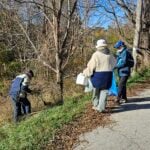
    CHBTC and ecoCaledon invite you to come plalking! We’ll walk, chat, and pick up litter as we do a there-and-back route west along the Caledon Trailway. Gloves, bags, and grabbers are provided for participants’ use. A hat, long sleeves and pants, and insect repellent are recommended. An optional stop at a local eatery will follow. Registrants can expect a reminder/update message one or two days before the event. This is a BTC Passport to Nature event.

2
3
4
5
6
  • Badlands Habitat Event a Passport to Nature Event – Buckthorn
    9:00 AM-12:00 PM
    11/06/2026

    Click here for more information or to register

    Hosting Club: Caledon Hills
    Category: Habitat Restoration Project
    Location (Google Maps): Cheltenham Badlands

    Hike Leader(s): Richard Smythe Click here to contact Hike Leader(s)

    Pace: Medium – 3 to 4 km/hour
    Terrain: Moderate – some hills and/or some poor footing

    Description

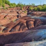
    On Friday, November 6th at 9:00 a.m. volunteers are needed to continue with Habitat Restoration at the Badlands. This is a significant ongoing project that requires a large group of volunteers. The focus will be on removing the buckthorn that can be cleared with extractigators and flagging the larger trees for removal in the spring of 2027.

    Registration to participate will be through the BTC Hike Schedule. Bring your BTC Passport to Nature brochure OR pick one up at the event and get your sticker to submit your passport for a prize from the Bruce Trail Conservancy.

    All volunteers will need glove, hat, long sleeves, long pants, rugged boots and a water bottle. Water and snacks will be provided along with a sense of accomplishment and pride that we are continuing the project to restore the Badlands.
    This restoration will proceed rain, or shine or flurries.

7
8
  • Plalking: Humber Valley Heritage Trail
    10:00 AM-11:30 AM
    11/08/2026

    Click here for more information or to register

    Hosting Club: Caledon Hills
    Category: General
    Location (Google Maps): Meet at the Ann & Samuel Sterne Municipal Parking Lot in Bolton. This lot is at the intersection of Ann Street and Sterne Street, with the main entrance from Sterne (across from The Valley and beside Mr. Sub). There is no entrance from Ann Street. We’ll meet at the north end of the parking lot, close to the Humber River.
    Please aim to arrive around 9:50 am, so we can start plalking as close to 10:00 am as possible. Thanks!

    Hike Leader(s): Elizabeth Ganong Click here to contact Hike Leader(s)

    Pace: Leisurely – 3 km/hour or less
    Terrain: Easy – mostly flat and usually good footing, Moderate – some hills and/or some poor footing
    Distance: 3 to 4 km

    Description

    CHBTC and ecoCaledon invite you to come plalking! We’ll walk, chat, and pick up litter as we do a there-and-back route east along the Humber Valley Heritage Trail. Gloves, bags, and grabbers are provided for participants’ use. A hat, long sleeves and pants, and insect repellent are recommended. An optional stop at a local eatery will follow. Registrants can expect a reminder/update message one or two days before the event. This is a BTC Passport to Nature event.

9
10
11
12
13
14
15
  • Car Hike Hockley Valley – The Lower Two Loops (11.5 km)
    9:00 AM-12:00 PM
    11/15/2026

    Click here for more information or to register

    Hosting Club: Toronto, Caledon Hills
    Category: Car Hike
    Location (Google Maps): Hockley Valley Provincial Park

    Hike Leader(s): Rob Schieck Click here to contact Hike Leader(s)

    Pace: Brisk (4-5 km/hr)
    Terrain: Challenging, Level 3 (Advanced – steep hills and some scrambling over boulders)
    Distance (km): 11.5

    Description

    If you enjoy hills, Hockley Valley has plenty to offer! Join us for an 11.5 km hike exploring the two lower loops of Hockley Valley Provincial Nature Reserve.

    Our route will take us along the Bruce Trail and its side trails, winding through beautiful hardwood and cedar forests, across rolling terrain, and up and down some of Hockley’s notorious hills.

    Don’t let the distance fool you! Hockley Valley is known for its challenging terrain, with numerous short but steep climbs that will give your legs a good workout. The rewards include lovely forest scenery, peaceful trails, and a great sense of accomplishment.

    We will try to maintain a brisk pace of approximately 5 km/h. Participants should be comfortable hiking at this pace over challenging, hilly terrain.

    What to bring: Sturdy hiking boots are essential, and hiking poles are highly recommended. Bring water, snacks, icers (traction devices), and clothing appropriate for November weather. Be prepared for muddy, icy, or slippery trail conditions.

    Come prepared for a few hills, some fresh air, good company, and an enjoyable morning on the Bruce Trail.

    Remember: What goes down in Hockley Valley must eventually climb back up!

16
17
  • City View Park, Burlington, Map 9.
    9:30 AM-1:00 PM
    11/17/2026

    Click here for more information or to register

    Hosting Club: Caledon Hills
    Category: Tuesday Hikers
    Location (Google Maps): City View Park South Lot, Burlington.
    From Highway 403 going west, turn right on Brant Street, left on Dundas Street, left on Kerns Rd., take second turn left into City View Park to the parking lot.

    Hike Leader(s): Mohammad Shafiq Click here to contact Hike Leader(s)

    Pace: Medium – 3 to 4 km/hour
    Terrain: Moderate – some hills and/or some poor footing
    Distance: 8 km

    Description

    From City View Park will connect with main Bruce Trail, also hike King ST and trails in conservation area. After snack break will trace back our steps and return to parking.
    Bring water, snack for refreshment break.
    Dress for the weather, poles are recommended.
    Optional refreshment stop after hike at Kopper Kettle in Waterdown.

18
19
20
21
22
  • Car Hike: Scotsdale Farm
    9:30 AM-2:30 PM
    11/22/2026

    Click here for more information or to register

    Hosting Club: Caledon Hills
    Category: General
    Location (Google Maps): Scotsdale Farm, Map 13. Directions; from Highway 401, head north on Trafalgar Road past Georgetown. Trafalgar briefly merges with Highway 7 for about 3 km before separating to the right at the village of Silver Creek. At the stop light in Silver Creek, continue north on Trafalgar Road for about 1 km to the entrance of Scotsdale Farm on your right. Drive in about half a kilometre to reach the parking area.

    Hike Leader(s): Lana Hubbard Click here to contact Hike Leader(s)

    Pace: Medium – 3 to 4 km/hour
    Terrain: Moderate – some hills and/or some poor footing
    Distance: 13 km

    Description

    🌈 Join us for a queer/trans-led, 2SLGBTQIA+ inclusive loop hike along the main Bruce Trail and its scenic side trails, including the stunning Great Esker Side Trail.

    This hike is welcoming to LGBTQ+ hikers, and anyone interested in connecting with community while enjoying a beautiful day on the trail.

    We’ll be hiking approximately 13 km at a medium pace. Please dress appropriately for the weather, bring plenty of water, and pack snacks or a light lunch. Some sections of the trail are rocky, so hiking poles are highly recommended.

23
24
25
26
27
28
  • Saturday Shorts Rockside Loop
    10:00 AM-12:00 PM
    11/28/2026

    Click here for more information or to register

    Hosting Club: Caledon Hills
    Category: General
    Location (Google Maps): Rockside Loop on Boston Mills Road, just west of Mississauga Road.

    Hike Leader(s): Lynn Dobson Click here to contact Hike Leader(s)

    Pace: Medium – 3 to 4 km/hour
    Terrain: Moderate – some hills and/or some poor footing
    Distance: 6 km

    Description

    This loop is appropriately named “Rockside”; it is! There are rolling hills, extended rocky sections through the forest and a short section of road before going back into a forested section. Along the way you will see a pink bench; houses nestled in the forest; rocky paths; and a beautiful section of forest to explore on a Saturday morning. Hiking poles are recommended. For those interested there will be a stop at a local restaurant or cafe at the end of the hike.

29
30
December
December
December
December
December