
Hike Schedule
Join us for a hike! Registration required.
All hikes available to BTC members. Some hikes are open to non-members.
See Refund Policy for Paid Hikes >
TIP: The calendar view displays up to 7 hikes on a day, but often there are more. Click “View more events” to see them all.
Categories
- 17May 17, 2026
Sunday Only (Niagara End 2 End)
https://hikes.brucetrail.org/event/sunday-only-niagara-end-2-end-2/Sorry, the registration cut-off time for this hike has been reached.Not a member? Click here to join today!Hosting Club: Niagara
Category: Hike
Location (Google Maps): Sunday May 18: Brock University 1812 Sir Issac Brock Way, St Catharines *Coordinates TBA. Hikers will receive notification well in advance of the hike.Hike Leader(s): Mary Ann Enns Click here to contact Hike Leader(s)
Pace: Leisurely <3 km/hr
Terrain: Moderate: some hills and some poor footingDescription
This is the NBTC Annual End to End 1 day hike from Balls Falls to Brock University. This is a self guided hike. The hike is also in conjunction with Niagara’s End 2 End in Three.Distance 27 km
Please arrive by 6.30am to check in. Buses will depart promptly at 7am. Hikers will be transported by bus to Balls Falls where they will hike at their own pace to final checkpoint at Brock University.
Niagara’s amazing volunteers will greet you approximately every 10km to replenish water, provide nutritious snacks, a place to rest and plenty of encouragement to keep you moving forward.
Trail Angels will also be available throughout the hike to provide assistance whenever needed.
Checkpoint coordinates and Trail Angel contact information will be shared with you well in advance.
Attention Trail Runners: Please contact the Hike Leader with your approximate pace so our checkpoint vollunteers can be ready for you. Thank you.
Pack for weather and terrain, cell phone is important to bring, appropriate footwear, poles if preferred, basic first aid and trail map or BT App. Hikers are responsible for informing the organizing personnel of their intention to drop out during the hike.
Fee includes bus and checkpoints.
Proceeds support Niagara Bruce Club which in turn supports The Bruce Trail Conservancy mission to “Preserving a ribbon of wilderness for everyone forever”
Car Hike: Blue Mountains E2E #2/4
https://hikes.brucetrail.org/event/car-hike-blue-mountains-e2e-2-4/Sorry, the registration cut-off time for this hike has been reached.Not a member? Click here to join today!Hosting Club: Toronto, Blue Mountains
Category: Car Hike
Location (Google Maps):Meet up location. Parking area off 15/16 Sideroad accessible only from Con 10 South. GPS N44.342784, W80.210628
Hike Leader(s): Ross Estrella Click here to contact Hike Leader(s)
Pace: Brisk (4-5 km/hr), Moderate (3-4 km/hr)
Terrain: Challenging, Hilly, Level 2 (Intermediate – some hills and uneven surfaces, rocks and roots underfoot), Rocky
Distance (km): 15.5kmDescription
Day 2/4 of BMBTC E2E. Hikers must complete the entire Blue Mountain section to earn and receive their badge upon completion. Missed segment/s must be made up prior to the completion of the last segment to receive your badge. Hikers who are completing their missed section of BMBTC are welcome to join. This segment will pass thru Devil’s Glen Provincial Park. Expect some challenging rolling hills, rocks and underfoot trail but you’ll be rewarded with stunning beauty of the surrounding landscape. We’ll be on a moderate to brisk pace. Day hike essentials to bring; lunch/snacks, sufficient liquid hydration of your choice, sun screen, bug spray, head covering for sun protection and dress appropriately for the forecasted weather. As we are in the middle of spring season some section could be muddy/slippery therefore, hiking poles, waterproof hiking shoe and gaiter are strongly recommended. Fifteen minutes early arrival is expected and please make sure your car ready for shuttling. We’ll shuttle to parking area on the North side of County Rd 91, 850 meters west of Concession 10. GPS N44.388871, W80.236727Cost of badge is Ten dollars for BTC members and Fifteen dollars for non members.
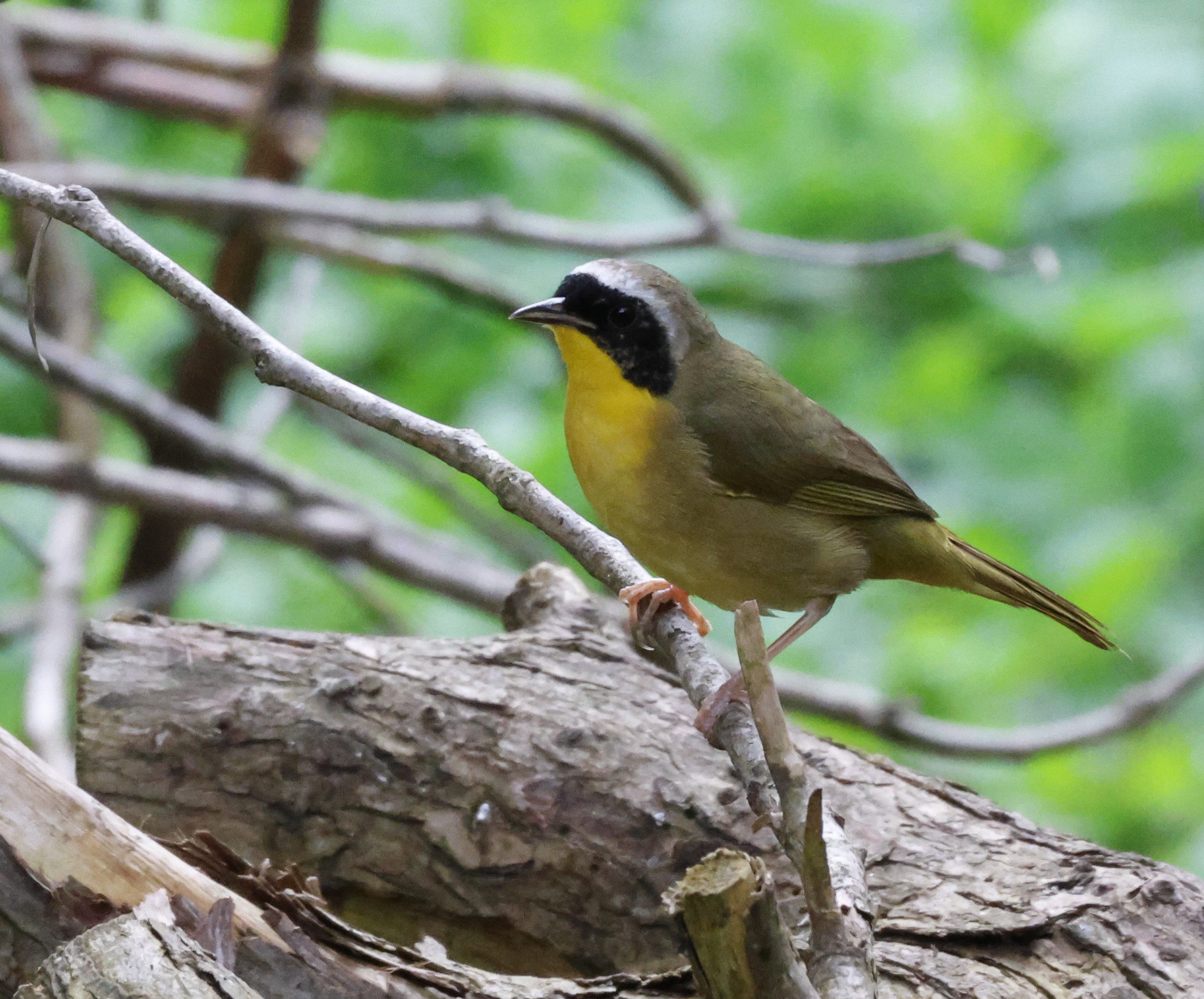
Birding at Black Creek Provincial Park
https://hikes.brucetrail.org/event/birding-at-black-creek-provincial-park-2/Sorry, the registration cut-off time for this hike has been reached.Not a member? Click here to join today!Hosting Club: Peninsula
Category: Birding
Location (Google Maps): Black Creek Provincial Park, Lion’s Head, ONHike Leader(s): Marg Glendon Click here to contact Hike Leader(s)
Pace: Leisurely (2.0 – 3.0 km/h): A relaxed pace with frequent breaks and a focus on enjoyment.
Terrain: Easy: Flat forested sections or lowland trails., Moderate: Rolling hills, mild slopes and rocky paths.
Distance: ~3 to 4 kmDescription
New to birding, curious about birds, or simply enjoy watching them? This short, easy hike is a great introduction to the basics of bird identification using the “5 S’s”: sound, shape, surroundings (habitat), size, and shade (colour).Bird enthusiasts, Pat and Rod Sein, will help us with bird identification, as we practice our birding ID skills along the way. This is a slow paced, stop and listen hike. Be sure to bring binoculars and your favourite bird ID guide. Birding kits – complete with binoculars and resources can also be borrowed from your local Bruce County library (advance booking recommended).
For those interested in earning one of the Peninsula Bruce Trail Club Birding Badges, confirmed bird sightings on this outing may be added to your list. Learn more about the Peninsula Bruce Trail Birding Badges here: https://peninsula.brucetrail.org/badges/
Along the hike, Pat and Rod will also share information about the Bruce Peninsula Biosphere Association, their efforts to protect and steward the environment, and learn more about our shared goals.
Children, 10 years and older, are welcome to join the hike with a supervising adult. Plan on a 1 1/2 – 2 hour “walk, stop, listen” hike experience.
Be prepared for wet, bumpy trail conditions that may be slippery. Weather can be variable at this time of year – dress according to the day’s condition. Bring a light backpack to carry water and personal items.
Sydenham E2E, hike 7 of 7.
https://hikes.brucetrail.org/event/car-hike-sydenham-e2e-hike-7-of-7/Sorry, the registration cut-off time for this hike has been reached.Not a member? Click here to join today!Hike open to BTC Members only.
Hosting Club: Toronto, Sydenham
Category: Car Hike
Location (Google Maps):Blue Water Park, Wiarton, coordinates N 44.742514,W 81.135140
Hike Leader(s): Smadar Junkin Click here to contact Hike Leader(s)
Pace: Brisk (4-5 km/hr)
Terrain: Challenging, Level 3 (Advanced – steep hills and some scrambling over boulders), Variable
Distance (km): 23.25 kmDescription
Badge day, treats or ice cream day. Another E2E will be done! Be there 15 minutes early, bring 2litres of water and food. If you need to get in touch with me use the “Contact Hike Leader” Dialogue box to send a message. We will be shuttling to km 148.5 and walking back. 😊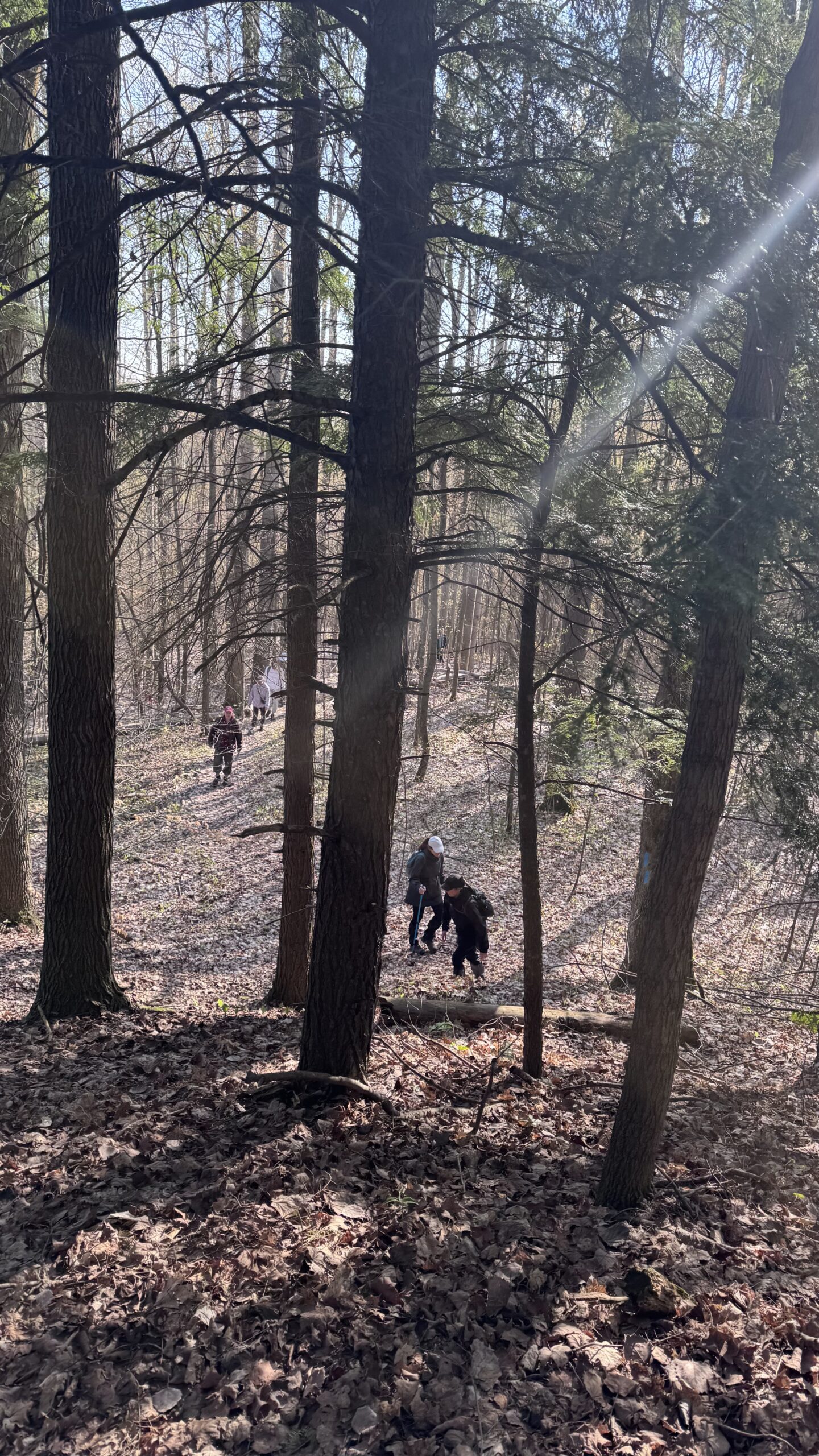
Car Hike: Uxbridge-Brock Track
https://hikes.brucetrail.org/event/car-hike-uxbridge-brock-track-4/Sorry, the registration cut-off time for this hike has been reached.Not a member? Click here to join today!Hosting Club: Toronto
Category: Car Hike
Location (Google Maps):Meet at the Brock Tract parking lot on the east side of Durham 1/Brock Rd., approximately 5 km south of Coppin’s Corners, Uxbridge or 1 km north of Uxbridge Pickering Town Line. 1401 Brock Rd. (Free parking).
Hike Leader(s): Amir Alemohammad Click here to contact Hike Leader(s)
Pace: Moderate (3-4 km/hr)
Terrain: Flat, Hilly, Level 2 (Intermediate – some hills and uneven surfaces, rocks and roots underfoot), Variable
Distance (km): 14-15Description
Join us for a wonderful hike in Uxbridge the capital trail of Canada, in starting from Brock Track parking lot. We will hike the Brock Track and Wilder Forest among the amazing trails of Uxbridge.Boots mandatory, poles recommended, bring 2 litres of water and dress according to weather conditions.
Please arrive at 8:15 for a 8:30 start.
Beware, Iphone Maps may take you to the wrong location. Check the location with Google Maps the previous night.
This is a joint hike with Oak Ridges Trail Association (ORTA).
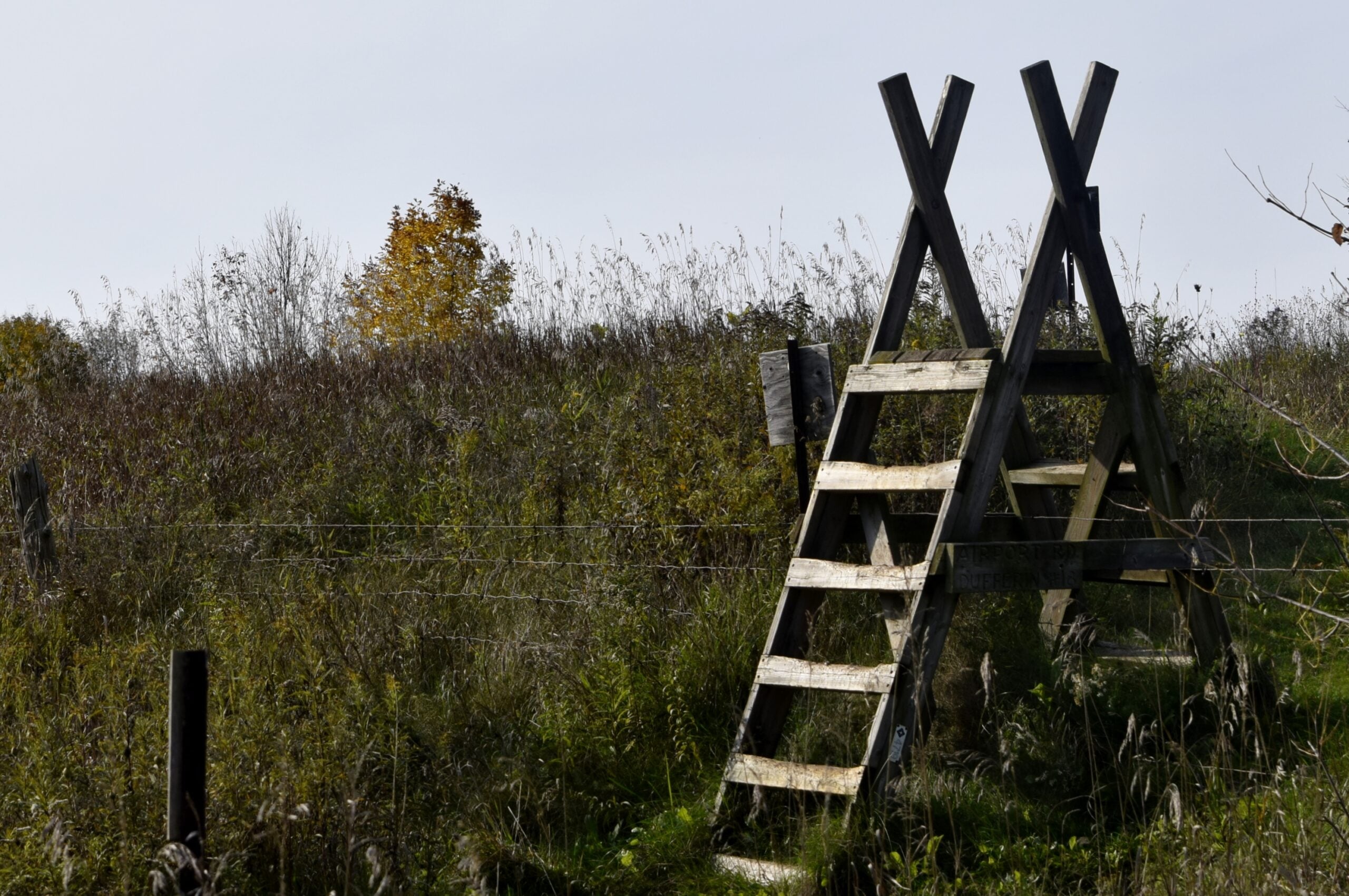
Caledon Hills E2E in 4 - Hike #1
https://hikes.brucetrail.org/event/caledon-hills-e2e-in-4-hike-1/Sorry, the registration cut-off time for this hike has been reached.Not a member? Click here to join today!This is a Multi-Day Hike
You are signing up for the following dates and times:
2026-05-17 at 08:45Hosting Club: Caledon Hills
Category: End-to-End
Location (Google Maps): Meet at Mono Community Centre, 754463 Mono Centre Rd., Mono, ON L9W 5W9, CanadaHike Leader(s): Dan Patterson Click here to contact Hike Leader(s)
Pace: Medium – 3 to 4 km/hour
Terrain: Strenuous – hilly with steep climbs and some poor footing
Distance: 20.94 kmDescription
Meet at Mono Community Center at 8:45 a.m. Look for tennis courts and park in the gravel parking lot. We will shuttle to 5th Line/Hockley Road parking lot at 9:00 a.m. This is an End-to-End hike series to complete the Caledon section of the Bruce Trail in 4 hikes. We will be hiking from the north end to the south end. Join for all or as many hikes as desired – you will need to register for each hike in the series which will take place on the following dates: May 17, 24, June 7, 21. Since this is a group hike, please consider your fitness level before registering. We will be walking at a pace of 3 km – 4 km per hour and hikers will need to keep up with the person in front of them for the duration of the hike. The hike series will also involve car shuttles and every hiker is expected to participate as drivers.Weather conditions can be variable, dressing in layers is recommended. Hiking boots are required and hiking poles are strongly recommended. Bring plenty of fluids, electrolytes and a snack. This section is challenging with many hills.
GO Train Hike: Lilacs At Royal Botantical Gardens Aboretum
https://hikes.brucetrail.org/event/go-train-hike-lilacs-at-royal-botantical-gardens-aboretum/Sorry, the registration cut-off time for this hike has been reached.Not a member? Click here to join today!Hosting Club: Toronto
Category: GO Train Hike
Location (Google Maps):Meet in the Great Hall of Union Station by the information desk with the clock with by 8:45 AM to take the Lakeshore West Express train towards Aldershot departing at 9:04 AM
. You may alternatively board the train departing Mimico GO Station at 9:03 AM that arrives 6 minutes before the 9:04 AM train from Union.
Hike Leader(s): Tom Swales Click here to contact Hike Leader(s)
Pace: Moderate (3-4 km/hr)
Terrain: Level 2 (Intermediate – some hills and uneven surfaces, rocks and roots underfoot), Variable
Distance (km): 10 kmDescription
On this trip we will visit the Katie Osborne Lilac collection, one of the world’s largest and diverse collections. Located primarily in the aboretum, peak blossom typically occurs in mid-to-late May, featuring hundreds of cultivars, including fragrant french hybrids. After the lilacs we will hike the trails of the north shore of Cootes Paradise (hilly).Please note the following before registering:
(1) You will need to book a shuttle bus ticket from the RBG Centre to the Aboretum for the 10:30 – 11:00 window (non-refundable) at https://secure.rbg.ca/overview/10577 ($10.00 + $3.30 booking fee and HST). This fare applies to adults and seniors. There is no extra charge to visit the lilacs and trails at the aboretum but it does not include exhibits in the RBG Centre or other gardens.
(2) We will disembark the GO Train at Burlington Station and take Hamilton Street Railroad Route #1 for 14 minutes to the RBG Centre. There is no extra cost for those using a Presto Card for the GO Train trip. The full fare return GO fare with Presto from Union Station is $20.70 (Seniors are half price). Using a Presto Card may be less than the GO $10 Day Pass as under the One Fare program your TTC and HSR fares are included.
Registration will be limited due to the connecting transit bus and shuttle to the Aboretum.
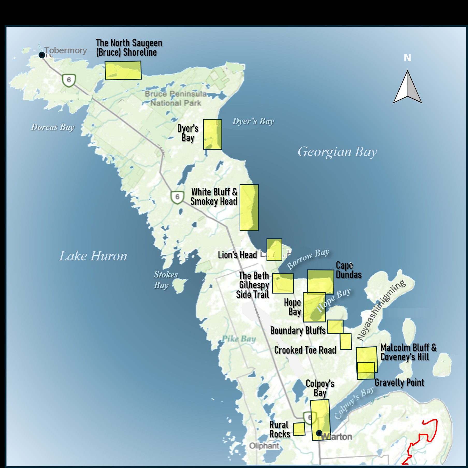
Geology Hike and Badge Series - White Bluff and Smokey Head
https://hikes.brucetrail.org/event/geology-hike-and-badge-series-white-bluff-and-smokey-head/Sorry, the registration cut-off time for this hike has been reached.Not a member? Click here to join today!Hosting Club: Peninsula
Category: Geology Hike
Location (Google Maps): White Bluff/Smokey HeadHike Leader(s): Beth Gilhespy Click here to contact Hike Leader(s)
Pace: Leisurely (2.0 – 3.0 km/h): A relaxed pace with frequent breaks and a focus on enjoyment., Medium (3.0 – 4.5 km/h): A comfortable pace for most hikers with steady progress.
Terrain: Moderate: Rolling hills, mild slopes and rocky paths.
Distance: 11.8Description
Join the adventure and earn the inaugural Peninsula Geology Badge! Over a stretch of 13 hikes and a couple of extra stops, we will explore the fascinating geology of the Peninsula to learn about the rocks, the shoreline features, glaciation, fossils and all things earthy. The 13 hikes are from the book “Walking Through Time – Exploring the Geology of the Saugeen (Bruce) Peninsula”. Having a copy will give you a lot of great information, but you do not have to purchase the book to attend and enjoy the hikes. Just bring your curiosity! We will make sure to hit all the locations that qualify for the beautiful new Walking Through Time – Saugeen (Bruce) Peninsula geology hike badge. If you would like to purchase a book I will have some available on the hikes, or you can pick one up from the BTC Head Office, at Ginger Press in Owen Sound, Suntrail Source for Adventure in Hepworth, the Shop at 84 Main in Lion’s Head and at Reader’s Haven in Tobermory.You are welcome to come on just a few of the hikes or on all of them, and the dates and hikes are as follows:
Date Geology Hike km
Saturday May 2, 2026 Colpoy’s Bay 9.0
Saturday May 9, 2026 Gravelly Point (am) and Rural Rocks (pm) 8.6
Saturday May 16, 2026 Malcolm Bluff 7.3
Sunday May 17, 2026 White Bluff/Smokey Head 11.8
Sunday May 24, 2026 Crooked Toe Road 5.5
Sunday May 31, 2026 Hope Bay 8.1
Sunday June 14, 2026 Boundary Bluffs 5.2
Saturday July 4, 2026 Cape Dundas 6.2
Saturday July 11, 2026 Beth Gilhespy Side Trail 7.6
Saturday August 8, 2026 Lion’s Head 11.0
Saturday August 15, 2026 Dyer’s Bay Loops 7.5
Saturday August 22, 2026 North Saugeen (Bruce) Shoreline 8.0
Meeting times will vary depending on the hike, but will generally be some time between 9 am and 10 am. Information on exact meeting times and locations will be sent out a few days prior to the hike.
Speyside to Vanderleck ST return
https://hikes.brucetrail.org/event/speyside-to-vanderleck-st-return-3/Sorry, the registration cut-off time for this hike has been reached.Not a member? Click here to join today!Hosting Club: Iroquoia
Category: General Hike
Location (Google Maps): Meet at the Speyside Pear Tree parking lot on 15 Side Road at 9:15 am.Hike Leader(s): Karen Bergmann Click here to contact Hike Leader(s)
Pace: Medium – 3 to 4 km/hr
Terrain: Moderate – Some hills and/or some poor footing
Distance: 8 kmsDescription
We will hike the main trail from Speyside, to the Al Shaw ST, Hilton Falls ST and onto the Vanderleck ST up to 17 Side Road and then return the same way. There are some very technical (rocky) sections on this hike but no major hills. Bring bug spray/bug net and a snack, as needed.
Side Trails Hike #4 Welland Canal & Bert Lowe ST
https://hikes.brucetrail.org/event/side-trails-hike-4-welland-canal-bert-lowe-st/Sorry, the registration cut-off time for this hike has been reached.Not a member? Click here to join today!Hosting Club: Niagara
Category: Car Pool
Location (Google Maps): Park at Sobey’s, Glendale Ave and carpool to Decew House Heritage Park km 31.2 Main TrailHike Leader(s): Lynskie Click here to contact Hike Leader(s)
Pace: Brisk 4-5 km/hr
Terrain: Easy: mostly flat, good footing
Distance: 15.5 kmDescription
Park at Sobey’s, Glendale Ave and carpool to Decew House Heritage Park km 31.2 Main Trail (N 43.107568º, W 79.249598º)
Cross the road and follow Bert Lowe ST until it reaches Main Trail at km 20.8
Take the Main Trail back to Sobey’s at km 21.9Photos: Murals painted on the back walls of buildings going uphill by flight locks, City of Thorold Water Tower,
Hiking Tunnel under 406Participate in all 9 scheduled hikes in the NBTC Side Trail Challenge or hike the side trails on your own. Submit your photos to collect the NBTC Side Trail badge.Fitness hike in the Pretty River Valley Provincial Park (spring flowers and gorgeous lookouts long hike)
https://hikes.brucetrail.org/event/fitness-hike-in-the-pretty-river-valley-provincial-park-spring-flowers-and-gorgeous-lookouts-long-hike/Sorry, the registration cut-off time for this hike has been reached.Not a member? Click here to join today!Hosting Club: Toronto, Blue Mountains
Category: Car Hike
Location (Google Maps):Pretty River Valley Provincial Park and Petun Conservation Area
Hike Leader(s): Natalia Svechnikova Click here to contact Hike Leader(s)
Pace: Moderate (3-4 km/hr)
Terrain: Level 3 (Advanced – steep hills and some scrambling over boulders)
Distance (km): about 17 kmDescription
Please join me for an enjoyable spring flowers hike on the Bruce Trail (main and side trails) in the Pretty River River Provincial Park and the Petun Conservation Area. We will be following a relatevily challenging loop of ca 17 km from the south of the park (the Pretty River Road) moving up north to the north-west following the Bruce Trail main and side trails into the Petun Conservation area and down south passing many gorgeaus lookouts.Please note that this is a long hike and a relatively long day trip if you are coming from the GTA.
We will try to keep a moderate pace of about 3 km/h while slowing down uphill. The trail is challenging with a few uphill sections after which we will stop for short water breaks. There will be a lunch break for about 20 min. We should be back to the parking lot around 4:30 pm.
Please be dressed for the weather, wear hiking shoes/boots, bring extra layers and pack your rain gear (just in case), at least 2 L of water, light lunch and snacks, your sunglasses and/or hut.
We will meet on the dedicated Pretty River PP parking lot on the Pretty River Road (exact map location 44.43147754685496, -80.27512513140113) around 10:30 am and start hiking at 10:40 am.
Please note that this hike is not suitable for a rainy/stormy day and will be cancelled in case of inclement weather.
Exploring Sydenham Hike #37 Mystery Cabin
https://hikes.brucetrail.org/event/exploring-sydenham-hike-37-mystery-cabin-2/Sorry, the registration cut-off time for this hike has been reached.Not a member? Click here to join today!Hosting Club: Sydenham
Category: General Hike
Location (Google Maps): We will carpool from 2888 3rd Ave. W., Owen SoundHike Leader(s): Bill Snel Click here to contact Hike Leader(s)
Pace: Leisurely: 3 km/h or less
Terrain: Easy: Mostly flat and good footing., Moderate: Some hills and/or poor footing
Distance: 3 kmDescription
We will carpool from Owen Sound to do a loop hike of the Mystery Cabin side trail. This is hike 37 in the book Exploring Sydenham. There will be one secret to find. If you do not have a book and would like one ($30) let me know by using the “Contact hike leader” link. - 18May 18, 2026
Monday only (Niagara End 2 End)
https://hikes.brucetrail.org/event/monday-only-niagara-end-2-end/Sorry, the registration cut-off time for this hike has been reached.Not a member? Click here to join today!Hosting Club: Niagara
Category: Hike
Location (Google Maps): Monday May 19: Queenston Heights Park, Niagara Parkway, Niagara on the Lake 43’159314-79.055405 ( south east parking. lot) * Parking pass will be handed out prior to boarding the bus.Hike Leader(s): Mary Ann Enns Click here to contact Hike Leader(s)
Pace: Leisurely <3 km/hr
Terrain: Moderate: some hills and some poor footing
Distance: 27 kmDescription
This is the NBTC Annual End to End Event in 1 day hike from Brock University to Queenston Cairn. This is a self guide hike. The hike is in conjunction with Niagara’s End to End in Three.Distance 27 km.
Please arrive by 6.30am to check in. Buses will depart promptly at 7am. Hikers will be transported by bus to Brock University, where they will hike at their own pace to final checkpoint at the Queenston Cairn.
Niagara’s amazing volunteers will greet you at approximately every 10km offering nutritious snacks, replenish water, a place to rest and provide plenty of encouragement to keep you moving forward.
Trial Angels will also be available throughout day to provide assistance whenever needed.
*Checkpoint coordinates and Trail Angel contact information will be shared with you well in advance.
Attention Trail Runners: Please contact the Hike Leader with your approximate pace so our checkpoint volunteers can be ready when you arrive. Thank you
Pack for weather and terrain, a cell phone is important to bring, appropriate footwear, poles if you prefer, basic first aid and trail map or BT App.
Hikers are responsible for informing the organizing personnel of their intention to drop out of the hike
Fee includes bus, checkpoint and parking in Queenston. * Parking passing will provided prior to boarding the bus.
Proceeds support the Niagara Bruce Club with in turn supports The Bruce Tail Conservancy mission to ” Preserving a ribbon of wilderness for everyone forever”.
Car Hike: Blue Mountains E2E #3/4
https://hikes.brucetrail.org/event/car-hike-blue-mountains-e2e-3-4/Sorry, the registration cut-off time for this hike has been reached.Not a member? Click here to join today!Hosting Club: Toronto, Blue Mountains
Category: Car Hike
Location (Google Maps):Meet up location. roadside parking along the north side of Maple Lane. Parking is prohibited on the south side of the road. Do not block driveways. GPS N44.504973, W80.331780
Hike Leader(s): Ross Estrella Click here to contact Hike Leader(s)
Pace: Brisk (4-5 km/hr), Moderate (3-4 km/hr)
Terrain: Challenging, Hilly, Level 2 (Intermediate – some hills and uneven surfaces, rocks and roots underfoot), Rocky
Distance (km): 12.0kmDescription
Day 3/4 of BMBTC E2E. Hikers must complete the entire Blue Mountain section to earn and receive their badge upon completion. Missed segment/s must be made up prior to the completion of the last segment to receive your badge. Hikers who are completing their missed section of BMBTC are welcome to join. This segment will pass thru Petun Conservation Area and Blue Mountain corridor. Expect some challenging rolling hills, rocks and underfoot trail but you’ll be rewarded with stunning beauty of the surrounding landscape. We’ll be on a moderate to brisk pace. Day hike essentials to bring; lunch/snacks, sufficient liquid hydration of your choice, sun screen, bug spray, head covering for sun protection and dress appropriately for the forecasted weather. As we are in the middle of spring season some section could be muddy/slippery therefore, hiking poles, waterproof hiking shoe and gaiter are strongly recommended. Fifteen minutes early arrival is expected and please make sure your car ready for shuttling.We’ll shuttle to parking area on the east side of 2nd Line, 320 meters north of km 55.7. GPS N44.449741, W80.307524
Cost of badge is Ten dollars for BTC members and Fifteen dollars for non members.
Car HIke: Dog-Friendly Caledon side trail hikes
https://hikes.brucetrail.org/event/car-hike-dog-friendly-caledon-side-trail-hikes/Sorry, the registration cut-off time for this hike has been reached.Not a member? Click here to join today!Hosting Club: Toronto, Caledon Hills
Category: Car Hike
Location (Google Maps): Hockley Valley SouthHike Leader(s): Lindita Kalo Click here to contact Hike Leader(s)
Pace: Mixed (See Hike Description), Moderate (3-4 km/hr)
Terrain: Challenging, Level 3 (Advanced – steep hills and some scrambling over boulders), Variable
Distance (km): 20km, Optional dropout at 10kmDescription
Join me on the series of dog friendly to complete Caledon side trail challenge. You have the option to hike 10km, or 20km. Both hikes Hockley Valley main Bruce trail and side trail.
Those hikes have some hills. We will keep moderate speed. For those joining both hikes be true to your abilities of hiking long distance.EASY DOES IT HIKE, Ed Burkout Trail
https://hikes.brucetrail.org/event/easy-does-it-ed-burkout-trail/Sorry, the registration cut-off time for this hike has been reached.Not a member? Click here to join today!Hosting Club: Niagara
Category: Leisurely
Location (Google Maps): Centennial Park, Church St., FenwickHike Leader(s): Diane Marlatt Click here to contact Hike Leader(s)
Pace: Leisurely <3 km/hr
Terrain: Easy: mostly flat, good footing
Distance: 6 KmDescription
Cancelled - Dufferin Hi-Land Side Trails Badge - Pine River Valley Loops
https://hikes.brucetrail.org/event/dufferin-hi-land-side-trails-badge-pine-river-valley-loops/Sorry, the registration cut-off time for this hike has been reached.Not a member? Click here to join today!Hike open to BTC Members only.
Hosting Club: Dufferin Hi-Land
Category: Cancelled
Location (Google Maps): Bruce Trail parking lot located off of 15 Sideroad 50 metres west of Prince of Wales (west of Kilgorie). See Google Maps link for GPS coordinates.Hike Leader(s): Stuart Law Click here to contact Hike Leader(s)
Pace: Medium
Terrain: Strenuous
Distance: 12.5 kmsDescription
Please join us for the first of a series of hikes to cover all the Side Trails in the beautiful Dufferin Hi-Land section. This hike is strenuous but rewarding given the many hills. Hiking boots mandatory. Please bring bug spray and wear long sleeves and pants. Please also bring 2L of water, a lunch and a smile. Special guest Dufferin Hi-Land club president, hike leader and BTC webmaster, Tom Thayer. - 19May 19, 2026
Long Haulers Hike NEW TIME NEW LOCATION
https://hikes.brucetrail.org/event/long-haulers-hike-new-time-new-location/Sorry, the registration cut-off time for this hike has been reached.Not a member? Click here to join today!Hosting Club: Niagara
Category: Hike
Location (Google Maps): Short Hills Wiley Road, ThoroldHike Leader(s): Alan Laver Click here to contact Hike Leader(s)
Pace: Fast 5+ km/hr
Terrain: Moderate: some hills and some poor footing
Distance: 10k+Description
Back to our regular Spot for the Tuesday Long Hike. Note the new location. We will hike the trails around Short Hills Dress for the weather and bring sunscreen bug spray, poles snack and drink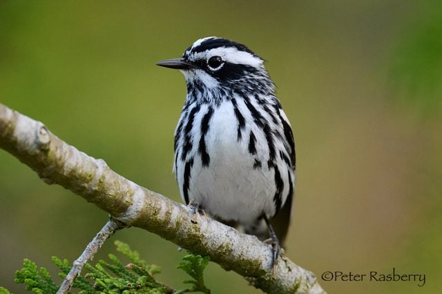
Warblers and Waterfowl
https://hikes.brucetrail.org/event/warblers-and-waterfowl-2/Sorry, the registration cut-off time for this hike has been reached.Not a member? Click here to join today!Hosting Club: Peninsula
Category: Birding
Location (Google Maps): Isaac Lake Road, Wiarton, OntarioHike Leader(s): Marg Glendon Click here to contact Hike Leader(s)
Pace: Leisurely (2.0 – 3.0 km/h): A relaxed pace with frequent breaks and a focus on enjoyment.
Terrain: Easy: Flat forested sections or lowland trails.
Distance: ~3kmDescription
Join local birding enthusiast and retired outdoor educator, Peter Rasberry, for some Spring birding at the Isaac Lake Management Area Tuesday, May 19. Raindate Wednesday, May 20.225 species have been recorded here on eBird. This hike date should put us smack in the middle of spring migration which bodes well for both warblers and waterfowl, and a host of other songbirds.
All levels of birding welcome! This hike is a family friendly hike – is a “walk, sit/stand, listen/observe” type of hike.
Binoculars would be helpful. Wear a hat, longsleeved shirt/pants. A bug net may be helpful. Bring a light backpack to carry water, snacks, bird ID guides, insect repellent and personal materials. A portable sit-stool/lawn chair is optional.
Binoculars and bird ID guides are available to borrow from your local Bruce County library – book ahead. This bird hike will be about 2 hours in duration. Participants are welcome to linger longer after the group hike.
A portapottie is available at the boat launch.
The Waterfall Hike - followed by an option for lunch at the Harrison Park Inn
https://hikes.brucetrail.org/event/the-waterfall-hike-followed-by-an-option-for-lunch-at-the-harrison-park-inn/Sorry, the registration cut-off time for this hike has been reached.Not a member? Click here to join today!Hosting Club: Sydenham
Category: General Hike
Location (Google Maps):Harrison Park parking lot close to the bridge
Hike Leader(s): Sheri Hatcher Click here to contact Hike Leader(s)
Pace: Brisk: 4 to 5 km/h
Terrain: Moderate: Some hills and/or poor footing
Distance: 15 kmDescription
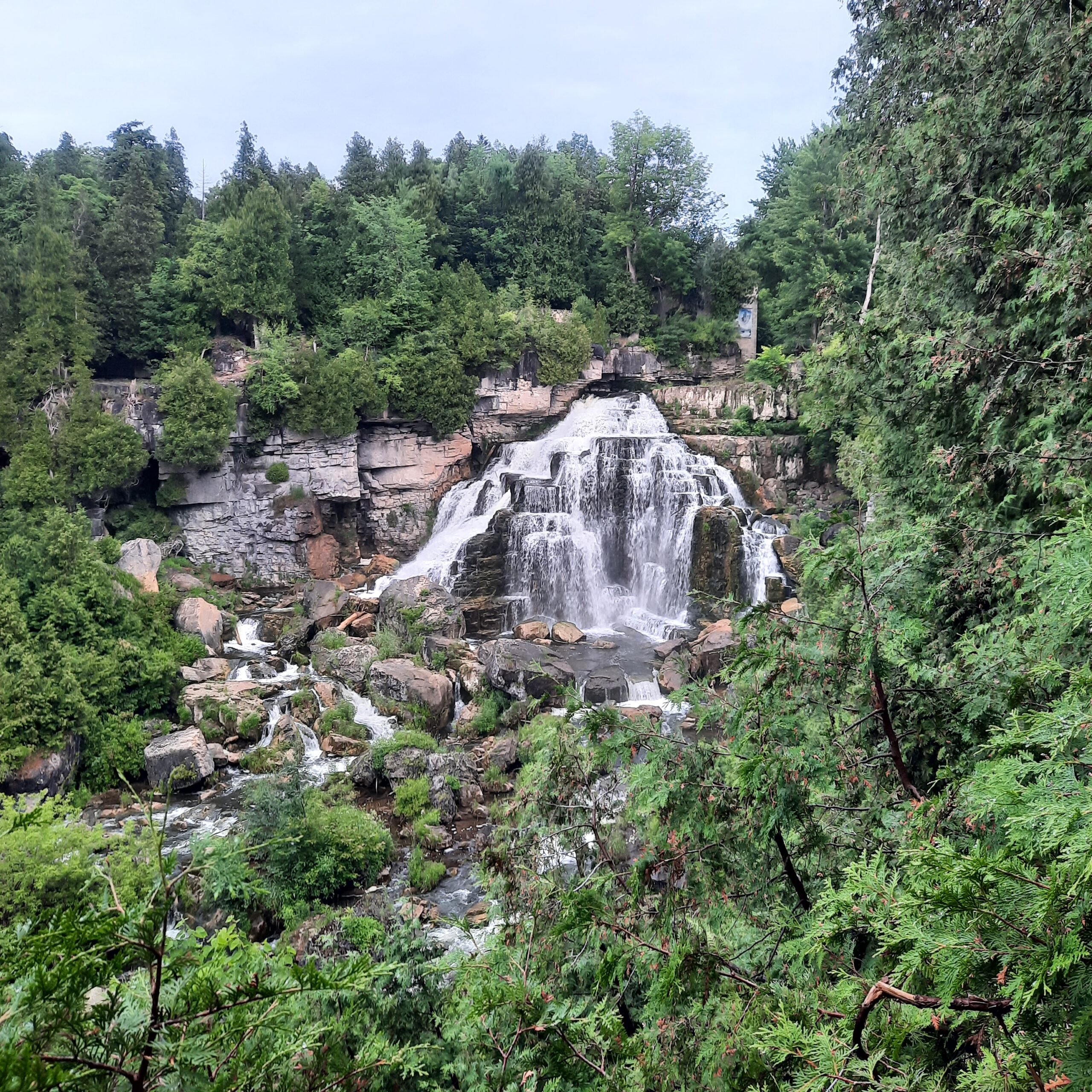
From Harrison Park, we will carpool to the Grey Bruce Tourist Information Centre (west of km 101.8 Ed 31), where our hike begins. We’ll follow the main trail from Springmount to Inglis Falls Conservation Area, then continue along the Harrison Park Side Trail to the Harrison Park Inn. Along the way, we’ll visit Jones Falls, Inglis Falls, and Weavers Creek Falls, taking short breaks to enjoy the beauty of the cascading water. We’ll finish at the Inn, where anyone who wishes can stay for a well‑deserved lunch.9:15 Short Hike, Rotary Park, St. Catharines
https://hikes.brucetrail.org/event/915-short-hike-rotary-park-st-catharines-20/Sorry, the registration cut-off time for this hike has been reached.Not a member? Click here to join today!Hosting Club: Niagara
Category: Hike
Location (Google Maps): Rotary Park, 376 Regional Rd 69, St. CatharinesHike Leader(s): Debbie Demizio Click here to contact Hike Leader(s)
Pace: Medium
Terrain: Moderate
Distance: 6 kmDescription
Hike the trails around Rotary Park, St. Catharines. Please bring water, hiking poles and appropriate footwear.Urban Walk: Valley View Park Thornhill
https://hikes.brucetrail.org/event/urban-walk-valley-view-park-thornhill-169/Sorry, the registration cut-off time for this hike has been reached.Not a member? Click here to join today!Hosting Club: Toronto
Location (Google Maps): Parking lot is off Sycamore Drive, East of Bayview , across Starbucks plaza
Bus 91 from Finch East station stops at Sycamore station.Hike Leader(s): MOHAMMAD AGHAMIRI Click here to contact Hike Leader(s)
Pace: Moderate (3-4 km/hr)
Terrain: Hilly, Level 2 (Intermediate – some hills and uneven surfaces, rocks and roots underfoot)
Distance (km): 6-7 kmDescription
We will explore Valleyview and Maple View parks, and walk along German Mill Creak, in return we stop in Huntington park and have snack under beautiful shed.Although this is considered an “Urban Walk”, you can expect some hills up and down and uneven surfaces with tree roots. Please bring hiking poles, Ice cleats water and snacks.
Primrose Loop Side Trail to Murphy's Pinnacle
https://hikes.brucetrail.org/event/primrose-loop-side-trail-to-murphys-pinnacle-4/Sorry, the registration cut-off time for this hike has been reached.Not a member? Click here to join today!Hosting Club: Dufferin Hi-Land
Category: Tuesday Hike
Location (Google Maps):Dufferin Hi-land. Map 20. Meet at roadside parking on Prince of Wales Rd. (County Rd. 19) where the Primrose Loop Side Trail crosses Prince of Wales Rd. From Primrose (intersection of Hwy 10 and 89) drive north for about 1.5 km. Parking is about 0.7 km north of the bridge on the east side of the road.
Hike Leader(s): Les Babbage, Inge Eckerick, Julie Daley,Tony Evangelista, Click here to contact Hike Leader(s)
Pace: Leisurely
Terrain: Slippery and Steep Sections, Moderate
Distance: Long hike 7 km Short hike 3kmDescription
We will hike the Primrose Loop Side Trail on the west side of Prince of Wales Rd. Then, after crossing the road and returning to the cars, we will head toward the Main Trail where we will turn left towards Murphy’s Pinnacle, climb to the top and take in the view. We will then return to Prince of Wales Rd. The short hike will end after completing the Primrose Loop Side Trail. Bring water and snacks.Tuesday Trekkers- Kimberley Forest
https://hikes.brucetrail.org/event/kimberley-forest-2/Sorry, the registration cut-off time for this hike has been reached.Not a member? Click here to join today!Hosting Club: Beaver Valley
Location (Google Maps): Beaver Valley section, km 82.4. Please meet at parking on 7A.
Map 26-ED 31Hike Leader(s): Kristina Rettie Click here to contact the hike leader.
Pace: Brisk, Medium
Terrain: Moderate, Some rocky footing, Some steep sections, Strenuous
Length of Hike: 11kmDescription
This loop hike will take us from km82.4 southbound through Kimberley Forest side Trail. Once we reach the end of Kimberley Forest we will continue on the Valley Crossover Side Trail and go up Beaver Valley ski hill. (yup, you read that right). We will then follow the escarpment north back to our cars.This time of year we can expect all types of trail conditions. Please be prepared for day of conditions.
Bring water and a snack
Please no dogs
Text Kristina @ 519-410-9077 for morning of cancellations
In/Out to Crawford Lake CA from Kilbride Park
https://hikes.brucetrail.org/event/in-out-to-crawford-lake-ca-from-kilbride-park/Sorry, the registration cut-off time for this hike has been reached.Not a member? Click here to join today!Hosting Club: Iroquoia
Category: General Hike
Location (Google Maps): We will meet behind Kilbride Public School (6611 Panton St.) by the tennis courts. Ignore the one-way arrowsHike Leader(s): Karen Capindale-Smith Click here to contact Hike Leader(s)
Pace: Medium – 3 to 4 km/hr
Terrain: Moderate – Some hills and/or some poor footing
Distance: 16+/- kmDescription
We will leave the parking lot at 9:30 am SHARP via the “Kilbride Pass” and entering the woods of Yaremko Nature Reserve. We will continue on the BT past the calcium pits over to Guelph Line where we will enter Crawford CA. Taking the side trail, we will make our way toward the lake (and hopefully around it if construction is completed). After lunch at the Information Centre we will hike the Crawford Lake Side Trail around to the lookout over the Nassagaweya Canyon. We will make our way back to Kilbride from here using alternate trails where possible.Please remember to dress in layers and bring water, snacks and lunch.
Baked goods can be expected 🙂
- 20May 20, 2026
8:30am Queenston Training Hike
https://hikes.brucetrail.org/event/830am-queenston-training-hike/Sorry, the registration cut-off time for this hike has been reached.Not a member? Click here to join today!Hike open to BTC Members only.
Hosting Club: Niagara
Category: Loop
Location (Google Maps): Locust Grove Picnic Area. Parking is free.Hike Leader(s): Suzanne Gourluck Click here to contact Hike Leader(s)
Pace: Brisk 4-5 km/hr
Terrain: Strenuous: hilly, with steep climbs, poor footing
Distance: 8 kmDescription
Do you need to do some training for an upcoming holiday or some Bruce Trail End to Ends? Then come and join us on this challenging loop in Queenston Heights.We will start at Locust Grove and go up the main flight of stairs to the monument. Then descend another flight of stairs down into Queenston where we will take the hill down to the dock before returning to the start to make it a loop.
We will repeat this together a few times!Be warned, the long flights of stairs and hills will make this a challenging hike so please consider this before signing up.
Please dress appropriately and bring water and poles.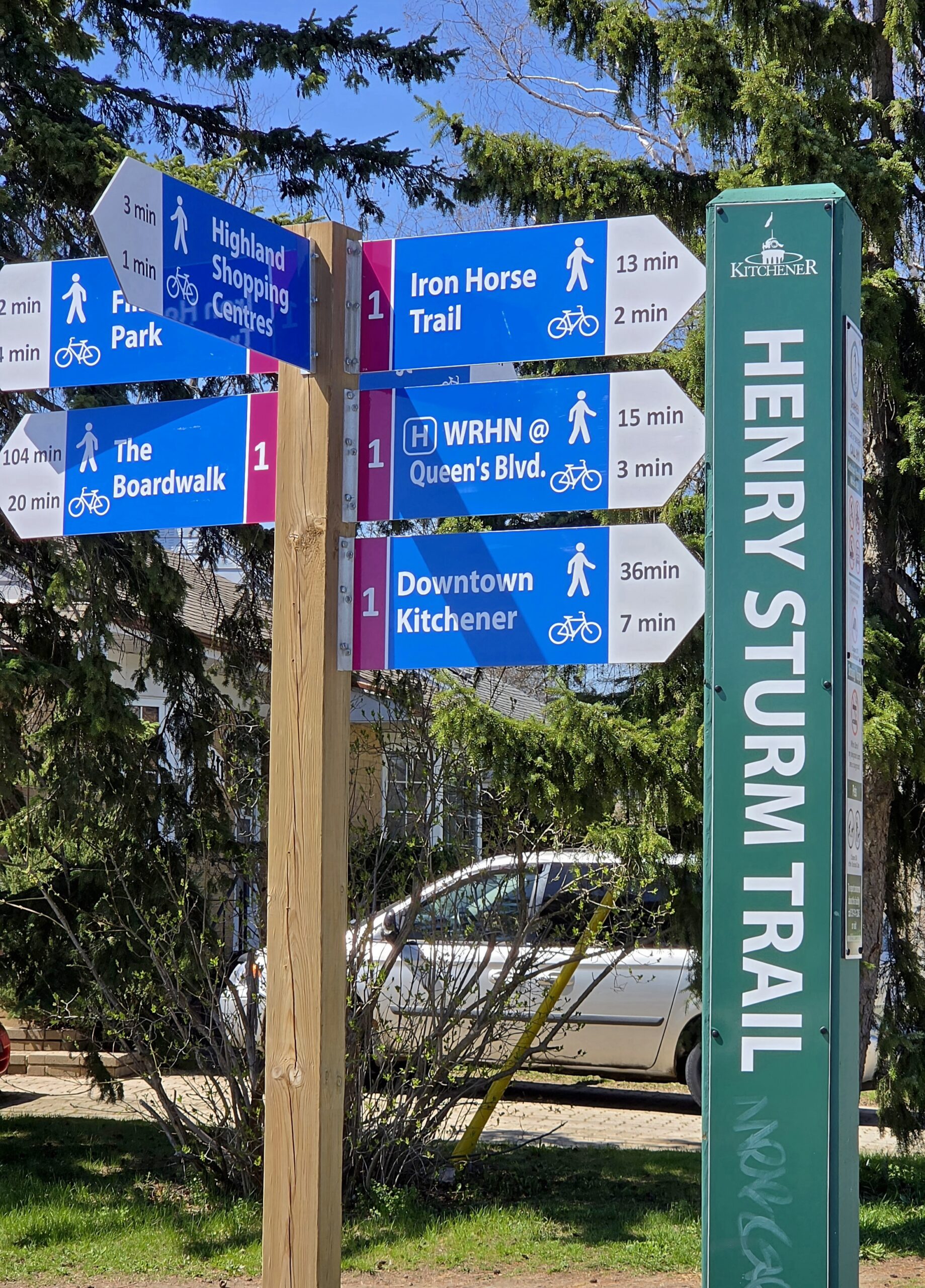
Waterloo Region Wednesday Wayfairers
https://hikes.brucetrail.org/event/waterloo-region-wednesday-wayfairers/Sorry, the registration cut-off time for this hike has been reached.Not a member? Click here to join today!Hosting Club: Caledon Hills
Category: General
Location (Google Maps): Meet at The Beer Store, 875 Highland Rd. W., (Highland Rd. and Fischer-Hallman Rd.)Hike Leader(s): Dan Patterson Click here to contact Hike Leader(s)
Pace: Medium – 3 to 4 km/hour
Terrain: Easy – mostly flat and usually good footing
Distance: 10 kmDescription
Meet at 8:45 a.m. and walk on the Henry Strum Trail connecting with the Hearth Green Trail to Lakeshore Park, then take the Conestoga Parkway overpass to Strasburg & Ottawa Streets for coffee. We will return on the same route back to the cars. Study boots, sufficient water, snacks and a good attitude are required. Poles are optional. This is a very flat trail.Birding Hike with David Turner
https://hikes.brucetrail.org/event/birding-hike-with-david-turner/Sorry, the registration cut-off time for this hike has been reached.Not a member? Click here to join today!Hosting Club: Blue Mountains
Category: Organized Hike
Location (Google Maps): We will meet at Tim’s and carpool to parking on 9/10 Sideroad Nottawasaga south of Nottawasaga Bluffs CA.Hike Leader(s): Jim Lewis Click here to contact Hike Leader(s)
Pace: Leisurely – 3 km/hr. or less
Terrain: Moderate – Some hills and/or some poor footing
Distance: 5kmDescription
Please join us for this birding hike, led by birding expert David Turner. David started birding as a youth in his home town in England, where he was born. He has been actively studying the birds in the Beaver Valley for over 15 years and has spotted over 230 species of the known 240 species. David started the Beaver Valley Birding Club, to bring together birding enthusiasts. It has over 770 members and is still growing. It will be a treat and very educational to spend some time with David as he shares his expertise.We will meet at Tim’s on 1st Street in Collingwood and carpool to Conc 10 Nottawasaga and follow the trail east past a beautiful meadow where Bobolinks nest. We will look for singing males defending their territories. There is a mix of hardwoods, cedars, and a sparkling stream that should provide more birds and spring wildflowers. We will loop back to our cars having completed about a 5 km hike. Bring your binoculars!
Spaces will be limited to 15 hikers, so please register in advance.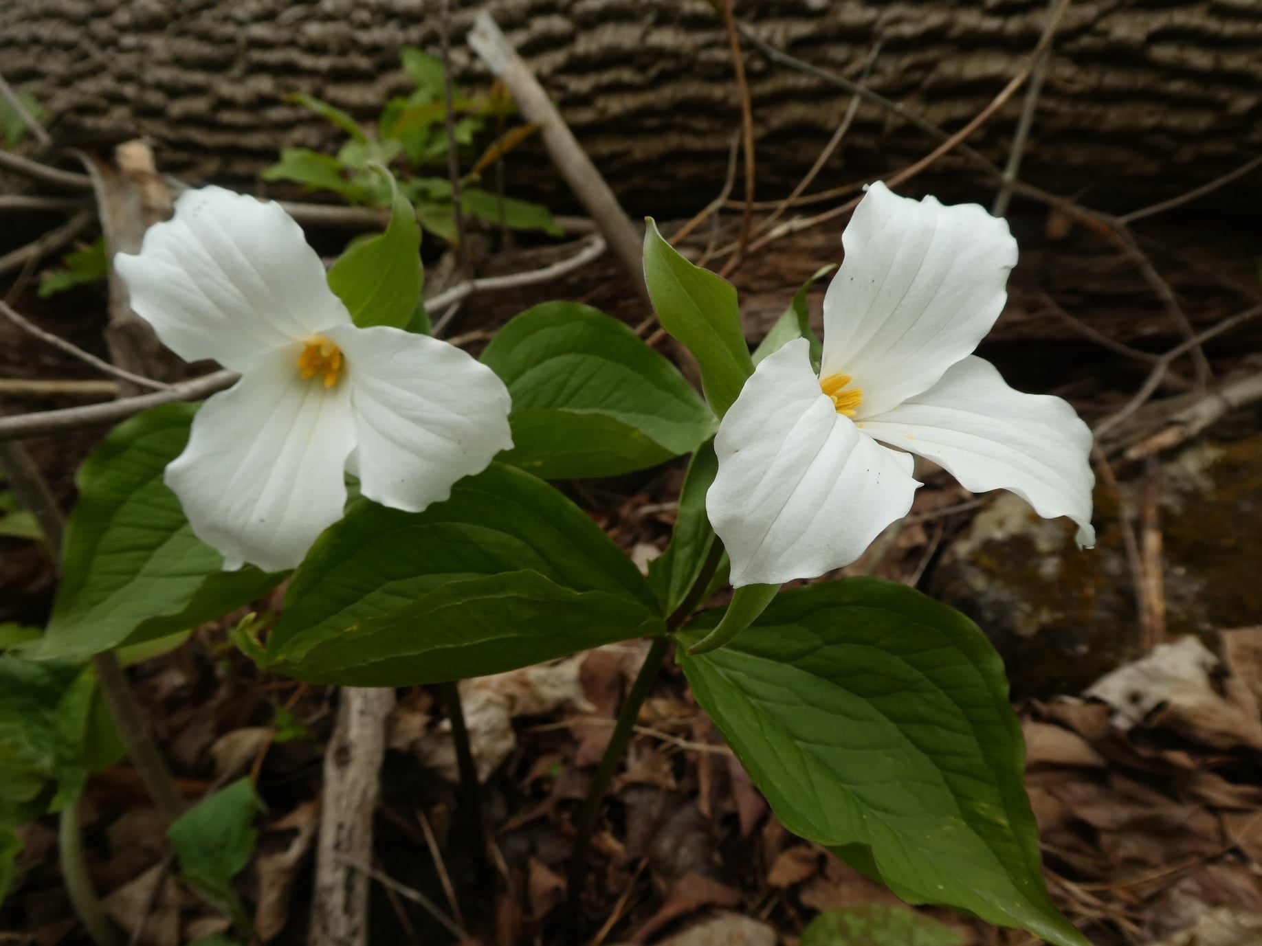
Halton Agreement Forest
https://hikes.brucetrail.org/event/halton-agreement-forest/Sorry, the registration cut-off time for this hike has been reached.Not a member? Click here to join today!Hosting Club: Iroquoia
Category: General Hike
Location (Google Maps): Meet at the corner of 10 Side Road and 4th Line at 9:15 am.Hike Leader(s): Karen Bergmann Click here to contact Hike Leader(s)
Pace: Medium – 3 to 4 km/hr
Terrain: Moderate – Some hills and/or some poor footing
Distance: 8 kmsDescription
On the lookout for Trillium and other wildflowers. We will hike the bike trails around a big loop. Bring bug spray/bug net and plenty of water.WEDNESDAY WALKERS - Loree Forest
https://hikes.brucetrail.org/event/wednesday-walkers-loree-forest-4/Sorry, the registration cut-off time for this hike has been reached.Not a member? Click here to join today!Hosting Club: Beaver Valley
Location (Google Maps): Paid parking on the shoulder of the 21st Side Road. Map 24, Edition 31 (Arrangements can be made in advance to shuttle to the trailhead.)
Hike Leader(s): Margaret Yaraskavitch Click here to contact the hike leader.
Pace: Medium
Terrain: Easy
Length of Hike: 6.5 kmsDescription
We will take the access road into Loree Forest where we will then walk a loop. Most of the Trail is flat. There will be views of Nottawasaga Bay and a walk through a mature deciduous forest. Then we take the access road back to our parking area. A popular well-enjoyed route. Please bring water.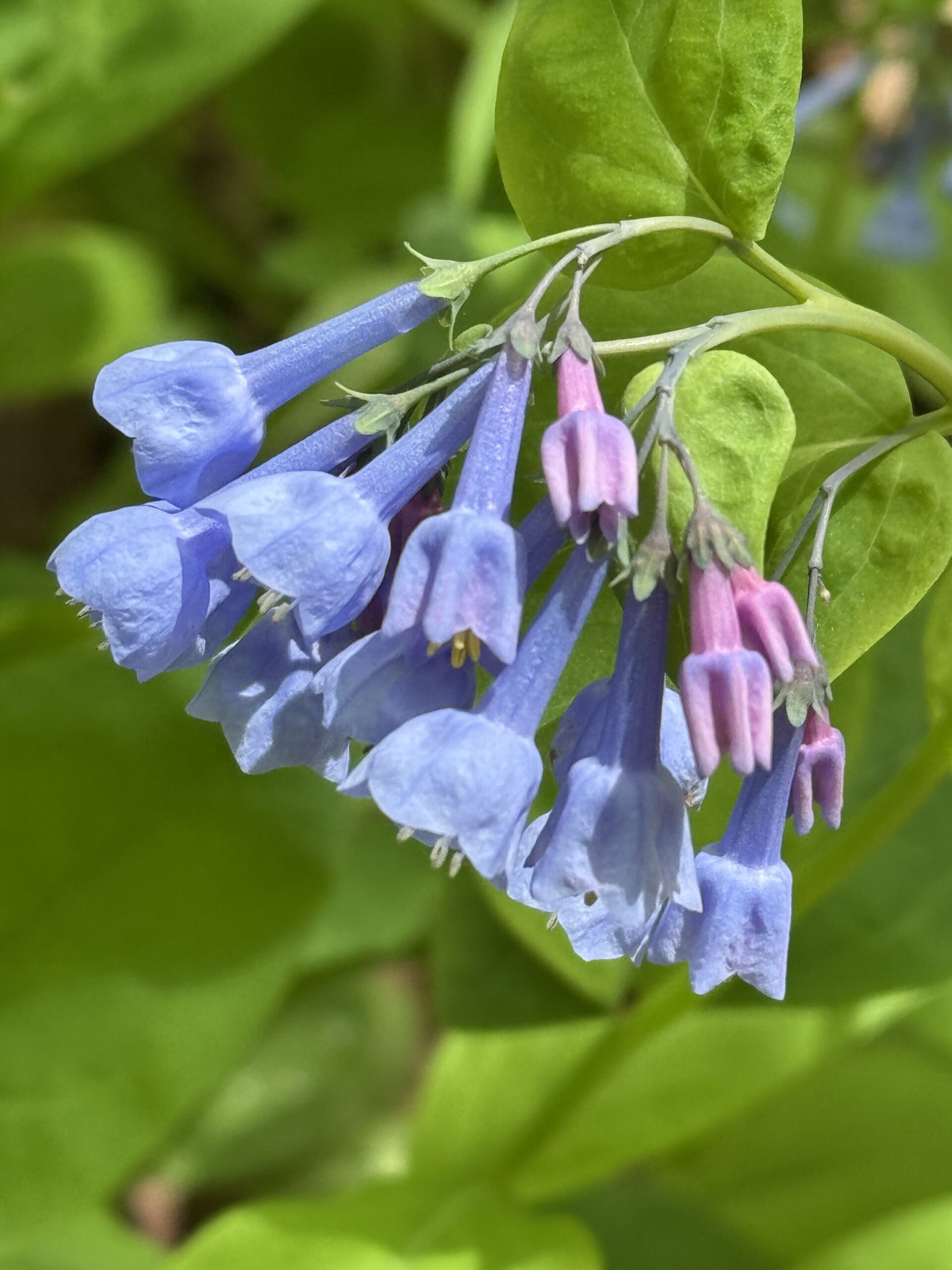
Annual Bluebell Hike
https://hikes.brucetrail.org/event/annual-bluebell-hike-2/Sorry, the registration cut-off time for this hike has been reached.Not a member? Click here to join today!Hosting Club: Iroquoia
Category: Good Companions
Location (Google Maps): Oakville, Sixteen Mile Creek ValleyHike Leader(s): Anne Armstrong Click here to contact Hike Leader(s)
Pace: Leisurely – 3km/hr or less
Terrain: Moderate – Some hills and/or some poor footing
Distance: Approx. 9 km. – 10 km.Description
Please join in this hike to savour the many wildflowers which grow in the Sixteen Mile Creek Valley, especially the Virginia Bluebells. Depending on the season’s progress they should be at their best. Please meet in the parking lot at the end of Old Upper Middle Rd., located south of the current Upper Middle Rd. and west of Oxford St. We will hike north into the valley and complete a loop, bringing us back to the start. Bring water, a snack, sunscreen and insect repellent. Poles may be useful for the hills. I will send out a message the day before with my contact information in the event that you need to cancel the morning of the hike.Niagara Glen Short and Sassy
https://hikes.brucetrail.org/event/niagara-glen-short-and-sassy-8/Sorry, the registration cut-off time for this hike has been reached.Not a member? Click here to join today!Hosting Club: Niagara, Iroquoia
Category: Good Companions
Location (Google Maps):Niagara Glen, 3050 Niagara Parkway, Niagara-on-the-Lake, ON
Hike Leader(s): Craig Sim Click here to contact Hike Leader(s)
Pace: Medium – 3 to 4 km/hr
Terrain: Moderate – Some hills and/or some poor footing
Distance: 7k (approximate)Description
Loop hike in beautiful Niagara Glen, NOT using Whirlpool Trail. We meet in between Niagara Glen parking lot and building near lot. Pay parking or Niagara parks pass. Trail ranges from moderate to quite rocky, has hills and stairs. Watch footing. Lots of boulders and great views close to Niagara River. We descend steel stairs before and after hike. Wear hiking boots or shoes. Bring water, snack, appropriate layered clothing for the weather and rain gear. Optional beverage/food after. Niagara Glen is close to both Butterfly Conservatory and Floral Clock.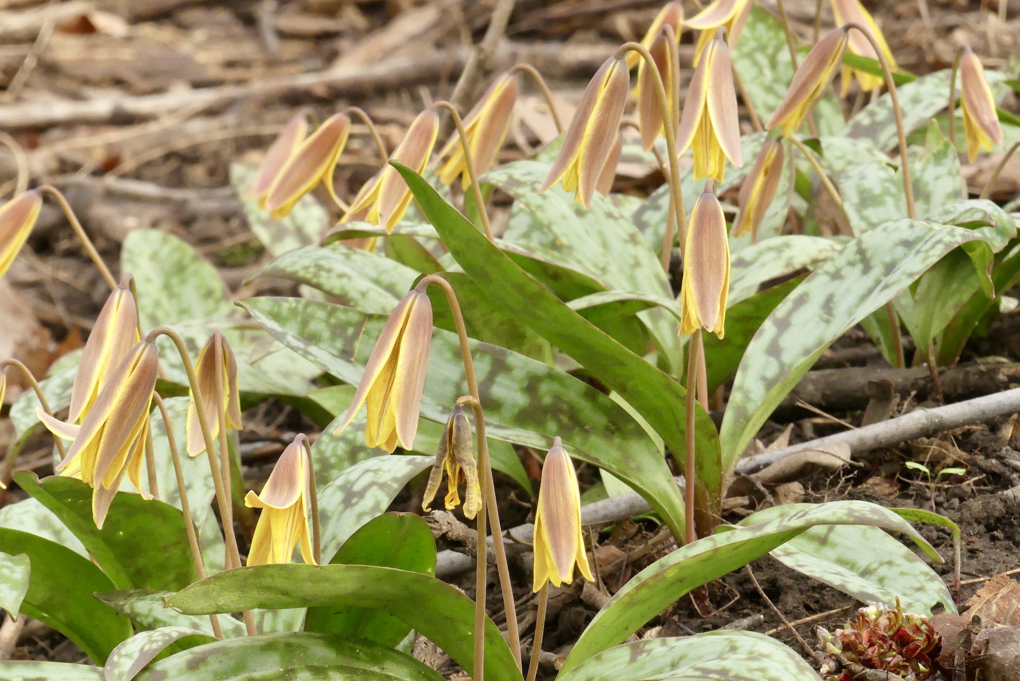
Car Hike: Tiptoe through the Wildflowers
https://hikes.brucetrail.org/event/car-hike-tiptoe-through-the-wildflowers/Sorry, the registration cut-off time for this hike has been reached.Not a member? Click here to join today!Hosting Club: Toronto
Category: Car Hike
Location (Google Maps): We will meet at the roadside parking on Third Line (Map 12)Hike Leader(s): Janet Patterson; Angelika Sommer Click here to contact Hike Leader(s)
Pace: Leisurely (2-3 km/hr)
Terrain: Level 1 (Easy – mostly on flat, well maintained trails with hard-packed surface), Variable
Distance (km): Approx 5 – 6 kDescription
Join us for a leisurely walk through a variety of forested areas and wetlands, on the main trail and the Charles Hildebrandt Side Trail. Together with our plant experts Angelika, Gen and Rose Mary, we will search for native wildflower species that thrive before the trees fully “leaf out”, and discuss their role in the forest ecosystem.This will be an ideal opportunity to document your sightings for the club’s Biodiversity Naturalist badge.
What to bring:
- water (1 litre minimum), lunch, snacks
- Sun screen, hat
- Insect repellent
- Smart phone, if you plan to use iNaturalist
This hike is brought to you by the TBTC Biodiversity Team. We endeavour to promote the critical role we can all play in protecting and conserving the Niagara Escarpment.
Limit of 10 participants
RAINBOW HIKE: Japanese Interval Walking - Chedokee Trail
https://hikes.brucetrail.org/event/rainbow-hike-japanese-interval-walking-chedokee-trail/Sorry, the registration cut-off time for this hike has been reached.Not a member? Click here to join today!Hosting Club: Iroquoia
Category: Rainbow Hike
Location (Google Maps): Hillcrest Loop, bottom of Dundurn stairsHike Leader(s): Doug O’Neill Click here to contact Hike Leader(s)
Pace: Brisk – 4 to 5 km/hr, Leisurely – 3km/hr or less
Terrain: Easy – Mostly flat and usually good footingDescription
Everyone is welcome on this uber-friendly, all-inclusive 2SLGBTQAI+ Rainbow Hike.Japanese Interval Walking was a hit last summer and fall so we’ll try it again this season!
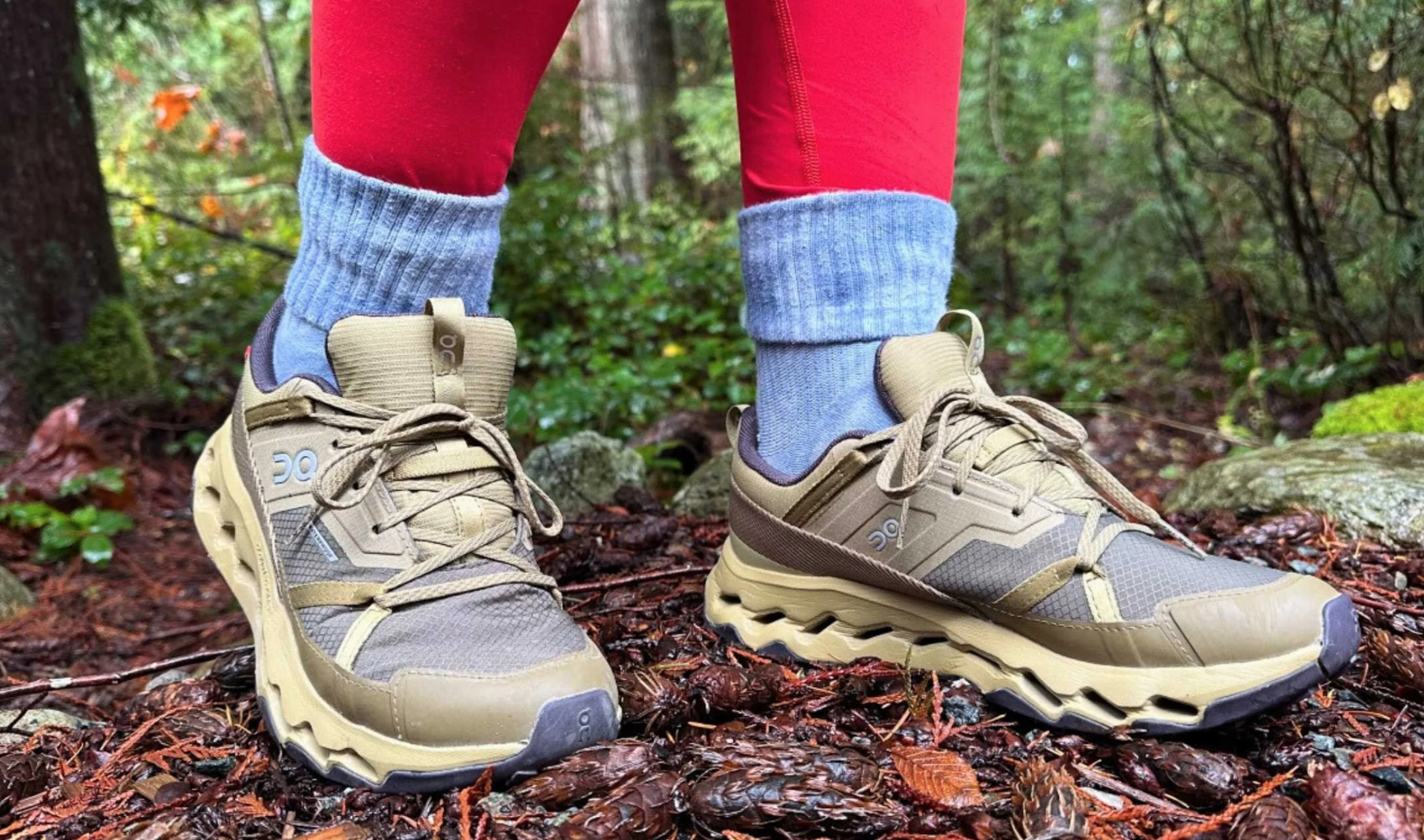
Tonight’s hike, along the Chedokee Trail and Robert MacLaren Sidetrail, features an opportunity to try Japanese interval walking (Nihon-shiki)—for at least two 30-minute segments. You’re welcome to hike at your own pace for part of the evening. We’ll stay on flat, rock-free sections of the trail. Suitable for first-timers.
How Japanese Interval Walking works:
• Alternate 3 minutes of brisk walking (enough to raise your heart rate and make talking difficult) with 3 minutes of slower, recovery walking
• Each cycle = 6 minutes; we’ll repeat it five times for a total of 30 minutes
• If everyone agrees, we’ll try another 30-minute interval toward the end of our hike.
• No one gets left behind (and if they did, well, we’ve not heard from them since)
The surprising part: last season’s participants actually found they had to force themselves to walk slowly for the slow segment. It’s a lot of fun!Everyone gets a Bruce Trail Rainbow Badge. Again, this is NOT a high-intensity hike.
Bring water, perhaps a snack if you’ve skipped dinner, and sturdy shoes (runners will work for this hike). Or lightweight hiking boots.
Coming by transit?: the No 7 Hillcrest Loop bus will drop you off right where we’ll begin the hike.
Driving: there’s parking on various side streets off Dundurn.Meeting spot: look for the benches at foot of Dundurn Stairs, next to bus loop.
Questions? Simply click “Contact Hike Leader” on the registration form.
- 21May 21, 2026
NEW TIME 8:00 Long Hike, Glen Road Jordan
https://hikes.brucetrail.org/event/new-time-800-long-hike-glen-road-jordan/Sorry, the registration cut-off time for this hike has been reached.Not a member? Click here to join today!Hosting Club: Niagara
Category: Hike
Location (Google Maps):3640 Glen Road Jordan
Hike Leader(s): Alan Laver Click here to contact Hike Leader(s)
Pace: Fast 5+ km/hr
Terrain: Strenuous: hilly, with steep climbs, poor footing
Distance: 10 kmDescription
Hike in and around Ball’s Falls and Jordan. Dress for the weather: bring bug spray, sunscreen drink and poles.Hiking around Jordan
https://hikes.brucetrail.org/event/hiking-around-jordan-55/Sorry, the registration cut-off time for this hike has been reached.Not a member? Click here to join today!Hosting Club: Niagara
Location (Google Maps): Sho’Arishon Park (Jordan Hollow)
Hike Leader(s): Debbie Demizio Click here to contact Hike Leader(s)
Pace: Medium 3- 4 km/hr
Terrain: Moderate: some hills and some poor footing
Distance: 7 kmDescription
Hiking in and around Jordan, Balls Falls and Jim Rainforth Trail alternating every 3 weeks.Seven Rivers Series - Hike 5 of 7
https://hikes.brucetrail.org/event/seven-rivers-series-hike-5-of-7/Sorry, the registration cut-off time for this hike has been reached.Not a member? Click here to join today!Hosting Club: Caledon Hills
Category: General
Location (Google Maps): Mad River – Blue Mountains Section.
Meet at Devil’s Glen parking lot off County Road 124, km 29.5.Hike Leader(s): Nancy Mooney Click here to contact Hike Leader(s)
Pace: Medium – 3 to 4 km/hour
Terrain: Moderate – some hills and/or some poor footing, Strenuous – hilly with steep climbs and some poor footing
Distance: 11 kmDescription
This is the fifth hike of the series and will take us along the Mad River including the Devil’s Glen viewing platform.Urban Walk: Valley View Park Thornhill
https://hikes.brucetrail.org/event/urban-walk-valley-view-park-thornhill-170/Sorry, the registration cut-off time for this hike has been reached.Not a member? Click here to join today!Hosting Club: Toronto
Location (Google Maps): Parking lot is off Sycamore Drive, East of Bayview , across Starbucks plaza
Bus 91 from Finch East station stops at Sycamore station.Hike Leader(s): MOHAMMAD AGHAMIRI Click here to contact Hike Leader(s)
Pace: Moderate (3-4 km/hr)
Terrain: Hilly, Level 2 (Intermediate – some hills and uneven surfaces, rocks and roots underfoot)
Distance (km): 6-7 kmDescription
We will explore Valleyview and Maple View parks, and walk along German Mill Creak, in return we stop in Huntington park and have snack under beautiful shed.Although this is considered an “Urban Walk”, you can expect some hills up and down and uneven surfaces with tree roots. Please bring hiking poles, Ice cleats water and snacks.

Car Hike: Whistling Gardens & Waterford Ponds & Heritage Trail 12 km
https://hikes.brucetrail.org/event/car-hike-whistling-gardens-waterford-ponds-heritage-trail-12-km/Sorry, the registration cut-off time for this hike has been reached.Not a member? Click here to join today!Hosting Club: Toronto
Category: Car Hike
Location (Google Maps): Whistling Gardens Parking Lot
698 Concession 3 Townsend, Wilsonville, ON N0E 1Z0Hike Leader(s): Jeanette Vincent Click here to contact Hike Leader(s)
Pace: Moderate (3-4 km/hr)
Terrain: Level 1 (Easy – mostly on flat, well maintained trails with hard-packed surface)
Distance (km): 12kmDescription
Whistling Gardens & Waterford Ponds & Heritage Trail 12 kmWhistling Gardens: 3 km (leisurely)
Waterford Ponds & Heritage Trail: 9 km (3 1/2 to 4 km/hr)Whistling Gardens is one of Ontario’s premier horticultural gardens. Since 2012, they have garnered regional, provincial, national and international awards and are home to North America’s largest peony collection, North America’s largest conifer collection and one of Canada’s largest computer run fountain shows. Stroll and explore over 20 acres of gardens displaying over 4,500 different plants including the rarest tree in the world; the Baishan Fir.
Whistling Gardens admission adults -$16.80 (Thursday is senior day $2.00 off)
Includes a Musical Fountain show. A greenhouse for visitors to purchase a variety of plants.Spring (May thru mid-June)
Trees: Magnolia, Redbud, Crab Apples, Serviceberry, Dogwood, Fringe Tree
Shrubs: Viburnum, Ninebark, Rhododendron, Azalea, Pearl Bush, Lilac, Fothergilla, Daphne, Berberis
Flowers: Creeping Phlox, Trillium, Mayapple, Peonies, Amsonia, False Indigo, Daffodils, HyacinthWe will eat our lunch in the garden.
After lunch we are off to Waterford Ponds & Heritage Trail – 9km from the gardens we will drive a 10/15 minute drive to the Waterford trail. Meeting place TBD.
Areas of interest on this hike. Black Bridge looks out onto panoramic views of the Waterford Ponds to the west, and the small, picturesque downtown area to the east ponds. The trail is a mixed paved and gravel route, relatively flat, with pedestrian bridges, exposed route through fields, urban passage with waterside sections.Bring a lunch and snacks. Where clothing suitable for the weather that day. Hiking shoes or boots, sunhat and sunscreen.

Urban Walk: Toronto Islands Evening Walk
https://hikes.brucetrail.org/event/urban-walk-toronto-islands-evening-walk-21/Sorry, the registration cut-off time for this hike has been reached.Not a member? Click here to join today!Hosting Club: Toronto
Location (Google Maps):
Jack Layton Ferry Terminal, by the gate to the Wards Island Ferry. Please arrive 20 minutes prior to departure to check in with hike leader.
From Union Station take the LRT and get off at the stop Ferry Docks.Walk up to the Ferry Docks on Queens Quay West, street level. at the foot of Bay Street.
Hike Leader(s): Miriam Stevens Click here to contact Hike Leader(s)
Pace: Leisurely (2-3 km/hr)
Terrain: Flat, Level 1 (Easy – mostly on flat, well maintained trails with hard-packed surface)
Distance (km): 6-9 kmDescription
After a day’s work come and “cool off” on the Toronto Islands free of fumes and traffic. Enjoy the view of the city skyline and Toronto’s beautiful island parkland.
Pack a dinner for a sit down picnic. Also bring a warm jacket and flashlight.
Return fare ticket for the ferry is $9.57 for adults, $6.15 for seniors
Please check the hike schedule for weather related cancellations (hike will be updated by 11:00 AM day of the hike if any changes)
Toronto Island evening hikes will take place every Thursday in May and June 2026.
Same time and same meeting place. No preregistration is required – just show up at the ferry docks at 5:40 PM and sign in with the hike leader. - 22May 22, 2026
Otter Lake and Maple Cross Nature Reserve at Cape Chin Birding Hike
https://hikes.brucetrail.org/event/otter-lake-and-maple-cross-nature-reserve-at-cape-chin-birding-hike/Sorry, the registration cut-off time for this hike has been reached.Not a member? Click here to join today!Hosting Club: Peninsula
Category: Birding
Location (Google Maps): 388 Cape Chin Road NorthHike Leader(s): Marg Glendon Click here to contact Hike Leader(s)
Pace: Leisurely (2.0 – 3.0 km/h): A relaxed pace with frequent breaks and a focus on enjoyment.
Terrain: Easy: Flat forested sections or lowland trails.
Distance: ~3.5 kmDescription
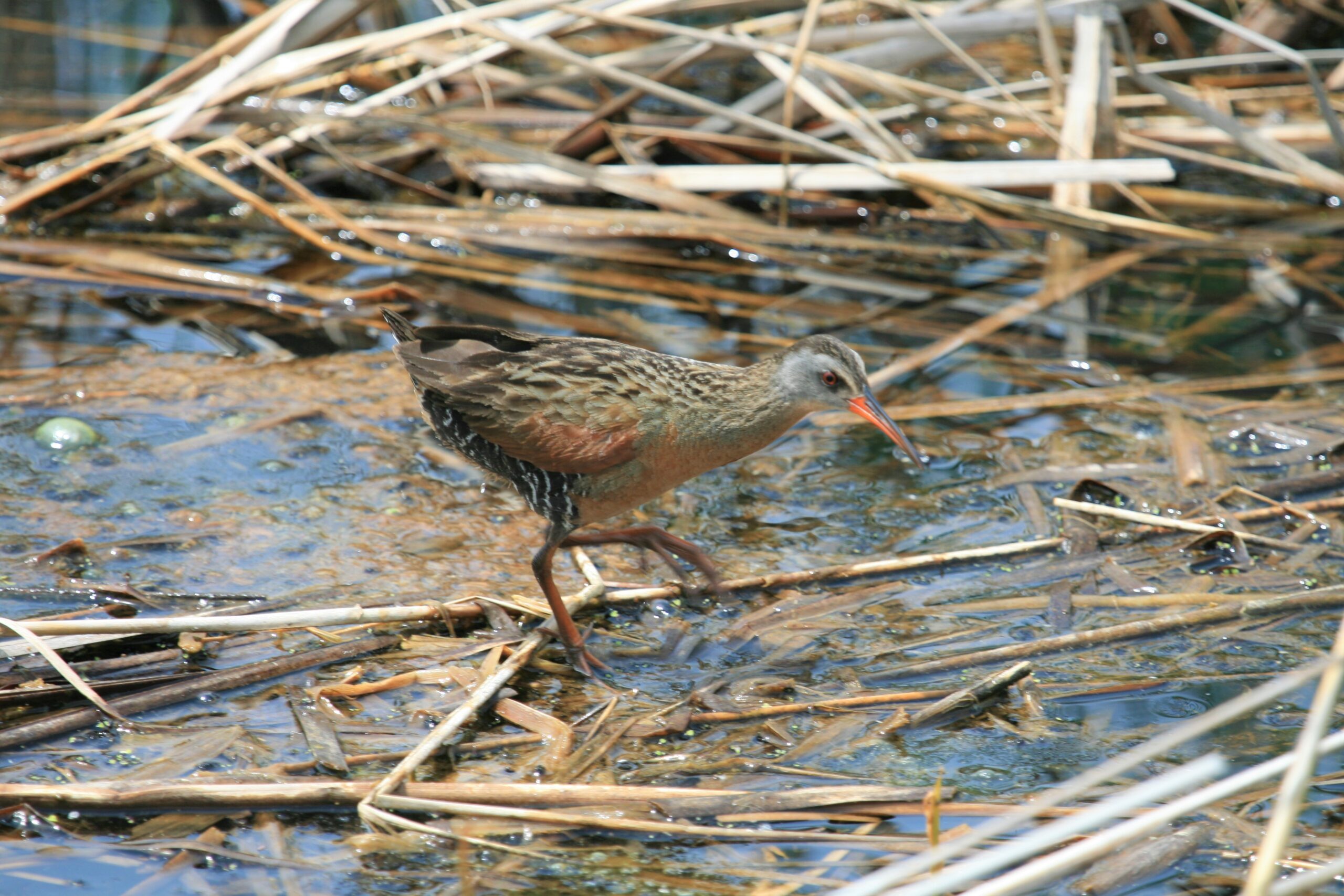
This is a “tandem” birding hike – Otter Lake Nature Reserve and nearby Maple Cross Nature Reserve at Cape Chin. Brian Popelier, BTC Ecologist, will introduce us to the wonders of Otter Lake’s Spring birding season, then at MCNRCC for more birding and to learn about habitat restoration here.The Otter Lake property is part of a larger provincially significant wetland complex. It is comprised of a variety of wetland habitats including meadow marsh, thicket swamp, deciduous treed swamp, Graminoid fen and the properties namesake, the shallow calcareous Otter Lake. The wetlands support water loving plants and host a variety of wetland and marsh birds, fish, amphibians and reptiles. introduce you to the wonders of Otter Lake’s spring birding season.
With 523 acres of iconic Saugeen (Bruce) Peninsula landscape, a breathtaking 270-degree view of Georgian Bay, and 1.8 kilometers of the Bruce Trail’s Optimum Route, the Maple Cross Nature Reserve at Cape Chin is a natural masterpiece and a true conservation gem.
Consider extending your day to enjoy more birding and hiking along the Bruce Trail.
In total, this hike will take about 2 1/2 – 3 hours. Bring binoculars, insect repellent, lunch, water and snacks. Wear sunscreen, hat, and sun protective clothing. We may encounter some wet spots, so wear water proof hiking boots and gators.
This is a perfect opportunity to work on your PBTC Birding Badge: https://peninsula.brucetrail.org/badges/
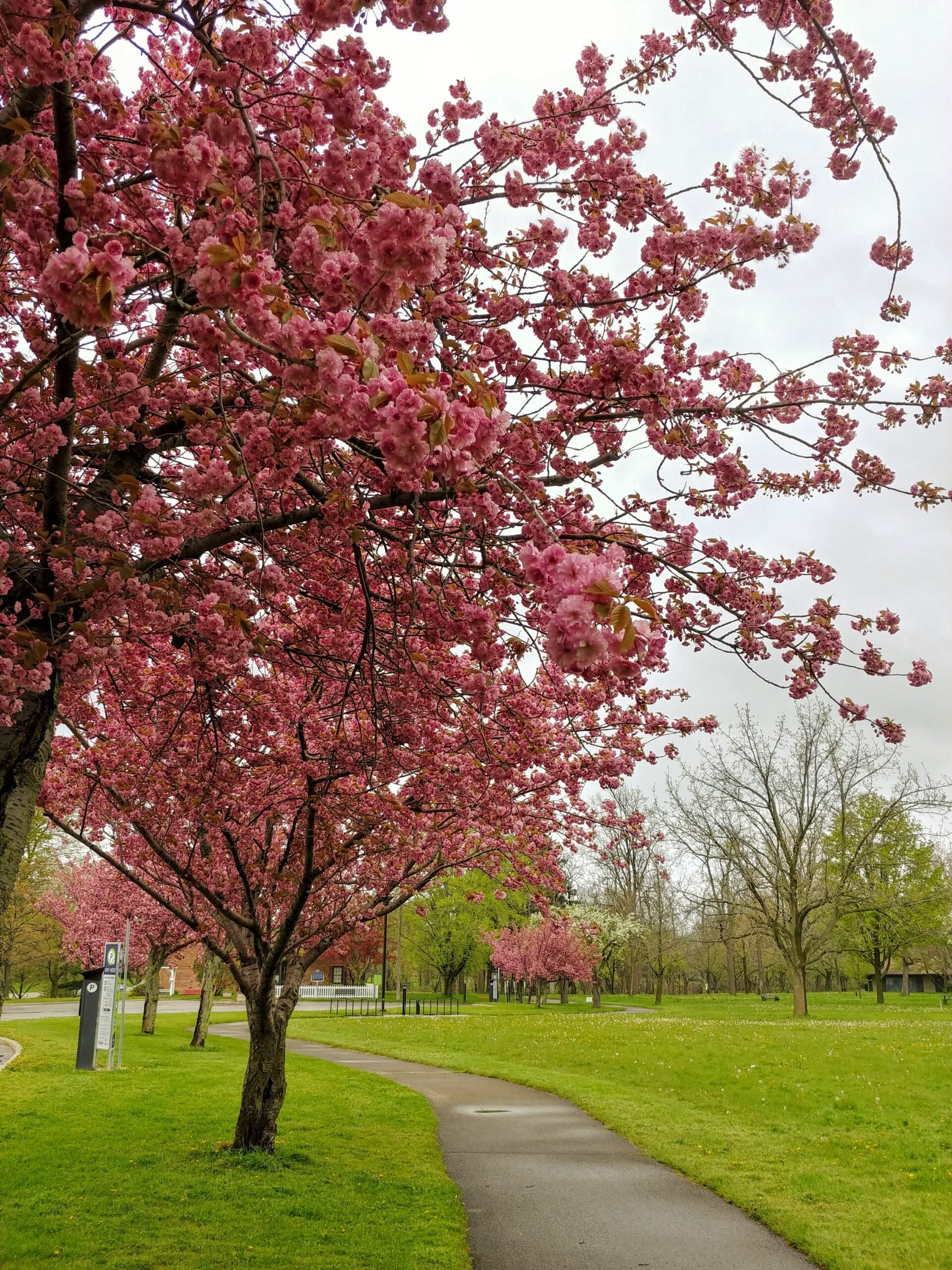
9:00 am Niagara-on-the-Lake Tour
https://hikes.brucetrail.org/event/900-am-niagara-on-the-lake-tour-62/Sorry, the registration cut-off time for this hike has been reached.Not a member? Click here to join today!Hike open to BTC Members only.
Hosting Club: Niagara
Category: Urban
Location (Google Maps):Veterans Memorial Park, park just outside the park on King Street
Hike Leader(s): Robin Garrett Click here to contact Hike Leader(s)
Pace: Leisurely <3 km/hr
Distance: 6-7 km
Description
Each Friday we will explore different neighbourhoods, trails and parkland throughout Historic Niagara-on-the-Lake.Moderate pace with some weeks entirely on sidewalks and roads while others may include a mix of trails and paved pathways. Great way to build up endurance for longer more strenuous hikes.
Prepare for cooler windy conditions on open parkland and along Lake Ontario and Niagara River trails.
Plan to stay for conversation and a warm cup of coffee or tea at Sweets & Swirls, Community Centre, Niagara Stone Road, NOTL
Niagara E2E #1: Quarry Road to Grimsby
https://hikes.brucetrail.org/event/niagara-e2e-1-quarry-road-to-grimsby/Sorry, the registration cut-off time for this hike has been reached.Not a member? Click here to join today!Hike open to BTC Members only.
Hosting Club: Dufferin Hi-Land
Category: General Hike
Location (Google Maps): Grimsby Lions Community Pool. Enter at 1 Elm Street at south end of Coronation Park. Just north of km 83.3 BTC Map 5. See Google Maps link for GPS.Hike Leader(s): Stuart Law Click here to contact Hike Leader(s)
Pace: Medium
Terrain: Slippery and Steep Sections, Moderate
Distance: 16 kmsDescription
Join us on this shuttle hike to begin our Friday treks across the beautiful Niagara Section. Mud, rocks and slippery slopes guaranteed. Please bring a garbage bag and an extra pair of footwear for the drive back. Boots mandatory. Hiking poles recommended. Please wear a hat, long sleeves and long pants and bring a head net for the bugs (just in case), 2.5L of water, a snack, a lunch, bug spray and sunscreen.Beaver Valley km 39.3-52.2 Ed 30
https://hikes.brucetrail.org/event/beaver-valley-km-39-3-52-2/Sorry, the registration cut-off time for this hike has been reached.Not a member? Click here to join today!Hosting Club: Beaver Valley
Category: Car Pool
Location (Google Maps): Fox Ridge RoadHike Leader(s): Erin Lyttle Click here to contact Hike Leader(s)
Pace: Brisk 4-5 km/hr
Terrain: Strenuous: hilly, with steep climbs, poor footing
Distance: 10Description
This hike is for those working on their Beaver Valley section end to end. We will meet at the parking on Fox Ridge Road where it meets the 3rd line road allowance (enter 597000 Fox Ridge Rd, Clarksburg, ON to get close) and carpool to the Beaver Valley Lookout parking (use 235082 Grey County Rd 13, Flesherton, ON N0C 1E0 in GPS). We will then hike back to our cars at Fox Ridge Road.This hike is for experienced hikers. We will be hiking in spring conditions (mud, ice, snow) so be prepared for it all. Please have your icers and poles at the ready and dress in layers including a waterproof outer layer. Hiking boots/shoes are mandatory. Please bring water/electrolytes and snacks, though we do not plan a meal break as this hike is scheduled between lunch and dinner time.
We will be shuttling to our starting point so please be prepared to participate in the shuttle.
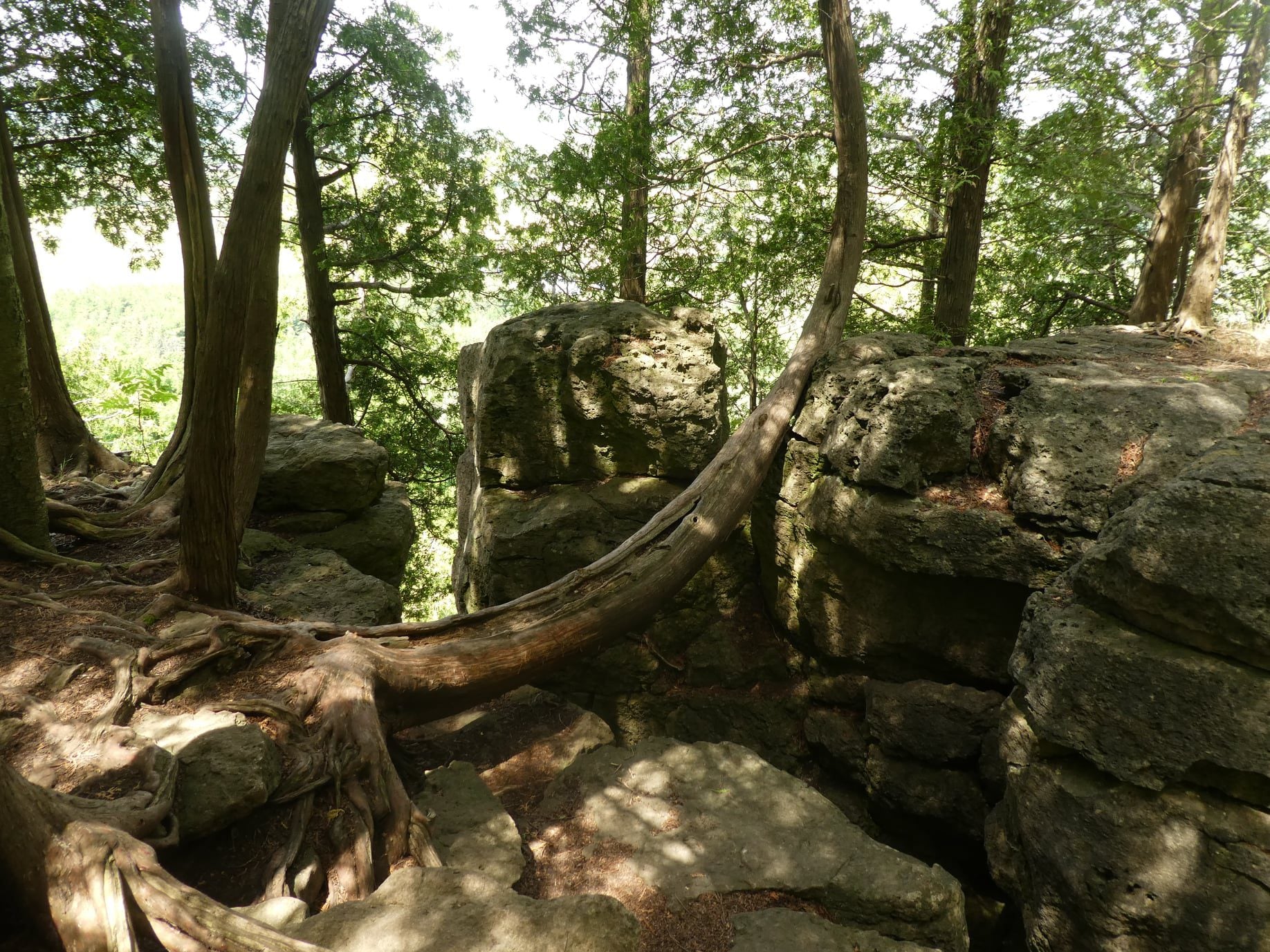
Afternoon hike - Mount Nemo (reservation required)
https://hikes.brucetrail.org/event/afternoon-hike-mount-nemo-reservation-required-2/Sorry, the registration cut-off time for this hike has been reached.Not a member? Click here to join today!Hosting Club: Iroquoia
Category: Afternoon/Evening Hikes
Location (Google Maps): Meet at 4:15 pm in the main parking lot at Mount Nemo on Guelph Line.Hike Leader(s): Karen Bergmann Click here to contact Hike Leader(s)
Pace: Medium – 3 to 4 km/hr
Terrain: Moderate – Some hills and/or some poor footing
Distance: 7 kmsDescription
Meet in the main parking lot at 4:15 and we will hike around the main loop and into the forest for a bit. Reserve your time at conservationhalton.caBurlington Waterfront Sculpture Trail Evening Hike
https://hikes.brucetrail.org/event/burlington-waterfront-sculpture-trail-evening-hike/Sorry, the registration cut-off time for this hike has been reached.Not a member? Click here to join today!Hosting Club: Iroquoia
Category: Afternoon/Evening Hikes
Location (Google Maps): Burlington Public Library – Central BranchHike Leader(s): Cathie Green, Colleen Mabalay Click here to contact Hike Leader(s)
Pace: Medium – 3 to 4 km/hr
Terrain: Easy – Mostly flat and usually good footing
Distance: Approx 6kmDescription
We will be meeting in the front parking lot of the Burlington Central Library. Bring a flashlight or headlamp. We will be hiking along the bike path to Spencer Smith Park to view the sculptures in the park. Starting at dusk, the major installations will be brought to life with theatrical lighting and music. Don’t forget your camera 📸 - 23May 23, 2026
Blue Mountains Annual End to End-TWO DAY EVENT.
https://hikes.brucetrail.org/event/blue-mountains-annual-end-to-end-two-day-event-3/Sorry, the registration cut-off time for this hike has been reached.Not a member? Click here to join today!This is a Multi-Day Hike
You are signing up for the following dates and times:
2026-05-23 at 06:30
2026-05-24 at 06:30Hosting Club: Blue Mountains
Category: End-to-End
Location (Google Maps):Meet/park at Highlands Nordic Duntroon Ontario
Hike Leader(s): Paul Swindall Click here to contact Hike Leader(s)
Pace: Brisk – 4 to 5 km/hr, Medium – 3 to 4 km/hr
Terrain: Moderate – Some hills and/or some poor footing
Distance: 69 km -Day 1: 37km Day 2: 32kmDescription
Join us this spring for the Blue Mountains Bruce Trail Club annual End-to-End hike event. This 2 Day Hike is for those hikers keen on a great big challenge You will wind your way through the beautiful and varied terrain of the Blue Mountains Club trails. Enjoy the early signs of nature awakening at this time of the year, the beautiful vistas and the rugged escarpment. You will cover the 69 km distance of our section which runs from Lavender to Swiss Meadows. Checkpoint stations will be offered approximately every 10 kms offering snacks, water refill and assistance along the way. A BBQ at Highlands Nordic is included at the end of Saturday Hike commencing at 1:00 pm. Hike details will be emailed to participants shortly after registration is received. Note, this event consists of longer distances and is generally not suitable for beginning hikers. REGISTRATION FOR NON-MEMBERS WILL OPEN 10 MARCH 2026Blue Mountains THREE DAY End to End - THREE DAY EVENT
https://hikes.brucetrail.org/event/blue-mountains-three-day-end-to-end-three-day-event-3/Sorry, the registration cut-off time for this hike has been reached.Not a member? Click here to join today!This is a Multi-Day Hike
You are signing up for the following dates and times:
2026-05-23 at 07:00
2026-05-24 at 07:00
2026-05-25 at 07:00Hosting Club: Blue Mountains
Category: End-to-End
Location (Google Maps):Day 1 Parking/Meeting location is at Nottawasaga Bluffs Conservation Area. Day 2 & 3 parking will be near Pretty River Valley Provincial Park. Details will follow after registration
Hike Leader(s): Robert Johnston Click here to contact Hike Leader(s)
Pace: Brisk – 4 to 5 km/hr
Terrain: Moderate – Some hills and/or some poor footing
Distance: 67 kmDescription
Join us this spring for the Blue Mountains Bruce Trail Club THREE DAY End-to-End hike event. This 3 Day hike is for those hikers wanting to complete our section over three days. Approximate Daily Hike Lengths: Day 1–22Km, Day 2–20Km, Day 3–25Km. You will wind your way through the beautiful and varied terrain of the Blue Mountains Club trails. Enjoy the early signs of nature awakening at this time of the year, the beautiful vistas and the rugged escarpment. You will cover the 67 km distance of our section which runs from Lavender to Swiss Meadows. Checkpoint stations will be offered approximately every 10 kms with snacks, water refill and assistance. A BBQ is included on the Saturday at the end of the hike day, at Highlands Nordic, and will commence at 1:00 pm. Details will be emailed to participants shortly after registration is received. Note, this event consists of longer distances and is generally not suitable for beginning hikers. REGISTRATION FOR NON-MEMBERS WILL OPEN 10 MARCH 2026Sydenham Bruce Trail E2E Run - Day 5 of 8 Only
https://hikes.brucetrail.org/event/sydenham-bruce-trail-e2e-run-day-5-of-8-only/Sorry, the registration cut-off time for this hike has been reached.Not a member? Click here to join today!Hike open to BTC Members only.
Hosting Club: Sydenham, Peninsula
Category: Sydenham E2E Trail Run
Location (Google Maps): Day 5 of the E2E Trail Run of the Sydenham Bruce Trail section. Meeting at Irish Block Road BTC parking.Hike Leader(s): Margie Gloade; Natalie Mechalko Click here to contact Hike Leader(s)
Pace: Fast (5.5 – 7.0 km/h+): A quick pace maintained by experienced hikers or trail runners.
Terrain: Difficult: Steep ascents/descents, rocky scrambling, and some rugged escarpment paths.
Distance: About 19kmDescription
This is a single-day registration – Day 5 of 8.The Sydenham Bruce Trail Club (SBTC), in partnership with the Peninsula Bruce Trail Club (PBTC), is excited to offer its first-ever trail running Sydenham End-to-End series in 2026. Join the fun for one of the eight days in this trail running series! The trail running Sydenham E2E series will take place over 4 weekends and 8 days, starting at 7:30am. Below is the start and end location and estimated distance for this day (subject to change slightly). The group will meet at the end location, and carpool to the start of each day’s route. You are expected to participate in shuttling vehicles.
Please carefully read the details below to understand the logistics, costs, important notes, and fitness required for this challenge.
Saturday, May 23, 2026: Centennial Tower Parking Lot to Irish Block Rd BTC Parking; ~19km.
- When you register here, you are registering for only one day in the series. (You also have the option of registering for the whole series for $60 even if you aren’t able to make all eight days).
- These are group trail runs. It is not a race. It is not a hike. There may be a couple different pace groups that naturally form, but you will be expected to stay with a group and wait to regroup at key locations. Runners are expected to remain between the lead runner and the sweep at all times. Anticipate each day to be running for about 3+/- hours, at a pace ranging from 7-9 min./km.
- Participants are expected to have some experience trail running as this is difficult terrain. There are also some roads, and some active farm fields. In some locations throughout Sydenham, trail running will not be permitted near livestock. On roads, runners are expected to follow standard Highway Traffic Act regulations, crossing safely and running on the shoulder, in single file, facing oncoming traffic.
- Mandatory gear includes a whistle and minimum 250ml of water carrying capacity. Trail runners will need to carry their own water and fuel.
- At approximate mid-way points each day, there will be volunteer support arranged so you can fill up water bottles. Some snacks (e.g. oranges, bananas, pretzels, cookies, water) will be provided but please plan to be self-sufficient.
- Exercise care and caution and common sense on trails, especially when passing other trail users. Let others know you are coming and that you intend to pass. Headphones/earbuds are not permitted while participating in this group run.
- Participants must be age 16 years or older.
- Dogs are not permitted.
- This trail run is for BTC members only. To become a member, click here: https://brucetrail.org/.
- The designated meeting points will not incur any personal parking fees but parking space is limited. Participants are encouraged to car pool whenever possible.
The single day fee is $20. This fee covers snacks, vehicle shuttle, volunteer support, and a donation to the PBTC hike program. There is also an option to register for the whole series ($60).
As per BTC policy, no refunds will be considered 30 days before the series starts (not after April 1, 2026).
The trail run will go ahead rain or shine, however, in extremely inclement weather, a date may be cancelled and rescheduled, ideally prior to the May 31st finish date.
Falling Waters in Two (badge hike)
https://hikes.brucetrail.org/event/falling-waters-in-two-badge-hike/Sorry, the registration cut-off time for this hike has been reached.Not a member? Click here to join today!This is a Multi-Day Hike
You are signing up for the following dates and times:
2026-05-23 at 08:00
2026-05-24 at 08:00Hosting Club: Beaver Valley
Location (Google Maps): We will meet at the Beaver Valley Ski Club lower parking lot, arrive by 7:45 a.m. for an 8:00 a.m. hike start. The ski club address is 100 Pioneer Drive, Markdale (off Grey Road 30). Coordinates are 44.357382, -80.543331 . Follow the driveway past the front entrance, and park at the far end of the parking lot, past the tennis courts. From this parking lot we will use our hikers’ cars to shuttle to the Hogg’s Falls Parking lot to begin our hike.
Hike Leader(s): Marg Parkin Click here to contact the hike leader.
Terrain: Some rocky footing, Some steep sections, Strenuous
Length of Hike: 16 KM + 14 KM (2 hikes)Description
We expect carpets of Trillium, Trout Lily and other spring ephemerals on the forest floors of Beaver Valley for this 2-day spring hike. The Falling Waters hike is known for its waterfalls and streams. This is a challenging hike with lots of elevation up and down the valley slopes, passing Hogg’s Fall and Eugenia Falls. We will break the loop into two days’ hikes, doing approximately 16 km on Saturday, and 14 on Sunday. Participants should self evaluate their ability t0 maintain a pace of 4km/hr on this hike. We expect to hike about 5-6 hours per day, including a short lunch break. A badge awaits you after completing both hikes, as well as bragging rights to having completed approximately 1,500 metres of elevation over the total 30-kilometer hike. Hikers should carry ample water, snacks and lunch. Hiking poles are recommended. May’s weather is variable, so hikers should dress accordingly and bring sunscreen and insect repellent.School Bus Hike: Iroquoia E2E #8/8 Crawford Lake/Kelso
https://hikes.brucetrail.org/event/school-bus-hike-iroquoia-8-8/Sorry, the registration cut-off time for this hike has been reached.Not a member? Click here to join today!Trip Information
Departure Time: 08:30
Return to City Time: 18:30
Departure Point: Kipling Departure PointOptional Items
Hiking ($.01)Hosting Club: Toronto
Category: Bus Hike
Location (Google Maps): Crawford Lake/KelsoHike Leader(s): Tom Swales, Felix Wan Click here to contact Hike Leader(s)
Pace: Moderate (3-4 km/hr)
Terrain: Hilly, Level 2 (Intermediate – some hills and uneven surfaces, rocks and roots underfoot), Variable
Distance (km): 14 km/17 kmDescription
The final stage of our Iroquoia E2E will take us through Crawford Lake and Kelso Conservation Areas to the border between the Iroquoia and Toronto sections. For those not doing the E2E and prefer a shorter distance there will be an option to reduce the total distance by 3 km. Expect a later return (approx. 6:30 PM). We will have a stop in Milton before returning to Kipling for refreshments, socializing, and celebrating the accomplishment of finishing the Iroquoia section over the eight hikes this Spring and last Fall. Anyone is welcome regardless of doing the E2E.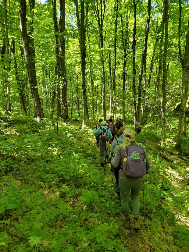
Sunday Side Trails / Sydney Bay Bluff and Hart's Tongue Ferns
https://hikes.brucetrail.org/event/sydney-bay-bluff-and-harts-tongue-ferns/Sorry, the registration cut-off time for this hike has been reached.Not a member? Click here to join today!Hosting Club: Peninsula
Category: Peninsula Blue Series
Location (Google Maps): Cape Croker Park, Park Road ParkingHike Leader(s): Jamie McDermid Click here to contact Hike Leader(s)
Pace: Medium (3.0 – 4.5 km/h): A comfortable pace for most hikers with steady progress.
Terrain: Moderate: Rolling hills, mild slopes and rocky paths.
Distance: 8 kmDescription
Peninsula BTC is offering a series of hikes covering all of the side trails on the Peninsula section of the Bruce Trail. These hikes are a great opportunity for those who want to do some hiking but don’t want to commit to a full end-to-end; for those who have completed an end-to-end and want to explore more of the beautiful trails on the Peninsula and for locals and visitors who want to get out on the trail on the weekend.The series will include 27 hikes on Sundays (and maybe the odd Saturday) over 2026 and 2027, covering more than 150 km of side trails or 78 trails! We will be offering hikes on a roughly biweekly basis, with hikes posted approximately two months in advance. The hikes will generally be loop hikes, although car shuttling may be required for a few hikes. Register for each hike individually, no need to commit to all 27 hikes!
For those who would like to earn the Peninsula Side Trails badge, these hikes provide a chance to join a group for some or all of the side trail hikes.
This hike uses the Hart’s Tongue Side Trail to make an 8km loop around Sydney Bay Bluff. The hike features views of Sydney Bay, some interesting rock features and lots of ferns and other plants in the lush, late spring forest.
Hikers should be prepared for cool weather and possible wet trails. Bring a lunch, water and snacks. Hike leader will contact registered hikers one week before the hike.
If you would like to be notified when the side trail hikes are posted, go to the bottom of the Hikes page on the PBTC website to sign-up for hike notifications.
Trillium hike Richmond hill 240
https://hikes.brucetrail.org/event/car-hike-bethesda-trail-richmond-hill-37/Sorry, the registration cut-off time for this hike has been reached.Not a member? Click here to join today!Hosting Club: Toronto
Location (Google Maps): Oak Ridges Corridor, Bethesda Trail Head Parking Lot, Bethesda Side Road, Richmond Hill, Ontario
Hike Leader(s): Mohammad Aghamiri Click here to contact Hike Leader(s)
Pace: Moderate (3-4 km/hr)
Terrain: Hilly, Level 2 (Intermediate – some hills and uneven surfaces, rocks and roots underfoot), Variable
Distance (km): 14-15 kmDescription
Join us to explore the trails of York Regional Forest and the Oak Ridges Corridor at Jefferson Forest and Bond lake,From parking lot we hike thought Jefferson forest and continue to Bond Lake and have snack beside the lake and return to parking around 13 to 13.30
Please bring lots of water and snacks ,hiking poles are recommended
phone number for the day of hike 289 588 6482
Car Hike: Hockley Crest, Airport Rd to Hockley Rd
https://hikes.brucetrail.org/event/car-hike-hockley-crest-airport-rd-to-hockley-rd/Sorry, the registration cut-off time for this hike has been reached.Not a member? Click here to join today!Hosting Club: Toronto, Caledon Hills
Category: Cancelled
Location (Google Maps): Meet at the Bruce Trail Parking Lot on Mono 5 Sideroad on the north side of the 5th Sideroad.Hike Leader(s): Amir Alemohammad Click here to contact Hike Leader(s)
Pace: Moderate (3-4 km/hr)
Terrain: Flat, Hilly, Level 2 (Intermediate – some hills and uneven surfaces, rocks and roots underfoot), Variable
Distance (km): 12-14 kmDescription
Join us for a out and back hike in Hockley Crest. The route explores a diverse landscape of dense sugar maple and beech hardwood forests, open grassy meadows, active pine plantations, and steep ravines. We will explore the main and side trails of the Bruce Trail. Bring at least two liters of water and your favorite snacks. Boots mandatory, poles recommended. Be prepared for the ticks and bugs. This is a joint hike with the ORTA.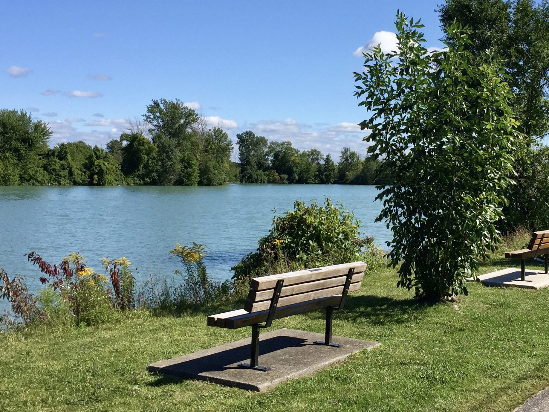
CANCELLED 9:00 am Walker Creek 5 4 3 2 1 Grounding Hike
https://hikes.brucetrail.org/event/900-am-walker-creek-54321-grounding-hike/Sorry, the registration cut-off time for this hike has been reached.Not a member? Click here to join today!Hike open to BTC Members only.
Hosting Club: Niagara
Category: Cancelled
Location (Google Maps): Welland Canal parking area at Lock 1 on Lakeshore RoadHike Leader(s): Suzanne Gourluck Click here to contact Hike Leader(s)
Pace: Leisurely <3 km/hr
Terrain: Easy: mostly flat, good footing
Distance: 9 kmDescription
*This hike is one of our new MINDFULNESS seriesJoin me on this 5 4 3 2 1 grounding hike and learn a simple strategy for managing anxious racing thoughts. We will hike through Malcomson Eco Park along Sunshine beach, up Walker Creek and back, stopping a couple of times along the way to ground ourselves using the 5 4 3 2 1 technique.
*If the parking lot at the canal is full please park in Malcolmson Eco Park (accessed at the Niagara/Lakeshore intersection) and walk up to the canal.🇨🇦 HISTORIC HIKE - LAURA SECORD LEGACY TRAIL PART 1 - QUEENSTON TO NIAGARA COLLEGE - 15 KM
https://hikes.brucetrail.org/event/%f0%9f%87%a8%f0%9f%87%a6-historic-hike-laura-secord-legacy-trail-part-1-queenston-to-niagara-college-15-km/Sorry, the registration cut-off time for this hike has been reached.Not a member? Click here to join today!Hosting Club: Toronto
Category: Car Hike
Location (Google Maps): Parking and departure: Meet at 9:30 am, parking at Niagara College – Daniel J. Patterson Campus, 135 Taylor road, Niagara-on-the-Lake, L0S 1J0. Parking is paid, day parking fee is $6.35. Parking Lot 1A coordinates 43.152026, -79.166394. We will car shuttle from there to the start of the hike.Hike Leader(s): Jeanette Vincent Click here to contact Hike Leader(s)
Pace: Moderate (3-4 km/hr)
Terrain: Flat, Level 2 (Intermediate – some hills and uneven surfaces, rocks and roots underfoot)
Distance (km): 15kmDescription
About the historic hike (part 1): This hike is part 1 of the series of 2 hikes. We will hike Laura Secord Legacy Trail, a modern day approximation of Laura’s actual route from her homestead in Queenston to DeCew House in Thorold where she delivered her fateful message to Lt. Fitzgibbon on June 22, 1813. Divided into five distinct stages and starts at the historic Laura Secord Homestead in picturesque Queenston, and travels along secluded Dee Road, across the Niagara Parkway, and through tranquil vineyards featuring wonderful views of the Escarpment and Brock’s Monument. Encompassing everything from ancient forested trails, open spaces of Firemen’s Park, Niagara Falls, to the edge of the Escarpment, a foot bridge, and the trail passes through the famed Screaming Tunnel, featured in Halloween ghost stories and at least one David Cronenberg horror film, to modern city sidewalks and urban parks.The 32km trail route was developed based on historical authenticity, safety, and natural ambiance.After the hike you may want to visit: Laura Secord Homestead: 29 Queenston St. Queenston, ON. Hours 10-5pm. Admission: Adult -13+ $10.50, Children 3-7 $7.00
“Laura Secord – Walk Into History” – background on Laura to outline Laura’s remarkable effort to warn a British officer about an impending attack by the invading American forces. – the impact that this one person had on the War of 1812. – the effort to commemorate Laura’s 32 km “walk” 200 years later (2013) and Bob Rennie’s involvement in the Secord Walk commemoration and unveiling of the related First Nations memorial near the DeCew house.
Bob will deliver the talk in a War of 1812 uniform similar to that of Lt James Ftitzgibbon (the officer Laura went to warn).
About the guest: Bob Rennie UE is an amateur historian and historical living history reenactor. Bob has given many presentations on various aspects of Canada’s early history and spends much of his time at War of 1812 enactments and commemorations. He is a quest speaker at the GVTA (Grand Valley Trails Association) AGM, Tuesday May, 12, 6:30 to 8:30 pm at the Forest Heights branch of the Kitchener Public Library. Bob will speak from 7:30 to 8:30pm.
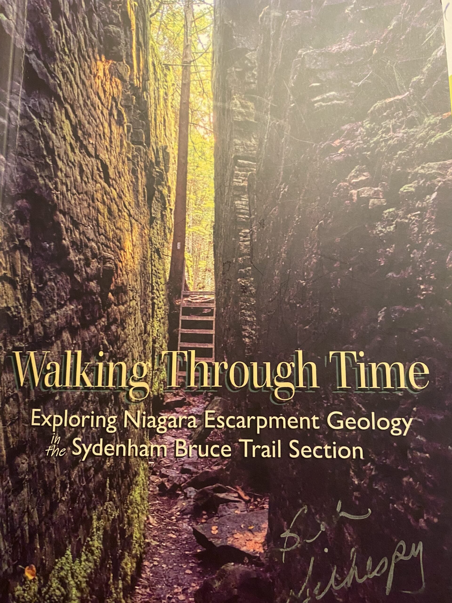
CANCELLED Geology Hike # 5 Boyd Crevice linear hike (extended)
https://hikes.brucetrail.org/event/geology-hike-5-boyd-crevice-linear-hike-extended/Sorry, the registration cut-off time for this hike has been reached.Not a member? Click here to join today!Hosting Club: Sydenham
Category: Geology Hike
Location (Google Maps):Dead end of Concession Road 11 south of Superior Street, Owen Sound. Roadside parking. Please park on the east side of the road. NOTE: ROAD CONSTRUCTION at Superior Street and 9th Avenue East (Hwy 6 & 10) . No access from west end of Superior Street. If you are coming from the south on Hwy 6 & 10, turn east (right) at Story brook Park Road. At Concession 10 turn left (north). At Superior Street turn left.(west) then turn left (south) on Concession Rd 11 to the trailhead. If coming from the north on 9th Avenue East, turn east at 8th Street East. Continue past the hospital to 28th Ave E/Concession Rd 10. turn right (south). At Superior Street turn west (right). At Concession Rd 11 turn left (south) to dead end parking. See map photo attached below.
Hike Leader(s): Sheri Hatcher Click here to contact Hike Leader(s)
Pace: Leisurely: 3 km/h or less
Terrain: Easy: Mostly flat and good footing., Moderate: Some hills and/or poor footing, Strenuous: Hilly with steep climbs and some poor footing., There might be muddy sections., There might be sections with water on the trail.
Distance: 5.5 km approx.Description
This is an extended version of Geology Hike # 5, following Beth Gilhespy’s book “Walking Through Time” in the Sydenham Bruce Trail Section. Please note the starting point for this hike. It is not the same as the trailhead in Beth’s Geology Book. This is a linear hike, starting on a rail trail and then entering the main trail and hiking east to the amazing karst geology, towering cliffs and cambering features of this iconic crevice system. We will return the same way.
Copies of Beth’s book will be available for purchase. Special member’s only price of $37.00 . Cash or etransfer. If paying with cash, please bring exact change. I am expecting a SPECIAL GUEST to join us ! Please bring water and a snack if you wish. Proper hiking footwear and hiking poles are recommended.Car Hike: Mono Cliffs CANCELLED
https://hikes.brucetrail.org/event/car-hike-mono-cliffs-8/Sorry, the registration cut-off time for this hike has been reached.Not a member? Click here to join today!Hosting Club: Toronto, Dufferin Hi-Land
Category: Car Hike
Location (Google Maps):Mono Cliffs Provincial Park, Map 19
Hike Leader(s): Al Brown Click here to contact Hike Leader(s)
Pace: Moderate (3-4 km/hr)
Terrain: Level 2 (Intermediate – some hills and uneven surfaces, rocks and roots underfoot), Variable
Distance (km): 14 kmDescription
We will complete a loop hike through Mono Cliffs PP and the North Outlier. The trail is mostly flat and under forest cover. We will stop at several viewpoints and natural features along the way.After the hike those interested may gather at a local establishment for refreshments.
To get to the meeting point go north on Hwy 10 past Orangeville to County Rd 8 (Mono Centre Road). Proceed east about 6 km to Mono Centre. The parking area for the community centre is 200 meters south of the T-intersection if you go too far. The entrance to the parking area is on your right just before a tennis court.
Urban Walk: Toronto Urban Badge Hike - 7 of 7
https://hikes.brucetrail.org/event/urban-walk-toronto-urban-badge-hike-7-of-7-3/Sorry, the registration cut-off time for this hike has been reached.Not a member? Click here to join today!Hosting Club: Toronto
Category: Urban Walk
Location (Google Maps): South Don River TrailHike Leader(s): Brian Rideout Click here to contact Hike Leader(s)
Pace: Moderate (3-4 km/hr)
Terrain: Flat
Distance (km): 9 kmDescription
Please join me at the south east corner of Overlea Blvd and Don Mills Rd by 10 AM. We will hike south on the Don Trail to the Distillery District (km 62.4 to km 71.4). Here is an online map with km markings of our route for all 7 hikes for the Toronto Urban Badge: https://onthegomap.com/s/c2c1hf3nPlease make sure you bring at least 2 liters of water, a lunch, bug spray and sunscreen.

Rainbow Hike: Sho’aríshon Park to Ball's Falls
https://hikes.brucetrail.org/event/rainbow-hike-shoarishon-park-to-balls-falls/Sorry, the registration cut-off time for this hike has been reached.Not a member? Click here to join today!Hosting Club: Niagara
Category: Loop
Location (Google Maps): Sho’aríshon Park, 3039 King St, Jordan, ONHike Leader(s): Angela Lytle Click here to contact Hike Leader(s)
Pace: Leisurely <3 km/hr
Terrain: Strenuous: hilly, with steep climbs, poor footing
Distance: 4-5 kmDescription
Join the Niagara Bruce Trail Club, Bridges Niagara Immigrant and Refugee Services and PFLAG Niagara for a Rainbow Hike from Sho’aríshon Park to Ball’s Falls.What is a Rainbow Hike?
These hikes aim to bring 2S-LGBTQIA+ folks and newcomers together with other newcomers and community members, friends and allies to enjoy nature and connect to the land and enjoy nature in all seasons. It is an intentionally affirming space for people of diverse backgrounds and identities with a focus on 2S-LGBTQIA+ inclusion. Everyone is welcome. Pride badges and stickers are free for all hikers!
Hike Details
Route: This hike loops from the parking lot at Sho’aríshon Park (Neutral Nation Legacy Cultural Park) along the Bruce Trail into Ball’s Falls Conservation Area and back.
Read more about the park and Indigenous history of this area here: https://www.lincoln.ca/council-and-administration/news-updates/media-release-town-lincoln-celebrates-opening-shoarishon
Terrain: The path goes along the creek and then up a tall, steep set of stairs to get to the conservation area at the top of the escarpment. Once up top the path is fairly even, looping around the conservation area. We will visit the main waterfall and take a break – feel free to bring snacks to share! We will then descend the steps and steep pathway back down.
We will adjust the pace to the group but be prepared for some rocky or uneven footing and climbing up and down. The terrain is not suitable for folks with mobility challenges.
We strongly recommend using hiking poles. Wearing good hiking shoes is a must. Carry water and dress in layers for changeable weather and carry insect repellent.
The hike goes ahead rain or shine unless there are dangerous weather conditions – the hike leader will contact you if anything changes.
***Please arrive by 9:50 to check in with the hike leaders for departure at 10.
Google map link to the parking lot location: https://maps.app.goo.gl/2s9CMz32y5gqt2A86
Habitat Restoration Planting at Riverside Woods
https://hikes.brucetrail.org/event/habitat-restoration-planting-at-riverside-woods/Sorry, the registration cut-off time for this hike has been reached.Not a member? Click here to join today!Hosting Club: Caledon Hills
Category: Habitat Restoration Project
Location (Google Maps): Akela & Scouters Heather and Ross Hamlin Nature Reserve at Riverside WoodsHike Leader(s): Sandra Green Click here to contact Hike Leader(s)
Pace: Leisurely – 3 km/hour or less
Terrain: Easy – mostly flat and usually good footing
Distance: Less than 1 kmDescription
This is a family friendly event. Volunteers will help restore the habitat for the Red Headed Woodpecker! Come join the CHBTC Biodiversity Team as we add to the biodiversity of our Riverside Woods property. We will be installing a variety of trees and shrubs in an area that was previously infested with Japanese Knotweed.The event will begin at 10:30 a.m. out of the main parking lot at Riverside Woods. We will hike down to the planting location and discuss the work that has been undertaken by BTC Staff and CHBTC Volunteers to remove invasive species along the way. Participants are asked to wear pants and sturdy footwear. Please bring water for drinking, as well as gardening or work gloves. Shovels and extra gloves will be provided.
Blue Mountains Annual End to End-BBQ Only
https://hikes.brucetrail.org/event/blue-mountains-annual-end-to-end-bbq-only-2/Sorry, the registration cut-off time for this hike has been reached.Not a member? Click here to join today!Hosting Club: Blue Mountains
Category: Organized Hike
Location (Google Maps):Hike Leader(s): Robert Johnston Click here to contact Hike Leader(s)
Pace: Leisurely – 3 km/hr. or less
Terrain: Easy – Mostly flat and usually good footing
Distance: 0Description
We’re firing up the Grill with hot dogs and hamburgers! Blue Mountain Club Members and friends are invited to join in at the E2E BBQ. Come on out to socialize and welcome our hikers in after their first day.Please note if you are registered for either the 2 Day or 3 Day E2E your BBQ is included. No need to register and pay for this.
If you are a Volunteer for this event your BBQ cost FREE. No need to register and pay for this.
There is no badge for this event other than the coveted mustard and ketchup stain!
Registration will be open until Friday, May 22.
BBQ will be held Saturday 24 May 1 pm to 5 pm at Highlands Nordic