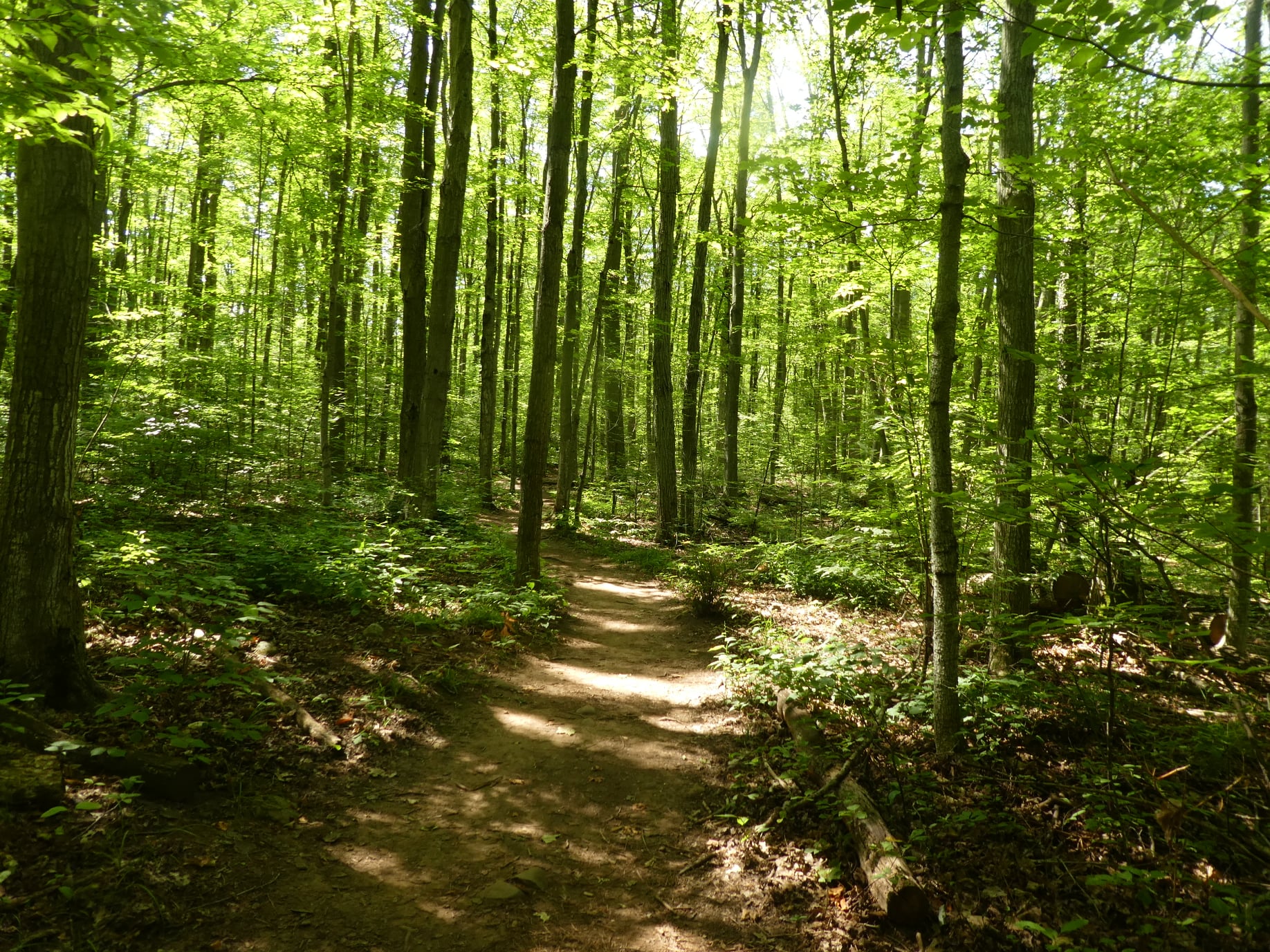
Hike Schedule
Join us for a hike! Registration required:
All hikes available to BTC members. Some hikes are open to non-members.
TIP: The calendar view displays up to 7 hikes on a day, but often there are more. Click “More events” to see them all.
Categories
- 20April 20, 2025

End-to-End Makeup Hike in 8: Richardson ST parking lot to Cape Chin North Rd.
https://hikes.brucetrail.org/event/end-to-end-makeup-hike-in-8-richardson-st-parking-lot-to-cape-chin-north-rd/Sorry, the registration cut-off time for this hike has been reached.Not a member? Click here to join today!Hike open to BTC Members only.
Hosting Club: Peninsula
Category: Peninsula E2E
Location (Google Maps): Cape Chin North Rd.Hike Leader(s): Kathleen Stahlbaum Click here to contact Hike Leader(s)
Pace: Medium (3.0 – 4.5 km/h): A comfortable pace for most hikers with steady progress.
Terrain: Difficult: Steep ascents/descents, rocky scrambling, and some rugged escarpment paths., Moderate: Rolling hills, mild slopes and rocky paths.
Distance: 20.0Description
Expectations: Expect to be on-trail for 7-9 hours each day, depending on the daily distance. Time on the trail may vary based on terrain, conditions, and the pace of the group. Breaks will be taken for lunch, snacks, photography, and to appreciate the scenery.Meeting Time: Please arrive no later than 15 minutes prior to the scheduled time.
Participant Requirements:
- Intermediate/experienced hikers, comfortable with longer distances and elevation gains.
- Must be physically fit for group hiking.
- Proper hiking boots, layered clothing, and wet weather gear required. Hiking poles recommended.
- Essentials: Lunch, snacks, water, bug spray.
- Breaks for photography and appreciation of local flora and fauna.
Car Shuttle: Ensure your vehicle is passenger-ready.
Accommodations: Early reservations recommended, especially near meeting points or in Lion’s Head. Suggested options: motels, campgrounds, hostels, and B&Bs.
Etobicoke Creek/Centennial Park/Elmhurst Creek
https://hikes.brucetrail.org/event/etobicoke-creek-centennial-park-elmhurst-creek-2/Sorry, the registration cut-off time for this hike has been reached.Not a member? Click here to join today!Hosting Club: Toronto
Category: Urban Walk
Location (Google Maps):Meet at Kipling Station on the bus platform level by the bus stop for route #49 Bloor to Markland Wood to take the bus scheduled to depart at 10:17 AM. Washrooms available at the west end of the bus platform. If driving, please advise the hike leader and you can meet us in the parking lot of Garnetwood Park the north side of Burnhamthorpe Road west of Mill Road and Etobicoke Creek (past the Sheridan Nurseries).
Hike Leader(s): Tom Swales, Click here to contact Hike Leader(s)
Pace: Moderate (3-4 km/hr)
Terrain: Variable
Distance: 10 kmDescription
We’ll hike north on the Etobicoke Creek trail to Eglinton, retrace our steps for about a km, and head into Centennial Park. Lunch will be by the Centennial Park Conservatory where we will also enjoy the floral displays. We’ll continue around Centennial park and return to Burnhamthorpe Road by Elmhurst Creek.Onthego Map Of Route:
https://onthegomap.com/s/m58stn93
Behind Brock
https://hikes.brucetrail.org/event/behind-brock/Sorry, the registration cut-off time for this hike has been reached.Not a member? Click here to join today!Hosting Club: Niagara
Category: In and Out
Location (Google Maps): decew house parkHike Leader(s): Sylvia Wheeler Click here to contact Hike Leader(s)
Pace: Medium
Terrain: Moderate
Distance: 10 kmDescription
Exploring Sydenham Hike #37
https://hikes.brucetrail.org/event/exploring-sydenham-hike-37/Sorry, the registration cut-off time for this hike has been reached.Not a member? Click here to join today!Hosting Club: Sydenham
Category: General Hike
Location (Google Maps): The Owen Sound Galaxy Cinema parking lot. Meet at the tall “Galaxy Centre” sign next to the traffic lights.Hike Leader(s): Bill Snel Click here to contact Hike Leader(s)
Pace: Leisurely: 3 km/h or less
Terrain: Moderate: Some hills and/or poor footing, There might be muddy sections., There might be sections with water on the trail.
Distance: 2.1 kmDescription
We will carpool to hike the Mystery Cabin loop. This is hike #37 in the book Exploring Sydenham. There will be one secret to find. If you do not have a book and would like one ($30) let me know by using the “Contact hike leader” link. - 21April 21, 2025
End-to-End Makeup Hike in 8: Chin North Rd. to Crane Lake Gate
https://hikes.brucetrail.org/event/end-to-end-makeup-hike-in-8-chin-north-rd-to-crane-lake-gate/Sorry, the registration cut-off time for this hike has been reached.Not a member? Click here to join today!Hike open to BTC Members only.
Hosting Club: Peninsula
Category: Peninsula E2E
Location (Google Maps): Crane Lake GateHike Leader(s): Shawn Radcliffe Click here to contact Hike Leader(s)
Pace: Medium (3.0 – 4.5 km/h): A comfortable pace for most hikers with steady progress.
Terrain: Difficult: Steep ascents/descents, rocky scrambling, and some rugged escarpment paths., Moderate: Rolling hills, mild slopes and rocky paths.
Distance: 21.4Description
Expectations: Expect to be on-trail for 7-9 hours each day, depending on the daily distance. Time on the trail may vary based on terrain, conditions, and the pace of the group. Breaks will be taken for lunch, snacks, photography, and to appreciate the scenery.Meeting Time: Please arrive no later than 15 minutes prior to the scheduled time.
Participant Requirements:
- Intermediate/experienced hikers, comfortable with longer distances and elevation gains.
- Must be physically fit for group hiking.
- Proper hiking boots, layered clothing, and wet weather gear required. Hiking poles recommended.
- Essentials: Lunch, snacks, water, bug spray.
- Breaks for photography and appreciation of local flora and fauna.
Car Shuttle: Ensure your vehicle is passenger-ready.
Accommodations: Early reservations recommended, especially near meeting points or in Lion’s Head. Suggested options: motels, campgrounds, hostels, and B&Bs.
Dufferin Hi-Land End-to-End #1 of 4
https://hikes.brucetrail.org/event/dufferin-hi-land-end-to-end-1-of-4/Sorry, the registration cut-off time for this hike has been reached.Not a member? Click here to join today!Hosting Club: Iroquoia, Dufferin Hi-Land
Category: General Hike
Location (Google Maps): Mono Community Centre Parking LotHike Leader(s): Pati Greenwood, Jeff Dowsett Click here to contact Hike Leader(s)
Pace: Medium – 3 to 4 km/hr
Terrain: Moderate – Some hills and/or some poor footing, Slippery Sections Likely
Distance: 14.8 kmDescription
This is an end-to-end hiking series to complete the Dufferin Highlands section of the Bruce Trail in 4 hikes, join us for one, some or all.The hikes will be undertaken at a medium pace of approximately 4 km/hour for 13 – 15 kms each hike. Please consider your fitness level before registering, this is a group hike, and everyone is expected to keep pace with the person in front of them for the duration of the hike.
The weather can be changeable at this time of year, so dress in layers for any possibility. The terrain may be wet and slippery in sections, wear hiking boots and bring hiking poles. Bring a snack, plenty of water and other hydration as needed.
We will be travelling from south to north over the series. The series will require car shuffles, and everyone will be expected to participate as drivers.
Today’s hike, the first of four, will be 14.8 km in length. Please plan to arrive at the meeting place by 8:15 am as we will start the car shuffle at 8:30 am sharp.
Further details will be provided to registered hikers a few days prior to the hike.
Hilton Falls - Halton Agreement Forest
https://hikes.brucetrail.org/event/hilton-falls-halton-agreement-forest-2/Sorry, the registration cut-off time for this hike has been reached.Not a member? Click here to join today!Hosting Club: Dufferin Hi-Land
Category: General Hike
Location (Google Maps): Intersection of 10 Side Road and Fourth Line just east of Guelph Line and north of the 401. Heading north from the 401 on Guelph Line (north of Campbellville), 10 Side Road is just north of the Mohawk Raceway at an Anglican church. 43.51582655169234. -79.99746499752806Hike Leader(s): Stuart Law Click here to contact Hike Leader(s)
Pace: Medium
Terrain: Slippery Sections Likely, Moderate
Distance: 17 kmsDescription
Join us for a hike at the top of the Sixteen Mile Creek watershed in the Halton Agreement Forest. We will take in a Hilton Falls engorged with Spring floodwater. It will be muddy, rocky and wet. Please bring 3L of water, a snack, a lunch, and a smile.Family Nature Hike
https://hikes.brucetrail.org/event/family-nature-hike/Sorry, the registration cut-off time for this hike has been reached.Not a member? Click here to join today!Hosting Club: Niagara, Peninsula
Category: Hike
Location (Google Maps): Woodend Parking Lot near Taylor RoadHike Leader(s): Mary-Lyn Hopper Click here to contact Hike Leader(s)
Pace: Leisurely
Terrain: Easy
Distance: 5 kmDescription
This Easter Monday hike is intended for adult individuals as well as families with school age children. We will be looking for signs of spring. - 22April 22, 2025
Peninsula in 6 Challenger Series
https://hikes.brucetrail.org/event/peninsula-in-6-challenger-series/Sorry, the registration cut-off time for this hike has been reached.Not a member? Click here to join today!Hike open to BTC Members only.
This is a Multi-Day Hike
You are signing up for the following dates and times:
2025-04-22 at 07:30
2025-04-23 at 07:00
2025-04-24 at 07:00
2025-04-29 at 07:30
2025-04-30 at 07:00
2025-05-01 at 07:00Hosting Club: Sydenham, Peninsula
Category: General Hike
Location (Google Maps): Bluewater Park, Wiarton, parking area opposite arena – First Hike only – Schedule with coordinates will be sent for remaining hikes to registered hikersHike Leader(s): Margaret O’Dell Click here to contact Hike Leader(s)
Pace: Brisk: 4 to 5 km/h, Fast: more than 5 km/h
Terrain: Strenuous: Hilly with steep climbs and some poor footing., There might be sections with water on the trail.Description
This is a Challenger series of hikes; we will complete the entire 163.1 km of the Peninsula section in 6 hikes. You are registering for 6 hikes, please review the dates carefully to ensure you are able to participate fully. Registration is limited to 6 persons.- This hike series is intended for experienced distance hikers only. Hikers must be able to sustain the distance and maintain a fast pace.
- If a hiker is unable to keep pace with the group, or finds the distance too challenging, their future hike registrations may be canceled by the hike leader.
- Be very aware of your ability to join this series.
- Hikes will average 4.5 km per hour including breaks, moving pace is 5 km per hour;
- Expect to be on-trail for 6 – 8 hours;
- Please arrive no later than 15 minutes prior to the meeting time;
- Hikers must carry sufficient hydration, accessible snacks, lunch, first-aid kit, rain gear, extra socks, and possibly protective boot covers (i.e. bags);
- Hikers will be expected to participate in shuttling hikers to the start and to drive shuttlers back to their car. Responsibility will be shared equally;
- Any applicable parking fees will be shared within the group.
Summary of the itinerary (km based on Bruce Trail Reference – Edition 31):
- Apr 22: Sydney Bay Rd to Wiarton Bluewater Park – 31.7 km
- Apr 23: Sydney Bay Rd to Rush Cove – 26.4 km
- Apr 24: Richardson Side Trail to Rush Cove – 28.6 km
- Apr 29: Richardson Side Trail to Dyers Bay – 26 km
- Apr 30: Dyers Bay to Halfway Dump – 27.5 km
- May 1: Halfway Dump to Tobermory – 25.2 km
A detailed schedule will be provided in advance of the series to registered hikers.
If you have concerns, or questions please use the Contact Hike Leader form to inquire in advance of registering.
9:00 Decew House (LOCATION CHANGE)
https://hikes.brucetrail.org/event/900-decew-house-location-change-4/Sorry, the registration cut-off time for this hike has been reached.Not a member? Click here to join today!Hosting Club: Niagara
Location (Google Maps): Decew House St Catharines
Pace: Medium
Terrain: Moderate
: 10kmDescription
Explore 12 mile creek and surrounding areas. Register for each hikeBring Poles, snack, and dress for the weather
EARTH DAY,
https://hikes.brucetrail.org/event/earth-day/Sorry, the registration cut-off time for this hike has been reached.Not a member? Click here to join today!Hosting Club: Niagara
Category: Event Hikes
Location (Google Maps): 5 St Paul St, St Catharines, On.Hike Leader(s): Diane Marlatt Click here to contact Hike Leader(s)
Pace: Leisurely
Terrain: Easy
Distance: 5kmDescription
EARTH DAY, 5km loop on 12 Mile Creek, bonus stay to help with clean-up/tree planting! Sally McGraw Real Estate has offered free parking at the back lot. Lindsay Taylor, Certified Arborist will give a short talk on the history and work being done on the 12 Mile Creek.9:15 Short Hike - Rotary Park, St. Catharines
https://hikes.brucetrail.org/event/915-short-hike-rotary-park-st-catharines-18/Sorry, the registration cut-off time for this hike has been reached.Not a member? Click here to join today!Hosting Club: Niagara
Category: In and Out
Location (Google Maps): Rotary Park, St. CatharinesHike Leader(s): Debbie Demizio Click here to contact Hike Leader(s)
Pace: Medium
Terrain: Moderate
Distance: ~ 6kmsDescription
Hike the trails around Rotary Park. Bring hiking boots and water.
Mt. Nemo to Kilbride
https://hikes.brucetrail.org/event/mt-nemo-to-kilbride-2/Sorry, the registration cut-off time for this hike has been reached.Not a member? Click here to join today!Hosting Club: Iroquoia
Category: General Hike
Location (Google Maps): We will meet/park at the back of Kilbride Public School (6611 Panton St.) at 9:30 SHARP and then shuttle to the lower parking lot of Mt Nemo CA (Walkers Line). I will need drivers with a Halton Conservation Pass to help shuttle hikers and would appreciate it if you would preregister a spot at the Mt Nemo parking lot. Thank you!Hike Leader(s): Karen Capindale-Smith Click here to contact Hike Leader(s)
Pace: Medium – 3 to 4 km/hr
Terrain: Strenuous – Hilly with steep climbs and some poor footing
Distance: 12 kmDescription
We will be following the BT up the escarpment and into Mt Nemo CA. We will be completing the North loop of the CA before leaving the park and walking along side various country properties before descending into the Cedar Springs Valley. From there we will cross Bronte Creek before climbing a series of strenuous hills out of the valley and into the village of Kilbride. Please remember to bring appropriate clothing/footwear, water, a snack and lunch.Baked good can be expected 🙂
Dufferin Hi-Land 60th Anniversary Highlight Hikes, Hike 1: Mono Cliffs/Laidlaw and South Outlier Side Trails
https://hikes.brucetrail.org/event/dufferin-hi-land-60th-anniversary-highlight-hikes-hike-1-mono-cliffs-laidlaw-and-south-outlier-side-trails/Sorry, the registration cut-off time for this hike has been reached.Not a member? Click here to join today!Hosting Club: Dufferin Hi-Land
Category: Tuesday Hike
Location (Google Maps):Dufferin Hi-Land Section, Map 19. Meet at Mono Community Centre hiker parking area off of 2nd Line Mono at south end of Mono Centre village.
Hike Leader(s): Les Babbage, Inge Eckerich, Julie Daley, Tony Evangelista Click here to contact Hike Leader(s)
Pace: Leisurely, Medium
Terrain: Easy
Distance: Long hike: 5.6 km; Short: 2 kmDescription
Join us in celebrating the 60th anniversary of the Dufferin Hi-Land Bruce Trail Club. The Club plans to award a 60th Anniversary badge to any hiker who completes 60 km of Dufferin Hi-Land trails – Main or Side Trails. Our Tuesday Hike group is offering a series of 10 hikes, covering most of the highlights of our section that meet this requirement. If you can’t make all of the hikes, make ups are allowed. Just hike 60K in Dufferin during 2025 and you qualify for the badgeToday’s hike will take the west arm of the Laidlaw Side Trail to the Main Trail. The short hike will return by way of the east arm of the Laidlaw Side Trail. The longer hike will continue on to the South Outlier Side Trail, returning by way of the Main Trail and the east arm of the Laidlaw Side Trail. Bring water, snacks and lots of enthusiasm!
Hockley Valley, Map 18
https://hikes.brucetrail.org/event/hockley-valley-map-18-2/Sorry, the registration cut-off time for this hike has been reached.Not a member? Click here to join today!Hosting Club: Caledon Hills
Category: Tuesday Hikers
Location (Google Maps): Meet at Hockley Road parking lot, north of Hockley Rd. and east of 2nd Line EHS.
DIRECTION: Go on Highway 410 north, this becomes Highway 10 north. After passing through Orangeville turn right on Hockley Road (7), drive about 5 km, shortly after passing 2nd Line EHS, BT parking lot is on the left.Hike Leader(s): Mohammad Shafiq Click here to contact Hike Leader(s)
Pace: Medium – 3 to 4 km/hour
Terrain: Strenuous – hilly with steep climbs and some poor footing
Distance: 10 kmDescription
Will hike parts of Hockley Valley trails; Glen Cross, Isabel East and Tom East connected by sections of main Bruce Trail. Bring hydration drink and snack. Hiking poles are strongly recommended, the distance may be shortened depending on weather conditions. Pace will vary due to hilly sections.
After hike there is optional refreshment stop, Hockley General or other place nearby. - 23April 23, 2025

8:30 Welland Canals Badge Hike #3 Sobeys to Richard Pierpoint Park
https://hikes.brucetrail.org/event/830-welland-canals-badge-hike-3-sobeys-to-richard-pierpoint-park/Sorry, the registration cut-off time for this hike has been reached.Not a member? Click here to join today!Hike open to BTC Members only.
Hosting Club: Niagara
Category: Loop
Location (Google Maps): Park in Sobey’s parking lot closest to the corner of Glendale Ave and Mountain St.Hike Leader(s): Suzanne Gourluck Click here to contact Hike Leader(s)
Pace: Medium
Terrain: Easy
Distance: 9 kmDescription
This is hike 3 of a series of 4 for the Welland Canal badge. This hike will take us past remnants of the first canal and many sections of the second canal. Bring a snack/water and dress for the weather.Griersville Hike
https://hikes.brucetrail.org/event/griersville-hike/Sorry, the registration cut-off time for this hike has been reached.Not a member? Click here to join today!Hosting Club: Blue Mountains
Category: Organized Hike
Location (Google Maps): Temporary Closure, check for updates. Hike meets in the parking lot behind Tim Hortons on First St. in Collingwood.Hike Leader(s): Frank Huggins Click here to contact Hike Leader(s)
Terrain: Moderate – Some hills and/or some poor footing
Distance: About 8k.Description
In and out hike about an hour each way. Enjoy views from the height of land separating the Beaver River Valley from the Bighead River Valley. Meander through cultivated fields and hardwood bush. Wear high boots to cross a few streams. Bring water and a snack.Massie Hills Ramble
https://hikes.brucetrail.org/event/massie-hills-ramble/Sorry, the registration cut-off time for this hike has been reached.Not a member? Click here to join today!Hosting Club: Sydenham
Category: General Hike
Location (Google Maps): Meet at the Roadside Parking on 6th Concession South, on the West side of the road – access by turning south from Grey County Rd 18 (which runs east from Rockford). We’ll meet by the sign that says Massie Hills Ski Trails. Please note that the meeting place is on Concession Six, not Sideroad Six. There is a small parking lot on Concession Six which is off road – this is NOT where we are meeting. Please continue south to the Roadside Parking. The Civic address for the parking area is 497250 Concession Six South.Hike Leader(s): Fran Turner Click here to contact Hike Leader(s)
Pace: Medium: 3 to 4 km/h
Terrain: Moderate: Some hills and/or poor footing
Distance: Approximately 6 kmDescription
This is a relatively easy hike featuring the rolling terrain of the Massie Hills Management Area. We will travel on a combination of Bruce Trail, Spey Forest Side Trail, and the Massie ski trails. The exact route will be determined by the trail conditions of the day – we’ll avoid low lying areas if the ground is wet and stick to the hills.
River and Ruin Loop
https://hikes.brucetrail.org/event/river-and-ruin-loop/Sorry, the registration cut-off time for this hike has been reached.Not a member? Click here to join today!Hosting Club: Iroquoia
Category: Good Companions
Location (Google Maps):Kilbride Park. Please park behind public school
Hike Leader(s): Jill Parratt Click here to contact Hike Leader(s)
Pace: Medium – 3 to 4 km/hr
Terrain: Moderate – Some hills and/or some poor footing
Distance: 7.5Description
Meet at 9:15 for a 9:30am start.We will hike (was Kilbride side trail) to River and Ruin and loop.
Some good hills so poles are recommended.
Lunch afterwards.
Wednesday Walkers - Mud Free Urban Walk Meaford
https://hikes.brucetrail.org/event/wednesday-walkers-mud-free-urban-walk-meaford/Sorry, the registration cut-off time for this hike has been reached.Not a member? Click here to join today!Hosting Club: Beaver Valley
Location (Google Maps): Meet in the Fred Raper Park parking area in Meaford
Hike Leader(s): Glenda Collings Click here to contact the hike leader.
Pace: Medium
Terrain: Moderate
Length of Hike: 1 1/2 hoursDescription
April is a muddy time of year on our Beaver Valley Trail, so let’s get out on some urban walks this month, have some exercise and enjoy the camaraderie we find with group walks. Dress appropriately for the weather and bring water. We’ll be walking along the waterfront and harbour, as well as a section of the Georgian Trail.Car Hike: Midweek Fitness Walk Around Island Lake (8.5 km)
https://hikes.brucetrail.org/event/car-hike-midweek-fitness-walk-around-island-lake-8-5-km-3/Sorry, the registration cut-off time for this hike has been reached.Not a member? Click here to join today!Hosting Club: Toronto
Category: Car Hike
Location (Google Maps):Island Lake Conservation Area (Hwy 10 and 4th Ave intersection)
Hike Leader(s): Natalia Svechnikova Click here to contact Hike Leader(s)
Pace: Moderate (3-4 km/hr)
Terrain: Flat
Distance: 8.5 kmDescription
Please join me for an enjoyable fitness walk (which is my first of the season) on a relatively flat and easy trail around the lake in the Island Lake Conservation area. The trail has treed sections as well as boardwalks near the water, meadows and more. I hope that we will see some nice spring flowers along the way. We will keep some steady but still comfortable pace of approximately 3-3.5 km/h. We will have a short break on the picnic area after about 6 km. Please dress for the weather and bring 2 L of water and some snacks/light lunch. We will meet at the start of the trail (near the large trail map) at 4th Ave and Hwy 10 intersection. You can park anywhere at the Zehrs Orangeville, Winners or Mark’s parking lot which is just across Hwy 10.Please note that this hike will be cancelled in case of inclement weather.
Afternoon Hike - Silver Creek area
https://hikes.brucetrail.org/event/afternoon-hike-silver-creek-area-3/Sorry, the registration cut-off time for this hike has been reached.Not a member? Click here to join today!Hosting Club: Iroquoia
Category: Afternoon/Evening Hikes
Location (Google Maps): Meet at 4:15 roadside on Fallbrook Trail at Silver Creek Conservation Area.Hike Leader(s): Karen Bergmann Click here to contact Hike Leader(s)
Pace: Medium – 3 to 4 km/hr
Terrain: Moderate – Some hills and/or some poor footing
Distance: 7 kmsDescription
We will hike around the Roberts ST and Irwin Quarry ST and then cross the road to the main trail and around a couple of side trails that you may not have known were there. - 24April 24, 2025
Urban Walk: Valley View Park Thornhill
https://hikes.brucetrail.org/event/urban-walk-valley-view-park-thornhill-76/Sorry, the registration cut-off time for this hike has been reached.Not a member? Click here to join today!Hosting Club: Toronto
Category: Urban Walk
Location (Google Maps): Parking lot is inside Sycamore Drive East of Bayview , across Starbucks plazaHike Leader(s): Mohammad Aghamiri Click here to contact Hike Leader(s)
Pace: Moderate (3-4 km/hr)
Terrain: Hilly, Level 2 (Intermediate – some hills and uneven surfaces, rocks and roots underfoot)
Distance: 7-8 kmDescription
We will explore Valleyview and Maple View parks, and walk along German Mill Creak, in return we stop in Huntington park and have snack under beautiful shed ,Even it is considered Urban walk, it is urban hike as we have some up and down hills and tree roots, please bring your hiking poles, water and snacks
9:00 am Long Hike Glen Road Jordan
https://hikes.brucetrail.org/event/900-am-long-hike-cave-spring-12/Sorry, the registration cut-off time for this hike has been reached.Not a member? Click here to join today!Hosting Club: Niagara
Location (Google Maps): Glen Road Jordan
Hike Leader(s): Alan Laver Click here to contact Hike Leader(s)
Pace: Medium
Terrain: Moderate
Distance: 10kDescription
From Glen Road explore the trail network on the escarpment You must register for each hike. Bring Poles, snack and a drink and dress for the weather
9:00 Queenston Heights
https://hikes.brucetrail.org/event/900-queenston-heights-4/Sorry, the registration cut-off time for this hike has been reached.Not a member? Click here to join today!Hike open to BTC Members only.
Hosting Club: Niagara
Category: In and Out
Location (Google Maps): Locus Grove Picnic Area. Free parking.Hike Leader(s): Suzanne Gourluck Click here to contact Hike Leader(s)
Pace: Brisk
Terrain: Moderate
Distance: 10 kmDescription
Let’s hike the main trail and some side trails from Locust Grove Picnic Area. This may involve ascending the escarpment depending on the route we take, but we will take it slowly. Dress for the weather and bring poles, water and a snack.Hiking Around Cave springs. NEW LOCATION
https://hikes.brucetrail.org/event/hiking-around-cave-springs-new-location-5/Sorry, the registration cut-off time for this hike has been reached.Not a member? Click here to join today!Hosting Club: Niagara
Location (Google Maps):
Cave Springs Conservation Area)
Hike Leader(s): Bill Russell Click here to contact Hike Leader(s)
Pace: Medium
Terrain: Moderate
Distance: 6kDescription
Hiking in and around Cave Springs
Spencer Adventure
https://hikes.brucetrail.org/event/spencer-adventure/Sorry, the registration cut-off time for this hike has been reached.Not a member? Click here to join today!Hosting Club: Iroquoia
Category: Thursday Group
Location (Google Maps): Christie Lake Conservation AreaHike Leader(s): Anne Armstrong Click here to contact Hike Leader(s)
Pace: Leisurely – 3km/hr or less
Terrain: Easy – Mostly flat and usually good footing
Distance: Approx. 10 km.Description
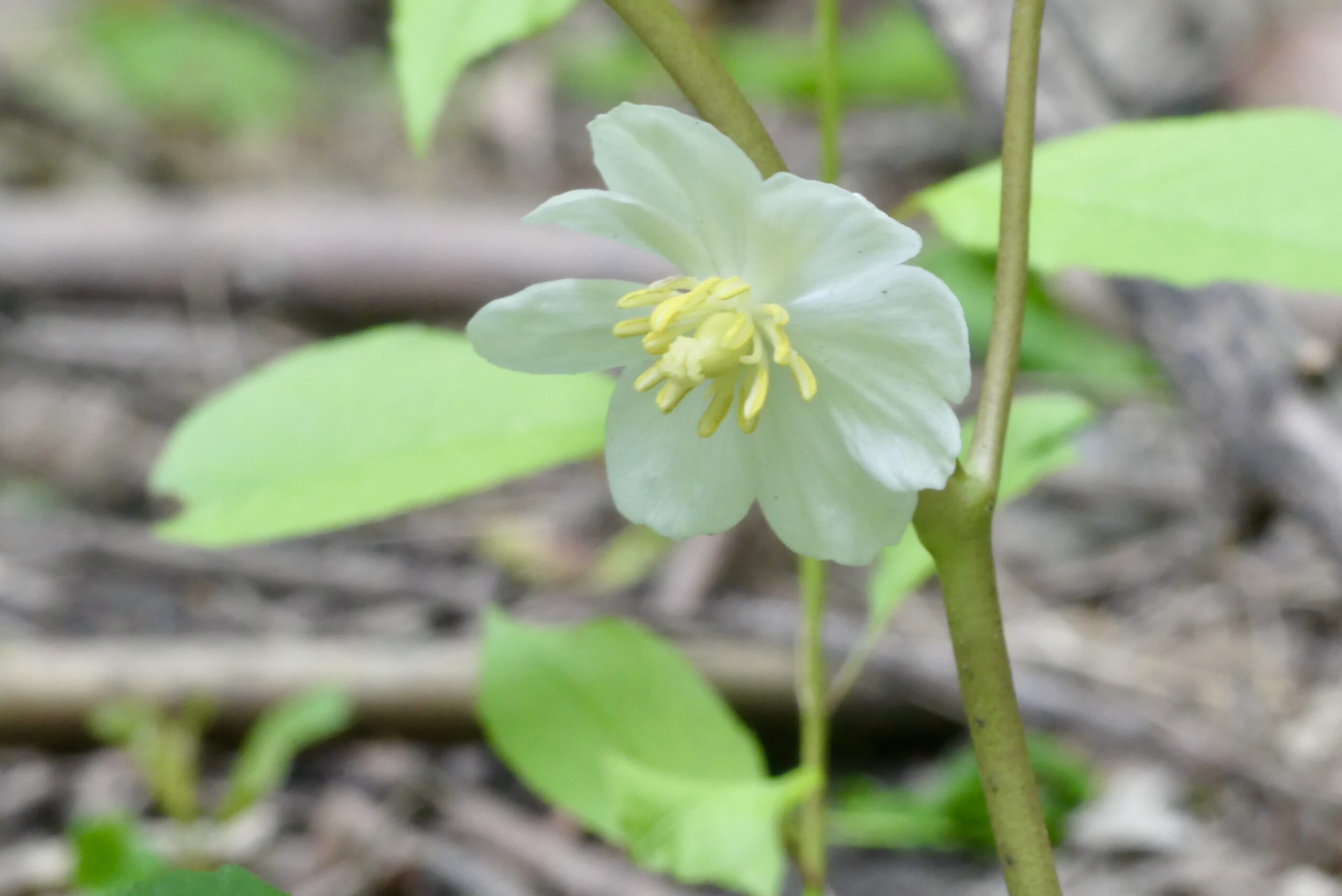
Spencer Adventure is a hiking trail along Spencer Creek terminating at Websters Falls where the creek plunges over the falls to the gorge below. We will start our hike at Christie Lake and eventually follow the creek to Websters Falls. Along the way there are many interesting historical features including a grist mill and Upper Canada’s first pulp and paper mill as well as lovely natural sights. Expect to see some early Spring wildflowers. Bring water, a snack and sunscreen and poles if using. Parking fee or Conservation Area - 25April 25, 2025

9:00 am Niagara-on-the-Lake Tour
https://hikes.brucetrail.org/event/900-am-niagara-on-the-lake-tour-40/Sorry, the registration cut-off time for this hike has been reached.Not a member? Click here to join today!Hosting Club: Niagara
Location (Google Maps):
Veterans Memorial Park, park just outside the park on King Street
Hike Leader(s): Robin Garrett Click here to contact Hike Leader(s)
Pace: Medium
Terrain: Easy
Distance: 6-7 kmDescription
Each Friday we will explore different neighbourhoods, trails and parkland throughout Historic Niagara-on-the-Lake.Moderate pace with some weeks entirely on sidewalks and roads while others may include a mix of trails and paved pathways. Great way to build up endurance for longer more strenuous hikes.
Prepare for cooler windy conditions on open parkland and along Lake Ontario and Niagara River trails.
Plan to stay for conversation and a warm cup of coffee or tea at Sweets & Swirls, Community Centre, Niagara Stone Road, NOTL
- 26April 26, 2025

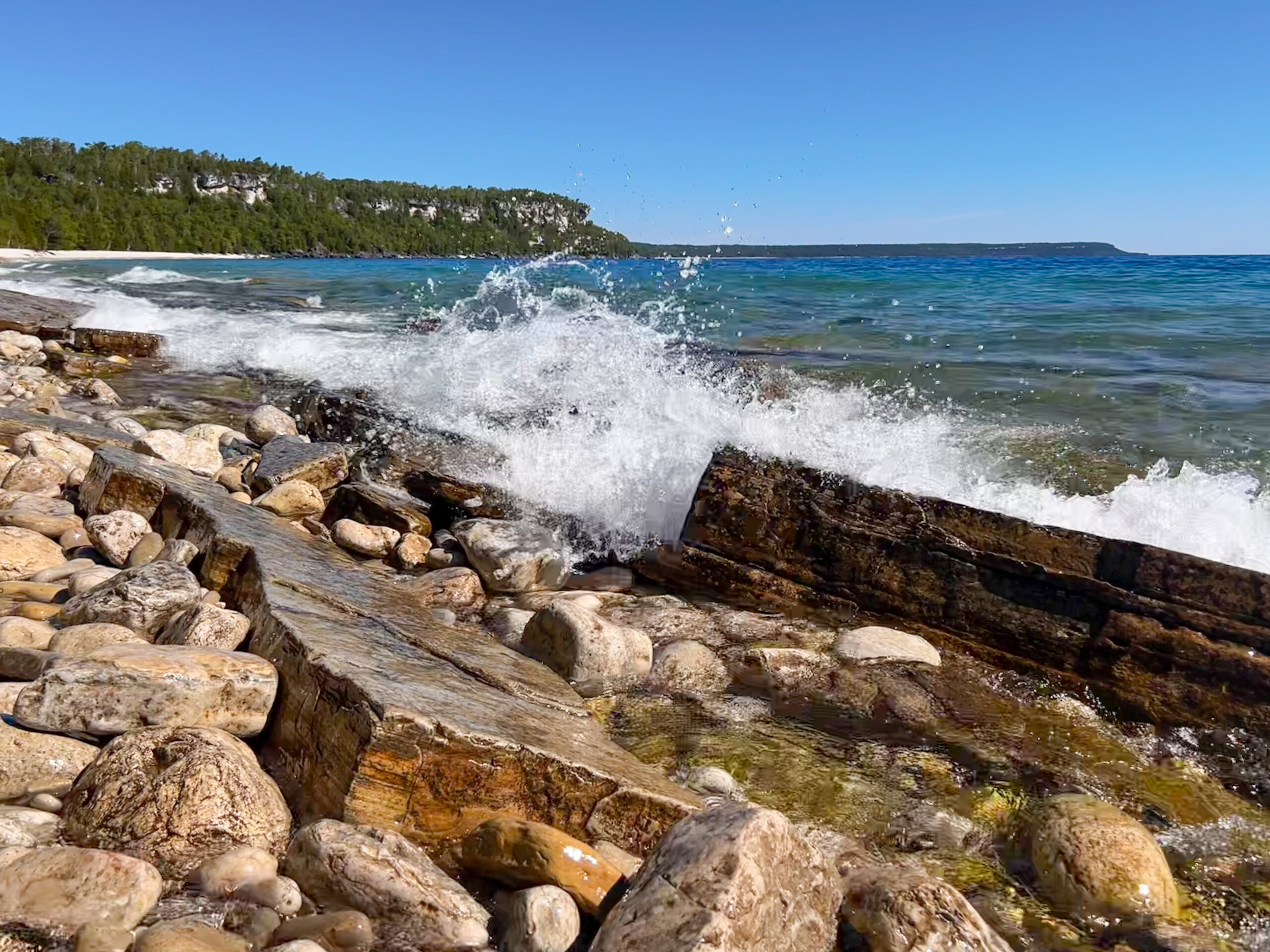
Peninsula Sunrise Series: Hope Bay Forest
https://hikes.brucetrail.org/event/peninsula-sunrise-series-hope-bay-forest/Sorry, the registration cut-off time for this hike has been reached.Not a member? Click here to join today!Hosting Club: Peninsula
Category: Sunrise Hike
Location (Google Maps): Roadside Parking at the south end of Cathedral Dr, Lion’s Head, ON N0H 1W0, CanadaHike Leader(s): Kathleen Stahlbaum Click here to contact Hike Leader(s)
Pace: Leisurely (2.0 – 3.0 km/h): A relaxed pace with frequent breaks and a focus on enjoyment.
Terrain: Difficult: Steep ascents/descents, rocky scrambling, and some rugged escarpment paths., Easy: Flat forested sections or lowland trails., Moderate: Rolling hills, mild slopes and rocky paths.
Distance: 7.0 kmDescription
Experience the magic of dawn on the Bruce Trail with the Sunrise Hike Series offered by the Peninsula Bruce Trail Club. These early morning hikes provide a perfect opportunity to awaken your senses, boost your energy, and immerse yourself in the tranquility of nature as the sun paints the sky with breathtaking hues. As we make our way through scenic forest trails, we’ll pause to witness the first light shimmering on the turquoise waters of Georgian Bay – a sight that will surely leave you in awe!Beyond the beauty, morning light helps regulate your circadian rhythm, elevating your mood, boosting energy levels and improving sleep quality. Whether you’re looking to start your day with a sense of calm, capture stunning sunrise shots, or simply reconnect with nature, these hikes offer a unique and inspiring way to greet the day.
On Saturday April 26th, join us in hiking along the Don Irish Side Trail, Main Trail, and portions of the Jack Poste Side Trail and Hopeness Side Trail through Hope Bay Provincial Forest to experience the sun rising over the Bay from the edge of the Escarpment. We’ll have the joy of taking in the stunning colours of the sky as the first light sparkles on the stunning turquoise waters. This peaceful sunrise hike is the perfect way to connect with nature, capture some incredible photos, and start the day with fresh air and inspiration. Whether you’re a morning person or just love a good adventure, come experience the magic of dawn from one of the best vantage points on the Bruce Peninsula!
Don’t forget to bring a headlamp or flashlight (preferably with a red light setting) as we begin our adventure in the pre-dawn quiet. Join us and discover how a sunrise hike can nourish your mind, body, and spirit—setting the tone for a brighter, more balanced day.
This hike is approximately 7 kms in length. Expect to be on the trail for 2.5-3 hours. Pace will be leisurely with ample time to enjoy the sunrise, take some photographs, and nourish yourself!
How to prepare
- Get a good night’s sleep
- Bring lots of water and a snack (breakfast and/or coffee are recommended if that’s your thing!)
- Bring a headlamp or flashlight (preferably with a red light setting)
- Wear waterproof hiking boots (there will be mud!)
- Hiking poles are recommended but not necessary
- Bring insect repellant or wear protective clothing – blackflies in particular are plentiful in late April!
Map 37, Edition 31

Iroquoia City of Waterfalls Challenge - 2 Day Shuttle Hike - Members Only
https://hikes.brucetrail.org/event/iroquoia-city-of-waterfalls-challenge-2-day-shuttle-hike-members-only/Sorry, the registration cut-off time for this hike has been reached.Not a member? Click here to join today!Hike open to BTC Members only.
This is a Multi-Day Hike
You are signing up for the following dates:
2025-04-26, 2025-04-27Hosting Club: Iroquoia
Category: City of Waterfalls – Special Event Fundraiser
Location (Google Maps): Day 1:April 26th – Parking lot at Cityview Park off Kerns Rd. Enter from Dundas St. (capacity 50) 43.351747, -79.862195
Day 2: April 27th – Parking lot off Mud St providing access to the Mud Street Side Trail (capacity 30)Hike Leader(s): Kristy Goss Click here to contact Hike Leader(s)
Pace: Brisk – 4 to 5 km/hr
Terrain: Dependent on Conditions, Moderate – Some hills and/or some poor footing
Distance: Approximately 22-25 km per dayDescription
Welcome to Iroquoia, City of Waterfalls Challenge! This is a fundraiser challenge event. All funds raised go towards the Iroquoia Bruce Trail Club to maintain the infrastructure of this beautiful section of trail and to “Preserve this ribbon of wilderness, for everyone, forever!”We also encourage participants to consider a membership with Conservation Hamilton
https://conservationhamilton.ca/hca-membership-pass/And/or Conservation Halton (50%discount with BTC membership)
https://www.conservationhalton.ca/park-fees-membership-rates/DAY 1: APRIL 26 – We will meet at Cityview Park and car shuttle to Spencer Gorge Parking Lot (Conservation Halton) and hike back. The cost at this parking lot is $16.50 per vehicle and driver plus $5.50 for each passenger. To be confirmed. Day 1 Distance (to be confirmed) 21-23km at a brisk pace, with opportunities to stop for photos & a break along the way.
DAY 2: APRIL 27 – We will meet in the parking area off of Mud St and car shuttle to Artaban Rd Parking Lot (Conservation Hamilton) and hike back. The cost for this parking lot is $11.00 per vehicle. To be confirmed. Day 1 Distance (to be confirmed) 22-25km, with opportunities to stop for photos & a break along the way.
Please ensure your vehicle is car shuttle ready by having a minimum of 4 seatbelts available – drivers do not pay for the parking. Please volunteer for this important component of this challenge or we can throw all the names into a hat. While we encourage carpooling to the start of the hike, please let the hike leader know if you’re planning to arrive with more than two people in your vehicle. This hike will be limited to 20 people including the hike leader so we will need at least 4 vehicles and one vehicle with 5 seatbelts to drive the drivers back at the end of the day. We will try to take as few vehicles as possible. On the second day, those who did not drive on the first day will be asked to drive.
There will be short breaks along the way to admire the waterfalls on route and a short lunch.
Please bring all the hiking items you require for a long day hike including 2l of water, snacks, lunch, first aid kit, rain gear if rain is forecast, plastic shower caps for your boots if muddy, bug spray, sunscreen, rimmed hat, poles (if you use them) and your camera for all the photo ops. Please ensure you are physically able to complete two long day hikes over two days – if you must drop out, you will have to arrange your own transportation back to your vehicle. There is public transportation, Uber, and taxi’s in the area. If you are concerned about whether you will be able to manage the distance over the two day period, it’s possible that you may need to wait until a 4 day version of this event is posted.
The new badge will be presented to all participants who have completed the challenge at the end of the second day.
Any questions may be directed through contact on this form.
Car Hike: 2025 TBTC AGM Hike and Meeting
https://hikes.brucetrail.org/event/car-hike-2025-tbtc-agm-hike-and-meeting/Sorry, the registration cut-off time for this hike has been reached.Not a member? Click here to join today!Hosting Club: Toronto
Category: Car Hike
Location (Google Maps): Silver Creek Conservation AreaHike Leader(s): Lindita Kalo Click here to contact Hike Leader(s)
Pace: Moderate (3-4 km/hr)
Terrain: Level 2 (Intermediate – some hills and uneven surfaces, rocks and roots underfoot), Variable
Distance: 12kmDescription
Join me for a wonderful hike of Side Trails Bennet Heritage/Great Esker and main Bruce trail 29.7-36.1km for a total of 12km with amazing views. This hike is a loop, with moderate to fast speed. After hikers can join for lunch 12:30pm at the 2025 TBTC AGM featuring guest speaker Adam Shoalts. You must register separately for the meeting on Eventbrite – https://www.eventbrite.ca/e/2025-tbtc-annual-general-meeting-tickets-1111143132019?aff=oddtdtcreator. Early bird registration for the AGM (including lunch) for members at the rate of $20.00 will be available until Februay 17th. A BTC membership number will be requested when registering for the meeting on Eventbrite. From February 18th the rate for AGM will increase to $25.00 and registration will be open to non-members. More information will be shared to registers hikers before few day before the hike.Bus Hike: 2025 TBTC AGM Hike and Meeting
https://hikes.brucetrail.org/event/bus-hike-2025-tbtc-agm-hike-and-meeting/Sorry, the registration cut-off time for this hike has been reached.Not a member? Click here to join today!Trip Information
Departure Time: 08:30
Return to City Time: 17:00
Departure Point: York Mills Bus PickupOptional Items
Hosting Club: Toronto
Category: Bus Hike
Location (Google Maps): Gellert Community Centre, GeorgetownPace: Leisurely (2-3 km/hr), Moderate (3-4 km/hr)
Terrain: Level 1 (Easy – mostly on flat, well maintained trails with hard-packed surface), Level 2 (Intermediate – some hills and uneven surfaces, rocks and roots underfoot), VariableDescription
The bus will depart from the York Mills departure point to the Georgetown area for a morning of hiking followed by lunch and the 2025 TBTC AGM featuring guest speaker Adam Shoalts.Note: You must register separately for the meeting on Eventbrite – https://www.eventbrite.ca/e/2025-tbtc-annual-general-meeting-tickets-1111143132019?aff=oddtdtcreator. Registration for the AGM is now open for non-members.
The TBTC Hike Leaders are pleased to offer you a choice of four hikes on this bus as listed below. Please register for the hike of your choice through the respective registration page. This will help us with the waiver forms and know the numbers to expect for each hike.
(1) Photography Hike at Limehouse Conservation Area with Marijo Roy and professional photographer Ankur Khurana
(2) A visit to the TBTC Seed Orchard with Janet Patterson, George Lennon, and BTC Restoration Specialist Lyndsey Wilkerson
(3) Moderate “Family Friendly” 6 km hike at Silver Creek with Monica Pasquali
(4) Moderate but faster 8 km hike around Silver Creek with Ross Estrella.

2025 TBTC AGM - Photography hike
https://hikes.brucetrail.org/event/2025-tbtc-agm-photography-hike/Sorry, the registration cut-off time for this hike has been reached.Not a member? Click here to join today!Hosting Club: Toronto
Category: TBTC Special Events
Location (Google Maps): Gellert Community Centre, GeorgetownHike Leader(s): Marijo Roy Click here to contact Hike Leader(s)
Pace: Leisurely (2-3 km/hr)
Terrain: Variable
Distance: n/aDescription
Please join us for a nature photography hike with professional photographer Ankur Khurana. Ankur has been captivated by photography since childhood, starting with a mini camera gifted by his father at age 7. Over time, his passion evolved from portraits, events, and landscapes to his true love—bird photography. Now an award-winning wildlife photographer and writer, Ankur’s work is deeply rooted in wildlife conservation. As a full-time storyteller with Feather Friendly, he combines his imagery and writing to raise awareness about bird-glass collisions and promote sustainable solutions. His portfolio can be viewed at www.ankurkhurana.ca. Ankur will provide tips and advice on how to improve your pictures. Bring your DSLR camera, iPad, iPhone, or other devices. After the hike, we will arrive at the Gellert Centre for lunch before the AGM starts.NOTE: The bus will depart from the York Mills departure point to the Georgetown area for a morning of hiking, followed by lunch and the 2025 TBTC AGM featuring guest speaker Adam Shoalts. This registration is for the Photography Hike only.
IMPORTANT:
You must register separately for the meeting on Eventbrite – https://www.eventbrite.ca/e/2025-tbtc-annual-general-meeting-tickets-1111143132019?aff=oddtdtcreator.
Participants who will be coming on the bus need to register and pay for the bus through the AGM Bus Hike registration.
Car Hike: Cherry Beach
https://hikes.brucetrail.org/event/car-hike-cherry-beach-5/Sorry, the registration cut-off time for this hike has been reached.Not a member? Click here to join today!Hosting Club: Toronto
Location (Google Maps): Free parking lot at the end of Cherry Street Toronto
Hike Leader(s): Mohammad Aghamiri Click here to contact Hike Leader(s)
Pace: Moderate (3-4 km/hr)
Terrain: Flat, Level 1 (Easy – mostly on flat, well maintained trails with hard-packed surface)
Distance: 12-14 kmDescription
We will walk along lake Ontario, visiting ponds ,swans and light house
• Please dress appropriately for the weather.
• We will have short water ,picture,Bio and a 15 minute snack breaks. Everyone is welcome!
*First Aid/CPR Course for active Iroquoia Bruce Trail Club Hike Leaders and Trail Maintenance Volunteers.
https://hikes.brucetrail.org/event/first-aid-cpr-course-for-active-iroquoia-bruce-trail-club-hike-leaders-and-trail-maintenance-volunteers/Sorry, the registration cut-off time for this hike has been reached.Not a member? Click here to join today!This is a Multi-Day Hike
You are signing up for the following dates and times:
2025-04-26 at 09:00
2025-04-27 atHosting Club: Iroquoia
Location (Google Maps): Bruce Trail Conservancy Offices
Hike Leader(s): Ruth Moffatt Click here to contact Hike Leader(s)
Distance: N/A
Description
This two-day course is for active volunteers who are regularly leading hikes or are involved with the Iroquoia Bruce trail maintenance program. This is a full weekend to receive your basic First Aid and CPR certification. The course is instructed by Scott Fraichine. The cost is covered by the BTC.Please do not register for this course unless you fully qualify as be the above.

Dufferin Hi-Land 60th Anniversary Side Trail Highlights
https://hikes.brucetrail.org/event/dufferin-hi-land-60th-anniversary-side-trail-highlights-6/Sorry, the registration cut-off time for this hike has been reached.Not a member? Click here to join today!Hosting Club: Dufferin Hi-Land
Category: General Hike
Location (Google Maps): Map 20: Park at north end of 2nd Line E (Access 2nd Line via 1st Line E north from Hwy 89 to 8 Sideroad)Hike Leader(s): su Bate, Carol Foley Click here to contact Hike Leader(s)
Pace: Brisk
Terrain: Moderate, Slippery Sections Likely
Distance: 9kmDescription
This is the 5th in a series of 6 loop hikes; each hike is between 9-12km in length. If you hike all 6 of the hikes in this series, or otherwise hike 60 km in Dufferin during 2025, you qualify for the 60th Anniversary badge.Bring a drink, a snack and your ICERS because the trail can be slippery, icy and muddy at this time of year. Dress for the weather! Getting closer to the end now :)We will follow 2nd Line ECL Side Trail to Oliver Creek Side Trail. Turn right on Oliver Creek and continue east to Bruce Main Trail at km 24.3. Follow Main Trail south to Mulmur Lookout Side Trail (km 20.7). Take side trips on the Boyne Creek and Mulmur Lookout Side Trails along the way. Return to parking by the same route or, for a shorter hike, stay on 2nd Line E when the Main Trail leaves the road just north of km 22.7.
1 + 1 + 1 = 3 Waterfalls; One Hike!
https://hikes.brucetrail.org/event/1-1-1-3-waterfalls-one-hike/Sorry, the registration cut-off time for this hike has been reached.Not a member? Click here to join today!Hosting Club: Caledon Hills
Category: General
Location (Google Maps): Dundas Valley Hamilton – Dundas Valley Conservation Area – Tiffany Falls Conservation Area
PARK: on Artaban Rd. within Dundas Valley Conservation Area 180 m north of Lion’s Club Rd. Parking fees apply.Hike Leader(s): Doris Harper Click here to contact Hike Leader(s)
Pace: Medium – 3 to 4 km/hour
Terrain: Moderate – some hills and/or some poor footing
Distance: approx. 5 kmDescription
From the parking area on Artaban Rd. we will hike the short distance to Sherman Falls. We will loop around the falls and then hike about 2 km, to Tiffany Falls. There is a short hiking trail into the Falls. From there we will return to the parking area. Total, about 5 km. There is an additional waterfall close by – Canterbury Falls which would add an additional 2.5 km to the hike. We can decide after we return from Tiffany Falls if anyone would like to hike to Canterbury Falls.Spring trails can be muddy and slick, poles recommended. Bring water and snacks.
Explore the TBTC Seed Orchard
https://hikes.brucetrail.org/event/explore-the-tbtc-seed-orchard/Sorry, the registration cut-off time for this hike has been reached.Not a member? Click here to join today!Hosting Club: Toronto
Category: TBTC Special Events
Location (Google Maps): Todd Bardes Side TrailHike Leader(s): Janet Patterson; George Lennon Click here to contact Hike Leader(s)
Pace: Leisurely (2-3 km/hr)
Terrain: Variable
Distance: approx 3 kmDescription
This is one of the bus hikes being offered in conjunction with the TBTC AGM. You must be registered (separately) for the AGM bus to take part in this hike.Come and learn about this innovative new project. We are fortunate to have the BTC’s Restoration Project Specialist, Lyndsey Wilkerson as our guide. Limited to 10 people due to the educational nature of the hike.
We’ll take a leisurely stroll to visit the Seed Orchard, which is located in a meadow adjacent to the Todd Bardes Side Trail, a unique seasonal wetland habitat. The purpose of this orchard – a protected area – is to foster the growth of native plants for the express purpose of producing seeds. These seeds will be collected annually and redistributed to support wetland restoration areas identified in the Toronto section but also in neighbouring Iroquoia and Caledon sections of the Bruce Trail.
A major goal of the TBTC Biodiversity Team is to foster an appreciation of the flora and fauna that thrive along the Bruce Trail. We also strive to protect native species from threats, such as the encroachment of invasive species.
“Native plants offer everything pollinators need: nectar, pollen and habitats that match their life cycles. Native plants also bloom at the perfect time for pollinators, making them essential allies in the effort to protect biodiversity.” ~ David Suzuki Foundation newsletter
Car Hike/Bus Hike Toronto BTC AGM: Silver Creek
https://hikes.brucetrail.org/event/car-hike-bus-hike-toronto-btc-agm-silver-creek/Sorry, the registration cut-off time for this hike has been reached.Not a member? Click here to join today!Hosting Club: Toronto
Category: TBTC Special Events
Location (Google Maps): Drivers will meet at the Silver Creek Outdoor Education parking lot – coordinates are 43.692615, -79.968433. (Map 13 of the Bruce Trail Reference Guide, Edition 31).
Bus Hikers will depart from the York Mills Departure Point (Seperate Registation – Please see hike description)Hike Leader(s): Ross Estrella, KJ Chong Click here to contact Hike Leader(s)
Pace: Brisk (4-5 km/hr)
Terrain: Level 2 (Intermediate – some hills and uneven surfaces, rocks and roots underfoot), Variable
Distance: 8 kmDescription
This hike is considered BOTH a “Bus Hike” AND a “Car Hike” because it is for people traveling by the TBTC bus leaving from York Mills and for people traveling by car. If traveling by bus then please ensure you also register and pay for the bus using this link: https://hikes.brucetrail.org/event/bus-hike-2025-tbtc-agm-hike-and-meeting/2025-04-26/Join us for a trek before the Toronto Bruce Trail Club’s Annual General Meeting on Saturday, April 26, 2025. We will use the main Bruce Trail, the Maureen Smith Side Trail, and the Bennett Heritage Trail to make an 8 km loop within Silver Creek Conservation Area. We will descend and ascend the Escarpment, cross Owl Creek and Snow’s Creek multiple times (bridges and boardwalks will keep our feet dry, thankfully!), and hike along the edges of fields and through mature forests. We will complete our loop by walking about 400 m on 27th Side Road in order to return to the Silver Creek Outdoor Education parking lot, admiring the little waterfall underneath the road bridge along the way.
You should bring enough water and food for the hike, comfortable footwear with good traction, appropriate clothing for the weather, and your energy and enthusiasm to complete our 8 km hike in 2 hours so we can make it to the AGM before the festivities begin!

Car Hike/Bus Hike: Sauntering around Silver Creek: MODERATE Hike
https://hikes.brucetrail.org/event/car-hike-bus-hike-sauntering-around-silver-creek-moderate-hike/Sorry, the registration cut-off time for this hike has been reached.Not a member? Click here to join today!Hosting Club: Toronto
Category: TBTC Special Events
Location (Google Maps): We will meet at the Silver Creek Outdoor Education parking lot – coordinates are 43.692615, -79.968433. (Map 13 of the Bruce Trail Reference Guide, Edition 31).Hike Leader(s): Monica Pasquali Click here to contact Hike Leader(s)
Pace: Moderate (3-4 km/hr)
Terrain: Level 2 (Intermediate – some hills and uneven surfaces, rocks and roots underfoot), Variable
Distance: 6 kmDescription
This hike is considered BOTH a “Bus Hike” AND a “Car Hike” because it is for people traveling by the TBTC bus leaving from York Mills and for people traveling by car. If traveling by bus then please ensure you also register and pay for the bus using this link: https://hikes.brucetrail.org/event/bus-hike-2025-tbtc-agm-hike-and-meeting/2025-04-26/Join me and my family for a stroll through Silver Creek Conservation Area before the Toronto Bruce Trail Club’s Annual General Meeting on Saturday, April 26, 2025. We will use the main Bruce Trail, the Roberts Side Trail, the Irwin Quarry Side Trail, and a small portion of the Bennett Heritage Trail to make a 6 km triple loop. We will go up and down the Escarpment a few times, enjoy the view over Silver Creek Valley, look for wetland critters as we walk along the edge of a pond, cross Owl Creek, and observe the beginnings of spring deep within mature forests. We will complete our hike by walking about 400 m on 27th Side Road in order to return to the Silver Creek Outdoor Education parking lot, admiring the little waterfall underneath the road bridge along the way.
Children under 13 years of age are encouraged to join their parents/guardians on this hike so they can fulfill the requirements for the Toronto Bruce Trail Club’s Youth Badge (https://torontobrucetrailclub.org/the-trail/badges) – all family members who are planning on joining us should register for the hike, including children. My own two children (ages are 11 and 14) will be participating in the hike so please feel free to bring children along as long as they can complete the 6 km distance at a moderate average pace of approximately 3 km/h.
You should bring enough water and food for a 2-hour hike, comfortable footwear with good traction, appropriate clothing for the weather, and a big smile because we’re going to have a terrific time together!
Invasive Species Event: Garlic Mustard Pull
https://hikes.brucetrail.org/event/invasive-species-event-garlic-mustard-pull-2/Sorry, the registration cut-off time for this hike has been reached.Not a member? Click here to join today!Hosting Club: Dufferin Hi-Land
Category: Special Events
Location (Google Maps): Boyne Valley. BTC Guidebook (31st ed.) Map 20 at km 19.4. Meet on 1st Line EHS south on 5 Sideroad at the stile. N 44.119199º, W 80.112593º. Roadside parking.Hike Leader(s): N/A
Pace: Leisurely
Terrain: Moderate
Distance: 4kmDescription
Join us to HELP REMOVE GARLIC MUSTARD!!We will hike in from 1st Line EHS picking invasive garlic mustard (reusable grocery bags or garbage bags work well). We will pick garlic mustard in that area for a while, dump it, then hike back out. Plenty of native spring plants to admire along the way – reducing invasive species will give these species a chance to thrive!
- students under 16 must be accompanied by a parent/guardian on this hike ( please refer to the BTC link https://brucetrail.org/wp-content/uploads/2024/02/VOL.05.01-Minors-Volunteering-Policy-Approved-February-2016-Reviewed-Oct-2020.pdf )
- students wishing to receive community service hours (3Hours) MUST bring service forms from school
- you must register and submit a completed waiver for this hike
- Please wear clothes for work – long pants tucked into socks, appropriate footwear (no sandals), long sleeves and work gloves
- Garbage bags will be provided
- Bring snacks, lunch and water as needed
This event is not a hike. There will be no certified hike leader present. Please contact Liz Jensen at liz@lizjensen.com for more information.