Hike Schedule
Join us for a hike! Registration required:
All hikes available to BTC members. Some hikes are open to non-members.
TIP: The calendar view displays up to 7 hikes on a day, but often there are more. Click “More events” to see them all.
Categories
- 02March 2, 2025
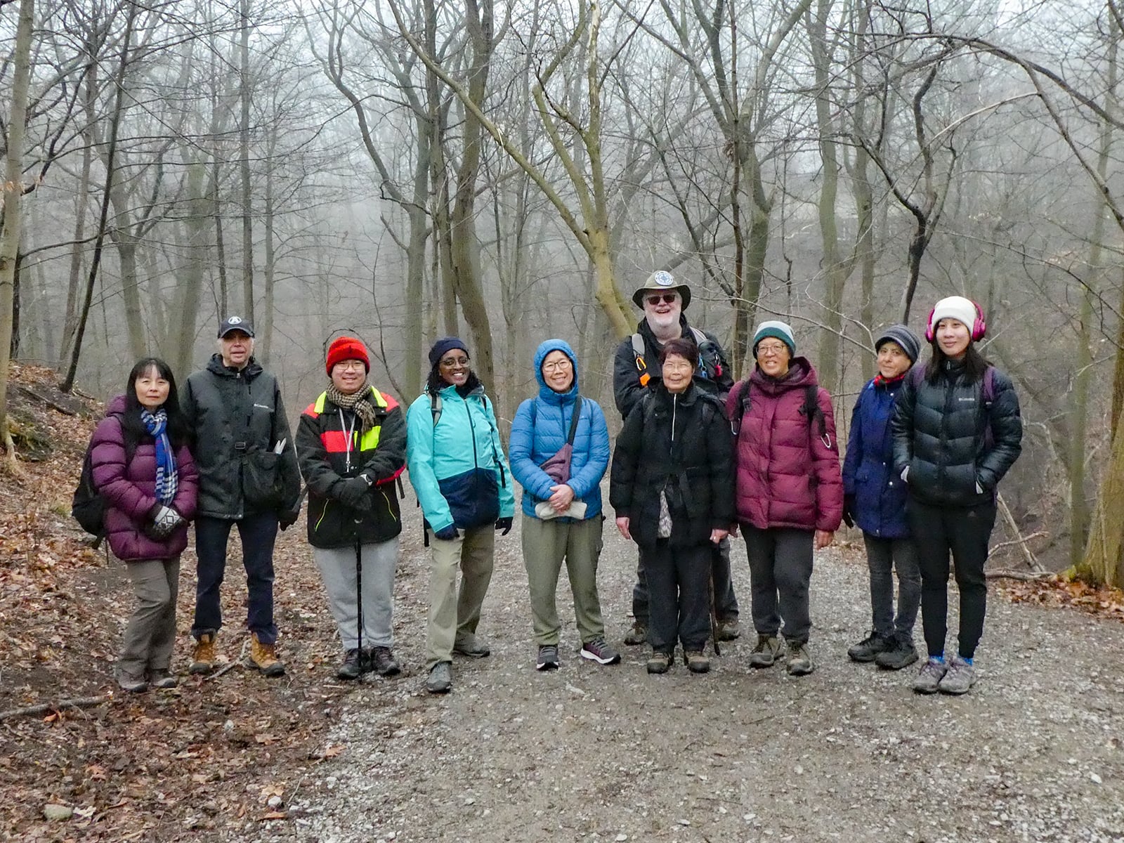
Urban Walk: Waterfront Trail 7/11 – Brimley
https://hikes.brucetrail.org/event/urban-walk-waterfront-trail-7-11-brimley/Sorry, the registration cut-off time for this hike has been reached.Not a member? Click here to join today!Hosting Club: Toronto
Category: Urban Walk
Location (Google Maps): CanadaHike Leader(s): Brian Rideout Click here to contact Hike Leader(s)
Pace: Moderate (3-4 km/hr)
Terrain: Hilly
Distance: 11.4 kmDescription
Please join me at Kennedy Station by 10:15 am. We will take the 12 Kingston Rd bus departing 10:33 am, arriving 10:49 am.We will hike along Kingston Rd, down to and east olong the Lake on the Doris MacCarthy Trail to Guildwood and then to Beechgrove Dr. The estimated distance is 11.4 km. Here is an online map of our route – Brimley to Beechgrove
Bring a snack, at least 2 liters of water, and icers. Dress for cold weather.
- 03March 3, 2025
Postponed - Hike 5 of 5 - Toronto Winter E2E
https://hikes.brucetrail.org/event/hike-5-of-5-toronto-winter-e2e/Sorry, the registration cut-off time for this hike has been reached.Not a member? Click here to join today!Hike open to BTC Members only.
Hosting Club: Caledon Hills
Category: End-to-End
Location (Google Maps): Meet at 9:15 at parking lot across from Limehouse Public School on south side of 22nd SideRoad. .Shuttle to Scotsdale Farm
Hike Leader(s): Jennie Greenfield Click here to contact Hike Leader(s)
Pace: Medium – 3 to 4 km/hour
Terrain: Moderate – some hills and/or some poor footing, Strenuous – hilly with steep climbs and some poor footing
Distance: 12 kmDescription
Hike 5 of 5 – connecting the blazes for the Toronto section!Bennett Heritage trail to the main trail. South through forested wetlands with boardwalks. Crossing busy roads, a little road walking then back to woodlands, and along fields before entering Limehouse and the Conservation Area. The trail passes a restored kiln and ruins of an old mill. Limehouse Side Trail to parking.
29.8 to 20.3 + 0.96 side trails = 10.46 km
- 04March 4, 2025
Urban Walk: Valley View Park Thornhill
https://hikes.brucetrail.org/event/urban-walk-valley-view-park-thornhill-60/Sorry, the registration cut-off time for this hike has been reached.Not a member? Click here to join today!Hosting Club: Toronto
Location (Google Maps): Parking lot is inside Sycamore Drive East of Bayview , north of Bayview Reservoir Park Playground
Hike Leader(s): Mohammad Aghamiri Click here to contact Hike Leader(s)
Pace: Moderate (3-4 km/hr)
Terrain: Level 2 (Intermediate – some hills and uneven surfaces, rocks and roots underfoot)
Distance: 7-8 kmDescription
We will explore Valleyview and Maple View parks, and walk along German Mill Creak,In return we stop in Huntington park and have snack under beautiful shed ,Even it is considered Urban walk, but it is urban hike as we have some up and down hills and tree roots, please bring your Ice cleats and hiking poles
9:00 Long Hike Wiley Road Short Hills
https://hikes.brucetrail.org/event/900-long-hike-wiley-road-short-hills-48/Sorry, the registration cut-off time for this hike has been reached.Not a member? Click here to join today!Hosting Club: Niagara
Location (Google Maps):
Short Hills Wiley Road Entrance
Pace: Medium
Terrain: Moderate
: 10kmDescription
Explore Short Hills and the majestic side trails of Scarlett Tanager, Hemlock. Swayze Falls and Terrace. Register for each hikeBring Poles, Icers, snack, and dress for the weather
9:15 Short Hike - Short Hills Park, Pelham Rd
https://hikes.brucetrail.org/event/915-short-hike-short-hills-park-pelham-rd-20/Sorry, the registration cut-off time for this hike has been reached.Not a member? Click here to join today!Hosting Club: Niagara
Category: Hike
Location (Google Maps): Shorthills Provincial Park, Pelham RdHike Leader(s): Debbie Demizio Click here to contact Hike Leader(s)
Pace: Medium
Terrain: Moderate
Distance: ~ 6kmsDescription
Hike the main and side trails in Short Hills Provincial Park. Bring hiking boots, water, sunscreen and icers (for winter hiking).Forks of the Credit
https://hikes.brucetrail.org/event/forks-of-the-credit-2/Sorry, the registration cut-off time for this hike has been reached.Not a member? Click here to join today!Hosting Club: Caledon Hills
Category: Tuesday Hikers
Location (Google Maps): Mississauga Rd. intersection with Elora-Cataract Trailway.
Driving direction: From Highway 401, north on Mississauga Rd., pass through Belfountain village, after crossing Cataract Rd. and Elora-Cataract Trailway, park on either side of the road.
Alternate: North on Highway 410, continue on Highway 10, at Caledon Village, left on Charleston Sideroad (24), left on Mississauga Rd., drive 2 km to the roadside parking.Hike Leader(s): Mohammad Shafiq Click here to contact Hike Leader(s)
Pace: Medium – 3 to 4 km/hour
Terrain: Moderate – some hills and/or some poor footing
Distance: 10 kmDescription
Will enter Forks of the Credit Conservation Area using Elora-Cataract Trailway and hike main Bruce Trail, Mill Pond Trail and parts of conservation trails.
Bring water, a warm drink and snack; poles are recommended.
Dress according to weather, in layers, cleats may be required for safe hiking.
Will observe Forest Bathing for 20 minutes during the hike.Black Bank Challenge
https://hikes.brucetrail.org/event/black-bank-challenge/Sorry, the registration cut-off time for this hike has been reached.Not a member? Click here to join today!Hosting Club: Dufferin Hi-Land
Category: Tuesday Hike
Location (Google Maps):Dufferin Hi-Land Section, Map 21. Meet at roadside parking on the east side of Centre Road about 1 Km south of Dufferin Rd 21.
Hike Leader(s): Inge Eckerich, Julie Daley, Tony Evangelista Click here to contact Hike Leader(s)
Pace: Leisurely
Terrain: Slippery and Steep Sections, Slippery Sections Likely
Distance: 4.4 km;Description
We will hike down Black Bank hill and continue on the Main Trail to Dufferin Rd 21 and back. Black Bank hill usually has a very large snow drift at the top of the hill at this time of year. Snowshoes may be essential. Icers could be required depending on conditions. Bring water and snacks. - 05March 5, 2025
Winter Wednesday Walkers - Margaret Paull Loop Cancelled - weather
https://hikes.brucetrail.org/event/winter-wednesday-walkers-margaret-paull-loop-3/Sorry, the registration cut-off time for this hike has been reached.Not a member? Click here to join today!Hosting Club: Beaver Valley
Location (Google Maps): Meet on 6th Line, north of Grey Road 119 (also called Sideroad 15), km 13.7, Map 24, Edition 31. Do not block driveway, gate or farm entrance.
Hike Leader(s): Glenda Collings Click here to contact the hike leader.
Pace: Medium
Terrain: Moderate
Length of Hike: Approx. 4 kmDescription
This will be a fairly short, but lovely loop, as we hike into the woods, past a flowerpot created by the waves of an ancient glacial lake, along Indian Creek and through fields with views. On winter hikes we may encounter bare ground, light snow, deep snow, or ice. Please bring snowshoes and icers to our Winter Wednesday Walkers outings. Wear appropriate clothing for the weather plus water and a snack.COVID-19 Precautions Before, During and After your Hike
- Each hiker joining a Bruce Trail Club organized hike must perform a self-screening check before hiking.
Find Ontario’s self-assessment tool here: https://covid-19.ontario.ca/self-assessment/ - If you are experiencing COVID-19 symptoms, stay home.
Other Guidelines
- Arrive 15 minutes before the start of the hike.
- Wear sturdy footwear and appropriate attire for the weather and the terrain.
Hiking poles are a good idea in any season, especially if the terrain is rocky or slippery. In winter, snowshoes or icers/crampons are needed when conditions dictate.
Wearing appropriate clothing and footwear prevents injuries and shows consideration for a safe and positive group hiking experience. - Always carry I.D. and your health card.
- Bring sufficient water and snacks (or lunch if indicated). A minimum of 1L of water is recommended on all hikes, and 3L is recommended for long, challenging hikes in the heat of the summer.
- Bring sunscreen and insect repellent (for spring and summer hikes).
- Bring your own first aid kit.
- Please leave dogs at home.

Winter Badge Wednesdays: Mono Centre
https://hikes.brucetrail.org/event/winter-badge-wednesdays-mono-centre-2/Sorry, the registration cut-off time for this hike has been reached.Not a member? Click here to join today!Hike open to BTC Members only.
Hosting Club: Caledon Hills
Category: General
Location (Google Maps): Meet at 10 am at the parking lot at Mono Community Centre. The centre is located at 754483 Mono Centre Rd. Please park in the gravel surface lot – which is the first lot as you drive in. You might notice the side trail sign at the edge of the lot. It is best to aim for arriving around 9:45, so we can start hiking as close to 10 am as possible. Thanks!Hike Leader(s): Elizabeth Ganong Click here to contact Hike Leader(s)
Pace: Medium – 3 to 4 km/hour
Terrain: Moderate – some hills and/or some poor footing
Distance: Between 4 and 5 kmDescription
This hike has been cancelled due to trail conditions and a special weather statement for Wednesday morning.Looking to get outside and enjoy nature in another season? You may wish to join in on one Wednesday hike in this winter series or all five! Complete all five as part of the series or do a combination of hikes within the series and your own winter hikes, and you will be eligible to receive the Caledon Winter Hiking Badge (further details below and on the CHBTC website under Club Badges).
This Wednesday’s hike takes us to the north end of the Caledon section as we use side trails and the main trail to make a 4 to 5 km route in the Whitetail Refuge Nature Reserve. Be prepared for winter conditions by bringing warm gear, poles, and icers. You are encouraged to bring water and a snack. No dogs please.
The hike leader for this hike is Elizabeth Ganong. Registrants can expect a reminder/update message one or two days before the hike.
If desired, this hike may be used towards the Caledon Winter Hiking Badge (5 winter hikes in the Caledon section that are 1 ½ hours or longer in length). Please keep a log of your hikes and follow the directions on the CHBTC website under Club Badges to receive your badge.
Evening Hike in Owen Sound followed by an Opportunity for Refreshments
https://hikes.brucetrail.org/event/evening-hike-in-owen-sound-followed-by-an-opportunity-for-refreshments-13/Sorry, the registration cut-off time for this hike has been reached.Not a member? Click here to join today!Hosting Club: Sydenham
Category: An evening walk.
Location (Google Maps): Municipal Parking Lot by the river on the West side of 1st Ave East between 7th St East and 8th St East in Owen Sound.Hike Leader(s): Harriet Nixon Click here to contact Hike Leader(s)
Pace: Brisk: 4 to 5 km/h
Terrain: Moderate: Some hills and/or poor footing
Distance: Approx 5 kmDescription
Join us for a brisk winter evening hike exploring the paths and neighbourhoods of Owen Sound, followed by an opportunity to socialize over refreshments. Please bring along icers, as there may be icy conditions. There is no need to show up 15 minutes early for this hike, but we will leave promptly at 7:00 pm. - Each hiker joining a Bruce Trail Club organized hike must perform a self-screening check before hiking.
- 06March 6, 2025
Stained Glass Badge Caledon E2E
https://hikes.brucetrail.org/event/stained-glass-badge-caledon-e2e/Sorry, the registration cut-off time for this hike has been reached.Not a member? Click here to join today!Hike open to BTC Members only.
This is a Multi-Day Hike
You are signing up for the following dates and times:
2025-03-06 at 08:30
2025-03-07 at 08:30
2025-03-15 at 08:30
2025-03-16 at 08:30Hosting Club: Toronto
Category: Car Hike
Location (Google Maps): Km 2.8 north end of Chinguacousy Rd coordinates N 43.785429,W 79.943325 map 14Hike Leader(s): Smadar Junkin Click here to contact Hike Leader(s)
Pace: Brisk (4-5 km/hr)
Terrain: Hilly, Variable
Distance: 15.9 kmDescription
Welcome to the Caledon fund raiser hikes series. The donations to this series will help preserve the ribbon of wilderness for everyone forever.
it will earn you the special badge of the stain glass Badlands.
you will be allowed to miss one hike which you will need to complete on your own before the last date of the series. You can also earn the Caledon winter badge for the additional cost of $10.
please note that it is a winter hike, dress accordingly with layers. Must bring along snowshoes and icers. 2 litres of water, snacks and lunch.day 2 we will meet at km 15.9 southwest shoulders of Willoughby rd. Coordinates N 43.831244,W 79.980588 map 15. We will shuttle to km 35.0 and walk back. Distance- 19.2 kms.
day 3- we will meet at km 35.0 Coolihans Sideroad coordinates N 43.937967, 79.934650 map 17. We will shuttle to km 51.8 and walk back. 17,3 km + a short walk on a road.day 4- we will meet at km 51.8 on east side of 5th line EHS south of Hockley Rd. Coordinates N 43.993527,W 80.014057 map 18.we will shuttle to km 72.4 and hike back. 21 kms
everyone is expected to participate in the shuttles.
arrive 15 minutes early (8:15), at 8:30 we will be in the cars and ready to go.Urban Walk: Valley View Park Thornhill
https://hikes.brucetrail.org/event/urban-walk-valley-view-park-thornhill-61/Sorry, the registration cut-off time for this hike has been reached.Not a member? Click here to join today!Hosting Club: Toronto
Location (Google Maps): Parking lot is inside Sycamore Drive East of Bayview , north of Bayview Reservoir Park Playground
Hike Leader(s): Mohammad Aghamiri Click here to contact Hike Leader(s)
Pace: Moderate (3-4 km/hr)
Terrain: Level 2 (Intermediate – some hills and uneven surfaces, rocks and roots underfoot)
Distance: 7-8 kmDescription
We will explore Valleyview and Maple View parks, and walk along German Mill Creak,In return we stop in Huntington park and have snack under beautiful shed ,Even it is considered Urban walk, but it is urban hike as we have some up and down hills and tree roots, please bring your Ice cleats and hiking poles
9:00 am Long Hike Cave Spring
https://hikes.brucetrail.org/event/900-am-long-hike-cave-spring-5/Sorry, the registration cut-off time for this hike has been reached.Not a member? Click here to join today!Hosting Club: Niagara
Location (Google Maps):
Cave Spring Conservation Area
Pace: Medium
Terrain: Moderate
: 10kDescription
From Cave Spring Conservation Area explore the trail network on the escarpment You must register for each hike. Bring Poles, snack and a drink and dress for the weatherHiking around Jordan
https://hikes.brucetrail.org/event/hiking-around-jordan-25/Sorry, the registration cut-off time for this hike has been reached.Not a member? Click here to join today!Hosting Club: Niagara
Category: Hike
Location (Google Maps): Shoarishon Park (formerly known as Jordan Hollow)Note: Due to construction at Shoarishon Park, Boo’s Restaurant across the street is allowing us to use their premises to park
Hike Leader(s): Bill Russell Click here to contact Hike Leader(s)
Pace: Medium
Terrain: Moderate
Distance: 6 – 7 kmDescription
Hike various trails in and around Jordan (Balls Falls, Jim Rainforth Trail, Bailey’s Bridge and through the village of Jordan
Welland Canal Series: Port Dalhousie
https://hikes.brucetrail.org/event/welland-canal-series-port-dalhousie/Sorry, the registration cut-off time for this hike has been reached.Not a member? Click here to join today!Hosting Club: Niagara, Sydenham
Category: Historical Hike
Location (Google Maps): Port Dalhousie Public Parking lot. N43.203031 W79.265362Hike Leader(s): Karen Buschert Click here to contact Hike Leader(s)
Pace: Medium: 3 to 4 km/h
Terrain: Easy: Mostly flat and good footing., There might be muddy sections.
Distance: Varies depending on day: 7km with optional 9 km hike along the Merritt Trail afterwardsDescription
Day 1 Port Dalhousie loop (~7 km *+ 9 km optional Merritt trail)This hike series begins with a loop near the original entrance to the Welland Canal (the First, Second and Third versions). When the Fourth Welland Canal was built, the entry point was changed to Port Weller, thus making a new, more direct route to Port Colborne and Lake Erie. This is Hike #4 of the Welland Canal Badge.
Park at Port Dalhousie Public Parking lot. Free parking in the off season. N43.203031 W79.265362
* If people wish to hike longer, we will have an option to do about 9 km of the Merritt Trail which starts at the same location. If interested in that option, please contact me so I can make arrangements for car shuttling prior to the hike.

To the Lake and Back
https://hikes.brucetrail.org/event/to-the-lake-and-back-2/Sorry, the registration cut-off time for this hike has been reached.Not a member? Click here to join today!Hosting Club: Iroquoia
Category: Easy Does It Hikes
Location (Google Maps): Oakville, Maplegrove PlazaHike Leader(s): Anne Armstrong Click here to contact Hike Leader(s)
Pace: Leisurely – 3km/hr or less
Terrain: Dependent on Conditions, Easy – Mostly flat and usually good footing
Distance: Approx 9 km.Description
This hike replaces one previously scheduled for Feb. 9, cancelled because of weather. This semi urban hike takes us from Maplegrove Plaza to Lake Ontario and back. We will follow Joshua Creek to the lake and return via the same route. There are a few short hills. Bring water, a snack and icers. Trails could be snow covered and icy. There are a number os small hills. Meet near the Rexall Drug Store at 9:45 am. for a 10:00 am. start. Optional refreshment stop afterwards.
Leader: Anne Armstrong - 07March 7, 2025

9:00 am Niagara-on-the-Lake Tour
https://hikes.brucetrail.org/event/900-am-niagara-on-the-lake-tour-33/Sorry, the registration cut-off time for this hike has been reached.Not a member? Click here to join today!Hosting Club: Niagara
Category: Urban
Location (Google Maps):Veterans Memorial Park, park just outside the park on King Street
Hike Leader(s): Margaret Northfield Click here to contact Hike Leader(s)
Pace: Medium
Terrain: Easy
Distance: 6-7 kmDescription
Each Friday we will explore different neighbourhoods, trails and parkland throughout Historic Niagara-on-the-Lake.Moderate pace with some weeks entirely on sidewalks and roads while others may include a mix of trails and paved pathways. Great way to build up endurance for longer more strenuous hikes.
Prepare for cooler windy conditions on open parkland and along Lake Ontario and Niagara River trails.
Plan to stay for conversation and a warm cup of coffee or tea at Sweets & Swirls, Community Centre, Niagara Stone Road, NOTL
- 08March 8, 2025
East Point Park Bird Sanctuary, Scarborough, ON
https://hikes.brucetrail.org/event/car-hike-bethesda-trail-richmond-hill-2/Sorry, the registration cut-off time for this hike has been reached.Not a member? Click here to join today!Hosting Club: Toronto
Location (Google Maps): East Point Park Bird Sanctuary, Scarborough, ON
parking lot at the end of Beech grove Dr.Hike Leader(s): Mohammad Aghamiri Click here to contact Hike Leader(s)
Pace: Moderate (3-4 km/hr)
Terrain: Flat, Variable
Distance: 12-14Description
We will hike along lake Ontario to Scarborough Bluffs.Please bring hiking poles, proper closing and shoes and lots of smile,
JJ Cooper Park (Chamberlain Crescent)
https://hikes.brucetrail.org/event/jj-cooper-park-chamberlain-crescent/Sorry, the registration cut-off time for this hike has been reached.Not a member? Click here to join today!Hosting Club: Blue Mountains
Category: Organized Hike
Location (Google Maps): Tim Hortons, First Street, CollingwoodHike Leader(s): David Little Click here to contact Hike Leader(s)
Pace: Medium – 3 to 4 km/hr
Terrain: Easy – Mostly flat and usually good footing
Distance: 7kmDescription
We meet at the parking lot behind Tim Horton’s on First Street in Collingwood. Then we do a car shuttle to JJ Cooper Park to begin our hike following the Black Ash Creek back to our cars.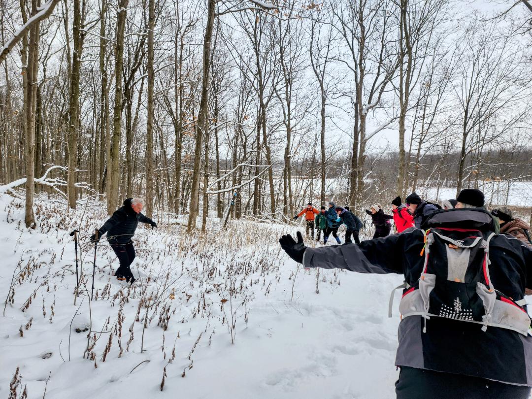
9:00 am Celebrate Winter with Tai Chi at Woodend
https://hikes.brucetrail.org/event/900-am-celebrate-winter-with-tai-chi-at-woodend/Sorry, the registration cut-off time for this hike has been reached.Not a member? Click here to join today!Hosting Club: Niagara
Category: Loop
Location (Google Maps):Woodend Conservation Area – km 15.5; Enter from Taylor Rd., 140 north of Warner Rd.
Hike Leader(s): Karen Couch Click here to contact Hike Leader(s)
Pace: Medium
Terrain: Moderate
Distance: 6 kmDescription
The celebration of Winter 2025 continues! Join in a hike that includes intermittent simple Tai Chi movement breaks led by Mike VanNatter. Gaiters, hiking poles and/or icers are recommended, depending on the conditions.This hike counts as 1 of 15 needed for a 2024/2025 Winter badge.

Saturday Shorts: Riverside Woods Nature Reserve
https://hikes.brucetrail.org/event/saturday-shorts-riverside-woods-nature-reserve-2/Sorry, the registration cut-off time for this hike has been reached.Not a member? Click here to join today!Hike open to BTC Members only.
Hosting Club: Caledon Hills
Category: General
Location (Google Maps): Meet at 10 am at the BTC parking lot, 713377 1st Line EHS, Mono. Go north on 1st Line from Side Road 5. Access is closed going south on 1st Line from Hockley Road during the winter. It is best to aim for arriving around 9:45, so we can start hiking as close to 10 am as possible. Thanks!Hike Leader(s): Elizabeth Ganong Click here to contact Hike Leader(s)
Pace: Medium – 3 to 4 km/hour
Terrain: Moderate – some hills and/or some poor footing
Distance: Between 4 and 5 kmDescription
Looking to get out on a Saturday but not give up your whole day? Saturday Shorts, a hiking series, will get you out in a small group on a short hike. This Saturday’s hike explores Riverside Woods on side trails and gentler nature reserve trails on a 4 or 5 km route. Be prepared for winter conditions by bringing warm gear, poles, and icers. You are encouraged to bring water and a snack. No dogs please.Registrants can expect a reminder/update message one or two days before the hike.
If desired, this hike may be used towards the Caledon Winter Hiking Badge (5 winter hikes in the Caledon section that are 1 ½ hours or longer in length). Please keep a log of your hikes and follow the directions on the CHBTC website under Club Badges to receive your badge.

Family Day in Tobermory – Bruce Trail Hike (Rescheduled)
https://hikes.brucetrail.org/event/family-day-in-tobermory-bruce-trail-hike-rescheduled/Sorry, the registration cut-off time for this hike has been reached.Not a member? Click here to join today!Hosting Club: Peninsula
Category: Winter Hikes
Location (Google Maps): Bruce Peninsula National Park at the Visitor’s Centre located at 120 Chi sin tib dek Rd, Tobermory ON. Meet at the front of the Visitor’s Centre.Hike Leader(s): Shawn Radcliffe Click here to contact Hike Leader(s)
Pace: Leisurely (2.0 – 3.0 km/h): A relaxed pace with frequent breaks and a focus on enjoyment., Medium (3.0 – 4.5 km/h): A comfortable pace for most hikers with steady progress.
Terrain: Moderate: Rolling hills, mild slopes and rocky paths.
Distance: 4.8 kmDescription
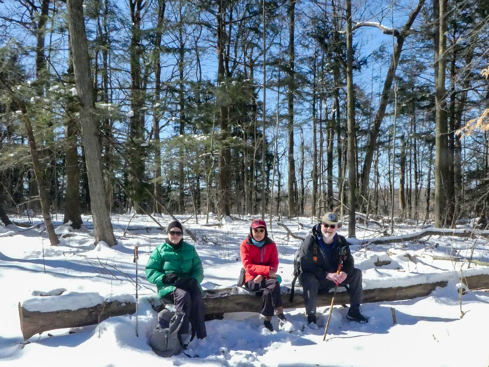
Family Day in Tobermory! Bruce Trail Hike, Campfire at the Bruce Peninsula National Park Visitor Centre and Family Activities at the Tobermory Community Centre!Our Family Day hike starts at the BPNP Visitor’s Centre. We will hike the Main Bruce Trail to the Burnt Loop Side Trail. This is a lovely winter hike (~4.8 km) through an enchanting forest with pretty views of Georgian Bay, Flower Pot and Bear’s Rump Islands taking approximately 2 1/2 hours. We will hike at steady pace with brief stops for drinks/snacks and water views.
The terrain on the first part of this trail is level, however the Burnt Loop Side Trail is a meandering, rocky trail with some short ups and downs and includes a short rocky beach section. If snow is deep, the remainder of the hike may be challenging for some. For those wishing to return to the Visitor Centre after reaching our first lookout (~1 km), a PBTC Hike Leader will return with you while the rest of the hiking group continues.
Winter hikes require extra thought and preparation. Weather can be unpredictable. Be prepared to bring snowshoes, icers and gators (optional). Hiking poles are essential for winter hikes. Make sure to wear layers of clothing, warm winter hat, winter hiking boots and mittens. Bring a light backpack for water and snacks.
Don’t have your own snowshoes? No problem! Arrive early to the Park Visitors Centre to borrow a pair of snowshoes for this hike (limited supplies).
After the hike, everyone is welcome to gather together by the fireplace or outdoor campfire at the Visitor’s Centre. Indoor washrooms are available here. The hike is free. However, park admission and parking fees apply.
Urban Walk: Waterfront Trail 9/11 – Ajax GO to Pickering GO
https://hikes.brucetrail.org/event/urban-walk-waterfront-trail-9-11-ajax-go-to-pickering-go-2/Sorry, the registration cut-off time for this hike has been reached.Not a member? Click here to join today!Hike open to BTC Members only.
Hosting Club: Toronto
Category: GO Train Hike
Location (Google Maps): CanadaHike Leader(s): Brian Rideout Click here to contact Hike Leader(s)
Pace: Moderate (3-4 km/hr)
Terrain: Flat
Distance: 11 kmDescription
Please join me under the clock in the Great Hall at Union Station by 9:05 am. We will take the eastbound Lakeshore Train departing Union Station GO at 9:20 am, arriving Ajax GO at 10:15 am. You may choose to join the group at Ajax GO Station.We will hike south to Lake Ontario (washrooms in the park), west to Sandy Beach Rd, and north to Bayly St with a pub stop at Irish Times adjacent to Pickering GO. Trains to Toronto depart at 25 minutes and 55 minutes after the hour.
Here is an online map of our route (please click on the link): Ajax to Pickering
You can buy a GO Transit day pass for $10.