Hike Schedule
Join us for a hike! Registration required:
All hikes available to BTC members. Some hikes are open to non-members.
TIP: The calendar view displays up to 7 hikes on a day, but often there are more. Click “More events” to see them all.
Categories
- 16June 16, 2024
10;00 Lock 3 picnic
https://hikes.brucetrail.org/event/1000-lock-3-picnic/Sorry, the registration cut-off time for this hike has been reached.Not a member? Click here to join today!Hosting Club: Niagara
Category: In and Out
Location (Google Maps): lock 3 museumHike Leader(s): Sylvia Wheeler Click here to contact Hike Leader(s)
Pace: Medium
Terrain: Easy
Distance: 5kDescription
Hike 90 minutes. Picnic at lock 3.
Urban Walk: Lynde Shores Conservation Area
https://hikes.brucetrail.org/event/urban-walk-lynde-shores-conservation-area/Sorry, the registration cut-off time for this hike has been reached.Not a member? Click here to join today!Hosting Club: Toronto
Category: Urban Walk
Location (Google Maps):Lynde Shores Conservation Area – New Parking Lot on Halls Road
Transit riders coming from Toronto can meet Tom Swales at Union Station in the Great Hall at 8.35 am. You will be taking the 8.50 GO Train to Whitby, taking a short bus ride, and will be walking down Halls Rd. to meet the drivers.
Parking Fee at the Conservation Area is $6.00 flat rate for the day
Hike Leader(s): Tom Swales, Lisa Lifshitz Click here to contact Hike Leader(s)
Pace: Moderate
Terrain: Flat
Distance: 10 kmDescription
We will hike a couple of loops, including the Chickadee Bird Feeder Trail and the Lake Ontario Trail, around the lovely Lynde Shores Conservation Area, 1225 Victoria Street, Whitby. This is a great spot for birds and other wildlife. Optional refreshment stop at the “Oak and Ale Whitby Shores” after the hike.Terrain and Speed – Flat, 3.5k, with stops for photos, viewing wildlife, or appreciating the beauty (approximately 4 hours)
Please let us know in the “Additional Information” field if you plan to take the GO Train or drive and park at the Lynde Shores Conservation Area.
- 17June 17, 2024

Sydenham Fundraiser End to End in Eight Days for the new Hart's Tongue Stained Glass Badge - June 17 - June 24/24 - Please read all details for this hike before registering.
https://hikes.brucetrail.org/event/sydenham-fundraiser-end-to-end-in-eight-days-for-the-new-harts-tongue-stained-glass-badge-june-17-june-24-24-please-read-all-details-for-this-hike-before-registering/Sorry, the registration cut-off time for this hike has been reached.Not a member? Click here to join today!This is a Multi-Day Hike
You are signing up for the following dates:
2024-06-17, 2024-06-18, 2024-06-19, 2024-06-20, 2024-06-21, 2024-06-22, 2024-06-23, 2024-06-24Hosting Club: Iroquoia, Sydenham
Category: Special Event
Location (Google Maps): Bluewater Park across from the arenaHike Leader(s): Ruth Moffatt Click here to contact Hike Leader(s)
Pace: Brisk – 4 to 5 km/hr, Medium – 3 to 4 km/hr
Terrain: Dependent on Conditions, Moderate – Some hills and/or some poor footing, Strenuous – Hilly with steep climbs and some poor footing
Distance: The entire section is about 175km which will be split over 8 days. Approx. 20-25km per dayDescription
Welcome to Sydenham Bruce Trail Club – This end to end will cover the entire section over 8 days. While the section is approx 175km in length, there are about 50km on road, mostly backroads.Overview
This is a special series of 8 hikes to complete the Sydenham section of the Bruce Trail. The organization, guidance, logistics and the Hart’s Tongue stained glass badge, designed by Joe Borges is included in your fee which is non-refundable. A little bit about the Hart’s Tongue Fern: https://en.wikipedia.org/wiki/Asplenium_scolopendrium. Proceeds support the Sydenham Bruce Trail Club which in turn supports the Bruce Trail Conservancy mission to “Preserving a ribbon of wilderness, for everyone, forever.” In addition to hiking the main trail, we may hike some of the loops required for the latest book – Exploring Sydenham by Ron Savage. Hiking these loops may occur immediately after the day’s hike or during if it does not take us too far off the main trail. If this is something you wish to participate in, it is suggested you pick up a copy of this book.
For this E2E in 8, we will be following the main trail southbound from Wiarton eventually finishing in Blantyre. Please note that you are signing up for the entire series of 8 hikes as a Group Hike. The Sydenham in 8 ETE is geared to experienced long distance hikers with the expectation of a 3 to 5.0 km/ hr. pace maintained over a 20km plus day. The section is approximately 175km so daily distances will be based on available parking. No dropout points have been established and therefore hikers who must drop out, will be responsible for their own transportation back to their vehicle. Please note that transportation back to your vehicle is very limited in this section. We will hike at a steady pace but there will be plenty of time to take pictures and to enjoy the flora and fauna of this beautiful section. This particular set of 8 hikes is intended to be Moderate/Brisk. Please be honest about your degree of physical fitness and abilities prior to registration. It is a group hike so it is important you are able to keep pace with the person in front of you.
Attire and Daily Hikes.
Hikers will be expected to be wearing proper hiking boots and layered clothing with the expectation of cool or warm and possibly wet weather. Sufficient food and at least 2l of water for a full day of hiking is required as well as hiking poles (if you use them), and wet weather gear is strongly recommended. Bug spray is also suggested. Clothing adjustments, bio-breaks are as needed. Please let the sweep person know and they will wait for you. A morning break around 10am and a 10-15 minute on-trail lunch break will be scheduled. An afternoon break will be based on our expected finish time. Depending on weather conditions, these times may vary. Everyone must carry a First Aid kit.
Missing Hikes/Making-up Hikes
This is a group hike and it is intended that all participants plan to attend each day, however, if you only need a portion of this section of trail, you are welcome to join for the days or section you need. The cost is the same either way. If you intend to participate in the entire 8 days but absolutely must miss one or two days, you may self-complete these days on your own and still qualify for the stained glass badge. Since this is a car shuttle hike, please ensure your vehicle is car shuttle ready. All participants will be expected to take turns either driving to the start or driving the drivers back at the end of the day. Carpooling to our meeting spot with 2 people in the car is generally ok but we would like to minimize and equalize the driving/shuttling as much as possible so it is fair for all participants. Hikes that are completed on this series may go toward completion of an independent ETE for the regular Sydenham ETE badge if you cannot finish all 8 days.
Parking Fees
Some parking locations might require paid parking. The fee for this E2E-in-8 does not include any parking/entry fees for hikers. These costs, where applicable, will be shared amongst all participants unless you have a parking or park pass.
Leave No Trace
Please remember, like all hikes, this is a Leave No Trace hike. Pack out whatever you pack in. Do not toss anything onto or into any sections of the trail. We will also try to leave the trail better than we found it so we will be collecting any trail trash along the way if there is any.
Dogs will not be welcome on this hike.
Accommodations
It is strongly recommended you make reservations for accommodations for this hike if you are participating from out of town. Accommodations can be made anywhere but Owen Sound has many motels to choose from as well as the KOA Campground. It is pretty central to the northern and the southern sections of the Sydenham section of trail. If you would like a roommate, I can share your email with any other registered participants who are also looking for shared accommodations. Please let me know.
Daily
We meet for each hike by at least 7:45am each day. A schedule for meeting and start locations will be sent to each participant in May. We will hike southerly each day. The schedule is subject to change.
Rattlesnake Point Crawford Lake Loop
https://hikes.brucetrail.org/event/rattlesnake-point-crawford-lake-loop/Sorry, the registration cut-off time for this hike has been reached.Not a member? Click here to join today!Hosting Club: Iroquoia
Category: General Hike
Location (Google Maps):Rattlesnake Point Conservation Area Parking Lot (Appleby Line 1km north of Derry Road.
Hike Leader(s): Pati Greenwood, Jeff Dowsett Click here to contact Hike Leader(s)
Pace: Medium – 3 to 4 km/hr
Terrain: Moderate – Some hills and/or some poor footing
Distance: 15KDescription
This will be a loop hike starting and ending on the Rattlesnake Point Side Trail. We will hike along the main trail as well as the Crawford Lake Side Trail, the Canyon By-Pass Side Trail and the Leach Porter Side Trail to create a loop. Regular breaks, including a lunch break will be provided. Bring a lunch, snacks and plenty of water. Wear appropriate hiking footwear as there are rocky sections along the trail. Parking reservations must be obtained from Conservation Halton. Please arrive at 8:15 am as we will leave promptly at 8:30 am. - 18June 18, 2024
NEW TIME 8:00 Long Hike Wiley Road Short Hills
https://hikes.brucetrail.org/event/new-time-800-long-hike-wiley-road-short-hills-7/Sorry, the registration cut-off time for this hike has been reached.Not a member? Click here to join today!Hosting Club: Niagara
Location (Google Maps):
Short Hills Wiley Road Entrance
Pace: Medium
Terrain: Moderate
: 10kmDescription
Explore Short Hills and the majestic side trails of Scarlett Tanager, Hemlock. Swayze Falls and Terrace. Register for each hike
Bring Poles bug spray water, snack, and dress for the weather
Hogg's Falls Loops
https://hikes.brucetrail.org/event/hoggs-falls-loops-3/Sorry, the registration cut-off time for this hike has been reached.Not a member? Click here to join today!Hosting Club: Dufferin Hi-Land
Category: Cancelled
Location (Google Maps):Beaver Valley Section, Map 26. Meet at SuperBurger (Intersection of Hwy 10 and 89 in Primrose) at 8:30 am or at Hogg’s Falls parking lot on Lower Valley Rd, north of Flesherton at 9:30 am.
Hike Leader(s): Les Babbage, Inge Eckerich, Julie Daley,Tony Evangelista Click here to contact Hike Leader(s)
Pace: Leisurely
Terrain: Moderate
Distance: 7.2 or 2.6 kmsDescription
We will explore a new loop created by construction of bridges across the Boyne River, joining Main Trail on the east and west banks. After returning to the parking lot, the longer hike will continue around the Uplands Meadow/Upper Beaver Valley Side Trails loop. Bring water, snacks.9:15 Short hike - Pelham Road, Short Hills
https://hikes.brucetrail.org/event/915-short-hike-pelham-road-short-hills-76/Sorry, the registration cut-off time for this hike has been reached.Not a member? Click here to join today!Hosting Club: Niagara
Location (Google Maps): Short Hills Provincial Park, Pelham Road entrance
Hike Leader(s): janet davey Click here to contact Hike Leader(s)
Pace: Medium
Terrain: Moderate
Distance: 6 kmsDescription
Hike the main and side trails in Short Hills Provincial Park. Bring hiking boots, water, sunscreen and bug spray. Please check yourself for ticks after the hike.Looping through Boyne Valley Provincial Park; main trail and 4 side trails
https://hikes.brucetrail.org/event/looping-through-boyne-valley-provincial-park-main-trail-and-4-side-trails/Sorry, the registration cut-off time for this hike has been reached.Not a member? Click here to join today!Hosting Club: Caledon Hills
Category: Tuesday Hikers
Location (Google Maps): Boyne Valley Provincial Park – Map 20 of the BTC Trail Guide. County Rd. 19 (Prince of Wales Rd. ) Parking Area – west of km 15.2 – approximately 80 metres south of the Prince of Wales side Trail.Hike Leader(s): Doris Harper Click here to contact Hike Leader(s)
Pace: Medium – 3 to 4 km/hour
Terrain: Moderate – some hills and/or some poor footing
Distance: 12 kmDescription
Starting from the parking lot on Prince Of Wales Rd., we will hike the Prince of Wales Side Trail, Primrose loop Side Trail, main trail, Boyne Valley Side Trail, and loop back by the main trail, and Prince of Wales Side Trail. Along the way we will also hike up the short side trail to Murphy’s Pinnacle with a 360 degree view of the surrounding landscape.Bring lunch, water, poles, the trail is hilly, dress for the weather. Tics are prevalent this year, protect yourself accordingly – sunscreen, bug spray, sun hat, long pants recommended.
- 19June 19, 2024

Summer Fen Series: Oliphant Fen & Petrel Point
https://hikes.brucetrail.org/event/summer-fen-series-oliphant-fen-petrel-point-2/Sorry, the registration cut-off time for this hike has been reached.Not a member? Click here to join today!Hike open to BTC Members only.
Hosting Club: Sydenham, Peninsula
Category: Botany Hike
Location (Google Maps): Oliphant Fen – by North Entrance of the Lorraine Brown BoardwalkHike Leader(s): Jeannine Kralt Click here to contact Hike Leader(s)
Pace: Leisurely: 3 km/h or less
Terrain: Easy: Mostly flat and good footing.
Distance: 3kmDescription
Join the Sydenham and Peninsula Bruce Trail Clubs for a hike series focusing on fens. Fens are unique coastal wetlands occurring along the escarpment, meadow marshes that have conditions that are favourable for a variety of interesting species including orchids.This easy hiking series will begin at Oliphant Fen, with a participant carpool to Petrel Point, returning to Oliphant thereafter. Observations count towards the PBTC Orchid Badge.
Come to one of the hikes or several to see how the fens change through the seasons. Carpooling encouraged – contact the hike leader if you are in need of a ride (no guarantees, but attempts will be made to help coordinate). Please plan to arrive 15 minutes in advance of the hike start time.
Please contact Jeannine, the hike leader, if you have any questions or concerns (link on this page).
WEDNESDAY WALKERS - Fox Ridge
https://hikes.brucetrail.org/event/wednesday-walkers-fox-ridge-2/Sorry, the registration cut-off time for this hike has been reached.Not a member? Click here to join today!Hosting Club: Beaver Valley
Location (Google Maps): Meet at the end of Fox Ridge Road where there is official parking, km 39.3 Map 25, Edition 31. We will take a couple vehicles to the start of our hike at Km 37.9 on Fox Ridge Road.
Hike Leader(s): Margaret Yaraskavitch Click here to contact the hike leader.
Pace: Medium
Terrain: Moderate
Length of Hike: 5 kmDescription
Our hike begins by walking through a hedgerow. Then we walk through a forested area and across some small streams. The Trail opens up to meadow with some views into the Valley. We’ll be experiencing land that was a fairly recent BTC land acquisition. On our return we will be walking along the pleasant Fox Ridge Road.COVID-19 Precautions Before, During and After your Hike
- Each hiker joining a Bruce Trail Club organized hike must perform a self-screening check before hiking.
Find Ontario’s self-assessment tool here: https://covid-19.ontario.ca/self-assessment/ - If you are experiencing COVID-19 symptoms, stay home.
Other Guidelines
- Arrive 15 minutes before the start of the hike.
- Wear sturdy footwear and appropriate attire for the weather and the terrain.
Hiking poles are a good idea in any season, especially if the terrain is rocky or slippery. In winter, snowshoes or icers/crampons are needed when conditions dictate.
Wearing appropriate clothing and footwear prevents injuries and shows consideration for a safe and positive group hiking experience. - Always carry I.D. and your health card.
- Bring sufficient water and snacks (or lunch if indicated). A minimum of 1L of water is recommended on all hikes, and 3L is recommended for long, challenging hikes in the heat of the summer.
- Bring sunscreen and insect repellent (for spring and summer hikes).
- Bring your own first aid kit.
- Please leave dogs at home.

Bronte Creek Ramble CANCELLED DUE TO EXCESSIVE HEAT!
https://hikes.brucetrail.org/event/bronte-creek-ramble/Sorry, the registration cut-off time for this hike has been reached.Not a member? Click here to join today!Hosting Club: Iroquoia
Category: Good Companions
Location (Google Maps): Oakville, Bronte Creek, East BankHike Leader(s): Anne Armstrong Click here to contact Hike Leader(s)
Pace: Leisurely – 3km/hr or less
Terrain: Easy – Mostly flat and usually good footing
Distance: Approx. 8 km.Description
This area is usually rich in wildflowers and offers excellent views down to Bronte Creek and to the west side of the creek. The trail takes us into Bronte Creek Provincial Park via urban and abandoned farm field trails to the east bank of Bronte Creek. Meet in the playground parking lot on Valleyridge Rd., just south of Highway 5, at 9:45 am. for a 10:00 am. start. Bring water, a snack, sunscreen and insect repellent. I suggest wearing long pants due to the possibility of the presence of ticks.
Leader: Anne Armstrong. I will send out a message a couple of days before the hike to give my contact details in the event that you must cancel the morning of the hike.11:00 am Hike & Picnic
https://hikes.brucetrail.org/event/1100-am-hike-picnic-15/Sorry, the registration cut-off time for this hike has been reached.Not a member? Click here to join today!Hike open to BTC Members only.
Hosting Club: Niagara
Category: Loop
Location (Google Maps): Locust Grove Picnic AreaHike Leader(s): Marion Hanover Click here to contact Hike Leader(s)
Pace: Medium
Terrain: Moderate
Distance: 7 kmDescription
Hike around Queenston area. Optional outdoor gathering in Locust Grove including pot luck picnic after the hike.Summer Solstice Potluck
https://hikes.brucetrail.org/event/summer-solstice-potluck-pre-registration-required-maximum-25-registered-hikers-for-this-event-petun-conservation-prv-lookouts-john-haigh-side-trail-loop/Sorry, the registration cut-off time for this hike has been reached.Not a member? Click here to join today!Hike open to BTC Members only.
Hosting Club: Blue Mountains
Category: Cancelled
Location (Google Maps): 49 Silver Creek Dr., CollingwoodHike Leader(s): Kelly-Leigh Thomas Click here to contact Hike Leader(s)
Pace: Medium – 3 to 4 km/hr
Terrain: Moderate – Some hills and/or some poor footing
Distance: 8 kmDescription
CANCELLED DUE TO WEATHER AND UNFORSEEN CIRCUMSTANCES - Each hiker joining a Bruce Trail Club organized hike must perform a self-screening check before hiking.
- 20June 20, 2024
NEW TIME 8:00 am Long Hike Jordan to Moyer / Louth
https://hikes.brucetrail.org/event/new-time-800-am-long-hike-jordan-to-moyer-louth-7/Sorry, the registration cut-off time for this hike has been reached.Not a member? Click here to join today!Hosting Club: Niagara
Location (Google Maps):
Jordan Hollow Park 3039 King St Jordan
Hike Leader(s): Alan Laver Click here to contact Hike Leader(s)
Pace: Medium
Terrain: Moderate
Distance: 10kDescription
From Jordan Hollow Hike the main trail to Upper and Lower Balls Falls, Moyer Road or Louth and Return. You must register for each hike. Bring Poles, sunscreen, bug spray , snack and a drink and dress for the weather
9:15 Short hike - Jordan Hollow
https://hikes.brucetrail.org/event/915-short-hike-jordan-hollow-115/Sorry, the registration cut-off time for this hike has been reached.Not a member? Click here to join today!Hosting Club: Niagara
Location (Google Maps): Jordan Hollow Park, Jordan Station
Hike Leader(s): Bill Russell Click here to contact Hike Leader(s)
Pace: Medium
Terrain: Strenuous
Distance: 6 kmsDescription
Hike the main and side trails around Jordan and Balls Falls. Bring hiking boots, water, sunscreen and bug spray.Beaver Valley End-to-End Hike 9 of 9
https://hikes.brucetrail.org/event/beaver-valley-end-to-end-hike-9-of-9/Sorry, the registration cut-off time for this hike has been reached.Not a member? Click here to join today!Hosting Club: Caledon Hills
Category: End-to-End
Location (Google Maps): Meet at Maple Lane on the north side, km 0.0 (67.3 of Blue Mountain Section). Shuttle to start at 6th Line.Hike Leader(s): Nancy Mooney Click here to contact Hike Leader(s)
Pace: Medium – 3 to 4 km/hour
Terrain: Moderate – some hills and/or some poor footing
Distance: 0.0 – 13.7 = 13.7 km totalDescription
This is the last hike of the series! The trail will take us through the Loree Forest and to the top of the Blue Mountains and Craigleith Ski Club.
Urban Walk: Toronto Islands Evening Walk
https://hikes.brucetrail.org/event/urban-walk-toronto-islands-evening-walk-8/Sorry, the registration cut-off time for this hike has been reached.Not a member? Click here to join today!Hosting Club: Toronto
Location (Google Maps): Jack Layton Ferry Terminal, near the gates to Wards Island Ferry. Arrive 20 minutes prior to departure to check in with hike leader.
From Union Station take the LRT and get off at the stop Ferry Docks.Walk up to the Ferry Docks on Queens Quay West, street level. at the foot of Bay Street.
Hike Leader(s): Miriam Stevens Click here to contact Hike Leader(s)
Pace: Leisurely
Terrain: Flat
Distance: 6-9 kmDescription
After a day’s work come and “cool off” on the Toronto Islands free of fumes and traffic. Enjoy the view of the city skyline and Toronto’s beautiful island parkland.
Pack a dinner for a sit down picnic. Food is not available for purchase on the Islands early in the season. Also bring a warm jacket and flashlight.
Return fare ticket for the ferry $9.11, $5.86 for seniors.
Hikes will take place rain or shine.
Toronto Island evening hikes will take place every THURSDAY in MAY and JUNE 2024.
Same time and same meeting place. No preregistration is required – just show up at the ferry docks at 5:40 PM and sign with the hike leader. - 21June 21, 2024
Scotsdale Farm - Pitt Duff and Trafalgar Side Trails Look
https://hikes.brucetrail.org/event/scotsdale-farm-pitt-duff-and-trafalgar-side-trails-look/Sorry, the registration cut-off time for this hike has been reached.Not a member? Click here to join today!Hosting Club: Iroquoia
Category: General Hike
Location (Google Maps): Scottsdale Farm Parking LotHike Leader(s): Pati Greenwood, Jeff Dowsett Click here to contact Hike Leader(s)
Pace: Medium – 3 to 4 km/hr
Terrain: Moderate – Some hills and/or some poor footing
Distance: 11kmDescription
We will follow the BT main trail and Duff Pitt and Trafalgar Side Trails for approximately 11 km.Bring plenty of water and a snack; dress appropriately for weather conditions. Insect repellent may be needed.
Please arrive at 8:15 am as well depart promptly at 8:30 am.
Summer Fen Series: Oliphant Fen & Petrel Point
https://hikes.brucetrail.org/event/summer-fen-series-oliphant-fen-petrel-point-4/Sorry, the registration cut-off time for this hike has been reached.Not a member? Click here to join today!Hosting Club: Sydenham, Peninsula
Category: Botany Hike
Location (Google Maps):Oliphant Fen – by North Entrance of the Lorraine Brown Boardwalk
Hike Leader(s): Jeannine Kralt Click here to contact Hike Leader(s)
Pace: Leisurely: 3 km/h or less
Terrain: Easy: Mostly flat and good footing.
Distance: 3kmDescription
Join the Sydenham and Peninsula Bruce Trail Clubs for a hike series focusing on fens. Fens are unique coastal wetlands occurring along the escarpment, meadow marshes that have conditions that are favourable for a variety of interesting species including orchids.This easy hiking series will begin at Oliphant Fen, with a participant carpool to Petrel Point, returning to Oliphant thereafter. Observations count towards the PBTC Orchid Badge.
Come to one of the hikes or several to see how the fens change through the seasons. Carpooling encouraged – contact the hike leader if you are in need of a ride (no guarantees, but attempts will be made to help coordinate). Please plan to arrive 15 minutes in advance of the hike start time.
Please contact Jeannine, the hike leader, if you have any questions or concerns (link on this page).
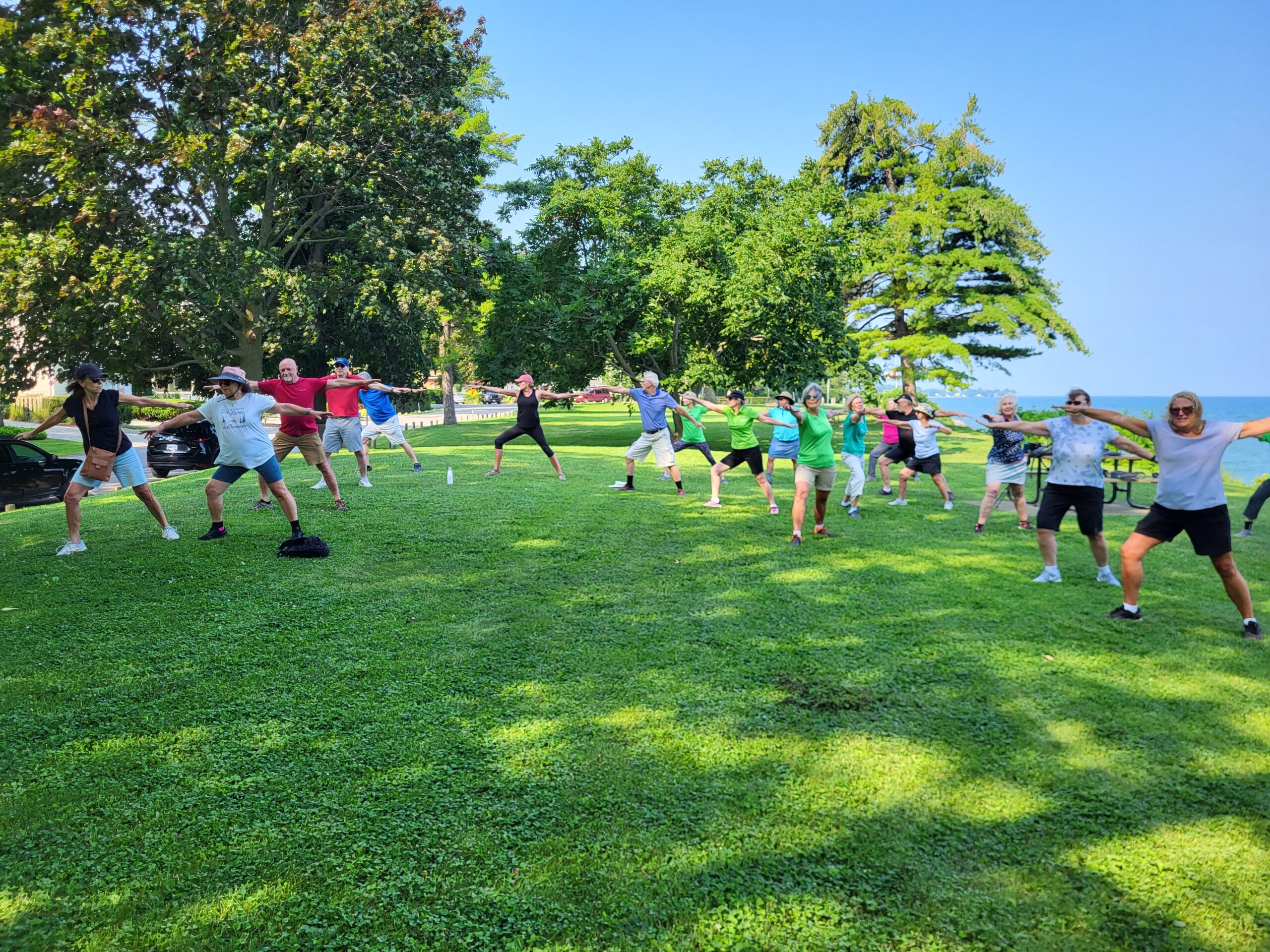
9:00 am Niagara on the Lake Tour & Some Yoga
https://hikes.brucetrail.org/event/900-am-niagara-on-the-lake-tour-some-yoga-17/Sorry, the registration cut-off time for this hike has been reached.Not a member? Click here to join today!Hosting Club: Niagara
Category: Urban
Location (Google Maps): Veteran’s Memorial Park, park just outside the park on King St.Hike Leader(s): Robin Garrett Click here to contact Hike Leader(s)
Pace: Medium
Terrain: Easy
Distance: 6 kmDescription
Enjoy the benefits of pausing for a yoga practice as we tour through the trails, parkland and Historic Niagara-on-the-Lake. No mat required. Movement will focus on a flow of standing poses designed especially for hikers. Plan to stay for conversation and a warm cup of coffee or tea at Sweets & Swirls, Community Centre, Niagara Stone Road, NOTL. - 22June 22, 2024

Laura Secord Special Event Hike
https://hikes.brucetrail.org/event/laura-secord-special-event-hike/Sorry, the registration cut-off time for this hike has been reached.Not a member? Click here to join today!Hosting Club: Niagara
Category: Event Hikes
Location (Google Maps): Niagara Region Office, 1815 Sir Isaac Brock Way, Thorold, ONHike Leader(s): Debbie Demizio Click here to contact Hike Leader(s)
Distance: 32 kms
Description
This is a self-led hike. Hike along the Bruce Trail from Laura Secord’s Homestead in Queenston to Decew House in Thorold. Participants will be transported by bus from check in at Niagara Region office to the start of the hike and will hike at their own pace to the final checkpoint. There will be volunteer drivers available to drive you back to your car once the hike is over. You may be asked to wear a mask in the car.Bring snacks, water and bug spray. We also recommend sunscreen, basic first aid supplies, spare socks and a cell phone. There will be 3 checkpoints (2 along the trail and one at the end) to replenish water and snacks and anyone wishing to drop out of the hike should do so at a checkpoint. Hikers are responsible for informing club volunteers of their intention to drop out.
You will receive a reminder email two days before the event with further details about the hike.
Car Hike: Seaton Trail Pickering
https://hikes.brucetrail.org/event/car-hike-seaton-trail-pickering/Sorry, the registration cut-off time for this hike has been reached.Not a member? Click here to join today!Hosting Club: Toronto
Category: Car Hike
Location (Google Maps): Free parking lot at 1 Mutual Street PickeringHike Leader(s): Mohammad Aghamiri Click here to contact Hike Leader(s)
Pace: Moderate
Terrain: Variable
Distance: 14-17 kmDescription
We will hike along Seaton trail and enjoy the lovely sceneries of forest and river at the same timeSome safety procedures during the hike:
1-Hikers must stay between the leader and the sweep.
2-Hikers must advise the leader or the sweep if they wish to leave the group.
3- Hikers must follow the whistle instructions: 1 blast- stay where you are; 2 blasts come to the leader; 3 blasts – come to the leader quickly.
4-Hike leader may request volunteers to stop at trail intersections, they need to help hikers to the direction the group walk and wait till they see the sweep .
5-Hikers have to make sure they can see the persons behind and in front of them.
Blue Mountains Stained Glass Badge - End 2 End in 6 Hikes
https://hikes.brucetrail.org/event/hike-1-6-stained-glass-end-2-end-badge-6-hikes/Sorry, the registration cut-off time for this hike has been reached.Not a member? Click here to join today!This is a Multi-Day Hike
You are signing up for the following dates and times:
2024-06-22 at 09:00
2024-06-29 at 09:00
2024-08-17 at 09:00
2024-08-31 at 09:00
2024-09-21 at 09:00
2024-10-05 at 09:00Hosting Club: Blue Mountains
Category: Register online ONLY
Location (Google Maps): TBDHike Leader(s): Hart Fischer Click here to contact Hike Leader(s)
Pace: Medium – 3 to 4 km/hr
Terrain: Moderate – Some hills and/or some poor footing, Strenuous – Hilly with steep climbs and some poor footingDescription
Hike Description TBD
The E2E Stained Glass badge is awarded to registered participants who complete the guided multi-day hikes offered by the club. Participants are required to register online for the series of multi-day hikes, led by a BTC hike leader, in which the entire Blue Mountains section of the trail is completed. This is a paid event requiring payment at time of registration (non-refundable). Up to one hike may be completed individually due to scheduling challenges – more than one missed hike will forfeit ability to earn badge. Ensure you are available for all hikes in the schedule prior to registering. You cannot earn this badge by hiking on your own. Registration is $30 for members and $40 for non-members which helps the Blue Mountains Bruce Trail Club in its efforts to support the Bruce Trail Conservancy’s Mission of “Preserving a ribbon of wilderness, for everyone, forever.”