Hike Schedule
Join us for a hike! Registration required.
All hikes available to BTC members. Some hikes are open to non-members.
See Refund Policy for Paid Hikes >
TIP: The calendar view displays up to 7 hikes on a day, but often there are more. Click “View more events” to see them all.
Categories
- 02July 2, 2023
Car Hike: Happy Valley.
https://hikes.brucetrail.org/event/900car-hike-happy-valley/Sorry, the registration cut-off time for this hike has been reached.Not a member? Click here to join today!Hosting Club: Niagara
Category: In and Out
Location (Google Maps): We will meet each other at the free sideroad parking on 16 Sideroad when we cross Weston Rd between King City and Happy Valley.Hike Leader(s): Mehrnoush Ahmadi Click here to contact Hike Leader(s)
Pace: Medium
Terrain: Easy
Distance: 14Description
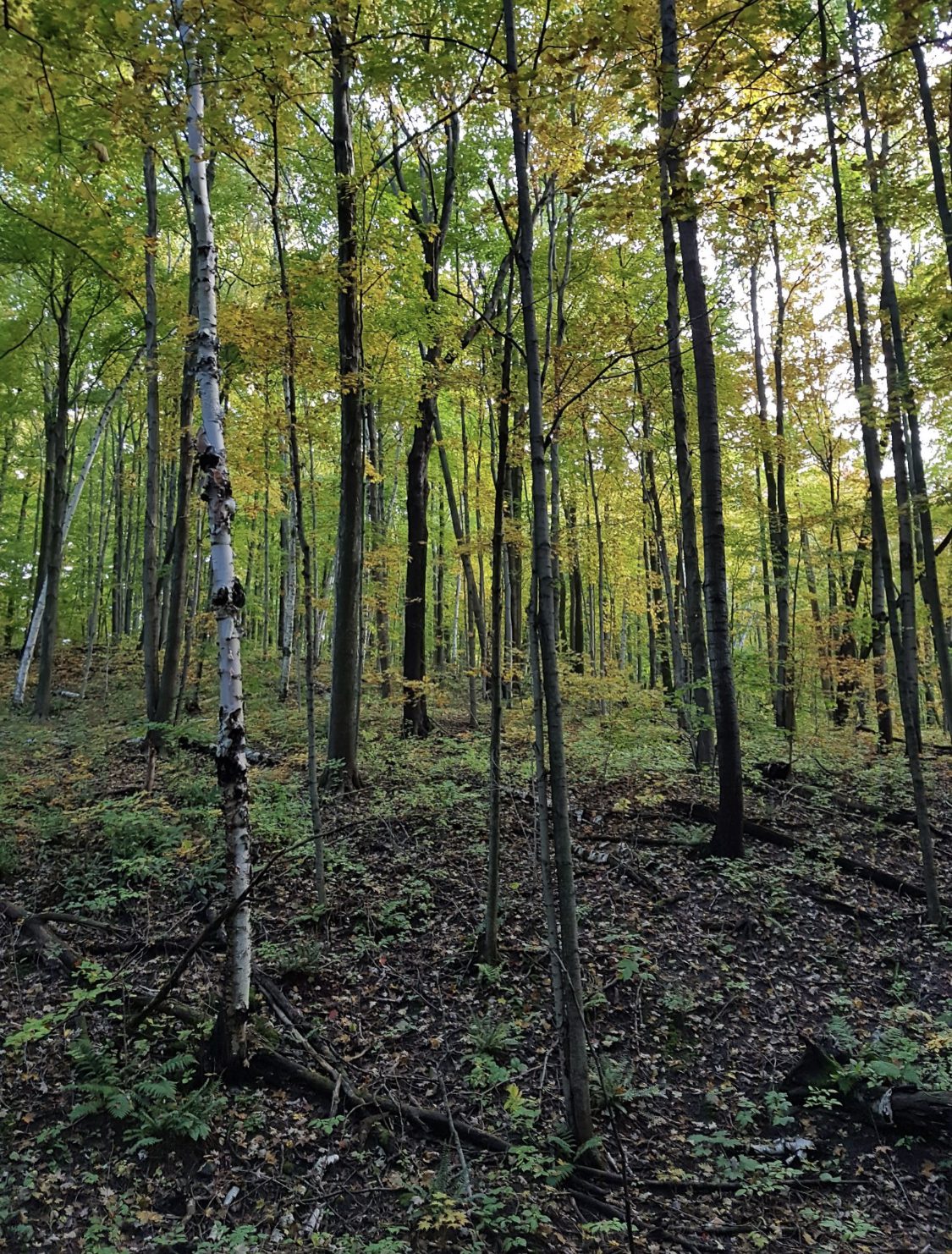
The Oakridge Trail in Happy Valley Forest offers a scenic and serene hiking experience. Explore lush woodlands, diverse terrain, and stunning viewpoints while immersing yourself in the tranquility of this protected forest.Dress appropriately for the weather conditions. Make sure to bring snacks or lunch, and a minimum of 2 litres of water.
During the hike, we will take short water breaks, as well as a 30-minute lunch break.
Every body is welcome! See you there!

Discovery Badge Series, 3/5 Shuttle Hike
https://hikes.brucetrail.org/event/discovery-badge-series-3-5-shuttle-hike/Sorry, the registration cut-off time for this hike has been reached.Not a member? Click here to join today!Hosting Club: Caledon Hills
Category: General
Location (Google Maps): Meet at Mono Community Centre, 754483 Mono Centre Rd, Mono, 44.026195, -80.071516Directions to Meeting Location: From ON-10 turn east onto Dufferin Rd. 8/Mono Centre Rd. Drive for approximately 6 km. The Community Centre is on the right hand side.
From Airport Road/County Rd. 18 turn west onto Dufferin Rd. 8/Mono Centre Rd. Drive for 6.5 km. The Community Centre is on the left hand side.
Shuttle to Parking Area – north of km 50.8 on the east side of 5th Line EHS, just south of Hockley Road (43.993572, -80.014057).
Hike Leader(s): Sandy Green and Dominique Garceau Click here to contact Hike Leader(s)
Pace: Medium – 3 to 4 km/hour
Terrain: Strenuous – hilly with steep climbs and some poor footing
Distance: 10.0 kmDescription
THIS HIKE HAS BEEN CANCELLED DUE TO INCLEMENT WEATHER. PARTICIPANTS HAVE BEEN NOTIFIED REGARDING A NEW DATE. Register individually for one, a few, or all of the five Discovery Badge Series hikes. Participants who complete all five hikes will be eligible to receive a CHBTC Discovery Hike Badge. Hike Three explores main Trail and the Hockley Heights, Glacier Valley, Hemlock Ridge, Springwater and Turnbull Side Trails in the Hockley Valley Area. Bring your choice of hydration and snacks. Hiking boots are highly recommended. See June 18, June 25, July 16, and July 23 for details pertaining to the other hikes in the series. (Note: If you wish to purchase badges, the cost of each badge is $10.00 for BTC members and $15.00 for non-members.)
Beaver Valley E2E #5 - Beaver Valley Ski Hill Challenge
https://hikes.brucetrail.org/event/beaver-valley-e2e-5-beaver-valley-ski-hill-challenge/Sorry, the registration cut-off time for this hike has been reached.Not a member? Click here to join today!Hike open to BTC Members only.
Hosting Club: Dufferin Hi-Land
Category: General Hike
Location (Google Maps): Roadside parking at the end of Sideroad 13A east of 7th Line, km 89.5 BTC map 27. 44.420867, -80.562233.Hike Leader(s): Stuart Law, Margery Cruise Click here to contact Hike Leader(s)
Pace: Medium
Terrain: Slippery and Steep Sections, Strenuous
Distance: 15.5 kms.Description
Hike 5 in our Humane Hiking Beaver Valley E2E. Lots of ups and downs and of course there is the killer Beaver Valley Ski hill. Strenuous hike for sure. Please bring 3L water, bug spray, sun screen, a snack, a lunch and a smile. Please be ready for the car shuttle at 9:15 sharp.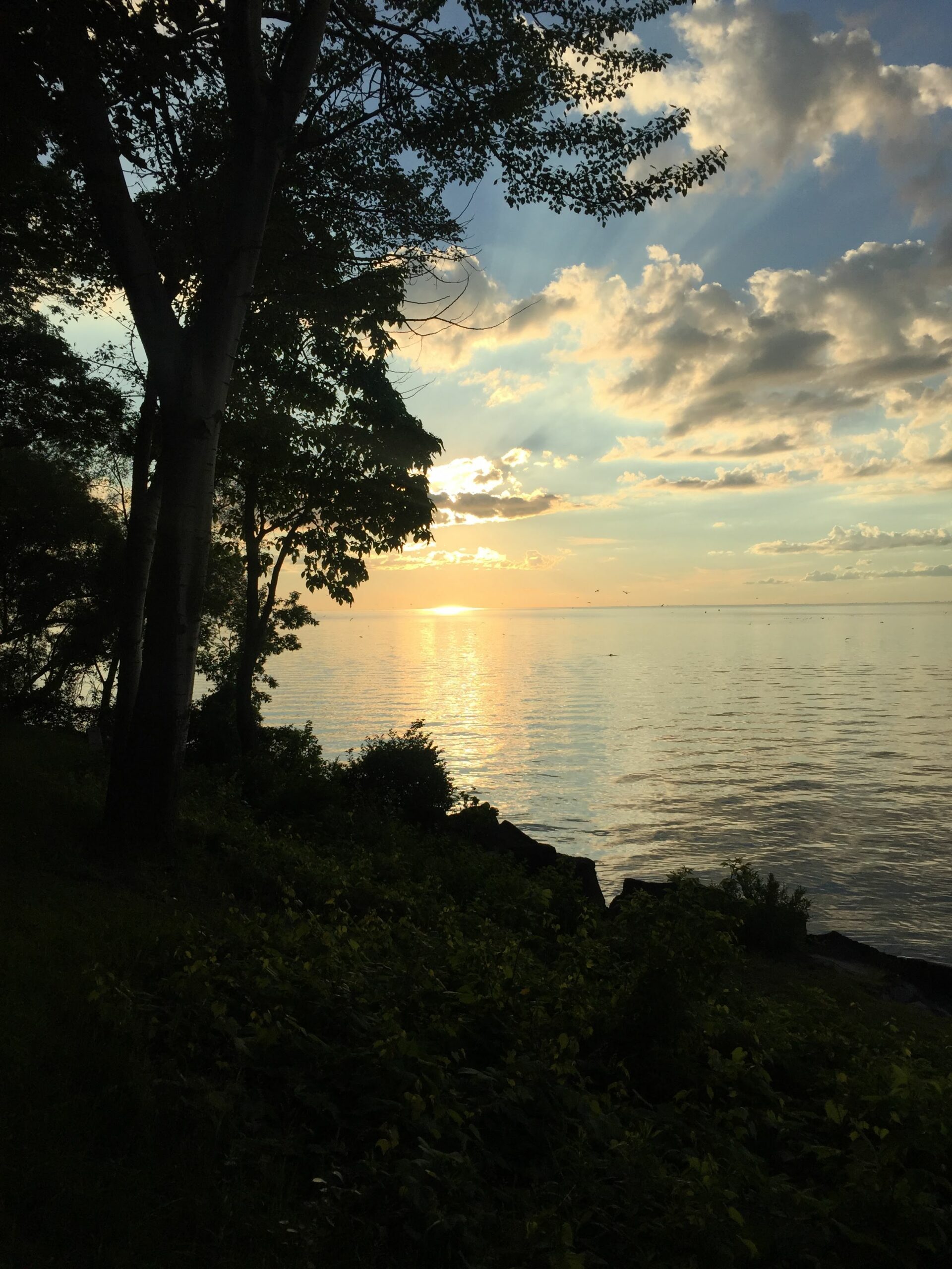
8:30 pm Sunset & Moonrise Night Hike in Niagara-on-the-Lake
https://hikes.brucetrail.org/event/830-pm-sunset-moonrise-night-hike-in-niagara-on-the-lake-4/Sorry, the registration cut-off time for this hike has been reached.Not a member? Click here to join today!Hosting Club: Niagara
Category: Night
Location (Google Maps): Veteran’s Memorial Park, park just outside the park on King St.Hike Leader(s): Robin Garrett Click here to contact Hike Leader(s)
Pace: Medium
Terrain: Easy
Distance: 6-7 kmDescription
Sunset & Moonrise Night Hike – Take in the magic of the setting sun and rising moon over Lake Ontario and the Niagara River. This hike includes a stop to connect with your senses – sights, sounds, smells and the rhythm of your breath. Counts towards your night hike badge (5 night hikes). - 03July 3, 2023
Beaver Valley E2E #6 - Beaverdale Forest to Epping
https://hikes.brucetrail.org/event/beaver-valley-e2e-6-beaverdale-forest-to-epping/Sorry, the registration cut-off time for this hike has been reached.Not a member? Click here to join today!Hike open to BTC Members only.
Hosting Club: Dufferin Hi-Land
Category: General Hike
Location (Google Maps): Epping Lookout. km 96.9 BTC Map 27. Grey Road 7, 300m north of 19 Sideroad. Conservation Authority fee payable.Hike Leader(s): Stuart Law, Susan Bate Click here to contact Hike Leader(s)
Pace: Medium
Terrain: Moderate
Distance: 11.5 kmsDescription
Hike 6 in our Beaver Valley E2E trek. Shorter hike today but calming and worth looking forward to. We will take in the main trail atop the Herman McConnell Memorial Forest to the Epping lookout taking in the Beaverdale Forest Side Trail. Please bring 2L of water, bug spray, sunscreen, a snack, a lunch and smile. Please ready for the car shuttle at 9:15 am sharp. - 04July 4, 2023
8:00 Long Hike Wiley Road Short Hills
https://hikes.brucetrail.org/event/800-long-hike-wiley-road-short-hills-21/Sorry, the registration cut-off time for this hike has been reached.Not a member? Click here to join today!Hosting Club: Niagara
Category: Loop
Location (Google Maps):Short Hills Wiley Road Entrance
Hike Leader(s): Alan Laver Click here to contact Hike Leader(s)
Pace: Medium
Terrain: Moderate
Distance: 10kmDescription
Explore Short Hills and the majestic side trails of Scarlett Tanager, Hemlock. Swayze Falls and Terrace. Register for each hike
Bring Poles water, snack, sunscreen and bug spray and dress for the weather
Falling Water-Beaver Valley (2 day independent)
https://hikes.brucetrail.org/event/falling-water-beaver-valley-2-day-independent/Sorry, the registration cut-off time for this hike has been reached.Not a member? Click here to join today!Hike open to BTC Members only.
This is a Multi-Day Hike
You are signing up for the following dates and times:
2023-07-04 at 09:00
2023-07-05 at 09:00Hosting Club: Beaver Valley
Location (Google Maps): Meet in the South end of the Beaver Valley Ski Club lower parking lot off Grey Road 30 both days. We will shuttle to our starting point at Hoggs Falls.
Hike Leader(s): Kristina Rettie Click here to contact the hike leader.
Pace: Brisk
Terrain: Moderate, Some rocky footing, Some steep sections, Strenuous
Length of Hike: Approx 30k over 2 daysDescription
Introducing a new independent 2 day Falling Water Badge, coming July 1st!!!Over the coarse of two days we will hike this challenging loop that takes us on both the east and west sides of the Beaver Valley.
These hikes are intended for experienced hikers that are able to hike 4-5km per hour for a minimum of 18k. Please be honest about you’re pace before signing up.
Bring lots of water and a snacks
Please no dogs
Please text Kristina @ 519-410-9077 for morning of cancelations
COVID-19 Precautions Before, During and After your Hike
- Each hiker joining a Bruce Trail Club organized hike must perform a self-screening check before hiking.
Find Ontario’s self-assessment tool here: https://covid-19.ontario.ca/self-assessment/ - If you are experiencing COVID-19 symptoms, stay home.
- Personal Protective Equipment:
- Hikers may choose to wear masks
Transportation
It is the Bruce Trail Conservancy’s current policy that car shuttles are allowed. It is at the discrepancy of individual hike leaders to make that decision.
Other Guidelines
- Arrive 15 minutes before the start of the hike.
- Wear sturdy footwear and appropriate attire for the weather and the terrain.
Hiking poles are a good idea in any season, especially if the terrain is rocky or slippery. In winter, snowshoes or icers/crampons are needed when conditions dictate.
Wearing appropriate clothing and footwear prevents injuries and shows consideration for a safe and positive group hiking experience. - Always carry I.D. and your health card.
- Bring sufficient water and snacks (or lunch if indicated). A minimum of 1L of water is recommended on all hikes, and 3L is recommended for long, challenging hikes in the heat of the summer.
- Bring sunscreen and insect repellent (for spring and summer hikes).
- Bring your own first aid kit.
- Please leave dogs at home.
9:15 Short Hike - Pelham Road, Short Hills
https://hikes.brucetrail.org/event/915-short-hike-pelham-road-short-hills-50/Sorry, the registration cut-off time for this hike has been reached.Not a member? Click here to join today!Hosting Club: Niagara
Location (Google Maps): Pelham Road entrance, Short Hills Provincial Park
Hike Leader(s): janet davey Click here to contact Hike Leader(s)
Pace: Medium
Terrain: Moderate
Distance: 6 kmsDescription
Hike the main and side trails in Short Hills Provincial Park. Bring hiking boots, water, sunscreen and bug spray.Mono Cliffs, map 19
https://hikes.brucetrail.org/event/mono-cliffs-map-19-3/Sorry, the registration cut-off time for this hike has been reached.Not a member? Click here to join today!Hosting Club: Caledon Hills
Category: Tuesday Hikers
Location (Google Maps): Mono Community Centre Parking, just south of Mono Centre.
Driving direction: From Highway 410 go north, continue on Highway 10, pass through Orangeville, continue to Mono Centre Rd. (8), turn right, road will merge with 2nd Line EHS north, parking on the right just before Mono Centre.Hike Leader(s): Mohammad Shafiq Click here to contact Hike Leader(s)
Pace: Medium – 3 to 4 km/hour
Terrain: Moderate – some hills and/or some poor footing
Distance: 13 kmDescription
Will hike main Bruce Trail, South Outlier, Walter Tovell, McCarston’s Lake and Lookout Side Trails.
Bring water, snack, bug spray and sun protection. Poles recommended. - Each hiker joining a Bruce Trail Club organized hike must perform a self-screening check before hiking.
- 05July 5, 2023
Monument Hill, Ganaraska
https://hikes.brucetrail.org/event/monument-hill-ganaraska-2/Sorry, the registration cut-off time for this hike has been reached.Not a member? Click here to join today!Hosting Club: Blue Mountains
Category: Register in person the morning of hike.
Location (Google Maps): Hike meets in the parking lot behind Tim Hortons on First St. in Collingwood.Hike Leader(s): David Little Click here to contact Hike Leader(s)
Pace: Medium – 3 to 4 km/hr
Terrain: Moderate – Some hills and/or some poor footing
Distance: 9kmDescription
This is a loop trail located near Wasaga Beach. Lots of hills and options to take. This will be an exploration of some new trails to hike! Be prepared to explore the variety within this hike. Bring a snack or lunch and water.11:00 am Hike & Picnic
https://hikes.brucetrail.org/event/1100-am-hike-picnic-10/Sorry, the registration cut-off time for this hike has been reached.Not a member? Click here to join today!Hosting Club: Niagara
Category: Loop
Location (Google Maps): Locust Grove Picnic AreaHike Leader(s): Marion Hanover Click here to contact Hike Leader(s)
Pace: Medium
Terrain: Moderate
Distance: 7 kmDescription
Hike around Queenston area. Optional outdoor gathering in Locust Grove including pot luck picnic.Evening Hike & Refreshments in Owen Sound
https://hikes.brucetrail.org/event/evening-hike-refreshments-in-owen-sound-2/Sorry, the registration cut-off time for this hike has been reached.Not a member? Click here to join today!Hosting Club: Sydenham
Category: An evening walk.
Location (Google Maps): Meet in the municipal parking lot by the river on the west side of 1st Ave. E between 7th St. E and 8th St. E in Owen Sound.Hike Leader(s): Harriet Nixon Click here to contact Hike Leader(s)
Pace: Medium: 3 to 4 km/h
Terrain: Moderate: Some hills and/or poor footing
Distance: Approx 5 kmDescription
Join us for a summer evening hike exploring trails & neighbourhoods in Owen Sound, followed by an opportunity for refreshments. No need to arrive 15 minutes early – the hike will leave at 7:00 pm. For further information contact Hike Leader Harriet Nixon at 519-373-6598 or harrietnixon@bmts.com. If you are unable to preregister, please call or text the hike leader. - 06July 6, 2023
8:00 am Long Hike Jordan to Moyer / Louth
https://hikes.brucetrail.org/event/800-am-long-hike-jordan-to-moyer-louth-48/Sorry, the registration cut-off time for this hike has been reached.Not a member? Click here to join today!Hosting Club: Niagara
Category: In and Out
Location (Google Maps):Jordan Hollow Park 3039 King St Jordan
Hike Leader(s): Alan Laver Click here to contact Hike Leader(s)
Pace: Medium
Terrain: Moderate
Distance: 10kDescription
From Jordan Hollow Hike the main trail to Upper and Lower Balls Falls, Moyer Road or Louth and Return. You must register for each hike. Bring Poles, sunscreen, bug spray , snack and a drink and dress for the weather
9:15 Short Hike - Jordan Hollow
https://hikes.brucetrail.org/event/915-short-hike-jordan-hollow-64/Sorry, the registration cut-off time for this hike has been reached.Not a member? Click here to join today!Hosting Club: Niagara
Location (Google Maps): Jordan Hollow Park, Jordan Station
Hike Leader(s): Bill Russell Click here to contact Hike Leader(s)
Pace: Medium
Terrain: Strenuous
Distance: 6 kmsDescription
Hike the main and side trails around Jordan and Balls Falls. Bring hiking boots, water, sunscreen and bug spray.Sydenham E2E Hike 11 of 14
https://hikes.brucetrail.org/event/sydenham-e2e-hike-11-of-14/Sorry, the registration cut-off time for this hike has been reached.Not a member? Click here to join today!Hosting Club: Caledon Hills
Category: End-to-End
Location (Google Maps): Meet at Woodford Community Centre parking area at km 41.7. Shuttle to start at km 56.3.Hike Leader(s): Nancy Mooney Click here to contact Hike Leader(s)
Pace: Medium – 3 to 4 km/hour
Terrain: Moderate – some hills and/or some poor footing
Distance: From km 56.3 to 41.7 plus a bit of side trail, total 15 km.Description
This hike takes us through Bayview Escarpment Nature Reserve offering great views from the edge of the escarpment. We will encounter deep crevices and high cliffs. Heading towards Woodford the trail goes through wooded areas with indicators of early settlements.
Chedoke (Cancelled)
https://hikes.brucetrail.org/event/chedoke/Sorry, the registration cut-off time for this hike has been reached.Not a member? Click here to join today!Hosting Club: Iroquoia
Category: Thursday Group
Location (Google Maps): Chedoke Golf ClubHike Leader(s): Colleen Mabalay Click here to contact Hike Leader(s)
Pace: Medium – 3 to 4 km/hr
Terrain: Moderate – Some hills and/or some poor footing
Distance: Approx 7kmDescription
Easy to moderate hike along the BT and bike trails. Bring water, sunscreen and bug spray.Urban Walk - Evening Ramble, Toronto Waterfront
https://hikes.brucetrail.org/event/urban-walk-evening-ramble-toronto-waterfront/Sorry, the registration cut-off time for this hike has been reached.Not a member? Click here to join today!Hosting Club: Toronto
Category: Urban Walk
Location (Google Maps): Meet at Beatty Boulevard Park at the south side of the intersection of Roncesvalles and Queen Street near the pedestrian bridge crossing the Gardiner ExpresswayHike Leader(s): Tom Swales Click here to contact Hike Leader(s)
Pace: Moderate
Terrain: Flat
Distance: 7 KMDescription
Join us for an evening walk along the Toronto Waterfront Trail from the foot of Roncesvalles to Bay Street/Union Station. Bring snack to have along the way. For anyone working on the new urban hike badge this walk walk will cover km 0 – 6.5 of the route (should you need to makeup the segment or want to take up the challenge). If there is interest I will lead an evening walk at at a different location each week on Thursdays through the Summer. - 07July 7, 2023
9:00 am Niagara on the Lake Tour & Some Yoga
https://hikes.brucetrail.org/event/900-am-niagara-on-the-lake-tour-some-yoga-10/Sorry, the registration cut-off time for this hike has been reached.Not a member? Click here to join today!Hosting Club: Niagara
Category: Urban
Location (Google Maps): Veteran’s Memorial Park, park just outside the park on King St.Hike Leader(s): Robin Garrett Click here to contact Hike Leader(s)
Pace: Medium
Terrain: Easy
Distance: 6 kmDescription
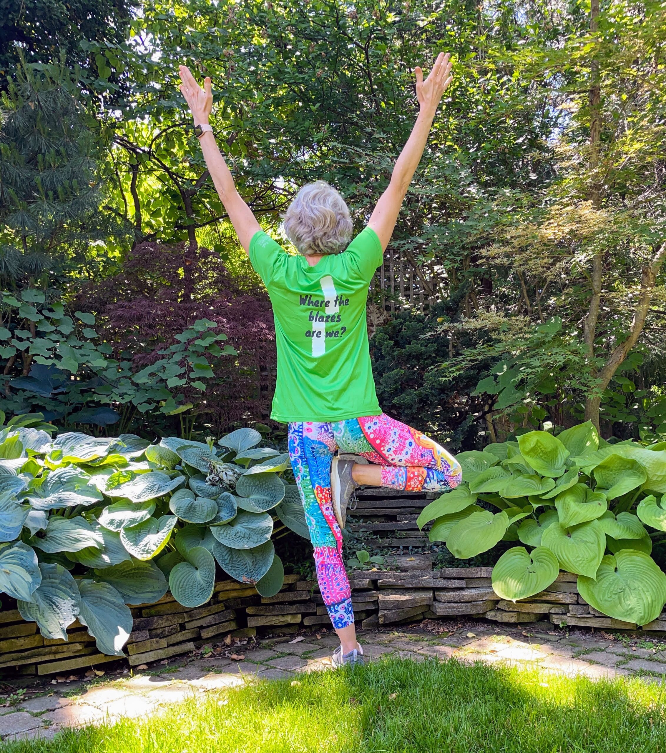
Enjoy the benefits of pausing for a yoga practice as we tour through the trails, parkland and Historic Niagara-on-the-Lake. No mat required. Movement will focus on a flow of standing poses designed especially for hikers. Plan to stay for conversation and a warm cup of coffee or tea at Sweets & Swirls, Community Centre, Niagara Stone Road, NOTL.Ross McLean Side Trail Loop
https://hikes.brucetrail.org/event/ross-mclean-side-trail-loop-2/Sorry, the registration cut-off time for this hike has been reached.Not a member? Click here to join today!Hosting Club: Sydenham
Category: General Hike
Location (Google Maps): The Owen Sound Galaxy Theatre parking lot. Meet at the tall “Galaxy Centre” sign next to the traffic lights.Hike Leader(s): Maureen McFarland Click here to contact Hike Leader(s)
Pace: Medium: 3 to 4 km/h
Terrain: Moderate: Some hills and/or poor footing
Distance: 8 kmsDescription
We’ll access the main trail from the Dawson Road Side Trail. From there we head north to the Ross McLean Side Trail. We return via the main trail to the Dawson Road Side Trail. Map 34. We will get a bit of an earlier start to try to beat the worst of the July heat. Bring sunscreen, bug repellant, lots of water and a snack. If you are unable to register, please call or text the hike leader at 647-918-4180. - 08July 8, 2023
Rim 2 Rim #1: Pretty River Rim - 1st in a series of 3 for the R2R badge
https://hikes.brucetrail.org/event/rim-2-rim-1-pretty-river-rim-1st-in-a-series-of-3-for-the-r2r-badge/Sorry, the registration cut-off time for this hike has been reached.Not a member? Click here to join today!Hosting Club: Blue Mountains
Category: Organized Hike
Location (Google Maps): Bruce Trail parking lot on Pretty River RoadHike Leader(s): Hart Fischer Click here to contact Hike Leader(s)
Pace: Brisk – 4 to 5 km/hr, Medium – 3 to 4 km/hr
Terrain: Moderate – Some hills and/or some poor footing, Strenuous – Hilly with steep climbs and some poor footing
Distance: 18.5kmDescription
HIKERS MUST REGISTER ON-LINE FOR THIS HIKE, NO morning sign-ins on this series as hikers will meet at trailhead.
About 18.5 km with almost 810 m elevation gain. Park your car in the small Bruce Trail Parking Lot [BTPL] on the Pretty River Road [44.428118, -80.276849]. If this small BTPL is filled, use the large Ontario Parks Lower Pretty River lot [44.430983, -80.275474]. Do not park along Pretty River Road as it is a strictly enforced no parking zone by the Town of Blue Mtns. The hike starts in the small BTPL. We will proceed north on the white blazed trail until we come to John Haigh Side Trail. Proceeding west past the highest point on the Bruce Trail, we will continue until we reach the intersection of the 2nd line and 6th Sideroad. We will then retrace our steps to the BTPL. After a break, we will proceed east along the white blazed trail until we reach the Blue Mtns Clearview Townline and head south to continue past Osprey-The Blue Mountains Townline. We will follow the white blazed trail up until we reach the blue side trail – Standing Rock & Caves Side Trail. Turning west, we will hike through the Singhampton Caves until it rejoins the white blazed trail again. We then turn east (left) and follow the white blazed trail which will bring us back to the parking lot. Bring lots of snacks, lunch and water. Contact the hike leader if registration is closed.Boyd Conservation Park Vaughan
https://hikes.brucetrail.org/event/car-hike-boyd-conservation-park-vaughan-2/Sorry, the registration cut-off time for this hike has been reached.Not a member? Click here to join today!Hosting Club: Toronto
Category: Car Hike
Location (Google Maps): Park in free parking lot beside the main gate of the parkHike Leader(s): Mohammad Aghamiri Click here to contact Hike Leader(s)
Pace: Moderate
Terrain: Variable
Distance: 14-15KMDescription
Some safety procedures during the hike:1-Hikers must stay between the leader and the sweep.
2-Hikers must advise the leader or the sweep if they wish to leave the group.
3- Hikers must follow the whistle instructions: 1 blast- stay where you are; 2 blasts come to the leader; 3 blasts – come to the leader quickly.
4-Hike leader may request volunteers to stop at trail intersections, they need to help hikers to the direction the group walk and wait till they see the sweep .
5-Hikers have to make sure they can see the persons behind and in front of them.
Bus Hike: Pathways To Port Dover Lynn Valley Trail
https://hikes.brucetrail.org/event/bus-hike-pathways-to-port-dover-lynn-valley-trail/Sorry, the registration cut-off time for this hike has been reached.Not a member? Click here to join today!Trip Information
Departure Time: 08:30
Return to City Time: 19:00
Departure Point: Kipling Departure PointOptional Items
Hosting Club: Toronto
Category: Bus Hike
Location (Google Maps): Lynn Valley TrailHike Leader(s): Tom Swales, Tiffany Harding, Steve Harding Click here to contact Hike Leader(s)
Pace: Moderate
Terrain: Flat, Variable
Distance: 12 kmDescription
Join me for a scenic and easy paced walk, a regular summer favorite led by Wayne Crockett, along the trails running through Norfolk County ending at historic Port Dover. The route is primarily on rail trails so is ideal for those who favor a flatter and easier route in the summer heat. Dropout at 8km. After the walk there will be the opportunity to indulge in the local perch fish and chips or hang out at the beach which together make Port Dover famous. Long Distance Bus Fare applies and there will be a late return (after 6:00 Pm).8:30 Louth Conservation
https://hikes.brucetrail.org/event/830-louth-conservation/Sorry, the registration cut-off time for this hike has been reached.Not a member? Click here to join today!Hike open to BTC Members only.
Hosting Club: Niagara
Category: In and Out
Location (Google Maps): Meet at Louth Conservation parking, on Staff Rd.Hike Leader(s): Vince Zvonar Click here to contact Hike Leader(s)
Pace: Medium
Terrain: Moderate
Distance: 10Description
Margaret Paull Side Trail
https://hikes.brucetrail.org/event/margaret-paull-side-trail-2/Sorry, the registration cut-off time for this hike has been reached.Not a member? Click here to join today!Hosting Club: Blue Mountains
Category: Register in person the morning of hike.
Location (Google Maps): Hike meets in the parking lot behind Tim Hortons on First St. in Collingwood.Hike Leader(s): Bob Moenck Click here to contact Hike Leader(s)
Pace: Leisurely – 3 km/hr. or less
Terrain: Easy – Mostly flat and usually good footing, Moderate – Some hills and/or some poor footing
Distance: 5kmDescription
We will drive via Grey Rd.119 to the end of the 6th Line in the Beaver Valley section. We will hike along the white blazed trail to km 11.3 where it joins up with the Margaret Paull Side Trail. We will follow the side trail back to the white blazed trail, then return to the cars. Bring water and a snack
9:00 Enjoy the Flora and the Fury of the Falls
https://hikes.brucetrail.org/event/930-enjoy-the-flora-and-the-falls/Sorry, the registration cut-off time for this hike has been reached.Not a member? Click here to join today!Hosting Club: Niagara
Category: In and Out
Location (Google Maps):Dufferin Islands parking lot, off Burning Springs Hill, Niagara Falls. Note: a parking fee applies, as part of the Niagara Falls Parkway parking system.
Hike Leader(s): Karen Couch Click here to contact Hike Leader(s)
Pace: Medium
Terrain: Easy
Distance: 6 kmsDescription
Experience the flora in the Dufferin Islands Nature Area, Oakes Garden Theatre and in between along the Niagara Parkway. Stop to take in the Fury of the Falls. This will include one of Niagara Parks formal Rose Gardens: Queen Victoria Park, just south of the Police station.Car Hike: Boyne Valley Provincial Park - BTC Map 20
https://hikes.brucetrail.org/event/car-hike-boyne-valley-provincial-park-btc-map-20/Sorry, the registration cut-off time for this hike has been reached.Not a member? Click here to join today!Hosting Club: Toronto
Category: Car Hike
Location (Google Maps): BTC Map 20 – Parking lot on County Road 19 (Prince of Wales Road) 80 meters south of the southern end of Prince of Wales Side Trail.
N44.100049, W80.137339Hike Leader(s): Ross Estrella Click here to contact Hike Leader(s)
Pace: Brisk, Moderate
Terrain: Hilly, Rocky, Variable
Distance: 15 kmsDescription
Join us on a scenic hike along Prince of Wales Side Trail, Primrose Loop Side Trail reaching to top of Murphy’s Pinnacle with a 360 degrees panoramic view of the sorrounding villages and it’s landscape. We’ll make a loop along Boyne Valley Provincial Park Side Trail and part of the Main Trail to Primrose Side Trail to parking lot. Pack at least 2 liters of water, snack and lunch. Wear appropriate clothing, hiking shoes/boots, bring bug spray, sunscreen and hat for sun protection. Hiking poles are a big help. Please arrive 15 minutes early for 9:15 start.Car Hike: Hockley Valley
https://hikes.brucetrail.org/event/car-hike-hockley-valley-3/Sorry, the registration cut-off time for this hike has been reached.Not a member? Click here to join today!Hosting Club: Toronto
Category: Car Hike
Location (Google Maps): Map 18, Parking lot on Hockley Road east of Hockley Valley Provincial Nature ReserveHike Leader(s): Al Brown Click here to contact Hike Leader(s)
Pace: Moderate
Terrain: Hilly
Distance: 14 km loopDescription
We will complete a 14 km loop hike through the Nature Reserve along the main and side trails. This is one of the hilliest sections of the Bruce Trail. The hike is mostly under forest canopy.After the hike those interested can join me on the patio of the nearby Hockley Valley Resort.
Parking is at the BTC lot on Hockley Road just east of the trail head. Drive north on Hwy 10 past Orangeville to Hockley Road. Turn right and go about 5 km to the parking lot which will be on your left.
Toronto Urban Badge Hike - 4 of 7
https://hikes.brucetrail.org/event/toronto-urban-badge-hike-4-of-7/Sorry, the registration cut-off time for this hike has been reached.Not a member? Click here to join today!Hosting Club: Toronto
Category: Urban Walk
Location (Google Maps): Toronto, Ontario, CanadaHike Leader(s): Brian Rideout Click here to contact Hike Leader(s)
Pace: Moderate
Terrain: Flat
Distance: 11.4 kmDescription
Please join me at the north west corner of Finch and Weston by 10 AM. We will hike east along the Finch Hydro Corridor Trail to Bathurst St (N of Finch) (km 30.2 to km 41.6). Here is an online map with km markings of our route for all 7 hikes for the Toronto Urban Badge.Please make sure you bring at least 2 liters of water, a lunch, bug spray and sunscreen.