5:45 AM-2:30 PM
06/10/2023
Sorry, the registration cut-off time for this hike has been reached.
Not a member? Click here to join today!Hosting Club: Niagara
Category: Event Hikes
Location (Google Maps): Niagara Regional Municipality Office, 1815 Sir Isaac Brock Way, Thorold ON L2V 4Y6
Pace: Medium
Terrain: Moderate
Distance: 32 kms
Description
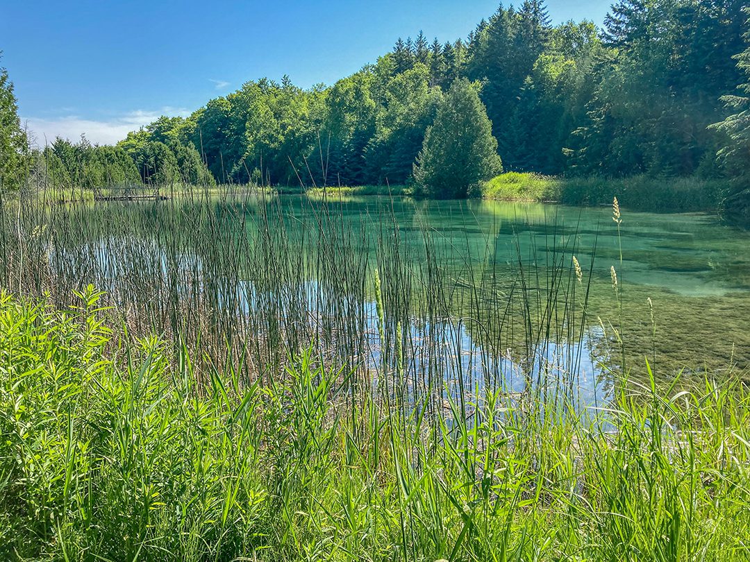
This is a self led hike. Hike along the Bruce Trail from Laura Secord’s homestead in Queenston to Decew House in Thorold. Participants will be transported by bus from check in to the start of the hike and will hike at their own pace to the final checkpoint. Masks are optional on buses. There will be drivers available to drive you back to your car once your hike is over. Masks must be worn in the car.
Bring snacks, water and bug spray. We also recommend sunscreen, basic first aid supplies, spare socks and a cell phone. There will be 3 checkpoints (2 along the trail and one at the end) to replenish water and snacks and anyone wishing to drop out of the hike should do so at a checkpoint. Hikers are responsible for informing club volunteers of their intention to drop out.
Event coordinator: Janet Davey, needstogolf@gmail.com
7:45 AM-2:00 PM
06/10/2023
Sorry, the registration cut-off time for this hike has been reached.
Not a member? Click here to join today!Hosting Club: Blue Mountains
Category: Register in person the morning of hike.
Location (Google Maps): Hike meets in the parking lot behind Tim Hortons on First St. in Collingwood.
Hike Leader(s): Anhong MacNeil Click here to contact Hike Leader(s)
Pace: Medium – 3 to 4 km/hr
Terrain: Moderate – Some hills and/or some poor footing, Strenuous – Hilly with steep climbs and some poor footing
Distance: 11km
Description
We will park on the 4th Line in the Caledon Hills section. We begin hiking at km 54.3 and hike to km 49.0 (Airport Rd) and return. The trail descends by way of switchback, passes through valleys and climbs the eastern ridge. There are significant hills on this hike. Bring a snack or lunch and water.
8:15 AM-1:30 AM
06/10/2023
Sorry, the registration cut-off time for this hike has been reached.
Not a member? Click here to join today!Hosting Club: Toronto
Category: Car Hike
Location (Google Maps): Bruce Trail parking lot 5th Line EHS, Hockley Rd,
Hike Leader(s): Amir Alemohammad, Mohammad Aghamiri Click here to contact Hike Leader(s)
Pace: Moderate
Terrain: Challenging, Hilly
Distance: 14-16 km
Description
This will be a beautiful loop hike in Bruce Trail main trail and some sidetrails between 5th and 3rd Line EHS (Hockley Rd). Mostly hilly with some scenic views.
9:00 AM-3:30 AM
06/10/2023
Sorry, the registration cut-off time for this hike has been reached.
Not a member? Click here to join today!Trip Information
Departure Time: 09:00
Return to City Time: 03:30
Departure Point: York Mills Bus Pickup
Optional Items
Hosting Club: Toronto
Category: Bus Hike
Location (Google Maps): Departure Point: York Mills Subway Station – 10 York Mills Road, North East corner of Yonge St. and York Mills Rd. – Outside York Mills Centre (Look for BTC chartered yellow School Bus)
Hike Leader(s): Janet Patterson and George Lennon
Pace: Leisurely
Terrain: Variable
Distance: Several hikes throughout the day of 3-5 km
Description
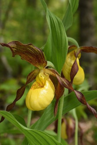
In every landscape along the Bruce Trail, we see wildlife and plants that are beautiful and ecologically important. In late spring and early summer, we find abundant wildflowers, mushrooms, and shrubs in the meadows and forests of the Niagara Escarpment. It is a wonderful time for butterflies. Come with us to learn about them. Come join us as we hike on the Bruce Trail and side trails near Georgetown. We’ll break into smaller groups, each with a hike leader and a local guide/expert, and stop regularly to listen to birds and admire flowers. Bring water, snack and lunch, sunscreen, insect repellent, and your camera.
School Bus transportation will be provided at the special rate of $10.00 (to be prepaid online by credit card upon registration). The TBTC Board has reduced the usual fares for this bus hike in order to broaden the appeal for hiking to newcomers. We encourage those who are not currently members of the BTC to come join us on this hike to learn about the Niagara Escarpment.
9:00 AM-2:00 PM
06/10/2023
Sorry, the registration cut-off time for this hike has been reached.
Not a member? Click here to join today!Hosting Club: Toronto
Category: Urban Walk
Location (Google Maps): Finch Subway Station Passenger Pick Up ( N.W. Yonge Street & Hendon Ave)
Hike Leader(s): Alina Lin
Pace: Moderate
Terrain: Flat
Distance: 15km
Description
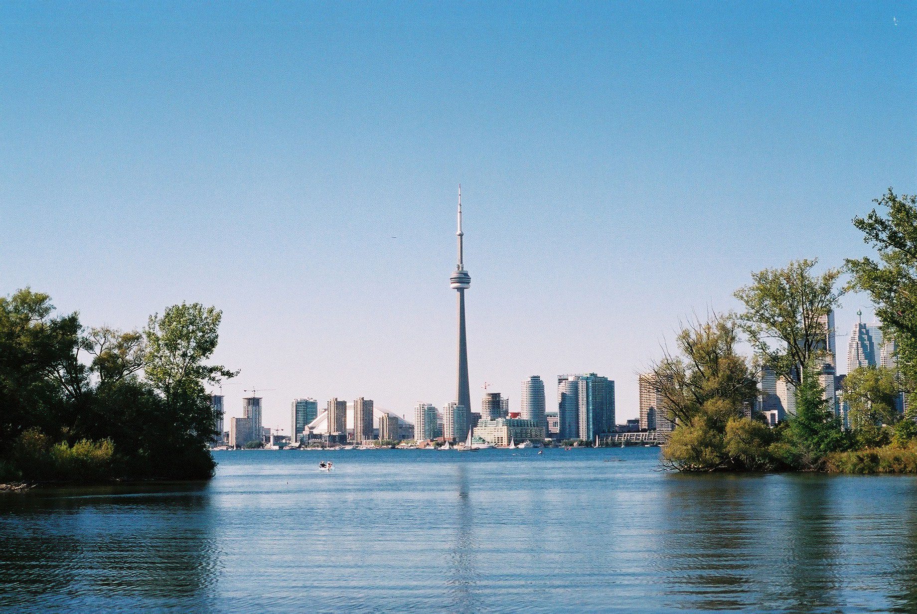
Embark on a captivating journey through Toronto’s remarkable urban trail systems. From the scenic Don River in the east to the captivating Waterfront in the south, the tranquil Humber River in the west, and the enchanting Finch Corridor in the north, this diverse collection of trails offers an unforgettable opportunity to explore the city’s longest trails on foot.
By interconnecting these four trail systems, which weave through more than ten parks and trails, we are creating an awe-inspiring loop spanning approximately 74 kilometers: https://onthegomap.com/s/c2c1hf3n . As a testament to your accomplishment, completing the entire loop will earn you the Toronto Urban Hiking Badge—the first ever urban hiking badge launched by the Toronto Bruce Trail Club.
Distance: 16km. Start from Finch Subway Station and end at Leslie St .& Eglinton Ave (Parking Lot #2 Wilket Creek Park)
Pace: 4kph
Trail condition: mostly flat and paved. Running shoes are recommended.
Bring water and snacks. Dress and prepare for the weather.
Dropouts are available anytime.
10:00 AM-12:30 PM
06/10/2023
Sorry, the registration cut-off time for this hike has been reached.
Not a member? Click here to join today!Hosting Club: Toronto
Category: Cancelled
Location (Google Maps): Scotsdale Farm Parking. Take Trafalgar Road north to where it merges with Highway 7. Continue north on Highway Trafalgar/Highway 7 to Halton Regional Road 3 (Signs for Regional Rd 3/Trafalgar Road N/Ballinafad/Brisbane) and turn right. Continue on Trafalgar/Regional Road 3 for 600 metres and driveway for Scotsdale Farm will be on the right. There is a blue and white sign.
Hike Leader(s): Tom Swales, David Royle Click here to contact Hike Leader(s)
Pace: Moderate
Terrain: Variable
Distance: 8 – 10 km
Description
Due to the poor air quality advisory by Environment Canada this hike is cancelled and will be rescheduled to a future date, likely in the Fall.
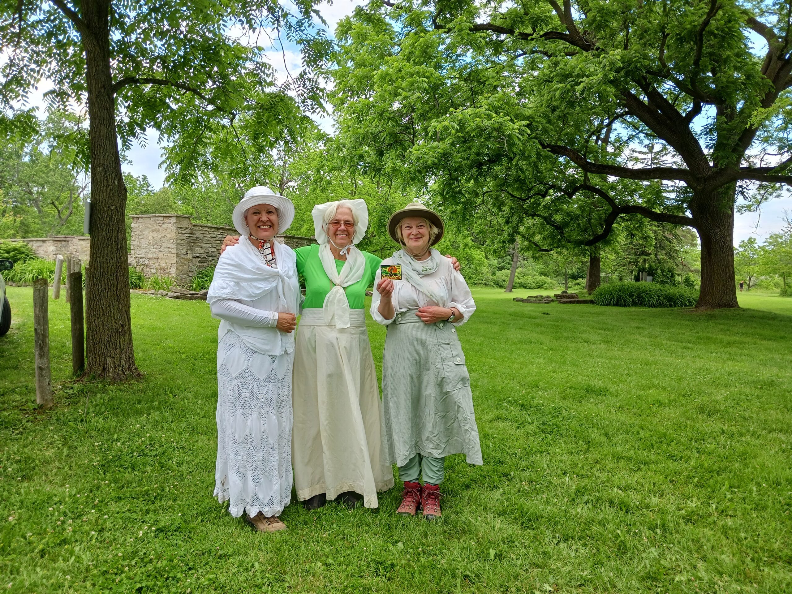
Join Maureen’s family and friends and the Toronto Bruce Trail Club to celebrate her life and years of service to the club on a moderate loop hike of 10 km on the trails around Scotsdale Farm near Georgetown. From leading hikes when based on Wards Island to serving as club president to founding the Halton Hills Chapter of the club, Maureen has had a long lasting impact. Let’s remember Maureen and give thanks by hiking the trails she spent much time on and loved followed by fellowship and post hike refreshments at The St. George Pub 7 Main Street N., Georgetown.
10:00 AM-1:15 PM
06/10/2023
Sorry, the registration cut-off time for this hike has been reached.
Not a member? Click here to join today!Hosting Club: Toronto
Category: Urban Walk
Location (Google Maps): Toronto, Ontario, Canada
Hike Leader(s): Brian Rideout Click here to contact Hike Leader(s)
Pace: Moderate
Terrain: Flat
Distance: 11 km
Description
Please join me at the south west corner of Finch and Weston by 10 AM. We will hike south on the Humber Recreational Trail to Scarlet and Eglinton (km 30.2 to km 19.2). Here is an online map with km markings of our route for all 7 hikes for the Toronto Urban Badge.
Please make sure you bring at least 2 liters of water, a lunch, bug spray and sunscreen.
https://hikes.brucetrail.org/event/memorial-forest-4/Sorry, the registration cut-off time for this hike has been reached.
Not a member? Click here to join today!Hosting Club: Sydenham
Category: General Hike
Location (Google Maps): Parking area at the west end of Young’s Dr., east of km 105.8 (Map 32)
Hike Leader(s): Ian Mills Click here to contact Hike Leader(s)
Pace: Medium: 3 to 4 km/h
Terrain: Moderate: Some hills and/or poor footing, There might be muddy sections., There might be sections with water on the trail.
Description
Looping via Memorial Forest, Merle Gunby Side Trails and main trail providing great views of Jones Falls where we can have a light snack. If you are unable to register please call the hike leader @ 416-848-8818.
1:00 PM-3:30 PM
06/10/2023
Sorry, the registration cut-off time for this hike has been reached.
Not a member? Click here to join today!Hosting Club: Caledon Hills
Category: Nature Walks
Location (Google Maps): Meet at the Bruce Trail Parking Lot on Mono 5 Sideroad on the north side of the road where the Trail crosses. Google GPS Coordinates: 43.974055, -79.984988
Directions: From Airport Road turn east onto 5 Sideroad and drive for 600 metres. The parking lot is on the left hand side.
Hike Leader(s): Sandy Green Click here to contact Hike Leader(s)
Pace: Leisurely – 3 km/hour or less
Terrain: Easy – mostly flat and usually good footing
Distance: 5.5 kilometres
Description
Join with other friends of the Caledon Hills Club to leisurely explore parts of the Main Trail, Hockleycrest Side Trail, Darcy’s Side Trail, and the Tall Timbers Bruce Trail Conservancy protected natural area. Bring your choice of hydration and snacks. Sturdy footwear is highly recommended.