Hike Schedule
Join us for a hike! Registration required:
All hikes available to BTC members. Some hikes are open to non-members.
TIP: The calendar view displays up to 7 hikes on a day, but often there are more. Click “More events” to see them all.
Categories
- 21May 21, 2023

Sunday Only Niagara End to End
https://hikes.brucetrail.org/event/sunday-only-niagara-end-to-end/Sorry, the registration cut-off time for this hike has been reached.Not a member? Click here to join today!Hosting Club: Niagara
Category: Event Hikes
Location (Google Maps):Sunday May 21: Brock University Parking Lot Merrittville Highway, St Catharines 43.115423, -79.247160
Terrain: Moderate
Distance: 27.1Description
This is the NBTC Annual End to End Event over 3 days from Grimsby to Queenston.
You are registering for Day 2 Only
Participants will be transported by bus from check in to the start of the hike and will hike at their own pace to the final checkpoint.It is a self led hike
Day 2 27k : https://www.plotaroute.com/route/994840?units=kmBring snacks, water and bug spray.
We would also recommend sunscreen, basic first aid supplies, spare socks and a cell phone.
There will be 3 checkpoints on each day along the trail to replenish water and snacks and anyone wishing to drop out of the hike should do so where possible at the checkpoint. Trail angels will also be available should hikers become incapacitated and unable to reach a checkpoint. Hikers are responsible for informing the Organizing Niagara Personnel of their intention to drop out.Caledon Hills E2E Hike #5- Hockley Valley to Mono Cliffs
https://hikes.brucetrail.org/event/caledon-hills-e2e-hike-5-hockley-valley-to-mono-cliffs/Sorry, the registration cut-off time for this hike has been reached.Not a member? Click here to join today!Hike open to BTC Members only.
Hosting Club: Dufferin Hi-Land
Category: General Hike
Location (Google Maps): Red P BTC parking on 3rd Line EHS north of Hockley Road at the start of the Glen Cross Side Trail. BTC Map 18.Hike Leader(s): Stuart Law Click here to contact Hike Leader(s)
Pace: Medium
Terrain: Dependent on Conditions, Slippery Sections Likely, Strenuous
Distance: 19 kmsDescription
Join us on our final Humane Hiking hike to complete the Caledon Hills section. We journey from the big hills of the Hockley Valley to the beautiful trails of Mono Cliffs Provincial Park taking in the main trail and the Glen Cross, South Outlier, Walter Tovell, Lookout and Laidlaw Side Trails. Please bring 2.5L of water, a garbage bag and extra footwear for the shuttle, bug spray, a snack, a lunch, an appreciation of nature and a smile.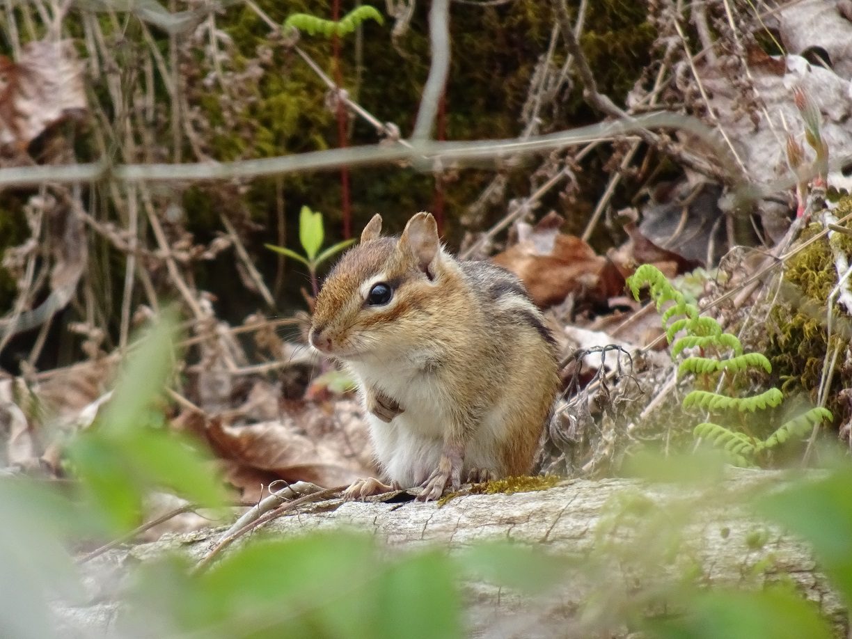
Car Hike: Springtime Family Hike at Silver Creek
https://hikes.brucetrail.org/event/car-hike-springtime-family-hike-at-silver-creek/Sorry, the registration cut-off time for this hike has been reached.Not a member? Click here to join today!Hosting Club: Toronto
Category: Car Hike
Location (Google Maps): We will meet at the parking lot of the Silver Creek Outdoor Education Centre.Hike Leader(s): Monica Pasquali, Andrew Proczek Click here to contact Hike Leader(s)
Pace: Leisurely
Terrain: Variable
Distance: 4.5 km, with the option to drop out at 3 kmDescription
Enjoy the sights, sounds, and smells of spring with a leisurely, family-friendly nature hike in the Silver Creek Conservation Area! After meeting at the Silver Creek Outdoor Education Centre parking lot at 10 am, we will walk north along the main trail, climbing the escarpment as we go, and then we will turn around and walk back south going downhill via the Roberts Side Trail, making a 3 km loop. For those who would like to extend their hike, they can join us on an additional loop that includes the Irwin Quarry Side Trail going up and the main trail going down, which will add an additional 1.5 km to the day’s hiking distance. Children under 13 years of age are encouraged to join their parents/guardians on this hike so they can fulfill the requirements for the Toronto Bruce Trail Club’s Youth Badge – all family members who are planning on joining us should register for the hike, including children. You should bring enough water and food for a 2-hour hike, comfortable hiking shoes, sun and bug protection, appropriate clothing for the weather, and good observational skills so we can spot lots of flora, fauna, and fungi while we hike. Please note that the trail is quite rocky and hilly in places, and is therefore not stroller-friendly, so any children who join us should be capable of walking on their own or be carried comfortably by their parents/guardians for the duration of the hike.Sunday Social Hike - Above Colpoys Bay
https://hikes.brucetrail.org/event/above-colpoys-bay/Sorry, the registration cut-off time for this hike has been reached.Not a member? Click here to join today!Hosting Club: Sydenham
Category: General Hike
Location (Google Maps): The Owen Sound Galaxy Theatre parking lot. Meet at the tall “Galaxy Centre” sign next to the traffic lights.Hike Leader(s): Danuta Valleau Click here to contact Hike Leader(s)
Pace: Medium: 3 to 4 km/h
Terrain: Moderate: Some hills and/or poor footing
Distance: 6 kmDescription
Following the Curley Harnden Side Trail, we walk along the forest track to the escarpment edge, turn right to follow the main trail for 2 km, then follow the Len Holley Side Trail for another 1.6 km to the parked cars.Bring bug repellent, sunscreen, water and snacks. Walking poles or sticks are helpful. If you are unable to register, please call or text Danuta Valleau at 519-378-5630 to let her know you are coming.
- 22May 22, 2023

Monday only Niagara End to End
https://hikes.brucetrail.org/event/monday-only-niagara-end-to-end/Sorry, the registration cut-off time for this hike has been reached.Not a member? Click here to join today!Hosting Club: Niagara
Category: Event Hikes
Location (Google Maps):Monday May 22: Queenston Heights Park, Niagara Parkway, Niagara-on-the-Lake, ON 43.1593144, -79.055405
Terrain: Moderate
Distance: 28Description
This is the NBTC Annual End to End Event over 3 days from Grimsby to Queenston.
You are Registering for Monday only
Participants will be transported by bus from check in to the start of the hike and will hike at their own pace to the final checkpoint.It is a self led hike
Day 3 28k :https://www.plotaroute.com/route/995636?units=kmBring snacks, water and bug spray.
We would also recommend sunscreen, basic first aid supplies, spare socks and a cell phone.
There will be 3 checkpoints on each day along the trail to replenish water and snacks and anyone wishing to drop out of the hike should do so where possible at the checkpoint. Trail angels will also be available should hikers become incapacitated and unable to reach a checkpoint. Hikers are responsible for informing the Organizing Niagara Personnel of their intention to drop out.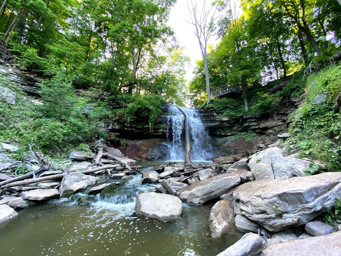
Clappison Woods to Smokey Hollow MAP 9
https://hikes.brucetrail.org/event/clappison-woods-to-smokey-hollow-map-9-2/Sorry, the registration cut-off time for this hike has been reached.Not a member? Click here to join today!Hosting Club: Iroquoia
Category: General Hike
Location (Google Maps): Park at Clappison Corners Walmart Parking Lot -east side -also parking lot above near Dollar Tree-we will meet in the grassy area between parking lotsHike Leader(s): Cathie Green Click here to contact Hike Leader(s)
Pace: Medium – 3 to 4 km/hr
Terrain: Moderate – Some hills and/or some poor footing
Distance: Approximately 12 kmsDescription
There and Back through Clappison Woods – we will follow that along to Grindstone Creek and Smokey Hollow FallsSome steep and rocky trail as well as staircase to view the Great Falls – Pack water, snack, wear weather appropriate clothing, hiking poles, boots recommended as well as bug spray
- 23May 23, 2023
8:00 NEW TIME Long Hike Wiley Road Short Hills
https://hikes.brucetrail.org/event/800-new-time-long-hike-wiley-road-short-hills-4/Sorry, the registration cut-off time for this hike has been reached.Not a member? Click here to join today!Hosting Club: Niagara
Location (Google Maps):
Short Hills Wiley Road Entrance
Pace: Medium
Terrain: Moderate
: 10kmDescription
Explore Short Hills and the majestic side trails of Scarlett Tanager, Hemlock. Swayze Falls and Terrace. Register for each hike
Bring Poles water, snack, sunscreen and bug spray and dress for the weather

Spring Birds and Blooms
https://hikes.brucetrail.org/event/spring-birds-and-blooms/Sorry, the registration cut-off time for this hike has been reached.Not a member? Click here to join today!Hosting Club: Peninsula
Location (Google Maps): Meet up at Dyers Bay Parking Lot 45.162455727854116, -81.34088304473234 . We will carpool to Britain Lake Road to Lillie Parking area km 113.4. Parking fees may be in effect for non-resident vehicles at Dyers Bay.
Hike Leader(s): Marg Glendon Click here to contact Hike Leader(s)
Pace: Leisurely
Terrain: Easy, Moderate
Distance: ~1.5 km with possibility of extended the hike distance, if time allows.Description
Join Peter Rasberry for a leisurely Spring hike on the Cottrill Lake Side Trail. This lovely sidetrail winds 1.4km through both mixed and hardwood forest, and along the shore of this small inland lake. This should be peak time for both spring wildflowers, and bird migration, so it will be a leisurely walk focusing on the identification and appreciation of both! If time permits, we will have the option of adding on the Anne and Clayton Roberts Side Trail.We will meet at the parking lot in Dyers Bay 45.162455727854116, -81.34088304473234 at 9:00 am, and car pool out the Britain Lake Road to the start of our hike at the Lillie Parking area km 113.4. Parking fees may be in effect for non-resident vehicles at Dyers Bay. Dress appropriately, bring snacks, water, cameras, binoculars and field guides. Insect repellant might also be useful.
This hike (including car pooling) is approximately 3 hours in duration.
9:15 Short hike - Pelham Road, Short Hills
https://hikes.brucetrail.org/event/915-short-hike-pelham-road-short-hills-44/Sorry, the registration cut-off time for this hike has been reached.Not a member? Click here to join today!Hosting Club: Niagara
Location (Google Maps): Pelham Road entrance, Short Hills Provincial Park
Hike Leader(s): janet davey Click here to contact Hike Leader(s)
Pace: Medium
Terrain: Moderate
Distance: 6 kmsDescription
Hike the main and side trails in Short Hills Provincial Park. Bring hiking boots, water and bug spray.Forks of the Credit
https://hikes.brucetrail.org/event/forks-of-the-credit-15/Sorry, the registration cut-off time for this hike has been reached.Not a member? Click here to join today!Hosting Club: Caledon Hills
Category: Tuesday Hikers
Location (Google Maps): Mississauga Rd. intersection with Elora-Cataract Trailway.
Driving direction: From Highway 401, north on Mississauga Rd., pass through Belfountain village, after crossing Cataract Rd. and Elora-Cataract Trailway, park on either side of the road.
Alternate: North on Highway 410, continue on Highway 10, at Caledon Village, left on Charleston Sideroad (24), left on Mississauga Rd., drive 2 km to the roadside parking.Hike Leader(s): Mohammad Shafiq Click here to contact Hike Leader(s)
Pace: Medium – 3 to 4 km/hour
Terrain: Moderate – some hills and/or some poor footing
Distance: 13 kmDescription
Will enter Forks of the Credit Conservation Area using the Elora-Cataract Trailway and hike the main Bruce Trail, Mill Pond, Cataract and Dorothy Medhurst Side Trails and parts of conservation trails. Lunch break at a lovely spot on the Credit River, one of the sweet spots on the river.
Bring 2 bottles of water and snack; poles are recommended.Will observe Forest Bathing for 20 minutes during the hike.
Distance will be adjusted depending on weather, ie reduced if too warm.
Hike leader contact: 416-566-0503
- 24May 24, 2023

Toronto End to End - 2 day, brisk $30 fee/members only
https://hikes.brucetrail.org/event/toronto-end-to-end-2-day-brisk/Sorry, the registration cut-off time for this hike has been reached.Not a member? Click here to join today!Hike open to BTC Members only.
This is a Multi-Day Hike
You are signing up for the following dates and times:
2023-05-24 at 07:30
2023-05-31 at 07:30Hosting Club: Iroquoia
Category: Special Event
Location (Google Maps): Limehouse Conservation Area
Intersection of 22 Sideroad and 5th LineHike Leader(s): Ruth Moffatt Click here to contact Hike Leader(s)
Pace: Brisk – 4 to 5 km/hr
Terrain: Dependent on Conditions, Strenuous – Hilly with steep climbs and some poor footing
Distance: May 24th about 29km; May 31 about 21kmDescription
This is a two day fundraiser hike for the Toronto Bruce Trail Club. Your fee includes the new stained glass badge featuring the historic limestone arch over Blackcreek. The fee goes towards supporting the Toronto Bruce Trail Club, which in turn supports the mission of the Bruce Trail Conservancy “preserving a ribbon of wilderness, for everyone, forever”.
https://hikingthegta.com/2015/06/23/limehouse/
Please meet at the same location both days and try to be 15 min early so we can leave promptly.
Please come prepared with at least 2 litres of water, snacks, lunch, bug spray, sun screen, first aid kit, and poles if you use them.
The hike will be a quick pace with not a lot of stopping 4km -5km per hour. Please be honest about your hiking abilities.
Like all hikes, this is a Leave No Trace. Please pack out what ever you pack in.
We will take time to collect any trail trash we see.
Since the top end of Toronto is land locked, we will do a do-si-do car shuttle which works really well for the 2.5km at the top end. It’ll all be explained when we get there.
Please come prepared to share in the cost of admission at Hilton Falls, where the hike starts on May 31.This is a car shuttle hike – please bring a mask in case anyone on the hike would prefer everyone in the vehicle to wear one.
If you have any questions, please do not hesitate to contact the hike leader.
Blue Mountains E2E Hike #6 in a series of 6 hikes
https://hikes.brucetrail.org/event/blue-mountains-e2e-hike-6-in-a-series-of-6-hikes/Sorry, the registration cut-off time for this hike has been reached.Not a member? Click here to join today!Hosting Club: Blue Mountains
Category: Organized Hike
Location (Google Maps): Hike meets in the parking lot behind Tim Hortons on First St. in Collingwood.Hike Leader(s): David Little Click here to contact Hike Leader(s)
Pace: Medium – 3 to 4 km/hr
Terrain: Moderate – Some hills and/or some poor footing
Distance: 13.5kmDescription
We will park the cars at km 67.3 on Maple Lane and car shuttle to km 55.7 to begin the hike. The trail ascends the Escarpment with a steep climb over large rocks and heads through a forest and some fields. On the top of the escarpment the trail passes through a deciduous forest. There are spectacular views of Georgian Bay and Collingwood as the trail makes its way along and just below the Escarpment. Bring a snack or lunch and water. Don’t forget to mail in your log and choose your payment option for your well deserved End2End badge. Map 23/24 Edition 30Pull Party - removing invasives along the trail
https://hikes.brucetrail.org/event/pull-party-removing-invasives-along-the-trail-2/Sorry, the registration cut-off time for this hike has been reached.Not a member? Click here to join today!Hosting Club: Niagara
Location (Google Maps): St Paul St Niagara Falls, north of Mountain Rd. Park on west side of road to enter
Hike Leader(s): Mary-Lyn Hopper Click here to contact Hike Leader(s)
Terrain: Easy
Description

Hermitage Loops
https://hikes.brucetrail.org/event/hermitage-loops-2/Sorry, the registration cut-off time for this hike has been reached.Not a member? Click here to join today!Hosting Club: Iroquoia
Category: Good Companions
Location (Google Maps):Hermitage parking lot, Dundas Valley Conservation Area, 621 Sulphur Springs Rd, near corner of Sulphur Springs Rd and Mineral Springs Rd.
Hike Leader(s): Craig Sim Click here to contact Hike Leader(s)
Pace: Medium – 3 to 4 km/hr
Terrain: Moderate – Some hills and/or some poor footing
Distance: 7k (approximate)Description
Meet in Hermitage parking lot, Dundas Valley Conservation Area, 621 Sulphur Springs Rd, near corner of Sulphur Springs Rd and Mineral Springs Rd. We will do loops within DVCA. One specific hill quite steep. Wear hiking boots. Dress in layers appropriate to weather, bring snack and water. Be aware of Covid protocols. We leave at 10am. To cancel day of hike text cell#289-659-0007. Cell day of hike only. - 25May 25, 2023
8:00 am Long Hike Jordan to Moyer / Louth NEW TIME
https://hikes.brucetrail.org/event/800-am-long-hike-jordan-to-moyer-louth-new-time-4/Sorry, the registration cut-off time for this hike has been reached.Not a member? Click here to join today!Hosting Club: Niagara
Location (Google Maps):
Jordan Hollow Park 3039 King St Jordan
Pace: Medium
Terrain: Moderate
: 10kDescription
From Jordan Hollow Hike the main trail to Upper and Lower Balls Falls, Moyer Road or Louth and Return. You must register for each hike. Bring Poles, sunscreen, bug spray , snack and a drink ices and dress for the weather
Woodford to Bognor Marsh
https://hikes.brucetrail.org/event/woodford-to-bognor-marsh/Sorry, the registration cut-off time for this hike has been reached.Not a member? Click here to join today!Hosting Club: Sydenham
Category: General Hike
Location (Google Maps): Bognor Marsh Conservation Area parking lot, northwest corner of County Road 18 and 4th Concession S, at km 29.4 (Map 30)Hike Leader(s): Maureen McFarland Click here to contact Hike Leader(s)
Pace: Medium: 3 to 4 km/h
Terrain: Moderate: Some hills and/or poor footing, Strenuous: Hilly with steep climbs and some poor footing.
Distance: 12.5 kmsDescription
We meet at Bognor Marsh and carpool to Woodford Community Centre. From there we hike south back to Bognor Marsh. Much of this hike is along the escarpment edge, with good views off to the east. It is a rugged section, with lots of crevices and a few climbs up and down the excarpment. We end at Bognor Marsh with views over the marsh and of the shore birds who make the marsh their home. Bognor Marsh may be quite wet in springtime. Bring a lunch or snack, and plenty of water. If you have a Grey Sauble Conservation Authority Parking Pass bring it too. Parking at Bognor Marsh is not free. If you are unable to register, please call or text Maureen McFarland at 647-918-4180 to let her know you are coming.Sydenham E2E Hike 6 of 14
https://hikes.brucetrail.org/event/sydenham-e2e-hike-6-of-14/Sorry, the registration cut-off time for this hike has been reached.Not a member? Click here to join today!Hosting Club: Caledon Hills
Category: End-to-End
Location (Google Maps): Meet in parking lot at Grey-Bruce Tourist Information Office west of km 104.4. Enter from Hwy 6, just north of the junction of Hwys 6 and 21. Shuttle to start at km 115.5.Hike Leader(s): Nancy Mooney Click here to contact Hike Leader(s)
Pace: Medium – 3 to 4 km/hour
Terrain: Easy – mostly flat and usually good footing, Moderate – some hills and/or some poor footing
Distance: From km 115.5 – 104.4 plus a bit of side trail. Total distance 11.5 km.Description
This hike is relatively easy as we leave the Georgian Bluffs area and approach Owen Sound via rail trail and roads. There are some areas with crevices and nice views along the way. Lunch or ice cream after!9:15 Short hike - Jordan Hollow
https://hikes.brucetrail.org/event/915-short-hike-jordan-hollow-58/Sorry, the registration cut-off time for this hike has been reached.Not a member? Click here to join today!Hosting Club: Niagara
Location (Google Maps): Jordan Hollow Park
Hike Leader(s): Bill Russell Click here to contact Hike Leader(s)
Pace: Medium
Terrain: Strenuous
Distance: 6 kmsDescription
Hike the main trail and side trails around Jordan and Balls Falls. Bring hiking boots, water and bug spray.
Hilton Falls Wildflower Treasures
https://hikes.brucetrail.org/event/hilton-falls-wildflower-treasures/Sorry, the registration cut-off time for this hike has been reached.Not a member? Click here to join today!Hosting Club: Iroquoia
Category: Thursday Group
Location (Google Maps): Hilton Falls Conservation Area, 4985 Campbellville Rd. MiltonHike Leader(s): Anne Armstrong Click here to contact Hike Leader(s)
Pace: Leisurely – 3km/hr or less
Terrain: Easy – Mostly flat and usually good footing
Distance: 10 – 11 Km.Description
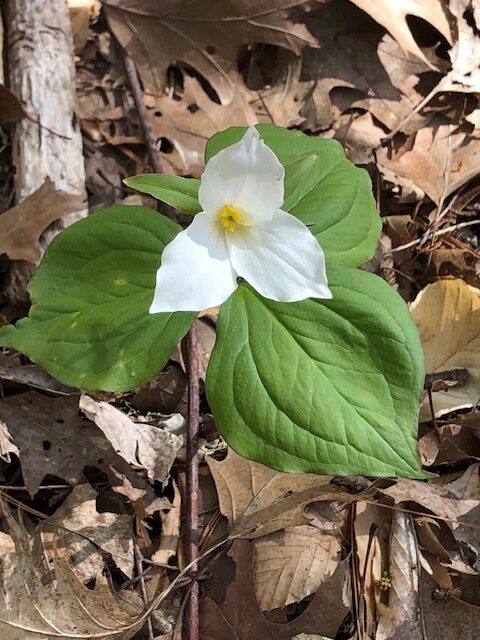
Hilton Falls Beaver Meadow route has some areas of a large concentration of wildflowers including variegated Trilliums and Perfoliate Bellwort. There are also some unusual ferns. Join us for this lovely circular route to search for wildflowers. We will stop at the falls for our snack. Bring water, a snack, sunscreen, insect repellent and poles if using.
Leader: Anne Armstrong 905 617 3937 hikingrandma@gmail.com
Spring Interpretive Hike
https://hikes.brucetrail.org/event/spring-interpretive-hike/Sorry, the registration cut-off time for this hike has been reached.Not a member? Click here to join today!Hosting Club: Peninsula
Location (Google Maps): Meet at the intersection of Crooked Toe Road and Boundary Road at 24.4 KM. Arrive a few minutes early so that we can begin the hike at 10 a.m.
Hike Leader(s): Marg Glendon Click here to contact Hike Leader(s)
Pace: Leisurely, Medium
Terrain: Easy, Moderate
Distance: ~5 kmDescription
Spring is here! Let’s explore the signs of Spring at the McIver Wetland and adjoining hardwood forest with Bob Knapp, a PBTC Land Steward. Bob will provide interpretation for this Spring hike. This wetland is a popular site for migrating birds, amphibians and reptiles. The hardwood forest will be coming alive with an unfurling of new green leaves, while fern and mossy rocks frame early Spring wildflowers. We will finish our hike with lunch on the cabin deck together.Bring a light backpack with a snack, water and lunch. Wear a hat, long sleeved protective clothing. Bring insect repellent. At this time of year, there may be some wet spots, please wear waterproof hiking boots. A camera, binoculars and gators might be helpful, but not essential.
This hike will be about 3 hours in duration.
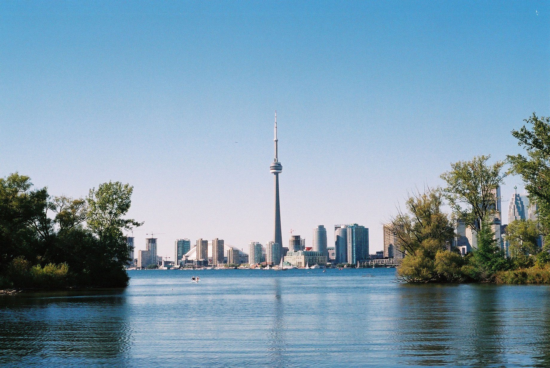
Toronto, Toronto Islands
https://hikes.brucetrail.org/event/toronto-toronto-islands-16/Sorry, the registration cut-off time for this hike has been reached.Not a member? Click here to join today!Hosting Club: Toronto
Location (Google Maps): Meet inside the Jack Layton Ferry Terminal, foot of Bay Street, beyond the cashiers selling the ferry tickets, in the open area with the benches and Muskoka chairs. From Union Station take the LRT one stop to “Ferry Docks” or take bus number #19 or #72 on Bay Street southbound to the Queens Quay. Walk across Queen Quay south through the park to the ferry terminal.
Hike Leader(s): Miriam Stevens, Tom Swales Click here to contact Hike Leader(s)
Pace: Leisurely
Terrain: Flat
Distance: 8-12 kmDescription
After a day’s work, come and “cool off” on the Toronto Islands free of fumes and traffic to enjoy the view of the city skyline and Toronto’s own beautiful island parkland oasis away from the city. Pack a dinner for a sit-down picnic. Note that food is not available for purchase on the islands early in the season. Bring a warm jacket and flashlight. Return ticket for the ferry is approximately $8.70, $5.60 for seniors. The hike will take place rain or shine. Toronto Island Evening Hikes will take place every Thursday in May and June, same time and meeting place. The route and time we return to the city may vary depending if the ferries are running on the Spring or Summer (starts in May) schedule. Contact Hike Leaders via the Contact form for further information or to confirm the current ferry schedule that will be in place the week of the hike. Registration is not required for this hike – just meet the Hike Leader at the above location. - 26May 26, 2023

9:00 Floral Clock & Botanical Gardens
https://hikes.brucetrail.org/event/900-floral-clock-botanical-gardens-2/Sorry, the registration cut-off time for this hike has been reached.Not a member? Click here to join today!Hosting Club: Niagara
Category: Leisurely
Location (Google Maps): Floral Clock Parking Lot (no charge)Hike Leader(s): Robin Garrett Click here to contact Hike Leader(s)
Pace: Medium
Terrain: Easy
Distance: 6 kmDescription
Enjoy the cheerfulness of budding spring flowers and trees. We will check out the new plantings at the Floral Clock, walk among the daffodils along the Niagara River Parkway trail, and loop through the Botanical Garden to revel in the magnificence of spring flowering plants and trees. - 27May 27, 2023
Blue Mountains Annual End to End-TWO DAY EVENT. This event is almost sold out, register today!
https://hikes.brucetrail.org/event/blue-mountains-2-day-end2end-event/Sorry, the registration cut-off time for this hike has been reached.Not a member? Click here to join today!This is a Multi-Day Hike
You are signing up for the following dates:
2023-05-27, 2023-05-28Hosting Club: Blue Mountains
Category: End-to-End
Location (Google Maps):Hike Leader(s): Christine Lasky Click here to contact Hike Leader(s)
Pace: Brisk – 4 to 5 km/hr, Fast – 5+ km/hr
Terrain: Moderate – Some hills and/or some poor footing, Strenuous – Hilly with steep climbs and some poor footing
Distance: 69 km -Day 1: 35km Day 2: 34kmDescription
Join us this spring for the Blue Mountains Bruce Trail Club annual End-to-End hike event. This 2 Day Hike is for those hikers keen on a great big challenge You will wind your way through the beautiful and varied terrain of the Blue Mountains Club trails. Enjoy the early signs of nature awakening at this time of the year, the beautiful vistas and the rugged escarpment. You will cover the 69 km distance of our section which runs from Lavender to Swiss Meadows. Checkpoint stations will be offered approximately every 10 kms offering snacks, water refill and assistance along the way. A BBQ at Highlands Nordic is included at the end of Saturday Hike commencing at 3:00 pm. Hike details will be emailed to participants shortly after registration is received. Note, this event consists of longer distances and is generally not suitable for beginning hikers.Blue Mountains THREE DAY End to End - THREE DAY EVENT (Sorry, this Event is Now Full - with a long wait list. The Two Day hike is almost full, register for it today. Good Luck!
https://hikes.brucetrail.org/event/blue-mountains-annual-end-to-end-three-day-event/Sorry, the registration cut-off time for this hike has been reached.Not a member? Click here to join today!This is a Multi-Day Hike
You are signing up for the following dates:
2023-05-27, 2023-05-28, 2023-05-29Hosting Club: Blue Mountains
Category: End-to-End
Location (Google Maps):Hike Leader(s): Christine Lasky Click here to contact Hike Leader(s)
Pace: Brisk – 4 to 5 km/hr, Medium – 3 to 4 km/hr
Terrain: Moderate – Some hills and/or some poor footing, Strenuous – Hilly with steep climbs and some poor footing
Distance: 69 kmDescription
Join us this spring for the Blue Mountains Bruce Trail Club all-new THREE DAY End-to-End hike event. This 3 Day hike is for those hikers wanting to complete our section over three days. You will wind your way through the beautiful and varied terrain of the Blue Mountains Club trails. Enjoy the early signs of nature awakening at this time of the year, the beautiful vistas and the rugged escarpment. You will cover the 69 km distance of our section which runs from Lavender to Swiss Meadows. Checkpoint stations will be offered approximately every 10 kms offering snacks, water refill and assistance along the way. A BBQ is included on the Saturday at the end of the hike day, at Highlands Nordic, and will commence at 3:00 pm. Details will be emailed to participants shortly after registration is received. Note, this event consists of longer distances and is generally not suitable for beginning hikers.Beaver Valley Section Hike 1: Swiss Meadows to Kolapore
https://hikes.brucetrail.org/event/beaver-valley-section-hike-1-swiss-meadows-to-kolapore/Sorry, the registration cut-off time for this hike has been reached.Not a member? Click here to join today!Hike open to BTC Members only.
Hosting Club: Dufferin Hi-Land
Category: General Hike
Location (Google Maps): Maple Lane Black BTC parking at km 0.0 Beaver Valley Section, BTC Map 24. N 44.504973, W 80.331780. Closest major intersection is at Banks where Hwy 119 crosses 4th Line. Our meeting spot is north and east of that.Hike Leader(s): Stuart Law Click here to contact Hike Leader(s)
Pace: Medium
Terrain: Dependent on Conditions, Moderate, Slippery Sections Likely
Distance: 24.5 kmsDescription
Join us on the first of a series of hikes to complete a Beaver Valley Section E2E. This hike is very long at 24.5 kms but the rest of the hikes will be about 15 kms each to accommodate the more difficult terrain in the valley itself. While our first hike is long we will be hiking it at a Humane Hiking pace (or as a very accomplished Toronto section hike leader once said – an “all day” pace) and we will stopping regularly to rest and hydrate. Please make sure you are ready to shuttle at 8:00 am sharp. A local overnight stay is recommended given the early start. Please bring 3L of water, a lunch, snacks, bug spray, sun block, an appreciation of nature and a smile. Hiking boots mandatory. Gaiters and poles recommended. Please bring a change of footwear and a garbage bag for the shuttle given the anticipated mud in spots along the way. No dropouts. Please be honest with your ability to hike the 24.5 km distance.Cherry Beach Down town Toronto
https://hikes.brucetrail.org/event/cherry-beach-down-town-toronto/Sorry, the registration cut-off time for this hike has been reached.Not a member? Click here to join today!Hosting Club: Toronto
Category: Car Hike
Location (Google Maps): free parking lot at the end of Cherry StreetHike Leader(s): Mohammad Aghamiri Click here to contact Hike Leader(s)
Pace: Moderate
Terrain: Flat
Distance: 14-15KMDescription
Park in Cherry Beach parking lotWe will explore Tommy Thompson park along Lake Ontario and listen to the birds and visit light house at the end of park.
Some safety procedures during the hike:
1-Hikers must stay between the leader and the sweep.
2-Hikers must advise the leader or the sweep if they wish to leave the group.
3- Hikers must follow the whistle instructions: 1 blast- stay where you are; 2 blasts come to the leader; 3 blasts – come to the leader quickly.
4-Hike leader may request volunteers to stop at trail intersections, they need to help hikers to the direction the group walk and wait till they see the sweep .
5-Hikers have to make sure they can see the persons behind and in front of them.
Bus Hike: Dundas Valley
https://hikes.brucetrail.org/event/bus-hike-dundas-valley/Sorry, the registration cut-off time for this hike has been reached.Not a member? Click here to join today!Trip Information
Departure Time: 08:30
Return to City Time: 17:30
Departure Point: Kipling Departure PointOptional Items
Shawn & Ed Brewery Visit ($.01)Hosting Club: Toronto
Category: Bus Hike
Location (Google Maps): Dundas Valley Conservation AreaHike Leader(s): Tom Swales, Peter Leeney, Tim Wainwright Click here to contact Hike Leader(s)
Pace: Moderate
Terrain: Hilly, Variable
Distance: 12 KMDescription
Join us for a Spring hike from Ancaster through the Dundas Valley Conservation Area on the Spring Valley Trail, Hilltop Trail, Headwaters Trail, Bruce Trail, McCormack Trail into the town of Dundas Ontario – “The Valley Town”. Hopefully, we’ll have the chance to enjoy the Spring wildflowers. Before returning to Toronto there will be the chance to explore the charming town, a glass or flight at the local craft brewery, or a refreshment stop of your choice..Urban Walk: Leslie Street Spit Bird Watching
https://hikes.brucetrail.org/event/urban-walk-leslie-street-spit-bird-watching-2/Sorry, the registration cut-off time for this hike has been reached.Not a member? Click here to join today!Hosting Club: Toronto
Category: Urban Walk
Location (Google Maps):Entrance to Tommy Thompson Park at Leslie St and Unwin Ave.
Hike Leader(s): Ray Berzins Click here to contact Hike Leader(s)
Pace: Leisurely
Terrain: Flat
Distance: 7 kmDescription
For first 3.5 km we will try to observe as much as possible along natural footpaths, so wear long pants, long stockings and whatever else will protect you from ticks. Bring binoculars. After lunch the nature walk will end and hikers can use the Multi-use Trail to continue walking to the end of the spit or return back to the park entrance by 2PM. It will be cooler and more windy than inland so bring warm clothing and a warm beverage with your lunch.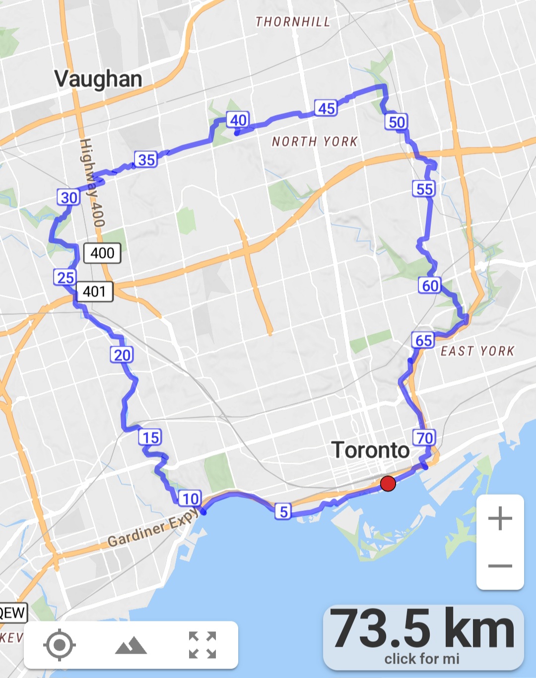
#2/5 Loop of Toronto Hike for Urban Hiking Badge - 18km
https://hikes.brucetrail.org/event/2-5-loop-of-toronto-hike-for-urban-hiking-badge-18km/Sorry, the registration cut-off time for this hike has been reached.Not a member? Click here to join today!Hosting Club: Toronto
Category: Urban Walk
Location (Google Maps): Old Mill Station entranceHike Leader(s): Alina Lin
Pace: Moderate
Terrain: Flat
Distance: 18kmDescription
Embark on a captivating journey through Toronto’s remarkable urban trail systems. From the scenic Don River in the east to the captivating Waterfront in the south, the tranquil Humber River in the west, and the enchanting Finch Corridor in the north, this diverse collection of trails offers an unforgettable opportunity to explore the city’s longest trails on foot.By interconnecting these four trail systems, which weave through more than ten parks and trails, we are creating an awe-inspiring loop spanning approximately 74 kilometers: https://onthegomap.com/s/c2c1hf3n . As a testament to your accomplishment, completing the entire loop will earn you the Toronto Urban Hiking Badge—the first ever urban hiking badge launched by the Toronto Bruce Trail Club.
Distance: 18km. Start from Old Mills and end at Finch & Weston.
Pace: 4kph
Trail condition: mostly flat and paved.
Bring water and snacks. Dress and prepare for the weather.
Georgian Bluffs - top of Kemble Mountain
https://hikes.brucetrail.org/event/georgian-bluffs-top-of-kemble-mountain-2/Sorry, the registration cut-off time for this hike has been reached.Not a member? Click here to join today!Hosting Club: Sydenham
Category: General Hike
Location (Google Maps): The Owen Sound Galaxy Theatre parking lot. Meet at the tall “Galaxy Centre” sign next to the traffic lights.Hike Leader(s): Ian Mills Click here to contact Hike Leader(s)
Pace: Medium: 3 to 4 km/h
Terrain: Strenuous: Hilly with steep climbs and some poor footing., There might be muddy sections., There might be sections with water on the trail.
Distance: 10 kmDescription
Starting at 145.3 (Map 34) and taking the Main Trail to the Mystery Cabin side trail and returning via the Main Trail to Nels Maher side trail. If you are unable to register please call or text Ian Mills @ 416-848-8818.Nature Hike - observing signs of Spring
https://hikes.brucetrail.org/event/nature-hike-observing-signs-of-spring/Sorry, the registration cut-off time for this hike has been reached.Not a member? Click here to join today!Hosting Club: Niagara
Category: Hike
Location (Google Maps): Fireman’s Park, Niagara Falls. Lower parking lot, off Dorchester Rd.Hike Leader(s): Mary-Lyn Hopper Click here to contact Hike Leader(s)
Pace: Leisurely
Terrain: ModerateDescription
- In this leisurely hike we will observe signs of nature
Bruce Trail Family Walk
https://hikes.brucetrail.org/event/bruce-trail-family-walk/Sorry, the registration cut-off time for this hike has been reached.Not a member? Click here to join today!Hosting Club: Sydenham, Peninsula
Location (Google Maps): Meet at the Bluewater Park Municipal Parking Lot in Wiarton (near Dockside Willie’s) a few minutes prior to 2:30 p.m.
Hike Leader(s): Marg Glendon
Pace: Leisurely
Terrain: Easy
Distance: ~2 KMDescription
Join a Bruce Trail Hike Leader for a short family nature scavenger hike along the Bruce Trail at Bluewater Park in Wiarton. This is an easy hike along flat terrain (fine gravel and paved surface). Learn about the Bruce Trail and how to find your way on the Bruce Trail. Help your child participate in a nature scavenger hunt along the hike. At the end of the hike, we will share our observations and talk about what we saw with one another! Bring a snack and enjoy a family picnic at the end of our hike, together!What to wear and bring:
Wear sturdy walking shoes, hat, sun protective clothing, and sunscreen. Bring water bottle for each person, a light backpack, cell phone, snacks for your family. A cell phone would be helpful, but not essential.
FREE!