- HikeType Urban Walk
- HikeIcon https://hikes.brucetrail.org/wp-content/uploads/formidable/7/marker_urban-walks.png
- PaceTypes Moderate
- TerrainTypes Flat
- PaidOuting No
Hosting Club: Toronto
Category: Urban Walk
Location (Google Maps): Old Mill Station entrance
Hike Leader(s): Alina Lin
Pace: Moderate
Terrain: Flat
Distance: 18km
Description
Embark on a captivating journey through Toronto's remarkable urban trail systems. From the scenic Don River in the east to the captivating Waterfront in the south, the tranquil Humber River in the west, and the enchanting Finch Corridor in the north, this diverse collection of trails offers an unforgettable opportunity to explore the city's longest trails on foot.
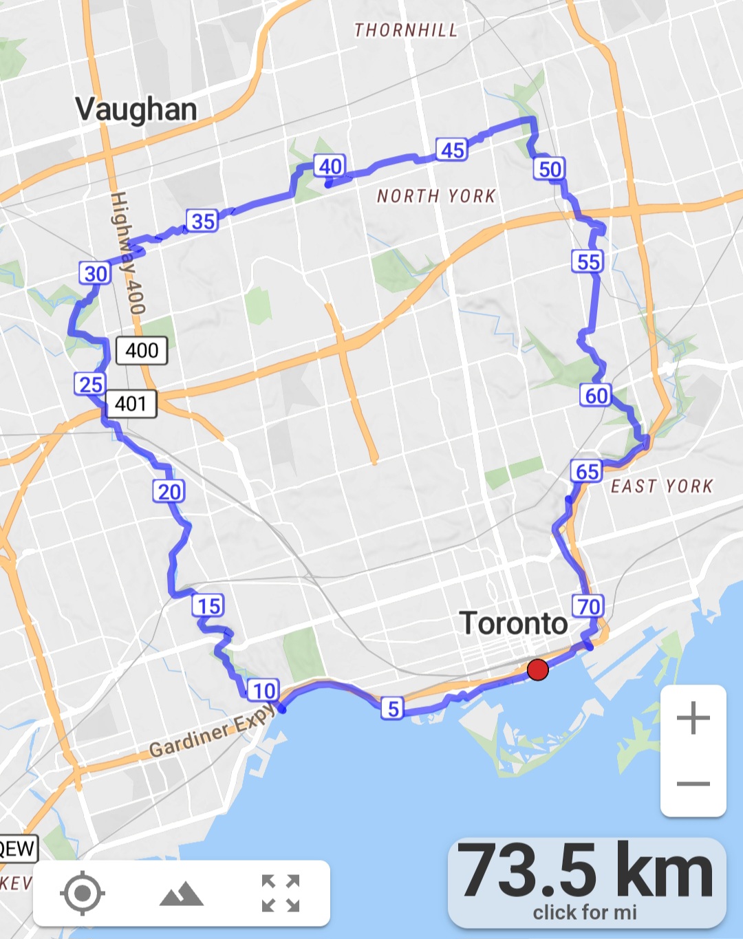
By interconnecting these four trail systems, which weave through more than ten parks and trails, we are creating an awe-inspiring loop spanning approximately 74 kilometers: https://onthegomap.com/s/c2c1hf3n . As a testament to your accomplishment, completing the entire loop will earn you the Toronto Urban Hiking Badge—the first ever urban hiking badge launched by the Toronto Bruce Trail Club.
Distance: 18km. Start from Old Mills and end at Finch & Weston.
Pace: 4kph
Trail condition: mostly flat and paved.
Bring water and snacks. Dress and prepare for the weather.