Hike Schedule
Join us for a hike! Registration required.
All hikes available to BTC members. Some hikes are open to non-members.
See Refund Policy for Paid Hikes >
TIP: The calendar view displays up to 7 hikes on a day, but often there are more. Click “View more events” to see them all.
Categories
- 01April 1, 2023
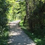
Car Hike: Lake front hike ,Scarborough
https://hikes.brucetrail.org/event/car-hike-lake-front-hike-scarborough-2/Sorry, the registration cut-off time for this hike has been reached.Not a member? Click here to join today!Hosting Club: Toronto
Category: Car Hike
Location (Google Maps): East Point Park Bird Sanctuary, Scarborough, ON
There is a parking lot at the end of Beechgrove Dr. there is a free parking lotHike Leader(s): Mohammad Aghamiri Click here to contact Hike Leader(s)
Pace: Moderate
Terrain: Flat, VariableDescription
We will hike along lake Ontario to Scarborough Bluffs.We may have a few hills on trails,
Please carefully read safety procedures during the hike:
1-Hikers must stay between the leader and the sweep.
2-Hikers must advise the leader or the sweep if they wish to leave the group.
3- Hikers must follow the whistle instructions: 1 blast- stay where you are; 2 blasts come to the leader; 3 blasts – come to the leader quickly.
4-Hike leader may request volunteers to stop at trail intersections, they need to help hikers to the direction the group walk and wait till they see the sweep .
5-Hikers have to make sure they can see the persons behind and in front of them.
- 01April 1, 2023
Bus hike: Hockley Valley and Mono Cliffs
https://hikes.brucetrail.org/event/bus-hike-hockley-valley-and-mono-cliffs/Sorry, the registration cut-off time for this hike has been reached.Not a member? Click here to join today!Trip Information
Departure Time: 08:30
Return to City Time: 18:00
Departure Point: York Mills Bus PickupOptional Items
Hosting Club: Toronto
Category: Bus Hike
Location (Google Maps): Hockley Valley Provincial Nature ReserveHike Leader(s): Martina Furrer, Brenda Dalglish, Michael Humpage, Mojgan Haghighat Click here to contact Hike Leader(s)
Terrain: Hilly, Variable
Distance: Moderate group 14 km, Slightly faster group 16 – 18 kmDescription
Welcome spring with a fun, scenic hike in Hockley Valley and Mono Cliffs. There will be two groups: a moderate group led by Brenda and a slightly faster group led by Martina. We will start at Hockley Rd and walk north to Dunby Rd (Map 18), stopping to eat lunch at the lookout just south of Dunby Rd. The moderate group will follow the main Bruce Trail, while the faster group will add some side trails. From Dunby Rd we will drive to 25 Sideroad, then walk south through Mono Cliffs Provincial Park to Mono Centre (Map 19). Short breaks at the lookout and McCarston’s Lake will give us a chance to enjoy the awesome views. If time and energy allows, the faster group might add the Turnbull Side Trail (1.7 km).Dropout at Dunby Rd (after about 7 km); this will be the only dropout.
Pack icers, lunch, water (1.5 to 2 litres), sun and rain protection.
- 01April 1, 2023
Old Mail Road, Kolapore
https://hikes.brucetrail.org/event/old-mail-road-kolapore-2/Sorry, the registration cut-off time for this hike has been reached.Not a member? Click here to join today!Hosting Club: Blue Mountains
Category: Register on-line or sign-in morning of hike
Location (Google Maps): Hike meets in the parking lot behind Tim Hortons on First St. in Collingwood.Hike Leader(s): Michelle Wacker Click here to contact Hike Leader(s)
Pace: Medium – 3 to 4 km/hr
Terrain: Moderate – Some hills and/or some poor footing
Distance: 10kmDescription
We will begin our hike at km19.1 on the 12th Sideroad in the Beaver Valley section. Hiking south through a deciduous woodlot, we arrive at a small piece of history. The Old Mail Road was a pioneer route into this area and was in use from the 1830’s until the 1850’s. Small parts of it still exist including a small section in this woodlot. The trail continues south to reach Grey Rd 19 and then travels through a BTC property to reach Grey Rd 2. Here, we will retrace our steps back to the cars. Bring water and lunch. Map 25 Edition 30 - 01April 1, 2023

9:00 Niagara Falls International Hike
https://hikes.brucetrail.org/event/900-niagara-falls-international-hike/Sorry, the registration cut-off time for this hike has been reached.Not a member? Click here to join today!Hosting Club: Niagara
Category: Leisurely
Location (Google Maps): Meet at Dufferin Islands Nature Park parking lot, near the intersection of Burning Springs Hill and the Niagara Parkway. There is a parking fee. Parking passes recommended.Hike Leader(s): Dan Wilson Click here to contact Hike Leader(s)
Pace: Leisurely
Terrain: Easy
Distance: 15kmDescription
From Queen Victoria Park to Niagara Falls State Park and back again! We will start on the Canadian side, hike through Dufferin Islands, view the waterfalls of Niagara and then cross the Rainbow Bridge to see them all from the American side!You will need your passport and $1 to cross the Rainbow Bridge. You may also be required to present your vaccination status upon request at the border.
- 01April 1, 2023
9:00 Cave Spring Witch Hunt
https://hikes.brucetrail.org/event/900-cave-spring-witch-hunt-6/Sorry, the registration cut-off time for this hike has been reached.Not a member? Click here to join today!Hosting Club: Niagara
Category: In and Out
Location (Google Maps):Parking lot Quarry Road Beamsville
Hike Leader(s): Bill Russell Click here to contact Hike Leader(s)
Pace: Leisurely
Terrain: Moderate
Distance: 6kDescription
Discover the history of the 19th Century Quarry Pioneers and the Cave Spring Witch.
- 01April 1, 2023
Urban Walk: Rosedale Ravines
https://hikes.brucetrail.org/event/urban-walk-rosedale-ravines/Sorry, the registration cut-off time for this hike has been reached.Not a member? Click here to join today!Hosting Club: Toronto
Category: Urban Walk
Location (Google Maps): Meet Pleasant Blvd Exit, St Clair Subway StationHike Leader(s): Tom Swales Click here to contact Hike Leader(s)
Pace: Moderate
Terrain: Variable
Distance: 10 kmDescription
Join us for a morning circular walk through David Balfour Park, Park Drive Reservation, the Evergreen Brickworks, Moore Park Ravine and Mount Pleasant Cemetery. On this walk we find nature close to the heart of the city. Effective icers (ice traction footwear) will be required. - 01April 1, 2023
Meditation Hike - Hungry Hollow
https://hikes.brucetrail.org/event/meditation-hike-hungry-hollow-3/Sorry, the registration cut-off time for this hike has been reached.Not a member? Click here to join today!Hosting Club: Iroquoia
Category: General Hike
Location (Google Maps): Trail begins on Miller Drive, Georgetown. Closest address is 121 Miller Drive, close to Miller Drive Park. Plenty of parking on the road.Hike Leader(s): Anita Bergsma Click here to contact Hike Leader(s)
Distance: 5.39 km
Description
Join me for a Guided Meditation Hike through Hungry Hollow Georgetown. It will be 5km at a slow to moderate pace on well groomed trails. The trails wind through the Hungry Hollow Ravine along Silver Creek. The trail is nestled in Georgetown and known for its beautiful nature, marshes, meadows, and ponds, with boardwalks, and bridges.Meet at 9:45am Sharp to get ready and hike in at 10:00am.Duration: 2.5 hoursAlso a great hike for those that would like to start hiking and looking for an introduction to how to hike.Please bring your phone with a full battery and earbuds to listen to the meditation. Download Spotify. The meditation will be for 1/2 hour with plenty of time to meet and chat with the other hikers for the duration of our hike together.Please wear hiking boots, backpack with water and snacks. Hiking poles are great for balance but optional. - 02April 2, 2023
Migration Monitor Hike
https://hikes.brucetrail.org/event/migration-monitor-hike-3/Sorry, the registration cut-off time for this hike has been reached.Not a member? Click here to join today!Hosting Club: Peninsula
Location (Google Maps): Parking for all hikes start at km 109.7, 30th Ed Ref Manual. Park adjacent to Cape Chin Mail boxes on Cape Chin North Road
Hike1 (Mar 12, 26, Apr 9): Otter Lake/Cape Chin Loop – see details below
Hike 2 (Mar 19, Apr 2, Apr 16): Borchardt/Cotrill Lk Loop – see details belowHike Leader(s): Tamara Wilson Click here to contact Hike Leader(s)
Pace: Leisurely
Terrain: Difficult
Distance: Each hike ranges 10 to 12 kmDescription
Join us as we look for clues of spring’s arrival on Cape Chin North. We will alternate two routes on a weekly basis, watching for seasonal changes along the wetlands, small inland lakes, woodlands and escarpment shoreline. We will stop, look and listen for the arrival of plants and flowers, birds and other harbingers of spring. Hikes are weather dependent and will be cancelled for treacherous local driving conditions (mud), rain, snow or very strong winds. Always check the road and weather conditions for the entire length of your trip up as local weather can be quite different. Some hikes may recommend snow shoe hikes (I will let you know). Poles and crampons are recommended for navigating wet and slippery conditions typical of spring hikes. It is recommended to bring snacks and water for the hike. A dry set of socks and shoes is a good idea for the trip home. A sweep, topic experts – all are welcome!
Alternating hikes:
Hike1 (Mar 12, 26, Apr 9): From km 109.7 parking, Otter Lk ST (2.2 km), up Cape Chin N Rd (past Tagwerk) to Cape Chin Meadow ST (1km) to Cape Chin Driveway (2.5 km) to house, North along MT back to parked vehicles (3.6 km ) – Total 9.3 km approx
Hike 2: (Mar 19, Apr 2, Apr 16) – From km 109.7 parking, MT North through Cape Chin Woods to Borchardt Parking (2.3 km), Minhinnik ST (1.7km) to Lillie Parking Lot, Take Cotrill Lk ST (1.4km) to Anne and Clayton Robert’s St (turn right) back to Britain Lk Rd (1km). At this point we will either a) follow Britain Lk Rd and reverse the route that we took (Minhinnik to Borchardt back along Borchardt to parking) – approx 12km OR b) if conditions are good, we will follow the Main Trail back along the escarpment to Borchardt PL and hike back to the vehicles along Borchardt.
- 02April 2, 2023
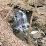
Dundas Valley Waterfalls at their best
https://hikes.brucetrail.org/event/dundas-valley-waterfalls-at-their-best/Sorry, the registration cut-off time for this hike has been reached.Not a member? Click here to join today!Hosting Club: Iroquoia
Category: General Hike
Location (Google Maps): Dundas Valley Conservation AreaHike Leader(s): Phillip Armstrong Click here to contact Hike Leader(s)
Pace: Medium – 3 to 4 km/hr
Terrain: Moderate – Some hills and/or some poor footing
Distance: 15kmDescription
It’s early spring the weather will have been wet by Sunday.Join us for a hike to see some of the best falls in the best scenery in Southern Ontario.
We will see Gatehouse Falls, Canterbury Falls,Sherman Falls and Tiffany Falls.Plenty of time for photo stops at the falls.
We will be on the main loop in Dundas Valley plus main trail over to Tiffany Falls for Lunch.
Return will be via Artaban Road back to the trail centre.
Make sure you have adequate food and water. Could be muddy in places.
Meet at 9-30 in the parking lot to allow us to go to the trail centre for bathrooms etc and start the hike at 10-00 a.m.
- 02April 2, 2023
Youth Hike at Louth (Ages 18-25 only)
https://hikes.brucetrail.org/event/youth-hike-at-louth-ages-18-25-only/Sorry, the registration cut-off time for this hike has been reached.Not a member? Click here to join today!Hosting Club: Niagara
Category: Youth Hike
Location (Google Maps): Louth Conservation Area in Lincoln.
Between Balls Falls and Rockway along the Bruce Trail.
Small parking lot but has roadside parkingHike Leader(s): Nolan Repovs Click here to contact Hike Leader(s)
Pace: Leisurely, Medium
Terrain: Moderate
Distance: 3 kmDescription
Ages 18-25 onlyJoin us at Louth Conservation Area for a youth hike! A great chance to connect with like minded young people, and possibly network, or just enjoy the hike.
It’s looking like it will be just above zero degrees, and we can expect it to be very muddy!
We will meet at the parking lot for noon