Hike Schedule
Join us for a hike! Registration required.
All hikes available to BTC members. Some hikes are open to non-members.
See Refund Policy for Paid Hikes >
TIP: The calendar view displays up to 7 hikes on a day, but often there are more. Click “View more events” to see them all.
Categories
- 26March 26, 2023
RESCHEDULED: Oak Ridges - Palgrave to Glen Haffy via the Dingle
https://hikes.brucetrail.org/event/oak-ridges-palgrave-to-glen-haffy-via-the-dingle/Sorry, the registration cut-off time for this hike has been reached.Not a member? Click here to join today!Hosting Club: Dufferin Hi-Land
Category: General Hike
Location (Google Maps): Caledon Hills, Map 17, Glen Haffy. Meet at roadside parking on Innis Lake Rd, just north-west of Finnerty Sideroad (Km 31.7), 1.6 km north-east of Airport Rd.Hike Leader(s): Les Babbage, Julie Daley Click here to contact Hike Leader(s)
Pace: Medium
Terrain: Moderate, Slippery Sections Likely
Distance: 12 kmDescription
We will car shuttle to the Palgrave Forest & Wildlife Area parking lot on Hwy 50, then hike west on the Oak Ridges Trail (formerly BTC Palgrave Side Trail) and the Dingle Trail to the Bruce Main Trail, then south-east to Innis Lake Road. The Oak Ridges trail passes through a gently rolling countryside of forests and fields, with short stretches on quiet roads. After visiting the historic Dingle community, the Glen Haffy Conservation Area section will offer us a few hills to the finish. Bring water, snacks and lunch. Icers may be required.Crawford Lake - Rattlesnake Point
https://hikes.brucetrail.org/event/crawford-lake-rattlesnake-point-2/Sorry, the registration cut-off time for this hike has been reached.Not a member? Click here to join today!Hosting Club: Dufferin Hi-Land
Category: General Hike
Location (Google Maps): Crawford Lake Conservation Area lower parking lot just after entrance gate. Conservation Halton online reservations required. 3115 Conservation Road
Milton, ON.Hike Leader(s): Stuart Law
Pace: Medium
Terrain: Dependent on Conditions, Moderate, Slippery and Steep Sections
Distance: 15 kmsDescription
Celebrate the arrival of Spring with a lovely walk in one of the jewels of the Conservation Halton parks system. We will start at Crawford Lake then cross the ancient glacial spillway of the Nassagaweya Canyon over to Rattlesnake Point and then head back. Lots of lookouts and classic Bruce Trail cliff-top scenery. There are certainly some steep icy sections so icers and a sound heart are a must. Online reservations are required at Halton Parks . There are no staff at the gate so prepayment online essential. Your money is going towards the conservation efforts we all believe in. Please bring icers as mentioned, a warm drink, water, a snack, a lunch, an appreciation of nature and a smile. Poles recommended. Please arrive at 9:15 for a 9:30 start.Migration Monitor Hike
https://hikes.brucetrail.org/event/migration-monitor-hike-2/Sorry, the registration cut-off time for this hike has been reached.Not a member? Click here to join today!Hosting Club: Peninsula
Location (Google Maps): Parking for all hikes start at km 109.7, 30th Ed Ref Manual. Park adjacent to Cape Chin Mail boxes on Cape Chin North Road
Hike1 (Mar 12, 26, Apr 9): Otter Lake/Cape Chin Loop – see details below
Hike 2 (Mar 19, Apr 2, Apr 16): Borchardt/Cotrill Lk Loop – see details belowHike Leader(s): Tamara Wilson Click here to contact Hike Leader(s)
Pace: Leisurely
Terrain: Difficult
Distance: Each hike ranges 10 to 12 kmDescription
Join us as we look for clues of spring’s arrival on Cape Chin North. We will alternate two routes on a weekly basis, watching for seasonal changes along the wetlands, small inland lakes, woodlands and escarpment shoreline. We will stop, look and listen for the arrival of plants and flowers, birds and other harbingers of spring. Hikes are weather dependent and will be cancelled for treacherous local driving conditions (mud), rain, snow or very strong winds. Always check the road and weather conditions for the entire length of your trip up as local weather can be quite different. Some hikes may recommend snow shoe hikes (I will let you know). Poles and crampons are recommended for navigating wet and slippery conditions typical of spring hikes. It is recommended to bring snacks and water for the hike. A dry set of socks and shoes is a good idea for the trip home. A sweep, topic experts – all are welcome!Alternating hikes:
Hike1 (Mar 12, 26, Apr 9): From km 109.7 parking, Otter Lk ST (2.2 km), up Cape Chin N Rd (past Tagwerk) to Cape Chin Meadow ST (1km) to Cape Chin Driveway (2.5 km) to house, North along MT back to parked vehicles (3.6 km ) – Total 9.3 km approx
Hike 2: (Mar 19, Apr 2, Apr 16) – From km 109.7 parking, MT North through Cape Chin Woods to Borchardt Parking (2.3 km), Minhinnik ST (1.7km) to Lillie Parking Lot, Take Cotrill Lk ST (1.4km) to Anne and Clayton Robert’s St (turn right) back to Britain Lk Rd (1km). At this point we will either a) follow Britain Lk Rd and reverse the route that we took (Minhinnik to Borchardt back along Borchardt to parking) – approx 12km OR b) if conditions are good, we will follow the Main Trail back along the escarpment to Borchardt PL and hike back to the vehicles along Borchardt.
Urban Walk: Ajax GO to Pickering GO
https://hikes.brucetrail.org/event/urban-walk-ajax-go-to-pickering-go-2/Sorry, the registration cut-off time for this hike has been reached.Not a member? Click here to join today!Hosting Club: Toronto
Category: Urban Walk
Location (Google Maps): Durham Waterfront TrailHike Leader(s): Brian Rideout Click here to contact Hike Leader(s)
Pace: Moderate
Terrain: Flat
Distance: 11 kmDescription
Please join me under the clock in the Great Hall at Union Station by 9:05 am. We will take the eastbound Lakeshore Train departing Union Station GO at 9:20 am, arriving Ajax GO at 10:06 am. You may choose to join the group at Ajax GO Station.We will hike south to Lake Ontario, west to Sandy Beach Rd, and north to Bayly St with a pub stop at Irish Times adjacent to Pickering GO.
Here is an online map of our route (please click on the link): Ajax to Pickering
You can buy a GO Transit day pass for $10 here Buy GO Transit E-tickets and Passes Online
Kemble Mountain Loop
https://hikes.brucetrail.org/event/kemble-mountain-loop/Sorry, the registration cut-off time for this hike has been reached.Not a member? Click here to join today!Hosting Club: Sydenham
Category: Snowshoe Hike
Location (Google Maps): The Owen Sound Galaxy Theatre parking lot. Meet at the tall “Galaxy Centre” sign next to the traffic lights.Hike Leader(s): Danuta Valleau Click here to contact Hike Leader(s)
Pace: Leisurely: 3 km/h or less
Terrain: Moderate: Some hills and/or poor footing
Distance: less than 3 kmDescription
Nels Maher Side Trail winds through mixed hardwood forest before meeting the main trial. This section of the main trail follows the top of the escarpment in a loop back to the parking area. In late March, we may see the first signs of spring growth in the woods. This trail is excellent for snowshoes if there is enough snow cover. Walking poles or sticks are recommended if you have them. Map 34. If you are unable to register, please call or text the leader at 519-378-5630. - 27March 27, 2023
2:00 Merritt Island
https://hikes.brucetrail.org/event/200-merritt-island/Sorry, the registration cut-off time for this hike has been reached.Not a member? Click here to join today!Hosting Club: Niagara
Category: Loop
Location (Google Maps): parking lot of Merritt Island at the west end of Cross st. WellandHike Leader(s): Heather Howkins Click here to contact Hike Leader(s)
Pace: Medium
Terrain: Easy
Distance: 7kDescription
flat hike along paved trail along side Welland Canal. - 28March 28, 2023
9:00 Long Hike Rockway
https://hikes.brucetrail.org/event/900-long-hike-wiley-road-short-hills-18/Sorry, the registration cut-off time for this hike has been reached.Not a member? Click here to join today!Hosting Club: Niagara
Location (Google Maps):
Short Hills Wiley Road Entrance
Hike Leader(s): Alan Laver Click here to contact Hike Leader(s)
Pace: Medium
Terrain: Moderate
Distance: 10kmDescription
Explore Rockway and Louth Conservation area Register for each hike
Bring Poles water, snack and Dress for the weather, Icers and layers/p>
9:15 Short hike - Rotary Park, St. Catharines
https://hikes.brucetrail.org/event/915-short-hike-rotary-park-st-catharines-4/Sorry, the registration cut-off time for this hike has been reached.Not a member? Click here to join today!Hosting Club: Niagara
Location (Google Maps): Rotary Park, St Catharines
Hike Leader(s): janet davey Click here to contact Hike Leader(s)
Pace: Medium
Terrain: Moderate
Distance: 6 kmsDescription
Hike the trails in Rotary Park. Bring hiking boots, water and icers.Port Credit to Rattray Marsh
https://hikes.brucetrail.org/event/port-credit-to-rattray-marsh/Sorry, the registration cut-off time for this hike has been reached.Not a member? Click here to join today!Hosting Club: Caledon Hills
Category: Urban Walk
Location (Google Maps): Port Credit parking behind Snug Harbour Restaurant. From QEW take Hurontario St south to Lakeshore Rd. Turn right and go 500 meters to Stavebank Rd. Turn left and drive to parking behind Snug Harbour. My cell phone is 905-301-4091.Hike Leader(s): Peter Leeney Click here to contact Hike Leader(s)
Pace: Moderate
Terrain: Flat
Distance: 12 kmDescription
We will follow the Waterfront Trail west through several parks to Rattray Marsh and return by the same route.Silver Creek- Great Esker side trail
https://hikes.brucetrail.org/event/silver-creek-great-esker-side-trail/Sorry, the registration cut-off time for this hike has been reached.Not a member? Click here to join today!Hosting Club: Dufferin Hi-Land
Category: Tuesday Hike
Location (Google Maps): Toronto Section, Map 13, Meet at intersection of 8th Line and 27th Sideroad, just north of Km 32.2Hike Leader(s): Inge Eckerich, Les Babbage, Julie Daley, Tony Evangelista Click here to contact Hike Leader(s)
Pace: Leisurely
Terrain: Slippery and Steep Sections
Distance: 6.0 kmDescription
We will hike a loop on the Main trail and Great Esker side trail. Bring icers. Snowshoes may be required - 29March 29, 2023
Hart's NEW Triple Inferno ** Experienced hikers Only!
https://hikes.brucetrail.org/event/harts-new-triple-inferno-experienced-hikers-only/Sorry, the registration cut-off time for this hike has been reached.Not a member? Click here to join today!Hosting Club: Blue Mountains
Category: Experienced hikers ONLY/STRENUOUS
Location (Google Maps): Hike meets in the parking lot behind Tim Hortons on First St. in Collingwood.Hike Leader(s): Hart Fischer Click here to contact Hike Leader(s)
Pace: Brisk – 4 to 5 km/hr
Terrain: Moderate – Some hills and/or some poor footing, Strenuous – Hilly with steep climbs and some poor footing
Distance: 12kmDescription
Three steep climbs makes for a very challenging hike. Footing is generally good but we may encounter some spots that are tricky along the way. Some road hiking. Terrain includes shale and sandstone. We will include Russ McConnell Side Trail and John Haigh Side Trail and Pretty River Side Trail at some point along the way when you are least expecting it! It is always a strenuous and fulfilling adventure! Bring water and lunch.Slough of Despond to Esther’s Bluff Loop
https://hikes.brucetrail.org/event/slough-of-despond-to-esthers-bluff-loop/Sorry, the registration cut-off time for this hike has been reached.Not a member? Click here to join today!Hosting Club: Sydenham
Category: Snowshoe Hike
Location (Google Maps): The Owen Sound Galaxy Theatre parking lot. Meet at the tall “Galaxy Centre” sign next to the traffic lights.Hike Leader(s): Maureen McFarland Click here to contact Hike Leader(s)
Pace: Medium: 3 to 4 km/h
Terrain: Moderate: Some hills and/or poor footing, There might be icy and slippery sections., There might be sections with water on the trail.
Distance: 6 kmsDescription
We will hike north on the Slough of Despond Side Trail over fields to the top of the escarpment. We hike along the escarpment edge with beautiful views of the slough and Esther’s Bluff. We return via the President’s Path Side Trail and Slough of Despond Side Trail. Hiking poles will be helpful. Map 34. If you are unable to register, please call or text the leader at 647-918-4180.
Albion Falls to Felker Falls and back
https://hikes.brucetrail.org/event/albion-falls-to-felker-falls-and-back/Sorry, the registration cut-off time for this hike has been reached.Not a member? Click here to join today!Hosting Club: Iroquoia
Category: Good Companions
Location (Google Maps): Meet before 9:30 in the parking lot off from Arbour Road directly across from Albion Falls. See map 7 in the BTC Guide. An enjoyable early spring walk that may have a lot of water flowing over both falls. We will partly decend into the lovely Red Hill Valley and come up on the other side. Depending on the weather, icers may be required. Will stop at Felker Falls for water and a snack. Feel free to join me for an optional coffee after the hike.Hike Leader(s): Paul Toffoletti Click here to contact Hike Leader(s)
Pace: Medium – 3 to 4 km/hr
Terrain: Dependent on Conditions, Moderate – Some hills and/or some poor footing
Distance: Approx. 8kmDescription
- 30March 30, 2023
Car Hike: Caledon End-to-End 3/4
https://hikes.brucetrail.org/event/car-hike-caledon-end-to-end-3-4/Sorry, the registration cut-off time for this hike has been reached.Not a member? Click here to join today!Hike open to BTC Members only.
Hosting Club: Toronto
Category: Car Hike
Location (Google Maps): Our meeting point today will be north of km 52.0 (GPS N43.993572, W80.014057) on the east side of the 5th Line EHS, just south of the Hockley Rd. on the BTC’s Hemlock Ridges Nature ReserveHike Leader(s): Jacqueline Van Dyke Click here to contact Hike Leader(s)
Pace: Brisk
Terrain: Challenging, Hilly
Distance: 17kmDescription
It will be hilly at the beginning of today’s hike! We’ll pass along a restored gravel pit (now a homestead) and a hiker’s bench, with vistas to the east, and pass through Hockleycrest where there is Xcountry skiing in the winter. Before arriving at our vehicles, we will hike on the easterly side Glen Haffy CA.Please bring enough food and drink to last the entire hike. Check the weather the night before and dress accordingly.
Please be prepared to share in the car shuttle.
9:00 am Long Hike Jordan to Moyer / Louth
https://hikes.brucetrail.org/event/900-am-long-hike-jordan-to-moyer-louth-43/Sorry, the registration cut-off time for this hike has been reached.Not a member? Click here to join today!Hosting Club: Niagara
Location (Google Maps):
Jordan Hollow Park 3039 King St Jordan
Pace: Medium
Terrain: Moderate
: 10kDescription
From Jordan Hollow Hike the main trail to Upper and Lower Balls Falls, Moyer Road or Louth and Return. You must register for each hike. Bring Poles, snack and a drink ices and dress for the weather
9:15 Short hike - Jordan Hollow
https://hikes.brucetrail.org/event/915-short-hike-jordan-hollow-50/Sorry, the registration cut-off time for this hike has been reached.Not a member? Click here to join today!Hosting Club: Niagara
Location (Google Maps): Jordan Hollow Park
Hike Leader(s): Bill Russell Click here to contact Hike Leader(s)
Pace: Medium
Terrain: Strenuous
Distance: 6 kmsDescription
Hike the main trail and side trails around Jordan and Balls Falls. Bring hiking boots, icers and water.Friendship Trail (City View Park to Grindstone Creek Loop)
https://hikes.brucetrail.org/event/friendship-trail-city-view-park-to-grindstone-creek-loop-3/Sorry, the registration cut-off time for this hike has been reached.Not a member? Click here to join today!Hosting Club: Iroquoia
Category: Thursday Group
Location (Google Maps):Meet at City View Park parking lot (South Entrance), Burlington. Located just south of Hwy #5 off of Kerns Rd.
Hike Leader(s): Karen Capindale-Smith Click here to contact Hike Leader(s)
Pace: Medium – 3 to 4 km/hr
Terrain: Moderate – Some hills and/or some poor footing, Slippery and Steep Sections, Slippery Sections Likely
Distance: 10km +Description
This 10.5 km hike will follow the main BT along the edge of the escarpment for great views of the Skyway bridge , Lake Ontario and surrounding area. We will continue to the outskirts of Waterdown and down into/out of the Grinestone Creek via the McNally and Waterdown Rd Side trails and main BT. Please dress in layers and bring water, a snack and lunch. Icers are MANDATORY. Hike leader: Karen Capindale-Smith, kjcapindale@gmail.com. Please use cell (905-749-0914) for hike morning cancellations. - 31March 31, 2023
9:00 Niagara-on-the-Lake Tour
https://hikes.brucetrail.org/event/900-niagara-on-the-lake-tour-10/Sorry, the registration cut-off time for this hike has been reached.Not a member? Click here to join today!Hosting Club: Niagara
Category: Urban
Location (Google Maps): Park on King St near Centre St – near the entrance to Veteran’s Memorial Park, Niagara-on-the-LakeHike Leader(s): Margaret Northfield Click here to contact Hike Leader(s)
Pace: Medium
Terrain: Easy
Distance: 6-7kmDescription
Each Friday we will explore some history of Niagara-on-the-Lake while getting a moderate paced walk. Discover where the Niagara River meets Lake Ontario. Experience the Heritage District, woods and the Niagara Parkway.
Some weeks may be totally on sidewalks and roads while others may include a mix of trail and paved pathways.
Great way to build up endurance for longer more strenuous hikes.
Plan to stay for conversation and a coffee at Sweets & Swirls, Community Centre, Niagara Stone Rd., NOTL
- 01April 1, 2023
Car Hike: Lake front hike ,Scarborough
https://hikes.brucetrail.org/event/car-hike-lake-front-hike-scarborough-2/Sorry, the registration cut-off time for this hike has been reached.Not a member? Click here to join today!Hosting Club: Toronto
Category: Car Hike
Location (Google Maps): East Point Park Bird Sanctuary, Scarborough, ON
There is a parking lot at the end of Beechgrove Dr. there is a free parking lotHike Leader(s): Mohammad Aghamiri Click here to contact Hike Leader(s)
Pace: Moderate
Terrain: Flat, VariableDescription
We will hike along lake Ontario to Scarborough Bluffs.We may have a few hills on trails,
Please carefully read safety procedures during the hike:
1-Hikers must stay between the leader and the sweep.
2-Hikers must advise the leader or the sweep if they wish to leave the group.
3- Hikers must follow the whistle instructions: 1 blast- stay where you are; 2 blasts come to the leader; 3 blasts – come to the leader quickly.
4-Hike leader may request volunteers to stop at trail intersections, they need to help hikers to the direction the group walk and wait till they see the sweep .
5-Hikers have to make sure they can see the persons behind and in front of them.
Bus hike: Hockley Valley and Mono Cliffs
https://hikes.brucetrail.org/event/bus-hike-hockley-valley-and-mono-cliffs/Sorry, the registration cut-off time for this hike has been reached.Not a member? Click here to join today!Trip Information
Departure Time: 08:30
Return to City Time: 18:00
Departure Point: York Mills Bus PickupOptional Items
Hosting Club: Toronto
Category: Bus Hike
Location (Google Maps): Hockley Valley Provincial Nature ReserveHike Leader(s): Martina Furrer, Brenda Dalglish, Michael Humpage, Mojgan Haghighat Click here to contact Hike Leader(s)
Terrain: Hilly, Variable
Distance: Moderate group 14 km, Slightly faster group 16 – 18 kmDescription
Welcome spring with a fun, scenic hike in Hockley Valley and Mono Cliffs. There will be two groups: a moderate group led by Brenda and a slightly faster group led by Martina. We will start at Hockley Rd and walk north to Dunby Rd (Map 18), stopping to eat lunch at the lookout just south of Dunby Rd. The moderate group will follow the main Bruce Trail, while the faster group will add some side trails. From Dunby Rd we will drive to 25 Sideroad, then walk south through Mono Cliffs Provincial Park to Mono Centre (Map 19). Short breaks at the lookout and McCarston’s Lake will give us a chance to enjoy the awesome views. If time and energy allows, the faster group might add the Turnbull Side Trail (1.7 km).Dropout at Dunby Rd (after about 7 km); this will be the only dropout.
Pack icers, lunch, water (1.5 to 2 litres), sun and rain protection.
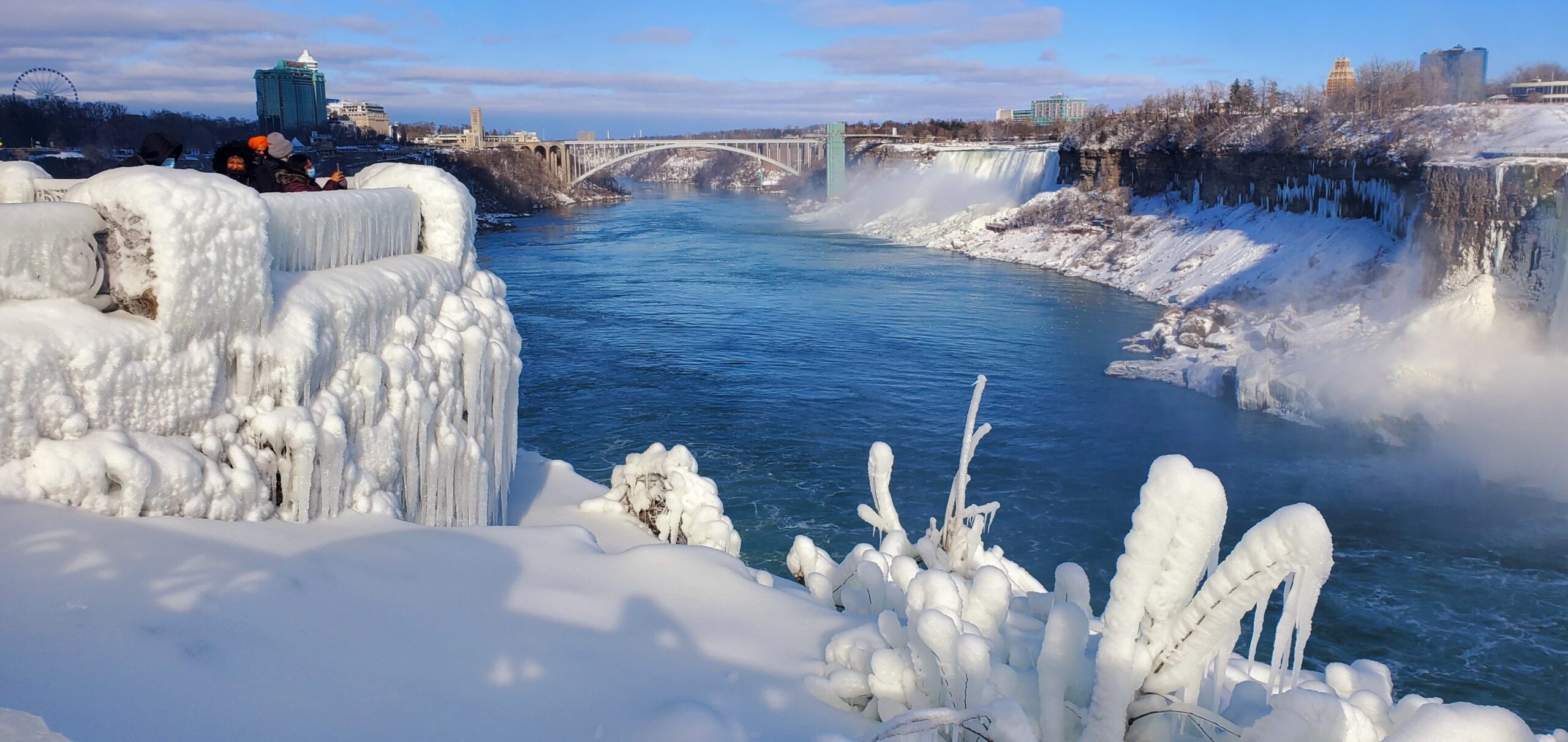
9:00 Niagara Falls International Hike
https://hikes.brucetrail.org/event/900-niagara-falls-international-hike/Sorry, the registration cut-off time for this hike has been reached.Not a member? Click here to join today!Hosting Club: Niagara
Category: Leisurely
Location (Google Maps): Meet at Dufferin Islands Nature Park parking lot, near the intersection of Burning Springs Hill and the Niagara Parkway. There is a parking fee. Parking passes recommended.Hike Leader(s): Dan Wilson Click here to contact Hike Leader(s)
Pace: Leisurely
Terrain: Easy
Distance: 15kmDescription
From Queen Victoria Park to Niagara Falls State Park and back again! We will start on the Canadian side, hike through Dufferin Islands, view the waterfalls of Niagara and then cross the Rainbow Bridge to see them all from the American side!You will need your passport and $1 to cross the Rainbow Bridge. You may also be required to present your vaccination status upon request at the border.
Old Mail Road, Kolapore
https://hikes.brucetrail.org/event/old-mail-road-kolapore-2/Sorry, the registration cut-off time for this hike has been reached.Not a member? Click here to join today!Hosting Club: Blue Mountains
Category: Register on-line or sign-in morning of hike
Location (Google Maps): Hike meets in the parking lot behind Tim Hortons on First St. in Collingwood.Hike Leader(s): Michelle Wacker Click here to contact Hike Leader(s)
Pace: Medium – 3 to 4 km/hr
Terrain: Moderate – Some hills and/or some poor footing
Distance: 10kmDescription
We will begin our hike at km19.1 on the 12th Sideroad in the Beaver Valley section. Hiking south through a deciduous woodlot, we arrive at a small piece of history. The Old Mail Road was a pioneer route into this area and was in use from the 1830’s until the 1850’s. Small parts of it still exist including a small section in this woodlot. The trail continues south to reach Grey Rd 19 and then travels through a BTC property to reach Grey Rd 2. Here, we will retrace our steps back to the cars. Bring water and lunch. Map 25 Edition 309:00 Cave Spring Witch Hunt
https://hikes.brucetrail.org/event/900-cave-spring-witch-hunt-6/Sorry, the registration cut-off time for this hike has been reached.Not a member? Click here to join today!Hosting Club: Niagara
Category: In and Out
Location (Google Maps):Parking lot Quarry Road Beamsville
Hike Leader(s): Bill Russell Click here to contact Hike Leader(s)
Pace: Leisurely
Terrain: Moderate
Distance: 6kDescription
Discover the history of the 19th Century Quarry Pioneers and the Cave Spring Witch.
Meditation Hike - Hungry Hollow
https://hikes.brucetrail.org/event/meditation-hike-hungry-hollow-3/Sorry, the registration cut-off time for this hike has been reached.Not a member? Click here to join today!Hosting Club: Iroquoia
Category: General Hike
Location (Google Maps): Trail begins on Miller Drive, Georgetown. Closest address is 121 Miller Drive, close to Miller Drive Park. Plenty of parking on the road.Hike Leader(s): Anita Bergsma Click here to contact Hike Leader(s)
Distance: 5.39 km
Description
Join me for a Guided Meditation Hike through Hungry Hollow Georgetown. It will be 5km at a slow to moderate pace on well groomed trails. The trails wind through the Hungry Hollow Ravine along Silver Creek. The trail is nestled in Georgetown and known for its beautiful nature, marshes, meadows, and ponds, with boardwalks, and bridges.Meet at 9:45am Sharp to get ready and hike in at 10:00am.Duration: 2.5 hoursAlso a great hike for those that would like to start hiking and looking for an introduction to how to hike.Please bring your phone with a full battery and earbuds to listen to the meditation. Download Spotify. The meditation will be for 1/2 hour with plenty of time to meet and chat with the other hikers for the duration of our hike together.Please wear hiking boots, backpack with water and snacks. Hiking poles are great for balance but optional.Urban Walk: Rosedale Ravines
https://hikes.brucetrail.org/event/urban-walk-rosedale-ravines/Sorry, the registration cut-off time for this hike has been reached.Not a member? Click here to join today!Hosting Club: Toronto
Category: Urban Walk
Location (Google Maps): Meet Pleasant Blvd Exit, St Clair Subway StationHike Leader(s): Tom Swales Click here to contact Hike Leader(s)
Pace: Moderate
Terrain: Variable
Distance: 10 kmDescription
Join us for a morning circular walk through David Balfour Park, Park Drive Reservation, the Evergreen Brickworks, Moore Park Ravine and Mount Pleasant Cemetery. On this walk we find nature close to the heart of the city. Effective icers (ice traction footwear) will be required.