Hike Schedule
Join us for a hike! Registration required.
All hikes available to BTC members. Some hikes are open to non-members.
See Refund Policy for Paid Hikes >
TIP: The calendar view displays up to 7 hikes on a day, but often there are more. Click “View more events” to see them all.
Categories
- 19March 19, 2023
9:00 Merritt Island
https://hikes.brucetrail.org/event/900-merritt-island-5/Sorry, the registration cut-off time for this hike has been reached.Not a member? Click here to join today!Hosting Club: Niagara
Category: Loop
Location (Google Maps):Parking Lot on Merritt Island at the west end of cross street Welland
Hike Leader(s): Sylvia Wheeler Click here to contact Hike Leader(s)
Pace: Medium
Terrain: Easy
Distance: 7kDescription
Flat hike along paved trail alongside the Welland Canal.

Urban Walk: Wayne's Beltline Trail Hike - Castle Frank Station modified to Glencairn Station
https://hikes.brucetrail.org/event/urban-walk-waynes-beltline-trail-hike-castle-frank-station-to-east-of-caledonia-road/Sorry, the registration cut-off time for this hike has been reached.Not a member? Click here to join today!Hosting Club: Toronto
Category: Urban Walk
Location (Google Maps): Meet outside Castle Frank Subway Station, Castle Frank Road Exit. If wanting to drive to the hike, park at the Evergreen Brickworks (550 Bayview Ave). Arrive by 10:15 am and wait by the washrooms. Please inform me by email if you are using this option.Hike Leader(s): Andrew Proczek; Michael Humpage Click here to contact Hike Leader(s)
Pace: Moderate
Terrain: Flat
Distance: 11.3 kmDescription
“Brisk morning walk from Castle Frank subway station to the end of the Beltline Trail, just west of Caledonia Road. Very warmish in the sun. Walked off without the water bottle I’d just filled. Not critical on a day like this but still would have been good to have it.“The start of the annual Moore Park Ravine Glacier. Bookended by the steeper Milkman’s Lane Glacier off Craigleigh Park. I am always impressed by the aesthetic sense shown by the city parks department when they put up fencing along the trails. Strong vibe of industrial waste zone.
“Someone is decorating the trees along the path from The Brickworks north to Moore Park Avenue. That would be most of the pictures I took as I’ve done the route a thousand times, give or take a few.” Wayne Crockett, December 12th, 2020.
Well, Wayne I have a little catching up to do. This will be my 2nd, so 998 more times to go, give or take a few. I chose this one of Wayne’s many urban hikes for this day to allow anyone wanting to attend the St. Pat’s Parade to be able to drop out at Oriole Park at 7 km, a short walk from Davisville Subway Station, and still be able to catch the parade which starts at 12 pm. Oriole Park will also be our lunch spot. Hikers will be able to walk over to the Tim Hortons across from the Subway. We will follow Wayne’s route except for a slight detour in Mount Pleasant Cemetery to visit the burial place of Glenn Gould and also the last resting spot of another valued and departed leader of our club, Jacqueline Holmes.
I will not be doing the final 2 plus Km of beltline past Allan Road but diverting north through Viewmount Park to Glencairn Station (Line 1).
The Route: https://onthegomap.com/s/8kt5jhve
I will inform if icers are needed. Washrooms at the Brickworks at 2 km, Tim Hortons (Yonge & Chaplin Cres.) at 7 km, and Larry Grossman Forest Hill Memorial Arena at 9 km. Please don’t follow Wayne’s example and forget your water bottle.
Drop out #1: 7 km Davisville Subway Station. Drop out #2: 9.6 km Bathurst St.
Migration Monitor Hike
https://hikes.brucetrail.org/event/migration-monitor-hike-4/Sorry, the registration cut-off time for this hike has been reached.Not a member? Click here to join today!Hosting Club: Peninsula
Location (Google Maps): Parking for all hikes start at km 109.7, 30th Ed Ref Manual. Park adjacent to Cape Chin Mail boxes on Cape Chin North Road
Hike1 (Mar 12, 26, Apr 9): Otter Lake/Cape Chin Loop – see details below
Hike 2 (Mar 19, Apr 2, Apr 16): Borchardt/Cotrill Lk Loop – see details belowHike Leader(s): Tamara Wilson Click here to contact Hike Leader(s)
Pace: Leisurely
Terrain: Difficult
Distance: Each hike ranges 10 to 12 kmDescription
Join us as we look for clues of spring’s arrival on Cape Chin North. We will alternate two routes on a weekly basis, watching for seasonal changes along the wetlands, small inland lakes, woodlands and escarpment shoreline. We will stop, look and listen for the arrival of plants and flowers, birds and other harbingers of spring. Hikes are weather dependent and will be cancelled for treacherous local driving conditions (mud), rain, snow or very strong winds. Always check the road and weather conditions for the entire length of your trip up as local weather can be quite different. Some hikes may recommend snow shoe hikes (I will let you know). Poles and crampons are recommended for navigating wet and slippery conditions typical of spring hikes. It is recommended to bring snacks and water for the hike. A dry set of socks and shoes is a good idea for the trip home. A sweep, topic experts – all are welcome!Alternating hikes:
Hike1 (Mar 12, 26, Apr 9): From km 109.7 parking, Otter Lk ST (2.2 km), up Cape Chin N Rd (past Tagwerk) to Cape Chin Meadow ST (1km) to Cape Chin Driveway (2.5 km) to house, North along MT back to parked vehicles (3.6 km ) – Total 9.3 km approx
Hike 2: (Mar 19, Apr 2, Apr 16) – From km 109.7 parking, MT North through Cape Chin Woods to Borchardt Parking (2.3 km), Minhinnik ST (1.7km) to Lillie Parking Lot, Take Cotrill Lk ST (1.4km) to Anne and Clayton Robert’s St (turn right) back to Britain Lk Rd (1km). At this point we will either a) follow Britain Lk Rd and reverse the route that we took (Minhinnik to Borchardt back along Borchardt to parking) – approx 12km OR b) if conditions are good, we will follow the Main Trail back along the escarpment to Borchardt PL and hike back to the vehicles along Borchardt.

Urban Walk: Waterfront Trail 8/8 - Port Union to Pickering!
https://hikes.brucetrail.org/event/urban-walk-waterfront-trail-8-8-beechgrove-to-pickering-2/Sorry, the registration cut-off time for this hike has been reached.Not a member? Click here to join today!Hosting Club: Toronto
Category: Urban Walk
Location (Google Maps):Scarborough/Durham Waterfront Trail
Hike Leader(s): Brian Rideout Click here to contact Hike Leader(s)
Pace: Moderate
Terrain: Flat
Distance: 11.9 kmDescription
Please meet me at Kennedy Station by 10:05 am. We will take the 86 Scarborough bus departing 10:19 am, arriving 10:54 am (includes a transfer to the 54 Lawrence East bus). We start hiking 11:00 am.Due to a trail closure the hike will start at Port Union. We will hike along the Waterfront Trail through Port Union and Rouge Hill to Pickering GO. The estimated distance is 9.8 km. Here is an online map of our route – Port Union to Pickering
Bring a snack, at least 2 liters of water, and icers. Dress for cold weather.
Harrison Park Ramble & Refreshments
https://hikes.brucetrail.org/event/harrison-park-ramble/Sorry, the registration cut-off time for this hike has been reached.Not a member? Click here to join today!Hosting Club: Sydenham
Category: General Hike
Location (Google Maps): Parking lot at Harrison Park, Owen Sound, in front of the Harrison Park Inn, north of km 96.7 (Map 32)Hike Leader(s): Maureen McFarland Click here to contact Hike Leader(s)
Pace: Leisurely: 3 km/h or less
Terrain: Easy: Mostly flat and good footing., There might be icy and slippery sections.
Distance: 2-3 kmsDescription
We will explore Harrison Park for an hour to an hour and a half. Where we go will depend upon the walking conditions. Snowshoes or icers may be needed. Check with the leader if you are unsure of what to bring. Refreshments afterwards at the Harrison Park Inn. Suitable for families and new hikers. Fun fact – The lands comprising Harrison Park were sold to the City of Owen Sound by the family of John Harrison after his death for $10,000 (half of which was paid by the Harrison family). The park was officially turned over to the city on July 7, 1912. For more informaion or if you are unable to register, please call or text the leader at 647-918-4180.2:00 pm Glenridge Quarry Loop
https://hikes.brucetrail.org/event/200-pm-glenridge-quarry-loop-3/Sorry, the registration cut-off time for this hike has been reached.Not a member? Click here to join today!Hike open to BTC Members only.
Hosting Club: Niagara
Category: Hike
Location (Google Maps): Glenridge Quarry Parking Lot, St. David’s Road, Map 3Hike Leader(s): Larry Lloyd Click here to contact Hike Leader(s)
Pace: Leisurely
Terrain: Easy
Distance: 5kDescription
Acombination of open trails with spectacular views across Lake Ontario and wooded trails including the main trail. - 20March 20, 2023
Car Hike: Toronto E2E 3/3
https://hikes.brucetrail.org/event/car-hike-toronto-e2e-3-3/Sorry, the registration cut-off time for this hike has been reached.Not a member? Click here to join today!Hike open to BTC Members only.
Hosting Club: Toronto
Category: Car Hike
Location (Google Maps): We will meet at km 48.3 (GPS N43.750866, W79.951452) at Boston Mills Rd. just west of the Mississauga Rd intersection.Hike Leader(s): Jacquie Van Dyke Click here to contact Hike Leader(s)
Pace: Brisk
Terrain: Rocky, Variable
Distance: 18 kmDescription
The third of three hikes to complete the Toronto E2E which includes a 4 km in/out due to parking in relation to where Toronto ends/Caledon begins. It’s badge day and hikers may wish to visit the Spirit Tree after the hike.It’s early spring so mud may abound! Be prepared with poles and gaitors. Hiking boots/shoes are mandatory. We’ll stop for snacks and lunch so bring 2L of water, snacks, and your lunch.
Be prepared to shuttle if you haven’t already had a turn.

9:30 Chloe Cooley Commemorative Hike
https://hikes.brucetrail.org/event/930-chloe-cooley-commemorative-hike/Sorry, the registration cut-off time for this hike has been reached.Not a member? Click here to join today!Hosting Club: Niagara
Category: In and Out
Location (Google Maps): Locust Grove Picnic Area, 14888 Niagara Parkway, Queenston, L0S 1L0Hike Leader(s): Karen Couch Click here to contact Hike Leader(s)
Pace: Medium
Terrain: Moderate
Distance: 7.4 kmsDescription
Chloe Cooley was a young Black enslaved woman whose brave act of resistance paved the way to freedom for so many like her, and set the stage for the great freedom movement of enslaved African Americans known as the Underground Railroad. We will hike to where her bravery took place, 14 MAR 1793. This will take us along the General Brock Side Trail (GBST) and on then on the Niagara Parkway (NP). The GBST’s terrain is hilly/moderate, whereas the NP is flat/easy. We will then retrace our steps back.For more information about Chloe Cooley click on the link below.
https://www.ctvnews.ca/lifestyle/canada-post-honours-chloe-cooley-with-stamp-for-black-history-month-1.6256243
- 21March 21, 2023
9:00 Long Hike Rockway
https://hikes.brucetrail.org/event/900-long-hike-wiley-road-short-hills-17/Sorry, the registration cut-off time for this hike has been reached.Not a member? Click here to join today!Hosting Club: Niagara
Location (Google Maps): Rockway
Hike Leader(s): Alan Laver Click here to contact Hike Leader(s)
Pace: Medium
Terrain: Moderate
Distance: 10kmDescription
Explore Rockway and Louth Conservation area Register for each hike
Bring Poles water, snack and Dress for the weather, Icers and layers/p>
9:15 Short hike - Rotary Park, St. Catharines
https://hikes.brucetrail.org/event/915-short-hike-rotary-park-st-catharines-3/Sorry, the registration cut-off time for this hike has been reached.Not a member? Click here to join today!Hosting Club: Niagara
Location (Google Maps): Rotary Park, St Catharines
Hike Leader(s): janet davey Click here to contact Hike Leader(s)
Pace: Medium
Terrain: Moderate
Distance: 6 kmsDescription
Hike the trails in Rotary Park. Bring hiking boots, water and icers.Old Baldy Climb
https://hikes.brucetrail.org/event/old-baldy-climb/Sorry, the registration cut-off time for this hike has been reached.Not a member? Click here to join today!Hosting Club: Beaver Valley
Location (Google Maps): Park at Km 46.8 Beaver Valley section on the east side of County Rd 13. (blue gates)
Map 26 Edition 30Hike Leader(s): Kristina Rettie Click here to contact the hike leader.
Pace: Brisk
Terrain: Some steep sections, Strenuous
Length of Hike: 6kmDescription
We will begin our hike with a 1.25km uphill challenge (heehee) Once all hikers have reached the top we will loop around the Mac Kirk Side Trail followed by a short out and back on the main trail. Then we retrace our steps back down the hill.Bring water and a snack
Please no dogs
Please text Kristina @ 519-410-9077 for morning of cancelations
COVID-19 Precautions Before, During and After your Hike
- Each hiker joining a Bruce Trail Club organized hike must perform a self-screening check before hiking.
Find Ontario’s self-assessment tool here: https://covid-19.ontario.ca/self-assessment/ - If you are experiencing COVID-19 symptoms, stay home.
- Personal Protective Equipment:
- Hikers may choose to wear masks
Transportation
It is the Bruce Trail Conservancy’s current policy that car shuttles are allowed. It is at the discrepancy of individual hike leaders to make that decision.
Other Guidelines
- Arrive 15 minutes before the start of the hike.
- Wear sturdy footwear and appropriate attire for the weather and the terrain.
Hiking poles are a good idea in any season, especially if the terrain is rocky or slippery. In winter, snowshoes or icers/crampons are needed when conditions dictate.
Wearing appropriate clothing and footwear prevents injuries and shows consideration for a safe and positive group hiking experience. - Always carry I.D. and your health card.
- Bring sufficient water and snacks (or lunch if indicated). A minimum of 1L of water is recommended on all hikes, and 3L is recommended for long, challenging hikes in the heat of the summer.
- Bring sunscreen and insect repellent (for spring and summer hikes).
- Bring your own first aid kit.
- Please leave dogs at home.
Halton Regional Forest
https://hikes.brucetrail.org/event/halton-regional-forest-5/Sorry, the registration cut-off time for this hike has been reached.Not a member? Click here to join today!Hosting Club: Caledon Hills
Category: Tuesday Hikers
Location (Google Maps): Parking at: 10 Side Road and 4th Line Nassagaweya (trail entrance to Halton Regional Forest).
From Highway 401 West, turn right (north) on Guelph Line, right on 10 Side Rd. it will bend northwards and become 4th Line Nassagaweya; park at the bend, roadside.Hike Leader(s): Mohammad Shafiq Click here to contact Hike Leader(s)
Pace: Medium – 3 to 4 km/hour
Terrain: Moderate – some hills and/or some poor footing
Distance: 13 kmDescription
Will hike trails in Halton Regional Forest and Hilton Falls Conservation Area, beautiful trails are relatively flat with some rocky parts. Snack break at Hilton Falls, possibly around fire pit. Will use different set of trails than last hike on Feb. 7th.
Bring water, snack and a warm drink.
Dress according to weather, icers are required, poles recommended.
Hike leader cell phone: 416-566-0503 (note that reception in hiking area is usually poor, leave messages to callback).
Check your email at 7:30 am, on the hike day, a message will be sent if there is change due to adverse weather or driving conditions.Humber Valley - 5 Sideroad to Glen Haffy Side Trail
https://hikes.brucetrail.org/event/humber-valley-5-sideroad-to-glen-haffy-side-trail/Sorry, the registration cut-off time for this hike has been reached.Not a member? Click here to join today!Hosting Club: Dufferin Hi-Land
Category: Tuesday Hike
Location (Google Maps): Caledon Hills Section, Map 18, Km 45.5
Meet at parking lot on 5 sideroad, east of Airport Rd, north of Hwy 9Hike Leader(s): Julie Daley, Les Babbage, Inge Eckerich, Tony Evangelista Click here to contact Hike Leader(s)
Pace: Leisurely, Medium
Terrain: Moderate, Slippery and Steep Sections
Distance: 7km, Short hike 3kmDescription
Hike will begin at the main parking lot on the north side of 5 Sideroad. We will hike the Main trail south to 7th Line (short hike will end here), continue south, then take the Glen Haffy Side Trail through the Humber Valley, ending at Mono-Adjala Townline. Cars will be shuttled to the end. Bring icers, snowshoes and/or poles, depending on the conditions. Bring snack. - Each hiker joining a Bruce Trail Club organized hike must perform a self-screening check before hiking.
- 22March 22, 2023
Devilish Madness at Glen Huron
https://hikes.brucetrail.org/event/devilish-madness-at-glen-huron-2/Sorry, the registration cut-off time for this hike has been reached.Not a member? Click here to join today!Hosting Club: Blue Mountains
Category: Register on-line or sign-in morning of hike
Location (Google Maps): Hike meets in the parking lot behind Tim Hortons on First St. in Collingwood.Hike Leader(s): Sandy McNair Click here to contact Hike Leader(s)
Pace: Brisk – 4 to 5 km/hr, Medium – 3 to 4 km/hr
Terrain: Moderate – Some hills and/or some poor footing, Strenuous – Hilly with steep climbs and some poor footing
Distance: 11kmDescription
Starting at Glen Huron the trail will immediately climb the escarpment, taking us through a variety of mixed forests to the edge of the Devil’s Glen Provincial Park. We will then encounter multiple switchbacks to descend to the Mad River Side Trail where we will enjoy seeing this river grow as we travel along the river bank to return to our cars. Bring a snack or lunch and water.Rocklyn Creek out and back
https://hikes.brucetrail.org/event/rocklyn-creek-out-and-back/Sorry, the registration cut-off time for this hike has been reached.Not a member? Click here to join today!Hosting Club: Sydenham
Category: General Hike
Location (Google Maps): Roadside parking at the east end of Deviation Road, where the Bruce trail crosses the road, just south of the T- intersection with Euphrasia St Vincent townline, at km 3.1 (Map 28)Hike Leader(s): Fran Turner Click here to contact Hike Leader(s)
Pace: Brisk: 4 to 5 km/h
Terrain: Strenuous: Hilly with steep climbs and some poor footing.
Distance: 8.6 kmDescription
Start spring off right with this pretty hike through the Rocklyn Creek valley. There are many attractive features on this hike, including a boardwalk over the creek, old growth trees, many intriguing crevices, cascading rapids and scenic views to the north. There are several steep inclines and there may be residual ice at this time of year. I will pre-hike this segment just prior to the hike date and will contact the hikers with recommendations re: footwear and need for crampons, etc. If you are unable to register, please call or text the leader at 519-590-0706.
10 am Lock 8 Gateway Park
https://hikes.brucetrail.org/event/10-am-louth-conservation-area/Sorry, the registration cut-off time for this hike has been reached.Not a member? Click here to join today!Hosting Club: Niagara
Category: Loop
Location (Google Maps): Lock 8 Gateway ParkHike Leader(s): Alicia Aitchison Click here to contact Hike Leader(s)
Pace: Medium
Terrain: Easy
Distance: ~ 6 kmDescription
Today is the 2023 opening day for the Welland Canal!We will meet at Lock 8 Gateway Park & walk south along the Canal & down West Street. Hopefully we will get lucky & see some ships going through the canal & while walking through West Street there will be the opportunity to stop at one of the bakery’s for a treat or beverage along the way.
Registration required.
Good Companions - Gage Park/Escarpment Loop
https://hikes.brucetrail.org/event/good-companions-gage-park-escarpment-loop-4/Sorry, the registration cut-off time for this hike has been reached.Not a member? Click here to join today!Hosting Club: Iroquoia
Category: Good Companions
Location (Google Maps):Gage Park parking lot in the south end of the park off of Lawrence Road in Hamilton
Hike Leader(s): Ted Bossence Click here to contact Hike Leader(s)
Pace: Medium – 3 to 4 km/hr
Terrain: Dependent on Conditions, Moderate – Some hills and/or some poor footing
Distance: 9 kmDescription
Following city streets, the rail trail and Kenilworth stairs we will do a loop returning to Gage Park. Bring icers, a snack and water. Dependent on weather the rail trail may be icy making icers possibly essential. Please arrive a few minutes before start time, we will leave on time. If the hike is cancelled due to bad weather, I will inform you by email on the evening before the hike.If you decide to cancel after 4:00pm Tuesday, please let me know by email – tedbossence@sympatico.ca or by text at 905 334-8752.
11:00 am Hike & Picnic
https://hikes.brucetrail.org/event/1100-am-hike-picnic-8/Sorry, the registration cut-off time for this hike has been reached.Not a member? Click here to join today!Hosting Club: Niagara
Category: Loop
Location (Google Maps):Locust Grove Picnic Area
Hike Leader(s): Marion Hanover Click here to contact Hike Leader(s)
Pace: Medium
Terrain: Moderate
Distance: 7 kmDescription
Hike around Queenston area. Optional outdoor gathering in Locust Grove including pot luck picnic. - 23March 23, 2023
Car Hike: Caledon End-to-End 2/4
https://hikes.brucetrail.org/event/car-hije-caledon-end-to-end-2-4/Sorry, the registration cut-off time for this hike has been reached.Not a member? Click here to join today!Hike open to BTC Members only.
Hosting Club: Toronto
Category: Car Hike
Location (Google Maps): We’ll meet at km 35.2 (GPS N43.937967, W.79.934650) on Coolihans Sideroad, east of where the Trail crosses the road.Hike Leader(s): Jacqueline Van Dyke Click here to contact Hike Leader(s)
Pace: Brisk
Terrain: Hilly, Variable
Distance: 19kmDescription
Today there will be a lot of road walking with terrific south facing views. For those interested in topography, we will be climbing the slope of the Paris Moraine and also following the Caledon Meltwater Discharge Channel, a significant post-glacial feature.Keep an eye on the weather, dress accordingly, and bring carry icers in your pack as you never know when you’ll need them.
Please bring enough food and drink to last the entire hike. We’ll be stopping for a morning snack and lunch.
We will be shuttling to our starting point, so please be prepared to be a shuttle driver.
9:00 am Long Hike Jordan to Moyer / Louth
https://hikes.brucetrail.org/event/900-am-long-hike-jordan-to-moyer-louth-42/Sorry, the registration cut-off time for this hike has been reached.Not a member? Click here to join today!Hosting Club: Niagara
Location (Google Maps):
Jordan Hollow Park 3039 King St Jordan
Pace: Medium
Terrain: Moderate
: 10kDescription
From Jordan Hollow Hike the main trail to Upper and Lower Balls Falls, Moyer Road or Louth and Return. You must register for each hike. Bring Poles, snack and a drink ices and dress for the weather
9:15 Short hike - Jordan Hollow
https://hikes.brucetrail.org/event/915-short-hike-jordan-hollow-49/Sorry, the registration cut-off time for this hike has been reached.Not a member? Click here to join today!Hosting Club: Niagara
Location (Google Maps): Jordan Hollow Park
Hike Leader(s): Bill Russell Click here to contact Hike Leader(s)
Pace: Medium
Terrain: Strenuous
Distance: 6 kmsDescription
Hike the main trail and side trails around Jordan and Balls Falls. Bring hiking boots, icers and water.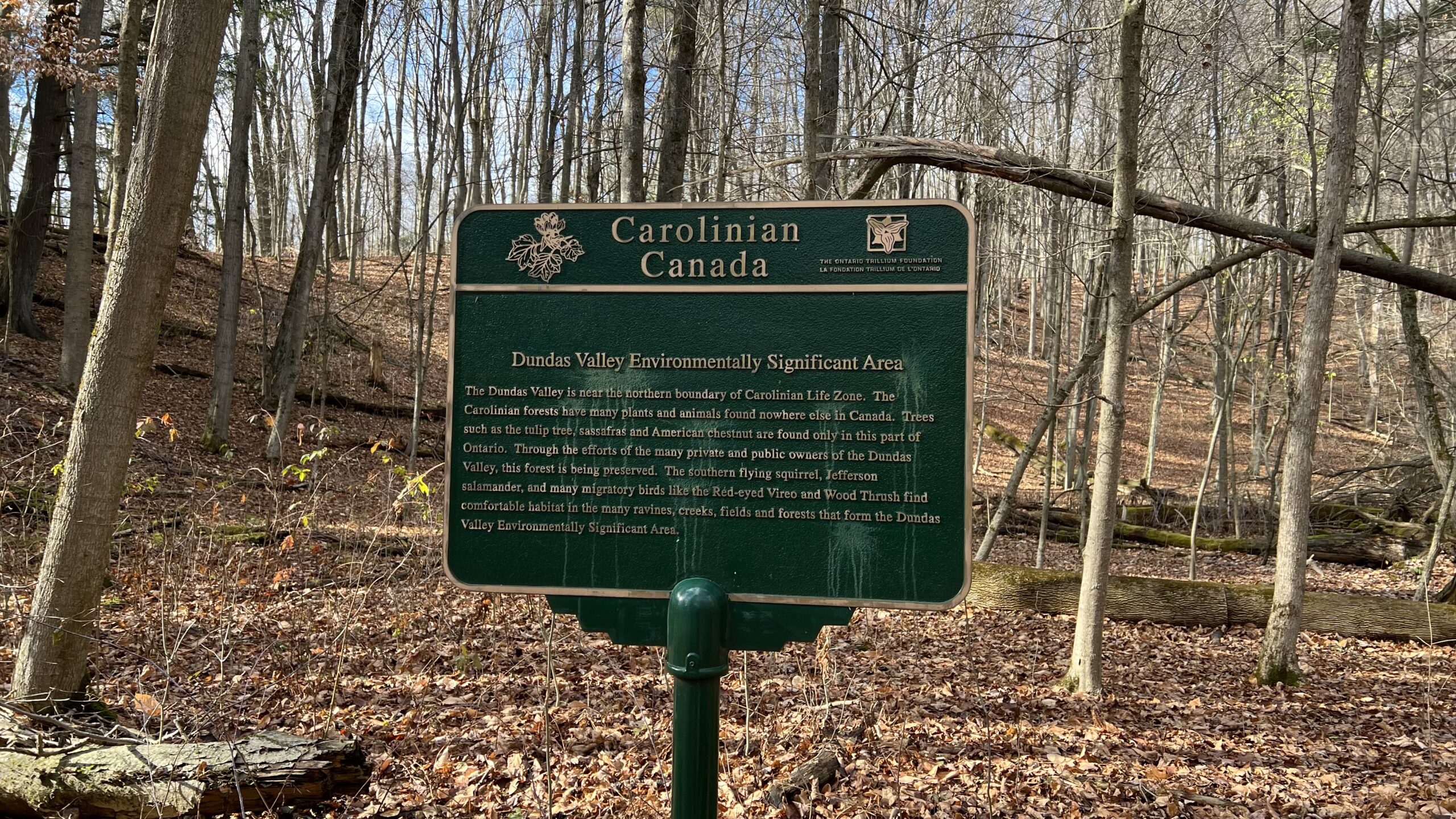
To the Falls and Back CANCELLED DUE TO RAIN
https://hikes.brucetrail.org/event/to-the-falls-and-back-5/Sorry, the registration cut-off time for this hike has been reached.Not a member? Click here to join today!Hosting Club: Iroquoia
Category: Thursday Group
Location (Google Maps): Dundas Valley Conservation Area, 650 Governor’s Rd. , DundasHike Leader(s): Phillip Armstrong Click here to contact Hike Leader(s)
Pace: Leisurely – 3km/hr or less, Medium – 3 to 4 km/hr
Terrain: Moderate – Some hills and/or some poor footing
Distance: 10 km.Description
Spring is a good time to see the waterfalls in Dundas Valley Conservation Area. Today we will hike a loop to Sherman Falls also seeing Grindstone Creek and Canterbury and Little Canterbury Falls along the way. Be prepared for some hills. Please note that there will be two levels of pace: medium and leisurely. Please arrive in the main parking lot at the the Governor’s Rd. entrance at 9:45 for a 10:00 am start. Bring water, a snack/ lunch, icers and poles if using. Parking fee in effect or a Conservation Area pass.
Leaders: Phill Armstrong/Anne Armstrong 416 895 3937 hikingrandpa@gmail.com - 24March 24, 2023
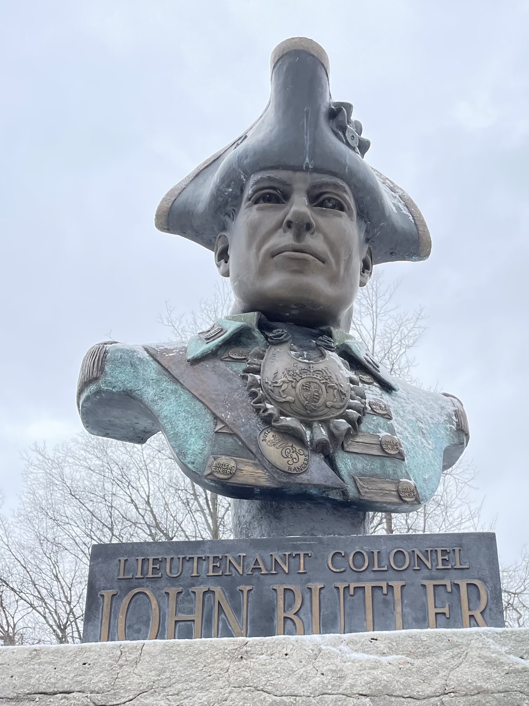
9:00 John Who?
https://hikes.brucetrail.org/event/9john-who/Sorry, the registration cut-off time for this hike has been reached.Not a member? Click here to join today!Hosting Club: Niagara
Category: Urban
Location (Google Maps): Park on King St near Centre St – at the entrance to the Veteran’s Memorial Park, Niagara-on-the-LakeHike Leader(s): Margaret Northfield Click here to contact Hike Leader(s)
Pace: Medium
Terrain: Easy
Distance: 6-7kmDescription
Living in NOTL you see so many Butlers – Butler’s Barracks, Butler St, Butler Homestead, Butler’s Bar & Grill… Just who is Butler. Colonel John Butler was from Connecticut but made many contributions to the founding of Upper Canada. We will explore his life while walking around the town as he once did. - 25March 25, 2023
Car Hike: Bethesda Trail Richmond Hill
https://hikes.brucetrail.org/event/car-hike-bethesda-trail-richmond-hill-7/Sorry, the registration cut-off time for this hike has been reached.Not a member? Click here to join today!Hosting Club: Toronto
Location (Google Maps): Oak Ridges Trail head Bethesda parking
Hike Leader(s): Mohammad Aghamiri Click here to contact Hike Leader(s)
Pace: Brisk
Terrain: Hilly, Variable
Distance: 14-15KMDescription
We will explore Oak Ridges Corridor in Richmond Hill, Hike around Bond lake .To reach there turn right to Bethesda side road from Bayview Ave. Then drive around 500 meter and park in Oak Ridges trail head parking.
It is winter time please bring your icers, hiking poles, proper closing and shoes and hot drinks,
Please carefully read safety procedures during the hike:
1-Hikers must stay between the leader and the sweep.
2-Hikers must advise the leader or the sweep if they wish to leave the group.
3- Hikers must follow the whistle instructions: 1 blast- stay where you are; 2 blasts come to the leader; 3 blasts – come to the leader quickly.
4-Hike leader may request volunteers to stop at trail intersections, they need to help hikers to the direction the group walk and wait till they see the sweep .
5-Hikers have to make sure they can see the persons behind and in front of them.
8:45 Niagara Ball’s Falls
https://hikes.brucetrail.org/event/845-niagara-balls-falls/Sorry, the registration cut-off time for this hike has been reached.Not a member? Click here to join today!Hike open to BTC Members only.
Hosting Club: Niagara
Category: Car Pool
Location (Google Maps): Meet at Glen Road Km 56.6. Coordinates N 43.139159,W 79.373912Hike Leader(s): Mojgan haghighat Click here to contact Hike Leader(s)
Pace: Medium
Terrain: Moderate
Distance: 13.2 KmDescription
We will meet at Km 56.6 and will shuttle to Kinsman Park km 69.8. We will walk on top of the escarpment for a while. We will get to Ball’s Falls where we can enjoy the falls and if time allows we can walk around the buildings.We will follow the rules of Covid 19. Bring Icers and two litres of water.
9:00 Hiking in and around Port Weller West
https://hikes.brucetrail.org/event/900-hiking-in-and-around-port-weller-west/Sorry, the registration cut-off time for this hike has been reached.Not a member? Click here to join today!Hosting Club: Niagara
Category: Hike
Location (Google Maps): Port Weller in North St. Catharines
Granthamn Lions Club, corner of Niagara and Lakeshore, St. CatharinesHike Leader(s): Sheila Massey Click here to contact Hike Leader(s)
Pace: Medium
Terrain: Moderate
Distance: Approximately 9 kmDescription
Hiking through Malcolmson Eco Park, along Sunset Beach and Walker’s Creek.CANCELLED - McCluskey's Rock
https://hikes.brucetrail.org/event/mccluskeys-rock-5/Sorry, the registration cut-off time for this hike has been reached.Not a member? Click here to join today!Hosting Club: Blue Mountains
Category: Cancelled
Location (Google Maps): Hike meets in the parking lot behind Tim Hortons on First St. in Collingwood.Hike Leader(s): Annette Sandberg Click here to contact Hike Leader(s)
Pace: Medium – 3 to 4 km/hr
Terrain: Moderate – Some hills and/or some poor footing
Distance: 8kmDescription
We will park on Sideroad 7B at km 43.5 in the Beaver Valley section. The in/out hike proceeds north on the white blazed trail which winds along the top of the escarpment before descending through a crack to the bottom. We then climb to the top again before descending once more to km 39.3. We get to enjoy it all over again as we retrace our steps back to the cars. Bring water and a snack.
Meditation Hike - Hungry Hollow
https://hikes.brucetrail.org/event/meditation-hike-hungry-hollow-2/Sorry, the registration cut-off time for this hike has been reached.Not a member? Click here to join today!Hosting Club: Iroquoia
Category: General Hike
Location (Google Maps):Trail begins on Miller Drive, Georgetown. Closest address is 124 Miller Drive. Plenty of parking on the road.
Hike Leader(s): Anita Bergsma Click here to contact Hike Leader(s)
Pace: Medium – 3 to 4 km/hr
Terrain: Easy – Mostly flat and usually good footing
Distance: 5 kmDescription
Join me for a Guided Meditation Hike through Hungry Hollow Georgetown. It will be 5km at a slow to moderate pace on well groomed trails. The trails wind through the Hungry Hollow Ravine along Silver Creek. The trail is nestled in Georgetown and known for its beautiful nature, marshes, meadows, and ponds, with boardwalks, and bridges.Meet at 9:45am Sharp to get ready and hike in at 10:00am.Duration: 2 hoursAlso a great hike for those that would like to start hiking and looking for an introduction to how to hike.Please bring your phone with a full battery and earbuds to listen to the meditation. Download Spotify. The meditation will be for 1/2 hour with plenty of time to meet and chat with the other hikers for the duration of our hike together.Please wear hiking boots, backpack with water and snacks. Hiking poles are great for balance but optional.Urban Walk: Don Mills Trails
https://hikes.brucetrail.org/event/urban-walk-don-mills-trails/Sorry, the registration cut-off time for this hike has been reached.Not a member? Click here to join today!Hosting Club: Toronto
Category: Urban Walk
Location (Google Maps): Meet in front of Civic Garden Centre, near Northwest corner of Leslie Street and Lawrence Avenue East. Due to a popular event at the Centre taking public transit is strongly recommended. Parking/Drop Off may be limited.Hike Leader(s): Tom Swales, Mehrnoush Ahmadi Click here to contact Hike Leader(s)
Pace: Moderate
Terrain: Hilly, Variable
Distance: 12 kmDescription
We’ll hike on the Leaside Spur Rail Trail, through Moccasin Trail Park, pass through the “Rainbow Bridge”, south to Wynford Drive, through Aga Khan Park, through the grounds of the Ontario Science Centre, north under Eglinton to Serena Gundy Park ending at Brentcliffe & Eglinton Ave East. Optional pub stop at Cork’s Beer & Wine Bar in Leaside. Bring icers (mandatory), lunch/snacks and water. There will be a couple of hills.