
Hike Schedule
Join us for a hike! Registration required.
All hikes available to BTC members. Some hikes are open to non-members.
See Refund Policy for Paid Hikes >
TIP: The calendar view displays up to 7 hikes on a day, but often there are more. Click “View more events” to see them all.
Categories
- 01November 1, 2026
Car Hike: Niagara E2E- 1 of 4
https://hikes.brucetrail.org/event/car-hike-niagara-e2e-1-of-4/Hike open to BTC Members only.
Registration Required:
Click here to register for this hike (5 spots remaining)Hosting Club: Toronto
Category: Car Hike
Location (Google Maps): We will meet at the Grimsby pool, coordinates N 43.193201,W 79.565301 Elm street. Map # 5Hike Leader(s): Smadar Junkin Click here to contact Hike Leader(s)
Pace: Brisk (4-5 km/hr)
Terrain: Hilly, Level 3 (Advanced – steep hills and some scrambling over boulders), Variable
Distance (km): 15.5 kmDescription
Welcome to Niagara E2E in 4. We will shuttle to the Margaret Reed side trail and after the short walk on the side trail we will hike back to the Grimsby pool. About 15.5 kms and 2 short side trails.
make sure to dress in layers, bring 2 litres of water, lunch, snack.
everyone is expected to participate in the car shuttle one or twice during the 4 days hike.
please be 15 minutes early so we can be in the shuttle cars and move by 8:30.if you have any questions please email me on my personal email smadarjunkin@hotmail.com
- 01November 1, 2026
Urban Dog-Friendly Walks & Hikes In Toronto
https://hikes.brucetrail.org/event/urban-dog-friendly-walks-hikes-in-toronto/This is a Multi-Day Hike
You are signing up for the following dates:
2026-11-01, 2026-11-08, 2026-11-15, 2026-11-22, 2026-11-29
Registration Required:
Click here to register for this hike (10 spots remaining)Hosting Club: Toronto
Category: Car Hike
Location (Google Maps): In Toronto Parks & Ravines. The location will be shared with registered hikers or contact the Hike Leader to InquireHike Leader(s): Lindita Kalo Click here to contact Hike Leader(s)
Pace: Moderate (3-4 km/hr)
Terrain: Level 2 (Intermediate – some hills and uneven surfaces, rocks and roots underfoot), Variable
Distance (km): 10-15kmDescription
Urban Dog-Friendly Walks & Hikes
Let’s meet and enjoy the outdoors with our best friends, our dogs!
This series of Toronto Urban Walks and hikes will feature a different location every Sunday. Each walk or hike will last approximately 2 to 4 hours and will follow either an out-and-back route or a loop.
Information about each location will be sent to registered participants on a weekly basis.
I have a 3-year-old Australian Shepherd who is friendly with both people and other dogs. I look forward to seeing you and your furry companions on our walks and hikes! Lindita. - 01November 1, 2026
Plalking: Caledon Trailway
https://hikes.brucetrail.org/event/plalking-caledon-trailway-2/
Registration Required:
Click here to register for this hike (10 spots remaining)Hosting Club: Caledon Hills
Category: General
Location (Google Maps): Meet at the Caledon East Community Complex parking lot. We’ll meet at the west end of the parking lot, close to the library branch within the complex. There are washrooms inside if needed before or after the event. Please aim to arrive around 9:50 am, so we can start plalking as close to 10:00 am as possible. Thanks!Hike Leader(s): Elizabeth Ganong Click here to contact Hike Leader(s)
Pace: Leisurely – 3 km/hour or less
Terrain: Easy – mostly flat and usually good footing
Distance: 3 to 4 kmDescription
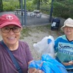
CHBTC and ecoCaledon invite you to come plalking! We’ll walk, chat, and pick up litter as we do a there-and-back route west along the Caledon Trailway. Gloves, bags, and grabbers are provided for participants’ use. A hat, long sleeves and pants, and insect repellent are recommended. An optional stop at a local eatery will follow. Registrants can expect a reminder/update message one or two days before the event. This is a BTC Passport to Nature event. - 02November 2, 2026
Dufferin Hi-Land Blues #4
https://hikes.brucetrail.org/event/dufferin-highland-blues-4/
REGISTRATION FULL: This hike has reached the maximum number of hikers.
Click here to be added to the Wait List.Hosting Club: Iroquoia, Dufferin Hi-Land
Category: General Hike
Location (Google Maps): Bruce Trail parking: 2nd Line EHS at the beginning of the Splitrock Side TrailHike Leader(s): Pati Greenwood, Jeff Dowsett Click here to contact Hike Leader(s)
Pace: Medium – 3 to 4 km/hr
Terrain: Moderate – Some hills and/or some poor footing, Strenuous – Hilly with steep climbs and some poor footing
Distance: 14 KMDescription
This is a series of five hikes in the Dufferin Hi-Land section of the Bruce Trail to complete all blue-blazed trails in the section. Hikers finishing all hikes in the series will be eligible to obtain the Dufferin Hi-Land Club’s Side Trails Badge. All hikes in the series will be loops including sections of the main trail and the entirety of several side trails.This fourth hike of the series will include completing the following side trails: Splitrock, Ralph Tremills, Narrows, 2nd Line EHS, Walter Tovell (north of Carriage), Lookout, & McCarsten’s Lake.
The trail will include steep and rocky sections, please wear appropriate footwear for the terrain; hiking boots or shoes. Hiking poles are recommended. Insects are not as active at this time of year; even so, come prepared by wearing long pants and long sleeves; bring insect repellent/bug nets as needed. Weather conditions can also be changeable so dress in layers, as needed. Bring plenty to drink and a snack/lunch.
Please arrive at the meeting place by 8:15 am for an 8:30 am departure.
- 02November 2, 2026
Car Hike: Niagara E2E, 2 of 4
https://hikes.brucetrail.org/event/car-hike-niagara-e2e-2-of-4/Hike open to BTC Members only.
Registration Required:
Click here to register for this hike (9 spots remaining)Hosting Club: Toronto
Category: Car Hike
Location (Google Maps): Roland Rd. South of km 42.3 coordinates N 43.090278,W 79.305073 map # 3Hike Leader(s): Smadar Junkin Click here to contact Hike Leader(s)
Pace: Brisk (4-5 km/hr)
Terrain: Hilly, Level 3 (Advanced – steep hills and some scrambling over boulders), Variable
Distance (km): 24.5 kms.Description
This hike is much longer then the first one, please be prepared for a longer hike with water, food and layering.
see all the details on hike #1. - 02November 2, 2026
Bent Rim 2 Loop
https://hikes.brucetrail.org/event/bent-rim-2-loop/
Registration Required:
Click here to register for this hike (10 spots remaining)Hosting Club: Iroquoia
Category: General Hike
Location (Google Maps): Meet in the small parking lot at 10050 6th Line.Hike Leader(s): Karen Bergmann Click here to contact Hike Leader(s)
Pace: Medium – 3 to 4 km/hr
Terrain: Moderate – Some hills and/or some poor footing
Distance: 9 kmsDescription
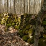
We will hike the Bent Rim 2 bike trail and back through the Halton Forest. Meet at 9:15 (earlier if possible) in the small parking lot at 10050 6th Line, about 3 kms north of Campbellville Rd. - 03November 3, 2026
Car Hike: Niagara E2E 3 of 4 hikes.
https://hikes.brucetrail.org/event/car-hike-niagara-e2e-3-of-4-hikes/Hike open to BTC Members only.
Registration Required:
Click here to register for this hike (7 spots remaining)Hosting Club: Toronto
Category: Car Hike
Location (Google Maps): Roland Rd. South of km 42.3 coordinates N 43.090278,W 79.305073 map # 3Hike Leader(s): Smadar Junkin Click here to contact Hike Leader(s)
Pace: Brisk (4-5 km/hr)
Terrain: Hilly, Level 3 (Advanced – steep hills and some scrambling over boulders), Variable
Distance (km): 24.5 kmDescription
We will shuttle to km 18.5 and walk back. About 24.5 kms.
please see details in day 1 hike. - 03November 3, 2026
Urban Walk: Valley View Park
https://hikes.brucetrail.org/event/urban-walk-valley-view-park-13/
Registration Required:
Click here to register for this hike (12 spots remaining)Hosting Club: Toronto
Location (Google Maps): Parking lot is off Sycamore Drive, East of Bayview , across Starbucks plaza
Bus 91 from Finch East station stops at Sycamore station.Hike Leader(s): MOHAMMAD AGHAMIRI Click here to contact Hike Leader(s)
Pace: Moderate (3-4 km/hr)
Terrain: Hilly, Level 2 (Intermediate – some hills and uneven surfaces, rocks and roots underfoot)
Distance (km): 7-8 kmDescription
We will explore Valleyview and Maple View parks, and walk along German Mills Creek, in return we stop in Huntington park and have snack ,coffee,tea .Although this is considered an “Urban Walk”, you can expect some hills up and down and uneven surfaces with tree roots. Please bring hiking poles, water and snacks.
phone number for the day of hike 289 588 6482
- 03November 3, 2026
Split Rock/Walter Tovell/Lookout Side Trails
https://hikes.brucetrail.org/event/split-rock-walter-tovell-lookout-side-trails/
Registration Required:
Click here to register for this hike (25 spots remaining)Hosting Club: Dufferin Hi-Land
Category: Tuesday Hike
Location (Google Maps):Dufferin Hi-Land Section, Map 19. Meet at Split Rock parking lot on 2nd line EHS about 1.5 km north of 25 Sideroad
Hike Leader(s): Inge Eckerich, Julie Daley, Tony Evangelista Les Babbage Click here to contact Hike Leader(s)
Pace: Leisurely
Terrain: Moderate
Distance: Long hike 6 km, Short hike 3.7 kmDescription
Today’s hike will include the Split Rock, 2nd Line EHS Walter Tovell and Lookout Side Trails,short hike will only do Split Rock loop - 04November 4, 2026
Car Hike: Niagara E2E - 4 of 4
https://hikes.brucetrail.org/event/car-hike-niagara-e2e-4-of-4/Hike open to BTC Members only.
Registration Required:
Click here to register for this hike (7 spots remaining)Hosting Club: Toronto
Category: Car Hike
Location (Google Maps): We will meet at Queenstone Heights in a small parking lot across from the official parking to avoid paying for parking. I’ll give the address to the hikers during the first 3 days of the hike at some point. Map 1Hike Leader(s): Smadar Junkin Click here to contact Hike Leader(s)
Pace: Brisk (4-5 km/hr)
Terrain: Hilly, Level 3 (Advanced – steep hills and some scrambling over boulders), Variable
Distance (km): 18.5Description
badge day! We will shuttle to km 18.5 and walk to the south cairn for badges, pictures and treats.
please see details on day 1