
Join us for a hike! Registration required:
All hikes available to BTC members. Some hikes are open to non-members.
TIP: The calendar view displays up to 7 hikes on a day, but often there are more. Click “More events” to see them all.
Toronto Hike Schedule
Toronto Bruce Trail Club Registration Live Dates
Day Winter Coach Program
Registration begins two weeks in advance of the event departure (at 8:00 PM)
Day Bus Hikes
Registration begins two weeks in advance of the event departure (at 8:00 PM) with some exceptions of special event hikes
Day Coach Hikes
Registration begins 7 weeks in advance of the event departure
Day Car Hikes and Urban Hikes
Registration begins two weeks in advance of the event departure
Overnight and Weekend Trips
Registration begins 12 weeks in advance of the event departure
To view all Bruce Trail Conservancy Hikes click here
- 06September 6, 2026
Car Hike: Uxbridge-Brock Track
https://hikes.brucetrail.org/event/car-hike-uxbridge-brock-track-9/Sorry, the registration cut-off time for this hike has been reached.Not a member? Click here to join today!Hosting Club: Toronto
Category: Car Hike
Location (Google Maps):Meet at the Brock Tract parking lot on the east side of Durham 1/Brock Rd., approximately 5 km south of Coppin’s Corners, Uxbridge or 1 km north of Uxbridge Pickering Town Line. 1401 Brock Rd. (Free parking).
Hike Leader(s): Amir Alemohammad Click here to contact Hike Leader(s)
Pace: Moderate (3-4 km/hr)
Terrain: Flat, Hilly, Level 2 (Intermediate – some hills and uneven surfaces, rocks and roots underfoot), Variable
Distance (km): 14-16 kmDescription
Join us for a wonderful hike in Uxbridge starting from Brock Track parking lot. We will hike the Brock Track and Wilder Forest among the amazing trails of Uxbridge.Boots mandatory, poles recommended, bring 2 litres of water and dress according to weather conditions.
Please arrive at 7:45 for a 8:00 start.
Beware, Iphone Maps may take you to the wrong location. Check the location with Google Maps the previous night.
This is a joint hike with Oak Ridges Trail Association (ORTA).
Tobermory, 2 of 3, Map 42
https://hikes.brucetrail.org/event/tobermory-2-of-3-map-41-42/Sorry, the registration cut-off time for this hike has been reached.Not a member? Click here to join today!Hosting Club: Toronto, Peninsula
Category: Car Hike
Location (Google Maps): Bruce Peninsula National ParkHike Leader(s): Alex Brown Click here to contact Hike Leader(s)
Pace: Mixed (See Hike Description)
Terrain: Level 2 (Intermediate – some hills and uneven surfaces, rocks and roots underfoot), Rocky, Variable
Distance (km): 14-15 kmDescription
This is the second of three hikes in this series. We will hike from the Bruce Peninsula National Park along Georgian Bay, north to Little Cove . Excellent views of the Bay.The meeting point will be the Cairn in Tobermory marking the northern terminus of the Bruce Trail or as agreed the previous day. We will then drive to the parking area at Little Cove Road (km 156.4) or National Park to drop off cars and start the hike.
Parking fees will apply. More information to be provided closer to the date.
Trail conditions are rocky which will make progress slow at times.
For those coming long distance, local accommodation should be available in Tobermory. More information about the hike will be posted closer to the date.
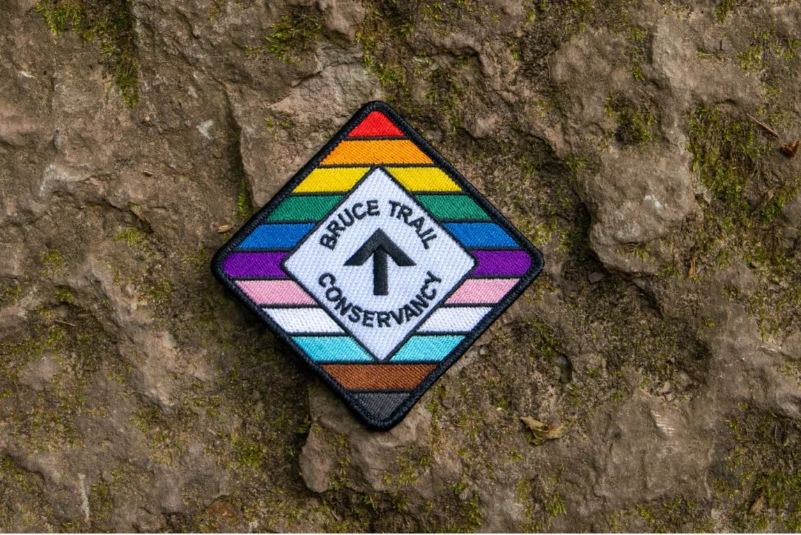
RAINBOW HIKE🌈: Trekking through Terra Cotta
https://hikes.brucetrail.org/event/rainbow-hike%f0%9f%8c%88-trekking-through-terra-cotta/Sorry, the registration cut-off time for this hike has been reached.Not a member? Click here to join today!Hosting Club: Toronto
Category: Car Hike
Location (Google Maps): We will meet at the roadside parking on Heritage Road (coordinates are 43.734079, -79.944033).Hike Leader(s): Monica Pasquali (she/her) Click here to contact Hike Leader(s)
Pace: Leisurely (2-3 km/hr), Moderate (3-4 km/hr)
Terrain: Level 1 (Easy – mostly on flat, well maintained trails with hard-packed surface), Level 2 (Intermediate – some hills and uneven surfaces, rocks and roots underfoot), Level 3 (Advanced – steep hills and some scrambling over boulders)
Distance (km): 10 kmDescription
This hike is part of our Rainbow Hike program🌈, which aims to foster connection, visibility, and community among 2SLGBTQIA+ hikers and allies. We’ll be joined by Doug O’Neill, who leads Rainbow Hikes with the Iroquoia Bruce Trail Club, and Lana Hubbard, a transgender hike leader with the Caledon Bruce Trail Club.After everyone checks in with me at the meeting location we’ll do a 10 km loop hike using the main trail and the Terra Cotta Side Trail. Most of our route will be level 2/intermediate difficulty but there will be one large hill to conquer as we summit the escarpment on the main trail (level 3/advanced) as well as a fairly long flat section along the Terra Cotta Side Trail (level 1/easy) so this hike has a bit of everything! Any fit Rainbow Hiker is welcome to join us.
Everyone who participates in this hike will receive a FREE Bruce Trail Pride Badge!
Please bring at least 2 litres of water and enough food for a 4-hour hike. You should wear comfortable hiking shoes and socks, a hat, a breathable shirt, and lightweight long pants (to minimize the risk of a tick bite). If rain is in the forecast then a rain jacket would also be a great idea. Sunblock and bug repellent are also useful if it’s a sunny and buggy day.
After the hike, anyone who is interested in joining me for lunch and drinks (both alcoholic and non-alcoholic options will be available) at nearby Badlands Brewing Company (https://www.badlandsbrewing.ca/) is more than welcome to do so. And if you don’t want to purchase your lunch then no worries — we’ll be eating at picnic tables in their outdoor Beer Garden so you can bring your lunch and still enjoy the good company and great conversation.
Looking forward to hiking with you on September 6th! And feel free to share this page/link with your 2SLGBTQIA+ friends and family.
For more information on Bruce Trail’s 2SLGBTQIA+ hikes, and to get information on upcoming Rainbow Hikes, please see the following webpage: https://brucetrail.org/pride-2026/
- 07September 7, 2026
Car Hike: Limehouse and Duff Pit
https://hikes.brucetrail.org/event/car-hike-limehouse-and-duff-pit/Sorry, the registration cut-off time for this hike has been reached.Not a member? Click here to join today!Hosting Club: Toronto
Category: Car Hike
Location (Google Maps): The Limehouse Community parking lot on the south side of 22 Sideroad, opposite Limehouse Public School.Hike Leader(s): Stewart Fleming Click here to contact Hike Leader(s)
Pace: Mixed (See Hike Description)
Terrain: Level 2 (Intermediate – some hills and uneven surfaces, rocks and roots underfoot), Variable
Distance (km): 15 kmDescription
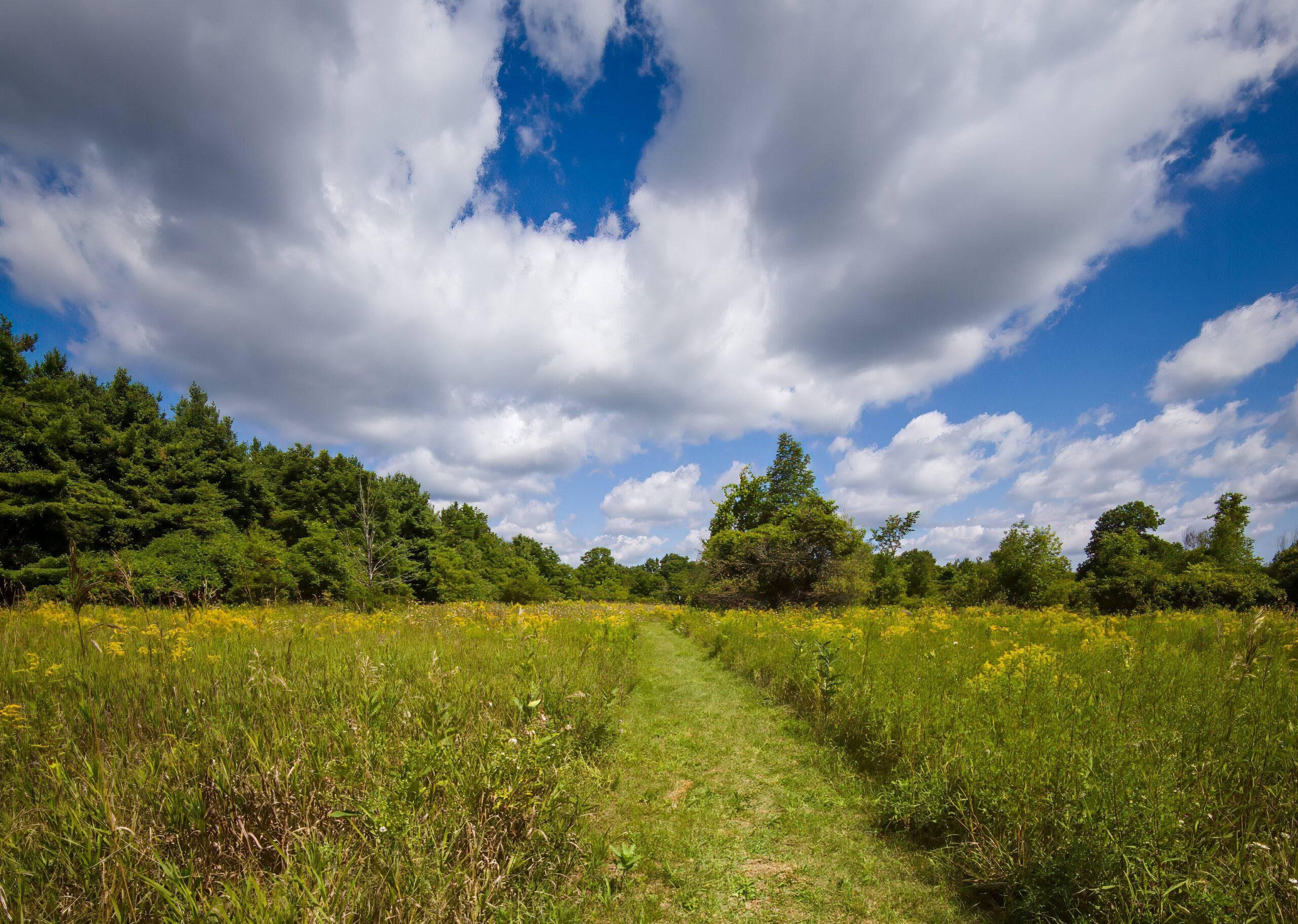
This hike takes us north from Limehouse along the Main Trail to Duff Pit and back. We will explore loops by taking the side trails, including the Todd Bardes Meadowland Side Trail past the Toronto Seed Orchard. Our hike follows the recently rerouted Main Trail, crossing new TBTC properties, bridges, and boardwalks.Our pace will be Brisk through the open areas and Moderate for the few hills, rocky spots, and for photo opportunities.
Please bring enough water (at least 2 litres) and food to maintain your energy for a 5-hour hike.
Comfortable hiking shoes or boots are a must. A rain shell is recommended in case of a wet weather forecast, along with a hat, sunscreen, and bug repellent for sunny weather or buggy trail conditions.
Dog-Friendly Hike: Hockley Valley Side trail series
https://hikes.brucetrail.org/event/dog-friendly-hike-hockley-valley-side-trail-series/Sorry, the registration cut-off time for this hike has been reached.Not a member? Click here to join today!Hosting Club: Toronto
Category: Car Hike
Location (Google Maps): Hockley ValleyHike Leader(s): Lindita Kalo Click here to contact Hike Leader(s)
Pace: Mixed (See Hike Description), Moderate (3-4 km/hr)
Terrain: Level 2 (Intermediate – some hills and uneven surfaces, rocks and roots underfoot), Variable
Distance (km): 12 kmDescription
Join me on the series of dog friendly to complete Caledon side trail challenge. Hockley Valley main Bruce trail and side trail.
This hike has some hills. We will keep moderate speed. be true to your abilities of hiking.
I have a 3 year old Aussie very friendly with people and other dogs.Tobermory, 3 of 3, Map 42
https://hikes.brucetrail.org/event/tobermory-3-of-3-map-42/Sorry, the registration cut-off time for this hike has been reached.Not a member? Click here to join today!Hosting Club: Toronto, Peninsula
Category: Car Hike
Location (Google Maps): Little Cove to TobermoryHike Leader(s): Alex Brown Click here to contact Hike Leader(s)
Pace: Mixed (See Hike Description)
Terrain: Rocky, Variable
Distance (km): 8-11 kmDescription
This is the third and last hike in this series, ending at the cairn in Tobermory. This hike will be shorter, allowing for an early departure for those wishing to head home. An optional hike on the Burnt Point Loop Side Trail is available for those interested.The meeting point will be the Cairn in Tobermory marking the northern terminus of the Bruce Trail. We will take two or three vehicles to the Little Cove parking area to start the hike. Parking fees will apply. More information to be provided closer to the date.
Trail conditions are in spots rocky which may slow us.
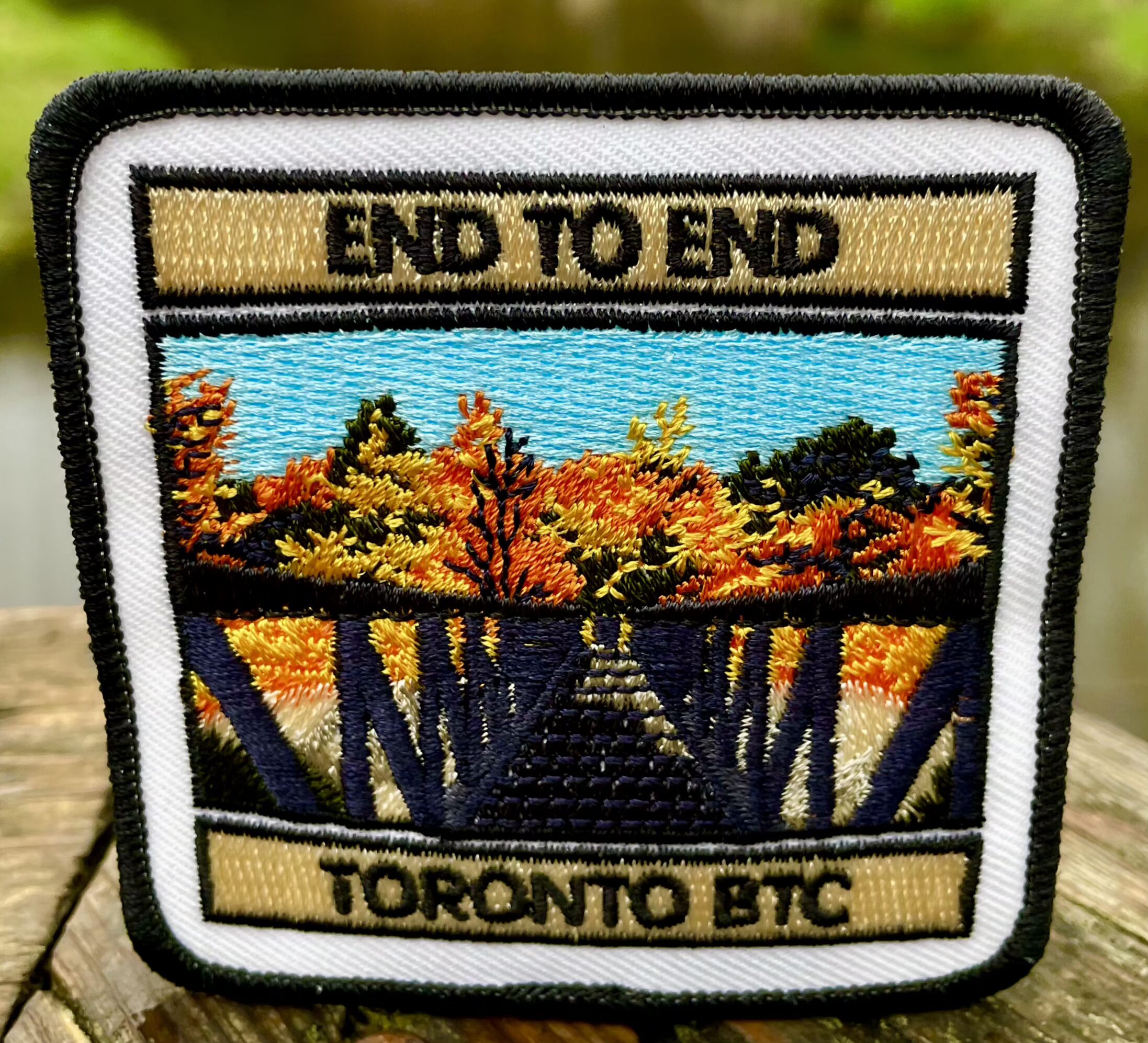
At the end of the hike those completing the Peninsula section and wanting to get their end to end badges will be presented them at the Cairn. Please contact the hike leader to order a badge for yourself. The cost will be confirmed when the order is place. Please allow two weeks for processing. After the hike those wishing to stop for refreshments are invited to meet at a nearby location. Otherwise, they can begin the drive home.
For those coming long distance, local accommodation should be available in Tobermory.
More information about the hike will be posted closer to the date.
- 08September 8, 2026
Urban Walk: McCowan District Trail/Scarborough Bluffs
https://hikes.brucetrail.org/event/urban-walk-mccowan-district-trail-scarborough-bluffs/Sorry, the registration cut-off time for this hike has been reached.Not a member? Click here to join today!Hosting Club: Toronto
Category: Urban Walk
Location (Google Maps): Meet outside Eglinton GO Station on Eglinton Ave east at Bellamy Road. Take TTC Morningside 116 from Kennedy Station to Bellamy Road North / Eglinton Go Station Stop (11 minutes, frequency every 8 minutes)Hike Leader(s): Tom Swales Click here to contact Hike Leader(s)
Pace: Moderate (3-4 km/hr)
Terrain: Flat, Level 2 (Intermediate – some hills and uneven surfaces, rocks and roots underfoot), Variable
Distance (km): 8-9 kmDescription
We’ll follow the local McCowan District Recreational Trail in Scarborough and then eventually to Resthaven Memorial Gardens leading us to Brimley Road and Kingston Road. We’ll approach the Scarborough Bluffs via the Chine Drive Ravine. We’ll be viewing the bluffs from above (not descending) from Scarborough Bluffs Park. We’ll finish at Rosetta McClain Gardens, one of Toronto’s nicest public gardens (on Kingston Road east of Birchmount Road). Join us for lunch, if you wish, at Len Duckworth Fish & Chips on Kingston Road for their lunch specialUrban hike: Valley View Park Thornhill
https://hikes.brucetrail.org/event/urban-hike-valley-view-park-thornhill-14/Sorry, the registration cut-off time for this hike has been reached.Not a member? Click here to join today!Hosting Club: Toronto
Location (Google Maps): Parking lot is off Sycamore Drive, East of Bayview , across Starbucks plaza
Bus 91 from Finch East station stops at Sycamore station.Hike Leader(s): MOHAMMAD AGHAMIRI Click here to contact Hike Leader(s)
Pace: Moderate (3-4 km/hr)
Terrain: Hilly, Level 2 (Intermediate – some hills and uneven surfaces, rocks and roots underfoot)
Distance (km): 7-8 kmDescription
We will explore Valleyview and Maple View parks, and walk along German Mills Creek, in return we stop in Huntington park and have snack ,coffee,tea .Although this is considered an “Urban Walk”, you can expect some hills up and down and uneven surfaces with tree roots. Please bring hiking poles, water and snacks.
phone number for the day of hike 289 588 6482
- 09September 9, 2026No events
- 10September 10, 2026
Urban Walk: Valley View Park Thornhill
https://hikes.brucetrail.org/event/urban-walk-valley-view-park-thornhill-178/Sorry, the registration cut-off time for this hike has been reached.Not a member? Click here to join today!Hosting Club: Toronto
Location (Google Maps): Parking lot is off Sycamore Drive, East of Bayview , across Starbucks plaza
Bus 91 from Finch East station stops at Sycamore station.Hike Leader(s): MOHAMMAD AGHAMIRI Click here to contact Hike Leader(s)
Pace: Moderate (3-4 km/hr)
Terrain: Hilly, Level 2 (Intermediate – some hills and uneven surfaces, rocks and roots underfoot)
Distance (km): 7-8 kmDescription
We will explore Valleyview and Maple View parks, and walk along German Mills Creek, in return we stop in Huntington park and have snack ,coffee,tea .Although this is considered an “Urban Walk”, you can expect some hills up and down and uneven surfaces with tree roots. Please bring hiking poles, water and snacks.
phone number for the day of hike 289 588 6482
- 11September 11, 2026No events
- 12September 12, 2026
Two Day Toronto End-to-End Event (participants hike independently, no hike leader)
https://hikes.brucetrail.org/event/two-day-toronto-end-to-end-event-participants-hike-independently-no-hike-leader-2/Sorry, the registration cut-off time for this hike has been reached.Not a member? Click here to join today!This is a Multi-Day Hike
You are signing up for the following dates:
2026-09-12, 2026-09-13Hosting Club: Toronto
Category: Annual TBTC E2E
Location (Google Maps): The Toronto Bruce Trail section which runs from just south of Hilton Falls CA on Appleby Line to the south entrance of the Cheltenham Badlands on Creditview Rd. On both days, we will meet in the village of Limehouse. The exact parking location in Limehouse will be emailed closer to the event date.Hike Leader(s): Jacqueline Van Dyke Click here to contact Hike Leader(s)
Pace: Brisk (4-5 km/hr)
Terrain: Challenging, Level 2 (Intermediate – some hills and uneven surfaces, rocks and roots underfoot)
Distance (km): Saturday, Sept. 12 – 28km/Sunday, Sept. 13 – 22kmDescription
Hike the Toronto section of the Bruce Trail over two days. Hikers must maintain a minimum pace of 4km/hr and reach the checkpoints by the cutoff time in order to continue. On Saturday, the buses will bring hikers from Limehouse to the south entrance of the Cheltenham Badlands where the hike will begin. Hikers will hike south to their vehicles in Limehouse – a distance of approximately 28km. Hikers will reach checkpoint 1 at km 38.8 (after hiking 11.6km) by 11:00 am and checkpoint 2 at km 27.8 (after hiking 11km) by 1:45 pm in order to continue. On Sunday, the buses will bring hikers from Limehouse, to km 0.0 on Appleby Line where the hike will begin. Hiking north to Limehouse, hikers must reach checkpoint 1 at km 11.4 in the Pear Tree parking lot by 11:00 am to continue. There will be sweeps on both days to assist hikers when needed. Water refill and refreshments will be available at the checkpoints. Bring your fully charged cell phone, basic 1st aid supplies, and a water bottle.Those who complete the distances on both days within the prescribed time limits will receive the special NEW 2 Day Club E2E badge. The registration fee includes the online registration fee, bus shuttle, refreshments, and the official NEW E2E badge. If any spots are still available at 9:00 am on July 8, registration will also be opened to non-members (child and adult) at a cost of $65. These are strenuous hikes suitable for experienced, long distance, faster paced hikers over the age of 16. Space is limited, hikes go rain or shine, and no dogs are permitted on this event. Hikers must find their own way each morning to the meeting point in Limehouse. Buses will leave Limehouse promptly at 8:00 am. There will be no refunds or tax receipts issued for anyone who cancels their registration. For questions, please contact Jacquie Van Dyke at vdyke0946@gmail.com. Registration closes at midnight on September 6, 2026. On September 1 or before, an email will go out to all participants with the exact parking location in Limehouse.
Bus Hike: Terra Cotta (New Hikers & Families Welcome)
https://hikes.brucetrail.org/event/bus-hike-terra-cotta-new-hikers-families-welcome/Sorry, the registration cut-off time for this hike has been reached.Not a member? Click here to join today!Trip Information
Departure Time: 08:30
Return to City Time: 17:30
Departure Point: York Mills Bus PickupOptional Items
Hiking ($.01)Hosting Club: Toronto
Category: Bus Hike
Location (Google Maps): Main Bruce Trail Boston Mills Road, through Terra Cotta Conservation Area, to Tenth LineHike Leader(s): Tom Swales, Felix Wan Click here to contact Hike Leader(s)
Pace: Moderate (3-4 km/hr)
Terrain: Level 2 (Intermediate – some hills and uneven surfaces, rocks and roots underfoot), Variable
Distance (km): 10-11 kmDescription
New Hikers (but all are welcome) are invited to join me on a 10 km Introductory Level Bus Hike on the Toronto Section of the Bruce Trail around Terra Cotta less than an hour from Toronto. Expect some downhill/uphill and tree roots but nothing too rocky or challenging. We’ll be following behind the hikers completing the club’s annual two day E2E hike. There will be the option of a short out and back hike on the Walking Fern Side Trail at the end. After the hike we’ll drive to Spirit Tree Estates Cidery that offers pizza and baked goods and a country store. Hopefully the weather cooperates so we can sit on the picnic tables outside. Optional dropout at 5 km. Hiking boots are recommended. Beginners and families welcome.- =>>> Please read the TBTC Paid Hikes Refund Policy before registering: https://torontobrucetrailclub.org/hikes/no-show-policy”. There will be no refunds for this hike if the registrant cancels or misses the coach on the date of departure for any reason. Registration fees are not transferrable between different hikes nor can unused fares qualify for a tax receipt.
Boyd Conservation Park, Islington Avenue, Vaughan
https://hikes.brucetrail.org/event/car-hike-boyd-conservation-park-vaughan-17/Sorry, the registration cut-off time for this hike has been reached.Not a member? Click here to join today!Hosting Club: Toronto
Location (Google Maps): Free Parking lot before entrance of park on Islington Ave.
Hike Leader(s): Mohammad Aghamiri Click here to contact Hike Leader(s)
Pace: Moderate (3-4 km/hr)
Terrain: Hilly, Level 2 (Intermediate – some hills and uneven surfaces, rocks and roots underfoot), Variable
Distance (km): 12-14 kmDescription
Let’s hike Boyd conservation park trails through beautiful valleys.Please bring lots of water and snacks ,hiking poles are recommended
phone number for the day of hike 289 588 6482
JEWELS OF GRAND VALLEY TRAIL - YORK TO CALEDONIA AND RUTHVEN PARK - 14 KM
https://hikes.brucetrail.org/event/jewels-of-grand-valley-trail-york-to-caledonia-and-ruthven-park-14-km/Sorry, the registration cut-off time for this hike has been reached.Not a member? Click here to join today!Hosting Club: Toronto
Category: Car Hike
Location (Google Maps): Parking and departure: Meet at 9:30am in Caledonia – Kinsmen Park trout park, Caledonia, at intersection of Caithness St. W (Rd 54) and Blair St. turn into the riverside parking lot.Hike Leader(s): Jeanette Vincent Click here to contact Hike Leader(s)
Pace: Moderate (3-4 km/hr)
Terrain: Flat, Level 1 (Easy – mostly on flat, well maintained trails with hard-packed surface), Variable
Distance (km): 14kmDescription
About this hike: This hike will be in Towpath section of GVTA: York to Caledonia and Ruthven Park, National Historic Site. This is a linear hike including areas of interest off the main trail. We will be walking on some of the streets in Caledonia and local trails along the river. Then we all drive to Ruthven Park where we will finish our hike on the Ruthven Park property trails.If you choose to, you will also have the opportunity to tour the Ruthven Greek Revival Mansion. There is a fee to tour inside the mansion: $12 adults, $10 senior 65+.About this series: Jewels of Grand Valley Trail is a series of hikes highlighting the beautiful parts of GVT in all 4 sections. Those hikes will range from about 6 km to 15 km. They will be led by Jeanette, Jane, Eva and Brandon through months of August to October. Come and enjoy the beauty of our trail!
Where: York, Caledonia, Ruthven Park
Length: 14 km
Category: Car shuttle
Pace and duration: Moderate, 3.5 km/hr. About 6.5 hours with lunch + car shuttle time.
Hike level: Moderate (2). Mainly flat, paved, maintained paths and trails.Parking and departure: Meet at 9:30 am in Caledonia – Kinsmen Park,trout park, Caledonia, Caledonia – riverside parking at intersection of Caithness St. W (Rd 54) and Blair St. 43.0744974 -79.9579234
From there we will carpool to York Park, York beside the Grand River across from the York General Store/gas station.(43.020717, -79.890382) and hike back to our cars.
After this portion of the hike we carpool to the cars at York Park, the start of our hike and all vehicles will drive to Ruthven Park (42.978026, -79.875623) where we will finish our hike on the Ruthven Park property trails. If you want a 2 or 3 km shorter hike you can opt out of joining us at Ruthven Park for the remainder of the hike.
Directions: Please use your favourite GPS app to obtain directions.
What to wear and bring: This is a September hike, please dress accordingly to the weather, bring a hat and sunscreen, sunglasses. If rain is forecasted, bring rain gear. Wear good hiking boots. Hiking poles are optional if you like using them. Bring water, snacks and pack a lunch – we will stop for lunch.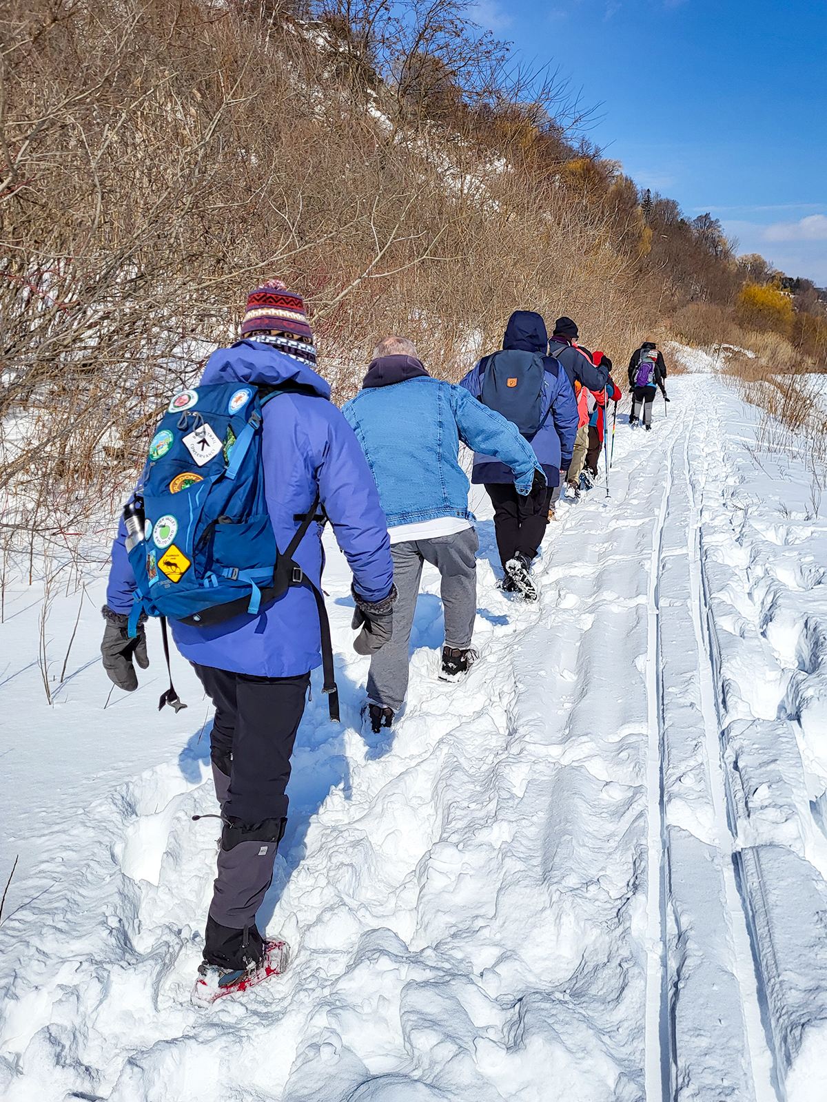
Urban Walk: Waterfront Trail 7/11 – Brimley
https://hikes.brucetrail.org/event/urban-walk-waterfront-trail-7-11-brimley-3/Sorry, the registration cut-off time for this hike has been reached.Not a member? Click here to join today!Hosting Club: Toronto
Category: Urban Walk
Location (Google Maps):Toronto, Ontario, Canada
Hike Leader(s): Brian Rideout Click here to contact Hike Leader(s)
Pace: Moderate (3-4 km/hr)
Terrain: Hilly
Distance (km): 11.4 kmDescription
Please join me at Kennedy Station by 10:15 am. We will take the 12 Kingston Rd bus departing 10:42 am, arriving 10:58 am.We will hike along Kingston Rd, down to and east along the Lake on the Doris MacCarthy Trail to Guildwood and then to Beechgrove Dr. The estimated distance is 11.4 km. Here is an online map of our route – Brimley to Beechgrove
Bring a snack, at least 2 liters of water, and icers. Dress for cold weather.