
Join us for a hike! Registration required:
All hikes available to BTC members. Some hikes are open to non-members.
TIP: The calendar view displays up to 7 hikes on a day, but often there are more. Click “More events” to see them all.
Toronto Hike Schedule
Toronto Bruce Trail Club Registration Live Dates
Day Winter Coach Program
Registration begins two weeks in advance of the event departure (at 8:00 PM)
Day Bus Hikes
Registration begins two weeks in advance of the event departure (at 8:00 PM) with some exceptions of special event hikes
Day Coach Hikes
Registration begins 7 weeks in advance of the event departure
Day Car Hikes and Urban Hikes
Registration begins two weeks in advance of the event departure
Overnight and Weekend Trips
Registration begins 12 weeks in advance of the event departure
To view all Bruce Trail Conservancy Hikes click here
- 08March 8, 2026
Car Hike: Jefferson Forest (Richmond Hill)
https://hikes.brucetrail.org/event/car-hike-jefferson-forest-richmond-hill-8/Sorry, the registration cut-off time for this hike has been reached.Not a member? Click here to join today!Hosting Club: Toronto
Category: Car Hike
Location (Google Maps):1245 Bethesda Side Rd, Richmond Hill, ON L4E 1A2 ( Bethesda Trail Head Parking lot)
Hike Leader(s): Amir Alemohammad Click here to contact Hike Leader(s)
Pace: Moderate (3-4 km/hr)
Terrain: Flat, Hilly, Level 2 (Intermediate – some hills and uneven surfaces, rocks and roots underfoot)
Distance (km): 10-11Description
Let’s roll the hills of the Jefferson Forest this winter! Every weekend, we’ll explore the winter wonderland at this beautiful park. Located in the heart of Richmond Hill, it boasts numerous hiking trails. This 3-hour hike can range from 10 to 12 kilometres, depending on the weather conditions. Remember to bring water, snacks, hiking boots, icers, poles, and your camera. Not recommended for beginners. Park in the free Bethesda parking lot and avoid parking along the road. Dress appropriately for the weather. Difficulty Level: 2 (Moderate).Please arrive @8:45AM for start of 9:00AM.
This is a joint hike with the Oak Ridges Trail Association (ORTA).
Car Hike: Hike #4 of 5 to earn the Toronto Side Trails Badge!
https://hikes.brucetrail.org/event/car-hike-hike-4-of-5-to-earn-the-toronto-side-trails-badge/Sorry, the registration cut-off time for this hike has been reached.Not a member? Click here to join today!Hosting Club: Toronto
Category: Car Hike
Location (Google Maps): We will meet at the Trafalgar & 401 Commuter Lot (43.571569, -79.831797) and then carpool to the start of the hike.Hike Leader(s): Monica Pasquali Click here to contact Hike Leader(s)
Pace: Leisurely (2-3 km/hr), Moderate (3-4 km/hr)
Terrain: Level 2 (Intermediate – some hills and uneven surfaces, rocks and roots underfoot)
Distance (km): 10.8 kmDescription
This is the fourth in a series of five hikes that will be offered approximately one Sunday per month so that participants can earn the Toronto Side Trails Badge during the winter and early spring. Each out-and-back hike will cover a distance of 8-11 km and be hiked at a leisurely to moderate pace (approximately 3 km/h). Please note that the hikes will be posted separately on the BTC calendar – you will have to register for each hike that you’re interested in joining.For this fourth hike we will explore one long side trail in the Toronto section of the Bruce Trail: the Vanderleck Side Trail.
Please dress appropriately for a winter hike by dressing in layers (wear an inner layer that wicks sweat away from your skin, a middle layer that keeps you warm, and an outer layer that protects you from wind and snow), wearing gloves/mittens and a toque, and wearing warm and comfortable footwear that has good traction in snow/ice (icers placed over your boots work great!). Hiking poles or walking sticks are an asset since they will help keep you balanced if the ground is slippery. As well, make sure you bring enough water and food for a 4 hour hike since we’ll be covering a total distance of 10.8 km over terrain that has some hills and exposed rocks.
Since parking might be limited at the places we’ll be hiking in this hike series, we will meet at the Trafalgar & 401 Commuter Lot (43.571569, -79.831797) and then carpool to the start of each hike. Please be prepared to participate in each carpool by ensuring you have space in your car if you are not already carpooling with others to the Commuter Lot meeting point.
After the hike, interested participants can join me at the Tim Horton’s on Trafalgar Road just a bit south of Highway 401 for some post-hike refreshment.
Looking forward to exploring some of Toronto’s side trails with you!
Urban Walk – Toronto Urban Badge Hike – 3 of 7
https://hikes.brucetrail.org/event/urban-walk-toronto-urban-badge-hike-3-of-7-4/Sorry, the registration cut-off time for this hike has been reached.Not a member? Click here to join today!Hosting Club: Toronto
Category: Urban Walk
Location (Google Maps): Toronto Waterfront TrailHike Leader(s): Brian Rideout Click here to contact Hike Leader(s)
Pace: Moderate (3-4 km/hr)
Terrain: Flat
Distance (km): 10.4 kmDescription
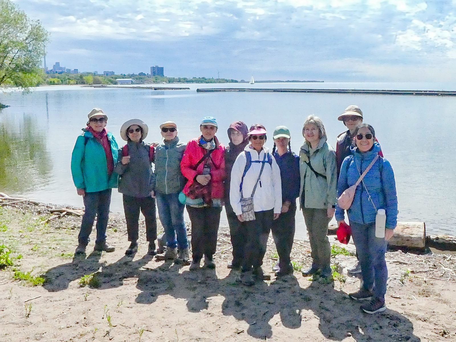
Please join me at the south west corner of Lakeshore Blvd West and Ellis by 10 AM. We will hike east along the Waterfront Trail to the Distillery District (km 8.3 to km 71.4). Here is an online map with km markings of our route for all 7 hikes for the Toronto Urban Badge. https://onthegomap.com/s/c2c1hf3nPlease make sure you bring at least 2 liters of water, a lunch, and icers.

Urban Walk: International Women's Day Hike - all are welcome
https://hikes.brucetrail.org/event/urban-walk-international-womens-day-hike-all-are-welcome/Sorry, the registration cut-off time for this hike has been reached.Not a member? Click here to join today!Hosting Club: Toronto, Beaver Valley
Category: Urban Walk
Location (Google Maps): Meet at Matt Cohen Park on South East corner of Spadina and Bloor across from JCC and Scotia Bank
Toronto Nordheimer Ravine to Cedarvale Ravine through Wychwood park.Hike Leader(s): Marina Wray and Marijo Roy Click here to contact Hike Leader(s)
Pace: Moderate (3-4 km/hr)
Terrain: Flat, Level 2 (Intermediate – some hills and uneven surfaces, rocks and roots underfoot), Other (Refer to Description)
Distance (km): 10 kmDescription
Join Marina on her “graduation hike” to become a certified TBTC Hike Leader. The hike is open to members and non members, to all who want to celebrate IWD and support women, community, nature, and movement. The hike will follow part of the route of Castle Frank Brook, a waterway that once carved a path through midtown Toronto until the 1930’s, when it was buried. We’ll hike some of its stream valleys that now make up part of Toronto’s ravine system.What to expect:
We’ll start our hike from Matt Cohen Park close to Spadina TTC station and head to Roycroft park and the Nordheimer Ravine trail where the CFB flowed. We’ll cross over to Cedarvale Ravine, where the trail offers short glimpses of water from the Brook. On our hike we’ll see signs of spring in the cattail wetlands. We’ll pass a 200 year-old elm tree and hike through Toronto’s historic Wychwood Park and see Taddle Creek pond. The Hike will finish at Bathurst and Dupont streets, a short bus ride or walking distance to Bathurst Subway station. Everyone is welcome to join us for a post hike bite and refreshment at Annex Social on Bathurst Street.
The hike goes ahead rain, snow or shine
What to Bring:
**The pathways in the ravine can be icy so ice traction footwear such as Crampon’s or Yaktrax are mandatory**
•Bring water, and snacks
• Dress in layersThank you
Marina and Marijo
- 09March 9, 2026No events
- 10March 10, 2026
Car Hike: Iroquoia Winter E2E 4/6
https://hikes.brucetrail.org/event/car-hike-iroquoia-winter-e2e-4-6-3/Sorry, the registration cut-off time for this hike has been reached.Not a member? Click here to join today!Hike open to BTC Members only.
Hosting Club: Toronto
Category: Car Hike
Location (Google Maps):Km 38.6, Chedoke Civic Golf Club. N 43.246205,W 79.906935
map 8
Hike Leader(s): Smadar Junkin Click here to contact Hike Leader(s)
Pace: Brisk (4-5 km/hr)
Terrain: Challenging, Level 3 (Advanced – steep hills and some scrambling over boulders), Variable
Distance (km): 20 kmDescription
4th hike in the winter E2E series. We will car shuttle to km 58.8, Sydenham Lookout and hike back. Please bring icers, snowshoes and 2 litres of water. Hike date may changed due to bad winter conditions. Come 15 minutes early. Hikers are expected to move at a pace of 4.5 km per hour.Urban Walk:: Valley View Park Thornhill
https://hikes.brucetrail.org/event/urban-walk-valley-view-park-thornhill-149/Sorry, the registration cut-off time for this hike has been reached.Not a member? Click here to join today!Hosting Club: Toronto
Location (Google Maps): Parking lot is off Sycamore Drive, East of Bayview , across Starbucks plaza
Bus 91 from Finch East station stops at Sycamore station.Hike Leader(s): Mohammad Aghamiri Click here to contact Hike Leader(s)
Pace: Moderate (3-4 km/hr)
Terrain: Hilly, Level 2 (Intermediate – some hills and uneven surfaces, rocks and roots underfoot), Variable
Distance (km): 6-7 kmDescription
We will explore Valleyview and Maple View parks, and walk along German Mill Creak, in return we stop in Huntington park and have snack under beautiful shed.Although this is considered an “Urban Walk”, you can expect some hills up and down and uneven surfaces with tree roots. Please bring hiking poles, Ice cleats water and snacks.
phone number for the day of hike 289 588 6482
- 11March 11, 2026
Car Hike: Iroquoia Winter E2E 5/6
https://hikes.brucetrail.org/event/car-hike-iroquoia-winter-e2e-5-6-2/Sorry, the registration cut-off time for this hike has been reached.Not a member? Click here to join today!Hosting Club: Toronto
Category: Car Hike
Location (Google Maps):Chedoke Civic Golf Club. N 43.246205,W 79.906935
map 6, 7
Hike Leader(s): Smadar junkin Click here to contact Hike Leader(s)
Pace: Brisk (4-5 km/hr)
Terrain: Challenging, Level 3 (Advanced – steep hills and some scrambling over boulders), Variable
Distance (km): 18 kmsDescription
This is the 5th hike towards the winter E2E badge. We will car shuttle to km 22.0 Veever Park Side Trail, Green Hill Ave and hike back. Bring icers, snowshoes and two litters of water. Arrive 15 minutes early. Hikers are expected to hike in a pace of 4.5 km per hour. - 12March 12, 2026

Car Hike: Iroquoia End-to-End in 7: Hike 1
https://hikes.brucetrail.org/event/car-hike-iroquoia-end-to-end-in-7-hike-1/Sorry, the registration cut-off time for this hike has been reached.Not a member? Click here to join today!Hike open to BTC Members only.
Hosting Club: Toronto
Category: Car Hike
Location (Google Maps): Meet at the Grimsby Pool, 1 Elm St at the south end of Coronation Park (GPS 43.193201, -79.565301). We’ll shuttle to the Oakridge Dr. Access Trail, km 18.2, roadside parking (GPS 43.213943, -79.742417) to begin our hike.Hike Leader(s): Jacqueline Van Dyke Click here to contact Hike Leader(s)
Pace: Brisk (4-5 km/hr), Moderate (3-4 km/hr)
Terrain: Variable
Distance (km): 19Description
Please join for one or more of this Iroquoia series to complete the section over 7 hikes. Hikers must register for individual hikes.Expect an average pace of 4 km/hr with snack/lunch breaks. Please arrive 15 minutes early so you’re ready for the shuttle to begin promptly at 8:30.
Hikers should be prepared for the season – layered clothing, hiking boots, snowshoes (if we get fresh snowfall), poles, water, snacks/lunch, first aid kit, and icers.
Hikers should be prepared to share their cars for shuttling – to be shared evenly.
If we encounter unsafe hiking or driving conditions, I will cancel/re-schedule the hike the day before. If you are unable to join us on the day of the hike, please text me at 647-231-0946.
Car Hike: Iroquoia winter E2E, hike 6/6
https://hikes.brucetrail.org/event/car-hike-iroquoia-winter-e2e-hike-6-6/Sorry, the registration cut-off time for this hike has been reached.Not a member? Click here to join today!Hike open to BTC Members only.
Hosting Club: Toronto
Category: Car Hike
Location (Google Maps):Grimsby Lions Community Pool, Elm street, N 43.193201,W 79.565301
Hike Leader(s): Smadar Junkin Click here to contact Hike Leader(s)
Pace: Brisk (4-5 km/hr)
Terrain: Level 3 (Advanced – steep hills and some scrambling over boulders)
Distance (km): 22 kmDescription
Badge day, treats day. Bring 2 litres of water. Bring icers and snowshoes to be able to hike in any trail conditions. Date of hike may need to be changed due to bad winter weather conditions. Please arrive 15 minutes early. Hikers are expected to walk at a 4.5 km per hour.We will car shuttle to Greenhill Ave Veever Park and hike back.
Urban Walk: Valley View Park Thornhill
https://hikes.brucetrail.org/event/urban-walk-valley-view-park-thornhill-150/Sorry, the registration cut-off time for this hike has been reached.Not a member? Click here to join today!Hosting Club: Toronto
Location (Google Maps): Parking lot is off Sycamore Drive, East of Bayview , across Starbucks plaza
Bus 91 from Finch East station stops at Sycamore station.Hike Leader(s): Mohammad Aghamiri Click here to contact Hike Leader(s)
Pace: Moderate (3-4 km/hr)
Terrain: Hilly, Level 2 (Intermediate – some hills and uneven surfaces, rocks and roots underfoot), Variable
Distance (km): 6-7 kmDescription
We will explore Valleyview and Maple View parks, and walk along German Mill Creak, in return we stop in Huntington park and have snack under beautiful shed.Although this is considered an “Urban Walk”, you can expect some hills up and down and uneven surfaces with tree roots. Please bring hiking poles, Ice cleats water and snacks.
phone number for the day of hike 289 588 6482
- 13March 13, 2026

Car Hike: Iroquoia End-to-End in 7: Hike 2
https://hikes.brucetrail.org/event/car-hike-iroquoia-end-to-end-in-7-hike-2/Sorry, the registration cut-off time for this hike has been reached.Not a member? Click here to join today!Hike open to BTC Members only.
Hosting Club: Toronto
Category: Car Hike
Location (Google Maps): Meet at the Oakridge Dr. Access Trail, km 18.2 (GPS 43.213943, -79.742417) and we’ll shuttle to the Hillcrest Ave. ST, km 37.1 (GPS 43.246437, -79.892130) to begin our hike.Hike Leader(s): Jacqueline Van Dyke Click here to contact Hike Leader(s)
Pace: Brisk (4-5 km/hr), Moderate (3-4 km/hr)
Terrain: Variable
Distance (km): 19Description
Please join for one or more of this Iroquoia series to complete the section over 7 hikes. Hikers must register for individual hikes.Expect an average pace of 4 km/hr with snack/lunch breaks. Please arrive 15 minutes early so you’re ready for the shuttle to begin promptly at 8:30.
Hikers should be prepared for the season – layered clothing, hiking boots, snowshoes (if we get fresh snowfall), poles, water, snacks/lunch, first aid kit, and icers.
Hikers should be prepared to share their cars for shuttling – to be shared evenly.
If we encounter unsafe hiking or driving conditions, I will cancel/re-schedule the hike the day before. If you are unable to join us on the day of the hike, please text me at 647-231-0946
- 14March 14, 2026
Car Hike Dufferin Hi-Land End2End 3/4
https://hikes.brucetrail.org/event/car-hike-dufferin-hi-land-end2end-3-4/Sorry, the registration cut-off time for this hike has been reached.Not a member? Click here to join today!Hosting Club: Toronto, Dufferin Hi-Land
Category: Car Hike
Location (Google Maps): Meet atRoadside Parking – on the north side of 8 Sideroad across from 2nd Line E. GPS N44.139350, W80.100503. Km 22.7, Map 20 Edition 31
Hike Leader(s): Ross Estrella Click here to contact Hike Leader(s)
Pace: Moderate (3-4 km/hr)
Terrain: Challenging, Hilly, Level 2 (Intermediate – some hills and uneven surfaces, rocks and roots underfoot), Rocky
Distance (km): 14Description
This is DHBTC E2E in 4. E2E hikers are rewarded the club coveted E2E badge upon completion. However, joiners must complete the four series hikes to earn their badge. Missed segment/s must be made up prior to the completion of the last leg to receive your badge. We’ll be on a moderate pace to enjoy, feel and see the stunning landscape and acquaint ourselves to the others souls on the group. Day hikes essentials to bring, lunch/snacks, sufficient preferred liquid hydration, sun screen, bug spray, head covering for sun protection, appropriate clothing for the weather, personal medication/s (if any), health card and your happy face and enthusiasm. Hiking shoes and poles are highly recommended. Please note that “Icers” are now mandatory on all hikes from the on set of Winter to mid-April. Showing up at meet up location for non-compliance will result to be refuse joining the group. Make sure you and your car are shuttle ready as everybody are expected to participate. Cost of badge is 10 dollars for BTC member and 15 dollars for non-member. Please arrive fifteen minutes early for car shuttling.This is a H4H-H4F !!! hike. If this schedule suits you, your welcome to join.
Note: to reach the specific parking lot location, use the specified GPS Coordinates at the meet-up location above.
School Bus Hike Toronto Section Winter Badge End to End #6 of 6/Friendly Moderate Hike Bruce Trail/Terra Cotta/Caledon Trailway
https://hikes.brucetrail.org/event/school-bus-hike-toronto-section-winter-badge-end-to-end-6-of-6/Sorry, the registration cut-off time for this hike has been reached.Not a member? Click here to join today!Trip Information
Departure Time: 08:30
Return to City Time: 18:00
Departure Point: York Mills Bus PickupOptional Items
Hosting Club: Toronto
Category: Bus Hike
Location (Google Maps):Toronto Section, Terra Cotta – Cheltenham
Hike Leader(s): George Lennon, Tom Swales, Ted Moriarty Click here to contact Hike Leader(s)
Pace: Leisurely (2-3 km/hr)
Terrain: Challenging, Level 2 (Intermediate – some hills and uneven surfaces, rocks and roots underfoot), Variable
Distance (km): 9-11 kmDescription
Come join us for the final bus hike of Winter, 2025-2026. The hike will cover the last 2.5 km of the Toronto section of the Main Bruce Trail and then follow the western section of the Caledon Trailway back to Terra Cotta Conservation Area. For those who have been on the five previous Winter Badge E2E hikes, completing this bus trip will qualify you for the awarding of the badge on this hike. For anyone taking this hike, it will be a moderate hike over the path of a former Canadian National (CN) rail line, originally built in 1877. Since the path is over the old rail bed, it is well-drained and well-surfaced, flat, and straight. However, it goes through woods and meadows, and we are already seeing there spring migratory birds like red-winged blackbirds and flocks of cedar waxwings. A celebration of the ending of the winter bus hikes and social hour will be held in Georgetown after the hike. Any hikers joining us for the very first time on a hike with the club on the Bruce Trail will receive a “My First Hike” badge.Glasgow Village Whitchurch-Stouffville 230
https://hikes.brucetrail.org/event/car-hike-cherry-beach-downtown-4/Sorry, the registration cut-off time for this hike has been reached.Not a member? Click here to join today!Hosting Club: Toronto
Location (Google Maps): Glasgow Trail, Concession Road 2
Park in parking lot at the head of trail
From Highway 404 turn right to Stouffville Rd, till to the end of road and turn left on York Durham line in About 1km turn right to Webb rd. and turn right to Concession Road 2 ,you will see parking lot in 500 meter.
Hike Leader(s): Mohammad Aghamiri Click here to contact Hike Leader(s)
Pace: Moderate (3-4 km/hr)
Terrain: Hilly, Level 2 (Intermediate – some hills and uneven surfaces, rocks and roots underfoot)
Distance (km): 12-14 kmDescription
Please bring at least 2L of water, a snack, sun screen and bug spray.Some safety procedures during the hike:
1-Hikers must stay between the leader and the sweep.
2-Hikers must advise the leader or the sweep if they wish to leave the group.
3- Hikers must follow the whistle instructions: 1 blast- stay where you are; 2 blasts come to the leader; 3 blasts – come to the leader quickly.
4-Hike leader may request volunteers to stop at trail intersections, they need to help hikers to the direction the group walk and wait till they see the sweep .
5-Hikers have to make sure they can see the persons behind and in front of them.
phone number for the day of hike 289 588 6482
Urban Walk: Humber River/Swansea Theatre Hike - CANCELLED
https://hikes.brucetrail.org/event/urban-walk-humber-river-swansea-theatre-hike-3/Sorry, the registration cut-off time for this hike has been reached.Not a member? Click here to join today!Hosting Club: Toronto
Category: Cancelled
Location (Google Maps):Meet by the TTC Stop on the Southeast Corner of Scarlett Road and Eglinton Avenue West. Take the #79 Scarlett Road bus from Runnymede Station to Eglinton or the Eglinton West #32A from Eglinton West Station to Scarlett Road.
Hike Leader(s): Miriam Stevens Click here to contact Hike Leader(s)
Pace: Leisurely (2-3 km/hr)
Terrain: Level 1 (Easy – mostly on flat, well maintained trails with hard-packed surface), Variable
Distance: 10-12 kmDescription
This hike has been CANCELLEDLeisurely hike (3 kms/hour – No Racers Please) suitable for beginners and families.
Hike along the Humber River trail and into the Swansea village at Runnymede road and Bloor street west. The hike will end opposite Runnymede Subway near the Village Playhouse Theatre and local restaurants and pubs. Distance may vary according to the weather and trail conditions and how people feel. Early dropout is possible at Old Mill Subway Station.After the hike you may choose to join us for dinner at around 6 PM at Ali Baba Mediterranean restaurant or at a nearby pub.
We will attend the play “These Shining Lives” at 8 PM at The Bloor West Village Players theatre, 2190 Bloor Street West, Toronto.
Call the Theatre directly at (416) 767 7702 to reserve your ticket, cost $26- $29.00. Please do mention that you’re with the Bruce Trail Conservancy, Toronto Club so they know we are supporting them.Anyone is welcome to join us for the hike only, join us for the theatre performance, or, join us for all three: Hike, Dinner and play. Paid parking is available off Kennedy Avenue north of Bloor Street West (behind the Village Playhouse Theatre building). There is no parking available at the start of the hike.