|
Sun | Mon | Tue | Wed | Thu | Fri | Sat |
|---|
October | October | October | October | October | October | 1   School Bus Hike: Dufferin Highland, Murphy’s Pinnacle School Bus Hike: Dufferin Highland, Murphy’s Pinnacle 8:30 AM-6:30 PM 11/01/2025 https://hikes.brucetrail.org/event/school-bus-hike-dufferin-highland-murphys-pinnacle/2025-11-01/ Trip Information
Departure Time: 08:30
Return to City Time: 18:30
Departure Point: York Mills Bus Pickup Click here for more information or to register Optional Items
Pick up at HWY 400 and Major Mac ($0.01)
Hosting Club: Toronto
Category: Bus Hike
Location (Google Maps): Dufferin Highland, Murphy’s Pinnacle Hike Leader(s): Martina Furrer, Janet McColeman, Robin Crombie, Duro Vukman Click here to contact Hike Leader(s) Pace: Brisk (4-5 km/hr), Moderate (3-4 km/hr)
Terrain: Hilly, Level 2 (Intermediate – some hills and uneven surfaces, rocks and roots underfoot), Variable
Distance: Fast group 16 to 18 km, Moderate group 13 km Description
Join us for a fantastic fall hike in the Dufferin Highlands (Map 20). Enjoy awesome views from Murphy’s Pinnacle and the Mulmur Lookout. We will split into two groups. The fast group will do the Primrose Loop Side Trail and then follow the main trail north to km 29.6 (about a 16 km hike). If time permits the fast group will also do the Rock Hill Park Side Trail. The moderate group will head straight to Murphy’s Pinnacle and follow the main trail north to km 29.6 (about a 13 km hike). Pack water, lunch, sun and rain protection. Refreshment stop in Primrose if time allows. Bus departs at 8:30 am from 10 York Mills Rd. We hope to be back in the city by 6 pm.
 Car Hike: Seaton Trail Car Hike: Seaton Trail 8:30 AM-1:00 PM 11/01/2025 https://hikes.brucetrail.org/event/car-hike-seaton-trail/2025-11-01/ - Car Hike: #6/7 Iroquoia Bruce Trail End-to-End -21 KM
9:00 AM-3:00 PM 11/01/2025 https://hikes.brucetrail.org/event/car-hike-6-7-iroquoia-bruce-trail-end-to-end-21-km/2025-11-01/ 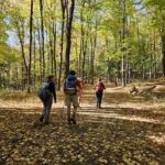 Click here for more information or to register Hosting Club: Toronto
Category: Car Hike
Location (Google Maps): KM83.5. Roadside parking on Guelph Line Hike Leader(s): Alina Lin Pace: Brisk (4-5 km/hr)
Terrain: Level 2 (Intermediate – some hills and uneven surfaces, rocks and roots underfoot)
Distance: 21 km Description
Let’s make this hike extra fun with a Halloween theme! You’re encouraged to dress up as whoever you want to be and enjoy a festive walk in the forest. Just remember — no matter what your costume is, sturdy hiking footwear is a must! This is the 6th hike of an End-to-End series covering the entire Iroquoia Bruce Trail section. The full section stretches over 120 kilometers from Grimsby to Milton. I am using Map Edition 29 to plan the hikes, and so please note that kilometer markings may not be fully up to date, and actual hiking distances may vary slightly. Meeting Point:
KM83.5. Roadside parking on Guelph Line, south of No. 1 Sideroad. GPS: 43.388387, -79.854327. Please arrive before 8:45am to allow time for car shuttle coordination. We will car shuttle to 103.8KM Roadside Parking on Twiss Rd North of Derry Rd. GPS: 43.447743, -79.953436. From there to hike back to KM83.5. All drivers are expected to participate in the car shuttle, either before or after the hike. All hikers are expected to chip in for parking fees, if applicable. Important Notes: - Wear sturdy hiking footwear and dress appropriately for the weather
- Bring snacks, and at least 1.5L of water
- No dropouts available.
- No pets.
 Urban Walk; Victoria Park subway station to Sunnybrook Park Urban Walk; Victoria Park subway station to Sunnybrook Park 10:00 AM-2:30 PM 11/01/2025 https://hikes.brucetrail.org/event/urban-walk-victoria-park-subway-station-to-sunnybrook-park-2/2025-11-01/ Click here for more information or to register Hosting Club: Toronto
Category: Urban Walk
Location (Google Maps): Start at Victoria Park subway station ticket collector. Several dropouts along the way. Final destination is Sunnybrook Health Centre on Bayview Ave Hike Leader(s): Ray Berzins Click here to contact Hike Leader(s) Pace: Moderate (3-4 km/hr)
Terrain: Level 1 (Easy – mostly on flat, well maintained trails with hard-packed surface)
Distance: 8.5 km Description
From Victoria Park subway we shall walk northeast along the Taylor Creek to the Don River, follow the West Don River to Sunnybrook Park. At Sunnybrook Health Centre on Bayview Ave is TTC #11 bus that connects with Davisville subway station and TTC #124 bus that connects with Lawrence subway. We shall have a picnic halfway so bring a sandwich and a thermos. Check your email at 8AM on day of hike to verify hike status.
- Car Hike: A hike to celebrate Halloween!
11:00 AM-4:00 PM 11/01/2025 https://hikes.brucetrail.org/event/car-hike-a-hike-to-celebrate-halloween/2025-11-01/  Click here for more information or to register Hosting Club: Toronto
Category: Car Hike
Location (Google Maps): We will meet at the larger parking lot in Woodend Conservation Area, 1 Taylor Rd, Niagara-on-the-Lake, ON L0S 1J0 (coordinates: 43.150276, -79.155092). Hike Leader(s): Monica Pasquali Click here to contact Hike Leader(s) Pace: Leisurely (2-3 km/hr)
Terrain: Level 1 (Easy – mostly on flat, well maintained trails with hard-packed surface), Level 2 (Intermediate – some hills and uneven surfaces, rocks and roots underfoot)
Distance: 8 km total, divided into two hikes of 4 km each Description
Calling all hikers who love Halloween and working on badge requirements! Today we will complete two of the three required hikes for the Niagara Bruce Trail Club’s Screaming Tunnel Badge. First, we’ll complete a 4 km out-and-back hike along the main Bruce Trail from Woodend Conservation Area to the “Screaming Tunnel” – please wear/bring your Halloween costume/hat for a photo op which is one of the requirements for the badge. Then we’ll all hop into our cars and drive about 11 km west to DeCew House Heritage Park, stopping for lunch along the way. After parking at DeCew House Heritage Park (address: 2370 DeCew Rd, Fonthill, ON L0S 1E6; coordinates: 43.107568, -79.249598) we’ll complete another 4 km out-and-back hike, but this time along the Bert Lowe Side Trail in order to visit another tunnel which is another requirement for the badge. Youth who are 15 years of age and under are encouraged to join their parents/guardians on this hike so they can also fulfill the requirements for the Niagara Bruce Trail Club’s Youth Hiking Badges. The Young Trail Blazer Badge simply requires the completion of one hike on the Niagara Bruce Trail, which our young participants will earn by completing today’s hikes. The Young Nature Blazer’s Badge requires our young participants to pay attention to what they see and hear during today’s hikes and then complete a write-up describing what they observed. Please note that all family members who are planning on joining us should register for the hike, including children. All hikers who register for today’s outing should bring water and snacks, comfortable hiking shoes, appropriate clothing for the weather, and payment for lunch if you intend to join us for lunch at a restaurant (e.g., Harvey’s). Information about all Niagara Bruce Trail Club badges can be found here: https://niagarabrucetrail.club/badges/ Please note that you will have to complete the third hike required for the Screaming Tunnel Badge by joining a “Witch of Cave Springs Hike” organized by the Niagara Bruce Trail Club in October/November, so keep an eye on the BTC hike schedule so you don’t miss your opportunity to do this: https://hikes.brucetrail.org/
 Urban Walk: Historical Hike – Old Georgetown and Glen Williams Urban Walk: Historical Hike – Old Georgetown and Glen Williams 11:30 AM-2:00 PM 11/01/2025 https://hikes.brucetrail.org/event/urban-walk-historical-hike-old-georgetown-and-glen-williams-2/2025-11-01/ Click here for more information or to register Hosting Club: Toronto
Category: GO Train Hike
Location (Google Maps): Georgetown Go Station Hike Leader(s): Tom Swales, Ted Moriarty Click here to contact Hike Leader(s) Pace: Leisurely (2-3 km/hr)
Terrain: Level 1 (Easy – mostly on flat, well maintained trails with hard-packed surface), Variable
Distance: 10K Description
Come join me for a 10K urban hike starting in Georgetown and learn about the area’s unique history in Glen Williams. Those leaving from Toronto can hop on the “Kitchener Line” Go Train at Union Station (at 9:48 am) or Bloor Go Station (at 9:58 a.m.). or Weston Go Station (10:07 a.m.) to arrive in Georgetown Go Train Station at 11:08 am (you’ll transfer to bus at Mt Pleasant Station in Brampton – a 20 minute stopover – for the rest of your journey). The return bus/train from Georgetown leaves at 3:07 p.m. There is a 15-minute stopover at Mount Pleasant Station on the return trip. You’ll be back at Union Station at 4:35 p.m. If you wish, you can also drive to the Georgetown Go Station (north parking lot) for the hike. GPS: 43.656030, -79.919159. The 2.5 hour hike will take us to the ruins of the historic Barber Mill (first site of hydro power in Ontario), then we will follow along the Credit Valley Footpath to the quaint town of Glen Wiliams (established 1825), with a chance to see artisan workshops and purchase sweets at Kits Kitchen or tea at the Main Street Market. After viewing some historic homes in the village, we will make our way back to Georgetown, following an abandoned rail line that takes us to the Georgetown Train Station, built in 1885. We’ll wander past more historic homes and finish (depending on timing) with a stop at Furnace Room craft brewery (across from the Station), This is a Level 1 (easy) hike with a easy/moderate pace, suitable for “fit” beginners. There are some hills and depending on the weather, there could be wet areas along the Credit River footpath. Dress for the time of year, bring hiking boots, poles if you wish, water, sunscreen and lunch/snacks. Go Transit weekend day passes are available online for $10. Limit: 14 Hikers
|
2 - Car Hike: Jefferson Forest and Bond Lake (Richmond Hill)
8:00 AM-12:00 PM 11/02/2025 https://hikes.brucetrail.org/event/car-hike-jefferson-forest-and-bond-lake-richmond-hill-7/2025-11-02/ 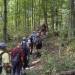 Click here for more information or to register Hosting Club: Toronto
Category: Car Hike
Location (Google Maps): 1245 Bethesda Side Rd, Richmond Hill, ON L4E 1A2 ( Bethesda Trail Head Parking lot) Hike Leader(s): Amir Alemohammad Click here to contact Hike Leader(s) Pace: Moderate (3-4 km/hr)
Terrain: Flat, Hilly, Level 2 (Intermediate – some hills and uneven surfaces, rocks and roots underfoot), Variable
Distance: 13-14 km Description
Join us for a wonderful hike in Jefferson Forest and have a snack/lunch beside the Bond Lake. We will hike among tall trees and bushes of the Jefferson Forest and across the Bayview-Yonge corridor to reach to the Bond Lake. Boots mandatory, poles recommended, bring at least 2L of water, bug spray, sunscreen, snack/lunch and dress according to the weather conditions. Please avoid parking along the road. Difficulty Level: 2 (Moderate) Please arrive @7:45 AM for start of 8:00AM. This is a joint hike with the Oak Ridges Trail Association (ORTA).
| 3 | 4 - Urban Walk: Valley View Park Thornhill
8:45 AM-11:00 AM 11/04/2025 https://hikes.brucetrail.org/event/urban-walk-valley-view-park-thornhill-104/2025-11-04/ Click here for more information or to register Hosting Club: Toronto
Category: Urban Walk
Location (Google Maps): Parking lot is off Sycamore Drive East of Bayview , across Starbucks plaza
Bus 91 from Finch east station stops at Sycamore station. Hike Leader(s): Mohammad Aghamiri Click here to contact Hike Leader(s) Pace: Moderate (3-4 km/hr)
Terrain: Hilly, Level 2 (Intermediate – some hills and uneven surfaces, rocks and roots underfoot)
Distance: 7-8 km Description
We will explore Valleyview and Maple View parks, and walk along German Mill Creak, in return we stop in Huntington park and have snack under beautiful shed , Even it is considered Urban walk, it is urban hike as we have some up and down hills and tree roots, please bring your hiking poles, water and snacks, phone number for the day of hike 289 588 6482
| 5 | 6 - Urban Walk: Valley View Park Thornhill
8:45 AM-11:00 AM 11/06/2025 https://hikes.brucetrail.org/event/urban-walk-valley-view-park-thornhill-115/2025-11-06/ Click here for more information or to register Hosting Club: Toronto Location (Google Maps): Parking lot is off Sycamore Drive East of Bayview , across Starbucks plaza
Bus 91 from Finch east station stops at Sycamore station. Hike Leader(s): Mohammad Aghamiri Click here to contact Hike Leader(s) Pace: Moderate (3-4 km/hr)
Terrain: Hilly, Level 2 (Intermediate – some hills and uneven surfaces, rocks and roots underfoot)
Distance: 7-8 km Description
We will explore Valleyview and Maple View parks, and walk along German Mill Creak, in return we stop in Huntington park and have snack under beautiful shed , Even it is considered Urban walk, it is urban hike as we have some up and down hills and tree roots, please bring your hiking poles, water and snacks, phone number for the day of hike 289 588 6482
| 7 | 8 - Car Hike: Nassagaweya Canyon’s Crawford Lake/Rattlesnake Point and Kelso Conservation Scenic Areas.
8:15 AM-3:00 PM 11/08/2025 https://hikes.brucetrail.org/event/car-hike-nassagaweya-canyons-crawford-lake-rattlesnake-point-and-kelso-conservation-scenic-areas/2025-11-08/ Click here for more information or to register Hosting Club: Iroquoia, Toronto
Category: Car Hike
Location (Google Maps): Meeting Location: Roadside parking on Twiss Rd north of Derry Rd. GPS Coordinates: N43.447743, W79.953436. Km 101.6 Map 10 Edition 31. Hike Leader(s): Ross Estrella Click here to contact Hike Leader(s) Pace: Brisk (4-5 km/hr), Moderate (3-4 km/hr)
Terrain: Hilly, Level 2 (Intermediate – some hills and uneven surfaces, rocks and roots underfoot), Rocky, Variable
Distance: 18 km Description
At a moderate to brisk pace, we’ll hike the scenic Kelso Conservation to Crawford Lake and Rattlesnake Point along the Nassagewaya Canyon. Please make sure you bring enough water for hydration, snacks and lunch. Equip yourself with durable hiking shoes/boots and hiking poles if you use them. Bring sunscreen, sun head covering and personal medications (if any) including ID and health card. Outfit layering is suggested to comfort self to changing weather. Please arrive 15 minutes early for car shuttling so we will depart in a timely manner.
- School Bus Hike: Iroquoia E2E (4/8)
8:30 AM-6:00 PM 11/08/2025 https://hikes.brucetrail.org/event/school-bus-hike-iroquoia-e2e-4-8/2025-11-08/ Trip Information
Departure Time: 08:30
Return to City Time: 18:00
Departure Point: Kipling Departure Point Click here for more information or to register Optional Items
Hosting Club: Toronto
Category: Bus Hike
Location (Google Maps): Hamilton (Map 7/8 – km 29.5 to km 45.2) Hike Leader(s): Tom Swales, Robin Crombie Click here to contact Hike Leader(s) Pace: Moderate (3-4 km/hr)
Terrain: Hilly, Level 2 (Intermediate – some hills and uneven surfaces, rocks and roots underfoot), Rocky
Distance: 16 km Description
Part four of our Iroquoia E2E will take us from Tiffany Falls (km 45.2), through the beautiful Dundas Valley Conservation Area, through the town of Dundas and to the Sydenham Lookout Point (km 60.0). (Bruce Trail Reference Guide 30th Edition Map 8) These hikes are intended for hikers taking the bus from Toronto only.
- Car Hike: Wilder Forest Uxbridge
8:30 AM-1:30 PM 11/08/2025 https://hikes.brucetrail.org/event/car-hike-wilder-forest-uxbridge-10/2025-11-08/ - Car Hike: #7/7 Iroquoia Bruce Trail End-to-End -19 KM
9:00 AM-3:00 PM 11/08/2025 https://hikes.brucetrail.org/event/car-hike-7-7-iroquoia-bruce-trail-end-to-end-19-km/2025-11-08/  Click here for more information or to register Hosting Club: Toronto
Category: Car Hike
Location (Google Maps): 103.8KM Roadside Parking on Twiss Rd. Hike Leader(s): Alina Lin Pace: Brisk (4-5 km/hr)
Terrain: Challenging, Flat, Hilly, Level 2 (Intermediate – some hills and uneven surfaces, rocks and roots underfoot), Rocky, Variable
Distance: 19 km Description
It’s the end of the fall colors, but it’s still lovely to walk in the forest, watching the last leaves swirl down in the wind and listening to the sound of footsteps on the thick carpet of fallen leaves. This is the 7th hike of an End-to-End series covering the entire Iroquoia Bruce Trail section. The full section stretches over 120 kilometers from Grimsby to Milton. I am using Map Edition 29 to plan the hikes, and so please note that kilometer markings may not be fully up to date, and actual hiking distances may vary slightly. Meeting Point:
103.8KM @ Roadside Parking on Twiss Rd, North of Derry Rd. GPS: 43.447743, -79.953436. Please arrive before 8:45am to allow time for car shuttle coordination. We will car shuttle to KM121.3. Kelso Conservation Area. Enter from Tremaine Rd between Steeles Ave nd Highway401. GPS: 43.503204, -79.947548. From there to hike back to KM103.8. Entrance fee applies at Kelso Conservation Area, see details at https://www.conservationhalton.ca/park-fees-membership-rates/ All drivers are expected to participate in the car shuttle, either before or after the hike. All hikers are expected to chip in for parking fees, if applicable. Important Notes: - Wear sturdy hiking footwear and dress appropriately for the weather
- Bring snacks, and at least 1.5L of water
- No dropouts available.
- No pets.
|
9 - Car Hike: Jefferson Forest and Bond Lake (Richmond Hill)
8:00 AM-12:00 PM 11/09/2025 https://hikes.brucetrail.org/event/car-hike-jefferson-forest-and-bond-lake-richmond-hill-8/2025-11-09/  Click here for more information or to register Hosting Club: Toronto
Category: Car Hike
Location (Google Maps): 1245 Bethesda Side Rd, Richmond Hill, ON L4E 1A2 ( Bethesda Trail Head Parking lot) Hike Leader(s): Amir Alemohammad Click here to contact Hike Leader(s) Pace: Moderate (3-4 km/hr)
Terrain: Flat, Hilly, Level 2 (Intermediate – some hills and uneven surfaces, rocks and roots underfoot), Variable
Distance: 13-14 km Description
Join us for a wonderful hike in Jefferson Forest and have a snack/lunch beside the Bond Lake. We will hike among tall trees and bushes of the Jefferson Forest and across the Bayview-Yonge corridor to reach to the Bond Lake. Boots mandatory, poles recommended, bring at least 2L of water, sunscreen, snack/lunch and dress according to the weather conditions. Please avoid parking along the road. Difficulty Level: 2 (Moderate). Please arrive @7:45 AM for start of 8:00AM. This is a joint hike with the Oak Ridges Trail Association (ORTA).
- GO Train Hike: Stoney Creek City Park Trails To Battlefield Park and Devil’s Punchbowl
10:30 AM-2:00 PM 11/09/2025 https://hikes.brucetrail.org/event/go-train-hike-stoney-creek-city-park-trails-to-battlefield-park-and-devils-punchbowl/2025-11-09/ Click here for more information or to register Hosting Club: Toronto
Category: GO Train Hike
Location (Google Maps): We will take the Niagara bound Express GO Train departing Union Station in Toronto departing at 9:04 AM arriving at Confederation GO Station in Stoney Creek at 10:30 AM. Meet us in the Great Hall of Union Station by the information desk over it by 8:50 AM or proceed to the Bay Street Concourse to board the train and you may find us in the accessibility coach (or find us when the train arrives at Confederation GO Station). On the return we will take the HSR Bus to return to Confederation GO and will be taking the GO Bus to Burlington to connect with the train (there’s no trains until 5:00 PM) Hike Leader(s): Tom Swales Click here to contact Hike Leader(s) Pace: Moderate (3-4 km/hr)
Terrain: Hilly, Level 2 (Intermediate – some hills and uneven surfaces, rocks and roots underfoot), Variable
Distance: 10-11 km Description
We will take the Niagara bound express train from Union Station to Confederation GO Station in Stoney Creek (stops at Exhibition and Port Credit) and make our way towards the Niagara Escarpment by way of the local park trails to Battlefield Park (home of the historic pivotol battle of June 6 1813) connecting to the Bruce Trail, Devil’s Punchbowl Side Trail, and the Devil’s Punchbowl Conservation Area Lookout. We will retrace our steps to Battlefield Park and take an HSR Bus to return to Confederation GO Station. While most of the terrain will be easy (Level 1) we will be ascending and descending the escarpment on the Devil’s Punchbowl Side Trail (about 94 metres) and hiking boots are recommended. Optional pub stop at Shoeless Joe’s by the GO Station. The return trip will involve taking a GO Bus direct to Burlington Station to connect with trains that run half hourly (making all regular stops). Anyone is welcome to join from GO stops on the way or meet us at 10:30 at Confederation GO Station.
| 10 | 11 - Urban Walk: Valley View Park Thornhill
8:45 AM-11:00 AM 11/11/2025 https://hikes.brucetrail.org/event/urban-walk-valley-view-park-thornhill-116/2025-11-11/ Click here for more information or to register Hosting Club: Toronto Location (Google Maps): Parking lot is off Sycamore Drive East of Bayview , across Starbucks plaza
Bus 91 from Finch east station stops at Sycamore station. Hike Leader(s): Mohammad Aghamiri Click here to contact Hike Leader(s) Pace: Moderate (3-4 km/hr)
Terrain: Hilly, Level 2 (Intermediate – some hills and uneven surfaces, rocks and roots underfoot)
Distance: 7-8 km Description
We will explore Valleyview and Maple View parks, and walk along German Mill Creak, in return we stop in Huntington park and have snack under beautiful shed , Even it is considered Urban walk, it is urban hike as we have some up and down hills and tree roots, please bring your hiking poles, water and snacks, phone number for the day of hike 289 588 6482
| 12 | 13 - Urban Walk: Valley View Park Thornhill
8:45 AM-11:00 AM 11/13/2025 https://hikes.brucetrail.org/event/urban-walk-valley-view-park-thornhill-117/2025-11-13/ Click here for more information or to register Hosting Club: Toronto Location (Google Maps): Parking lot is off Sycamore Drive East of Bayview , across Starbucks plaza
Bus 91 from Finch east station stops at Sycamore station. Hike Leader(s): Mohammad Aghamiri Click here to contact Hike Leader(s) Pace: Moderate (3-4 km/hr)
Terrain: Hilly, Level 2 (Intermediate – some hills and uneven surfaces, rocks and roots underfoot)
Distance: 7-8 km Description
We will explore Valleyview and Maple View parks, and walk along German Mill Creak, in return we stop in Huntington park and have snack under beautiful shed , Even it is considered Urban walk, it is urban hike as we have some up and down hills and tree roots, please bring your hiking poles, water and snacks, phone number for the day of hike 289 588 6482
| 14 - City Of Waterfalls.
8:30 AM-3:30 PM 11/14/2025 https://hikes.brucetrail.org/event/city-of-waterfalls/2025-11-14/ Hike open to BTC Members only. This is a Multi-Day HikeYou are signing up for the following dates and times:
2025-11-14 at 08:30
2025-11-16 at 08:30 Click here for more information or to register Hosting Club: Toronto
Category: Car Hike
Location (Google Maps): Cityview Park Main Lot coordinates 43.351747,-79.862195 maps 8,9 Hike Leader(s): Smadar Junkin Click here to contact Hike Leader(s) Pace: Brisk (4-5 km/hr)
Terrain: Challenging, Hilly, Level 2 (Intermediate – some hills and uneven surfaces, rocks and roots underfoot)
Distance: 21.3 kms Description
This hike series of 2 hikes will take us through the beautiful water falls of Hamilton. On the first day we will shuttle to Tews Falls+ Dundas Peak Parking. There is a parking fees of $11 to be shared between the hikers. We will go through Tews falls, Borer’s Falls, Great Falls. Other highlights- Dundas Lookout, Sydenham Lookout, Grindstone Creek, McNally Reserve Donor Wall. on November 16 we will meet at Mud Street Side Trail Parking coordinates 43.200682, -79.815214 maps 7, 8 we will shuttle to Artaban Road Parking coordinates, fees of $11 per car to be shared between the hikers. we will go through Sherman Falls, Tiffany Falls, Lower Cheroke Falls, Upper Princess Falls, Mountview Falls, Sanatorium Falls, Albion Falls, Buttermilk Falls, other highlights- Hamilton Cityscape, Stairs, Hamilton Branford Rail Trail please arrive 15 minutes early so we can start the shuttle by 8:30. Bring food, 2 litres of water. Everyone is expected to participate in the shattle.
| 15 - Did someone say badge?!! Two-Day Falling Water Badge – School Bus Hike (#1 of 2)
8:30 AM-6:30 PM 11/15/2025 https://hikes.brucetrail.org/event/did-someone-say-badge-two-day-falling-water-badge-school-bus-hike/2025-11-15/ 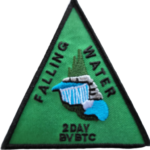 Trip Information
Departure Time: 08:30
Return to City Time: 18:30
Departure Point: Kipling Departure Point Click here for more information or to register Optional Items
Badge (optional) - Members ($10)
Badge (optional) - Non-members ($15)
Hosting Club: Toronto
Category: Bus Hike
Location (Google Maps): Beaver Valley Ski Club Hike Leader(s): Marijo Roy, Felix Wan Click here to contact Hike Leader(s) Pace: Moderate (3-4 km/hr)
Terrain: Challenging, Level 2 (Intermediate – some hills and uneven surfaces, rocks and roots underfoot)
Distance: 30 km over two Saturdays Description
Please join us for a series of two 15 km hikes to earn the Two-Day Falling Water badge. These beautiful hikes will take us on both the east and west sides of the Beaver Valley. The Falling Water section includes some challenging parts, with plenty of ups and downs and several steep sections. Those who complete the entire loop will receive the Two-Day Falling Water Triangle badge. The fee ($10.00 for members; $15.00 for non-members) will be collected on the bus at the start of Hike #2 for those who opt to obtain the badge. Hike #1 of 2 (BT Map #26) – Today, we’ll hike east on the Valley Crossover Side Trail, then south to Hogg’s Falls, reaching km 65.2. A late return to Kipling Station is expected. Reminders:
1. Wear sturdy footwear and appropriate attire for the weather and the terrain (snow might be present).
2. Hiking poles are a good idea in any season, especially when the terrain is rocky or slippery.
3. Always carry I.D. and your health card.
4. Bring lunch, sufficient water, and snacks. A minimum of 2L of water is recommended.
5. Bring your own first aid kit. Looking forward to hiking with you, Marijo and Felix
- Car Hike: Happy Valley King City
8:30 AM-1:15 PM 11/15/2025 https://hikes.brucetrail.org/event/car-hike-happy-valley-king-city-7/2025-11-15/ Click here for more information or to register Hosting Club: Toronto
Category: Car Hike
Location (Google Maps): Happy Valley, Oak Ridges Trail 16th Sideroad & Weston Road Please park along 16th Side road Hike Leader(s): Mohammad Aghamiri Click here to contact Hike Leader(s) Pace: Moderate (3-4 km/hr)
Terrain: Hilly, Level 2 (Intermediate – some hills and uneven surfaces, rocks and roots underfoot)
Distance: 12-14 km Description
Come and join us to view nice scenery and look out of Happy valley
- #1/3 Toronto E2E & in Memory of Doug Sloan – 18KM
9:00 AM-2:30 PM 11/15/2025 https://hikes.brucetrail.org/event/hike-in-memory-of-doug-sloan-from-speyside-to-kelso-18km/2025-11-15/ 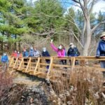 Click here for more information or to register Hosting Club: Toronto
Category: Car Hike
Location (Google Maps): KM121.3. Kelso Conservation Area Hike Leader(s): Alina Lin Pace: Brisk (4-5 km/hr)
Terrain: Challenging, Hilly, Level 2 (Intermediate – some hills and uneven surfaces, rocks and roots underfoot), Rocky, Variable
Distance: 19 km Description
If you have been a member of the Bruce Trail community long enough, you might have heard of Doug Sloan, a legendary hiker who completed the Bruce Trail End-to-End more than 50 times—he actually achieved his 50th completion in 2015 and stopped counting afterward, though he continued hiking until he passed away in December 2021. As an avid hiker, committed Hike Leader and Trail Captain, and passionate supporter of the Bruce Trail, Doug made countless friends on the trail and inspired many with his remarkable dedication and accomplishments. In May 2024, a plaque “The Doug Sloan Wetland” was unveiled in Speyside to honour his contributions and achievements. My last hike with Doug was on November 14, 2020, when he joined the final hike of a Toronto Section double-badge End-to-End series I led, during which he presented badges to qualifying hikers. That hike took place between Kelso Conservation Area and Speyside. It feels fitting that my current End-to-End journey brings me back to the same area around the same time of year. On November 15, 2025, I am leading a hike from Speyside to Kelso Conservation Area and making it a hike in memory of Doug Sloan. Our hike will start at Speyside, where Doug’s commemorative plaque stands, and end at Kelso, where this group photo was taken back on November14, 2020. Meeting Point:
Kelso Conservation Area parking lot. Enter from Tremaine Rd between Steeles Ave nd Highway401. GPS: 43.503204, -79.947548. Entrance fee applies at Kelso Conservation Area, see details at https://www.conservationhalton.ca/park-fees-membership-rates/ Please arrive at the parking lot before 8:45am to allow time for car shuttle coordination. We will car shuttle to Toronto Section KM14.1. 17th side road, GPS: 43.592859,-79.980456. From there to hike back to Kelso Conservation Area. All drivers are expected to participate in the car shuttle, either before or after the hike. All hikers are expected to chip in for parking fees, if applicable. Important Notes: - Wear sturdy hiking footwear and dress appropriately for the weather
- Bring snacks, and at least 1.5L of water
- No dropouts available.
- No pets.
|
16 - Urban Walk: Rosedale Ravines
10:00 AM-1:00 PM 11/16/2025 https://hikes.brucetrail.org/event/urban-walk-rosedale-ravines-3/2025-11-16/ Click here for more information or to register Hosting Club: Toronto
Category: Urban Walk
Location (Google Maps): Meet Pleasant Blvd Exit, St Clair Subway Station Hike Leader(s): Tom Swales Click here to contact Hike Leader(s) Pace: Moderate (3-4 km/hr)
Terrain: Level 1 (Easy – mostly on flat, well maintained trails with hard-packed surface), Variable
Distance: 10 km Description
Join us for a morning circular walk through David Balfour Park, Park Drive Reservation, the Evergreen Brickworks, Moore Park Ravine and Mount Pleasant Cemetery. On this walk we find nature close to the heart of the city.
| 17 | 18 - Heather & Steve’s 3rd Annual Fall Cairn to Cairn – Toronto section
7:45 AM 11/18/2025 https://hikes.brucetrail.org/event/heather-steves-3rd-annual-fall-cairn-to-cairn-toronto-section/2025-11-18/ 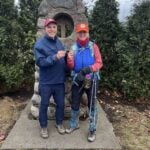 Hike open to BTC Members only. This is a Multi-Day HikeYou are signing up for the following dates and times:
2025-11-18 at 07:45
2025-11-19 at
2025-11-20 at Click here for more information or to register Hosting Club: Toronto, Caledon Hills
Category: End-to-End
Location (Google Maps): Roadside parking – north of km 32.3 (Map 13) on the eastern shoulder of Eighth Line at the southernmost intersection with 27 Sideroad. (Capacity 4 cars) Hike Leader(s): Heather Murch Click here to contact Hike Leader(s) Pace: Brisk – 4 to 5 km/hour
Terrain: Strenuous – hilly with steep climbs and some poor footing
Distance: 18.5 km Description
This hike series covers the Toronto section; 51 km over 3 days. We will meet each morning at 7:45 and be ready to shuttle at 8:00. Hikers will take turns shuttling and taking drivers to their cars each day. Any parking costs will be shared among hikers. Hikers should wear layered clothing, hiking boots, poles, hat, sunscreen, bug spray, rain gear and bring plenty of water, snacks and lunch. We will hike rain or shine. Full itinerary will be emailed to hikers the week before the first hike.
- Urban Walk: Valley View Park Thornhill
8:45 AM-11:00 AM 11/18/2025 https://hikes.brucetrail.org/event/urban-walk-valley-view-park-thornhill-118/2025-11-18/ Click here for more information or to register Hosting Club: Toronto Location (Google Maps): Parking lot is off Sycamore Drive East of Bayview , across Starbucks plaza
Bus 91 from Finch east station stops at Sycamore station. Hike Leader(s): Mohammad Aghamiri Click here to contact Hike Leader(s) Pace: Moderate (3-4 km/hr)
Terrain: Hilly, Level 2 (Intermediate – some hills and uneven surfaces, rocks and roots underfoot)
Distance: 7-8 km Description
We will explore Valleyview and Maple View parks, and walk along German Mill Creak, in return we stop in Huntington park and have snack under beautiful shed , Even it is considered Urban walk, it is urban hike as we have some up and down hills and tree roots, please bring your hiking poles, water and snacks, phone number for the day of hike 289 588 6482
| 19 | 20 - Urban Walk: Valley View Park Thornhill
8:45 AM-11:00 AM 11/20/2025 https://hikes.brucetrail.org/event/urban-walk-valley-view-park-thornhill-119/2025-11-20/ Click here for more information or to register Hosting Club: Toronto Location (Google Maps): Parking lot is off Sycamore Drive East of Bayview , across Starbucks plaza
Bus 91 from Finch east station stops at Sycamore station. Hike Leader(s): Mohammad Aghamiri Click here to contact Hike Leader(s) Pace: Moderate (3-4 km/hr)
Terrain: Hilly, Level 2 (Intermediate – some hills and uneven surfaces, rocks and roots underfoot)
Distance: 7-8 km Description
We will explore Valleyview and Maple View parks, and walk along German Mill Creak, in return we stop in Huntington park and have snack under beautiful shed. Although this is considered an “Urban Walk”, you can expect some hills up and down and uneven surfaces with tree roots. Please bring hiking poles, water and snacks. phone number for the day of hike 289 588 6482
| 21 | 22 - Did someone say badge?!! Two-Day Falling Water Badge – School Bus Hike (#2 of 2)
8:30 AM-6:30 PM 11/22/2025 https://hikes.brucetrail.org/event/did-someone-say-badge-two-day-falling-water-badge-school-bus-hike-2-of-2/2025-11-22/  Trip Information
Departure Time: 08:30
Return to City Time: 18:30
Departure Point: Kipling Departure Point Click here for more information or to register Optional Items
Badge (optional) - Members ($10)
Badge (optional) - Non-members ($15)
Hosting Club: Toronto
Category: Bus Hike
Location (Google Maps): Beaver Valley Ski Club Hike Leader(s): Marijo Roy, Felix Wan Click here to contact Hike Leader(s) Pace: Moderate (3-4 km/hr)
Terrain: Challenging, Level 2 (Intermediate – some hills and uneven surfaces, rocks and roots underfoot)
Distance: 30 km over two Saturdays Description
Please join us for a series of two 15 km hikes to earn the Two-Day Falling Water badge. These beautiful hikes will take us on both the east and west sides of the Beaver Valley. The Falling Water section features many challenging parts, with lots of ups and downs, and some quite steep sections. Those who complete the entire loop will receive the Two-Day Falling Water Triangle badge. The fee ($10.00 for members; $15.00 for non-members) will be collected on the bus at the start of Hike #2 for those who opt to obtain the badge. Hike #2 of 2 (BT Map #26) – Starting at Eugenia’s Falls, we’ll hike south to Hogg’s Falls, and then continue on side trails, covering approximately 12 km. There will be a dropout point at about 7 km (Hogg’s Falls). Reminders:
1. Wear sturdy footwear and appropriate attire for the weather and the terrain (snow might be present).
2. Hiking poles are a good idea in any season, especially when the terrain is rocky or slippery.
3. Always carry I.D. and your health card.
4. Bring lunch, sufficient water, and snacks. A minimum of 2L of water is recommended.
5. Bring your own first aid kit. A late return to Kipling Station is expected. Looking forward to hiking with you, Marijo and Felix
- Car Hike: Bethesda Trail Richmond Hill
8:30 AM-1:15 PM 11/22/2025 https://hikes.brucetrail.org/event/car-hike-bethesda-trail-richmond-hill-32/2025-11-22/ Click here for more information or to register Hosting Club: Toronto Location (Google Maps): Free parking lot at the head of trail Bethesda Side Road off Bayview Ave. across Wilcox lake Hike Leader(s): Mohammad Aghamiri Click here to contact Hike Leader(s) Pace: Moderate (3-4 km/hr)
Terrain: Hilly, Level 2 (Intermediate – some hills and uneven surfaces, rocks and roots underfoot)
Distance: 14-15 km Description
Join us to explore the trails of York Regional Forest and the Oak Ridges Corridor at Jefferson Forest and Bond lake, From parking lot we hike thought Jefferson forest and continue to Bond Lake and have snack beside the lake and return to parking around 13 to 13.30
- Car Hike: Cardio Conditioning at Hockley Valley
8:30 AM-1:30 PM 11/22/2025 https://hikes.brucetrail.org/event/car-hike-cardio-conditioning-at-hockley-valley/2025-11-22/ Click here for more information or to register Hosting Club: Toronto, Caledon Hills
Category: Car Hike
Location (Google Maps): Roadside parking on 4th line EHS at the entrance to the Peter Beecham Side Trail. Km 54.9 Map 18, Edition 31. GPS Coordinates N43.976327, W80.026621 Hike Leader(s): Ross Estrella Click here to contact Hike Leader(s) Pace: Brisk (4-5 km/hr), Fast (5 km/hr or greater)
Terrain: Challenging, Hilly, Level 2 (Intermediate – some hills and uneven surfaces, rocks and roots underfoot)
Distance: 14 km Description
Now that the colder temperature is upon us, let’s not freeze ourselves. Join me and others for a cardio conditioning (study shows that short distance on a fast pace is physically more beneficial vs long distance on a slow pace) and the trails of Hockley Valley, widely known as the hilliest section of the Bruce Trail is an ideal place to surely warm-up our body and spirit. Things to bring on a day hike, sun protection, rain/snow jacket, snacks, lunch, beverages, first aid kit, personal medication (if any) and health card. We’ll be on a brisk to fast pace with occasional stop for photos while maintaining the pace. Layered clothing, durable hiking shoe and hiking poles (if using) is highly recommended. Don’t forget to bring your happy faces and enthusiasm Please arrive fifteen minutes early for car shuttling. Let’s go hike !!
- Wayne Crockett Memorial Hike from High Park to St Lawrence Market – 13KM
9:30 AM-1:00 PM 11/22/2025 https://hikes.brucetrail.org/event/wayne-crockett-memorial-hike-from-high-park-to-st-lawrence-market-13km/2025-11-22/  Click here for more information or to register Hosting Club: Toronto
Category: Urban Walk
Location (Google Maps): High Park North Gate Hike Leader(s): Tom Swales, Alina Lin, Janet McColeman, Ted Moriarty Click here to contact Hike Leader(s) Pace: Moderate (3-4 km/hr)
Terrain: Flat, Level 1 (Easy – mostly on flat, well maintained trails with hard-packed surface)
Distance: 13 KM Description
🌿 Memorial Hike in Honour of Wayne Crockett 🌿 Wayne Crockett was more than a hike leader — he was a friend, mentor, and inspiration to so many in the hiking community. His love for nature, walking, and connecting with people made every hike memorable. Wayne touched countless lives through his kindness, humour, and genuine spirit. To celebrate Wayne’s legacy, we’ll gather for a Memorial Hike in his honour, beginning at High Park and then Sir Casimir Gzowski Park , where a memorial bench and a tree with a plaque stand as a lasting tribute to him. After a moment of remembrance, we’ll head east along the Waterfront Trail, taking in the beautiful lakeside scenery that Wayne so loved. Our journey will end at the St. Lawrence Market, where hikers can enjoy good food, good company, and all the vibrant sights and flavours the Market offers — just the kind of lively experience Wayne would have appreciated. Come join us to walk, remember, and celebrate a cherished friend who inspired so many steps and smiles along the trail. Let’s walk together in Wayne’s spirit — with friendship, laughter, and love for the trail. A few notes: - Dress appropriately for the weather
- Bring water and snacks
- Running shoes are recommended over hiking boots for dry day.
- No pets.
- Urban Walk: Humber River/Swansea Theatre Hike
3:00 PM-6:00 PM 11/22/2025 https://hikes.brucetrail.org/event/urban-walk-humber-river-swansea-theatre-hike-2/2025-11-22/ Click here for more information or to register Hosting Club: Toronto
Category: Urban Walk
Location (Google Maps): Meet by the TTC Stop on the Southeast Corner of Scarlett Road and Eglinton Avenue West. Take the #79 Scarlett Road bus from Runnymede Station to Eglinton or the Eglinton West #32A from Eglinton West Station to Scarlett Road. Hike Leader(s): Miriam Stevens Click here to contact Hike Leader(s) Pace: Leisurely (2-3 km/hr)
Terrain: Level 1 (Easy – mostly on flat, well maintained trails with hard-packed surface), Variable
Distance: 10-12 km Description
Leisurely hike (3 kms/hour – No Racers Please) suitable for beginners and families.
Hike along the Humber River trail and into the Swansea village at Runnymede road and Bloor street west. The hike will end opposite Runnymede Subway near the Village Playhouse Theatre and local restaurants and pubs. Distance may vary according to the weather and trail conditions and how people feel. Early dropout is possible at Old Mill Subway Station. After the hike you may choose to join us for dinner at around 6 PM at Ali Baba Mediterranean restaurant or at a nearby pub. We will attend the play “Filthy Rich” at 8 PM at The Bloor West Village Players theatre, 2190 Bloor Street West, Toronto.
Call the Theatre directly at (416) 767 7702 to reserve your ticket, cost $26- $29.00. Please do mention that you’re with the Bruce Trail Conservancy, Toronto Club so they know we are supporting them. Anyone is welcome to join us for the hike only, join us for the theatre performance, or, join us for all three: Hike, Dinner and play. Paid parking is available off Kennedy Avenue north of Bloor Street West (behind the Village Playhouse Theatre building). There is no parking available at the start of the hike.
|
23 - Car Hike: Exploring Uxbridge Trails (Wilder Forest, Walker Woods, and Glen Major Forest)
8:00 AM-12:15 PM 11/23/2025 https://hikes.brucetrail.org/event/car-hike-exploring-uxbridge-trails-wilder-forest-walker-woods-and-glen-major-forest-18/2025-11-23/  Click here for more information or to register Hosting Club: Toronto
Category: Car Hike
Location (Google Maps): 2499 Brock Rd, Uxbridge, ON L9P 1R4. We will meet at the East Duffins Headwaters parking lot at the WILDER FOREST trail head. As soon as you got off the Brock Road, passing the horse back riding facility, there is a free designated parking lot 70 meters down the lane to your right. It includes a sign board for East Duffins Headwaters with a map of the trails. Please do not park on the lane or in the horse back riding property. Hike Leader(s): Amir Alemohammad Click here to contact Hike Leader(s) Pace: Moderate (3-4 km/hr)
Terrain: Flat, Hilly, Level 2 (Intermediate – some hills and uneven surfaces, rocks and roots underfoot), Variable
Distance: Approx.15-16 Km Description
Join us for a delightful hike in Uxbridge, as we explore Wilder Forest, Walker Woods, and Glen Major Forest on a scenic loop starting from Brock Road. We’ll pass Concession Road 6, heading west and back, while also venturing onto several side trails for even more stunning views. What to Expect: •Beautiful scenic views and lookouts facing south •A mix of hilly and flat terrain •Frequent 2-minute breaks for hydration and photos, with a 10-20 minute lunch/snack stop •Stay on designated trails at all time What to Bring and Wear: •Hiking Boots and poles (recommended) and be prepared for the ice on the trail, keep your icers handy. •At least 2 liters of water •Your favorite snacks and lunch (pack your own refreshments for an outdoor meal) •Dress according to variable weather conditions! Important Details: •Stay on the designated trails •Be prepared for the elements and enjoy the adventure! Looking forward to seeing you on the trail! Don’t forget your camera and a smile as we explore the beauty of the Uxbridge trails! This is a joint hike with the Oak Ridges Trail Association (ORTA).
| 24 | 25 - Urban Walk: Valley View Park Thornhill
8:45 AM-11:00 AM 11/25/2025 https://hikes.brucetrail.org/event/urban-walk-valley-view-park-thornhill-120/2025-11-25/ Click here for more information or to register Hosting Club: Toronto Location (Google Maps): Parking lot is off Sycamore Drive East of Bayview , across Starbucks plaza
Bus 91 from Finch east station stops at Sycamore station. Hike Leader(s): Mohammad Aghamiri Click here to contact Hike Leader(s) Pace: Moderate (3-4 km/hr)
Terrain: Hilly, Level 2 (Intermediate – some hills and uneven surfaces, rocks and roots underfoot)
Distance: 7-8 km Description
We will explore Valleyview and Maple View parks, and walk along German Mill Creak, in return we stop in Huntington park and have snack under beautiful shed. Although this is considered an “Urban Walk”, you can expect some hills up and down and uneven surfaces with tree roots. Please bring hiking poles, water and snacks. phone number for the day of hike 289 588 6482
| 26 | 27 - Urban Walk: Valley View Park Thornhill
8:45 AM-11:00 AM 11/27/2025 https://hikes.brucetrail.org/event/urban-walk-valley-view-park-thornhill-121/2025-11-27/ Click here for more information or to register Hosting Club: Toronto Location (Google Maps): Parking lot is off Sycamore Drive East of Bayview , across Starbucks plaza
Bus 91 from Finch east station stops at Sycamore station. Hike Leader(s): Mohammad Aghamiri Click here to contact Hike Leader(s) Pace: Moderate (3-4 km/hr)
Terrain: Hilly, Level 2 (Intermediate – some hills and uneven surfaces, rocks and roots underfoot)
Distance: 7-8 km Description
We will explore Valleyview and Maple View parks, and walk along German Mill Creak, in return we stop in Huntington park and have snack under beautiful shed. Although this is considered an “Urban Walk”, you can expect some hills up and down and uneven surfaces with tree roots. Please bring hiking poles, water and snacks. phone number for the day of hike 289 588 6482
| 28 | 29 - Car Hike: Scenic Adam Dopko ST, Felker’s Falls via Devil Punch Bowl
8:30 AM-2:15 PM 11/29/2025 https://hikes.brucetrail.org/event/car-hike-scenic-adam-dopko-st-felkers-falls-via-devil-punch-bowl/2025-11-29/ Click here for more information or to register Hosting Club: Iroquoia, Toronto
Category: Car Hike
Location (Google Maps): Meeting location GPS coordinates, N43.202814, W79.791216 at Km 23.2 Map 6, Edition 31. Felker’s Falls Parking Area. From Mud St, turn north on Paramount Drive and continue to Ackland St and follow signs to parking aera. Please follow these coordinates to arrive at the specific parking lot. Hike Leader(s): Ross Estrella Click here to contact Hike Leader(s) Pace: Brisk (4-5 km/hr)
Terrain: Hilly, Level 2 (Intermediate – some hills and uneven surfaces, rocks and roots underfoot), Rocky, Variable
Distance: 17 kms Description
From the hilly and beautiful Adam Dopko St, we’ll follow the Main Trail to Felker’s Falls via Devil Punch Bowl on a brisk pace. We’ll have occasional stops for photo shoots while maintaining the pace. Items to bring on day hike: Snacks, lunch, sufficient hydration liquid, sun protection, rain/snow jacket and first aid kit. Now that we’re on an unsettled weather condition clothes layering is highly recommended. Durable hiking shoe/boot and poles (if your using) are recommended. Always bring your personal medication if any and health card and most of all bring your happy face and enthusiasm. Before signing please make sure you’ll be able to pace with the rest of the group. Please arrive fifteen minutes early for car shuttling. See you all at the trail. Note: Shift in weather forecast of snow starting midweek thru the weekend. Please bring your icers and gaiters in case it’s needed.
- Car Hike: Boyd Conservation Park Vaughan
8:30 AM-1:15 PM 11/29/2025 https://hikes.brucetrail.org/event/car-hike-boyd-conservation-park-vaughan-10/2025-11-29/ Click here for more information or to register Hosting Club: Toronto
Category: Car Hike
Location (Google Maps): Free parking lot before main entrance of park Hike Leader(s): Mohammad Aghamiri Click here to contact Hike Leader(s) Pace: Moderate (3-4 km/hr)
Terrain: Hilly, Level 2 (Intermediate – some hills and uneven surfaces, rocks and roots underfoot), Variable
Distance: 12-14 km Description
Let’s hike Boyd conservation park trails through beautiful valleys. Please bring lots of water and snacks ,hiking poles are recommended phone number for the day of hike 289 588 6482
- School Bus Hike: Northumberland Forest and Peter’s Woods
8:30 AM-6:30 PM 11/29/2025 https://hikes.brucetrail.org/event/school-bus-hike-northumberland-forest-and-peters-woods/2025-11-29/ Trip Information
Departure Time: 08:30
Return to City Time: 18:30
Departure Point: York Mills Bus Pickup Click here for more information or to register Optional Items
Moderate group ($0.01)
Fast group ($0.01)
Hosting Club: Toronto
Category: Bus Hike
Location (Google Maps): Northumberland Forest Hike Leader(s): Martina Furrer, Leila Damband, Roland Mark, Duro Vukman Click here to contact Hike Leader(s) Pace: Brisk (4-5 km/hr), Moderate (3-4 km/hr)
Terrain: Hilly, Level 2 (Intermediate – some hills and uneven surfaces, rocks and roots underfoot), Variable
Distance: 15 km Description
Join us for a fun hike on the Oak Ridges Trail and through the rolling hills of the beautiful Northumberland County Forest. We will explore a black oak woodland, one of Canada’s rarest habitats, and stop to enjoy the view of the Rice Lake plains from the top of Lookout Mountain. Our day will also include a walk through Peter’s Woods, a magnificent old growth forest that’s home to oak and maple trees that are more than 400 years old. Finish with refreshments and holiday shopping at The Big Apple. Expect some short, steep hills. Total distance: moderate group about 12 km, fast group 15 km +
- Car Hike: #2/3 Toronto End to End – 21KM
9:00 AM-3:15 PM 11/29/2025 https://hikes.brucetrail.org/event/car-hike-2-3-toronto-e2e-in-memory-of-doug-sloan-21km/2025-11-29/  Click here for more information or to register Hosting Club: Toronto
Category: Car Hike
Location (Google Maps): 17th side road Hike Leader(s): Alina Lin Pace: Brisk (4-5 km/hr)
Terrain: Challenging, Hilly, Level 2 (Intermediate – some hills and uneven surfaces, rocks and roots underfoot), Rocky, Variable
Distance: 21 km Description
Meeting Point:
17th side road parking, GPS: 43.592859,-79.980456. Please arrive at the parking area before 8:45am to allow time for car shuttle coordination. We will car shuttle to Roadside parking east of KM33.4 across from the Eighth Line Side Trail on Eighth Line. GPS: 43.679840, -79.966419. From there we will hike main trail back to 17th Side Road Parking. All drivers are expected to participate in the car shuttle, either before or after the hike. All hikers are expected to chip in for parking fees, if applicable. Important Notes: - Wear sturdy hiking footwear and dress appropriately for the weather
- Bring snacks, and at least 1L of water
- No dropouts available.
- No pets.
|
30 | December | December | December | December | December | December |