
The BTC office will be closed Tues. Sept. 22 and Wed. Sept. 23. The office will reopen on Thurs. Sept. 24 at 9 am. Thank you for your understanding.
Join us for a hike! Registration required:
All hikes available to BTC members. Some hikes are open to non-members.
TIP: The calendar view displays up to 7 hikes on a day, but often there are more. Click “More events” to see them all.
Toronto Hike Schedule
Toronto Bruce Trail Club Registration Live Dates
Day Winter Coach Program
Registration begins two weeks in advance of the event departure (at 8:00 PM)
Day Bus Hikes
Registration begins two weeks in advance of the event departure (at 8:00 PM) with some exceptions of special event hikes
Day Coach Hikes
Registration begins 7 weeks in advance of the event departure
Day Car Hikes and Urban Hikes
Registration begins two weeks in advance of the event departure
Overnight and Weekend Trips
Registration begins 12 weeks in advance of the event departure
To view all Bruce Trail Conservancy Hikes click here
- 24March 24, 2024

Car Hike: Hike #3 to earn the Dufferin Hi-Land Youth and/or Side Trails Badge!
https://hikes.brucetrail.org/event/car-hike-hike-3-to-earn-the-dufferin-hi-land-youth-and-or-side-trails-badge/Sorry, the registration cut-off time for this hike has been reached.Not a member? Click here to join today!Hosting Club: Toronto, Caledon Hills, Dufferin Hi-Land
Category: Car Hike
Location (Google Maps): We will meet at Mono Cliffs Provincial Park at 795086 3rd Line EHS (Map 19 of the Bruce Trail Reference Guide, Edition 31). Note that reservations and fees apply to this parking lot.Hike Leader(s): Monica Pasquali Click here to contact Hike Leader(s)
Pace: Leisurely
Terrain: Variable
Distance: 9 kmDescription
Calling all families with children who love hiking and earning badges!!!This is the third in a series of ten hikes that will be offered throughout 2024 on a roughly monthly basis so that children who are 15 years of age and younger can earn the Dufferin Hi-Land Adventurer Youth Badge and their parents/guardians can earn the Dufferin Hi-Land Side Trails Badge at the same time!!! Details regarding the requirements for each badge can be found here: https://dufferinbrucetrailclub.org/dufferin-bruce-trail-club-badges/ Each of the ten hikes will be a loop hike so no car shuttles will be needed, and each hike will cover a distance of approximately 6-9 km hiked at a leisurely pace (2-3 km/h) so children and adults alike can participate.
This third hike will be a late winter/early spring hike to explore some side trails within and south of Mono Cliffs Provincial Park, specifically the Carriage Side Trail, the South Outlier Connector, the South Outlier Loop Trail, and the Whitetail Refuge Side Trail (this last side trail is part of the Caledon Hills section of the Bruce Trail). Please dress appropriately for a late winter/early spring hike by dressing in layers (wear an inner layer that wicks sweat away from your skin, a middle layer that keeps you warm, and an outer layer that protects you from wind and snow), wearing gloves/mittens and a toque, and wearing warm and comfortable footwear that has good traction in snow/ice (icers placed over your boots work great!). Hiking poles or walking sticks are an asset since they will help keep you balanced if the ground is slippery. As well, make sure you bring enough water and food for a 3-4 hour hike since we’ll be covering a total distance of approximately 9 km.
*Please note that this hike will begin at a later time than the other hikes in this series because it involves a paid parking lot at Mono Cliffs Provincial Park with set time slots. I will email people registered for this hike five days before the day of the hike so they can reserve their parking space at Mono Cliffs Provincial Park beforehand. The cost to park for a 4-hour time slot at Mono Cliffs Provincial Park is $8.50.
Hopefully you’ll be able to join me on Sunday, March 24th! Until then, happy hiking, everyone!
- 25March 25, 2024No events
- 26March 26, 2024
Urban Walk: Valley View Park Thornhill
https://hikes.brucetrail.org/event/urban-walk-valley-view-park-thornhill-18/Sorry, the registration cut-off time for this hike has been reached.Not a member? Click here to join today!Hosting Club: Toronto
Location (Google Maps): Parking lot at the corner of Bayview Ave, and Sycamore Dr. South of Highway 7
Hike Leader(s): Mohammad Aghamiri Click here to contact Hike Leader(s)
Pace: Moderate
Terrain: Hilly
Distance: 7-8 kmDescription
We will explore Valleyview and Huntington park and walk along German Mill Creek,It is winter time and trail is hilly bring proper clothing, ,hiking boots ,and ice cleats.
- 27March 27, 2024No events
- 28March 28, 2024
Urban Walk: Valley View Park Thornhill
https://hikes.brucetrail.org/event/urban-walk-valley-view-park-thornhill-19/Sorry, the registration cut-off time for this hike has been reached.Not a member? Click here to join today!Hosting Club: Toronto
Location (Google Maps): Parking lot at the corner of Bayview Ave, and Sycamore Dr. South of Highway 7
Hike Leader(s): Mohammad Aghamiri Click here to contact Hike Leader(s)
Pace: Moderate
Terrain: Hilly
Distance: 7-8 kmDescription
We will explore Valleyview and Huntington park and walk along German Mill Creek,It is winter time and trail is hilly bring proper clothing, ,hiking boots ,and ice cleats.
- 29March 29, 2024

Urban Walk: Georgina Lakeshore & Metro Road Tract
https://hikes.brucetrail.org/event/urban-walk-georgina-lakeshore-metro-road-tract/Sorry, the registration cut-off time for this hike has been reached.Not a member? Click here to join today!Hosting Club: Toronto
Category: Urban Walk
Location (Google Maps): Georgina, OntarioHike Leader(s): Celia Ho Click here to contact Hike Leader(s)
Pace: Moderate
Terrain: Flat, Variable
Distance: 16.71 kmDescription
Discover Georgina with an exploratory trip to Georgina’s lakeshore along Lake Simcoe and the Metro Road Tract trail in York Region. https://onthegomap.com/s/1r6ogqb7Meeting point: Yonge Street and Steeles Avenue intersection northbound bus stop (If coming from the subway you may choose to board the bus at Finch bus terminal and meet at the next transfer stop or the starting point of the walk/hike)
Transit: York Region Transit Viva Blue bus
Commuting route (to destination):
blue, Yonge / Steeles to Yonge / Davis Northbound, 9:32 AM – 10:32 AM
050, Davis Dr / Yonge St to Metro Rd / Dalton Rd, 10:37 AM – 11:41 AMCommuting route (return trip):
050, Metro Rd / Lake Dr N to Davis Dr / Yonge St, 4:11 PM – 5:06 PM
blue, Yonge / Davis Southbound to Finch, 5:15 PM – 6:30 PMDistance: 16.71 km
Pace: 4 km/hour
Note: Please be advised that the commuting time is +2 hours each way.
- 30March 30, 2024
Car Hike: Toronto E2E 2/3
https://hikes.brucetrail.org/event/car-hike-toronto-e2e-2-3-2/Sorry, the registration cut-off time for this hike has been reached.Not a member? Click here to join today!Hosting Club: Toronto
Category: Car Hike
Location (Google Maps): We will again meet at km 17.4 (GPS N43.615163, W79.975157) on the east side of the road where the trail crosses Fourth Line and do our shuttle from there.Hike Leader(s): Jacquie Van Dyke Click here to contact Hike Leader(s)
Pace: Moderate
Terrain: Variable
Distance: 16 kmDescription
This is the second of three hikes in this series to complete the Toronto E2E. We will be hiking in early spring conditions (mud, ice, snow) so be prepared for it all. Please have your icers, gaitors, and poles at the ready. Hiking boots/shoes are mandatory. We will stop for snacks and lunch so bring 2L of water, snacks, and your lunch.We will be shuttling to our starting point so pleased be prepared participate in the shuttle. All Covid 19 restrictions will be followed.
Today we will be hiking past the “Hole in the Wall” in Limehouse.
Car Hike: Sydenham E2E 2/8
https://hikes.brucetrail.org/event/car-hike-sydenham-e2e-2-8/Sorry, the registration cut-off time for this hike has been reached.Not a member? Click here to join today!Hike open to BTC Members only.
Hosting Club: Toronto
Category: Car Hike
Location (Google Maps):We will meet at km 20.7. Coordinates N 44.507399,W 80.810098 shoulders of 6th concession S
Hike Leader(s): Smadar Junkin Click here to contact Hike Leader(s)
Pace: Brisk
Terrain: Challenging, Variable
Distance: 21.4 kmDescription
2nd hike of 8, we will carpool to km 41,7 and hike back. Bring icers and 2 litres of water. We will follow all Covid 19 instructions. Please arrive 15 minutes early, so the car shuttle can leave by 8:30. Everyone is expected to participate in car shuttle throughout the 8 days. Expected pace is 4- 4.5 km per hour moving time.Car Hike: Wilder Forest Uxbridge
https://hikes.brucetrail.org/event/car-hike-wilder-forest-uxbridge-4/Sorry, the registration cut-off time for this hike has been reached.Not a member? Click here to join today!Hosting Club: Toronto
Location (Google Maps): 2499 Brock Road, Uxbridge, ON there is a free parking when you enter the road off brock road beside Horse training facility
Hike Leader(s): Mohammad Aghamiri Click here to contact Hike Leader(s)
Pace: Moderate
Terrain: Variable
Distance: 14-17KMDescription
We will explore Wilder forest and the beautiful scenery of Uxbridge forests.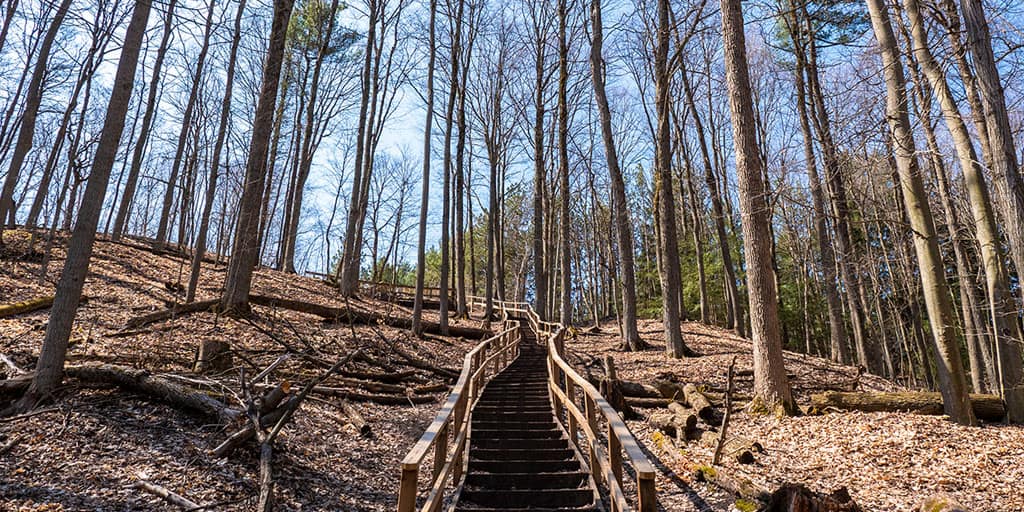
Urban Walk: Peggy's Wood, Dave Kerwin Trail & Thornton Bales Conservation Area (99 Steps)
https://hikes.brucetrail.org/event/urban-walk-peggys-wood-dave-kerwin-trail-thornton-bales-conservation-area-99-steps/Sorry, the registration cut-off time for this hike has been reached.Not a member? Click here to join today!Hike open to BTC Members only.
Hosting Club: Toronto
Category: Urban Walk
Location (Google Maps): Newmarket, East Gwillimbury, King City, OntarioHike Leader(s): Celia Ho Click here to contact Hike Leader(s)
Pace: Moderate
Terrain: Flat, Hilly, Variable
Distance: 16.79 kmDescription
Discover Newmarket, East Gwillimbury, and King City with an exploratory trip to Peggy’s Wood, Dave Kerwin Trail and the Thornton Bales Conservation Area (99 Steps) in York Region. https://onthegomap.com/s/5ckipp28Meeting point: Finch Bus Terminal
Transit: York Region Transit Viva bus
Commuting route (to destination):
blue, Finch to Newmarket Terminal, 9:14 AM – 10:23 AM
Commuting route (return trip):
057, Bathurst St / Keith Av to Newmarket Terminal, 3:16 PM – 3:23 PM
blue, Newmarket Terminal to Finch, 3:36 PM – 4:58 PMDistance: 16.79 km
Pace: 4 km/hour
Note: Please be advised that the commuting time is +1 hours each way.
!!! Beware of steep incline in the Thornton Bales Conservation Area (99 Steps): The change in vertical elevation from the top of the 99 steps to the bottom is a larger change in elevation than the drop over Niagara Falls!
Car Hike: Caledon Trailway
https://hikes.brucetrail.org/event/car-hike-caledon-trailway/Sorry, the registration cut-off time for this hike has been reached.Not a member? Click here to join today!Hosting Club: Toronto
Category: Car Hike
Location (Google Maps): Caledon Rail TrailHike Leader(s): Al Brown Click here to contact Hike Leader(s)
Pace: Moderate
Terrain: Flat
Distance: 17 kmDescription
We will hike the Caledon Rail Trail from Mississauga Road to Caledon East. This hike is intended to get us started on the spring hiking season. Hiking boots are recommended but not essential. Trail conditions should be mostly dry depending on weather.From Caledon East we car pool to Mississauga Road and hike back. The hike passes through Inglewood and natural areas. East of Hwy 10 we pass through a swampy area frequented by beavers. We will also pass a remnant of the past when railways held our country together. After the hike you may join other hikers for a coffee at the Four Corners Cafe.
To get to the meeting point drive north on Airport Road from King Street in Caledon. Turn right on Old Church Road and go less than 1 km to the Town Hall (on your right). Meet other hikers at the south west corner of the parking area
Urban Walk: Old Mill Subway station to Weston Lions Park
https://hikes.brucetrail.org/event/urban-walk-old-mill-subway-station-to-weston-lions-park/Sorry, the registration cut-off time for this hike has been reached.Not a member? Click here to join today!Hosting Club: Toronto
Category: Urban Walk
Location (Google Maps): Old Mill Subway stationHike Leader(s): Ray Berzins Click here to contact Hike Leader(s)
Pace: Moderate
Terrain: Flat
Distance: 9 kmDescription
An Easter Saturday hike.
We start at Old Mill subway Station and walk upstream along the Humber River. I expect to hear lots of birds in James Gardens.
When we arrive in Weston at end of hike around 12:30 PM a Pizza Pizza, Tim Hortons as well as other restaurants are nearby if you have not brought a lunch to eat in Weston Lions Park.To travel by transit back home from Weston Lions Park, there is an Eastbound Eglinton West #52 bus to Lawrence West subway or Lawrence subway station. There is also the Southbound Weston #89 bus to Keele subway station. To travel to Union Station the Weston UP Express or GO station is just East of Weston Road.