Join us for a hike! Registration required:
All hikes available to BTC members. Some hikes are open to non-members.
TIP: The calendar view displays up to 7 hikes on a day, but often there are more. Click “More events” to see them all.
Toronto Hike Schedule
Toronto Bruce Trail Club Registration Live Dates
Day Winter Coach Program
Registration begins two weeks in advance of the event departure (at 8:00 PM)
Day Bus Hikes
Registration begins two weeks in advance of the event departure (at 8:00 PM) with some exceptions of special event hikes
Day Coach Hikes
Registration begins 7 weeks in advance of the event departure
Day Car Hikes and Urban Hikes
Registration begins two weeks in advance of the event departure
Overnight and Weekend Trips
Registration begins 12 weeks in advance of the event departure
To view all Bruce Trail Conservancy Hikes click here
- 16July 16, 2023
Urban Walk: Inspirational Steps event
https://hikes.brucetrail.org/event/urban-walk-inspirational-steps-event/Sorry, the registration cut-off time for this hike has been reached.Not a member? Click here to join today!Hosting Club: Toronto
Category: Urban Walk
Location (Google Maps): Sandalwood parkway and Dixie. Brampton Soccer centerHike Leader(s): Mike Dhesi Click here to contact Hike Leader(s)
Pace: Leisurely
Terrain: Flat
Distance: 6 KMDescription
We will follow the Chinguacousy Trail going SouthInspirational Steps is a run/walk that hopes to challenge individuals to better themselves and bring together the community to celebrate all the things that inspire us.
Urban Walk: St. Andrew to Sunnybrook Park Loop Hike
https://hikes.brucetrail.org/event/urban-wall-st-andrew-to-sunnybrook-park-loop-hike/Sorry, the registration cut-off time for this hike has been reached.Not a member? Click here to join today!Hosting Club: Toronto
Category: Urban Walk
Location (Google Maps): Transit users meet hike leader(s) at TTC York Mills bus platforms by 9 am to take the 9:05 bus 78 (St. Andrew’s to Bayview). We will be commencing the hike from Toba Dr. & Legacy Cr at 9:17 to arrive at Irving Paisley Park by 9:45.
Car users arrive at Irving Paisley Park, 2539 Bayview Ave (SE corner of Bayview Avenue and York Mills Road, behind the Arena) by 9:35 to meet the transit group arriving at 9:45. Entrance to Parking Lot is off of York Mills Road.
Transit users wishing a later start time can take the 95 A or B, York Mills bus from York Mills Station leaving every 10 minutes and arriving at Bayview & York Mills in 7 minutes.Hike Leader(s): Andrew Proczek; Tiffany Harding; Steve Harding Click here to contact Hike Leader(s)
Pace: Moderate
Terrain: Flat, Other (Refer to Description), Variable
Distance: 13 km (transit users); 14 km (car users)Description
Join us for a pleasant walk along Wilket Creek and West Don River through Glendon Forest as we loop around the playing fields of Sunnybrook Park and hike north picking up Wilket Creek to Edwards Gardens.Important note: this hike has a creek crossing. Under normal conditions we can keep our feet dry by stepping on flat stones to cross the shallow stream. It is an easy crossing. The stones are evenly spaced and sturdy. If it should rain prior to the hike, we will need to take our shoes off and wade across. Even then it will still be shallow. Bring a small towel or handkerchief to dry your feet.
Transit users, here are your options (car users will finish the loop back to their cars for a 14 km trip):
Option 1: St. Andrew’s Park to Edwards Gardens (13 km)
Option 2: Irving Paisley Park to Edwards Gardens (11 km)
Option 3: St. Andrew’s Park and loop back with car users to Irving Paisley Park (16 km)
The route: https://onthegomap.com/s/gidabt1r
Lunch stop at Frost Library Garden, Glendon College Campus (York University).
Please pack a lunch or snacks and 2 litres water. Water fountain by the washrooms in Sunnybrook Park. Bring insect repellant, sun screen and a hat.
Public Washrooms at Glendon College, Sunnybrook Park and Edwards Gardens as well as bio breaks along the trail. For anyone arriving early to Irving Paisley Park there are washrooms at the Metro across Bayview Ave (west side) and there is also a coffee shop.
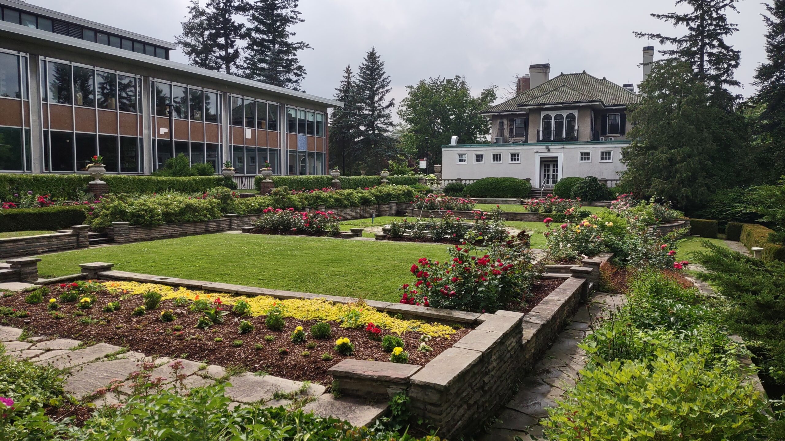
Photo is of Frost Library Garden.

Toronto Urban Badge Hike - 3 of 7
https://hikes.brucetrail.org/event/toronto-urban-badge-hike-3-of-7-2/Sorry, the registration cut-off time for this hike has been reached.Not a member? Click here to join today!Hosting Club: Toronto
Location (Google Maps): Toronto, Ontario, Canada
Hike Leader(s): Brian Rideout Click here to contact Hike Leader(s)
Pace: Moderate
Terrain: Flat
Distance: 10.4 kmDescription
Please join me at the south west corner of Lakeshore Blvd West and Ellis by 10 AM. We will hike east along the Waterfront Trail to the Distillery District (km 8.3 to km 71.4). Here is an online map with km markings of our route for all 7 hikes for the Toronto Urban Badge.Please make sure you bring at least 2 liters of water, a lunch, bug spray and sunscreen.