
Join us for a hike! Registration required:
All hikes available to BTC members. Some hikes are open to non-members.
TIP: The calendar view displays up to 7 hikes on a day, but often there are more. Click “More events” to see them all.
Toronto Hike Schedule
Toronto Bruce Trail Club Registration Live Dates
Day Winter Coach Program
Registration begins two weeks in advance of the event departure (at 8:00 PM)
Day Bus Hikes
Registration begins two weeks in advance of the event departure (at 8:00 PM) with some exceptions of special event hikes
Day Coach Hikes
Registration begins 7 weeks in advance of the event departure
Day Car Hikes and Urban Hikes
Registration begins two weeks in advance of the event departure
Overnight and Weekend Trips
Registration begins 12 weeks in advance of the event departure
To view all Bruce Trail Conservancy Hikes click here
- 05February 5, 2023
Dufferin E2E 1/3
https://hikes.brucetrail.org/event/dufferin-e2e-1-3/Sorry, the registration cut-off time for this hike has been reached.Not a member? Click here to join today!Hike open to BTC Members only.
Hosting Club: Toronto
Category: Car Hike
Location (Google Maps): We will meet at km 18.7. Coordinates N 44.117420,W 80.128361. A 100 meters trail leads to the main trail.Hike Leader(s): Smadar Junkin Click here to contact Hike Leader(s)
Pace: Brisk
Terrain: Hilly, Variable
Distance: 18.7 kmDescription
First hike of three to complete the Dufferin section end to end. This is a winter hike. Could be hiking in deep snow. Make sure to bring snowshoes and icers. Dress in layers. Bring 2 litres of water. We will follow the covid 19 instructions. We will shuttle to km 0.0. Please note that we will park in Mono centre. It is a paid parking. We will all share the parking cost.Car Hike: Etobicoke Creek 1st of 3
https://hikes.brucetrail.org/event/car-hike-etobicoke-creek-1st-of-3/Sorry, the registration cut-off time for this hike has been reached.Not a member? Click here to join today!Hosting Club: Toronto
Category: Car Hike
Location (Google Maps): Tim Hortons at Mayfield and Hwy. 10 (Hurontario Street ) BramptonHike Leader(s): Mike Dhesi Click here to contact Hike Leader(s)
Pace: Leisurely
Terrain: Flat
Distance: 9KMDescription
We will follow the Etobicoke Creek South, hoping to finish around Brampton city hall. Please arrive at least 15-20 minutes prior to the start time.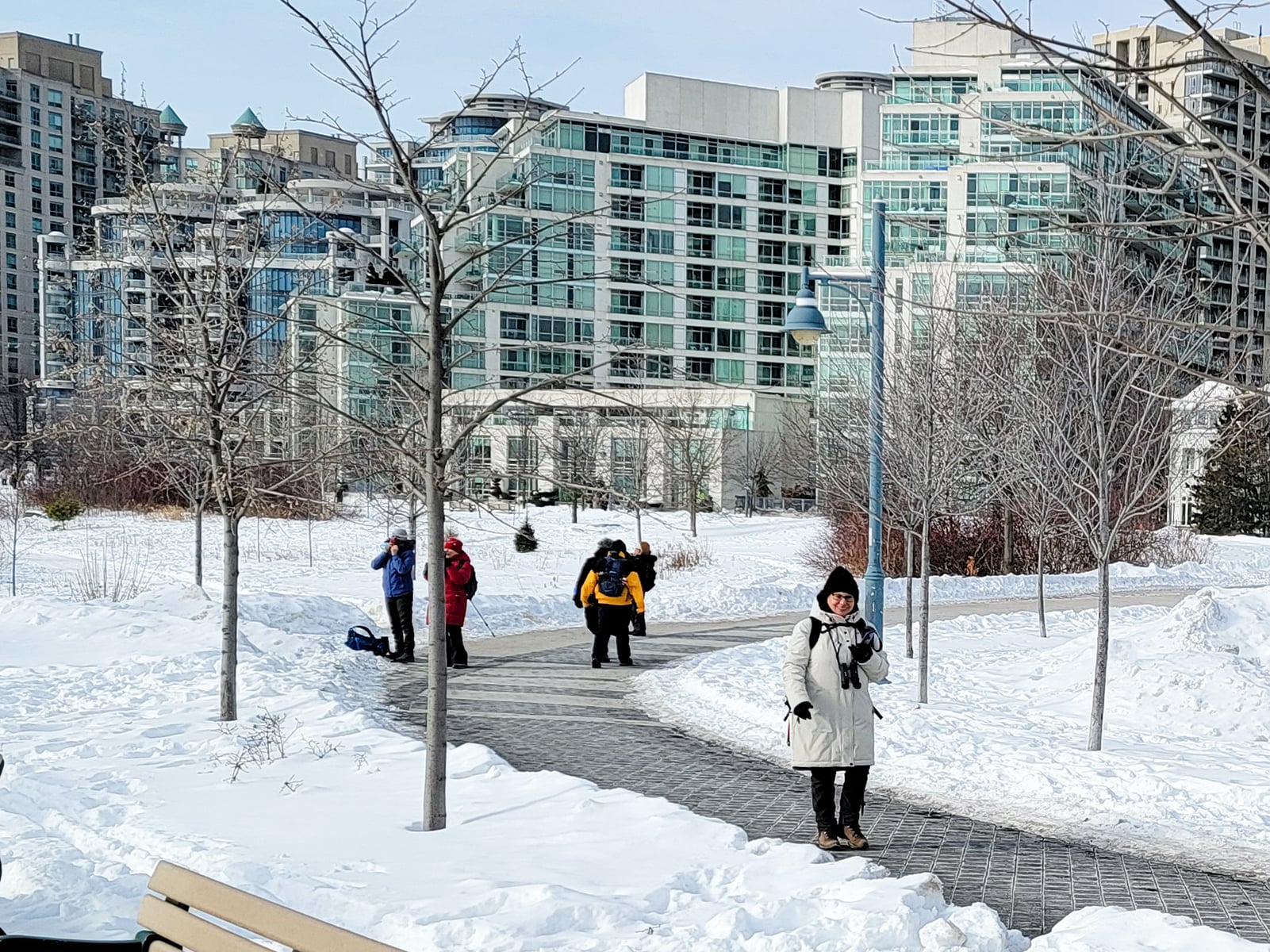
Urban Walk: Waterfront Trail 4/8 - Parklawn
https://hikes.brucetrail.org/event/urban-walk-waterfront-trail-4-8-parklawn-2/Sorry, the registration cut-off time for this hike has been reached.Not a member? Click here to join today!Hosting Club: Toronto
Location (Google Maps): Toronto Waterfront Trail
Hike Leader(s): Brian Rideout Click here to contact Hike Leader(s)
Pace: Moderate
Terrain: Flat
Distance: 9.1Description
Please join me at Old Mill Station no later than 9:12 am. We will take the 66 bus departing 9:27 am, arriving 9:40 am. If you want to meet us at Parklawn and Lakeshore, please be there by 9:40 am. We start hiking at 9:50 am.We will hike east along the lake to Spadina. The estimated distance is 9.1 km. Here is an online map of our route Parklawn to SpadinaBring a snack, at least 2 liters of water, and icers. Dress for cold weather. - 06February 6, 2023
Dufferin Hi-land E2E # 2
https://hikes.brucetrail.org/event/dufferin-hi-land-e2e-2/Sorry, the registration cut-off time for this hike has been reached.Not a member? Click here to join today!Hike open to BTC Members only.
Hosting Club: Toronto
Category: Car Hike
Location (Google Maps): Km 18.7 coordinates N 44.117420,W 80.128361 centre street south of the 5 Sideroad. A. 100 meters south of the main trail.Hike Leader(s): Smadar Junkin Click here to contact Hike Leader(s)
Pace: Brisk
Terrain: Hilly, Variable
Distance: 19 kmDescription
We will shuttle to km 37.7 and hike to the cars. Bring snowshoes and icers, 2 litres of water. We will follow all Covid 19 instructions. Please note that there may be a need to change the date due to winter conditions. - 07February 7, 2023
Car Hike: Winter Walk and Wonder
https://hikes.brucetrail.org/event/car-hike-winter-walk-and-wonder-2/Sorry, the registration cut-off time for this hike has been reached.Not a member? Click here to join today!Hosting Club: Toronto
Category: Car Hike
Location (Google Maps): Meet at the (roadside) parking area at the end of 17 Sideroad, 730 m northeast of Halton Rd 25. Map 12.Hike Leader(s): Janet Patterson Click here to contact Hike Leader(s)
Pace: Leisurely
Terrain: Variable
Distance: approximately 2 kDescription
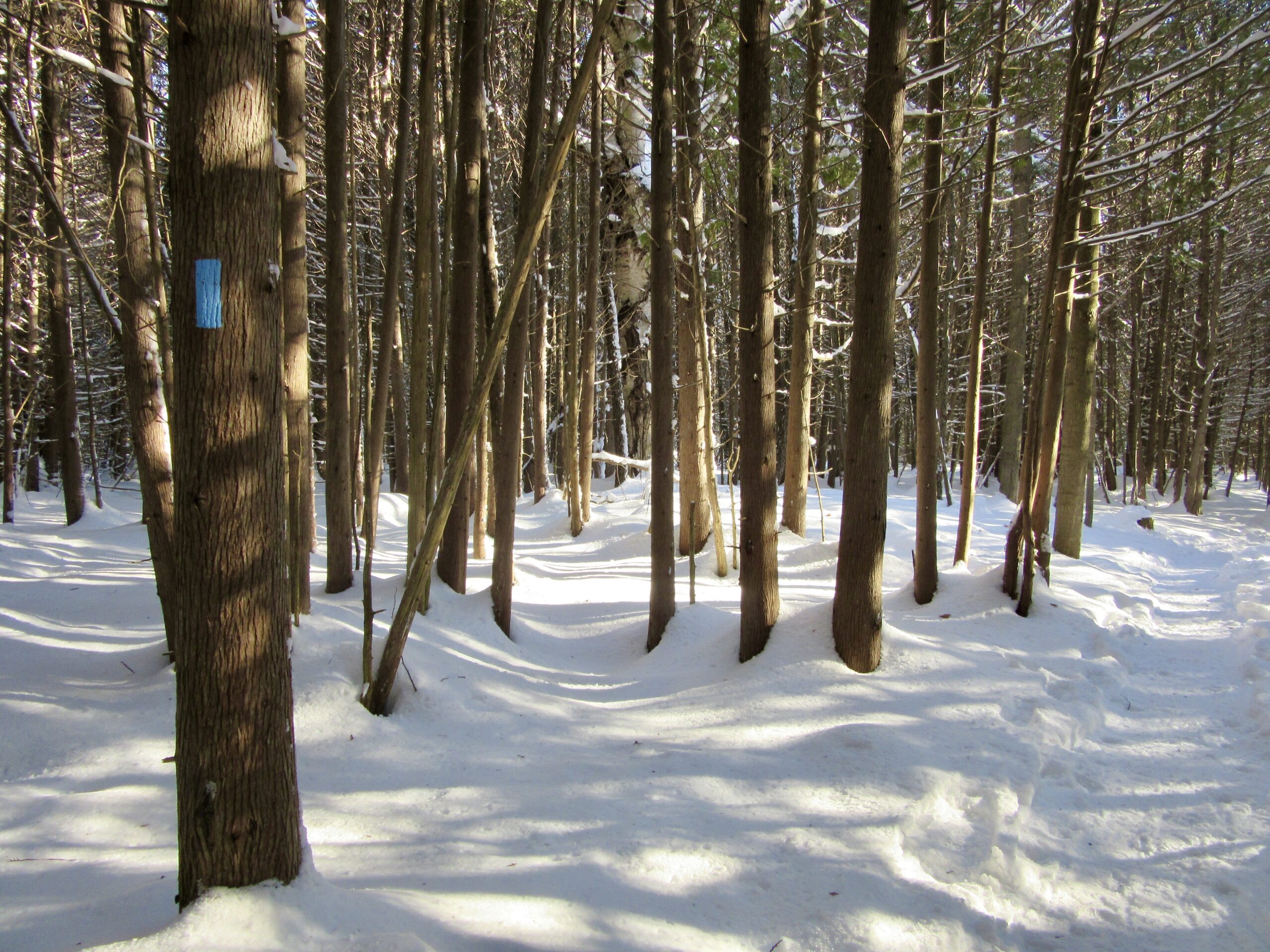
Join us for a slow walk in the woods to observe and identify the impressive variety of trees in this area, without the benefit of examining their leaves! The distinctions found in twigs, buds and bark are just some of the clues we will be seeking, with the assistance of our guide, Adam Brylowski, an ecologist on staff at the BTC.
Please dress for the weather, and along with your curiosity, I suggest a hot drink, water and lunch or snack. End time and distance we’ll travel are estimates, depending on weather snd trail conditions.
This hike is brought to you by the TBTC’s Biodiversity Team. We endeavour to promote the critical role we can all play in protecting and conserving the Niagara Escarpment.
Limit of 10
- 08February 8, 2023
Car Hike: Caledon E2E and winter badge 3/4
https://hikes.brucetrail.org/event/car-hike-caledon-e2e-and-winter-badge-3-4/Sorry, the registration cut-off time for this hike has been reached.Not a member? Click here to join today!Hike open to BTC Members only.
This is a Multi-Day Hike
You are signing up for the following dates and times:
2023-02-08 at 08:30Hosting Club: Toronto
Category: Car Hike
Location (Google Maps): Km 35.2 coordinates N 43.937967,W 79.934650Hike Leader(s): Smadar Junkin Click here to contact Hike Leader(s)
Pace: Brisk
Terrain: Challenging, Hilly
Distance: 17 km.Description
We will shuttle to km 52 and walk back, some challenging hills. Bring snowshoes and icers. Bring 2 litres of water. This hike will also be used for the winter badge as we will make the time for it. Make sure to check your email before the hike for a change of date because of bad weather. We will follow covid 19 rules. - 09February 9, 2023No events
- 10February 10, 2023
Caledon E2E and winter badge 2/4
https://hikes.brucetrail.org/event/caledon-e2e-and-winter-badge-2-4/Sorry, the registration cut-off time for this hike has been reached.Not a member? Click here to join today!Hike open to BTC Members only.
This is a Multi-Day Hike
You are signing up for the following dates and times:
2023-02-10 at 08:30Hosting Club: Toronto
Category: Car Hike
Location (Google Maps): Km 35.2. Coordinates N 43.937967,W 79.934650Hike Leader(s): Smadar Junkin Click here to contact Hike Leader(s)
Pace: Brisk
Terrain: Hilly, Variable
Distance: 19kmDescription
We will shuttle to km 16.1 and hike back. The hike includes road walking. Be ready for cold winds on the road sections. This hike will qualify for the winter badge. We will allow time for that badge. Must have icers and snowshoes. Bring 2 litres of water. We will follow covid 19 rules. Check for change of date before the hike in case of bad weather. - 11February 11, 2023
Cancelled: Winter Coach Trip: Awenda Provincial Park
https://hikes.brucetrail.org/event/winter-coach-trip-awenda-provincial-park/Sorry, the registration cut-off time for this hike has been reached.Not a member? Click here to join today!Hosting Club: Toronto
Category: Cancelled
Location (Google Maps): Awenda Provincial ParkHike Leader(s): Martina Furrer; Nijole Mockevicius; Tanya Cora Click here to contact Hike Leader(s)
Description
Trip cancelled due to weather and too many cancellations.Bus departs 10 York Mills Rd at 8:00 AM and Major Mackenzie Dr and HWY 400 Park and Ride at 8:20 AM. If you wish to be picked up at the Major Mackenzie Dr and HWY 400 Park and Ride, select that option when you register. Please arrive 15 minutes before departure. The bus waits for no one.
Join us for an awesome day of cross-country skiing and snowshoeing in beautiful Awenda Provincial Park. For information about trail conditions visit: https://www.ontarioparks.com/skireport. Snowshoers: Explore the trails on your own or join Nijole and Tanya for a guided 10 KM snowshoe hike on Awenda’s beautiful winter trails. The hike will traverse parts of the Bluff, Wendat, and Connector trails, and will also circle around Kettle’s Lake. Mostly flat with a few short hills. Pace will be approximately 3 km/hr. Plenty of time to take pictures and enjoy the scenery. Skiers: Enjoy self-guided tours of Awenda’s beautiful ski trails with majestic views of Georgian Bay. No rentals.
Coach fares and park admission must be paid online when you register. Masks are mandatory while on the bus.
Car Hike: Glasgow Village Whitchurch-Stouffville
https://hikes.brucetrail.org/event/car-hike-glasgow-village-whitchurch-stouffville-4/Sorry, the registration cut-off time for this hike has been reached.Not a member? Click here to join today!Hosting Club: Toronto
Category: Car Hike
Location (Google Maps): Concession Road 2, Whitchurch-Stouffville, ONHike Leader(s): Mohammad Aghamiri Click here to contact Hike Leader(s)
Pace: Moderate
Terrain: Variable
Distance: 14-15KMDescription
We will explore beautiful trails in Rouge park ,Glasgow village and around Secord pondUrban Walk: Uxbridge Trails
https://hikes.brucetrail.org/event/urban-walk-uxbridge-trails/Sorry, the registration cut-off time for this hike has been reached.Not a member? Click here to join today!Hosting Club: Toronto
Category: Urban Walk
Location (Google Maps): Union Station – Meet in the Great Hall by the information desk with the clock over it by 9:00. We will take the 9:13 Stouffville Line train to Mount Joy GO Station and connect to the GO Bus towards Uxbridge. You may alternatively board the GO Train at Kennedy GO Station or stops in north Scarborough. The GO $10.00 Transit Day Pass, available for smart phones, is valid for return travel on the train and GO Bus. Hikers without a smart phone may purchase the Day Pass from the Hike Leader. Seniors return fare from Union is $11.06.Hike Leader(s): Tom Swales
Pace: Moderate
Terrain: Variable
Distance: 12Description
Join us for a winter hike on the Countryside Preserve trails, the Ewan and Historic Trails into downtown Uxbridge, and the Trans Canada Trail over the trestle bridge. We’ll also pass by the historic train station and railway museum. Due to the limited bus service plan on joining us for a refreshment stop before returning to the city. Bring icers (mandatory) and poles if preferred. The trails are well used so walking should be fairly easy unless there is a lot of fresh snow.Car Hike: Caledon Rail Trail
https://hikes.brucetrail.org/event/car-hike-caledon-rail-trail/Sorry, the registration cut-off time for this hike has been reached.Not a member? Click here to join today!Hosting Club: Toronto
Category: Car Hike
Location (Google Maps): Caledon Rail TrailHike Leader(s): Al Brown Click here to contact Hike Leader(s)
Pace: Moderate
Terrain: Flat
Distance: 11 kmDescription
We will hike the Caledon Rail Trail from Inglewood to Caledon East. This trail is flat and should be mostly packed snow throughout. Icers are recommended.We will meet in Caledon East at the Four Corners Bakery and car pool to the starting point in Inglewood. After the hike those wishing to may join us for a hot drink in the Four Corners Bakery before heading off.
Directions: From Hwy 10 north of Brampton, go north to Olde Baseline Road. Go east about 8 Km to Airport Road. Go north on Airport Road about 1.5 Km to Caledon East. The Four Corners Bakery is on your right about 100 meters south of the stoplight. There is street parking available on both sides or Airport Road in this location.

Urban Walk: Waterfront Trail 6/8 - Lakeshore East
https://hikes.brucetrail.org/event/urban-walk-waterfront-trail-6-8-lakeshore-east/Sorry, the registration cut-off time for this hike has been reached.Not a member? Click here to join today!Hosting Club: Toronto
Category: Urban Walk
Location (Google Maps): Toronto/ScarboroughHike Leader(s): Brian Rideout Click here to contact Hike Leader(s)
Pace: Moderate
Terrain: Flat
Distance: 10.9 kmDescription
Please join me at the Tim Horton’s at Lakeshore and Leslie no later than 9:50 am. We start hiking at 10:00 am.We will hike east on Lakeshore, along the Beaches Boardwalk, and on Kingston Rd to Brimley Rd. The estimated distance is 10.9 km. Here is an online map of our route Lakeshore to Brimley RdBring a snack, at least 2 liters of water, and icers. Dress for cold weather.