|
Sun | Mon | Tue | Wed | Thu | Fri | Sat |
|---|
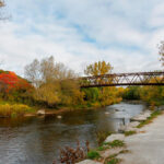
October | October | October | 1  Car Hike: Nature Appreciation – Rockside Side Trail Car Hike: Nature Appreciation – Rockside Side Trail 10:30 AM-2:30 AM 11/01/2023 https://hikes.brucetrail.org/event/car-hike-nature-appreciation-rockside-side-trail/2023-11-01/ 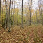 Click here for more information or to register Hosting Club: Toronto
Category: Car Hike
Location (Google Maps): Parking is at the end of Boston Mills Road, just west of the intersection with Mississauga Road. Take care not to block the private driveway.
Driving directions: From Highway 410 north, continue on Highway 10, left on King Street, right on Mississauga Rd., left on Boston Mills Rd. to parking at the dead end. Hike Leader(s): Janet Patterson Click here to contact Hike Leader(s) Pace: Leisurely
Terrain: Variable
Distance: approximately 6 k Description We’ll take a slower pace to allow time to observe and identify the ferns, fungi, birds, dragonflies, etc. that we encounter along the trail. Using the iNaturalist app, participants will be encouraged to take photos with their smartphones and contribute observations to the Bruce Trail Conservancy’s iNaturalist Project. Of course anyone who simply wants to take in the wonders of nature while we walk is also welcome to come along! Note: Limit of 10 hikers, and registration is mandatory. https://brucetrail.org/pages/get-involved/volunteering/citizen-science This is a perfect opportunity to accumulate sightings towards earning your Naturalist badge! Bring your curiosity, nature guidebooks, binoculars, cameras, bug repellent, lunch and water. Please wear proper hiking shoes or boots.
| 2 | 3 | 4 - Car Hike: Seaton Trail North
8:15 AM-1:15 PM 11/04/2023 https://hikes.brucetrail.org/event/seaton-trail-north-5/2023-11-04/ Click here for more information or to register Hosting Club: Toronto
Category: Car Hike
Location (Google Maps): Free parking lot at 1 Mutual Street Pickering Hike Leader(s): Mohammad Aghamiri Click here to contact Hike Leader(s) Pace: Moderate
Terrain: Variable
Distance: 14-15KM Description
We will hike along Seaton trail and enjoy the lovely sceneries of forest and river at the same time Some safety procedures during the hike: 1-Hikers must stay between the leader and the sweep. 2-Hikers must advise the leader or the sweep if they wish to leave the group. 3- Hikers must follow the whistle instructions: 1 blast- stay where you are; 2 blasts come to the leader; 3 blasts – come to the leader quickly. 4-Hike leader may request volunteers to stop at trail intersections, they need to help hikers to the direction the group walk and wait till they see the sweep . 5-Hikers have to make sure they can see the persons behind and in front of them.
 Car Hike: Toronto Section Fund Raiser Stained Glass Badge Car Hike: Toronto Section Fund Raiser Stained Glass Badge 8:30 AM-3:00 AM 11/04/2023 https://hikes.brucetrail.org/event/car-hike-toronto-section-fund-raiser-stained-glass-badge/2023-11-04/ Hike open to BTC Members only. This is a Multi-Day HikeYou are signing up for the following dates and times:
2023-11-04 at 08:30
2023-11-11 at 08:30
2023-11-18 at 08:30 Click here for more information or to register Hosting Club: Toronto
Category: Car Hike
Location (Google Maps): Meet 17.4k, N 43.615163,W 79.975157 and drive to Hilton Conservation Area paid parking, N 43.505705,W 79.961589 Hike Leader(s): Lindita Kalo Click here to contact Hike Leader(s) Pace: Brisk
Terrain: Rocky
Distance: 14-18k per hike Description
Earn The new Toronto stained glass badge!!!
You are registering for the three days – Nov 4(0-17.4k),Nov 11(17.4-36.1k),& Nov 18(36.1-50.3k)
Hikers need to complete all three hikes with the leader. Hikers are allowed to miss one hike that they will make up on their own and still qualify for the badge. Please keep a log of the missed hikes and give them to the leader on the last day.
The fee goes towards supporting the Toronto Bruce Trail Club, which in turn supports the mission of the Bruce Trail Conservancy “preserving a ribbon of wilderness, for everyone, forever”.
For the time being registration is limited to members of the Bruce Trail Conservancy. Small group as parking is limited.
We will hike within 4-5k per hour over varied/rocky terrain. Please be honest with yourself of your physical fitness level to hike at this pace over rocky terrain.
Arrive 15 minutes early, wear sturdy footwear, bring 2 liters of water. We will carpool to the beginning of the hike. Paid parking will be shared.
-
 Bus Hike: Toronto Section E2E 4 of 4 – Terra Cotta/Cheltenham Bus Hike: Toronto Section E2E 4 of 4 – Terra Cotta/Cheltenham 8:30 AM-5:00 PM 11/04/2023 https://hikes.brucetrail.org/event/bus-hike-toronto-section-e2e-4-of-4-terra-cotta-cheltenham/2023-11-04/  Trip Information
Departure Time: 08:30
Return to City Time: 17:00
Departure Point: Kipling Departure Point Click here for more information or to register Optional Items
Hosting Club: Toronto
Category: Bus Hike
Location (Google Maps): Toronto Section Hike Leader(s): Tom Swales & Celia Ho Click here to contact Hike Leader(s) Pace: Moderate
Terrain: Variable
Distance: 15 Description
Join us to hike the Toronto section of the Bruce Trail in a series of four moderate pace/moderate distance Level 2 hikes (15-16 km a day). Those who complete all 4 hikes will qualify for the Toronto club’s diamond E2E badge. The badge fee ($5 members/$15 non-members) will be collected on Hike #3. Members may alternatively choose to use the hikes to earn the new stained glass Limehouse stone bridge fundraiser badge. Available to members only the badge fee is $30 and proceeds go to protecting and preserving the Bruce Trail. Please contact the Hike Leader if you are interested in earning the fundraiser badge for further instructions. This badge can be earned only on one of the series of special group hikes led by a BTC Hike Leader and not individually. Hikers who complete all 4 hikes will qualify for either the diamond badge or stained glass fundraiser badge, as they have chosen. Any hikers are welcome to join the hikes regardless of working towards one of E2E badges. There will be a refreshment/social stop in Georgetown after the hike before returning to the Kipling Station departure point by approximately 5:30 PM This final hike in the series will take us between the Terra Conservation Area and the Caledon section border leading past the Cheltenham Badlands. ** Hikers are required to bring a mask and wear it on the bus. Masks must fit properly and cover the nose, mouth and chin. For the highest level of protection against Covid-19, respiratory viruses or the flu, KN95 or N95 masks are recommended. **
- Car Hike: Dufferin Hi-Land BTC E2E
8:30 AM-3:00 PM 11/04/2023 https://hikes.brucetrail.org/event/car-hike-dufferin-hi-land-btc-e2e/2023-11-04/  This is a Multi-Day HikeYou are signing up for the following dates:
2023-11-04, 2023-11-05, 2023-11-11 Click here for more information or to register Hosting Club: Toronto
Category: Car Hike
Location (Google Maps): (Google Location) Km 55.7 Map 21, GPS N44.268877, W-80.”-“156810 Meet at roadside parking along Mulmur-Nottawasaga Townline between Lavender Hill Rd. and 1st Line EHS. Please arrive fifteen minutes early for car shuttle. All other meeting points will be emailed to participating hikers at a later date. Hike Leader(s): Ross Estrella Click here to contact Hike Leader(s) Pace: Brisk
Terrain: Rocky, Variable Description
Wanna to earn the Dufferin Hi-Land E2E Badge? Join a three day hike covering the 56.3 kms length of the club. Autumn is ideal time for hiking as you can breathe in the sweet smell of the golden leaves as you stroll beneath the trees or when stepping on the freshly fallen leaves on the ground. Add to soothing crisp air clearing our lungs, there’s *no bugs.* We’ll be pacing on a 4-5 km an hour with occasional stoppage to capture the beauty of the landscape. Please ensure to bring enough water for hydration, snack and lunch. Dress appropriately for the weather including proper footwear. Arm yourself with sunscreen and head protection against sun or rain and First Aid Kit if available be included in your backpack. Please note that you’re signing for a three day hike. All three hikes must be completed with the hike leader to earn the Badge. If you miss one or two legs of the section you may perform a make up hike and still qualify for the badge. Cost of Badge is $10.00 for BTC member and $15.00 dollars for Non member.
- Car Hike: Caledon Section – White and Blue Trails hike (1) – 19KM
9:00 AM-3:00 PM 11/04/2023 https://hikes.brucetrail.org/event/car-hike-caledon-section-white-and-blue-trails-hike-1-19km/2023-11-04/ Click here for more information or to register Hosting Club: Toronto
Category: Car Hike
Location (Google Maps): We meet at Hockley Road Parking Area just east of 61.3KM located on the North side of Hockley Road. Please do not park on Hockley Road. Hike Leader(s): Fayyaz Mahmood Click here to contact Hike Leader(s) Pace: Fast
Terrain: Challenging, Variable
Distance: 19 KM Description
This is a fast paced hike on the Main Trail and the Side Trails (ST) on Map 18, in the Caledon section.
From the parking lot we will enter the Main Trail at 61.3KM, Map 18 (Ed. 30). We will hike to Dunby Road, Map 18, 68.0KM (Ed. 30). We will then return back and hike through the Cam Snell ST, Glen Cross ST, Isabel East ST and Tom East ST to return to the parking lot.
Bring 1.5 – 2 liters of water and your lunch. Please dress for the weather.
Hiking boots are required. No dogs.
- Car Hike: Scotsdale Farm
10:00 AM-2:30 PM 11/04/2023 https://hikes.brucetrail.org/event/car-hike-scotsdale-farm-4/2023-11-04/ Click here for more information or to register Hosting Club: Toronto
Category: Car Hike
Location (Google Maps): Scotsdale Farm Hike Leader(s): Al Brown Click here to contact Hike Leader(s) Pace: Moderate
Terrain: Variable Description
We will hike through Scotsdale Farm on the main trail plus the Bennet and Great Esker side trails. This route takes us through a variety of terrain from rocky escarpment outcrops to glacial features and former farmlands, over small rivers. Most of the trail is in the forest. Hiking boots are recommended. After the hike all are invited to meet for refreshments in Georgetown. To get to the meeting place drive north on Trafalgar Road past Georgetown. Turn left onto Hwy 7 and go about 5 km to the stop light at Silver Creek. Turn right onto Trafalgar again and go about 1 km to the entrance. The parking area is adjacent to the old homestead, about half a kilometer from the road.
 Urban Walk: Theatre Hike – Humber River/Swansea Urban Walk: Theatre Hike – Humber River/Swansea 3:00 PM-6:00 PM 11/04/2023 https://hikes.brucetrail.org/event/urban-walk-theatre-hike-humber-river-swansea/2023-11-04/ Click here for more information or to register Hosting Club: Toronto
Category: Urban Walk
Location (Google Maps): Meet at 3 PM at the bus Route #79 stop at south east corner of Scarlett Road and Eglinton West. Hike Leader(s): Miriam Stevens Click here to contact Hike Leader(s) Pace: Leisurely
Terrain: Flat
Distance: 9-10 km Description Join us for a leisurely hike (3 km/hour) over mostly flat terrain. Suitable for beginners and families. We will follow the Humber River Trail to Old Mill and then hike parts of Swansea to Runnymede & Bloor. Optional dropout at Old Mill Subway Station. After the hike you may choose to join us for dinner at 6:00 PM either at Ali Baba Mediterranean Cuisine or at a nearby pub (your choice, both near Runnymede Subway and the theatre). We will attend the play at 8:00 PM at the Village Players, 2190E Bloor Street West to see the play “A sting in the Tale” by Brian Clemens & Dennis Spooner . Call the theatre directly at 416 767 7702 to reserve your ticket ($29.00 adults and seniors) and mention that you are with the Bruce Trail Conservancy, Toronto Club. Anyone may choose to come for the hike only, join us for the theatre performance, or join us for all three: Hike, dinner and play.
|
5 - Urban Walk: Hinder Area-Earl Bales Park & Some Yoga
9:00 AM-1:30 PM 11/05/2023 https://hikes.brucetrail.org/event/urban-hike-hinder-area-earl-bales-park-some-yoga/2023-11-05/  Click here for more information or to register Hosting Club: Toronto
Category: Urban Walk
Location (Google Maps): We will meet at the TTC bus platform area inside Finch Station (bus # 36). See Meeting details below. Hike Leader(s): Leonora Rochwerger Click here to contact Hike Leader(s) Pace: Moderate
Terrain: Variable
Distance: 8 km Description
Description: We will start our hike at the Herbert G. Carnegie Centennial Centre and will walk along the West Don River Trail through the beautiful forested ravine system of the Hinder Area. Along the way, we will find a flat area to pause – weather permitting- and do some gentle Yoga standing poses- no Yoga mat is required. We will continue our hike through Earl Bales Park, where we will stop for lunch. After lunch, we will start our way back and end our hike on Bathurst St, North of Sheppard Ave. Route map (approximate): https://onthegomap.com/s/6dmpit3j How to get there and get home: We will meet as a group no later than 09:00 at the TTC bus platform inside Finch Station, in order to take together bus #36. If you are arriving by subway- go up (without exiting) to the TTC bus platform. Otherwise, enter the Finch station and walk to the TTC bus platform.
To go back to Finch Station at the end of the hike, the Bus # 7 runs North on Bathurst, with a transfer to Bus #36 Eastbound towards Finch Station. What to bring: Proper walking /hiking shoes, at least 1.5 liters of water and a packed lunch. Appropriate clothing for the weather. No Yoga mats required. No dogs allowed
- Urban Walk: Hamilton Beach Trail Walk
10:00 AM-3:45 PM 11/05/2023 https://hikes.brucetrail.org/event/urban-walk-hamilton-beach-walk/2023-11-05/  Click here for more information or to register Hosting Club: Toronto
Category: Urban Walk
Location (Google Maps): Burlington GO Station to Hamilton Beach Trail Hike Leader(s): Ginny Giraudi Click here to contact Hike Leader(s) Pace: Moderate
Terrain: Flat
Distance: 13 km Description
If you are coming from Union Station, take the 9:03 am Westbound Lakeshore train to Burlington GO Station. We will meet inside the Burlington GO Station Building near the bathrooms and we will start hiking at 10 am. If you are driving, you can park at Burlington GO Station for free on the weekends. We will hike from Burlington GO to the Hamilton Beach Trail stopping for lunch at Confederation Park and then we will return to the Burlington GO Station by taking the #12 GO Bus that leaves from Centennial Pkwy north of the QEW in Hamilton. You may consider buying a 10 dollar weekend GO day pass that is only available as an e-ticket that you activate on your phone. Please see the route map here.
| 6 | 7 | 8 - Car Hike: Caledon Section – White and Blue Trails hike (2) – 18KM
8:30 AM-2:30 PM 11/08/2023 https://hikes.brucetrail.org/event/car-hike-caledon-section-white-and-blue-trails-hike-2-18km/2023-11-08/ Click here for more information or to register Hosting Club: Toronto
Category: Car Hike
Location (Google Maps): We meet at Hockley Road Parking Area just east of 61.3KM located on the North side of Hockley Road. Please do not park on Hockley Road. Hike Leader(s): Fayyaz Mahmood Click here to contact Hike Leader(s) Pace: Fast
Terrain: Challenging, Rocky
Distance: 17 KM Description
This is the second hike is a series of fast paced hikes on the Main Trail and the Side Trails (ST) on Map 18, in the Caledon section.
From the parking lot we will enter the Main Trail at 61.3KM, Map 18 (Ed. 30) and walk South on the trail to 5th Line EHS, Map 18, 52.3KM. We will then turn back and hike through the Griffith Ravine ST on the way back to return to the parking lot.
Bring 1.5 – 2 liters of water and your lunch. Please dress for the weather.
Hiking boots are required. No dogs.
| 9 | 10 | 11 - Bus Hike: Blue Mountains End to End Part IV of VI
8:00 AM-7:00 PM 11/11/2023 https://hikes.brucetrail.org/event/blue-mountains-end-to-end-part-iv/2023-11-11/  Trip Information
Departure Time: 08:00
Return to City Time: 19:00
Departure Point: York Mills Bus Pickup Click here for more information or to register Optional Items
Hosting Club: Toronto
Category: Bus Hike
Location (Google Maps): Map 22 of the Bruce Trail Reference and Guide. Km 34.2 to 21.9km Hike Leader(s): George Lennon and Michael Humpage Click here to contact Hike Leader(s) Pace: Moderate
Terrain: Variable
Distance: 12.3km Description
Bus departs 10 York Mills Rd at 8:00 AM and Major Mackenzie Dr and HWY 400 Park and Ride at 8:20 AM. If you wish to be picked up at the Major Mackenzie Dr and HWY 400 Park and Ride, type ‘yes’ in the additional information field. Please arrive 15 minutes before departure. The bus waits for no one. We will begin the hike at km 34.2 by winding our way through forest and farmland to the entrance of Devil’s Glen Provincial Park. We will walk to the nearby lookout platform to admire the steep bedrock gorge at the edge of the escarpment. The lower valley walls are steep and covered with dense deciduous forest. Rare harts tongue and smooth cliff brake ferns grow on these steep cliffs. We will descend a series of natural steps down to the Mad River. Then we climb uphill switchbacks to reach the junction with the Ganaraska Trail that stretches from here to Port Hope. The Bruce Trail continues along the Escarpment edge to McKinney’s Hill and its superb view to the east. The trail passes Freedom Rock and the Nottawasaga Bluffs Lookout. Some white cedar trees in this park are well over 1,000 years old. We will end the day’s hike at km 21.9, and then head for Shelburne for refreshments before our return to Toronto. ** Hikers are required to bring a mask and wear it on the bus. Masks must fit properly and cover the nose, mouth and chin. For the highest level of protection against Covid-19, respiratory viruses or the flu, KN95 or N95 masks are recommended. **
- Car Hike: Rouge National Park Toronto
8:30 AM-1:45 PM 11/11/2023 https://hikes.brucetrail.org/event/car-hike-rouge-national-park-toronto-7/2023-11-11/ Click here for more information or to register Hosting Club: Toronto
Category: Car Hike
Location (Google Maps): Rouge Park, Zoo Road Parking Lot, off Meadowvale Road north of Sheppard Ave Hike Leader(s): Mohammad Aghamiri Click here to contact Hike Leader(s) Pace: Moderate
Terrain: Hilly
Distance: 14-17KM Description
Will explore Toronto part of Rouge park along Rouge river and Little Rouge Creek, Some safety procedures during the hike: 1-Hikers must stay between the leader and the sweep. 2-Hikers must advise the leader or the sweep if they wish to leave the group. 3- Hikers must follow the whistle instructions: 1 blast- stay where you are; 2 blasts come to the leader; 3 blasts – come to the leader quickly. 4-Hike leader may request volunteers to stop at trail intersections, they need to help hikers to the direction the group walk and wait till they see the sweep . 5-Hikers have to make sure they can see the persons behind and in front of them.
- Car Hike: Caledon Section – White and Blue Trails hike (3) – 19KM
8:30 AM-3:00 PM 11/11/2023 https://hikes.brucetrail.org/event/car-hike-caledon-section-white-and-blue-trails-hike-3-19km/2023-11-11/ Click here for more information or to register Hosting Club: Toronto
Category: Car Hike
Location (Google Maps): We meet at the Mono 5 Sideroad parking on the North side of the road where the trail crosses the road. Hike Leader(s): Fayyaz Mahmood Click here to contact Hike Leader(s) Pace: Brisk
Terrain: Challenging, Rocky
Distance: 18.8KM Description This is a fast paced hike on the Main Trail and the Side Trails (ST) on Map 18, in Hockley Valley, Caledon Hills section.
We will walk North from the parking lot Map 18, 45.5KM (Ed 30) on the Main Trail taking the Hemlock Ridge (ST), until we reach 4th Line EHS (54.3KM). We return back, hiking the Glacier Valley Side Trail ST, Hockley Crest ST, Harmony ST and the Darcy ST coming out on Mono 5 Sideroad to walk back to the cars.
Bring 1.5 – 2 liters of water and your lunch. Please dress for the weather.
Hiking boots are required. No dogs.
|
12 - Car Hike: Scotsdale Farm – White and Blue Trails hike – 18.5KM
8:30 AM-3:00 PM 11/12/2023 https://hikes.brucetrail.org/event/car-hike-scotsdale-farm-white-and-blue-trails-hike-18-5km/2023-11-12/ Click here for more information or to register Hosting Club: Toronto
Category: Car Hike
Location (Google Maps): We meet in the parking lot at Scotsdale Farm. Enter from Trafalgar Road, 1.7KM from where Trafalgar Road leaves Highway 7. Hike Leader(s): Fayyaz Mahmood Click here to contact Hike Leader(s) Pace: Brisk
Terrain: Challenging, Rocky
Distance: 18.5KM Description
We will hike the Main trail and Side Trails (ST) in the Scotsdale Farm / Silver Creek area. We start on the Bennett Heritage ST going North to join the Main Bruce trail at 35.1KM, Map 13, Ed 30. We turn back on the Main trail and join the Great Esker ST at 33.4KM. We leave the Great Esker trail to take the new Trafalgar ST, Reservoir ST and finally the Duff Pit ST to return back to the Main trail at 28.4KM. We take the Main trail going north until 31.2KM and take the Maureen Smith ST to return back on the Bennett Heritage ST to return back to the parking lot.
Dress according to the weather. Hiking boots are required.
Bring your lunch and 1.5-2 litres of water. No dogs.
| 13 | 14 | 15 | 16 | 17 - Urban Walk: Rattray Marsh Evening Hike
6:30 PM-9:30 PM 11/17/2023 https://hikes.brucetrail.org/event/urban-walk-rattray-marsh-evening-hike/2023-11-17/  Click here for more information or to register Hosting Club: Toronto
Category: Urban Walk
Location (Google Maps): Clarkson GO Station Hike Leader(s): Ginny Giraudi Click here to contact Hike Leader(s) Pace: Moderate
Terrain: Flat
Distance: 12 km Description
We will meet inside the Clarkson GO Station near the bathrooms at 6:30 pm and walk along the lake through Rattray Marsh to Port Credit (see route here.) Head lamps or flashlights are required as the sun will have set. The after hike stop is the Archtop Coffee Bar and Market in Port Credit. Hikers can take the 23 Lakeshore Westbound Miway bus back to the Clarkson GO (Presto is accepted) or they can use the nearby Port Credit GO Station to return home.
| 18 - Car Hike: Hike of 2 lakes King city
8:30 AM-1:30 PM 11/18/2023 https://hikes.brucetrail.org/event/car-hike-hike-of-2-lakes-king-city-9/2023-11-18/ Click here for more information or to register Hosting Club: Toronto
Category: Car Hike
Location (Google Maps): Park along Fairfield Dr. or Dufferin Street, Gathering at trail head in Dufferin Street. Hike Leader(s): Mohammad Aghamiri Click here to contact Hike Leader(s) Pace: Moderate
Terrain: Variable
Distance: 14-17KM Description
Will explore Toronto part of Rouge park along Rouge river and Little Rouge Creek, Some safety procedures during the hike: 1-Hikers must stay between the leader and the sweep. 2-Hikers must advise the leader or the sweep if they wish to leave the group. 3- Hikers must follow the whistle instructions: 1 blast- stay where you are; 2 blasts come to the leader; 3 blasts – come to the leader quickly. 4-Hike leader may request volunteers to stop at trail intersections, they need to help hikers to the direction the group walk and wait till they see the sweep . 5-Hikers have to make sure they can see the persons behind and in front of them.
- Bus Hike: Hockley Valley and Mono Cliffs
8:30 AM-6:00 PM 11/18/2023 https://hikes.brucetrail.org/event/bus-hike-hockley-valley-and-mono-cliffs-2/2023-11-18/ Trip Information
Departure Time: 08:30
Return to City Time: 18:00
Departure Point: York Mills Bus Pickup Click here for more information or to register Optional Items
Hosting Club: Toronto
Category: Bus Hike
Location (Google Maps): Hockley Valley and Mono Cliffs Hike Leader(s): Martina Furrer, Brenda Menezes, Mojgan Haghighat, Duro Vukman Click here to contact Hike Leader(s) Pace: Moderate
Terrain: Hilly
Distance: Fast group: 16 to 18 km, Moderate group: about 13 km Description Join us for an awesome hike with great views and fun hills. We will split into two groups and hike from Hockley Valley to the Split Rock Side Trail. Moderate group will hike about 13 km, and the fast group 16 to 18 km. Refreshments after if time allows. Bus departs York Mills Station at 8:30 am.
- Car Hike: A March and a Market
9:00 AM-11:00 AM 11/18/2023 https://hikes.brucetrail.org/event/car-hike-a-march-and-a-market/2023-11-18/  Click here for more information or to register Hosting Club: Toronto
Category: Car Hike
Location (Google Maps): We will meet at the parking lot of Spirit Tree Estate Cidery located at 1137 Boston Mills Rd, Caledon. (Map 14 of the Bruce Trail Reference Guide, Edition 30) Hike Leader(s): Monica Pasquali Click here to contact Hike Leader(s) Pace: Leisurely
Terrain: Flat, Variable
Distance: 5.8 km Description
Celebrate the upcoming holidays with a march along the Bruce Trail and a visit to a local artisan market! First, we’ll do an out-and-back march along the main trail of the Bruce Trail as it flows out of the Toronto section and into the Caledon Hills section. We will begin our hike at the Spirit Tree Estate Cidery parking lot and then follow the main trail on Boston Mills Road and Creditview Road in order to reach the Cheltenham Badlands. We will continue our hike along the main trail that runs through the Badlands, as well as walk along Olde Baseline Road for a short distance in order to see the Badlands in all their glory! We will then retrace our steps to return to Spirit Tree Estate Cidery. After our hike, we’ll visit the “Handcrafted with Love” artisan market at Spirit Tree Estate Cidery to do a little holiday shopping, and we’ll follow that up with a delicious pizza lunch enjoyed outdoors at the cidery. For the main Bruce Trail in the Toronto section: Children under 13 years of age who participate in this hike will be eligible for the Toronto Bruce Trail Club’s Youth Badge (https://torontobrucetrailclub.org/the-trail/badges) – all family members who are planning on joining us should register for the hike, including children. For the main Bruce Trail in the Caledon section: While on our hike within the Cheltenham Badlands, I will provide assistance to hikers of all ages who are interested in earning the Caledon Hills Bruce Trail Club’s Nature Hunter Badge (http://caledonbrucetrail.ca/hiking/club-badges/nature-hunt-badge/). I will point out and identify trees and wildflowers as we hike, as well as explain plant life cycles. You should bring enough water and food for a 2-hour hike, comfortable hiking shoes, appropriate clothing for the weather, a camera if you want to work on the Caledon Hills Bruce Trail Club’s Nature Hunter Badge, and money if you intend to join us for shopping and lunch at Spirit Tree Estate Cidery (https://spirittreecider.com/) after the hike.
- Car Hike; Crawford Lake Loop
10:00 AM-12:30 PM 11/18/2023 https://hikes.brucetrail.org/event/car-hike-crawford-lake-loop-2/2023-11-18/ 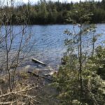 Click here for more information or to register Hosting Club: Toronto
Category: Car Hike
Location (Google Maps): 10 a.m. from Crawford Lake Conservation Area – 3115 Conservation Rd. Milton ON L9T 2X3, Canada (map)
Meeting point is at the parking lot next to the Visitor Centre Hike Leader(s): Jeanette Vincent Click here to contact Hike Leader(s) Pace: Moderate (3-4 km/hr)
Terrain: Variable
Distance: 8km Description
We will hike around Crawford Lake, a rare example of a meromictic lake and the Bruce Trail on our way to the Nassagaweya Canyon with great views and looping back to the Longhouse Village. Crawford Lake is also an important site for global scientific research. Click here to learn more about these studies and how our rare meromictic lake may help scientists define a new proposed epoch: the Anthropocene. Additional Notes: - Reservations are not required but are recommended. If you book online, you can reserve your spot and save money on gate fees.
- Click to reserve. https://www.conservationhalton.ca/parks/crawford-lake/
For the hike
What to bring: water and snacks/lunch
What to wear: Wear hiking boots or good walking shoes. Be prepared for the weather forecast of the day.
|
19 - Urban Walk: Credit River Ravine
10:00 AM-3:00 PM 11/19/2023 https://hikes.brucetrail.org/event/urban-walk-credit-river-ravine/2023-11-19/ - Car Hike: Forks of the Credit
10:30 AM-3:00 PM 11/19/2023 https://hikes.brucetrail.org/event/car-hike-forks-of-the-credit-3/2023-11-19/ Click here for more information or to register Hosting Club: Toronto
Category: Car Hike
Location (Google Maps): Forks of the Credit Provincial Park and Elora Cataract Trailway Hike Leader(s): Al Brown Click here to contact Hike Leader(s) Pace: Moderate
Terrain: Hilly
Distance: 10 km Description
This will be an 10 km loop hike into the Forks of the Credit Park from the Elora Cataract Trailway. We will hike around the Kettle Lake and up to see the falls. After the hike those interested are invited to take refreshments in the village of Erin. Hiking boots are recommended plus cool weather clothing. To get to the meeting place drive north on Mississauga Road passing through the village of Belfountain. About 5 km north of Belfountain the Trailway crosses Mississauga Road. There is parking on the shoulders here but beware of no parking areas.
| 20 - Toronto End to End in 2
7:45 AM 11/20/2023 https://hikes.brucetrail.org/event/toronto-end-to-end-in-2/2023-11-20/  Click here for more information or to register Hosting Club: Iroquoia, Toronto
Category: General Hike
Location (Google Maps): Meeting place and trailhead coordinates will be emailed to registered hikers the week before Hike Leader(s): Steven White Click here to contact Hike Leader(s) Pace: Brisk – 4 to 5 km/hr
Terrain: Moderate – Some hills and/or some poor footing
Distance: 24-27 km per day Description
This series of hikes will entitle the successful hiker to obtain the new stained glass badge – a beautiful and unique badge. This series of hikes is for the experienced hiker due to pace (Brisk) , strenuous sections of Toronto trail and length of hike each day. Hikers should anticipate fall and winter conditions – boots, icers, poles, gators, layered clothing and come water, snacks, lunch, first aid kit. We will take turns shuttling from meeting place to trailhead each day and a driver will need to take the shuttle drivers back to their car at the end of the hike. We will meet each day at 7:45 and shuttle to trailhead – hikers should arrive 15 minutes early to ensure ready to leave at 7:45. Anticipate most hikes will take approx 6-7 hours including lunch and snack breaks. Please ensure you are physically able to manage the pace of this hike, potential wintry conditions and daily distance before registering. Refunds are not permitted. Your fee includes the badge.
- Car Hike: Toronto in 3 (New Fund Raising Badge)
8:30 AM-3:00 PM 11/20/2023 https://hikes.brucetrail.org/event/car-hike-toronto-in-3-new-fund-raising-badge/2023-11-20/ Hike open to BTC Members only. This is a Multi-Day HikeYou are signing up for the following dates and times:
2023-11-20 at 08:30
2023-11-27 at 08:30
2023-12-04 at 08:30 Click here for more information or to register Hosting Club: Toronto
Category: Car Hike
Location (Google Maps): Km 17.4, 4th line. Coordinates N 43.615163,W 79.975157 Hike Leader(s): Smadar Junkin Click here to contact Hike Leader(s) Pace: Brisk
Terrain: Challenging, Variable
Distance: 17.4 kms Description
Registered hikers will earn a new badge. The new Toronto stained glass badge!!! You are registering for the three days – November 20, November 27, and Dec 4th. Hikers need to complete all three hikes with the leader. Hikers are allowed to miss one hike that they will make up on their own and still qualify for the badge. Please keep a log of the missed hikes and give them to the leader on the last day. The fee goes towards supporting the Toronto Bruce Trail Club, which in turn supports the mission of the Bruce Trail Conservancy “preserving a ribbon of wilderness, for everyone, forever”.
For the time being registration is limited to members of the Bruce Trail Conservancy.
This hike is intended to be BRISK (4-5k per hour). Register only if you are capable of sustaining this pace for the day over varied/rocky terrain. Hikers are expected to follow the COVID 19 guideline and stay home if they have symptoms. Hikers may choose to wear masks. Arrive 15 minutes early, wear sturdy footwear, always carry ID cards, bring 2 litres of water, bring your own first aid kit.
| 21 - Car Hike: Iroquoia-in-6 Fundraising Hike Series
8:30 AM-4:00 PM 11/21/2023 https://hikes.brucetrail.org/event/iroquoia-in-6-fundraising-hike-series/2023-11-21/  Hike open to BTC Members only. This is a Multi-Day HikeYou are signing up for the following dates:
2023-11-21, 2023-11-22, 2023-11-23, 2023-12-05, 2023-12-06, 2023-12-07 Click here for more information or to register Hosting Club: Toronto
Category: Car Hike
Location (Google Maps): We will meet for the first hike at the Grimsby Lions Community Pool. Enter at 1 Elm St. at the south end of Coronation Park. Hike Leader(s): Fayyaz Mahmood Click here to contact Hike Leader(s) Pace: Moderate
Terrain: Challenging
Distance: Distances will range between 15 and 26km. Description This is a special series of 6 hikes to complete the entire Iroquoia section of the Bruce Trail. The badge, included in the registration fee, was designed by Joe Borges and features the endangered Jefferson Salamander. For this E2E in 6, we will be following the trail northbound, eventually finishing at the Toronto/Iroquoia border. The Iroquoia in 6 series is geared to experienced long distance hikers with the expectation of a 3-4 km/hr pace maintained over an 18 to 25km day. This pace must also be maintained on the hills, not just on the flat or gentle gradients. No dropout points have been established and therefore hikers who must drop out, will be responsible for their own transportation back to their vehicles. Please be honest about your hiking abilities. Hikers will be expected to be wearing proper hiking footwear and layered clothing with the expectation of cool and possible wet weather and icy trail conditions. Sufficient food and water for a full day of hiking is required and hiking poles, crampons (icers) and wet weather gear are recommended. A 10-15 minute on-trail lunch break will be scheduled. The time will depend on weather conditions. The fee goes towards supporting the Iroquoia Bruce Trail Club, which in turn supports the mission of the Bruce Trail Conservancy, which is: “Preserving a ribbon of wilderness, for everyone, forever.” A maximum of 1 (of the 6) hikes can be self-completed as a result of scheduling challenges, but it is intended that this badge should be earned while hiking as part of a group led by a certified hike leader. If you miss more than one hike but still complete the distances on your own, you may apply for the regular club E2E badge. The hiking schedule will be sent to all registered participants prior to our start date. PLEASE NOTE… THERE ARE NO REFUNDS!! This series of linear hikes will require car shuttling and you must be willing to share in the driving. Some parking locations require paid parking, and hikes that enter Halton Conservation Areas may require reservations. The fee for the E2E-in-6 does not cover any parking/entry fees for hikers who are not members of the Halton CA and/or Hamilton CA. If the group has enough hikers who are members of a CA, those passes will be utilized (thank you in advance) to minimize costs. Since conservation passes are not free, please consider nominal compensation to the pass holder. At least one hike begins in one CA and possibly ends at another, so parking fees are unavoidable for non-CA members.
| 22 | 23 - Car Hike: Iroquoia in 6, fund raiser
8:30 AM-2:00 PM 11/23/2023 https://hikes.brucetrail.org/event/iroquoia-in-6-fund-raiser/2023-11-23/ Hike open to BTC Members only. This is a Multi-Day HikeYou are signing up for the following dates:
2023-11-23, 2023-11-24, 2023-11-30, 2023-12-01, 2023-12-07, 2023-12-08 Click here for more information or to register Hosting Club: Toronto
Category: Car Hike
Location (Google Maps): Twiss Rd north of Derry Rd. Coordinates 43.447743,-79.953436 first day.
All other meeting points will be emailed to the participating hikers at a later date. Hike Leader(s): Smadar Junkin Click here to contact Hike Leader(s) Pace: Brisk
Terrain: Hilly, Variable
Distance: 19 km Description
Please note that this special series of 6 hikes to complete the Iroquoia section of the Bruce Trail event is a fund raiser to support the Iroquoia Club which in turn supports the mission of the Bruce Trail Conservancy which “preserving a ribbon of wilderness for everyone forever”. The cost is $30 per hiker. The funds will be collected by the Toronto club and will be transferred to the Iroquoia Club. please note that you are signing for the entire series of 6 hikes a group hikes as a group hike. please note that there are no refunds or transfers for the registration fee. If you register and change your mind, please cancel your name from the registered list as there will be others on the waiting list. this hike series will reward you with a special fundraising badge, stain window style of the Jefferson salamander.
Expected moving pace is 4- 4.5 km an hour. It is important that you keep pace with the person ahead of you. No dropout points have been established. If hikers drops out, they are responsible for transportation to their vehicle. hikers will be expected to wear proper hiking boots and layered clothing according to the weather. Sufficient food and water for the length of the hike is expected. Wet weather gear is strongly recommended. hikers are allowed to miss two group hikes, and expected to finish those on their own within the time frame of the series. registration fee does not include parking and hikers are expected to share parking costs collectively.
| 24 - Urban Walk: Bronte Village
10:00 AM-12:00 PM 11/24/2023 https://hikes.brucetrail.org/event/urban-walk-bronte-village/2023-11-24/ 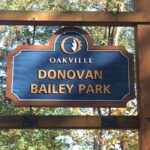 Click here for more information or to register Hosting Club: Toronto
Category: Urban Walk
Location (Google Maps): Meet at the Bronte Athletic Park parking lot. The baseball diamond will be on your right as you enter. Hike Leader(s): Roger Harris Click here to contact Hike Leader(s) Pace: Moderate
Terrain: Flat
Distance: 8 km Description
We will follow Donovan Bailey Trail to Bronte Road, then take Heritage Trail to Bronte Harbour. After a short break, we will continue along Waterfront Trail to Water’s Edge Drive, then walk southwest along Marine Drive to return to our starting point. The route is on a mixture of paved and packed gravel paths. If you would like to read up on this walk, it is described as Hike No. 11 (‘Donovan Bailey/Bronte Village Loop’) in Nicola Ross’ book ”Halton Hikes” (2016). Please dress appropriately for the weather. Hiking books and poles will not be necessary. Bring one litre of water, and a lunch or snacks.
| 25 - Bus Hike: Blue Mountains End to End Part V of VI
8:00 AM-7:00 PM 11/25/2023 https://hikes.brucetrail.org/event/blue-mountains-end-to-end-part-v/2023-11-25/  Trip Information
Departure Time: 08:00
Return to City Time: 19:00
Departure Point: York Mills Bus Pickup Click here for more information or to register Optional Items
Hosting Club: Toronto, Blue Mountains
Category: Bus Hike
Location (Google Maps): Map 22 of the Bruce Trail Reference and Guide. Km 21.9 to km11.9 Hike Leader(s): George Lennon and Michael Humpage Click here to contact Hike Leader(s) Pace: Moderate
Terrain: Variable
Distance: 10km Description
Bus departs 10 York Mills Rd at 8:00 AM and Major Mackenzie Dr and HWY 400 Park and Ride at 8:20 AM. If you wish to be picked up at the Major Mackenzie Dr and HWY 400 Park and Ride, please email hike leaders. Please arrive 15 minutes before departure. The bus waits for no one. Our hiking will resume at km 21.9 where we left off in the Nottawasaga Bluffs Conservation Area. We will pass by the ruins of a settlers’ lime kiln before entering mature cedar forests and then immature forests. Glaciers have deposited the spoon-shaped mounds of sand and gravel, called drumlins, that are on the left of the trail. Bring lunch and water. We will bid farewell to each other for the winter with a stopover in Shelburne on the way home to Toronto, and we will look to complete our end-to-end next spring. If you are planning to order an end-to-end badge for the Blue Mountains Section please type ‘Yes’ in the Additional information Field when you register. I will collect from you your log and the $5 to pay for the badge on the hike when we hold the last of our hikes in this series next spring. I will email notice of our final hike to hikers on these Blue Mountains bus hikes when we have set the date next spring. ** Hikers are required to bring a mask and wear it on the bus. Masks must fit properly and cover the nose, mouth and chin. For the highest level of protection against Covid-19, respiratory viruses or the flu, KN95 or N95 masks are recommended. **
- Car Hike: Bethesda Trail Richmond Hill
8:30 AM-1:45 PM 11/25/2023 https://hikes.brucetrail.org/event/car-hike-bethesda-trail-richmond-hill-13/2023-11-25/ Click here for more information or to register Hosting Club: Toronto
Category: Car Hike
Location (Google Maps): Meet at Bethesda Trail Head Parking on Bethesda Sideroad off Bayview Avenue, across from Lake Wilcox. This parking lot is free. Hike Leader(s): Mohammad Aghamiri Click here to contact Hike Leader(s) Pace: Moderate
Terrain: Variable
Distance: 14-17KM Description
Join us to explore Jefferson Forest and Bond lake , Please bring hiking poles, proper closing and shoes and lots of water, Please carefully read safety procedures during the hike: 1-Hikers must stay between the leader and the sweep. 2-Hikers must advise the leader or the sweep if they wish to leave the group. 3- Hikers must follow the whistle instructions: 1 blast- stay where you are; 2 blasts come to the leader; 3 blasts – come to the leader quickly. 4-Hike leader may request volunteers to stop at trail intersections, they need to help hikers to the direction the group walk and wait till they see the sweep . 5-Hikers have to make sure they can see the persons behind and in front of them.
- #1/4 Toronto Urban Badge Hike – 18km
10:00 AM-3:00 AM 11/25/2023 https://hikes.brucetrail.org/event/urban-walk-1-4-toronto-urban-badge-hike-18km/2023-11-25/  Click here for more information or to register Hosting Club: Toronto
Category: Urban Walk
Location (Google Maps): Evergreen Brick Works – TTC 28 Terminal. TTC bus 28 connects Davisville Station and Evergreen Brick Works. Hike Leader(s): Alina Lin Click here to contact Hike Leader(s) Pace: Moderate
Terrain: Flat
Distance: 19 KM Description
Let’s explore the city in winter and build up our appetites for the holiday season while earning the unique Toronto Urban Hike Badge. To qualify for the badge, we will embark on a 74 KM loop (map: https://onthegomap.com/s/c2c1hf3n ) through a series of four Saturday hikes scheduled for Nov 25 (18 KM), Dec 2 (17 KM), Dec 9 (23 KM), and Dec 16 (20 KM). On both Nov 25 and Dec 2, we will conclude our hikes at Leslie & Sheppard, with the option to visit the Mountain Equipment Company North York store for an introduction to winter hiking gear. Please bring hot beverage and snacks/light lunch for our journey. We will take short breaks for restroom stops and lunch at suitable locations along the trails. The majority of the route consists of paved paths, so running shoes are recommended over hiking boots. Badges by request will be presented at the last hike. The cost of the badge is $5 for members and $15 for non-members.
- Urban Walk: Toronto Beach Walk and Glen Stewart Ravine
10:30 AM-1:30 PM 11/25/2023 https://hikes.brucetrail.org/event/urban-walk-toronto-beach-walk-and-glen-stewart-ravine/2023-11-25/  Click here for more information or to register Hosting Club: Toronto
Category: Urban Walk
Location (Google Maps): Meet at the Toronto Public Library, Beaches Branch, 2161 Queen Street East, Toronto, M4L 1J Hike Leader(s): Jeanette Vincen Click here to contact Hike Leader(s) Pace: Moderate
Terrain: Flat, Other (Refer to Description)
Distance: 10km Description Meet at the Toronto Public Library, Beaches Branch. We will walk the boardwalk and easy pathways that wind along the variety of beaches from Silver Birch Avenue to Ashbridges Bay Park. It will be an out and back route, with lots of views into Lake Ontario, you will see many points of interest, parks, Kew gardens, including the historic Leuty Lifesaving Station and the historic architecture of the Ashbridges Bay Wastewater Treatment Plant, the R.C. Harris Filtration Plant. I have frequent visits to this area and we will make our way across Queen St. to walk the Glen Stewart Ravine a nice ascent, taking in beautiful picturesque natural areas along Ames creek, meandering on elevated boardwalks and stair cases and then descending the area on some of the pleasing neighourhood streets back to our start at the Beaches Branch Library. A pleasing area that offers a little something for everyone! If you want something a little shorter you can drop-out at various areas along the way. No dogs. Good footwear, snacks/lunch and water. Dress according to the weather conditions.
|
26 - Urban Walk: Tommy Thompson Park-Toronto’s Urban Wilderness (on the Leslie Street Spit) Toronto
10:30 AM-2:00 PM 11/26/2023 https://hikes.brucetrail.org/event/urban-walk-tommy-thompson-park-torontos-urban-wilderness-on-the-leslie-street-spit-toronto/2023-11-26/  Hike open to BTC Members only. Click here for more information or to register Hosting Club: Toronto
Category: Urban Walk
Location (Google Maps): Tommy Thompson Park, 1 Leslie St. Toronto Hike Leader(s): Jeanette Vincent Click here to contact Hike Leader(s) Pace: Moderate
Terrain: Flat
Distance: 12km Description
Meet at 10:30 a.m. at the entrance parking lot at 1 Leslie St. We will walk to the end of the spit and back using some of the various side trails. A unique place to experience nature and wildlife. The spit has been made from the rubble from an ever growing Toronto which began in 1959. Excellent views of Toronto and Lake Ontario. No dogs. Bring snack/lunch water. Dropouts along the way. Dress appropriate for the weather conditions.
| 27 | 28 | 29 - Urban walk: Colonel Sam Smith Park
10:00 AM-11:30 AM 11/29/2023 https://hikes.brucetrail.org/event/urban-walk-colonel-sam-smith-park/2023-11-29/  Click here for more information or to register Hosting Club: Toronto
Category: Urban Walk
Location (Google Maps): Meet in front of The Gatehouse, located at the Northeast corner of Colonel Samuel Smith Park (Lake Shore and 14th Street) Hike Leader(s): Roger Harris Click here to contact Hike Leader(s) Pace: Leisurely
Terrain: Flat
Distance: 5 km Description
We will explore Colonel Samuel Smith Park, including the waterfront and the exterior grounds of the former Lakeshore Psychiatric Hospital (now part of Humber College). The route is on a mixture of paved and packed gravel paths. Multiple inside washrooms and a covered picnic area are available. There is limited free parking immediately south of The Gatehouse. A large parking lot is located at the end of Colonel Samuel Smith Park Drive. If coming via TTC, please take the 44 Kipling South bus from Kipling subway station to Lake Shore. Please dress appropriately for the weather. Hiking books and poles will not be necessary. Bring a thermos of coffee or tea, and snacks.
| 30 | December | December |