Join us for a hike! Registration required:
All hikes available to BTC members. Some hikes are open to non-members.
TIP: The calendar view displays up to 7 hikes on a day, but often there are more. Click “More events” to see them all.
Toronto Hike Schedule
Toronto Bruce Trail Club Registration Live Dates
Day Winter Coach Program
Registration begins one week in advance of the event departure
Day Bus Hikes
Registration begins one week in advance of the event departure
Day Coach Hikes
Registration begins 4 weeks in advance of the event departure
Day Car Hikes and Urban Hikes
Registration begins two weeks in advance of the event departure
Overnight and Weekend Trips
Registration begins 12 weeks in advance of the event departure
Val David Winter Weekend Trip
Registration begins 17 weeks in advance of the event departure
To view all Bruce Trail Conservancy Hikes click here
Hosting Club: Toronto
Category: Car Hike
Location (Google Maps): 16232 ON-48, Whitchurch-Stouffville, ON L4A 7X4 . Eldred King is just north of Aurora Rd off Markham Rd (HWY 48) . When the sign Eldred King Woodlands appears turn unto the gravel roadway and follow it to the parking lot. Parking is free and there are security guards until closing time.
I urge everyone doing this hike to arrive at least 15 mins before departure time so we can start on time.
We start the hike early (8:00 a.m.) to beat the heat. Walk with your hiking essentials including at least 2 litres of water, and a light lunch. Dress for the weather.
Hike Leader(s): Victor Ramautar Cell: 416-708-8199 Co-Leader Fred Berktin Click here to contact Hike Leader(s)
Pace: Moderate
Terrain: Rocky, Variable
Distance: 12-15kms
Description
Hosting Club: Toronto
Category: Urban Walk
Location (Google Maps): Meet at MiWay Kipling Terminal Platform 16 for 8:34 a.m. departure MiWay Bus #1. Walk 5 minutes west from Kipling Subway Station to the Terminal. Or if going directly to the hike, meet the rest of us by the washrooms at Erindale Park. The entrance to Erindale Park is 1695 Dundas Street West, just east of Mississauga Road. Try to arrive 10-15 minutes ahead of time.
Hike Leader(s): Andrew Proczek Click here to contact Hike Leader(s)
Pace: Moderate
Terrain: Variable
Distance: 13.2 Km
Description
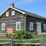
We will be hiking north along the Culham trail form Erindale Park as far as Eglington Ave and returning by way of Leslie Log House, Mullet Creek, Trapper’s Green, and Sawmill Valley Trail to UTM, finishing our scenic loop back at our starting point. This is mostly a flat hike with 3 hills and a few rocky sections where you have to watch your footing. Mostly it is smooth sailing. Our lunch stop will be on the grounds of Leslie Log House at the 7.6 km mark. Water fountain and public washrooms at Erindale Park only, nature stop prior to our lunch break. There should be an ice cream vendor waiting for us in Erindale Park on our return.
The route:https://onthegomap.com/s/d70uqhva
Hosting Club: Toronto
Category: General
Location (Google Maps): Map 15, km 16.1. Take Hwy 10 north to Caledon Village. Turn left on Hwy 24 (Charleston Sideroad). Go 1.5 km and turn left on Willoughby Rd.
Follow 3 km to roadside parking at Escarpment Sideroad.
Hike Leader(s): Peter Leeney Click here to contact Hike Leader(s)
Pace: Medium – 3 to 4 km/hour
Terrain: Moderate – some hills and/or some poor footing
Distance: 12 km
Description
A loop hike through Forks of the Credit. Expect some hilly sections.

Hosting Club: Toronto
Category: Urban Walk
Location (Google Maps): Meet at the front entrance to the Castle Frank Subway Station.
Hike Leader(s): Wayne Crockett Click here to contact Hike Leader(s)
Pace: Leisurely
Terrain: Flat
Distance: 11 km
Description
Join me for a pleasant walk from Castle Frank Subway through the Yellow Creek Ravine, Mount Pleasant Cemetery and the Beltline Trail westward to near Caledonia Road and Eglinton Avenue West.
Registration for this event opens on July 31st.
An early start to avoid the worst heat of the day.
Route: https://onthegomap.com/s/q2fklgbf
What you’ll need: Comfortable walking shoes, 2 litres of water, snacks.
How to get home: We will be passing near to Davisville Station on the Yonge Line and Eglinton West Station on the University-Spadina Line if you wish to drop out during the walk. At the end of the day you can catch the Eglinton 32 eastbound to the north/south subway lines or the 47 Lansdowne south to the Bloor/Danforth.
Hike open to BTC Members only.
Hosting Club: Toronto
Category: Urban Walk
Location (Google Maps): Meet Whitby GO Station North Exit by Bus Platform #7 (DRT Route #917). GO Train from Toronto Departs Danforth Station 8:16 AM arriving at 8:58 AM. We will take bus #917 for seven minutes to a stop near the conservation area – $0.80 if you show your GO Ticket/Pass. Drivers may take the bus & pay full fare ($3.25 Presto/$4.00 Cash, Seniors 2.15/$2.75) or meet at the Conservation Area (Parking $6.00 Flat Rate) – note the lot does get busy. GO Transit $10 Day Pass is available on smart phones only. Hikers without smart phone may meet at Main Street Subway Station and purchase through Hike Leader.
Hike Leader(s): Tom Swales Click here to contact Hike Leader(s)
Pace: Moderate
Terrain: Flat, Other (Refer to Description)
Distance: 11-12
Description
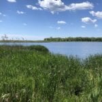
A short 7 minute bus ride from the Whitby GO Station we will explore the trails of beautiful Lynde Shores Conservation Area where birds and wildlife are regularly spotted. We pass through the bird feeder trail, two marshes and the Lake Ontario Shoreline. Option to visit the tap room of Town Brewery craft brewery before returning to the GO Station.
Surfaces include pavement, rocks, some sand and gravel/dirt trails. One small step down to the beach. Hiking Boots and long (or zip-off) pants recommended.
On The Go Maps Route Map:
https://onthegomap.com/s/ho466tn0
Preregistration begins July 31st 2021
Limited to Maximum 12 Hikers
Hike open to BTC Members only.
Hosting Club: Toronto
Category: Urban Walk
Location (Google Maps): Meet at TTC Bus Loop by Bluffers Park Beach. Take Bus #175 Bluffers Park from Kennedy Station to end of the line. Bus runs every 15 minutes, travel time is 20 minutes. Taking the TTC bus service is strongly recommended.
Hike Leader(s): Tom Swales Click here to contact Hike Leader(s)
Pace: Moderate
Terrain: Flat
Distance: 8
Description
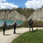
Morning hike around Bluffers Park Beach and Bluffers Park viewing the Scarborough Bluffs.
Preregistration Begins Aug 7 2021
Limited To Maximum of 12 Hikers
Hosting Club: Toronto
Category: Urban Walk
Location (Google Maps): Meet at west exit of the North York Centre subway station–towards the reflecting pool of Mel Lastman Square.
Hike Leader(s): George Lennon Click here to contact Hike Leader(s)
Pace: Leisurely
Terrain: Variable
Distance: 13.5 km
Description
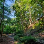
We will explore quiet trails along the West Don River into some of the least-known woods in the city. We will pass through York Cemetery to Gwendolyn Park and Earl Bales Park and the Hinder Property. Looping through the West Don Parkland, we return via the Hinder Property and Burnett Park to Mel Lastman Square. Some steep descents and climbs, so walking poles are highly recommended. It can be buggy along the Hydro Corridor. Bring spray, sunscreen if it is a bright day, and snacks and drinking water.
Hike open to BTC Members only.
Hosting Club: Toronto
Category: Car Hike
Location (Google Maps): Aldershot GO/Via Station, North Side outside the Station Building by the Bus Loop
Hike Leader(s): Tom Swales, Andrew Proczek Click here to contact Hike Leader(s)
Pace: Moderate
Terrain: Other (Refer to Description), Variable
Distance: 12
Description
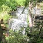
We will hike northwest through the Anita Dutka-Buchin Nature Sanctuary, to Old Waterdown Road meeting the Norman Pearson Side Trail which descends the escarpment to the Grindstone Creek Valley meeting the main Bruce Trail at km 71.6. The trail climbs the valley slopes through Smokey Hollow eventually leading to steps ascending to the lookout over Great Falls (or Smokey Hollow Falls) at km 72.4. We will hike into the village of Waterdown where there will be the opportunity to stop at the Copper Kettle for apple fritters. Our return will be on the Bruce Trail and the McNally Side Trail (km 73.2) completing the Great Falls loop and then back to Old Waterdown Road following an alternate trail southeast through the nature sanctuary to Aldershot station.
Hiking boots required, trekking poles are optional. Some steep hills and steps. Bring at least 2 liters of water, bug spray, sunscreen and a lunch.
This hike will be transit accessible by GO Transit. The Lakeshore West Train departs Union Station at 8:15 am and arrives at Aldershot Station at 9:20 am. GO Transit is offering a weekend day-pass for $10 if purchased on a smart phone (not available at the stations). If you don’t have a smart phone the pass can be purchased from the hike leader at Union Station. Those wishing to travel together Meet at Union Station before 8:00 by the clock under the information desk in the Great Hall.
Bruce Trail Guide Reference: Map 9