|
Sun | Mon | Tue | Wed | Thu | Fri | Sat |
|---|
August | August | August | August | August | 1 | 2 |
3 | 4 | 5 | 6 - Good Companions – Dundas Driving Park to Tews Falls and Return
9:00 AM-12:00 PM 09/06/2023 https://hikes.brucetrail.org/event/good-companions-dundas-driving-park-to-tews-falls-and-return-2/2023-09-06/ Hike open to BTC Members only. Click here for more information or to register Hosting Club: Iroquoia
Category: Good Companions
Location (Google Maps): Dundas Driving Park – Main parking area – See map below Hike Leader(s): Ted Bossence Click here to contact Hike Leader(s) Pace: Medium – 3 to 4 km/hr
Terrain: Strenuous – Hilly with steep climbs and some poor footing
Distance: 7.5 km Description
We will walk, following city streets, to the Tews Falls Side trail. We will ascend the escarpment and onwards to view Tews Falls. We will then return with a stop at the Dundas Peak Viewpoint and retrace our steps back to the Dundas Driving Park. Bring water, sunscreen, bug repellant and a snack. Hiking poles recommended. Please arrive at the car park by 8:50 am in order to be walking by 9:00 am (note the earlier start time). If you must cancel after 3:00 pm on Tuesday Sept 5, please inform me by text at 905 334-8752 or email at tedbossence@sympatico.ca . I will inform you if the hike is cancelled due to rain. Please check your email the evening before the hike.
| 7 - RattlesnakePoint Loop
9:30 AM-12:30 PM 09/07/2023 https://hikes.brucetrail.org/event/rattlesnakepoint-loop/2023-09-07/ Click here for more information or to register Hosting Club: Iroquoia
Category: Thursday Group
Location (Google Maps): Rattlesnake Point Conservation Area, Appleby Line Hike Leader(s): Anne Armstrong Click here to contact Hike Leader(s) Pace: Leisurely – 3km/hr or less
Terrain: Moderate – Some hills and/or some poor footing
Distance: Approx. 8 – 9 km. Description
Join us to hike the trails of Rattlesnake Point. Our trails follow the escarpment heights and the canyon between Crawford Lake and Rattlesnake Point Conservation Areas. There is one long descent into the canyon and another more gentle ascent back to the top. Meet in the LOWER parking lot of the conservation area at 9:45 am. for a 10:00 am. start. Bring water, sunscreen, insect repellent and poles if using. A registration is required to enter the conservation area.
Leader: Anne Armstrong 905 617 3937 hikingrandma@gmail.com
- Friendship Trail (City View Park to Grindstone Creek Loop)
10:00 AM-1:30 PM 09/07/2023 https://hikes.brucetrail.org/event/friendship-trail-city-view-park-to-grindstone-creek-loop-4/2023-09-07/ Click here for more information or to register Hosting Club: Iroquoia
Category: Thursday Group
Location (Google Maps): Meet at City View Park parking lot (South Entrance), Burlington. Located just south of Hwy #5 off of Kerns Rd. Hike Leader(s): Karen Capindale-Smith Click here to contact Hike Leader(s) Pace: Medium – 3 to 4 km/hr
Terrain: Strenuous – Hilly with steep climbs and some poor footing
Distance: 10km + Description
This 10.5 km hike will follow the main BT along the edge of the escarpment for great views of the Skyway bridge , Lake Ontario and surrounding area. We will continue to the outskirts of Waterdown and down into/out of the Grindstone Creek via the McNally and Waterdown Rd Side trails and main BT. Please dress in layers and bring water, a snack and lunch. Hike leader: Karen Capindale-Smith, kjcapindale@gmail.com. Please use cell (905-749-0914) for hike morning cancellations. Expect baked goods 🙂
| 8 | 9 |
10 - Terra Cotta Loop
9:30 AM-2:00 PM 09/10/2023 https://hikes.brucetrail.org/event/terra-cotta-loop-7/2023-09-10/ Click here for more information or to register Hosting Club: Iroquoia
Category: General Hike
Location (Google Maps): Roadside parking on Heritage Road Hike Leader(s): Pati Greenwood, Jeff Dowsett Click here to contact Hike Leader(s) Pace: Medium – 3 to 4 km/hr
Terrain: Moderate – Some hills and/or some poor footing
Distance: 15 k Description
Starting from the roadside parking, the hike will follow the main trail, the Terra Cotta Side Trail, and the Rockside Side Trail to form a loop. Regular breaks and a lunch stop will be included. Bring snacks, lunch and plenty of water. Please arrive at 9:15 am as we will depart promptly at 9:30 am.
- Canada Goose/Limehouse Bruce Trail Hike
10:00 AM-12:30 PM 09/10/2023 https://hikes.brucetrail.org/event/canada-goose-limehouse-bruce-trail-hike/2023-09-10/  Click here for more information or to register Hosting Club: Iroquoia
Category: General Hike
Location (Google Maps): Main Trail to Canada Goose Side Trail through to the Limehouse Conservation. Hike Leader(s): Anita Bergsma Click here to contact Hike Leader(s) Pace: Medium – 3 to 4 km/hr
Terrain: Moderate – Some hills and/or some poor footing
Distance: 10.3 Description
Join us for a beautiful hike of the Main Trail to the Canada goose Side Trail through to the Limehouse Conservation, looping back to the start point on September 10th, 2023. It will be a 10.3km at a medium pace with moderate terrain, paths and road. Meet at 9:45am Sharp to get ready and hike in at 10:00am. Duration: 2.5 hours There is plenty parking is on the shoulder of 4th Line . Please do not park in the garage parking lot. The community of Limehouse was first settled in 1820. By the 1840’s limestone quarrying and “burning” of limestone in kilns to make lime, had begun. The Grand Trunk Railway built its line through Limehouse in 1856 which required 200 workers and their families to settle in the area. Discover the geological heart of the area known as the “Hole in the Wall” where a ladder leads to cracks in the escarpment rock. Experience the past as you walk by remnants of the lime industry. Stand before huge lime kilns and the old powder-house. Also a great hike for those that would like to start hiking and looking for an introduction to hiking. Please wear hiking boots, bug spray, hat, backpack with water and snacks. Hiking poles are great for balance but optional. Wear long pants and long sleeve shirt as mosquitos and ticks have been bad.
| 11 | 12 | 13 | 14 | 15 | 16  Iroquoia End-to-End – 4 days Iroquoia End-to-End – 4 days 7:00 AM 09/16/2023 https://hikes.brucetrail.org/event/iroquoia-end-to-end-4-days/2023-09-16/  This is a Multi-Day HikeYou are signing up for the following dates and times:
2023-09-16 at 07:00
2023-09-17 at 07:00
2023-09-23 at 07:00
2023-09-24 at 07:00 Click here for more information or to register Hosting Club: Iroquoia
Category: Special Event
Location (Google Maps): Two different bus loading locations (one for each wknd) will be provided to registered hikers only. Unregistered hikers who show up will not be permitted to board the buses. Hike Leader(s): Parvinder Sachdeva Click here to contact Hike Leader(s) Pace: Brisk – 4 to 5 km/hr, Fast – 5+ km/hr
Terrain: Moderate – Some hills and/or some poor footing, Slippery Sections Likely, Strenuous – Hilly with steep climbs and some poor footing
Distance: 122km (30-35 each day) Description
Please join us for the Iroquoia Bruce Trail Club annual self-led End-to-End. You can enjoy and complete the 122 km distance over four days (approximately 30-35km each day). Please be honest about your physical abilities. These 4 days are not recommended for new hikers or anyone who hasn’t completed these sort of distances recently.
The registration fee is non-refundable and non-transferable. The hikes will traverse the varied terrain from Grimbsy in the south, to the 401 in Milton. Checkpoint stations will be approximately every 10 km offering snacks, water refill, and assistance. The hike is $95 for members and $110 for non-members and includes bus transportation from the meeting point to the hike starting point, refreshments, parking, permit costs, and the official E2E badge. Registration opens at 3 pm on Tuesday, July 4, 2023 for Bruce Trail Conservancy members. If any spots are still available at 3 pm on Thursday, July 13, 2023, registration will also be opened for non-members. Details will be emailed to participants once registration is received. As mentioned, these are longer hikes and are not suitable for beginning hikers. For both events, hikers are expected to maintain an average pace of 4 km/hr (or more). Hikers will be required to reach each checkpoint on each day by a prescribed time in order to continue, and ensure everyone is off the trail before dark. Please be aware that volunteers are running this event and will be waiting. Space is limited, hikes go rain or shine, and no dogs are permitted on this event. For questions, please contact Parvinder Sachdeva at pavvysingh@gmail.com
- Sherman Falls Loop
10:00 AM-1:00 PM 09/16/2023 https://hikes.brucetrail.org/event/sherman-falls-loop/2023-09-16/  Click here for more information or to register Hosting Club: Iroquoia
Category: General Hike
Location (Google Maps): Dundas Valley Conservation Area, 650 Governor’s Rd., Dundas, Not Hike Leader(s): Anne Armstrong Click here to contact Hike Leader(s) Pace: Leisurely – 3km/hr or less
Terrain: Moderate – Some hills and/or some poor footing
Distance: Approx. 10 km. Description
Please join in for a pleasant hike in the Dundas Valley CA. We will complete a loop using a combination of CA trails and Bruce Trail. Our loop takes us past a number of waterfalls including Sherman Falls. Park in the last parking lot and make your way to our meeting point at the trail centre. Meet at 9:45 am for a 10:00 am. start. Bring water, a snack, insect repellent and sunscreen. Parking fee in effect or a Conservation Area pass. Join in a pleasant hike in the Dundas Valley CA. We will hike a loop using a combination of Bruce Trail and Conservation Area trails. Our loop will take us past a number of waterfalls including Sherman Falls. Expect some hills. Bring water, a snack, insect repellent and sunscreen. Parking fee in effect or a Conservation Area pass.
Leader: Anne Armstrong 905 617 3937 hikingrandma@gmail.com
|
17 | 18 | 19 | 20 - Niagara Glen Short and Sassy
10:00 AM-12:00 PM 09/20/2023 https://hikes.brucetrail.org/event/niagara-glen-short-and-sassy/2023-09-20/ Click here for more information or to register Hosting Club: Iroquoia
Category: Good Companions
Location (Google Maps): Niagara Glen, 3050 Niagara Parkway, Niagara-on-the-Lake, ON Hike Leader(s): Craig Sim Click here to contact Hike Leader(s) Pace: Leisurely – 3km/hr or less
Terrain: Moderate – Some hills and/or some poor footing
Distance: 4-5k (approximate) Description
Loop hike in beautiful Niagara Glen, NOT using Whirlpool Trail. We meet in between Niagara Glen parking lot and building near lot. Pay parking or Niagara parks pass. Trail ranges from moderate to quite rocky, has hills and stairs. Watch footing. Lots of boulders and great views close to Niagara River. We descend steel stairs before and after hike. Wear hiking boots or shoes. Bring water, snack, appropriate layered clothing for the weather and rain gear. Keep in mind that if you find 4-5k a short hike, you can stroll along paths immediately adjacent up top after, or drive to Niagara Falls and stroll more there. Niagara Glen is close to both Butterfly Conservatory and Floral Clock. To cancel on day of hike text cell #289-659-0007 day of hike only.
| 21 - Twiss Rd to Crawford Lake
10:30 AM-2:30 PM 09/21/2023 https://hikes.brucetrail.org/event/twiss-rd-to-crawford-lake-2/2023-09-21/  Click here for more information or to register Hosting Club: Iroquoia
Category: General Hike
Location (Google Maps): We will meet at roadside parking on Twiss Rd at the Calcium Pitts – Map 11- 102.6 Hike Leader(s): Cathie Green Click here to contact Hike Leader(s) Pace: Medium – 3 to 4 km/hr
Terrain: Moderate – Some hills and/or some poor footing
Distance: Approximately 12 kms Description
We will meet at Twiss Road roadside parking -see Map 11, 102.6 and hike the White Blazes, main trail north towards Crawford Lake Conservation Area – we will hike the Conservation’s Hide and Seek trail and tour the Species at Risk wooden carvings. There may be washrooms open at the Visitor Centre- stopping for lunch/snack at picnic table at the Iroquoian Village-We will take the boardwalk around the meromictic lake on return trip and then back onto the Bruce Trail – approximately 12 kms there and back. —NOTE—The beginning of this hike can be strenuous as it involves scrambling up some rocks and for the first few kilometers the trail could be rocky footing — Wear good hiking boots/poles-Dress weather appropriate and bring water and snack/lunch -Any questions or concerns, please contact me via email or text at 416-931-2095 cathiekygreen@gmail.com Hike participants is limited as parking is limited I would invite anyone to consider taking out a membership with Halton Conservation(although not required for hike) – they give you a discount as a BTC member
| 22 - Scotsdale Farm
9:30 AM-1:00 AM 09/22/2023 https://hikes.brucetrail.org/event/scotsdale-farm-15/2023-09-22/ Click here for more information or to register Hosting Club: Iroquoia
Category: General Hike
Location (Google Maps): Scotsdale Farm Parking Lot Hike Leader(s): Pati Greenwood, Jeff Dowsett Click here to contact Hike Leader(s) Pace: Medium – 3 to 4 km/hr
Terrain: Moderate – Some hills and/or some poor footing
Distance: 13k Description We will hike the main trail, the Bennett Side trail and the Great Esker Side Trail for a 13k loop. Bring a snack and plenty of water. Wear sturdy footwear and clothing appropriate to conditions.
| 23 |
24 | 25 - Sydenham End to End in Eight Days – Moderate/Brisk pace Up to 25km per day – Please read all details for the hike before registering.
8:00 AM-3:00 PM 09/25/2023 https://hikes.brucetrail.org/event/sydenham-end-to-end-in-eight-days-moderate-brisk-pace-up-to-30km-per-day-please-read-all-details-for-the-hike-before-registering/2023-09-25/  Hike open to BTC Members only. This is a Multi-Day HikeYou are signing up for the following dates:
2023-09-25, 2023-09-26, 2023-09-27, 2023-09-28, 2023-09-29, 2023-09-30, 2023-10-01, 2023-10-02 Click here for more information or to register Hosting Club: Iroquoia
Category: General Hike
Location (Google Maps): Sydenham Section Hike Leader(s): Ruth Moffatt Click here to contact Hike Leader(s) Pace: Brisk – 4 to 5 km/hr, Medium – 3 to 4 km/hr
Terrain: Dependent on Conditions, Moderate – Some hills and/or some poor footing, Strenuous – Hilly with steep climbs and some poor footing
Distance: Up to 25km per day approximately. Description
Sydenham End to End. We will hike everyday for 8 days straight starting in Blantyre and making our way to Wiarton. Please note, you are signing up for all 8 days when you register for this hike. Sydenham section has approximately 50km of road and totals about 170km over all so we will break it into 8 days of varying distances depending on appropriate parking locations. The schedule will be sent to all registered hikers within a month of the start. If you do not live locally, I highly recommend you book accommodations somewhere in Owen Sound which is approximately mid-way of the entire section. This hike is rated as moderate/brisk – 3-5km per hour depending on terrain. Please be honest about your physical abilities when signing up for this hike. Upon completion of the 8 days, you will be entitled to apply for the new Sydenham ETE badge. This hike is open to members only. We will hike rain or shine. Please check daily forecast and dress appropriately for the weather. Please carry your own first aid kit, 2 litres of water and enough food and snacks to provide enough energy for a long day of hiking. We will hike at a steady pace but will break at around 10am, noon and for an afternoon break if we are hiking past 2pm. Everyone will be expected to take turns either being the driver to the start of the hike or driving the drivers back to their vehicles at the end of the day. There will always be time to stop and take photos and enjoy the flora, fauna and scenery along the way. Completion of all 8 days will qualify you for a new ETE badge, released this year. (see image) Current cost is $10 for members. I will try to make the badges available on our last day. Please, no dogs.
| 26 | 27 - Hilton Falls
9:30 AM-12:30 PM 09/27/2023 https://hikes.brucetrail.org/event/hilton-falls-8/2023-09-27/ 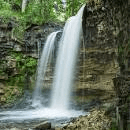 Click here for more information or to register Hosting Club: Iroquoia
Category: General Hike
Location (Google Maps): Hilton Falls Conservation Area Parking Lot Hike Leader(s): Susan Glofcheskie & Family Click here to contact Hike Leader(s) Pace: Brisk – 4 to 5 km/hr, Medium – 3 to 4 km/hr
Terrain: Moderate – Some hills and/or some poor footing
Distance: 10 – 11 km Description
This is a loop hike. Parking fee applies (unless you have a Halton Parks pass, a great value) and you must reserve from 9:30 am to 12:30 pm. Hike leader: Susan Glofcheskie: email: glofcheskies@rogers.com. Cell 416-576-3163. Please use email prior to the hike and cell on the day of the hike. Wear appropriate quick-dry clothing and hiking boots. Bring sunscreen, insect repellant (summer), icers (winter), snacks, a personal first aid kit and 1 – 2 litres of water. For personalized driving directions, click on the hike in the BTC hike calendar, then on (Google Maps) to the right of the word Location, and your smart phone should navigate you to the correct location. Please arrive at least 15 minutes early. If you are unable to attend, please email me as soon as possible in advance of the hike, or text me if it is < 2 hours before the hike.
- Good Companions – Spring Valley – Ancaster
10:00 AM-12:30 PM 09/27/2023 https://hikes.brucetrail.org/event/good-companions-spring-valley-ancaster-3/2023-09-27/ Hike open to BTC Members only. Click here for more information or to register Hosting Club: Iroquoia
Category: Good Companions
Location (Google Maps): Ancaster Little League Ball Park – Jerseyville Rd (across from the Ancaster Lions Outdoor Pool) – See map below Hike Leader(s): Ted Bossence Click here to contact Hike Leader(s) Pace: Medium – 3 to 4 km/hr
Terrain: Strenuous – Hilly with steep climbs and some poor footing
Distance: 8 – 10 km depending on whether we follow the Headwaters Trail to the end or not Description
We will follow the Spring Valley Trail, Martins Road, Headwaters Trail etc. in the western part of the Dundas Valley . Bring sunscreen, bug repellant, water and a snack (poles would also be useful). If I cancel due to rain I will notify you by email no later than the night before, so please check your emails before you leave for the hike. Please arrive a few minutes before the 10:00am time since I will be leaving promptly at 10:00. If you need to cancel after the 4:00pm cut-off time, please inform me by email the day before the hike at tedbossence@sympatico.ca , or by text at (905) 334-8752 the morning of the hike.
| 28 - Mt. Nemo CA to Kilbride Public School, Map 10
9:30 AM-2:00 PM 09/28/2023 https://hikes.brucetrail.org/event/mt-nemo-ca-to-kilbride-public-school-map-10-3/2023-09-28/ Click here for more information or to register Hosting Club: Iroquoia
Category: Thursday Group
Location (Google Maps): Meet at the back of Kilbride Public School (by park and tennis courts). 6611 Panton St. (just off Kilbride st). Will be a shuttle to the Walker Line access to Mt. Nemo CA Hike Leader(s): Karen Capindale-Smith Click here to contact Hike Leader(s) Pace: Medium – 3 to 4 km/hr
Terrain: Strenuous – Hilly with steep climbs and some poor footing
Distance: 12 km Description We will shuttle to Walkers Line access of Mt Nemo CA and follow main BT up escarpment into Conservation Area ( for lovely views of the countryside and hopefully some fall colours) and out along rural roads. We will continue on into Bronte Creek/Cedar Springs Valley. We will finish our hike climbing a strenuous stretch out of the valley and into the village of Kilbride. Driver(s) will be needed to drive back to starting point to recover shuttle car(s). Bring water, snacks, lunch and appropriate clothing layers for the weather. Drivers with Conservation pass may need a reservation to access the Mt Nemo CA parking lot.
Hike Leader: Karen Capindale-Smith; kjcapindale@gmail.com; hike morning use cell (905) 749-0914. Baked goods can be expected 🙂
| 29 - Hilton Falls Ramble
10:00 AM-1:00 PM 09/29/2023 https://hikes.brucetrail.org/event/hilton-falls-ramble-5/2023-09-29/  Click here for more information or to register Hosting Club: Iroquoia
Category: General Hike
Location (Google Maps): Hilton Falls Conservation Area, 4985 Campbellville Rd. Hike Leader(s): Anne Armstrong Click here to contact Hike Leader(s) Pace: Leisurely – 3km/hr or less
Terrain: Easy – Mostly flat and usually good footing
Distance: Approx. 10 km. Description
Join us for a ramble around the Hilton Falls trails. We will use a combination of Bruce Trail Side trails and Conservation Area to explore this beautiful area. Perhaps there will be a good amount of water in the falls. Mostly flat, easy trails with some rocky sections and one long hill to climb. Meet in the main parking lot at 9:45 for a 10:00 am. start. Bring water, a snack, sunscreen and insect repellent. Reservation required, can be made through the Halton Conservation Parks Reservation system. This will be a leisurely paced hike.
Leader:Anne Armstrong 905 617 3937 hikingrandma@gmail.com
| 30 - Steeltown Stomp 2023
8:00 AM-4:00 AM 09/30/2023 https://hikes.brucetrail.org/event/steeltown-stomp-2023/2023-09-30/  Click here for more information or to register Hosting Club: Iroquoia
Category: Steeltown Stomp
Location (Google Maps): Mohawk 4 Ice Centre, 710 Mountain Brow Blvd., Hamilton ON, L8T 5A9. Please park at the north end of the parking lot. Event Coordinator(s): Samar Smith Click here to contact Event Coordinator(s)
Event Start Times: 8:00 AM, 8:15 AM, 8:30 AM, 8:45 AM Pace: Brisk – 4 to 5 km/hr, Fast – 5+ km/hr, Medium – 3 to 4 km/hr
Terrain: Strenuous – Hilly with steep climbs and some poor footing
Distance: Hike approximately 23 kms and climb up and down approximately 2000 steps. Description
Looking for a distance and strength challenge? The Steeltown Stomp is just what you’ve been looking for! Climb up and down approximately 2000 steps of the escarpment stairs, and hike over 20 kilometres in the Iroquoia Bruce Trail Club’s annual Steeltown Stomp. This is a self-guided hike along the Bruce Trail, the Escarpment Rail Trail, and the Chedoke Radial Trail, climbing up and down the 7 sets of stairs along the Hamilton Escarpment as you go. Everyone who completes the route and goes through the two checkpoints will earn the coveted Steeltown Stomp badge. Please Note: This is an arduous hike and requires a high level of fitness due to the stair climbing required. Fee: $30 fee includes checkpoint snacks, badge, and helps to support the Bruce Trail Conservancy in its mission to preserve a ribbon of wilderness, for everyone, forever. Check in: At the registration booth set up at the north end of the parking lot of the Mohawk 4 Ice Centre. We have set up staggered start times – choose 8:00, 8:15, 8:30, or 8:45 when you register and you will start the hike as you are checked in. This is not a race, and you will not be timed. Checkpoints: Start and end at the Mohawk 4 Ice Centre. There is a second turnaround checkpoint at the Chedoke Golf Course. Route: Follow the yellow blazes…special yellow blazes will be set up to mark the route. In addition, the route has been set up on the AllTrails app. If you have this downloaded on your phone, you can follow the route using the app. Outbound route Inbound route What to bring: Bring your own water. You will be able to refill your own water bottles at public water fountains along the route. Wear comfortable, sturdy shoes (hiking boots are not necessary), and dress for the weather. Protect yourself from insects and sun. Safety Precautions: Normal hiker etiquette and safety precautions apply…https://brucetrail.org/explore-the-trail/#Bruce-Trail-101 Donations: If you are interested in contributing further to the BTC, please click here. FAQ’s What if it rains? This is a rain or shine event. What if I need to drop out? As we are in an urban area, there are places to meet a taxi or a ride along the way. This must be arranged by you, the participant. If you have to drop out during the event, please let us know by text or phone to Samar Smith at 416-662-9192. How long will it take to finish? We estimate that the hike will take between 3 and 5 hours. Are dogs allowed? No. The stairs will be too crowded during this event. Contact: Samar Smith at iroquoiabrucetrailclub@gmail.com or 416-662-9192
|