Join us for a hike! Registration required:
All hikes available to BTC members. Some hikes are open to non-members.
TIP: The calendar view displays up to 7 hikes on a day, but often there are more. Click “More events” to see them all.
To view all Bruce Trail Conservancy Hikes click hereHike open to BTC Members only.
Hosting Club: Iroquoia
Category: Good Companions
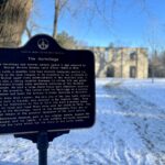
Location (Google Maps): Mountsberg Conservation area
2259 Milburough Town Line
Campbellville ON
L0P 1B0
Hike Leader(s): Jill Parratt Click here to contact Hike Leader(s)
Pace: Medium – 3 to 4 km/hr
Terrain: Easy – Mostly flat and usually good footing
Distance: 7.5
Description
Please meet at 9:15 for a 9:30 start.
You will need to reserve at time spot at Mountsberg Conservation area at www.conservationhalton.ca
Please bring water and icers.
Text me at 905-399-3601 on day of hike for cancelations or questions.
Jill Parratt

This is a Multi-Day Hike
You are signing up for the following dates:
2023-03-02, 2023-03-03, 2023-03-04, 2023-03-05, 2023-03-06
Hosting Club: Iroquoia
Category: General Hike
Location (Google Maps): Meet first day at Lavender Cemetery. Various locations; schedule will be sent to all participants.
Hike Leader(s): Ruth Moffatt Click here to contact Hike Leader(s)
Pace: Brisk – 4 to 5 km/hr
Distance: Approx 100km over 5 days
Description
We will hike the requirements for both the Blue Mtn Winter End to End and the Winter Rim to Rim over 5 days. A hike schedule will be sent to registered participants. There will be wintery conditions – bring icers and snowshoes, lots of water and snacks. It will be tough hiking so be sure of your physical ability before signing up for this hike which will be split: First day – BM ETE, 2nd and 3rd day – Rim to Rim and 4th and 5th day – BM ETE.
Hosting Club: Iroquoia
Category: General Hike
Location (Google Maps): Dundas Valley Conservation Area, 650 Governor’s Rd. Dundas
Hike Leader(s): Anne Armstrong Click here to contact Hike Leader(s)
Pace: Medium – 3 to 4 km/hr
Terrain: Moderate – Some hills and/or some poor footing
Distance: Approx. 10 km.
Description
Join us to hike the lovely trails and hills of the Dundas Valley Conservation Area with its many hills and ravines. Park in the last parking lot of the Governor’s Rd. entrance and make your way up to the trail centre which has bathrooms. The hike starts at 10:00 am. so try to arrive by 9:45 am. Bring water, a snack/lunch, icers and poles if using. Parking fee or Conservation Area pass.
Leader: Anne Armstrong 905 617 3937 hikingrandma@gmail.com
Hosting Club: Iroquoia
Category: Good Companions
Location (Google Maps): Sixteen Mile Creek – River Glen Blvd./Neyagawa Blvd.Intersection, Oakville
Hike Leader(s): Anne Armstrong Click here to contact Hike Leader(s)
Pace: Leisurely – 3km/hr or less
Terrain: Easy – Mostly flat and usually good footing
Distance: Approx. 9 km.
Description
Although this oasis sits in the middle of Oakville, once on the trail system one would not know it. The trails are on sides of the Sixteen Mile Creek and are sometimes on top of the banks and other times down beside the creek. The valley is rich in history, both Indigenous and early settlers from Europe and the USA. Come join us for this beautiful hike and learn more about the valley. Meet on the southeast corner of Neyagawa Blvd. and River Glen Blvd. at 9:45 am. for a 10:00 am. start. Park in the lot beside the baseball fields. Bring water, a snack. Icers may be necessary and poles are useful. We will be going down two long hills and up two.
Leader: Anne Armstrong 905 617 3937 hikingrandma@gmail.com
Hosting Club: Iroquoia
Category: General Hike
Location (Google Maps): Meet DUNDURN CASTLE 610 York St Hamilton Parking Lot
Hike Leader(s): Cathie Green Click here to contact Hike Leader(s)
Pace: Medium – 3 to 4 km/hr
Terrain: Easy – Mostly flat and usually good footing
Distance: 6-8 kms
Description
Meet at 10 am at Dundurn Castle Parking Lot(no fees) off York St Hamilton-easy access from 403
We will hike along the ridge to the stairs leading us down to Hamilton Bay Waterfront and hike the paved path to Bayfront Park and hike along some of their
bayfront trails – we will return along city side streets -Please wear suitable clothing and footwear for the weather/Poles, Icers/ water, snack.
OPTIONAL Social afterwards to have lunch at the Admiral Inn across the street from parking lot-
If interested in lunch-email me at cathiekygreen@gmail.com and/or text me 416-931-2095 to let me know
Hike open to BTC Members only.
Hosting Club: Iroquoia
Category: Good Companions
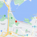
Location (Google Maps): Chedoke Golf Course Parking Lot, Hamilton (See map below)
Hike Leader(s): Ted Bossence Click here to contact Hike Leader(s)
Pace: Medium – 3 to 4 km/hr
Terrain: Dependent on Conditions, Moderate – Some hills and/or some poor footing, Slippery and Steep Sections, Slippery Sections Likely
Distance: 7.5 km
Description
We will head east from the Chedoke Golf Course parking lot along the radial line and then onto the Bruce Trail up the escarpment. We will need to cross busy Beckett’s Drive/Queen Street Hill. We will then follow the Bruce Trail to the top of the escarpment and then descending to the city streets and return via the tree lined streets to the radial trail and the golf course parking lot.
Bring icers, water and a snack. Walk will be cancelled in case of poor weather/driving conditions (please check your email the evening before).
Please arrive 10 minutes before the start time and we will start walking at 10:00 am sharp! Please inform me by email at tedbossence@sympatico.ca if you cancel after the registration cut-off time on the Tuesday and by text at 905 334-8752 if you cancel the morning of the hike.
Hosting Club: Iroquoia
Category: Good Companions
Location (Google Maps):
Gage Park parking lot in the south end of the park off of Lawrence Road in Hamilton
Hike Leader(s): Ted Bossence Click here to contact Hike Leader(s)
Pace: Medium – 3 to 4 km/hr
Terrain: Dependent on Conditions, Moderate – Some hills and/or some poor footing
Distance: 9 km
Description
Following city streets, the rail trail and Kenilworth stairs we will do a loop returning to Gage Park. Bring icers, a snack and water. Dependent on weather the rail trail may be icy making icers possibly essential. Please arrive a few minutes before start time, we will leave on time. If the hike is cancelled due to bad weather, I will inform you by email on the evening before the hike.
If you decide to cancel after 4:00pm Tuesday, please let me know by email – tedbossence@sympatico.ca or by text at 905 334-8752.

Hosting Club: Iroquoia
Category: Thursday Group
Location (Google Maps): Dundas Valley Conservation Area, 650 Governor’s Rd. , Dundas
Hike Leader(s): Phillip Armstrong Click here to contact Hike Leader(s)
Pace: Leisurely – 3km/hr or less, Medium – 3 to 4 km/hr
Terrain: Moderate – Some hills and/or some poor footing
Distance: 10 km.
Description
Spring is a good time to see the waterfalls in Dundas Valley Conservation Area. Today we will hike a loop to Sherman Falls also seeing Grindstone Creek and Canterbury and Little Canterbury Falls along the way. Be prepared for some hills. Please note that there will be two levels of pace: medium and leisurely. Please arrive in the main parking lot at the the Governor’s Rd. entrance at 9:45 for a 10:00 am start. Bring water, a snack/ lunch, icers and poles if using. Parking fee in effect or a Conservation Area pass.
Leaders: Phill Armstrong/Anne Armstrong 416 895 3937 hikingrandpa@gmail.com
Hosting Club: Iroquoia
Category: General Hike
Location (Google Maps):
Trail begins on Miller Drive, Georgetown. Closest address is 124 Miller Drive. Plenty of parking on the road.
Hike Leader(s): Anita Bergsma Click here to contact Hike Leader(s)
Pace: Medium – 3 to 4 km/hr
Terrain: Easy – Mostly flat and usually good footing
Distance: 5 km
Description

Hosting Club: Iroquoia
Category: Good Companions
Location (Google Maps): Meet before 9:30 in the parking lot off from Arbour Road directly across from Albion Falls. See map 7 in the BTC Guide. An enjoyable early spring walk that may have a lot of water flowing over both falls. We will partly decend into the lovely Red Hill Valley and come up on the other side. Depending on the weather, icers may be required. Will stop at Felker Falls for water and a snack. Feel free to join me for an optional coffee after the hike.
Hike Leader(s): Paul Toffoletti Click here to contact Hike Leader(s)
Pace: Medium – 3 to 4 km/hr
Terrain: Dependent on Conditions, Moderate – Some hills and/or some poor footing
Distance: Approx. 8km
Description
Hosting Club: Iroquoia
Category: Thursday Group
Location (Google Maps):
Meet at City View Park parking lot (South Entrance), Burlington. Located just south of Hwy #5 off of Kerns Rd.
Hike Leader(s): Karen Capindale-Smith Click here to contact Hike Leader(s)
Pace: Medium – 3 to 4 km/hr
Terrain: Moderate – Some hills and/or some poor footing, Slippery and Steep Sections, Slippery Sections Likely
Distance: 10km +
Description
This 10.5 km hike will follow the main BT along the edge of the escarpment for great views of the Skyway bridge , Lake Ontario and surrounding area. We will continue to the outskirts of Waterdown and down into/out of the Grinestone Creek via the McNally and Waterdown Rd Side trails and main BT. Please dress in layers and bring water, a snack and lunch. Icers are MANDATORY. Hike leader: Karen Capindale-Smith, kjcapindale@gmail.com. Please use cell (905-749-0914) for hike morning cancellations.