Join us for a hike! Registration required:
All hikes available to BTC members. Some hikes are open to non-members.
TIP: The calendar view displays up to 7 hikes on a day, but often there are more. Click “More events” to see them all.
To view all Bruce Trail Conservancy Hikes click hereHosting Club: Iroquoia
Category: Good Companions
Location (Google Maps): Crawford Lake Conservation Area, Guelph Line
Hike Leader(s): Anne Armstrong Click here to contact Hike Leader(s)
Pace: Leisurely – 3km/hr or less
Terrain: Moderate – Some hills and/or some poor footing
Distance: Approx. 9 km.
Description
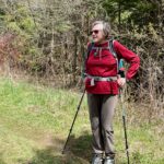
Crawford Lake with its rich history of Indigenous peoples and early settlers as well as its position on the Niagara Escarpment never fails to please. We will complete a circuit of the lake, the conservation area and Bruce Trail, both white and blue, as well as snowshoe trails to explore this area. Expect some rocky areas where you can practise your “rock dancing”. Bring water, a snack, sunscreen, insect repellent and poles if using. Arrive at 9:45 for a 10;00 am. start. Reservation for Conservation Area required.
Leader: Anne Armstrong 905 617 3937 hikingrandma@gmail.com
Hosting Club: Iroquoia
Category: Good Companions
Location (Google Maps): CIty View Park Burlington
Hike Leader(s): Mary Rose Click here to contact Hike Leader(s)
Pace: Medium – 3 to 4 km/hr
Terrain: Moderate – Some hills and/or some poor footing
Distance: 8K
Description
We will follow some Bruce trails and some local ones. There are a few easy hills. We will stop for water and a snack and check out the turtles at the quarry.
City View Park now has a new Centre with washrooms (ole) and picnic benches.
PARKING There is plenty of free parking but make sure you do NOT go to the SOUTH lot. We will meet in the lot closest to Highway 5 near the soccer fields.
Hosting Club: Iroquoia
Category: Thursday Group
Location (Google Maps): South Parking Lot at Cityview Park Burlington. Entrance on Kerns Rd.
Do not park at the soccer fields North Entrance.
Hike Leader(s): Phillip Armstrong Click here to contact Hike Leader(s)
Pace: Medium – 3 to 4 km/hr
Terrain: Moderate – Some hills and/or some poor footing
Distance: 7km to 10km
Description
Hike to Fishers Pond and return. Optional Iain Reid Side trail (hilly and steep ) and further option to go down into Kerncliffe Park.
Hike will be about 7km or longer to about 10km if you do the Ian Reid and Kerncliffe extensions

This is a Multi-Day Hike
You are signing up for the following dates and times:
2022-09-17 at 07:00
2022-09-18 at 07:00
2022-09-24 at 07:00
2022-09-25 at 07:00
Hosting Club: Iroquoia
Category: Special Event
Location (Google Maps):
Hike Leader(s): Christine Hanley Click here to contact Hike Leader(s)
Distance: Approximately 122km
Description
The 2022 Iroquoia E2E will be held September 17, 18, 24 & 25.
Please see our Event on Eventbrite for additional details & to register:
http://www.iroquoia.on.ca/index.php/2022/06/27/2022-iroquoia-4-day-e2e-registration-opens-june-30/
Due to this summer’s BTC website update, the Iroquoia club opted to use Eventbrite for registrations this year. You may only register via Eventbrite.
Hosting Club: Iroquoia
Category: General Hike
Location (Google Maps): Please meet at the Red BTC parking lot behind Kilbride Public School. Kilbride PS is off Panton Street in Kilbride north of Burlington. About 1 km northwest of km 97.9 BTC Map 10.
Hike Leader(s): Stuart Law Click here to contact Hike Leader(s)
Pace: Medium – 3 to 4 km/hr
Terrain: Moderate – Some hills and/or some poor footing
Distance: 16 km
Description
Join us for a shuttle hike from Zimmerman to Kilbride passing through Mount Nemo and the Bronte Creek Valley. We will climb the escarpment up to Mount Nemo then head along the brow at Mount Nemo for some spectacular views before a bit of road walking that will take us to the River and Ruin Side Trail then Kilbride. Please bring 3L of water, a snack, a lunch, an appreciation of nature and a smile. Hiking boots mandatory. Poles recommended. Forest bathing likely. Possible optional pub stop after.
Hosting Club: Iroquoia
Category: General Hike
Location (Google Maps): City View Park, Burlington
Hike Leader(s): Anne Armstrong Click here to contact Hike Leader(s)
Pace: Leisurely – 3km/hr or less
Terrain: Moderate – Some hills and/or some poor footing
Distance: Approx. 11 km.
Description
This hike will take us to Smokey Hollow in Waterdown and back, using main trail with one side trail (Upper Grindstone Creek). It will be early Fall so we may see some evidence leaves turning colour and late wildflowers. Meet in the south (east of Kerns) parking lot at City View Park on Kerns Rd. at 9:45 am. for a 10:00 am. start. Park in the first lot on your right. Bring water, a snack/lunch, sunscreen and insect repellent. Hiking poles may be useful.
Leader: Anne Armstrong 905 617 3937 hikingrandma@gmail.com
Hosting Club: Iroquoia
Category: General Hike
Location (Google Maps): Scotsdale Farm – 13807 Trafagar Rd.
Hike Leader(s): Anne Armstrong Click here to contact Hike Leader(s)
Pace: Leisurely – 3km/hr or less
Terrain: Moderate – Some hills and/or some poor footing
Distance: Approx.9 – 10 km.
Description
This hike will take us west of Scotsdale Fare, away from the main trails of Scotsdale Farm. We will hike west on main trail to Highway 7 where we will cross to pick up the Duff Pit Sidetrail. Moderate trails will take us to the now disused cistern which once provided water to Georgetown. After a light snack and drink we will retrace our steps back to Scotsdale. Fall colours are beginning and we may be rewarded with some. Please meet in the parking lot near the farmhouse at 9:45 am. for a 10:00 am. start. Bring water and a snack or lunch. Poles may be useful.
Hike open to BTC Members only.
This is a Multi-Day Hike
You are signing up for the following dates and times:
2022-09-26 at 08:00
2022-09-27 at
2022-09-28 at
2022-12-29 at
2022-09-30 at
Hosting Club: Iroquoia
Category: Special Event
Location (Google Maps):
Hike Leader(s): Louise Langlais Click here to contact Hike Leader(s)
Pace: Brisk – 4 to 5 km/hr, Medium – 3 to 4 km/hr
Terrain: Moderate – Some hills and/or some poor footing
Distance: 12-29 km, depending on the day
Description
Join us for a series of hikes in the gorgeous Frontenac Provincial Park! We will hike Sep 26-30, 2022 on some of the amazing trails in this park. You can hike for this entire period or just join us for a day or two, your choice.
This semi-wilderness park features Canadian Shield granite outcrops, vast wetlands, 28 lakes, mixed forests, plants and wildlife. Trails wind through rugged terrain to areas such as: Moulton Gorge, Arkon Lake Bog, the Black Lake homestead and the Crab Lake mines.
From Otter Lake, hikers and canoeists head into the interior for glimpses of osprey and kingfisher, deer and black bear, coyote, fox, and abundant beaver. Some of the many unique features along the trails include lookouts, beaver ponds, abandoned mica mines, the remains of a homestead, extensive boardwalk and rock ridges.
***Hikers are to make their own arrangements for accommodation*** PLEASE DO NOT SIGN UP UNTIL YOU HAVE A PLACE TO STAY.
A favourite place to stay near the park is the lovely Snug Harbour Resort: http://www.snugharbour.on.ca
You should make your reservation ASAP because these cabins book up quickly!
Hikers will be also responsible for transportation to and from the hikes.
The hike schedule and meeting locations for each day will be provided to participants closer to the date.
Hosting Club: Iroquoia
Category: Good Companions
Location (Google Maps): Merrick Field Centre Parking Lot – end of Lions Club Road, Ancaster
Hike Leader(s): Ted Bossence Click here to contact Hike Leader(s)
Pace: Medium – 3 to 4 km/hr
Terrain: Strenuous – Hilly with steep climbs and some poor footing
Distance: 7.5 km
Description
We will do a circular walk from the Merrick Field Centre using various trails and will see Canterbury and Sherman Falls along the way.
Please arrive a few minutes early, I will be leaving on time, with or without you.
If you decide not to cancel after 4:00 pm on the day prior to the hike, please inform me by email that evening or by text at 905 334 8752 the morning of the hike.
Hike will be cancelled in case of rain. I will inform you by email the evening before the hike if this is the case.
Bring water, a snack, sunscreen, insect repellant and your own first aid kit.
Hosting Club: Iroquoia
Category: Thursday Group
Location (Google Maps): Meet at the N.E. corner of the Mohawk 4 Ice Arena parking lot.
710 Mountain Brow Blvd
Hike Leader(s): Phillip Armstrong Click here to contact Hike Leader(s)
Pace: Medium – 3 to 4 km/hr
Terrain: Moderate – Some hills and/or some poor footing
Distance: 10km
Description
Hike past Albion Falls and Buttermilk Falls to Felkers Falls and return.
Bring lunch which we will have overlooking Felkers Falls