Join us for a hike! Registration required:
All hikes available to BTC members. Some hikes are open to non-members.
TIP: The calendar view displays up to 7 hikes on a day, but often there are more. Click “More events” to see them all.
To view all Bruce Trail Conservancy Hikes click hereHosting Club: Iroquoia
Category: General Hike
Location (Google Maps): Designated Bruce Trail parking lot in City View Park off Kerns Road (second entrance south of Highway 5 (Dundas Street)). Bruce Trail Guide Map 9. 2500 Kerns Road, Burlington, L7P 1P8.
Hike Leader(s): Stuart Law Click here to contact Hike Leader(s)
Pace: Medium – 3 to 4 km/hr
Terrain: Moderate – Some hills and/or some poor footing
Distance: 12 km
Description
Enjoy a fresh peaceful Sunday morning in the Waterdown Woods on the brow of the Escarpment with great views of Hamilton Harbour and the hopefully ice-encrusted Great Falls. We will descend the Grindstone Creek Valley before climbing the Norman Pearson Side Trail back to the Main Trail. We will also take in the King, Kerncliff Park and Ian Reid Side Trails. There will be plenty of ups and downs and most likely some packed snow and ice. Please bring your icers, a warm drink and a snack. Optional refreshment stop after. Please pre-register at stuarthikes@gmail.com so that I can get an idea of numbers and let you know if the hike has to be cancelled for any reason. Thank you.
Hosting Club: Iroquoia, Toronto
Category: General Hike
Location (Google Maps): Hilton Falls Conservation Area
Hike Leader(s): Anne Armstrong Click here to contact Hike Leader(s)
Pace: Leisurely – 3km/hr or less
Terrain: Moderate – Some hills and/or some poor footing
Distance: Approx. 9 kms.
Description
While Hilton Falls in winter is known for its skiing it also has good hiking, especially this year with little to no snow. Meet in the parking lot of Hilton Falls Conservation area at 10:15 am. for a 10:30 am. start. We will explore the trails, including the Falls. Bring water, a snack and icers. Be prepared for icy spots, mud or both. Map 11. Hilton Falls C.A is located on #5 Sideroad, also known as Regional Rd. 9 or Campbellville Rd.
Hosting Club: Iroquoia
Category: Happy Wanderers
Location (Google Maps): Meet at Roadside Parking – km 83.5 on Guelph Line, south of No. 1 Sideroad. Do not block farm gate (10 cars) N 43.388387, W 79.854327
Shuttle to Rock Chapel Nature Sanctuary, km 62.2 Enter from Rock Chapel Rd, 1.5 km south of Hwy 5, 1.8 km west of Hwy 6. Free parking for RBG member, otherwise day-use fee applies (30 cars) N 43.290604, W 79.937090
Hike Leader(s): Steven White Click here to contact Hike Leader(s)
Terrain: Moderate – Some hills and/or some poor footing
Description
For those looking to enjoy some winter hiking or to complete Iroquoia E2E and achieve their Winter badge, I have planned 6 Monday hikes. Please register ahead of the hike, so I can do car shuttle planning and to contact hikers if inclement weather requires us to re-schedule the hike. Email stevenwhite901@gmail.com or text 289-242-9415
Bring water, snack, lunch, hiking boots, icers. Sorry no dogs.
Hosting Club: Iroquoia
Category: Good Companions
Location (Google Maps): Meet at Car Park, Old Mud Street near intersection with Pritchard. Hamilton East Mountain.
Hike Leader(s): Terry Rose Click here to contact Hike Leader(s)
Pace: Leisurely – 3km/hr or less
Terrain: Moderate – Some hills and/or some poor footing
Distance: 8 km
Description
We will do a loop hike in the Red Hill Valley, returning via Buttermilk and Albion Falls. Adjust according to conditions. Icers mandatory.
Hosting Club: Iroquoia
Category: Thursday Group
Location (Google Maps): Dundas Valley Conservation Area
Hike Leader(s): Anne Armstrong Click here to contact Hike Leader(s)
Pace: Leisurely – 3km/hr or less
Terrain: Moderate – Some hills and/or some poor footing
Distance: 8 to 10 km.
Description
Dundas Valley never disappoints with its beautiful trails, hills and valleys. It is especially lovely in the winter. Dundas Valley CA is on Governors Rd., west of the Dundas town centre. Meet in the last parking lot. We will hike the Canterbury Loop and for those who wish we can hike the Sawmill Valley Loop. Bring a lunch/snack. Icers may be necessary. Parking fee in effect or Conservation Area pass. Map 8.
Leader: Anne Armstrong 905 617 3937
HIKE CANCELLED DUE TO IMPENDING SNOWFALL
Hosting Club: Iroquoia
Category: Education Hike
Location (Google Maps): Dundas Old Town Hall
Hike Leader(s): Bronwen Tregunno Click here to contact Hike Leader(s)
Pace: Leisurely – 3km/hr or less
Terrain: Moderate – Some hills and/or some poor footing
Distance: 3-4 km
Description
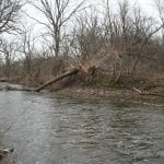
NOTE! Takes place Feb 6th 10AM – 11:30 AM!! Please come a few minutes early to sign in so we can start promptly at 10AM. Join local history buff Fraser Forrest as he takes us along the Spencer Creek Trail in Dundas to learn about the industrial background and changes along Spencer Creek. We’ll be starting at old Dundas Town Hall and walking along the creek starting the trail at the Metro. The This is a gentle walk of about 3-4 kilometres depending on the group with multiple stops to talk about history. Dress warm and wear good boots in case trail is slippery. Have icers on hand, poles recommended. Bring snack and water. Optional stop afterwards at Grupetto Cafe. Contact Bron for more information or to register brontreg@cogeco.ca or cell with text 905-334-4013 (leave message – will have on day of walk). Cancelled in inclement weather or if the trail is too icy.
Hosting Club: Iroquoia
Category: General Hike
Location (Google Maps): City View Park/Kerns Rd. Burlington
Hike Leader(s): Anne Armstrong Click here to contact Hike Leader(s)
Pace: Leisurely – 3km/hr or less
Terrain: Moderate – Some hills and/or some poor footing
Distance: 8 km.
Description
This there and back hike will take us to Smokey Hollow on Waterdown Rd. in Watertown. The trail will give us some good views over the escarpment toward the Skyway Bridge and the lake and take us to Smokey Hollow, very important in the early days of Watertown. Bring a snack and water. Icers may be necessary. City View Park is on the east side of Kerns Rd. Enter via the most southerly entrance. Map 9.
Leader: Anne Armstrong 905 337 3937 hikingrandma@gmail.com
Hosting Club: Iroquoia
Category: Happy Wanderers
Location (Google Maps): Meet at Roadside Parking – km 83.5 on Guelph Line, south of No. 1 Sideroad. Do not block farm gate (10 cars) N43.388387, W79.854327
Shuttle to Roadside Parking – km 103.8 on Twiss Rd north of Derry Rd (6 cars) N 43.447743, W 79.953436
Hike Leader(s): Steven White Click here to contact Hike Leader(s)
Terrain: Moderate – Some hills and/or some poor footing
Distance: 20.3km
Description
For those looking to enjoy some winter hiking or to complete Iroquoia E2E and achieve their Winter badge, I have planned 6 Monday hikes. Please register ahead of the hike, so I can do car shuttle planning and to contact hikers if inclement weather requires us to re-schedule the hike. Email stevenwhite901@gmail.com or text 289-242-9415
Bring water, snack, lunch, hiking boots, icers. Sorry no dogs.
Hosting Club: Iroquoia
Category: Special Event
Location (Google Maps): Meet at Bayfront Park, Bay Street North, Hamilton.
Hike Leader(s): Terry Rose Click here to contact Hike Leader(s)
Pace: Medium – 3 to 4 km/hr
Terrain: Easy – Mostly flat and usually good footing
Distance: 8 km
Description
We will hike along Hamilton Harbour to Princess Point; from there we cross the playing fields, past the Catholic Cathedral and on to the Hamilton Convention Centre, arriving around 11:45. This will be the 18th Annual “SOUPFEST” and Iroquoia BTC, under various leaders, has been there for most of those years.
For $20 ($15 for seniors)** you get to select four delicious cups of soup from the best restaurants in the area (bread included). The proceeds go to Living Rock Ministries, an NGO that does great work with troubled youth in Hamilton. There is entertainment and door prizes with plenty of sporting and media celebrities on hand. For more information and advanced tickets go to: https://www.livingrock.ca/soupfest
** Advanced prices are $17 and $12
After lunch return to Bayfront Park at your leisure.
Hosting Club: Iroquoia
Category: Hikers R Us
Location (Google Maps): Scotsdale Farm. From 401 north on Trafalgar Rd pass Georgetown turn left on highway 7 going north to Trafalgar Rd turn right go north about 2.0 turn right into Scotsdale Farmparking lot. Map 13,29.7 km
Hike Leader(s): Ronald Granger Click here to contact Hike Leader(s)
Pace: Medium – 3 to 4 km/hr
Terrain: Moderate – Some hills and/or some poor footing, Slippery Sections Likely
Distance: 12 Km
Description
Loop hike on the main trial ,Bennett Heritage and Robert side trails. Icers maybe required. pub stop after hike.
Hosting Club: Iroquoia
Category: Thursday Group
Location (Google Maps): Meet In the North West corner of Maple Grove Shopping Centre
Hike Leader(s): Norman Young Click here to contact Hike Leader(s)
Pace: Medium – 3 to 4 km/hr
Terrain: Easy – Mostly flat and usually good footing
Description
A walk along Joshua Creek ravine over to Lakeshore Park in Mississauga.
Dress appropriately for the weather, Bring snack, water and icers
Hosting Club: Iroquoia
Category: General Hike
Location (Google Maps): Tobermory
Hike Leader(s): Greg Vincent Click here to contact Hike Leader(s)
Pace: Leisurely – 3km/hr or less
Terrain: Moderate – Some hills and/or some poor footing
Distance: 10 km
Description
Snowshoeing the trails of the Bruce Peninsula National Park
We arrive in Tobermory Friday 14 Feb. and will snowshoe Saturday, Sunday and Monday morning. New to snowshoeing? We will help you. We stay and have our meals at the Princess Hotel in Tobermory, the weekend is restricted to those staying with us at the Princess Hotel. Please call the Princess 1-877-901-8282 for the costs and a reservation, please say you are with Greg Vincent’s snowshoeing weekend. You will need a car to access this outing. Questions? Contact Greg at Vincent.greg@gmail.com or 519- 579-8210.
Hosting Club: Iroquoia
Category: General Hike
Location (Google Maps): Bruce Trail Pear Tree Parking lot at km 11.4, Map 12 (29th Edition); south side of Side Road 15 just west of Highway 25.
Hike Leader(s): Stuart Law Click here to contact Hike Leader(s)
Pace: Medium – 3 to 4 km/hr
Terrain: Moderate – Some hills and/or some poor footing
Distance: 12 kms
Description
Join us for a quiet Sunday morning loop hike in the woods on the Al Shaw Side Trail, the Vanderleck Side Trail, the Cliff Hatch Side Trail and portions of the Main Trail connecting all three. The terrain is rocky in sections and will be icy. Please wear good hiking boots and icers and dress in layers for the weather. We will stop for a snack so please bring something to eat and a warm drink. Please pre-register at stuarthikes@gmail.com so that I can get an idea of numbers and contact you if the hike has to be cancelled for any reason. Please meet at 845 am so that we can all sign in first and be ready to hike at 9. Thank you.

Hosting Club: Niagara, Iroquoia, Caledon Hills, Dufferin Hi-Land, Blue Mountains, Beaver Valley, Sydenham, Peninsula
Category: Special Event
Location (Google Maps): Caledon
Hike Leader(s): Ruth Moffatt Click here to contact Hike Leader(s)
Pace: Brisk – 4 to 5 km/hr
Terrain: Strenuous – Hilly with steep climbs and some poor footing
Distance: 21 km
Description
Day 1/3 – Approx 21km
http://caledonbrucetrail.ca/wp-content/uploads/2019/03/Caledon-Hills-Historical-Hike-Series-Badge-2019-03-25.pdf
Meet at Roadside Parking -On Innis Lake Road, north of Finnerty Sideroad (31.6km – 5 cars) N 43.918917, W79.909387
Shuttle to Mono Side Road (44.3km – 5 cars) north side of the road where the trail crosses N 43.974055, W79.984988
Please register for this hike as it will be postponed and rescheduled in the event of inclement weather.
Limited to 10 people.
Day 2/3 Feb 18
Day3/3 Feb 20

Hosting Club: Niagara, Iroquoia, Caledon Hills, Dufferin Hi-Land, Blue Mountains, Beaver Valley, Sydenham, Peninsula
Location (Google Maps): Caledon
Hike Leader(s): Ruth Moffatt Click here to contact Hike Leader(s)
Pace: Brisk – 4 to 5 km/hr
Terrain: Strenuous – Hilly with steep climbs and some poor footing
Distance: Approx 23km
Description
Day 2/3 – Approx 23km
http://caledonbrucetrail.ca/wp-content/uploads/2019/03/Caledon-Hills-Historical-Hike-Series-Badge-2019-03-25.pdf
Meet on the Forks of the Credit Rd between Chisholm and Dominion Streets. (8.8km – 5 cars) N 43.803809, W79.993002
Please register for this hike as it will be postponed and rescheduled in the event of inclement weather.
Limited to 10 people.
Day3/3 Feb 20
Hosting Club: Iroquoia
Category: Hikers R Us
Location (Google Maps): Meet at the Oakville Town Hall
Hike Leader(s): Norman Young Click here to contact Hike Leader(s)
Pace: Medium – 3 to 4 km/hr
Terrain: Moderate – Some hills and/or some poor footing
Distance: 13 km
Description
Dress according to the weather. Bring water, snack etc plus icers
This is a loop hike from the town hall up through Iroquois Woods and northerly on Joshua Creek paths

Hosting Club: Niagara, Iroquoia, Caledon Hills, Dufferin Hi-Land, Blue Mountains, Beaver Valley, Sydenham, Peninsula
Category: Special Event
Location (Google Maps): Caledon
Hike Leader(s): Ruth Moffatt Click here to contact Hike Leader(s)
Pace: Brisk – 4 to 5 km/hr
Terrain: Strenuous – Hilly with steep climbs and some poor footing
Distance: 10km
Description
Day 3/3 – Approx 10km
http://caledonbrucetrail.ca/wp-content/uploads/2019/03/Caledon-Hills-Historical-Hike-Series-Badge-2019-03-25.pdf
Meet on north side of Hockley Rd at Hockley Side Trail (60.1km) N 43.972857, W 80.056330
Please register for this hike as it will be postponed and rescheduled in the event of inclement weather.
Limited to 10 people.
Hosting Club: Iroquoia, Caledon Hills, Dufferin Hi-Land, Blue Mountains, Beaver Valley, Sydenham, Peninsula
Category: Special Event
Location (Google Maps): Caledon Hills
Hike Leader(s): Ruth Moffatt Click here to contact Hike Leader(s)
Pace: Brisk – 4 to 5 km/hr
Terrain: Strenuous – Hilly with steep climbs and some poor footing
Distance: 9.4km
Description
This, half day, is Day 1 of the Discovery Hike Series of hikes in Caledon Hills. We will complete the requirements for Discovery Hike # 4 Map 18
Meet at Hockley Road Parking Area – east of km 60.1 Located on the north side of Hockley Road, approx 2.5km east of Hwy 10
Shuttle to Parking Area – north of km 50.8 on the east side of 5th Line EHS, just south of Hockley Rd (43.993572, -80.014057)
http://caledonbrucetrail.ca/wp-content/uploads/2019/05/CHBTC-Discovery-Badge-Hikes-2019-05-18.pdf
Please register for these hikes as we will cancel/postpone in the event of inclement weather. Limited to 10 participants.
Hosting Club: Niagara, Iroquoia, Caledon Hills, Dufferin Hi-Land, Blue Mountains, Beaver Valley, Sydenham, Peninsula
Category: Special Event
Location (Google Maps): Caledon Hills
Hike Leader(s): Ruth Moffatt Click here to contact Hike Leader(s)
Pace: Brisk – 4 to 5 km/hr
Terrain: Strenuous – Hilly with steep climbs and some poor footing
Distance: Approx 25km and possibly 2 car shuttles.
Description
This is Day 2 of the Discovery Hike Series of hikes in Caledon Hills. Please contact hike leader if you’d like to join this hike.
http://caledonbrucetrail.ca/wp-content/uploads/2019/05/CHBTC-Discovery-Badge-Hikes-2019-05-18.pdf
Please register for these hikes as we will cancel/postpone in the event of inclement weather. Limited to 10 participants.
Hosting Club: Iroquoia
Category: General Hike
Location (Google Maps): Dundas Valley Conservation Area Governor’s Rd. Dundas
Hike Leader(s): Anne Armstrong Click here to contact Hike Leader(s)
Pace: Leisurely – 3km/hr or less
Terrain: Moderate – Some hills and/or some poor footing
Distance: 8-10 km.
Description
Meet in the last parking lot in the Dundas Valley Conservation Area on Governor’s Rd. west of downtown Dundas. We will hike part of the main loop and then the blue side trail to Canterbury Falls and back. Depending on conditions we may do the Sawmill Trail. Bring water and a snack. Icers may be necessary. Parkin fee or Conservation Area pass.
Leader: Anne Armstrong 905 337 3937 hikingrandma@gmail.com
Hosting Club: Iroquoia
Category: Happy Wanderers
Location (Google Maps): Meet at Hilton Falls Conservation Area – west of km 1.0 of Toronto Section. Enter from Campbellville Rd (Halton Rd 9) (100 cars) N43.505705, W 79.961589 Winter Re-Route shortens hike
Shuttle to Roadside Parking – km 103.8 on Twiss Rd north of Derry Rd (6 cars) N 43.447743, W 79.953436
Hike Leader(s): Steven White Click here to contact Hike Leader(s)
Terrain: Moderate – Some hills and/or some poor footing
Distance: 13.1km
Description
For those looking to enjoy some winter hiking or to complete Iroquoia E2E and achieve their Winter badge, I have planned 6 Monday hikes. Please register ahead of the hike, so I can do car shuttle planning and to contact hikers if inclement weather requires us to re-schedule the hike. Email stevenwhite901@gmail.com or text 289-242-9415
Bring water, snack, lunch, hiking boots, icers. Sorry no dogs.
Hosting Club: Niagara, Iroquoia, Caledon Hills, Dufferin Hi-Land, Blue Mountains, Beaver Valley, Sydenham, Peninsula
Category: Special Event
Location (Google Maps): Caledon Hills
Hike Leader(s): Ruth Moffatt Click here to contact Hike Leader(s)
Pace: Brisk – 4 to 5 km/hr
Terrain: Strenuous – Hilly with steep climbs and some poor footing
Distance: Approx 25km and possibly two car shuttles
Description
This is Day 3 of the Discovery Hike Series of hikes in Caledon Hills.
Please contact hike leader if you’d like to join this hike. Details will be provided as to where to meet.
http://caledonbrucetrail.ca/wp-content/uploads/2019/05/CHBTC-Discovery-Badge-Hikes-2019-05-18.pdf
Please register for these hikes as we will cancel/postpone in the event of inclement weather. Limited to 10 participants.
Hosting Club: Iroquoia
Category: Hikers R Us
Location (Google Maps): Meet for departure at Parking lot on 5th Side Road at 44.3 km Map 18. We will snowshoe for 3 to 4 hours looping 8+ through the Hockley Crest side trails.
Hike Leader(s): Cynthia Archer Click here to contact Hike Leader(s)
Pace: Medium – 3 to 4 km/hr
Terrain: Moderate – Some hills and/or some poor footing
Distance: 8 km
Description
Hopefully you will require snow shoes. Bring icers just in case. Please register with the hike leader in case there is a change in plans due to weather. We will stop briefly for lunch. Cynthia Archer 416 573 4236
Hosting Club: Iroquoia
Category: Good Companions
Location (Google Maps): Dundas Valley Conservation Area Main entrance. Meet In Last Parking Lot.
Hike Leader(s): Lorraine Sherred Click here to contact Hike Leader(s)
Pace: Medium – 3 to 4 km/hr
Terrain: Moderate – Some hills and/or some poor footing
Description
Several loops through Dundas Valley. there is a Entrance fee. Free to Conservation members. CANCELLED
Hosting Club: Iroquoia
Category: Thursday Group
Location (Google Maps): Car Park at corner of Old Mud Street and Pritchard. Hamilton East Mountain.
Hike Leader(s): Terry Rose Click here to contact Hike Leader(s)
Pace: Medium – 3 to 4 km/hr
Terrain: Moderate – Some hills and/or some poor footing
Distance: 8 km
Description
We will do a loop hike in the Red Hill Valley using a combination of Main Trail and Side Trails. We will return via Buttermilk Falls and Albion Falls