
Categories
- 05July 5, 2026
Car Hike: Jefferson Forest/Bond Lake
https://hikes.brucetrail.org/event/car-hike-jefferson-forest-bond-lake-4/Sorry, the registration cut-off time for this hike has been reached.Not a member? Click here to join today!Hosting Club: Toronto
Category: Car Hike
Location (Google Maps):1245 Bethesda Side Rd, Richmond Hill, ON L4E 1A2 ( Bethesda Trail Head Parking lot)
Hike Leader(s): Amir Alemohammad Click here to contact Hike Leader(s)
Pace: Moderate (3-4 km/hr)
Terrain: Flat, Hilly, Level 2 (Intermediate – some hills and uneven surfaces, rocks and roots underfoot)
Distance (km): 12-13KmDescription
Let’s roll the hills of the Jefferson Forest and around the Bond Lake. Every week we hike in Jefferson Forest, located in the heart of Richmond Hill, it boasts numerous hiking trails. This 3.5 hour hike can range from 14 to 15 kilometres, depending on the weather conditions. Remember to bring water, snacks, hiking boots, poles, and your camera. Not recommended for beginners. Park in the free Bethesda parking lot and avoid parking along the road. Dress appropriately for the weather. Difficulty Level: 2 (Moderate).Please arrive @7:45AM for start of 8:00AM.
This is a joint hike with the Oak Ridges Trail Association (ORTA).
what3words:
https://w3w.co/twisting.mailer.awakes
Sunny Sundays - Fairmount Siegerman Loop
https://hikes.brucetrail.org/event/sunny-sundays-fairmount-siegerman-loop/Sorry, the registration cut-off time for this hike has been reached.Not a member? Click here to join today!Hosting Club: Beaver Valley
Location (Google Maps): Meet at the corner of Sideroad 22C and 3rd Line, km 99.9, Map 28, Edition 31, 44.480795,-80.523684.
Hike Leader(s): Mike Arkless Click here to contact the hike leader.
Pace: Medium
Terrain: Moderate, Some rocky footing, Some steep sections, Strenuous
Length of Hike: Approx. 13 kmDescription
This is a loop hike, which takes us along a road allowance and some road to view Webwood Falls, through the fields of the Fairmount Side Trail, then along the main trail through lovely forest, the Siegerman property, and back to our cars. The pace will be medium, 3 to 4 km/hour. Dress for the weather, bring sufficient water and snacks. So we know whether or not to expect you, if you need to cancel please do so on the online calendar or by contacting the hike leader through this hike’s “click here to contact the hike leader” option in the hike schedule.
Boots and Books - The Iroquoia Bruce Trail Book Club
https://hikes.brucetrail.org/event/boots-and-books-the-iroquoia-bruce-trail-book-club-3/Sorry, the registration cut-off time for this hike has been reached.Not a member? Click here to join today!Hosting Club: Iroquoia
Category: Boots and Books – The Iroquoia Bruce Trail Book Club
Location (Google Maps): Chedoke Golf Club Parking LotHike Leader(s): Ruth Moffatt Click here to contact Hike Leader(s)
Pace: Medium – 3 to 4 km/hr
Terrain: Dependent on Conditions, Moderate – Some hills and/or some poor footing
Distance: Approx 8kmDescription
Welcome to the 4thIroquoia Bruce Trail Book Club – “Boots and Books”Our book is A History of Canada in 10 Maps by Adam Shoalts. Please check your local library for available copies of this book.
We will hike from the parking lot westbound along the Chedoke Radial Trail and return – about 8km which will take about 2.5-3 hours approximately. Please wear suitable foot wear, dress for the weather and bring poles if you use them. Please bring enough snacks and water suitable for the length/duration of the hike. It is not necessary to bring the book.
Our July book will be “A History of Canada in 10 Maps” by Adam Shoalts and the August book will be “Woman, Watching” by Merilyn Simonds. It may be a good idea to reserve this book now from your local library.
The hike is open to everyone whether you have read the book or not but there may he spoilers, if you haven’t read it. It will be open to 10 people to keep it more intimate for discussing the book.
If your plans change, please cancel your registration so that people who are waitlisted may join.
To cancel your registration, here is a step by step:
– Sign into your account on the Bruce Trail website.
– Go to the Hike Schedule
– Click on My Hikes tab which you should find at the top of the schedule
– Scroll to the appropriate hike you wish to cancel
– Cursor to the far right of the hike to the Action column
– Click cancel under the hike you wish to cancel.
Black Bank
https://hikes.brucetrail.org/event/black-bank-2/Sorry, the registration cut-off time for this hike has been reached.Not a member? Click here to join today!Hosting Club: Iroquoia
Category: General Hike
Location (Google Maps): Meet roadside at 9:15 at the corner of 20th Side Road and Prince of Wales Rd, just north of Kilgorie.Hike Leader(s): Karen Bergmann Click here to contact Hike Leader(s)
Pace: Medium – 3 to 4 km/hr
Terrain: Moderate – Some hills and/or some poor footing
Distance: 9 kmsDescription
This hike will take us into a challenging valley with rocks and hills and then through a cattle pasture and over a few stiles. Black Bank is in the Dufferin Section. You are welcome to ride with me from Mississauga if you don’t want to drive. I’ll send an email a couple of days prior to the hike to remind you and see who wants to carpool.Please bring sufficient water, a snack as needed, and bug spray/bug net.
Waterfront Trail 2/11 - Mississauga WF Trail
https://hikes.brucetrail.org/event/waterfront-trail-2-11-mississauga-wf-trail-2/Sorry, the registration cut-off time for this hike has been reached.Not a member? Click here to join today!Hosting Club: Toronto
Category: Urban Walk
Location (Google Maps):Mississauga Waterfront Trail
Hike Leader(s): Brian Rideout Click here to contact Hike Leader(s)
Pace: Moderate (3-4 km/hr)
Terrain: Flat
Distance (km): 8.9 kmDescription
Please join me at Union Station under the clock inside the Great Hall no later than 9:00 am. We will take the Lakeshore West train departing 9:14 am, arriving 9:42 am (subject to GO Transit schedule changes). If you want to meet us in Port Credit, please be there by 9:42 am. We start hiking no later than 10:00 am. Consider purchasing the $10 day pass for the GO train for use with your smart phone. Some of you may find the regular senior rate is cheaper. Purchase your ticket / pass in advance.We will hike from Port Credit to Long Branch along the shoreline. The estimated distance is 8.9 km. Here is an online map of our route – Port Credit to Long Branch https://onthegomap.com/s/8dml9cim
Bring a snack, at least 2 liters of water, sun screen and bug spray.
- 06July 6, 2026
Car Hike: Beaver valley E2E #1/5
https://hikes.brucetrail.org/event/car-hike-beaver-valley-e2e-hike-1-5/Sorry, the registration cut-off time for this hike has been reached.Not a member? Click here to join today!Hosting Club: Toronto, Beaver Valley
Category: Car Hike
Location (Google Maps):Meet at Kolapore parking, south of km 23.8 Grey Rd 2. Coordinates N 44.422919,W 80.405597 map 25
Hike Leader(s): Smadar Junkin Click here to contact Hike Leader(s)
Pace: Brisk (4-5 km/hr)
Terrain: Challenging, Hilly, Level 3 (Advanced – steep hills and some scrambling over boulders)
Distance (km): About 24kms. A little longer then the map shows because of a reroute.Description
This is the first of 5 consecutive days to complete the Beaver Valley section. Beaver Valley is beautiful and challenging section. Please note that these hikes are long and are at the height of summer. Please assess your ability to keep up with the pace and distance of these hikes series before registering.
we will shuttle to km 0.0 and hike back. Bring at least 2 litres of water, snacks and lunch. Bug repellent and sun screen.make sure to arrive at 8:15 for each hike so we can be in the cars and ready to go by 8:30. All participants need to drive car shuttles as many times as needed at the duration of these hikes. Please note that you need to register to each hike individually.
this is a no reply email. If you need to get in touch with me, please use my personal email address above.
Hilton Falls Side Trail - Shuttle Hike - RESCHEDULED FROM MARCH 30
https://hikes.brucetrail.org/event/hilton-falls-side-trail-shuttle-hike/Sorry, the registration cut-off time for this hike has been reached.Not a member? Click here to join today!Hosting Club: Iroquoia
Category: General Hike
Location (Google Maps): Hilton Falls Conservation AreaHike Leader(s): Pati Greenwood, Jeff Dowsett Click here to contact Hike Leader(s)
Pace: Medium – 3 to 4 km/hr
Terrain: Dependent on Conditions, Moderate – Some hills and/or some poor footing
Distance: 16 kmDescription
From Hilton Falls Conservation Area, we will shuttle to the Bruce Trail Pear Tree Parking. We will make our way to the Hilton Falls Side Trail following the main trail and the Al Shaw Side Trail. We will hike along the Hilton Falls Side Trail to the main trail and the Philip Gosling Side Trail back to Hilton Falls parking lot.Hydration is important at this time of year. Bring plenty to drink, electrolytes, as well as a snack. Insects, including ticks, are sure to be in full force so take steps to avoid being bitten; wear long sleeves and pants, and bring insect repellent. Also wear hiking boots as the terrain will be quite rugged in areas. Hiking poles are recommended.
Please arrive at the meeting place by 8:15 am for an 8:30 am departure. A park registration will be required for those parking at Hilton Falls for the day. Car shuttle arrangements will be worked out with registered hikers a few days prior to the hike.
The hike will be dependent on weather conditions.
Allanburg Bridge, Walk along Welland Canal Path
https://hikes.brucetrail.org/event/allanurg-bridge-walk-along-welland-canal-path/Sorry, the registration cut-off time for this hike has been reached.Not a member? Click here to join today!Hosting Club: Niagara
Category: Leisurely
Location (Google Maps): 3330 Lundy’s Lane, Allanburg, OnHike Leader(s): Diane Marlatt Click here to contact Hike Leader(s)
Pace: Leisurely <3 km/hr
Terrain: Easy: mostly flat, good footing
Distance: 4 KmDescription
- 07July 7, 2026
Long Hike Short Hills
https://hikes.brucetrail.org/event/long-hike-short-hills/Sorry, the registration cut-off time for this hike has been reached.Not a member? Click here to join today!Hosting Club: Niagara
Category: Hike
Location (Google Maps):Short Hills Wiley Road, Thorold
Hike Leader(s): Alan Laver Click here to contact Hike Leader(s)
Pace: Brisk 4-5 km/hr
Terrain: Moderate: some hills and some poor footing
Distance: 10k+Description
Our regular Spot for the Tuesday Long Hike. Note the new location. We will hike the trails around Short Hills Dress for the weather and bring sunscreen bug spray, poles snack and drinkCar Hike: Beaver Valley E2E #2/5
https://hikes.brucetrail.org/event/car-hike-beaver-valley-e2e-hike-2-5/Sorry, the registration cut-off time for this hike has been reached.Not a member? Click here to join today!Hosting Club: Toronto, Beaver Valley
Category: Car Hike
Location (Google Maps):Same as day 1
Hike Leader(s): Smadar Junkin Click here to contact Hike Leader(s)
Pace: Brisk (4-5 km/hr)
Terrain: Challenging, Hilly, Level 3 (Advanced – steep hills and some scrambling over boulders)
Distance (km): 26kms and a bit of road walking on each end.Description
Please see hike instructions on day 1.we will shuttle to north of km 50.0 west side of Grey Rd 13 and walk back.
9:15 Short Hike, Short Hills Provincial Park, St. Catharines
https://hikes.brucetrail.org/event/915-short-hike-short-hills-provincial-park-st-catharines-3/Sorry, the registration cut-off time for this hike has been reached.Not a member? Click here to join today!Hosting Club: Niagara
Category: Hike
Location (Google Maps): Short Hills Provincial Park, Pelham Rd entranceHike Leader(s): Debbie Demizio Click here to contact Hike Leader(s)
Pace: Medium 3- 4 km/hr
Terrain: Moderate: some hills and some poor footing
Distance: 6 kmDescription
Hike the main and side trails of Short Hills Provincial Park. Please bring water, insect repellent, sunscreen and hiking poles. Check yourself for ticks following the hike.Urban Walk: ET Seton/Taylor Creek
https://hikes.brucetrail.org/event/urban-walk-et-seton-taylor-creek/Sorry, the registration cut-off time for this hike has been reached.Not a member? Click here to join today!Hosting Club: Toronto
Category: Urban Walk
Location (Google Maps): ET Seton Park and Taylor Creek Park. Meet at Sunnybrook Park Station on Line 5 (Eglinton Crosstown) at the interection of Eglionton Avenue and Leslie StreetHike Leader(s): Tom Swales Click here to contact Hike Leader(s)
Pace: Moderate (3-4 km/hr)
Terrain: Flat, Level 1 (Easy – mostly on flat, well maintained trails with hard-packed surface)
Distance (km): 8 kmDescription
Join us for a morning urban walk through ET Seton and Taylor Creek Parks.Map of route:
https://onthegomap.com/s/bq3rdkfc
The hike will finish at Victoria Park Subway Station on Line 2.
There is no washrooms at Sunnybrook Park Station (the nearest facilities are at Eglinton Station on Line 1 and Line 5). We will stop at facilities in the park at 1.6 km and 6.0 km.
Urban Walk: Valley View/Huntington Park
https://hikes.brucetrail.org/event/urban-walk-valley-view-huntington-park-thornhill/Sorry, the registration cut-off time for this hike has been reached.Not a member? Click here to join today!Hosting Club: Toronto
Location (Google Maps): Parking lot is off Sycamore Drive, East of Bayview , across Starbucks plaza
Bus 91 from Finch East station stops at Sycamore station.Hike Leader(s): Mohammad Aghamiri Click here to contact Hike Leader(s)
Pace: Moderate (3-4 km/hr)
Terrain: Hilly, Level 2 (Intermediate – some hills and uneven surfaces, rocks and roots underfoot)
Distance (km): 6-7 kmDescription
We will explore Valleyview and Maple View parks, and walk along German Mill Creak, in return we stop in Huntington park and have snack under beautiful shed.Although this is considered an “Urban Walk”, you can expect some hills up and down and uneven surfaces with tree roots. Please bring hiking poles, water and snacks.
Forks of the Credit
https://hikes.brucetrail.org/event/forks-of-the-credit-7/Sorry, the registration cut-off time for this hike has been reached.Not a member? Click here to join today!Hosting Club: Caledon Hills
Category: Tuesday Hikers
Location (Google Maps): Mississauga Rd. intersection with Elora-Cataract Trailway.
Driving direction: From Highway 401, north on Mississauga Rd., pass through Belfountain village, after crossing Cataract Rd. and Elora-Cataract Trailway, park on either side of the road.
Alternate direction: North on Highway 410, continue on Highway 10, at Caledon Village, left on Charleston Sideroad (24), left on Mississauga Rd., drive 2 km to the roadside parking.Hike Leader(s): Mohammad Shafiq Click here to contact Hike Leader(s)
Pace: Medium – 3 to 4 km/hour
Terrain: Moderate – some hills and/or some poor footing
Distance: 8-10 kmDescription
Will enter Forks of the Credit Conservation Area using Elora-Cataract Trailway and hike main Bruce Trail, Mill Pond Trail and parts of conservation trails.
Bring 2 bottles of water and snack; poles are recommended.
Optional refreshment stop at one of the cafes nearby – more information on the hiking day.
CANCELLED - Afternoon Hike - Scotsdale Farm
https://hikes.brucetrail.org/event/afternoon-hike-scotsdale-farm-2/Sorry, the registration cut-off time for this hike has been reached.Not a member? Click here to join today!Hosting Club: Iroquoia
Category: Afternoon/Evening Hikes
Location (Google Maps): Meet at 4:15 pm in the parking lot on 8 Line.Hike Leader(s): Karen Bergmann Click here to contact Hike Leader(s)
Pace: Medium – 3 to 4 km/hr
Terrain: Moderate – Some hills and/or some poor footing
Distance: 6 kmsDescription
Meeting at 4:15 pm in the parking lot off 8 Line, we will hike a 6 kms loop. There are some rocky bits and a few hills.Please bring water and bug spray/bug net.
- 08July 8, 2026
Car Hike: Beaver Valley E2E 3/5
https://hikes.brucetrail.org/event/car-hike-beaver-valley-e2e-3-5/Sorry, the registration cut-off time for this hike has been reached.Not a member? Click here to join today!Hosting Club: Toronto, Beaver Valley
Category: Car Hike
Location (Google Maps):Graham Hill Rd 60 meters to the west of km 74.2. Coordinates N 44.333807,W 80.554916 map # 26.
Hike Leader(s): Smadar Junkin Click here to contact Hike Leader(s)
Pace: Brisk (4-5 km/hr)
Terrain: Challenging, Hilly, Level 3 (Advanced – steep hills and some scrambling over boulders)
Distance (km): 24 kms.Description
Please see hike notes on hike #1. We will shuttle to km 50.0 and hike back.
RIM 2 RIM Badge Hike #1 Pretty River Rim (First in a series of 3 for the Rim2Rim badge)
https://hikes.brucetrail.org/event/rim-2-rim-badge-hike-1-pretty-river-rim-first-in-a-series-of-3-for-the-rim2rim-badge-2/Sorry, the registration cut-off time for this hike has been reached.Not a member? Click here to join today!Hosting Club: Blue Mountains
Category: Organized Hike
Location (Google Maps): Snowmobiler’s Lot at Pretty River Provincial Park.
549949 Pretty River Rd, Nottawa, ON L0M 1P0Hike Leader(s): Rob Johnston Click here to contact Hike Leader(s)
Pace: Medium – 3 to 4 km/hr
Terrain: Strenuous – Hilly with steep climbs and some poor footing
Distance: 18.5Description
This is the first of three the Rim-To-Rim hikes required for the Blue Mountain Rim-To-Rim badge. Each of these hikes starts at the bottom of a river valley, hikes up one side and back, then up the other side of the valley and back. As such these are very hilly and strenuous.About 18.5 km with almost 810 m elevation gain.
Meet at Trailhead. Park your car in the large Ontario Parks Lower Pretty River lot [44.430983, -80.275474]. Do not park along Pretty River Road as it is a strictly enforced no parking zone. Proceed north on the white blazed trail up the escarpment to the blue blazed side trail – John Haigh Side Trail. Proceed west past the highest point on the Bruce Trail. Continue until you reach the intersection of the 2nd line and 6th Sideroad. Retrace your steps back to the parking lot. Have a break. Proceed east along the white blazed trail until you reach the Blue Mtns Clearview Townline. Head south and continue south past Osprey-The Blue Mountains Townline. Follow the white blazed trail until you reach the blue side trail – Standing Rock & Caves Side Trail. Turn west and take the blue blazed side trail through the Singhampton Caves until it rejoins the white blazed trail again. Turn east (left) and follow the white blazed trail which turns west and then north retracing your steps back to the parking lot. Bring lots of snacks, lunch and water. Check the other two Rim-To-Rim hikes in the schedule on 5 Aug 2026 and 29 Aug 2026
WEDNESDAY WALKERS - Exploring Eagle's Summit
https://hikes.brucetrail.org/event/wednesday-walkers-exploring-eagles-summit/Sorry, the registration cut-off time for this hike has been reached.Not a member? Click here to join today!Hosting Club: Beaver Valley
Location (Google Maps): Beaver Valley Rest Area. On the west side of Grey Road 13. South of the hamlet of Kimberley.
Hike Leader(s): Margaret Yaraskavitch Click here to contact the hike leader.
Pace: Medium
Terrain: Some rocky footing, Some steep sections
Length of Hike: 6.4 kmDescription
Here’s an opportunity to explore the newly acquired (2025) Eagle’s Summit Nature Reserve. We will park at the easily accessible parking off of Grey Road 13 and cross the road. From there, we will head uphill and then follow Side Trails to experience some of the loops available in this Reserve. Valley Vista ST to the main trail, then north to the East Mountain ST, on to Pond View ST, north again on the main trail to Valley Vista ST to reach the Rockface ST. We use the Cascades ST to get back down again to Grey Road 13. Great views across the valley and interesting features en route! Please bring water.
Hiking the Credit
https://hikes.brucetrail.org/event/hiking-the-credit/Sorry, the registration cut-off time for this hike has been reached.Not a member? Click here to join today!Hosting Club: Iroquoia
Category: Good Companions
Location (Google Maps): Erindale Park/Culham Trail, 1695 Dundas St., MississaugaHike Leader(s): Anne Armstrong Click here to contact Hike Leader(s)
Pace: Leisurely – 3km/hr or less
Terrain: Easy – Mostly flat and usually good footing
Distance: Approx. 9 km.Description
Join in this easy hike which follows the Credit River up to Highway 403. We will then climb a gentle hill to do a loop which then returns us back to the river. Bring a snack, water, insect repellent and sunscreen. Poles for the climb and loop may be useful. I will send an email out the night before with my contact information in the event you need to cancel the night before or the morning of the hike.Evening Hike in Owen Sound followed by an Opportunity for Refreshments
https://hikes.brucetrail.org/event/evening-hike-in-owen-sound-followed-by-an-opportunity-for-refreshments-23/Sorry, the registration cut-off time for this hike has been reached.Not a member? Click here to join today!Hosting Club: Sydenham
Category: An evening walk.
Location (Google Maps): Meet in the municipal parking lot by the river on the West side of 1st Ave East between 7th St East and 8th St East in Owen Sound.Hike Leader(s): Harriet Nixon Click here to contact Hike Leader(s)
Pace: Brisk: 4 to 5 km/h
Terrain: Moderate: Some hills and/or poor footing
Distance: Approx 5 kmDescription
Join us for a brisk summer evening hike exploring the paths and neighbourhoods within the City of Owen Sound. Please note this month this hike takes place on the second Wednesday evening, so you can enjoy Canada Day on the first Wednesday evening. There is no need to show up 15 minutes early for this hike, but we will leave promptly at 7:00 pm. Following the hike there is an opportunity to socialize over refreshments. - 09July 9, 2026
8:00 am Long hike NEW Location. Bailey bridge Jordan
https://hikes.brucetrail.org/event/800-am-long-hike-new-location-bailey-bridge-jordan-2/Sorry, the registration cut-off time for this hike has been reached.Not a member? Click here to join today!Hosting Club: Niagara
Location (Google Maps):
Bailey bridge Jordan
Pace: Brisk 4-5 km/hr
Terrain: Strenuous: hilly, with steep climbs, poor footing
: ~10kDescription
This will be our permanent location . Hike up from the Bailey bridge to Balls Falls and explore the trailsYou must register for each hike. Bring Poles, snack and a drink. Dress for the weather
Car Hike: Beaver Valley E2E 4/5
https://hikes.brucetrail.org/event/car-hike-beaver-valley-e2e-4-5/Sorry, the registration cut-off time for this hike has been reached.Not a member? Click here to join today!Hosting Club: Toronto, Beaver Valley
Category: Car Hike
Location (Google Maps):Same as day 3.
Hike Leader(s): Smadar Junkin Click here to contact Hike Leader(s)
Pace: Brisk (4-5 km/hr)
Terrain: Challenging, Hilly, Level 3 (Advanced – steep hills and some scrambling over boulders)
Distance (km): 21.5 kmsDescription
Please look at hike 1 for the instructions. We will shuttle to km 95.7 and walk back.Loree Forest Loop
https://hikes.brucetrail.org/event/loree-forest-loop/Sorry, the registration cut-off time for this hike has been reached.Not a member? Click here to join today!Hosting Club: Beaver Valley
Location (Google Maps): Meet at the roadside parking area where 4th line and Sideroad 21 meet at the beginning of the Intercept Side Trail. Note this is not the paid parking area for Loree Forest. There is parking space for about 5 cars at this location.
Pace: Medium
Terrain: Moderate, Some rocky footing, Some steep sections, Strenuous
Length of Hike: 10.2 kmDescription
Hike leader, Alan McPherson. This is a loop hike starting on the Intercept side trail and then turning north when we join the main trail. We will follow the main trail around the Len Gertler Memorial Loree Forest until heading south and crossing 21 Sideroad. We will continue on main trail until Loree side trail which will take us back to 21 sideroad where we cross again and meet up with the main trail. Follow the main trail south this time, back to parking.
Please arrive 10 minutes early for introductions so we can start at 9:00 am sharp. There are several hilly sections which can be slick when wet. Most of our walk will be in the shade of the forest, but there are some open sections. Bring water and snacks as we will take regular breaks to enjoy views or other sights. Sunscreen and bug protection are always recommended.Hiking Around Jordan
https://hikes.brucetrail.org/event/hiking-around-jordan-62/Sorry, the registration cut-off time for this hike has been reached.Not a member? Click here to join today!Hosting Club: Niagara
Location (Google Maps): Sho’Arishon Park (Jordan Hollow)
Hike Leader(s): Bill Russell Click here to contact Hike Leader(s)
Pace: Medium 3- 4 km/hr
Terrain: Moderate: some hills and some poor footing
Distance: 7 kmDescription
Hiking in and around Jordan, Rainforth Trail and Balls Falls, alternating every 3 weeks.
CANCELLED - Twiss Rd to Crawford Lake return
https://hikes.brucetrail.org/event/twiss-rd-to-crawford-lake-return-2/Sorry, the registration cut-off time for this hike has been reached.Not a member? Click here to join today!Hosting Club: Iroquoia
Category: General Hike
Location (Google Maps): Meet roadside on Twiss Road at 9:15 am.Hike Leader(s): Karen Bergmann Click here to contact Hike Leader(s)
Pace: Medium – 3 to 4 km/hr
Terrain: Strenuous – Hilly with steep climbs and some poor footing
Distance: 10 kmsDescription
Meeting roadside at 9:15 am on Twiss Road, we will hike to Crawford Lake and around the trails and back to Twiss Road. There are some rocky sections along the way. Please bring water and a snack and bug spray/bug net.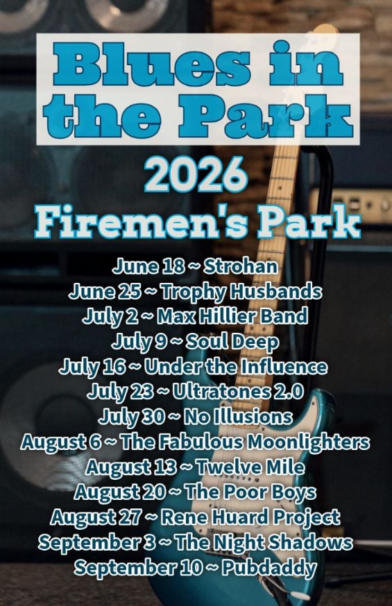
Hike, followed by Blues in the Park
https://hikes.brucetrail.org/event/hike-followed-by-blues-in-the-park-2/Sorry, the registration cut-off time for this hike has been reached.Not a member? Click here to join today!Hosting Club: Niagara
Category: Leisurely
Location (Google Maps):2275 Dorchester Rd, Niagara Falls, ON L2J 0H1
Hike Leader(s): Marion Hanover Click here to contact Hike Leader(s)
Pace: Leisurely <3 km/hr
Terrain: Moderate: some hills and some poor footing
Distance: 4kmDescription
Hike series Thursday evenings throughout the summer, followed by optional Blues in the Park. Come prepared to hike 1.5 leisure hike. Various blues bands free of charge starting at 7pm in the park. Bring lawn chair, beverage and snack to share. - 10July 10, 2026
Rattlesnake Point - Crawford Lake Loop
https://hikes.brucetrail.org/event/rattlesnake-point-crawford-lake-loop-3/Sorry, the registration cut-off time for this hike has been reached.Not a member? Click here to join today!Hosting Club: Iroquoia
Category: General Hike
Location (Google Maps): Rattlesnake Conservation Area – reservation requiredHike Leader(s): Pati Greenwood, Jeff Dowsett Click here to contact Hike Leader(s)
Pace: Medium – 3 to 4 km/hr
Terrain: Moderate – Some hills and/or some poor footing
Distance: 15 kmDescription
Starting at Rattlesnake Point Conservation Area, we will hike on the Main Trail and Side Trails to Crawford Lake, around the escarpment edge, down through the Nassagaweya Canyon and back up to our meeting area in the parking lot at Rattlesnake Point. Wear hiking boots and bring poles.Dress for the weather conditions and insects – long sleeves and pants are suggested. Bring plenty to drink, a snack as well as sunscreen and insect repellent.
Please arrive at the meeting place in the main parking lot, by 8:15 am for an 8:30 am departure. Park reservations will be required. They can be obtained online at Halton Conservation Area web-site: https://www.conservationhalton.ca/.
Car Hike: Beaver Valley E2E 5/5
https://hikes.brucetrail.org/event/car-hike-beaver-valley-e2e-5-5/Sorry, the registration cut-off time for this hike has been reached.Not a member? Click here to join today!Hosting Club: Toronto, Beaver Valley
Category: Car Hike
Location (Google Maps):Km 117.3 grey Rd 12. Coordinates N 44.500537,W 80.632902 map 28. Please note that this parking is not marked on the map. It is marked on the Bruce Trail App.
Hike Leader(s): Smadar Junkin Click here to contact Hike Leader(s)
Pace: Brisk (4-5 km/hr)
Terrain: Challenging, Hilly, Level 3 (Advanced – steep hills and some scrambling over boulders)
Distance (km): 21.6Description
Last day, badge day, treats day. We will shuttle to km 95.7 and hike back. See hike notes on day 1.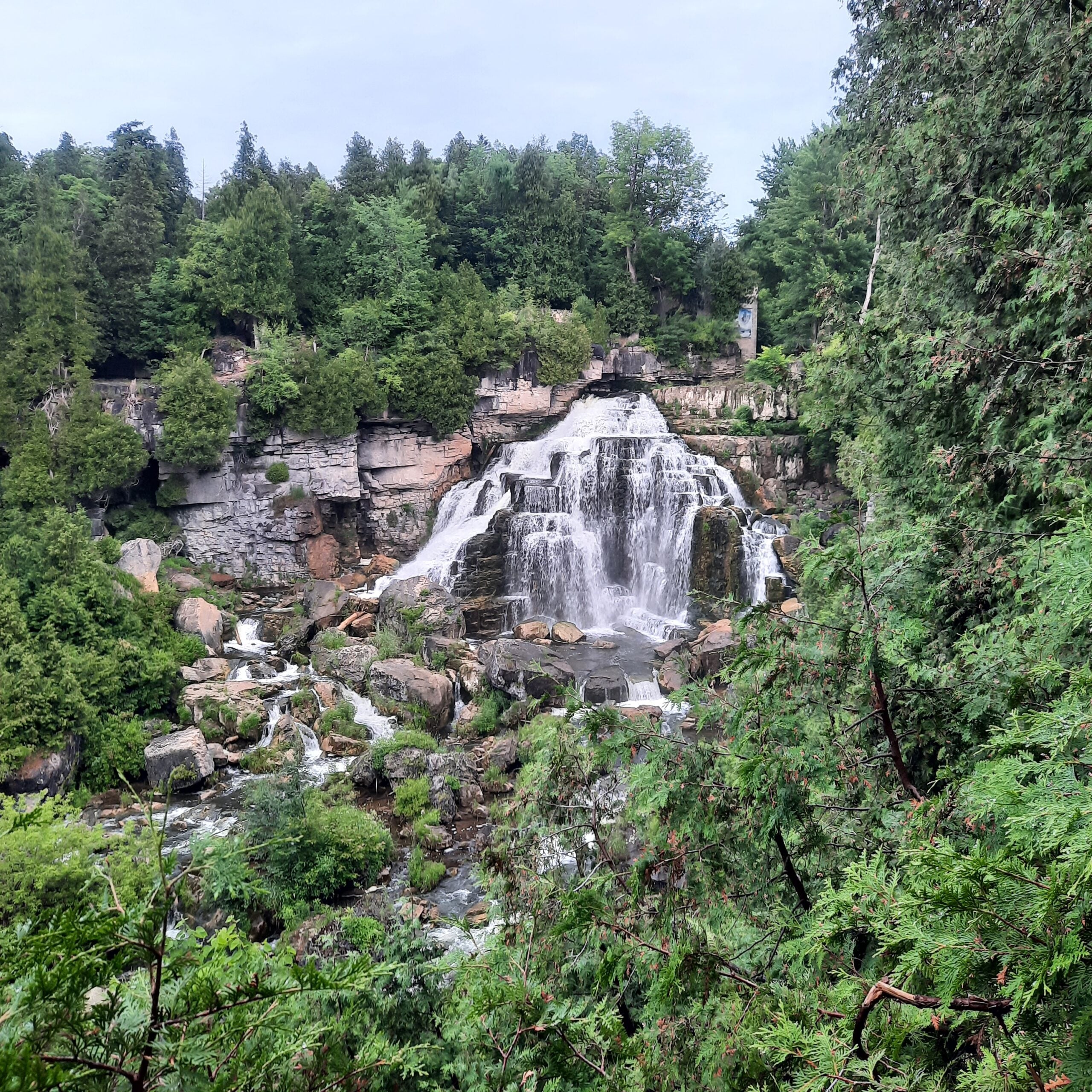
Brisk Fridays - Southeast loop from Harrison Park
https://hikes.brucetrail.org/event/brisk-fridays-southeast-loop-from-harrison-park/Sorry, the registration cut-off time for this hike has been reached.Not a member? Click here to join today!Hosting Club: Sydenham
Category: Brisk Fridays
Location (Google Maps): Harrison Park parking lot by the restaurantHike Leader(s): Stewart Brown Click here to contact Hike Leader(s)
Pace: Brisk: 4 to 5 km/h
Terrain: Moderate: Some hills and/or poor footing, Strenuous: Hilly with steep climbs and some poor footing.
Distance: 15 kmDescription
A fun summer hike from Harrison Park to Inglis Falls to Sydenham Nature Reserve loop. Then we follow the rail trail to the north and take the main trail to Centennial Tower and return to ice cream via the Harrison Park Side Trail. Be prepared for a brisk pace and some rocky terrain although most of the trail is moderate.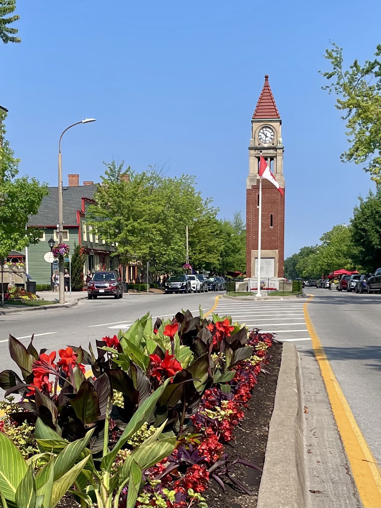
Niagara-on-the-Lake Tour
https://hikes.brucetrail.org/event/niagara-on-the-lake-tour-31/Sorry, the registration cut-off time for this hike has been reached.Not a member? Click here to join today!Hosting Club: Niagara
Category: Urban
Location (Google Maps): Park on King St near Centre St, Niagara-on-the-LakeHike Leader(s): Margaret Northfield Click here to contact Hike Leader(s)
Pace: Medium 3- 4 km/hr
Terrain: Easy: mostly flat, good footing
Distance: 6-7kmDescription
Each Friday we will explore Niagara-on-the-Lake while getting a moderate paced walk. Discover where the Niagara River meets Lake Ontario. Experience the Heritage District, woods and the Niagara Parkway.Some weeks may be totally on sidewalks and roads while others may include a mix of trail and paved pathways.
Great way to build up endurance for longer more strenuous hikes.
Plan to stay for conversation and a coffee at Sweets & Swirls, Community Centre, Niagara Stone Rd., NOTL
- 11July 11, 2026

Peninsula Sunrise Series: White Bluff
https://hikes.brucetrail.org/event/peninsula-sunrise-series-white-bluff/Sorry, the registration cut-off time for this hike has been reached.Not a member? Click here to join today!Hosting Club: Peninsula
Category: Sunrise Hike
Location (Google Maps): Forty Hills Road Bruce Trail LotHike Leader(s): Kathleen Stahlbaum Click here to contact Hike Leader(s)
Pace: Leisurely (2.0 – 3.0 km/h): A relaxed pace with frequent breaks and a focus on enjoyment., Medium (3.0 – 4.5 km/h): A comfortable pace for most hikers with steady progress.
Terrain: Difficult: Steep ascents/descents, rocky scrambling, and some rugged escarpment paths., Moderate: Rolling hills, mild slopes and rocky paths.
Distance: 5.8 kmDescription
Experience the magic of dawn on the Bruce Trail with the Sunrise Hike Series offered by the Peninsula Bruce Trail Club. These early morning hikes provide a perfect opportunity to awaken your senses, boost your energy, and immerse yourself in the tranquility of nature as the sun paints the sky with breathtaking hues. As we make our way through scenic forest trails, we’ll pause to witness the first light shimmering on the turquoise waters of Georgian Bay – a sight that will surely leave you in awe!Beyond the beauty, morning light helps regulate your circadian rhythm, elevating your mood, boosting energy levels and improving sleep quality. Whether you’re looking to start your day with a sense of calm, capture stunning sunrise photos, or simply reconnect with nature, these hikes offer a unique and inspiring way to greet the day.
On Saturday July 11th, join us in hiking through the Smokey Head White Bluffs Nature Reserve and along the edge of White Bluff, where we’ll experience the sun rising over Lion’s Head. We’ll have the joy of taking in the stunning colours of the sky as the first light sparkles on the stunning turquoise waters of Isthmus Bay. This peaceful sunrise hike is the perfect way to connect with nature, capture some incredible photos, and start the day with fresh air and inspiration. Whether you’re a morning person or just love a good adventure, come experience the magic of dawn from one of the best vantage points on the Bruce Peninsula!
Don’t forget to bring a headlamp or flashlight (preferably with a red light setting) as we begin our adventure in the pre-dawn quiet. Join us and discover how a sunrise hike can nourish your mind, body, and spirit – setting the tone for a brighter, more balanced day.
This hike is approximately 6 kms in length. Expect to be on the trail for 2.5-3 hours. Pace will be leisurely with ample time to enjoy the sunrise, take some photographs, and nourish yourself! Please note: terrain is challenging with rock scrambling and tripping hazards. Experienced hikers only.
How to prepare
- Get a good night’s sleep
- Bring lots of water and a snack (breakfast and/or coffee are recommended if that’s your thing!)
- Bring a headlamp or flashlight (preferably with a red light setting)
- Wear waterproof hiking boots
- Hiking poles are recommended but not necessary
- Bring insect repellant or wear protective clothing
In the event of cloudy/rainy weather, the hike will be held on Sunday, July 12th. Please watch your emails for a confirmation the week of the hike!
Car Hike: Exploring Uxbridge Trails
https://hikes.brucetrail.org/event/car-hike-exploring-uxbridge-trails/
Registration Required:
Click here to register for this hike (14 spots remaining)Hosting Club: Toronto
Category: Car Hike
Location (Google Maps):2499 Brock Rd, Uxbridge, ON L9P 1R4. We will meet at the East Duffins Headwaters parking lot at the WILDER FOREST trail head. As soon as you got off the Brock Road, passing the horse back riding facility, there is a free designated parking lot 70 meters down the lane to your right. It includes a sign board for East Duffins Headwaters with a map of the trails. Please do not park on the lane or in the horse back riding property.
Hike Leader(s): Amir Alemohammad Click here to contact Hike Leader(s)
Pace: Moderate (3-4 km/hr)
Terrain: Flat, Hilly, Variable
Distance (km): Approx.15-16 KmDescription
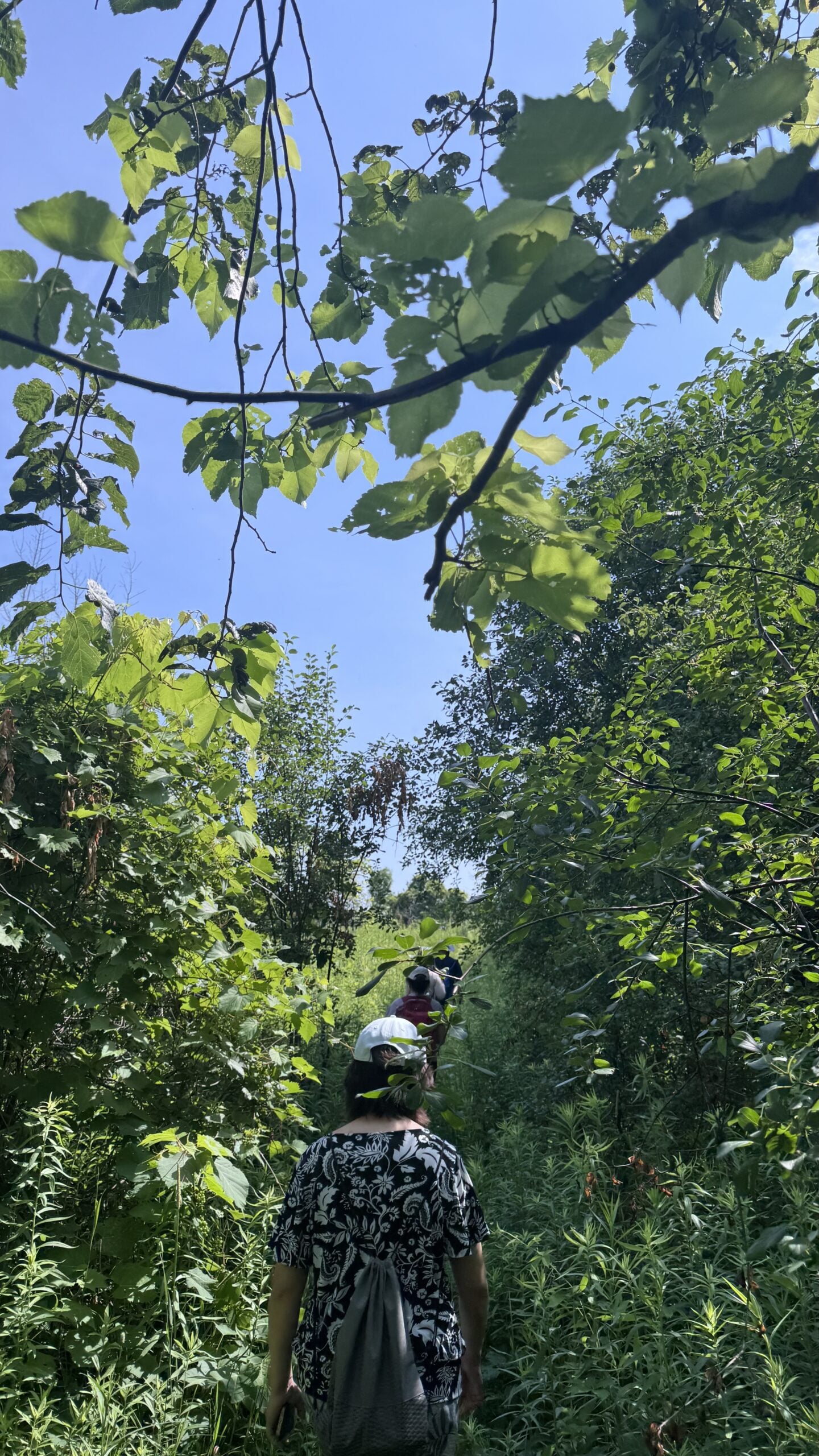
Join us for a delightful hike in Uxbridge, as we explore Wilder Forest, Walker Woods, and Glen Major Forest on a scenic loop starting from Brock Road. We’ll pass Concession Road 6, heading east and back, while also venturing onto several side trails for even more stunning views.What to Expect:
•Beautiful scenic views and lookouts facing south
•A mix of hilly and flat terrain
•Frequent 2-minute breaks for hydration and photos, with a 10 minute snack stop
•Stay on designated trails at all time
What to Bring and Wear:
•Hiking Boots (mandatory), poles (recommended) and be prepared for the ticks on the trail, keep your bug spray handy.
•At least 2 liters of water
•Your favorite snacks (pack your own refreshments for an outdoor meal)
•Dress according to variable weather conditions!
Important Details:
•Stay on the designated trails
•Be prepared for the elements and enjoy the adventure!
This hike is not recommended for beginners.
Looking forward to seeing you on the trail!
Don’t forget your camera and a smile as we explore the beauty of the Uxbridge trails!
This is a joint hike with the Oak Ridges Trail Association (ORTA).
School Bus Hike: Lynn Valley Trail
https://hikes.brucetrail.org/event/school-bus-hike-pathways-to-port-dover-lynn-valley-trail/Trip Information
Departure Time: 08:30
Return to City Time: 19:00
Departure Point: Kipling Departure Point
Registration Required:
Registration Costs
Members - $30.00
Child Members - $15.00
Non-Members - $37.00
Child Non-Members - $19.00
Long Distance Fees apply
A late return is anticipated
Click here to register for this hike (13 spots remaining)Optional Items
Hosting Club: Toronto
Category: Bus Hike
Location (Google Maps):Lynn Valley Trail
Hike Leader(s): Tom Swales & Felix Wan Click here to contact Hike Leader(s)
Pace: Moderate (3-4 km/hr)
Terrain: Flat, Level 1 (Easy – mostly on flat, well maintained trails with hard-packed surface)
Distance (km): 12 kmDescription
Join us for a scenic and easy paced walk, a regular summer favorite along the trails running through Norfolk County from downtown Simcoe ending at historic Port Dover. The route is primarily on rail trails so is ideal for those who favor a flatter and easier route in the summer heat. Dropout at 8km. We will stop at the Simcoe Recreation Centre before the hike to use the facilities. After the hike there will be the opportunity to indulge in the local perch fish and chips or hang out at the beach which together make Port Dover famous. Long Distance Bus Fare applies and there will be a late return (after 6:00 Pm).Boyd Conservation park247
https://hikes.brucetrail.org/event/car-hike-boyd-conservation-park-vaughan-15/
Registration Required:
Click here to register for this hike (20 spots remaining)Hosting Club: Toronto
Location (Google Maps): Free Parking lot before entrance of park on Islington Ave.
Hike Leader(s): Mohammad Aghamiri Click here to contact Hike Leader(s)
Pace: Moderate (3-4 km/hr)
Terrain: Hilly, Level 2 (Intermediate – some hills and uneven surfaces, rocks and roots underfoot), Variable
Distance (km): 12-14 kmDescription
Let’s hike Boyd conservation park trails through beautiful valleys.Please bring lots of water and snacks ,hiking poles are recommended
phone number for the day of hike 289 588 6482
Seven Rivers Hike Badge Series- Hike 7
https://hikes.brucetrail.org/event/seven-rivers-hike-badge-series-hike-7/Sorry, the registration cut-off time for this hike has been reached.Not a member? Click here to join today!This is a Multi-Day Hike
You are signing up for the following dates and times:
2026-07-11 at 08:45Hosting Club: Dufferin Hi-Land
Category: General Hike
Location (Google Maps): Humber River Caledon Section Maps 17 and 18
Parking: East of Airport Road past the Taoist Tai Chi Centre on Mono 5 SideroadHike Leader(s): Tristan Goguen and Pat Foley Click here to contact Hike Leader(s)
Pace: Medium
Terrain: Moderate
Distance: 11.4 KmDescription
This series features rivers in our Headwaters area: the Humber, Nottawasaga, Boyne, Pine, Mad, Noisy and Pretty Rivers and includes 7 hikes from three Bruce Trail Sections: Blue Mountains (3), Dufferin Hi-Land (2) and Caledon Hills (2).First hike is in the Caledon Hills section of the Bruce Trail and we will view the Humber River. Maps 17 and 18
Today we will hike southbound from the parking lot on 5 Side Rd. to the viewpoint looking out over the Humber Valley. From there we continue southbound past the Glen Haffy Side Trail remaining on the main trail and continuing on the main trail to just before Highway 9. From there we will head back to the parking area. For anyone wishing to add distance to their hike we can add a couple of loops in the forest near the Taoist Tai Chi Centre. Optionally we can have lunch in the gazebo which is about 1 km north of the parking lot.
Please be prepared for the weather, we will hike rain or shine. Ensure you have enough water,lunch and snacks, sunscreen and bug repellent. Hats and sunglasses are recommended as are poles and sturdy shoes.
For those wishing to earn their 7 Rivers – complete all 7 hikes, badges will be available on the last day from the hike leaders at a cost of $10 for members and $15 for non members.
Anyone completing make-up hikes may log their hikes and apply directly to the Dufferin Highlands BT Club for the badge.
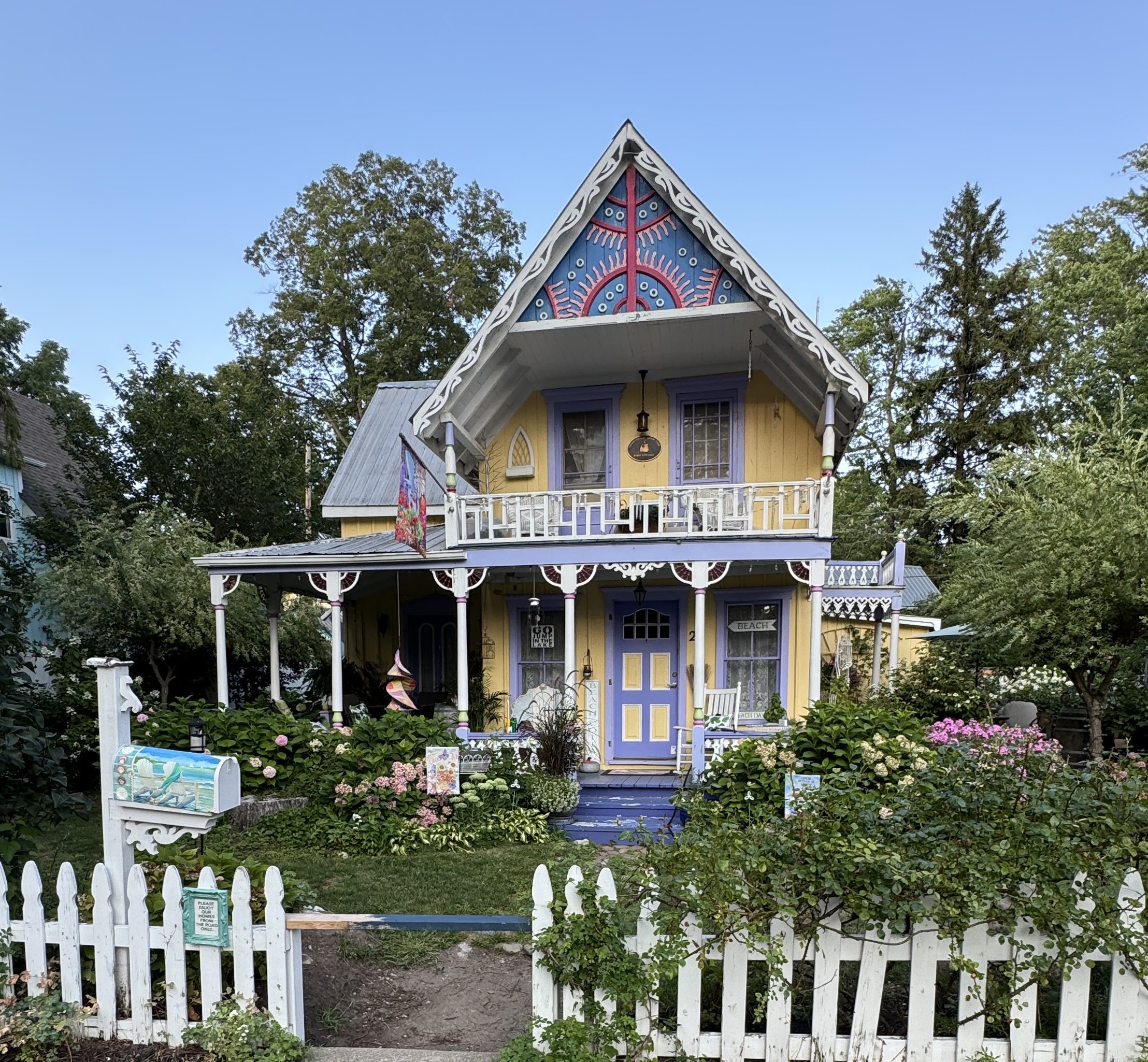
Urban Hike - Grimsby - “The Painted Ladies”
https://hikes.brucetrail.org/event/urban-hike-grimsby-the-painted-ladies/
Registration Required:
Click here to register for this hike (3 spots remaining)Hosting Club: Iroquoia
Category: Urban Hikes
Location (Google Maps): Nelles Beach Park – 91 Lake St, GrimsbyHike Leader(s): Ruth Moffatt Click here to contact Hike Leader(s)
Pace: Leisurely – 3km/hr or less
Terrain: Easy – Mostly flat and usually good footing
Distance: Approximately 7kmDescription
Please join us for an Urban Hike where we will explore all the wonderful “Painted Ladies” of Historic Grimsby Beach. A stop at all the favourites as well as some history of this at one time Methodist Church Camp meeting ground from the 1800’s. These Painted Ladies or gingerbread cottages are said to rival those in San Francisco.Please join us for this very special treat.
Geology Hike and Badge Series - Beth Gilhespy Side Trail
https://hikes.brucetrail.org/event/geology-hike-and-badge-series-beth-gilhespy-side-trail/
Registration Required:
Click here to register for this hike (3 spots remaining)Hosting Club: Peninsula
Category: Geology Hike
Location (Google Maps): Beth Gilhespy Side Trail, Barrow BayHike Leader(s): Beth Gilhespy Click here to contact Hike Leader(s)
Pace: Leisurely (2.0 – 3.0 km/h): A relaxed pace with frequent breaks and a focus on enjoyment.
Terrain: Moderate: Rolling hills, mild slopes and rocky paths.
Distance: 7.6Description
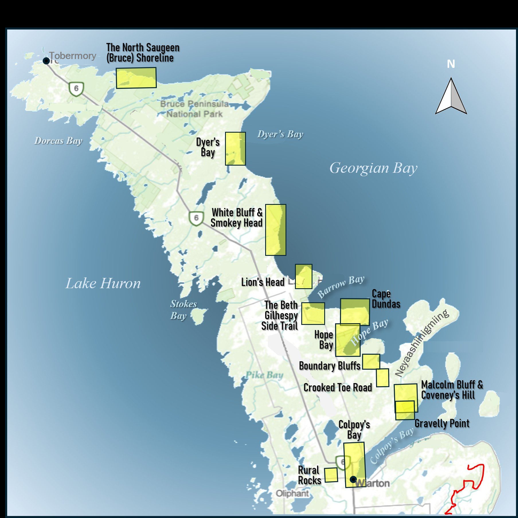
Join the adventure and earn the inaugural Peninsula Geology Badge! Over a stretch of 13 hikes and a couple of extra stops, we will explore the fascinating geology of the Peninsula to learn about the rocks, the shoreline features, glaciation, fossils and all things earthy. The 13 hikes are from the book “Walking Through Time – Exploring the Geology of the Saugeen (Bruce) Peninsula”. Having a copy will give you a lot of great information, but you do not have to purchase the book to attend and enjoy the hikes. Just bring your curiosity! We will make sure to hit all the locations that qualify for the beautiful new Walking Through Time – Saugeen (Bruce) Peninsula geology hike badge. If you would like to purchase a book I will have some available on the hikes, or you can pick one up from the BTC Head Office, at Ginger Press in Owen Sound, Suntrail Source for Adventure in Hepworth, the Shop at 84 Main in Lion’s Head and at Reader’s Haven in Tobermory.You are welcome to come on just a few of the hikes or on all of them, and the dates and hikes are as follows:
Date Geology Hike km
Saturday May 2, 2026 Colpoy’s Bay 9.0
Saturday May 9, 2026 Gravelly Point (am) and Rural Rocks (pm) 8.6
Saturday May 16, 2026 Malcolm Bluff 7.3
Sunday May 17, 2026 White Bluff/Smokey Head 11.8
Sunday May 24, 2026 Crooked Toe Road 5.5
Sunday May 31, 2026 Hope Bay 8.1
Sunday June 14, 2026 Boundary Bluffs 5.2
Saturday July 4, 2026 Cape Dundas 6.2
Saturday July 11, 2026 Beth Gilhespy Side Trail 7.6
Saturday August 8, 2026 Lion’s Head 11.0
Saturday August 15, 2026 Dyer’s Bay Loops 7.5
Saturday August 22, 2026 North Saugeen (Bruce) Shoreline 8.0
Meeting times will vary depending on the hike, but will generally be some time between 9 am and 10 am. Information on exact meeting times and locations will be sent out a few days prior to the hike.
Car Hike: Scotsdale Farm
https://hikes.brucetrail.org/event/car-hike-scotsdale-farm-22/
Registration Required:
Click here to register for this hike (9 spots remaining)Hosting Club: Caledon Hills
Category: General
Location (Google Maps): Scotsdale Farm, Map 13. Directions; from Highway 401, head north on Trafalgar Road past Georgetown. Trafalgar briefly merges with Highway 7 for about 3 km before separating to the right at the village of Silver Creek. At the stop light in Silver Creek, continue north on Trafalgar Road for about 1 km to the entrance of Scotsdale Farm on your right. Drive in about half a kilometre to reach the parking area.Hike Leader(s): Lana Hubbard Click here to contact Hike Leader(s)
Pace: Medium – 3 to 4 km/hour
Terrain: Moderate – some hills and/or some poor footing
Distance: 13 kmDescription
🌈 Join us for a queer/trans-led, 2SLGBTQIA+ inclusive loop hike along the main Bruce Trail and its scenic side trails, including the stunning Great Esker Side Trail.This hike is welcoming to LGBTQ+ hikers, and anyone interested in connecting with community while enjoying a beautiful day on the trail.
We’ll be hiking approximately 14 km at a medium pace. Please dress appropriately for the weather, bring plenty of water, and pack snacks or a light lunch. Some sections of the trail are rocky, so hiking poles are highly recommended.
Weather permitting, I’ll be heading to the Copper Kettle after the hike for refreshments, and everyone is welcome to join. ^_^
Drum Circle and Leisurely Hike - CANCELLED
https://hikes.brucetrail.org/event/drum-circle-and-leisurely-hike/Sorry, the registration cut-off time for this hike has been reached.Not a member? Click here to join today!Hosting Club: Caledon Hills
Category: General
Location (Google Maps): Riverside Woods – Meet at the pavilion as you enter the property along the lane, 71337 1st Line EHS, Mono. It is easier to go north on the 1st Line from Sideroad 5 than it is to go south on the 1st Line from Hockley Road. Please aim to arrive by 9:45 to get set up and upHike Leader(s): Lynn Dobson
Pace: Leisurely – 3 km/hour or less
Terrain: Moderate – some hills and/or some poor footing
Distance: 5 kmDescription
On July 11th, 2026 at 10:00 a.m. there will be a Drum Circle and Hike at Riverside Woods. Participants will engage in an interactive, joyful and energizing 1-hr drum circle facilitated by Terri Segal of Rhythmic by Nature. No musical experience is required and drums (Djembe) are provided.Participants will then enjoy some light refreshments and a leisurely paced hike will follow for those able and interested. Participants will need to bring a lawn chair; wear shoes suitable for hiking and bring your own water bottle – refills will be available. There is a limit of 30 participants.
Waterfront Trail 3/11 - Long Branch
https://hikes.brucetrail.org/event/waterfront-trail-3-11-long-branch/Sorry, the registration cut-off time for this hike has been reached.Not a member? Click here to join today!Hosting Club: Toronto
Category: Urban Walk
Location (Google Maps):Etobicoke Waterfront Trail
Hike Leader(s): Brian Rideout Click here to contact Hike Leader(s)
Pace: Moderate (3-4 km/hr)
Terrain: Flat
Distance (km): 9 kmDescription
Please join me at Kipling Station by 9:15 am. We will take the 123 bus departing 9:30 am, arriving 9:53 am. If you want to meet us at the Long Branch loop, be there by 9:53 am. We start hiking at 10:00 am.We will hike to the lake and then east to Parklawn. There we can catch a bus to Old Mill Station or take the Lakeshore bus / streetcar. The estimated distance is 9 km. Here is an online map of our route – Long Branch to Parklawn
Bring a snack, at least 2 liters of water, sun screen and bug spray.