Categories
- 09May 9, 2026
Peninsula Sunrise Series: Cape Chin Maplecross Reserve
https://hikes.brucetrail.org/event/peninsula-sunrise-series-cape-chin-maplecross-reserve/Sorry, the registration cut-off time for this hike has been reached.Not a member? Click here to join today!Hosting Club: Peninsula
Category: Sunrise Hike
Location (Google Maps): Cape Chin Maplecross Parking Lot at 388 Cape Chin Rd. NHike Leader(s): Kathleen Stahlbaum Click here to contact Hike Leader(s)
Pace: Leisurely (2.0 – 3.0 km/h): A relaxed pace with frequent breaks and a focus on enjoyment.
Terrain: Easy: Flat forested sections or lowland trails.
Distance: ~6 kmDescription
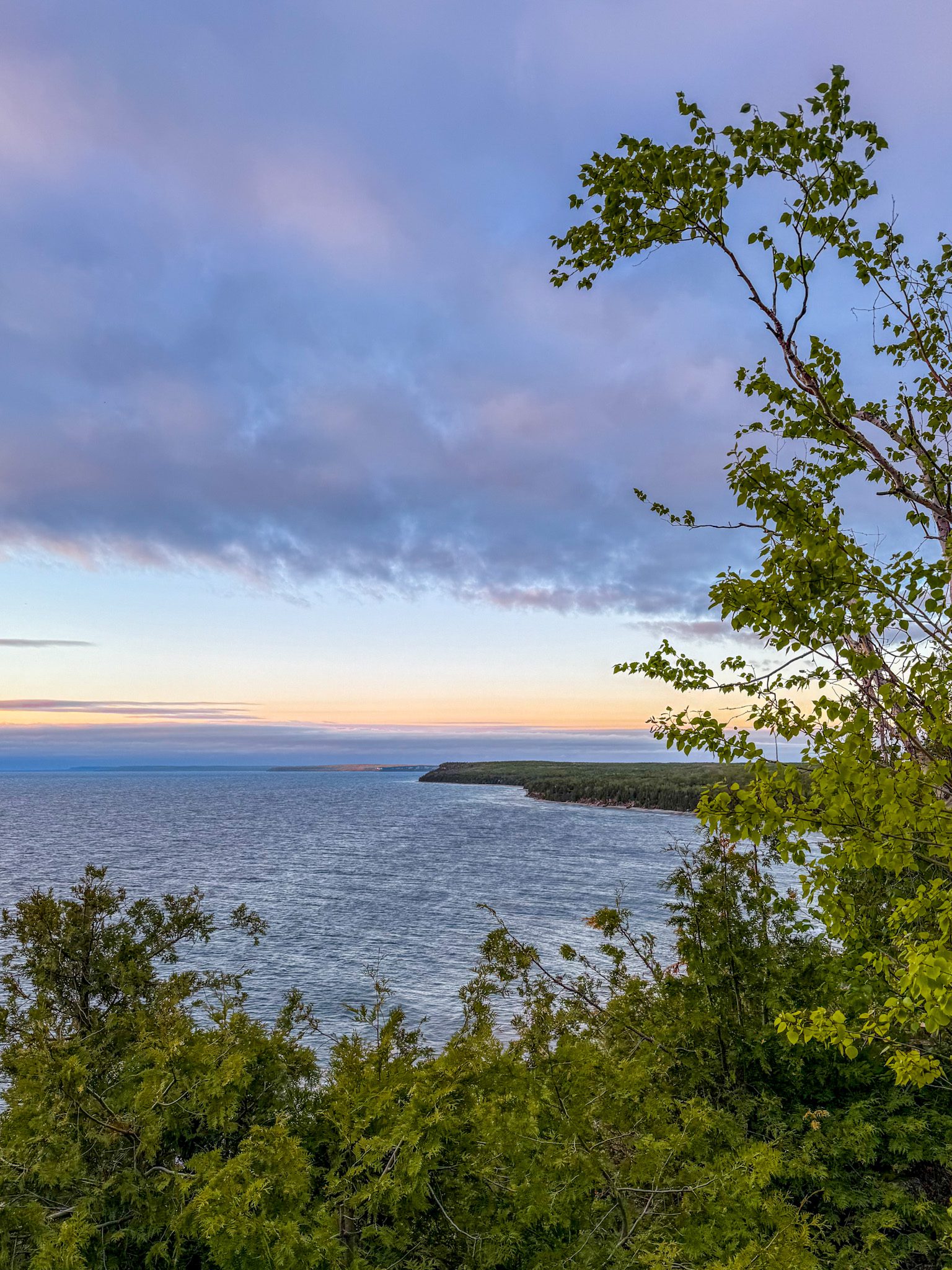
Experience the magic of dawn on the Bruce Trail with the Sunrise Hike Series offered by the Peninsula Bruce Trail Club. These early morning hikes provide a perfect opportunity to awaken your senses, boost your energy, and immerse yourself in the tranquility of nature as the sun paints the sky with breathtaking hues. As we make our way through scenic forest trails, we’ll pause to witness the first light shimmering on the turquoise waters of Georgian Bay – a sight that will surely leave you in awe!Beyond the beauty, morning light helps regulate your circadian rhythm, elevating your mood, boosting energy levels and improving sleep quality. Whether you’re looking to start your day with a sense of calm, capture stunning sunrise photos, or simply reconnect with nature, these hikes offer a unique and inspiring way to greet the day.
On Saturday May 9th, join us in hiking the Cape Chin Maple Cross property to the edge of the Niagara Escarpment, where we’ll experience the sun rising over the Bay from the iconic Cape Chin lookout. We’ll have the joy of taking in the stunning colours of the sky as the first light sparkles on the stunning turquoise waters. This peaceful sunrise hike is the perfect way to connect with nature, capture some incredible photos, and start the day with fresh air and inspiration. Whether you’re a morning person or just love a good adventure, come experience the magic of dawn from one of the best vantage points on the Bruce Peninsula!
Don’t forget to bring a headlamp or flashlight (preferably with a red light setting) as we begin our adventure in the pre-dawn quiet. Join us and discover how a sunrise hike can nourish your mind, body, and spirit – setting the tone for a brighter, more balanced day.
We will be hiking up the dirt/gravel road to the iconic Cape Chin lookout. This hike is approximately 6 kms in length. Expect to be out for ~2 hours. Pace will be leisurely with ample time to enjoy the sunrise, take some photographs, and nourish yourself!
How to prepare
- Get a good night’s sleep
- Bring lots of water and a snack (breakfast and/or coffee are recommended if that’s your thing!)
- Bring a headlamp or flashlight (preferably with a red light setting)
- Wear waterproof hiking boots (There will be mud!)
- Hiking poles are recommended but not necessary
- Bring insect repellant or wear protective clothing
In the event of cloudy/rainy weather, the hike will be held on Sunday, May 11th. Please watch your emails for a confirmation the week of the hike!
Dufferin Hi-Land Two Day End-to-End Hike
https://hikes.brucetrail.org/event/dufferin-hi-land-two-day-end-to-end-hike-2/Sorry, the registration cut-off time for this hike has been reached.Not a member? Click here to join today!This is a Multi-Day Hike
You are signing up for the following dates and times:
2026-05-09 at 07:00
2026-05-10 at 07:00Hosting Club: Dufferin Hi-Land
Category: Special Events
Location (Google Maps): Marshalling and Parking at 586387 10 Sideroad, Mulmur; ON; buses leave from the parking areaHike Leader(s): Don Stewart; Nicholas (Nick) Howard Click here to contact Hike Leader(s)
Pace: Fast
Terrain: Slippery and Steep Sections, Strenuous
Distance: Saturday +/- 30 Km; Sunday +/- 23 KmDescription
This is our annual “fundraiser” 2 Day End-to-End “Red Trillium” Badge hike. Check points along the route will refresh and supply you while experienced “Sweeps” will encourage you! Come and enjoy Springtime in Dufferin and experience the majestic views afforded from the “High Lands”. Not open to children under 13 years of age.Sydenham Bruce Trail E2E Run - Day 3 of 8 Only
https://hikes.brucetrail.org/event/sydenham-bruce-trail-e2e-run-day-3-of-8-only/Sorry, the registration cut-off time for this hike has been reached.Not a member? Click here to join today!Hike open to BTC Members only.
Hosting Club: Sydenham, Peninsula
Category: Sydenham E2E Trail Run
Location (Google Maps): Day 3 of the E2E Trail Run of the Sydenham Bruce Trail section. Meeting at 19th Street W & Somers Street, Owen SoundHike Leader(s): Margie Gloade; Natalie Mechalko Click here to contact Hike Leader(s)
Pace: Fast (5.5 – 7.0 km/h+): A quick pace maintained by experienced hikers or trail runners.
Terrain: Difficult: Steep ascents/descents, rocky scrambling, and some rugged escarpment paths.
Distance: About 20kmDescription
This is a single-day registration – Day 3 of 8.The Sydenham Bruce Trail Club (SBTC), in partnership with the Peninsula Bruce Trail Club (PBTC), is excited to offer its first-ever trail running Sydenham End-to-End series in 2026. Join the fun for one of the eight days in this trail running series! The trail running Sydenham E2E series will take place over 4 weekends and 8 days, starting at 7:30am. Below is the start and end location and estimated distance for this day (subject to change slightly). The group will meet at the end location, and carpool to the start of each day’s route. You are expected to participate in shuttling vehicles.
Please carefully read the details below to understand the logistics, costs, important notes, and fitness required for this challenge.
Saturday May 9, 2026: Lindenwood Rd BTC Parking to 19th Street W & Somers St., Owen Sound; ~20km.
- When you register here, you are registering for only one day in the series. (You also have the option of registering for the whole series for $60 even if you aren’t able to make all eight days).
- These are group trail runs. It is not a race. It is not a hike. There may be a couple different pace groups that naturally form, but you will be expected to stay with a group and wait to regroup at key locations. Runners are expected to remain between the lead runner and the sweep at all times. Anticipate each day to be running for about 3+/- hours, at a pace ranging from 7-9 min./km.
- Participants are expected to have some experience trail running as this is difficult terrain. There are also some roads, and some active farm fields. In some locations throughout Sydenham, trail running will not be permitted near livestock. On roads, runners are expected to follow standard Highway Traffic Act regulations, crossing safely and running on the shoulder, in single file, facing oncoming traffic.
- Mandatory gear includes a whistle and minimum 250ml of water carrying capacity. Trail runners will need to carry their own water and fuel.
- At approximate mid-way points each day, there will be volunteer support arranged so you can fill up water bottles. Some snacks (e.g. oranges, bananas, pretzels, cookies, water) will be provided but please plan to be self-sufficient.
- Exercise care and caution and common sense on trails, especially when passing other trail users. Let others know you are coming and that you intend to pass. Headphones/earbuds are not permitted while participating in this group run.
- Participants must be age 16 years or older.
- Dogs are not permitted.
- This trail run is for BTC members only. To become a member, click here: https://brucetrail.org/.
- The designated meeting points will not incur any personal parking fees but parking space is limited. Participants are encouraged to car pool whenever possible.
The single day fee is $20. This fee covers snacks, vehicle shuttle, volunteer support, and a donation to the PBTC hike program. There is also an option to register for the whole series ($60).
As per BTC policy, no refunds will be considered 30 days before the series starts (not after April 1, 2026).
The trail run will go ahead rain or shine, however, in extremely inclement weather, a date may be cancelled and rescheduled, ideally prior to the May 31st finish date.
RAINBOW HIKE: World Migratory Bird Day + Iroquoia BTC Pre-AGM Hike
https://hikes.brucetrail.org/event/rainbow-hike-world-migratory-bird-day-iroquoia-btc-pre-agm-hike/Sorry, the registration cut-off time for this hike has been reached.Not a member? Click here to join today!Hosting Club: Iroquoia
Category: Rainbow Hike
Location (Google Maps): Meet at the start of the Spencer Creek Trail (Dundas St/Cootes Dr (HWY 8))Hike Leader(s): Shayne Ward Click here to contact Hike Leader(s)
Pace: Leisurely – 3km/hr or less
Terrain: Easy – Mostly flat and usually good footing, Moderate – Some hills and/or some poor footing
Distance: 5KMDescription
Join us on World Migratory Bird Day for a pre-AGM Rainbow Hike! 🦅 🦉 🦆This gentle early-morning outing will explore the trails around Spencer Creek and Cootes Paradise, one of the region’s most important bird migration areas. We will start at the trailhead parking lot on the southeast corner of Dundas Street and Cootes Drive (HWY 8) and hike along the creek, under the HWY 8 (under the bridge does involve some moderate stepping and slight ‘duck’ing for us tall folks).
Plan to arrive for 745AM and we’ll have a small crash course on downloading and using two popular birding apps, Merlin Bird ID and eBird recording our sightings as part of World Migratory Bird Day! We’ll depart by 8-810AM. Hoping to catch some Blue Herons, Black-crowned Night Herons, and if we’re lucky, a sighting of the RBG resident Bald Eagles!
🌈 This is a queer-led, 2SLGBTQIA+ inclusive Rainbow Hike, welcoming LGBTQ+ hikers, allies, birders, photographers, and anyone interested in connecting with nature and community before the AGM. This is a short, relaxed hike (approx. 5 km) designed to get everyone back in time for the AGM Meet-and-Greet at 10:30 AM at the Westdale Theatre.
What to Bring
• Water and light snacks
• Weather-appropriate clothing and sturdy footwear
• Binoculars or camera if you have them (optional but fun! And a cell phone counts!)After the hike, we encourage participants to join fellow members at the Iroquoia Bruce Trail Club AGM just a short walk away at the Westdale Theatre. Not a Bruce Trail member yet?! Sign up here!
https://brucetrail.org/become-a-member/Come enjoy a spring morning on the trail, celebrate migratory birds, and connect with your Bruce Trail community!
🐾 Please leave pets at home for this hike! It’s peak migration season and we’ll be passing through an important bird migration and nesting area, so we want to keep disturbance to our feathered friends to a minimum! 🐦
🚗 🚌 This outing is accessible by car or public transit.
Planning to drive?
Parking is free but limited at the trailhead. We also ask for some assistance with shuttling folks back to the Westdale Theatre afterward for the Iroquoia Bruce Trail AGM.Taking the Bus?
HSR #5 (Delaware) stops near the trailhead entrance! Map of the bus and it’s schedule can be found here.
https://www.hamilton.ca/sites/default/files/2024-04/5-Delaware-apr24.pdfFree Bruce Trail Rainbow badges and stickers for all participants!
Questions? Simply click “Contact Hike Leader” on the registration form.
Iroquoia Bruce Trail Club Pre-AGM / Westdale to Princess Point
https://hikes.brucetrail.org/event/iroquoia-bruce-trail-club-pre-agm-westdale-to-princess-point/Sorry, the registration cut-off time for this hike has been reached.Not a member? Click here to join today!Hike open to BTC Members only.
Hosting Club: Iroquoia
Category: Special Event
Location (Google Maps): Hamilton Parking Lot #1002
85 Oak Knoll Dr, Hamilton ON L8S 4C2Hike Leader(s): Joe Borges Click here to contact Hike Leader(s)
Terrain: Dependent on Conditions, Moderate – Some hills and/or some poor footing
Distance: 4.7 kmDescription
Join us for a pre-AGM hike.
If you’d like to view the hike route, please click the All Trails link below. It’s approx. 5 km so we should be back in plenty time for the Meet-and-Greet at 10:30, before the AGM.
https://www.alltrails.com/explore/custom-routes/custom-route-be20ded?u=m&sh=4wexyxThe hike route will start from the Hamilton Parking Lot #1002 heading to Princess Point, and loop back to the parking lot.
From the lot it’s a short walk to the Westdale Theatre, if you are attending the AGM afterwards. Parking is $3 per hour, or all day for $15.Please bring enough water and snacks for your hike. Trails may be muddy at this time of year, so gaiters would be useful.
We encourage Hikers to register and stay for the AGM after our Hike. Connect with other members, help commemorate a wonderful year for the Club and to celebrate all our amazing volunteers.
Full AGM Details and Agenda below.
AGM LOCATION:
The Westdale Theatre, 1014 King St W, Hamilton, ON L8S 1L4
10:30 – 11:00 AM
MEET-AND-GREET
Connect with your Trail Community
11:00 – 11:45 AM
IBTC AGM & VOLUNTEER AWARDS
Celebrate the Heart of our Club
11:45 – 12:30 PM
HOT LUNCH
Enjoy a delicious meal locally catered.SPECIAL EVENT // BRUCE TRAIL TALKS / SESSION 1: Indigenous Trails
FREE for all IBTC Members attending the AGM
1:05 pmWelcome & Introduction by BTC CEO Michael McDonald
1:10 pm
First Nations Trail Systems
A historical & archaeological perspective with Martin S. Cooper, Snr Archaeologist, ASI Toronto
1:30 pm
First Nations Priorities
For engagement, education, and reconciliation, a current perspective
with Tim Johnson and Rick Hill2:00 pm
Panel Discussion
with Tim, Rick, Martin and moderated by Michael McDonald
Key takeaways, challenges, & priorities for action, including audience Q&A2:30 pm
Closing remarks Michael
Loop Hike Hockley Rd 5th Line EHS to 3rd Line EHS
https://hikes.brucetrail.org/event/car-hike-loop-hike-hockley-rd-5th-ehs-to-3rd-ehs/Sorry, the registration cut-off time for this hike has been reached.Not a member? Click here to join today!Hosting Club: Toronto, Caledon Hills
Category: Car Hike
Location (Google Maps): Bruce Trail parking lot on the east side of 5th Line EHS, just south of Hockley Rd. (873603 5 EHS LINE, Mono, ON L9W 6N3)Hike Leader(s): Amir Alemohammad
Pace: Moderate (3-4 km/hr)
Terrain: Hilly, Level 2 (Intermediate – some hills and uneven surfaces, rocks and roots underfoot), Variable
Distance (km): 12-14Description
Join us for a loop hike along the trails of the Hockley Rd region, one of the most beautiful hiking areas in Caledon. Known for its rolling hills, forested trails, and ever-changing seasonal scenery, this hike takes you through a mixed hardwood forest, providing ample shade—perfect for this time of year. You’ll also encounter moderate elevation changes, with some sections following ridge lines and valleys that offer occasional breathtaking scenic viewpoints. We will hike main and side trails between 5th and 3rd Line EHS. Boots mandatory, poles recommended, bring two litres of water, your snack and dress according to weather conditions.School Bus Hike: Iroquoia E2E #7/8 (Map 10 Mount Nemo)
https://hikes.brucetrail.org/event/school-bus-hike-iroquia-e2e-7/Sorry, the registration cut-off time for this hike has been reached.Not a member? Click here to join today!Trip Information
Departure Time: 08:30
Return to City Time: 18:30
Departure Point: Kipling Departure PointOptional Items
Hiking ($.01)Hosting Club: Toronto
Category: Bus Hike
Location (Google Maps): Mount Nemo, Kilbride (Map #10)Hike Leader(s): Tom Swales, Marina Wray Click here to contact Hike Leader(s)
Pace: Moderate (3-4 km/hr)
Terrain: Hilly, Level 2 (Intermediate – some hills and uneven surfaces, rocks and roots underfoot), Rocky, Variable
Distance (km): 17 kmDescription
The seventh hike in our Iroquia E2E will take us through Mount Nemo Conservation Area (scenic view on top of the escarpment), Maple Cross Nature Reserve and Kilbride Pass to Crawford Lake Conservation Area. We begin with a steep climb up the escarment to Mount Nemo Conservation area but it will level out for the rest of the hike. There will be a stop for refreshments and socializing in Milton before returning to Kipling Station. Dropouts at 10 km and 15 km. Anyone is welcome regardless if doing the E2E or not.Trillium hike Richmond hill
https://hikes.brucetrail.org/event/car-hike-rouge-national-park-scarborough-on-8/Sorry, the registration cut-off time for this hike has been reached.Not a member? Click here to join today!Hosting Club: Toronto
Category: Car Hike
Location (Google Maps): Oak Ridges Corridor, Bethesda Trail Head Parking Lot, Bethesda Side Road, Richmond Hill, OntarioHike Leader(s): MOHAMMAD AGHAMIRI Click here to contact Hike Leader(s)
Pace: Moderate (3-4 km/hr)
Terrain: Hilly, Level 2 (Intermediate – some hills and uneven surfaces, rocks and roots underfoot), Variable
Distance (km): 12-14 kmDescription
Join us to explore the trails of York Regional Forest and the Oak Ridges Corridor at Jefferson Forest and Bond lake,Now is the trillium time come and view thousands of this beautiful flower.
The White Trillium became Ontario’s official flower in 1937. The Trillium blooms in early spring throughout the province, with its white blossom associated with peace and hope.
From parking lot we hike thought Jefferson forest and continue to Bond Lake and have snack beside the lake and return to parking around 13 to 13.30
Please bring lots of water and snacks ,hiking poles are recommended
phone number for the day of hike 289 588 6482
Craigleith Community Centre
https://hikes.brucetrail.org/event/craigleith-community-centre-4/Sorry, the registration cut-off time for this hike has been reached.Not a member? Click here to join today!Hosting Club: Blue Mountains
Category: Organized Hike
Location (Google Maps): Tim Hortons, First Street, CollingwoodHike Leader(s): David Little Click here to contact Hike Leader(s)
Pace: Leisurely – 3 km/hr. or less
Terrain: Easy – Mostly flat and usually good footing
Distance: 5 kmDescription
We will follow the Georgian Trail past former Railway Station to the Nippising Ridge Trail and return. This is an easy hike with lots of opportunities to recall the history of Craigleith.
Woodend to Fireman's and Back
https://hikes.brucetrail.org/event/woodend-to-firemans-and-back-3/Sorry, the registration cut-off time for this hike has been reached.Not a member? Click here to join today!Hosting Club: Niagara
Category: Loop
Location (Google Maps): Meet at entrance to Woodend Conservation Area, Taylor Rd, Niagara-on-the-LakeHike Leader(s): Margaret Northfield Click here to contact Hike Leader(s)
Pace: Medium 3- 4 km/hr
Terrain: Moderate: some hills and some poor footing
Distance: 11-12kmDescription
Hike from Woodend Conservation Area to Fireman’s and back. Mostly main trail of the Bruce. Water, snack and poles recommended.
Geology Hike and Badge Series - Gravelly Point and Rural Rocks
https://hikes.brucetrail.org/event/geology-hike-and-badge-series-gravelly-point-and-rural-rocks/Sorry, the registration cut-off time for this hike has been reached.Not a member? Click here to join today!Hosting Club: Peninsula
Category: Geology Hike
Location (Google Maps): Gravelly Point and Rural RocksHike Leader(s): Beth Gilhespy Click here to contact Hike Leader(s)
Pace: Leisurely (2.0 – 3.0 km/h): A relaxed pace with frequent breaks and a focus on enjoyment.
Terrain: Moderate: Rolling hills, mild slopes and rocky paths.
Distance: 8.6Description
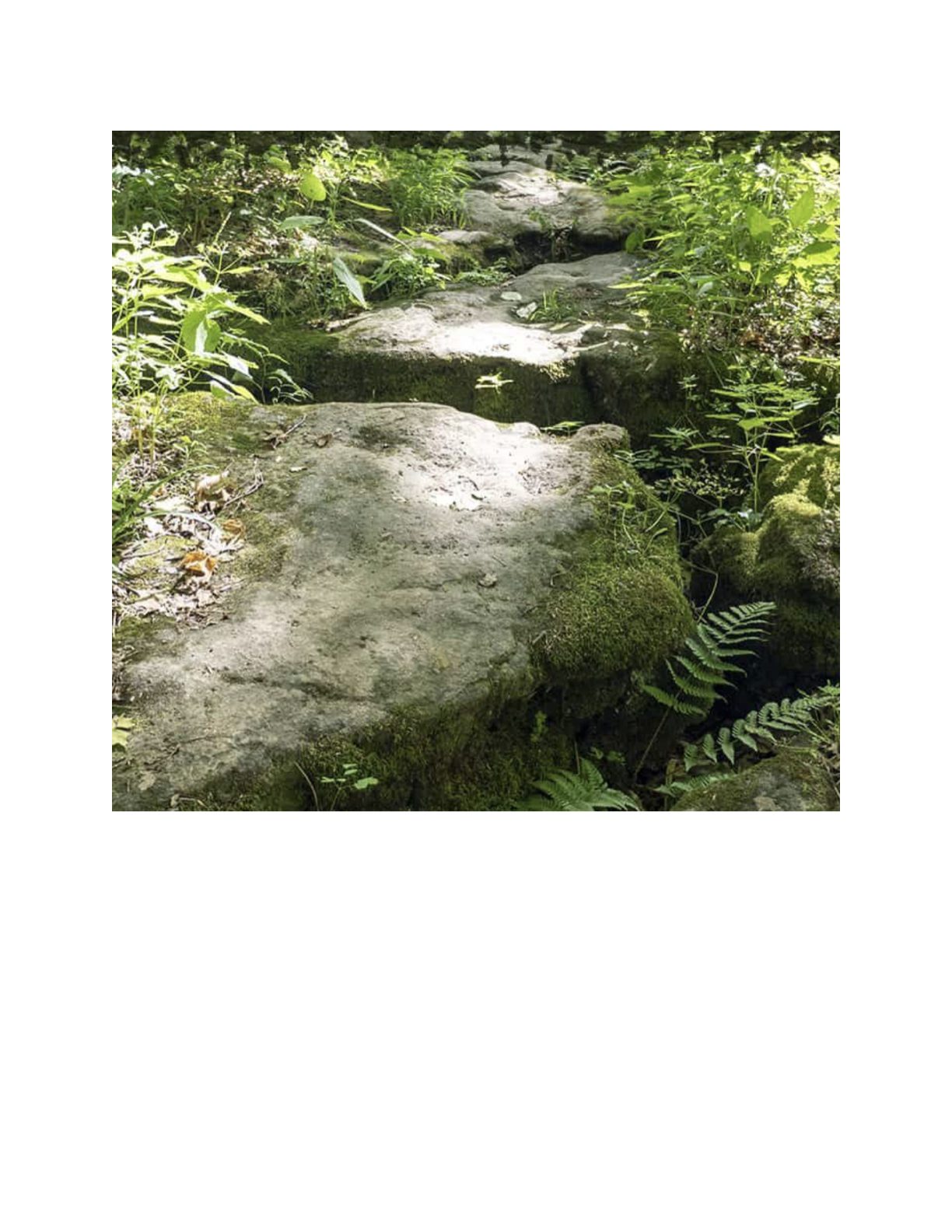
Join the adventure and earn the inaugural Peninsula Geology Badge! Over a stretch of 13 hikes and a couple of extra stops, we will explore the fascinating geology of the Peninsula to learn about the rocks, the shoreline features, glaciation, fossils and all things earthy. The 13 hikes are from the book “Walking Through Time – Exploring the Geology of the Saugeen (Bruce) Peninsula”. Having a copy will give you a lot of great information, but you do not have to purchase the book to attend and enjoy the hikes. Just bring your curiosity! We will make sure to hit all the locations that qualify for the beautiful new Walking Through Time – Saugeen (Bruce) Peninsula geology hike badge. If you would like to purchase a book I will have some available on the hikes, or you can pick one up from the BTC Head Office, at Ginger Press in Owen Sound, Suntrail Source for Adventure in Hepworth, the Shop at 84 Main in Lion’s Head and at Reader’s Haven in Tobermory.You are welcome to come on just a few of the hikes or on all of them, and the dates and hikes are as follows:
Date Geology Hike km
Saturday May 2, 2026 Colpoy’s Bay 9.0
Saturday May 9, 2026 Gravelly Point (am) and Rural Rocks (pm) 8.6
Saturday May 16, 2026 Malcolm Bluff 7.3
Sunday May 17, 2026 White Bluff/Smokey Head 11.8
Sunday May 24, 2026 Crooked Toe Road 5.5
Sunday May 31, 2026 Hope Bay 8.1
Sunday June 14, 2026 Boundary Bluffs 5.2
Saturday July 4, 2026 Cape Dundas 6.2
Saturday July 11, 2026 Beth Gilhespy Side Trail 7.6
Saturday August 8, 2026 Lion’s Head 11.0
Saturday August 15, 2026 Dyer’s Bay Loops 7.5
Saturday August 22, 2026 North Saugeen (Bruce) Shoreline 8.0
Meeting times will vary depending on the hike, but will generally be some time between 9 am and 10 am. Information on exact meeting times and locations will be sent out a few days prior to the hike.
Geology Hike #2 Silent Valley
https://hikes.brucetrail.org/event/geology-hike-2-silent-valley-2/Sorry, the registration cut-off time for this hike has been reached.Not a member? Click here to join today!Hosting Club: Sydenham
Category: Geology Hike
Location (Google Maps):BT roadside parking at dead end of 2nd Concession South, north of Grey Road 18. Map 30, ed. 31, near km 34.5, southern end of Silent Valley Sidetrail. You have an option to meet at the north-east corner of the parking lot at Home Depot on Highway 26 on the east side of Owen Sound and carpool from there. Carol will meet you there at 9:00 am.
Hike Leader(s): Carol Graham-Mullin Click here to contact Hike Leader(s)
Pace: Leisurely: 3 km/h or less
Terrain: Moderate: Some hills and/or poor footing, Strenuous: Hilly with steep climbs and some poor footing., There might be muddy sections., There might be sections with water on the trail.
Distance: 6.5 kmDescription
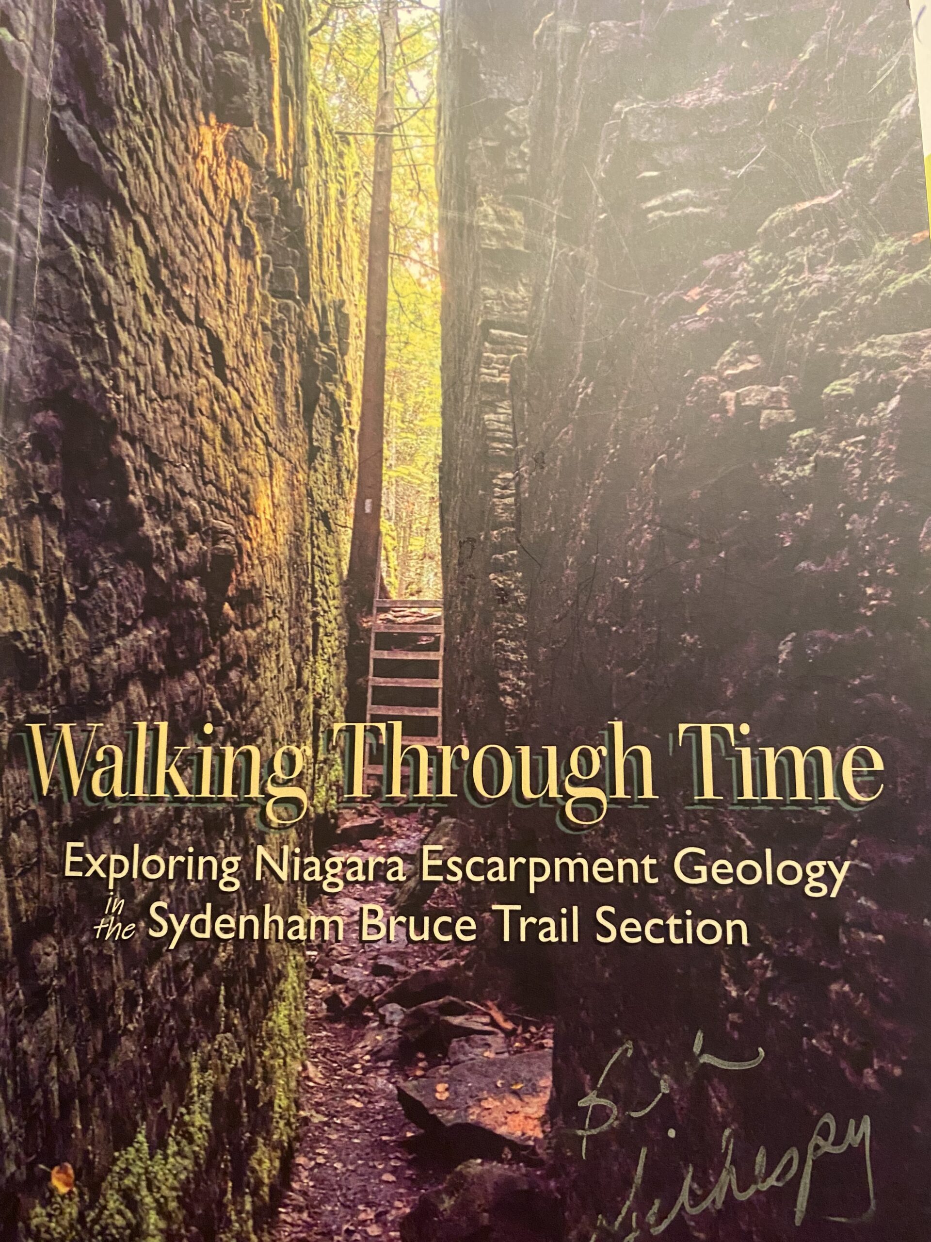
Loop hike of Silent Valley. Geology Hike # 2 in series of 16 hikes from Beth’s newest book “Walking Through Time”.
Join Carol Graham-Mullin for this exploration of Silent Valley. Fascinating escarpment geology along with ancient cedars, rare ferns, fossils and more ! The final route to be hiked may be slightly altered due to closure of upper main trail flooding. Don’t worry, we will visit all the exciting geological features !Copies of Beth’s book, “Walking through Time” will be available for purchase at the end of the hike. A special member’s only price of $37.00 , cash or etransfer. This hike can be credited towards the Sydenham Geology Badge.
10:00 NBTC SPRING Nature Hike
https://hikes.brucetrail.org/event/1000-nbtc-spring-nature-hike-3/Sorry, the registration cut-off time for this hike has been reached.Not a member? Click here to join today!Hosting Club: Niagara
Category: Loop
Location (Google Maps):Louth Conservation Area
Hike Leader(s): Helen Hermansen Click here to contact Hike Leader(s)
Pace: Medium
Terrain: Moderate
Distance: ~5kmDescription
NBTC SPRING NATURE HIKEHiking boots and poles are recommend as the terrain is rocky in sections.
Join us for the NBTC Nature Hike series to learn more about the biodiversity along the Niagara Escarpment. We will explore the trails throughout Louth Conservation area which offer beauty in all four seasons. Hikes will be held January, May, August & October – it will be amazing to see all the changes throughout the seasons. Your hike leaders, members of the NBTC Biodiversity Committee, will share their knowledge of the amazing flora & fauna along the trail as well as any biodiversity projects in the works for this year.
Parking is at the Louth Conservation Area Parking Lot on Staff Ave. Hiking boots and poles are recommend as the terrain is rocky in sections.
Note that he hike will be rescheduled in the event of heavy rains or heavy snow.
Car Hike: Scotsdale Farm
https://hikes.brucetrail.org/event/car-hike-scotsdale-farm-19/Sorry, the registration cut-off time for this hike has been reached.Not a member? Click here to join today!Hosting Club: Toronto
Category: Car Hike
Location (Google Maps):Scotsdale Farm, Map 13
Hike Leader(s): Al Brown Click here to contact Hike Leader(s)
Pace: Moderate (3-4 km/hr)
Terrain: Level 2 (Intermediate – some hills and uneven surfaces, rocks and roots underfoot), Variable
Distance (km): 10-13 kmDescription
Come join me for on the Bruce Trail to see the spring flowers and the first buds of the forest canopy.We will complete a loop hike on the main and side trails through Scotsdale Farm. The trails offer shorter routes for those who do not want to complete the full length. After the hike all are invited to join me for refreshments at the Shepherd’s Crook in old Georgetown.
To get to the meeting point from Hwy 401 go north on Trafalgar Road past Georgetown to the juncture with Hwy 7. North on Hwy 7 to Silver Creek. Turn right and back onto Trafalgar Road. Go north about 1.5 km to the entrance of Scotsdale Farm on your right. The parking area is about 0.5 km from Trafalgar Road near the old homestead.
Urban Walk: Humber River/Swansea Theatre Hike
https://hikes.brucetrail.org/event/urban-walk-humber-river-swansea-theatre-hike-4/Sorry, the registration cut-off time for this hike has been reached.Not a member? Click here to join today!Hosting Club: Toronto
Category: Urban Walk
Location (Google Maps):Meet by the TTC Stop on the Southeast Corner of Scarlett Road and Eglinton Avenue West. Take the #79 Scarlett Road bus from Runnymede Station to Eglinton or the Eglinton West #32A from Eglinton West Station to Scarlett Road.
Hike Leader(s): Miriam Stevens Click here to contact Hike Leader(s)
Pace: Leisurely (2-3 km/hr)
Terrain: Level 1 (Easy – mostly on flat, well maintained trails with hard-packed surface), Variable
Distance: 10-12 kmDescription
Leisurely hike (3 kms/hour – No Racers Please) suitable for beginners and families.
Hike along the Humber River trail and into the Swansea village at Runnymede road and Bloor street west. The hike will end opposite Runnymede Subway near the Village Playhouse Theatre and local restaurants and pubs. Distance may vary according to the weather and trail conditions and how people feel. Early dropout is possible at Old Mill Subway Station.After the hike you are invited to join us for dinner at around 6 PM at Ali Baba Mediterranean restaurant.
We will attend the play “The Cottage” at 8 PM at The Bloor West Village Players theatre, 2190 Bloor Street West, Toronto.
Call the Theatre directly at (416) 767 7702 to reserve your ticket, cost $26- $29.00. Please do mention that you’re with the Bruce Trail Conservancy, Toronto Club so they know we are supporting them.Paid parking is available off Kennedy Avenue north of Bloor Street West (behind the Village Playhouse Theatre building). There is no parking available at the start of the hike.