Categories
- 28March 28, 2026
8:30 Fort 2 Fort Prep
https://hikes.brucetrail.org/event/830-fort-2-fort-prep/Sorry, the registration cut-off time for this hike has been reached.Not a member? Click here to join today!Hosting Club: Niagara
Category: In and Out
Location (Google Maps): Locust Grove Picnic Area, 14888 Niagara River Parkway, QueenstonHike Leader(s): Karen Couch Click here to contact Hike Leader(s)
Pace: Brisk
Terrain: Easy
Distance: 14Description
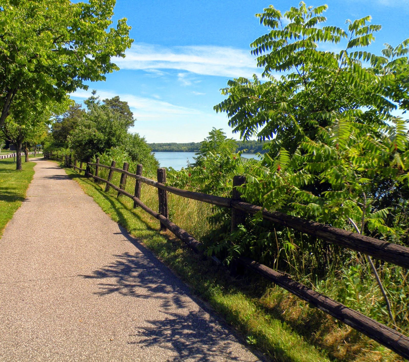
The Niagara River Recreational trail, which we will follow, is a paved path, with grass on both sides. Walkers/Hikers will go at their own pace and turn around after 90 minutes. At a brisk pace of 4-5 km/hour hikers should reach the Whirlpool Aero Car parking lot (and then retrace their steps).Trail runners or running shoes are recommended. Consider using hiking poles to promote blood flow through your hands and/or to help you establish a consistent rhythm (which can increase your speed). Carry water and snacks as needed.
Note: There may not be any washrooms open along this route. They are available at Queenston Heights Park, across the road from where we will park.
Plan to be ready to leave promptly at 8:30.
Toronto Section - Winter Magic
https://hikes.brucetrail.org/event/toronto-section-winter-magic/Sorry, the registration cut-off time for this hike has been reached.Not a member? Click here to join today!Hosting Club: Iroquoia, Toronto
Category: Good Companions
Location (Google Maps): Meeting Point at parking lot on St. Helena Rd. near its juntion with Regional Rd 25. Note: The far end of this road is posted as “No parking” ( please park on the right side across houses- close to the trail.Hike Leader(s): Corina Seceleanu Click here to contact Hike Leader(s)
Pace: Medium – 3 to 4 km/hr
Terrain: Dependent on Conditions, Moderate – Some hills and/or some poor footing, Slippery Sections Likely
Distance: 22.5kmDescription
Hello Fellow Hikers,Please join me for an unforgettable adventure as we explore a breathtaking stretch of the Toronto section of the Bruce Trail. This exhilarating and rewarding 22.5 km route forms a mostly open loop that highlights the beauty and character of a section that’s especially close to my heart.
Our journey begins (after the car shuttle point ) at Spyside Bruce Trail Pear Tree Park On. 15 Side Road 200 M South of Halton Rd 25 . From here, we’ll head out counterclockwise along a side trail before joining the main trail. Along the way, we’ll pass several notable landmarks within Hilton Falls Conservation Area, including the enchanting Hilton Falls, its serene reservoir, and a number of impressive glacial potholes.
Once we merge onto the main trail, we’ll enjoy approximately 9 km of steady ascent all the way to Helena Road, where our adventure concludes. This stretch of the Escarpment is both rewarding and challenging, offering sweeping vistas toward Milton, Mississauga, and Toronto—views that make every step worthwhile.Expectations: This is a medium with a difficult section (last portion ) hike but we gone tackle in various pace to allow ourself to enjoy and immerse in an endless beauty of this exploration. Expect to be on-trail 6- 7 hours. Breaks will be taken for lunch, snacks, photography, and to appreciate the scenery.
Meeting Time: Please arrive no later than 15 minutes prior to the scheduled time.
Participant Requirements:
- Intermediate/experienced hikers, comfortable with longer distances and some elevation gains.
- Must be physically fit for group hiking, and mentally for an endurance of 22.5 km
- Proper hiking boots, layered clothing, and wet/cold weather gear. Hiking poles and icers recommendated/ must.
- Essentials: Lunch, snacks, water (1.5 2L min) , and your enthusiasm
- Breaks for photography and appreciation wildlife (if lucky, as I was seeing a bald eagle) and bio breaks as well.
We’ll run a short car shuttle from Helena Rd. meeting point to the Bruce Trail Pear Tree Park parking area on 15 Sideroad, about 200 metres southwest of Halton Road 25 where the hike will start . This quick shuttle will make logistics easy and ensure we finish right on time.
Boyd Conservation Park ,Vaughan
https://hikes.brucetrail.org/event/car-hike-german-mills/Sorry, the registration cut-off time for this hike has been reached.Not a member? Click here to join today!Hosting Club: Toronto
Location (Google Maps): Free Parking lot before entrance of park on Islington Ave.
Hike Leader(s): Mohammad Aghamiri Click here to contact Hike Leader(s)
Pace: Moderate (3-4 km/hr)
Terrain: Hilly, Level 2 (Intermediate – some hills and uneven surfaces, rocks and roots underfoot), Variable
Distance (km): 12-14 kmDescription
Let’s hike Boyd conservation park trails through beautiful valleys.Please bring lots of water and snacks ,hiking poles are recommended
phone number for the day of hike 289 588 6482
Car Hike: Uxbridge-Brock Track
https://hikes.brucetrail.org/event/car-hike-uxbridge-brock-track/Sorry, the registration cut-off time for this hike has been reached.Not a member? Click here to join today!Hosting Club: Toronto
Category: Car Hike
Location (Google Maps): Meet at the Brock Tract parking lot on the east side of Durham 1/Brock Rd., approximately 5 km south of Coppin’s Corners, Uxbridge or 1 km north of Uxbridge Pickering Town Line. 1401 Brock Rd. (Free parking).Hike Leader(s): Amir Alemohammad Click here to contact Hike Leader(s)
Pace: Moderate (3-4 km/hr)
Terrain: Flat, Hilly, Level 2 (Intermediate – some hills and uneven surfaces, rocks and roots underfoot), Variable
Distance (km): 10-12 kmDescription
Join us for a wonderful hike in Uxbridge starting from Brock Track parking lot. We will hike the Brock Track and Wilder Forest among the amazing trails of Uxbridge.Boots and icers mandatory, poles recommended, bring 2 litres of water and dress according to weather conditions. Be prepared for icy/snowy conditions.
Please arrive at 8:45 for a 9:00 start.
Beware, Iphone Maps may take you to the wrong location. Check the location with Google Maps the previous night.
This is a joint hike with Oak Ridges Trail Association (ORTA).

Port Wellar Spit
https://hikes.brucetrail.org/event/port-wellar-spit/Sorry, the registration cut-off time for this hike has been reached.Not a member? Click here to join today!Hosting Club: Niagara
Category: Loop
Location (Google Maps): Meet at Happy Rolf’s Animal Farm, 650 Read Rd, St CatharinesHike Leader(s): Margaret Northfield Click here to contact Hike Leader(s)
Pace: Medium
Terrain: Easy
Distance: 8kmDescription
Park at Happy Rolf’s Animal Farm. We will be walking along Lake Ontario to the Port Wellar spit. It will be an out and back hike with a few diverges.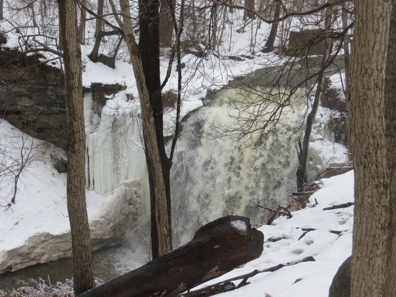
Go Train Hike: Smokey Hollow and Waterdown by GO Train
https://hikes.brucetrail.org/event/go-train-hike-smokey-hollow-and-waterdown-by-go-train/Sorry, the registration cut-off time for this hike has been reached.Not a member? Click here to join today!Hosting Club: Toronto
Category: GO Train Hike
Location (Google Maps): Aldershot GO Station to WaterdownHike Leader(s): Michael Humpage, Felix Wan Click here to contact Hike Leader(s)
Pace: Moderate (3-4 km/hr)
Terrain: Hilly, Level 2 (Intermediate – some hills and uneven surfaces, rocks and roots underfoot), Rocky, Variable
Distance (km): 14 kmDescription
Please meet me under the clock in the Great Hall in Union Station by 8:45 AM. We will take the 9:04 AM (to be confirmed) Lakeshore West train to Aldershot GO arriving at 10:02 AM. We will hike from Aldershot GO station into Waterdown and then return to Aldershot GO station. The hike will be a mix of country roads and trails. For the most part this is an in and an out hike. Part of the hike will be on the Bruce Trail through Grindstone Creek and passing by Smokey Hollow waterfall. There is one steep descent, followed by one very steep climb. Continuing past Smokey Hollow we will hike into Waterdown where hikers can go to the Copper Kettle cafe and purchase food or drink if they wish.Please bring water (2 litres recommended), a lunch, bug spray and sunscreen. At this time of year conditions could be quite muddy so come prepared. Icers, poles and gaiters may be useful.
Registration is limited to 20 spots.
Saturday Shorts: Glen Haffy
https://hikes.brucetrail.org/event/saturday-shorts-glen-haffy-6/Sorry, the registration cut-off time for this hike has been reached.Not a member? Click here to join today!Hosting Club: Caledon Hills
Category: General
Location (Google Maps): Meet at 10 am at the roadside parking on Coolihans Sideroad, km 35.0 Map 17, near where the Trail crosses the road. This is just west of the intersection of Glen Haffy Road and Coolihans Sideroad. It is best to aim for arriving around 9:45, so we can start hiking as close to 10 am as possible. Thanks!Hike Leader(s): Elizabeth Ganong Click here to contact Hike Leader(s)
Pace: Leisurely – 3 km/hour or less
Terrain: Moderate – some hills and/or some poor footing
Distance: Approximately 4 to 5 kmDescription
Looking to get out on a Saturday but not give up your whole day? Saturday Shorts, a hiking series, will get you out in a small group on a short hike. This Saturday’s hike is at Glen Haffy. If the trails are snow-covered, we’ll hike the main Bruce Trail and Glen Haffy’s red loop, which makes a route under 4 km. If trail conditions permit, we may use a slightly longer route, about 5 km. Be prepared for winter conditions by bringing warm gear, poles, and icers. You are encouraged to bring water and a snack. No dogs please. Registrants can expect a reminder/update message one or two days before the hike.