Categories
- 04October 4, 2026
Bruce Trail Day - Long Hike Event
https://hikes.brucetrail.org/event/bruce-trail-day-long-hike-event/
Registration Required:
Registration Costs
Members - $20.00
Child Members - $20.00
Non-Members - $30.00
Child Non-Members - $30.00
Click here to register for this hike (10 spots remaining)Hosting Club: Sydenham
Category: General Hike
Location (Google Maps):Wiarton Blue Water Park – the gravel lot by the baseball diamond just off Brown St.
Hike Leader(s): Bill Snel Click here to contact Hike Leader(s)
Pace: Medium: 3 to 4 km/h
Terrain: Easy: Mostly flat and good footing., Moderate: Some hills and/or poor footing, There might be muddy sections., There might be sections with water on the trail.
Distance: 23.2 kmDescription
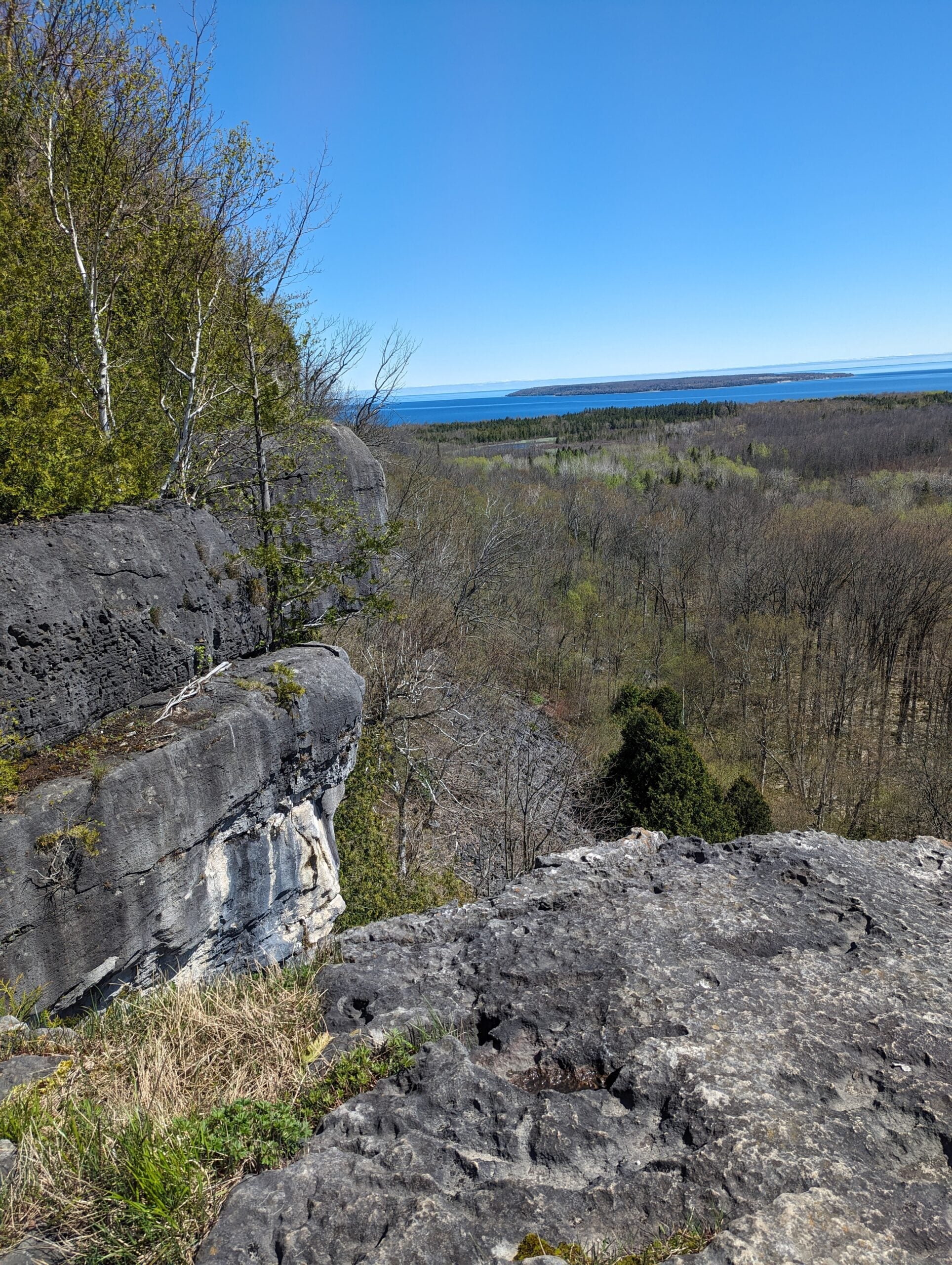
A chance to celebrate Bruce Trail Day by joining the last day of the Sydenham Club’s 2026 End-to-End in 8 hikes. This hike may be an opportunity to start a self-directed End-to-End in Sydenham or to “fill in the pieces”. The hike distance of just over 23 km will be challenging and you should be in good shape to participate. You will be joining a group of approximately 40 hikers who have already experienced 7 days spread over 4 week-ends. The fee includes bus transportation from parking and the hike end location in Wiarton to the hike start where the bus will drop you off at Graham’s Hill Rd. Then you hike back to your vehicle. You will benefit from 2 checkpoints along the way with water and delicious snacks. The trail largely follows the escarpment edge and the scenery is spectacular: Big Bay Sideroad, Ancient Beach Nature Reserve, Skinner’s Bluff, Skinner’s Woods, Colpoy’s Bay islands, Bruce’s Caves Conservation Area, Wiarton Airport. You will hike without a leader at your own pace but we will provide a team of volunteers to assist hikers including a sweep to bring up the rear of the group. You must bring everything needed for the days hike such as at least a litre of water, lunch, your own first aid, etc. NO REFUNDS will be issued. For additional information email sydenhame2e@gmail.com.
Fifth Annual Music Hike and Bruce Trail Day
https://hikes.brucetrail.org/event/fifth-annual-music-hike-and-bruce-trail-day/
Registration is not required for this hike. Meet us at the location below.Hosting Club: Blue Mountains
Category: Organized Hike
Location (Google Maps): Nottawasaga Bluffs, 8861 Sideroad 15/16 Nottawasaga, SinghamptonHike Leader(s): Rob Johnston Click here to contact Hike Leader(s)
Pace: Leisurely – 3 km/hr. or less
Terrain: Moderate – Some hills and/or some poor footingDescription
Join us for the Fifth Annual Music Hike and Bruce Trail Day, a unique celebration where music meets nature. Musicians will be scattered throughout the scenic wilderness, serenading hikers as they explore breathtaking forest trails and lookouts.Fitness hike in the Beaver Valley
https://hikes.brucetrail.org/event/fitness-hike-in-the-beaver-valley-beaver-valley-short-loop-19-2-km/
Registration Required:
Click here to register for this hike (12 spots remaining)Hosting Club: Toronto, Beaver Valley
Category: Car Hike
Location (Google Maps):Beaver Valley Short Loop, 19.2 km
Hike Leader(s): Natalia Svechnikova Click here to contact Hike Leader(s)
Pace: Moderate (3-4 km/hr)
Terrain: Challenging, Hilly, Level 3 (Advanced – steep hills and some scrambling over boulders)
Distance (km): about 19.2 kmDescription
Please join me for a challenging hike on the Bruce Trail (main and side trails) in the Beaver Valley. We will be following the Beaver Valley Short loop of ca 19.2 km from the Hogg’s Falls Parking lot (170491-172753, Lower Valley Rd, Flesherton, ON N0C 1E0). From there, we will start hiking the main Bruce Trail toward Eugenia Falls and continue with the loop counter-clockwise. We will make short water and pit breaks and one long (at least 45 min) lunch break to eat, rest and enjoy, and we should finish the hike before 5 pm. After the hike, we will have a stop at a brewery or cidery (we will decide on the hike) before we head home.For more information (including technical details) about this loop, please check “Beaver Valley Short Loop” on the Alltrails app on your phone or click on this link to the website: https://www.alltrails.com/trail/canada/ontario/beaver-valley-short-loop
Please note that this is a long hike and a relatively long day trip if you are coming from the GTA.
We will try to keep a moderate pace of about 3 km/h while slowing down uphill. The trail is challenging with a few uphill sections after which we will stop for short water breaks.
Please be dressed for the weather, wear hiking shoes/boots, bring extra layers and pack your rain gear (just in case), at least 2 L of water, light lunch and several snacks, your sunglasses and/or hut.
We will meet at the Hogg’s Falls Parking lot (170491-172753, Lower Valley Rd, Flesherton, ON N0C 1E0)
Please note that this hike is not suitable for a rainy/stormy day and will be cancelled in case of inclement weather.
10:30 NBTC FALL Nature Hike
https://hikes.brucetrail.org/event/1030-nbtc-fall-nature-hike/
Registration Required:
Click here to register for this hike (14 spots remaining)Hosting Club: Niagara
Category: Loop
Location (Google Maps):Louth Conservation Area
Hike Leader(s): Helen Hermansen Click here to contact Hike Leader(s)
Pace: Leisurely <3 km/hr
Terrain: Moderate: some hills and some poor footing
Distance: ~5kmDescription
NBTC FALL NATURE HIKEHiking boots and poles are recommend as the terrain is rocky in sections.
Join us for the NBTC Nature Hike series to learn more about the biodiversity along the Niagara Escarpment. We will explore the trails throughout Louth Conservation area which offer beauty in all four seasons. Hikes will be held January, May, July & October – it will be amazing to see all the changes throughout the seasons. Your hike leaders, members of the NBTC Biodiversity Committee, will share their knowledge of the amazing flora & fauna along the trail as well as any biodiversity projects in the works for this year.
Parking is at the Louth Conservation Area Parking Lot on Staff Ave. Hiking boots and poles are recommend as the terrain is rocky in sections.
Note that he hike will be rescheduled in the event of heavy rains or heavy snow.
An Introduction to Sketch Nature Journalling - Bruce Trail Day special event
https://hikes.brucetrail.org/event/an-introduction-to-sketch-nature-journalling-bruce-trail-day-special-event/
Registration Required:
Click here to register for this hike (9 spots remaining)Hosting Club: Sydenham
Category: Sketch or Paint Hike
Location (Google Maps): Meet at the Bruce Trail Day tent in Harrison Park in Owen Sound. The tent will be beside the parking lot for the Harrison Park Inn Restaurant.Hike Leader(s): Fran Turner Click here to contact Hike Leader(s)
Pace: Leisurely: 3 km/h or less
Terrain: Easy: Mostly flat and good footing.
Distance: We will be hiking short distances to find suitable spots to do our nature journalling. Maximum distance covered approximately 3 km.Description
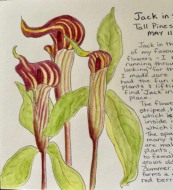
- Nature journalling is a wonderful way to slow down and connect with the natural world around us. It is perfect for anyone who wants to sharpen their powers of observation and learn more about the plants, birds and animals that they see. This session is suitable for all skill levels. You do NOT need to be an artist to enjoy nature journalling. But you do need to be willing to sit quietly and carefully observe what you see. We will cover basic topics such as: what is a nature journal, equipment and supplies, how to get started, what to include in your journal. We will look at examples of various types of journals so you get an idea of how you might like to create your own. And then we will spend time in several different locations, creating our first journal entries. You will need to bring: a folding chair which is easy to carry, several sharp pencils (preferably 2B, but HB is okay), an eraser, and a sketchbook with a hard cover (so you can draw in your lap), or blank, loose paper attached to a clipboard. Optional items are: fine tip black ink markers or pens, pencil crayons, watercolour paints, watercolour pencils, or ink pencils.
- 05October 5, 2026No events
- 06October 6, 2026No events
- 07October 7, 2026
Apple Pie Trail Hike
https://hikes.brucetrail.org/event/apple-pie-trail-hike/
Registration Required:
Click here to register for this hike (14 spots remaining)Hosting Club: Blue Mountains
Category: Organized Hike
Location (Google Maps): Large parking lot behind Tim Hortons First Street CollingwoodHike Leader(s): Claire Pearson Click here to contact Hike Leader(s)
Pace: Medium – 3 to 4 km/hr
Terrain: Easy – Mostly flat and usually good footing, Moderate – Some hills and/or some poor footing
Distance: 5.3kmDescription
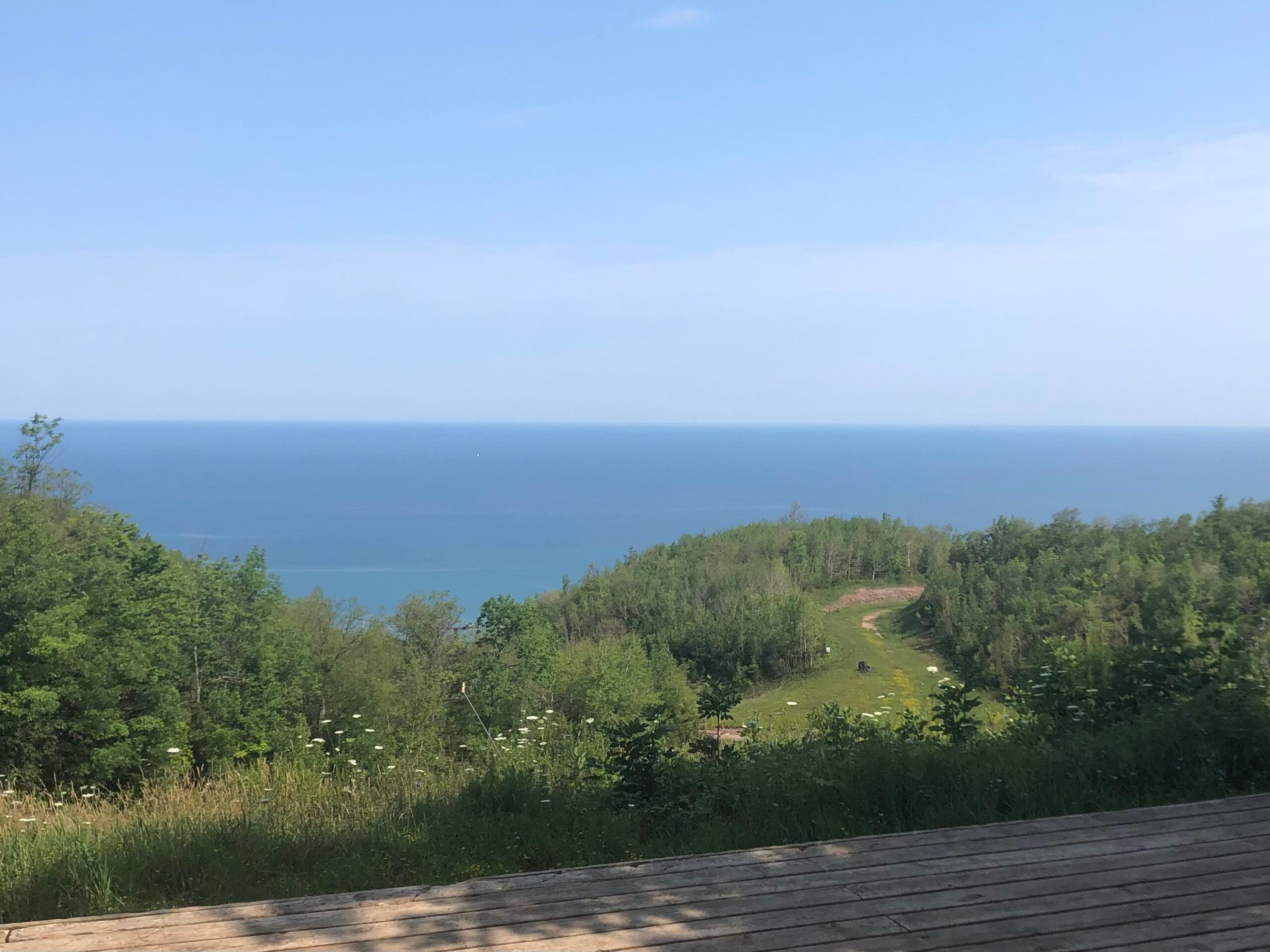
We will meet at 8:30am in the large parking lot behind Tim Hortons on First Street Collingwood. At 8:45am, we will carpool up Grey Road 119, turning right on 4th Line, and then left on 21st Sideroad. We will park in the paid parking spots at Loree Forest and complete the Len Gertler Memorial Forest Loop. This trail takes you through a gorgeous woodland to a scenic viewpoint of Georgian Bay. After the hike, we will make our way to one of the Farmer’s Markets in the area where we will have the opportunity to purchase apples, pies, and other baked goods.Evening Hike including visiting the Mill Dam Salmon Run!
https://hikes.brucetrail.org/event/evening-hike-including-visiting-the-mill-dam-salmon-run/
Registration Required:
Click here to register for this hike (99 spots remaining)Hosting Club: Sydenham
Category: An evening walk.
Location (Google Maps): Meet in the municipal parking lot by the river on the West side of First Ave East between 7th St East and 8th St East in Owen Sound.Hike Leader(s): Harriet Nixon Click here to contact Hike Leader(s)
Pace: Brisk: 4 to 5 km/h
Terrain: Moderate: Some hills and/or poor footing
Distance: Approx 6 kmDescription
Join us for a brisk evening hike exploring the paths and neighbourhoods of Owen Sound. We will be visiting the Mill Dam to witness the salmon migrating up the fish ladder! Following the hike there is an opportunity to socialize over refreshments. There is no need to show up 15 minutes early for this hike, but we will leave promptly at 7:00 pm. - 08October 8, 2026
Toronto Fall Series Hike 6 of 9
https://hikes.brucetrail.org/event/toronto-fall-series-hike-6-of-9/
REGISTRATION FULL: This hike has reached the maximum number of hikers.
Click here to be added to the Wait List.Hosting Club: Caledon Hills
Category: End-to-End
Location (Google Maps): Meet at Limehouse parking, across from the school. Map 12 north of km 21.6 on the south side of 22 Sideroad.Hike Leader(s): Nancy Mooney Click here to contact Hike Leader(s)
Pace: Medium – 3 to 4 km/hour
Terrain: Easy – mostly flat and usually good footing, Moderate – some hills and/or some poor footing
Distance: 13.2 km loopDescription
This is the sixth hike of the series and takes us through Limehouse Conservation Area, the Hole in the Wall, Black Creek and Canada Goose Side Trails. - 09October 9, 2026No events
- 10October 10, 2026

Fall Colours 2-Day Official Club End-to-End
https://hikes.brucetrail.org/event/fall-colours-2-day-official-club-end-to-end/This is a Multi-Day Hike
You are signing up for the following dates and times:
2026-10-10 at 07:30
2026-10-11 at 07:30
Registration Required:
Registration Costs
Members - $50.00
Child Members - $50.00
Non-Members - $60.00
Child Non-Members - $60.00
Click here to register for this hike (38 spots remaining)Hosting Club: Caledon Hills
Category: End-to-End
Location (Google Maps): On Saturday and Sunday, meet at Coolihans Side Road at km 35.0, east of where the Trail crosses the road. Google Maps GPS Coordinates: 43.937967, – 79.934650.From Airport Rd, head east on Coolihans Side Road for 850 metres. Park well off the road on the north side.
Hike Leader(s): Sandy Green Click here to contact Hike Leader(s)
Pace: Brisk – 4 to 5 km/hour
Terrain: Strenuous – hilly with steep climbs and some poor footing
Distance: 72 kilometresDescription
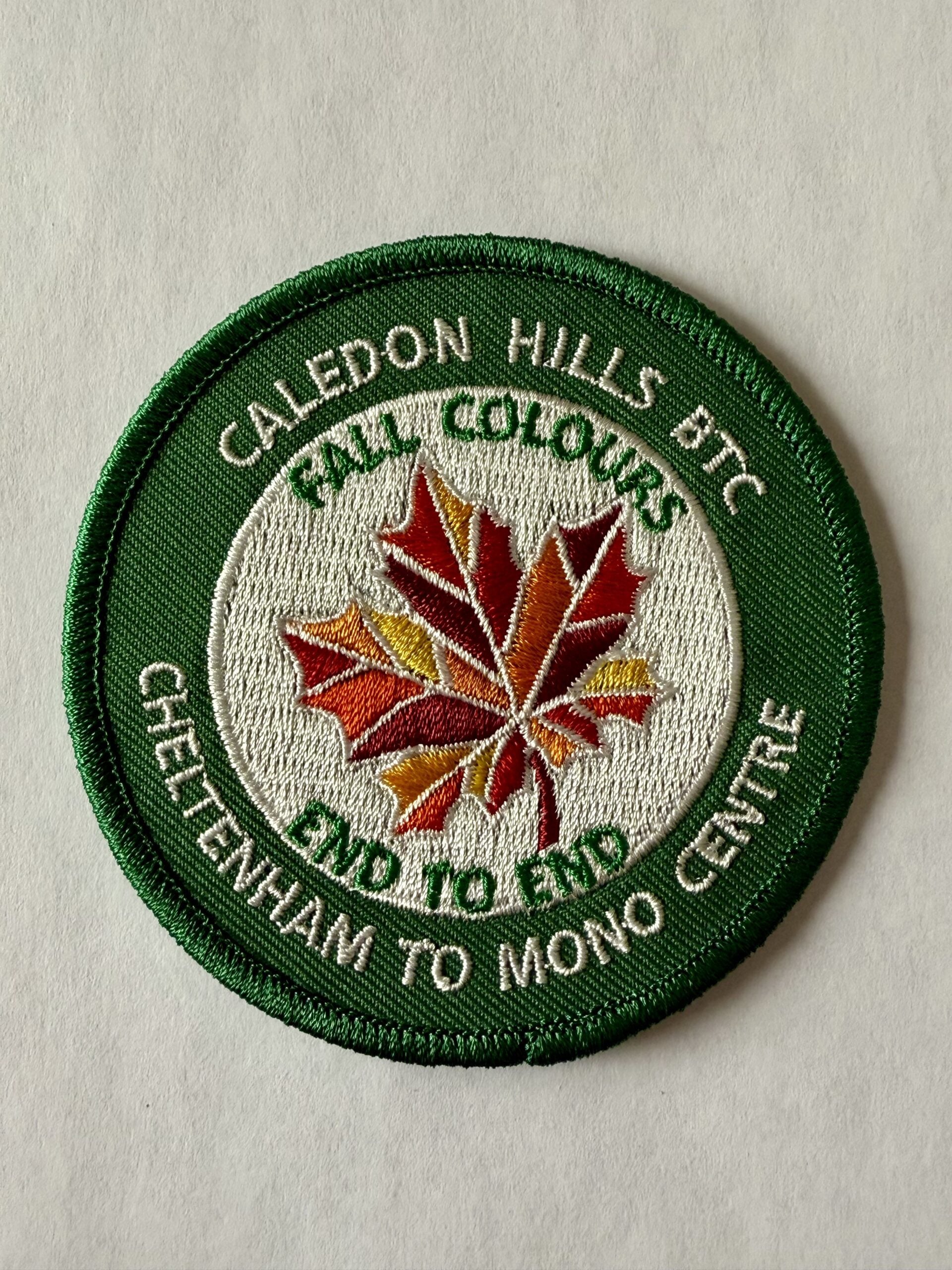
NEW BADGE ALERTPlan to enjoy spectacular fall colours as you hike the approximately 72 kilometres of main trail through the famous Caledon Hills on Saturday and Sunday of Thanksgiving weekend.
The registration fee covers the BTC Hike Schedule Processing Fee, daily bus transportation, and an end-to-end badge on completion.
Participants are shuttled by school bus from the meeting places to the start locations.
Hikers hike independently or with other participants. There is no leader, but there is a designated sweep.
Checkpoints are located every 7-11 km along the route. Volunteers provide light refreshments and beverages at the checkpoints.
Participants are expected to hike at a pace of approximately 4 km/hr or faster. There are cut-off times. The cut-off times are calculated using a 4 km/hr pace, a 15-minute late-start buffer, and an additional 15-minute rest time at each checkpoint.
Refunds are allowed up to 60 days before the event.
The event promises to be a FUN one!
2-Day Event Itinerary – Saturday, October 10, 2026 and Sunday, October 11, 2026
The bus leaves at 7:30 am sharp each day. Please plan to arrive at least 20-30 minutes before departure.
On Saturday and Sunday, meet at Coolihans Side Road at km 35.0, east of where the Trail crosses the road. Google Maps GPS Coordinates: 43.937967, – 79.934650. From Airport Rd, head east on Coolihans Side Road for 850 metres. Park well off the road on the north side.
On Saturday, the bus will drop participants off at the northern end of the Caledon Hills section, at County Rd 8. Hikers will then head south back to Coolihans Side Road. Checkpoints are located approximately 11 km, 18 km, 29 km (Cut-off Time: 4:00 pm), and 37 km into the hike.
On Sunday, the bus will drop the group off at Creditview Road, km 0.0. They will then hike north, back to Coolihans Side Road. Checkpoints are located approximately 9.5 km, 21 km, 27 km (Cut-off Time: 4:00 pm), and 34 km into the hike.
Car Hike: Oak Ridges Corridor
https://hikes.brucetrail.org/event/car-hike-oak-ridges-corridor-4/
Registration Required:
Click here to register for this hike (27 spots remaining)Hosting Club: Toronto
Location (Google Maps): Oak Ridges Corridor, Bethesda Trail Head Parking Lot, Bethesda Side Road, Richmond Hill, Ontario
Hike Leader(s): MOHAMMAD AGHAMIRI Click here to contact Hike Leader(s)
Pace: Moderate (3-4 km/hr)
Terrain: Hilly, Level 2 (Intermediate – some hills and uneven surfaces, rocks and roots underfoot)
Distance (km): 14-15 kmDescription
Join us to explore the trails of York Regional Forest and the Oak Ridges Corridor at Jefferson Forest and Bond lake,From parking lot we hike thought Jefferson forest and continue to Bond Lake and have snack beside the lake and return to parking around 1:pm
Please bring lots of water and snacks ,hiking poles are recommended,it is Mosquto and Tick season ,be prepared .
phone number for the day of hike 289 588 6482
Fall Colours 3-Day Official Club End-to-End
https://hikes.brucetrail.org/event/fall-colours-3-day-official-club-end-to-end/This is a Multi-Day Hike
You are signing up for the following dates and times:
2026-10-10 at 08:30
2026-10-11 at 08:30
2026-10-12 at 08:30
Registration Required:
Registration Costs
Members - $75.00
Child Members - $75.00
Non-Members - $90.00
Child Non-Members - $90.00
Click here to register for this hike (39 spots remaining)Hosting Club: Caledon Hills
Category: End-to-End
Location (Google Maps): On Saturday, meet at the Fung Loy Kok Taoist Tai Chi-International Centre
248305 Side Road 5, Mono, ON L9W 6C3. Google Maps GPS Coordinates: 43.975421, -79.989252.From Airport Road, turn east onto Side Road 5. Drive 270 metres to the entrance of the International Centre on the left. Enter the driveway and head straight for approximately 50 metres. Parking is in a field on the right.
See meet up details in the description below for Sunday and Monday.
Hike Leader(s): Sandy Green Click here to contact Hike Leader(s)
Pace: Brisk – 4 to 5 km/hour
Terrain: Strenuous – hilly with steep climbs and some poor footing
Distance: 72 kilometresDescription
Plan to enjoy spectacular fall colours as you hike the approximately 72 kilometres of main trail through the famous Caledon Hills over the Thanksgiving long weekend.The registration fee covers the BTC Hike Schedule Processing Fee, daily bus transportation, and an end-to-end badge on completion.
Participants are shuttled by school bus from the meeting places to the start locations.
Hikers hike independently or with other participants. There is no leader, but there is a designated sweep.
Checkpoints are located every 7-11 km along the route. Volunteers provide light refreshments and beverages at the checkpoints.
Participants are expected to hike at a pace of approximately 4 km/hr or faster. There are cut-off times. The cut-off times are calculated using a 4 km/hr pace, a 15-minute late-start buffer, and an additional 15-minute rest time at each checkpoint.
Refunds are allowed up to 60 days before the event.
The event promises to be a FUN one!
3-Day Event Itinerary – Saturday, October 10, 2026, Sunday, October 11, 2026, and Monday, October 12, 2026
The bus leaves at 8:30 a.m. sharp, each day. Please plan to arrive at least 20 – 30 minutes before the departure time.
On Saturday, meet at the Fung Loy Kok Taoist Tai Chi-International Centre, 248305 Side Road 5, Mono, ON L9W 6C3. Google Maps GPS Coordinates: 43.975421, -79.989252. From Airport Road, turn east onto Side Road 5. Drive 270 metres to the entrance of the International Centre on the left. Enter the driveway and head straight for approximately 50 metres. Parking is in a field on the right. The buildings and facilities of the International Centre are off limits to participants during this Bruce Trail event. The bus will take participants to the northern end of the Caledon Hills section, at County Rd 8. The group will then hike south, back to the International Centre.Checkpoints are located approximately 11 km, 18 km (Cut-off Time: 2:00 pm), and 27 km into the hike.
On Sunday, meet at km 20.8, the north/east corner of Escarpment Side Road and Heart Lake Road. Park on the north side of Escarpment Side Road, well off of the road, 43.859911, -79.947606. The bus will take hikers to km 0.0 on Creditview Road. Participants will then hike back to the meeting place on Escarpment Side Road. Checkpoints are located approximately 9.5 km (Cut-off Time: 11:45) and 21 km into the hike.
On Monday, meet at the Fung Loy Kok Taoist Tai Chi-International Centre. The bus will take participants to Escarpment Side Road and Heart Lake Road. Everyone will then hike back to the International Centre. Checkpoints are located approximately 10 km, 17.5 km (Cut-off Time: 2:00 pm), and 24 km into the hike.
Please note that on Saturday and Monday, the final checkpoint (the end of the hike) is slightly off the Bruce Trail. There will be signs in place to direct hikers. Also note that the meeting place on Sunday is different than the other two days.