Categories
- 31August 31, 2025
Urban Walk: Bluffers Park
https://hikes.brucetrail.org/event/urban-walk-bluffers-park-3/Sorry, the registration cut-off time for this hike has been reached.Not a member? Click here to join today!Hosting Club: Toronto
Category: Urban Walk
Location (Google Maps):Bluffer’s Park, Scarborough
Hike Leader(s): Tom Swales Click here to contact Hike Leader(s)
Pace: Moderate (3-4 km/hr)
Terrain: Flat, Level 1 (Easy – mostly on flat, well maintained trails with hard-packed surface)
Distance: 7 kmDescription
Enjoy the scenic views of the cliffs at Scarborough’s Bluffers Park and hike along the beach to the east. Meet at Kennedy Station on the bus platform for Route #201 Bluffers Park at 10:00 to take the bus scheduled to depart at 10:20 AM to arrive at the park approximately 20 minutes later. Taking transit is strongly recommended as the park gets very busy on the weekends. (free parking is available at Kennedy Station). Optional pub stop after the hike at the Dogfish Pub in the park. Great chicken wings!Exploring Sydenham Hike #30 Sarawak Woods
https://hikes.brucetrail.org/event/exploring-sydenham-hike-30-sarawak-woods/Sorry, the registration cut-off time for this hike has been reached.Not a member? Click here to join today!Hosting Club: Sydenham
Category: General Hike
Location (Google Maps): The Owen Sound Galaxy Cinema parking lot. Meet at the tall “Galaxy Centre” sign next to the traffic lights.Hike Leader(s): Bill Snel Click here to contact Hike Leader(s)
Pace: Leisurely: 3 km/h or less
Terrain: Moderate: Some hills and/or poor footing, Strenuous: Hilly with steep climbs and some poor footing.
Distance: 2 kmDescription
We will carpool to do a loop hike of Sarawak Woods. This is hike 30 in the book Exploring Sydenham. There will be one secret to find. If you do not have a book and would like one ($30) let me know by using the “Contact hike leader” link. - 01September 1, 2025
Welland Canals Badge Hike 1
https://hikes.brucetrail.org/event/welland-canals-badge-hike-1/Sorry, the registration cut-off time for this hike has been reached.Not a member? Click here to join today!Hosting Club: Niagara
Category: Loop
Location (Google Maps): Allanburg Bridge Parking lot Hwy 20Hike Leader(s): Erin Lyttle Click here to contact Hike Leader(s)
Pace: Medium
Terrain: Easy, Moderate
Distance: 18.9kmDescription
Meet at Allanburg Bridge on the Welland Canal and Hwy 20, there is a gravel parking lot. We will be doing the Welland Canals Hike #1 to give a flavour of all 4 Welland Canals. Since this hike is the longest in the series, we are starting at 8 (the other hikes start at 8:30) on Labour Day and will be walking at a quick pace to meet our goal of being finished before lunch. If you are interested in receiving your badge after completing the 4th hike on Sept 29th, please let me know and pay in cash or via etransfer (I can give you directions on the hike) $10 for members (please provide BTC number) or $15 for non-members. Badge info: https://niagarabrucetrail.club/badges/Please wear good walking shoes (the path/trail is mostly flat), poles if you like and water/snacks.
8:30 am Hydro Hill Training
https://hikes.brucetrail.org/event/830-am-hydro-hill-training-7/Sorry, the registration cut-off time for this hike has been reached.Not a member? Click here to join today!Hosting Club: Niagara
Category: In and Out
Location (Google Maps):Lockhart Drive, St Catharines, by the large yellow swing gate.
Hike Leader(s): Suzanne Gourluck Click here to contact Hike Leader(s)
Pace: Brisk
Terrain: Strenuous
Distance: 6 kmsDescription
This challenging “hike” is intended for those wishing to train for future challenging hikes. Choose your own pace to go up and down the moderately steep hill over 60 minutes. The terrain is a hard packed gravel surface. Feel free to bring light weights to increase the intensity of your training. Bring water, hiking poles, snack and dress for the weather.
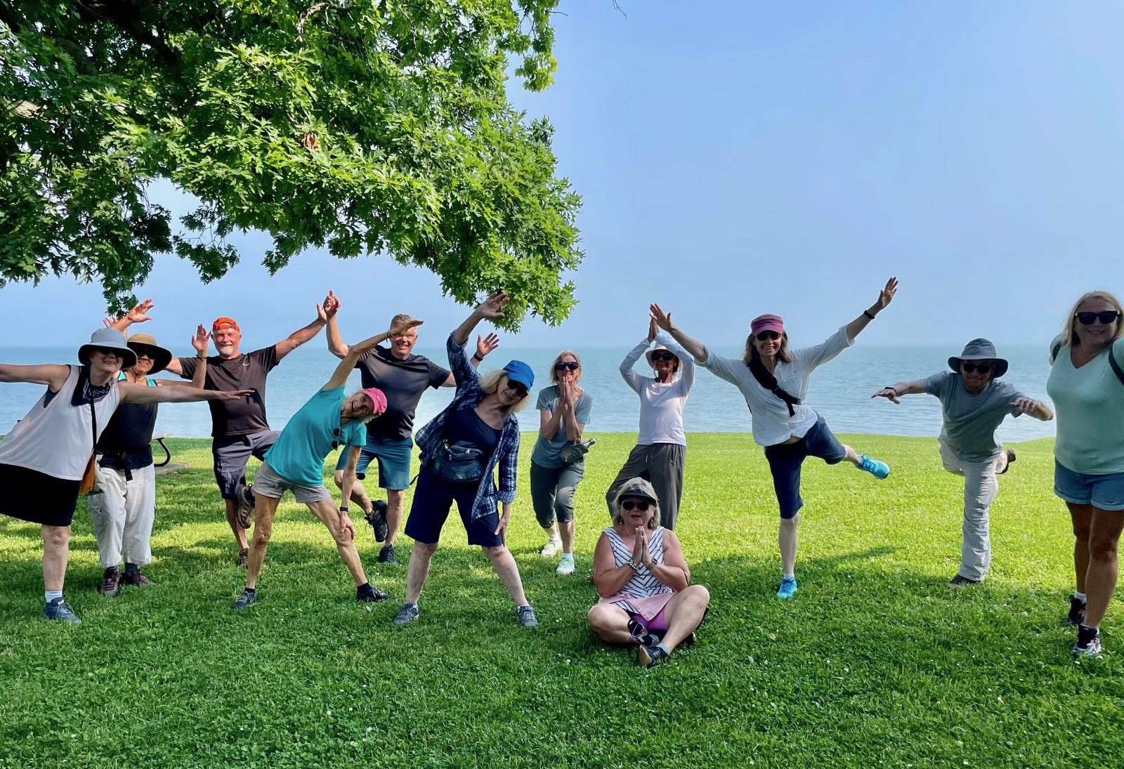
Bend. Breathe. Belong - Gentle yoga followed by a 5km hike.
https://hikes.brucetrail.org/event/bend-breathe-belong-gentle-yoga-followed-by-a-hike/Sorry, the registration cut-off time for this hike has been reached.Not a member? Click here to join today!Hosting Club: Iroquoia
Category: Special Event
Location (Google Maps): Please park in the Lions Club Pool Parking lot in Grimsby 1 Elm St and walk into the park area under the trees.Hike Leader(s): Ruth Moffatt Click here to contact Hike Leader(s)
Pace: Leisurely – 3km/hr or less
Terrain: Moderate – Some hills and/or some poor footing, Strenuous – Hilly with steep climbs and some poor footing
Distance: About and hour of yoga followed by a hike up to Beamer’s Conservation AreaDescription
Here’s a perfect way to welcome September –Join Certified Yoga Instructor Angela and Certified Hike Leader Ruth, both Iroquoia Bruce Trail Club volunteers, for a morning of gentle yoga and a 5km hike up to Beamer’s Conservation Area. Please bring your yoga mat and water and any props you like to have and afterwards you will need comfortable hiking shoes or running shoes for the hike as well as water and snacks if you need. Everyone is welcome; please register.
Time: 9:00am – 12:00noon
Date: Sept 1, 2025
Location: Coronation Park which is accessible from the Lion’s Club Pool parking lot at 1 Elm St, Grimsby. Just park and walk into the park under the trees.
Cost: By donation. All proceeds go to the Iroquoia Bruce Trail Club who will use the funds towards “Preserving a ribbon of Wilderness, for Everyone, Forever.”Urban Walk: Labour Day Walk
https://hikes.brucetrail.org/event/urban-walk-labour-day-walk/Sorry, the registration cut-off time for this hike has been reached.Not a member? Click here to join today!Hosting Club: Toronto
Category: Urban Walk
Location (Google Maps): Forest Hill/BeltlineHike Leader(s): Danny Pivnick Click here to contact Hike Leader(s)
Pace: Moderate (3-4 km/hr)
Terrain: Flat, Level 1 (Easy – mostly on flat, well maintained trails with hard-packed surface)
Distance: 8 kmsDescription
Join us for this nice and relaxing late afternoon walk on Labour Day. We will meet in front of the Loblaws on St. Clair (next to St. Clair West subway station) and proceed up through the pretty Cedarvale Ravine and eventually meet up with the Beltline Trail where we will then proceed to Yonge and St. Clair and the end of the walk. A great way to finish off the holiday weekend! (Note that the start and end points are slightly different) - 02September 2, 2025
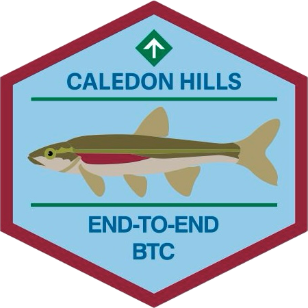
Caledon Hills End-to-End & Fall Trail Audit
https://hikes.brucetrail.org/event/caledon-hills-end-to-end-fall-trail-audit/Sorry, the registration cut-off time for this hike has been reached.Not a member? Click here to join today!This is a Multi-Day Hike
You are signing up for the following dates:
2025-09-02, 2025-09-03, 2025-09-04Hosting Club: Caledon Hills
Category: End-to-End
Location (Google Maps): Meet at BTC parking on the east side of the 5th Line EHS, just south of Hockley Road, 43.993572, -80.014057.Directions: From Hwy #10 head east on Hockley Road for 9.4 km. Turn right onto 5 Line E/5th Line EHS. Drive for 90 m. The parking lot is on the left.
Shuttle to Mono Community Centre Parking Lot, 44.026195, -80.071516
Hike Leader(s): Sandy Green Click here to contact Hike Leader(s)
Pace: Brisk – 4 to 5 km/hour
Terrain: Strenuous – hilly with steep climbs and some poor footing
Distance: 21.5 kilometresDescription
Earn the new Redside Dace End-to-End badge in three hikes. This series follows the Club’s Fall Colour’s E2E plan, with a couple of distance modifications. The hikes provide an opportunity to audit and prepare the Trail before the Thanksgiving event. Bring gardening pruners if you have them. Periodically, the group will quickly trim back overgrown vegetation. Pack sufficient water and snacks to boost your energy.Hike 1 – Hike southbound from Mono Community Centre south to km 51.7/Access to Hemlock Ridge ST. Distance: approximately 21.5 km
Hike 2 – Hike northbound from km 0.0/Creditview Road to approx km 26/Mountainview Road. Distance: approximately 26 km
Hike 3 – Hike northbound from km 26/Mountainview Road to km 51.7/Access to Hemlock Ridge ST. Distance: approximately 26 km
Up-to-date details will be provided to participants closer to the dates due to a trail reroute in the Mountainview Road area in the spring.
8:00 Long Hike Wiley Road Short Hills
https://hikes.brucetrail.org/event/800-long-hike-wiley-road-short-hills-11/Sorry, the registration cut-off time for this hike has been reached.Not a member? Click here to join today!Hosting Club: Niagara
Location (Google Maps):
Short Hills Wiley Road Entrance
Pace: Medium
Terrain: Moderate
: 10kmDescription
Explore Short Hills and the majestic side trails of Scarlett Tanager, Hemlock. Swayze Falls and Terrace. Register for each hikeBring Poles, Sun Screen Bug Spray, snack, and dress for the weather
Urban Walk: Valley View Park Thornhill
https://hikes.brucetrail.org/event/urban-walk-valley-view-park-thornhill-98/Sorry, the registration cut-off time for this hike has been reached.Not a member? Click here to join today!Hosting Club: Toronto
Location (Google Maps): Parking lot is off Sycamore Drive East of Bayview , across Starbucks plaza
Bus 91 from Finch east station stops at Sycamore station.Hike Leader(s): Mohammad Aghamiri Click here to contact Hike Leader(s)
Pace: Moderate (3-4 km/hr)
Terrain: Hilly, Level 2 (Intermediate – some hills and uneven surfaces, rocks and roots underfoot), Variable
Distance: 6-7 kmDescription
We will explore Valleyview and Maple View parks, and walk along German Mill Creak, in return we stop in Huntington park and have snack under beautiful shed ,Even it is considered Urban walk, it is urban hike as we have some up and down hills and tree roots, please bring your hiking poles, water and snacks,
phone number for the day of hike 289 588 6482
9:15 Short hike - Pelham Road, Short Hills
https://hikes.brucetrail.org/event/915-short-hike-pelham-road-short-hills-13/Sorry, the registration cut-off time for this hike has been reached.Not a member? Click here to join today!Hosting Club: Niagara
Category: Loop
Location (Google Maps): Pelham Road entrance, Short Hills Provincial ParkHike Leader(s): janet davey Click here to contact Hike Leader(s)
Pace: Medium
Terrain: Moderate
Distance: 6 kmsDescription
Hike the main and sidetrails in Shorthills Provincial Park. Please wear hiking boots, bring water and insect repellant. Check yourself for ticks following the hike.Mono Centre, Turnbull, Springwater, Third Outlier and Whitetail Refuge Side Trails
https://hikes.brucetrail.org/event/mono-centre-turnbull-springwater-third-outlier-and-whitetail-refuge-side-trails/Sorry, the registration cut-off time for this hike has been reached.Not a member? Click here to join today!Hosting Club: Dufferin Hi-Land
Category: Tuesday Hike
Location (Google Maps):Caledon Hills Section, Map 19. Meet at Mono Community Centre hiker parking area.
Hike Leader(s): Inge Eckerich, Les Babbage, Inge Eckerich, Julie Daley, Tony Evangelista Click here to contact Hike Leader(s)
Pace: Leisurely
Terrain: Slippery and Steep Sections, Moderate
Distance: 6.0 Km, Short hike 3.5 kmDescription
We will hike the Main trail to Turnbull Side Trail and Springwater Side Trail. The short hike will return to parking lot by Main Trail. Longer hike will continue south on Main Trail to the newly opened Third Outlier Side Trail, connecting to the Whitetail Refuge Side Trail and returning to parking by way of the Laidlaw Side Trail. Bring water and snacks.Mono Cliffs, Map 19
https://hikes.brucetrail.org/event/mono-cliffs-map-19-2/Sorry, the registration cut-off time for this hike has been reached.Not a member? Click here to join today!Hosting Club: Caledon Hills
Category: Tuesday Hikers
Location (Google Maps): Mono Community Centre Parking, 200 m south of Mono Centre. Free in the gravel surface lot. do not park on the paved surface.
Driving direction: From Highway 410 go north, continue on Highway 10, pass through Orangeville, continue to Mono Centre Rd. (8), turn right, road will merge with 2nd Line EHS north, parking on the right just before Mono Centre.Hike Leader(s): Mohammad Shafiq Click here to contact Hike Leader(s)
Pace: Medium – 3 to 4 km/hour
Terrain: Moderate – some hills and/or some poor footing
Distance: 12 – 13 kmDescription
Will hike main Bruce Trail, South Outlier, Walter Tovell, McCarston’s Lake and Lookout Side Trails.
Bring water, snack, bug spray and sun protection. Poles recommended.Maple Cross Ridge Nature Reserve Kemble Loop hike
https://hikes.brucetrail.org/event/maple-cross-ridge-nature-reserve-kemble-loop-hike/Sorry, the registration cut-off time for this hike has been reached.Not a member? Click here to join today!Hosting Club: Sydenham
Category: General Hike
Location (Google Maps): Kemble Arena
401297 Kemble Rock Road
Kemble, ON
N0H1S0Hike Leader(s): Cindy Paczkowski Click here to contact Hike Leader(s)
Pace: Medium: 3 to 4 km/h
Terrain: Moderate: Some hills and/or poor footing, Strenuous: Hilly with steep climbs and some poor footing., There might be muddy sections., There might be sections with water on the trail.
Distance: 10 kmDescription
We will carpool from the Kemble arena to the parking at the Edmonstone side trail on map 34. From there we head NW on the side trails to meet the white blazed Bruce trail through to the Don Richards side trail. We loop back to the parking via Mystery cabin side trail and Maple Cross Ridge side trails then back onto the white blazed trail to the parking. Please wear sturdy shoes/boots and clothing that will protect you from insects and possible poison ivy. - 03September 3, 2025
Beaver Valley Geology Badge Hike #6/8 Wodehouse Karst (Southern Route)
https://hikes.brucetrail.org/event/beaver-valley-geology-badge-hike-6-8-wodehouse-karst-southern-route/Sorry, the registration cut-off time for this hike has been reached.Not a member? Click here to join today!Hosting Club: Blue Mountains
Category: Organized Hike
Location (Google Maps): Tim Hortons, First Street, CollingwoodHike Leader(s): Annette Sandberg Click here to contact Hike Leader(s)
Pace: Medium – 3 to 4 km/hr
Terrain: Moderate – Some hills and/or some poor footing
Distance: 8.8Description
Wodehouse Karst (Southern Route): Rock Outcrop in Bowles Gully at Stop 9 (Pages 98-100) At Bowles Gully two Escarpment rock layers – the Amabel Dolostone and the Manitoulin Dolostone – outcrop along the sides of the steep ski hill.WEDNESDAY WALKERS - Stew Hilt's Side Trail
https://hikes.brucetrail.org/event/wednesday-walkers-stew-hilts-side-trail-2/Sorry, the registration cut-off time for this hike has been reached.Not a member? Click here to join today!Hosting Club: Beaver Valley
Location (Google Maps): Meet in the parking lot at the end of Johnston’s Side Road off of Grey Road 32, km 74.3, Map 26, Edition 31
Hike Leader(s): Margaret Yaraskavitch Click here to contact the hike leader.
Pace: Medium
Terrain: Moderate, Some rocky footing, Some steep sections
Length of Hike: 5.9 kmDescription
This hike takes us through BTC protected land. We will walk through a mature deciduous forest on the Main Trail and then we’ll walk the Stew Hilt’s Side Trail. Crossing a stream, we reach a waterfall, usually trickling in the fall. Our route will have us return on the higher Main Trail which provides a beautiful view of the Cuckoo Valley.Guidelines:
- Arrive 15 minutes before the start of the hike.
- Wear sturdy footwear and appropriate attire for the weather and the terrain.
Hiking poles are a good idea in any season, especially if the terrain is rocky or slippery. In winter, snowshoes or icers/crampons are needed when conditions dictate.
Wearing appropriate clothing and footwear prevents injuries and shows consideration for a safe and positive group hiking experience. - Always carry I.D. and your health card.
- Bring sufficient water and snacks (or lunch if indicated). A minimum of 1L of water is recommended on all hikes, and 3L is recommended for long, challenging hikes in the heat of the summer.
- Bring sunscreen and insect repellent (for spring and summer hikes).
- Bring your own first aid kit.
- Please leave dogs at home.

Hilton Falls (reservation required)
https://hikes.brucetrail.org/event/hilton-falls-reservation-required-2/Sorry, the registration cut-off time for this hike has been reached.Not a member? Click here to join today!Hosting Club: Iroquoia
Category: General Hike
Location (Google Maps): Meet in the parking lot at Hilton Falls Conservation Area at 9:15 am.Hike Leader(s): Karen Bergmann Click here to contact Hike Leader(s)
Pace: Medium – 3 to 4 km/hr
Terrain: Moderate – Some hills and/or some poor footing
Distance: 8 kmsDescription
We will hike to the Falls and then around to Bent Rim 1 and back to the cars. Reserve your time at conservationhalton.caEvening Hike in Owen Sound followed by an Opportunity for Refreshments
https://hikes.brucetrail.org/event/evening-hike-in-owen-sound-followed-by-an-opportunity-for-refreshments-18/Sorry, the registration cut-off time for this hike has been reached.Not a member? Click here to join today!Hosting Club: Sydenham
Category: An evening walk.
Location (Google Maps): Meet in the municipal parking lot by the river on the west side of 1st Ave E between 7th St E and 8th St E in Owen SoundHike Leader(s): Harriet Nixon Click here to contact Hike Leader(s)
Pace: Brisk: 4 to 5 km/h
Terrain: Moderate: Some hills and/or poor footing
Distance: Approx 6 kmDescription
Join us for a brisk summer`s evening hike exploring Owen Sound paths and neighbourhoods, followed by an opportunity for refreshments. There is no need to show up 15 minutes early for this hike, but we will leave promptly at 7:00 pm - 04September 4, 2025
8:00 am Long Hike Cave Spring Conservation Area
https://hikes.brucetrail.org/event/800-am-long-hike-cave-spring-conservation-area-10/Sorry, the registration cut-off time for this hike has been reached.Not a member? Click here to join today!Hosting Club: Niagara
Location (Google Maps):
Cave Spring Conservation Area
Pace: Medium
Terrain: Moderate
: 10kDescription
This will be our permanent Thursday Location until Bridge repairs complete. From Cave Spring Conservation Area explore the trail network on the escarpment towards Kinsman Park and Moyer Road.You must register for each hike. Bring Poles, snack bug spray, sunscreen and a drink. Dress for the weather
Urban Walk: Valley View Park Thornhill
https://hikes.brucetrail.org/event/urban-walk-valley-view-park-thornhill-99/Sorry, the registration cut-off time for this hike has been reached.Not a member? Click here to join today!Hosting Club: Toronto
Category: Urban Walk
Location (Google Maps): Parking lot is off Sycamore Drive East of Bayview , across Starbucks plaza
Bus 91 from Finch east station stops at Sycamore station.Hike Leader(s): Mohammad Aghamiri Click here to contact Hike Leader(s)
Pace: Moderate (3-4 km/hr)
Terrain: Hilly, Level 2 (Intermediate – some hills and uneven surfaces, rocks and roots underfoot), Variable
Distance: 7-8 kmDescription
We will explore Valleyview and Maple View parks, and walk along German Mill Creak, in return we stop in Huntington park and have snack under beautiful shed ,Even it is considered Urban walk, it is urban hike as we have some up and down hills and tree roots, please bring your hiking poles, water and snacks,
phone number for the day of hike 289 588 6482
Hiking around Jordan
https://hikes.brucetrail.org/event/hiking-around-jordan-30/Sorry, the registration cut-off time for this hike has been reached.Not a member? Click here to join today!Hosting Club: Niagara
Category: Hike
Location (Google Maps): 3649 Glen Road, Lincoln LOR 1SOHike Leader(s): Bill Russell Click here to contact Hike Leader(s)
Pace: Medium
Terrain: Moderate
Distance: 6 kmsDescription
Hike the trails around Jordan including Balls Fall or Jordan Village - 05September 5, 2025
9:00 am Niagara on the Lake Tour & Some Yoga
https://hikes.brucetrail.org/event/900-am-niagara-on-the-lake-tour-some-yoga-5/Sorry, the registration cut-off time for this hike has been reached.Not a member? Click here to join today!Hosting Club: Niagara
Category: Urban
Location (Google Maps):Veteran’s Memorial Park, park just outside the park on King St.
Hike Leader(s): Robin Garrett Click here to contact Hike Leader(s)
Pace: Medium
Terrain: Easy
Distance: 6 kmDescription
Enjoy the benefits of pausing for a yoga practice as we tour through the trails, parkland and Historic Niagara-on-the-Lake. No mat required. Movement will focus on a flow of standing poses designed especially for hikers. Plan to stay for conversation and a warm cup of coffee or tea at Sweets & Swirls, Community Centre, Niagara Stone Road, NOTL. - 06September 6, 2025

One Day Toronto End-to-End Event (participants hike independently, no hike leader)
https://hikes.brucetrail.org/event/one-day-toronto-end-to-end-event-participants-hike-independently-no-hike-leader/Sorry, the registration cut-off time for this hike has been reached.Not a member? Click here to join today!Hosting Club: Toronto
Category: Annual TBTC E2E
Location (Google Maps): On Saturday September 6, hike the entire Toronto section of the Bruce Trail north to south, of just over 50km.Hike Leader(s): Jacquie Van Dyke Click here to contact Hike Leader(s)
Pace: Brisk (4-5 km/hr), Fast (5 km/hr or greater)
Terrain: Challenging
Distance: 50.4 kmDescription
Come test your grit on our 1 day E2E which will be held on Saturday Sept. 6, 2025. Cost for members is $40 which includes bus transportation from Hilton Falls CA to the south end of Cheltenham Badlands (where you will begin your hike), online registration fees, parking in Hilton Falls CA, and the official one day E2E badge. We will be offering snacks and water every 10-11km. Any available spots left on June 23 will be opened to non-members at a cost of $45. This is a long, strenuous hike suitable for experienced, fast paced hikers. Hikers are expected to to maintain a minimum pace of 4km/hr and must reach each checkpoint by a prescribed time in order to continue to ensure everyone is off the trail before dark. Meet at the Hilton Falls CA entrance gate at 5:30 am (Gate will be opened early for us). The bus will leave the parking lot at 6:00 am promptly to bring you to your starting point at km 50.4 where you will begin hiking back to your vehicle.Based on the hike beginning at 6:45am, hikers must reach checkpoint 1 at km 38.8 (11.6km) by 9:30 am, checkpoint 2 at km 27.8 (11.1km) by 12:15 pm, checkpoint 3 at km 17.4 (10.4 km) by 2:45 pm, checkpoint 4 at km 8.9 (8.5 km) by 5:00 pm to continue. Bring your fully charged cell phone, basic 1st aid supplies, and a water bottle.
Space is limited, hikes go rain or shine, and no dogs are welcome. Hikers over the age of 16 are permitted on this event. There will be no refunds or tax receipts issued for anyone who cancels their registration. For specific questions, please contact Jacquie Van Dyke at vdyke0946@gmail.com. Registration closes at midnight on August 31, 2025.

Two Day Toronto End-to-End Event (participants hike independently, no hike leader)
https://hikes.brucetrail.org/event/two-day-toronto-end-to-end-event-participants-hike-independently-no-hike-leader/Sorry, the registration cut-off time for this hike has been reached.Not a member? Click here to join today!This is a Multi-Day Hike
You are signing up for the following dates and times:
2025-09-06 at 07:30
2025-09-07 at 07:30Hosting Club: Toronto
Category: Annual TBTC E2E
Location (Google Maps): The Toronto Bruce Trail section which runs from just south of Hilton Falls CA on Appleby Line to the south entrance of the Cheltenham Badlands on Creditview Rd. On both days, we will meet in the community parking lot in the village of Limehouse (GPS Coordinates 43.638154, -79.979152), 11139 22nd Side Road, below the school.Hike Leader(s): Jacquie Van Dyke Click here to contact Hike Leader(s)
Pace: Brisk (4-5 km/hr), Fast (5 km/hr or greater)
Terrain: Challenging
Distance: Saturday, Sept. 6 – 28km, Sunday, Sept 7 – 22kmDescription
Hike the Toronto section of the Bruce Trail over two days. Hikers must maintain a minimum pace 0f 4km/hr and reach the checkpoints by the cutoff time in order to continue. On Saturday, the bus will take hikers from Limehouse to the south entrance of the Cheltenham Badlands where the hike will begin. Hikers will hike south to their vehicles in Limehouse – a distance of approximately 28 km. Hikers will reach checkpoint 1 at km 38.8 (11.6 km) by 11:00 am and checkpoint 2 at km 27.8 (11.0 km) by 1:45 pm to continue. On Sunday, the bus will take hikers again from Limehouse, to km 0.0 on Appleby Line where the hike will begin. Hiking north to Limehouse, hikers must reach checkpoint 1 at km 11.4 in the Pear Tree parking lot by 11:00 am to continue. Water refill and snacks will be available at the checkpoints. Bring your fully charged cell phone, basic 1st aid supplies, and a water bottle.Those who complete the distances on both days will receive the special 2 Day Club E2E badge. The registration fee includes the online registration fee, bus shuttle, and the official E2E badge. If any spots are still available at 9:00 am on Monday June 23, registration will also be opened for non-members (child and adult) at a cost of $65. These are strenuous hikes suitable for experienced, long distance, fast paced hikers. Space is limited, hikes go rain or shine, and no dogs are permitted on this event. Hikers must find their own way each morning to the meeting point in Limehouse. There will be no refunds or tax receipts issued for anyone who cancels their registration. For questions, please contact Jacquie Van Dyke at vdyke0946@gmail.com. Registration closes at midnight on August 31, 2025. On September 1, an email will go out to all participants with the exact parking location. It will be in Limehouse.

Peninsula ETE Fundraiser Hike - Badge Hike - 8 Straight Days - Sept 6-13/25 - 7:45am Please read all details before registering for this hike.
https://hikes.brucetrail.org/event/peninsula-ete-fundraiser-hike-sept-7-14-25-745am-please-read-all-details-before-registering-for-this-hike/Sorry, the registration cut-off time for this hike has been reached.Not a member? Click here to join today!This is a Multi-Day Hike
You are signing up for the following dates and times:
2025-09-06 at 07:45
2025-09-07 at
2025-09-08 at
2025-09-09 at
2025-09-10 at
2025-09-11 at
2025-09-12 at
2025-09-13 atHosting Club: Iroquoia, Peninsula
Category: Stained Glass Badge End to End Fundraiser Hike
Location (Google Maps):Bluewater Park – across from the arena in Wiarton
Hike Leader(s): Ruth Moffatt Click here to contact Hike Leader(s)
Pace: Brisk – 4 to 5 km/hr
Terrain: Dependent on Conditions, Moderate – Some hills and/or some poor footing, Strenuous – Hilly with steep climbs and some poor footing
Distance: 165km over 8 days ~ 20km – 25 km+ per day.Description
OverviewImportant – Please do not register for this hike unless you are sure you can attend all 8 days. You may only miss 1 day if you have to.
This is a special series of 8 hikes to complete the Peninsula section of the Bruce Trail. The organization, guidance, logistics and the Turkey Vulture stained glass badge is included in your fee which is non-refundable. (You may swap out the stained-glass badge for the regular end to end badge) Proceeds support the Peninsula Bruce Trail Club which in turn supports the Bruce Trail Conservancy mission to “Preserving a ribbon of wilderness, for everyone, forever.”For this E2E in 8, we will be following the main trail northbound eventually finishing in Tobermory. Please note that you are signing up for the entire series of 8 hikes as a Group Hike. The Peninsula in 8 series is geared to experienced long distance hikers with the expectation of a 3 to 5.0 km/ hr. pace maintained over a 20km plus day. The section is approximately 165km so daily distances will be based on available parking. No dropout points have been established and therefore hikers who must drop out, will be responsible for their own transportation back to their vehicle. Please note that public transportation back to your vehicle is basically non-existent in this section. Please be honest about your hiking abilities. We will hike at a steady pace but there will be plenty of time to take pictures and to enjoy the flora and fauna of this beautiful but challenging section. This particular set of 8 hikes is intended to be Moderate/Brisk. It is a group hike so it is important you are able to keep pace with the person in front of you.
Attire and Daily Hikes.
Hikers will be expected to be wearing proper hiking boots and layered clothing with the expectation of cool and possible wet weather. Sufficient food and water for a full day of hiking is required as well as hiking poles (if you use them), and wet weather gear is strongly recommended. Bug spray is also suggested. Clothing adjustments, bio-breaks are as needed. Please let the sweep person know and they will wait for you. A morning break around 10am and a 10-15 minute on-trail lunch break will be scheduled. An afternoon break will be based on our expected finish time. Depending on weather conditions, these times may vary. Everyone must carry a First Aid kit.
Since this is an end to end that would normally be held over 10 days, please do not sign up for this hike if you need to miss any of the days. It is 8 straight days and your attendance is needed in each of the days for sharing of car shuttling. One day may be made up if you absolutely must miss a day.
All participants will be expected to take turns either driving to the start or driving the drivers back at the end of the day. Carpooling to our meeting spot with 2 people in the car is generally ok but we would like to minimize and equalize the driving/shuttling as much as possible so it is fair for all participants.
Parking Fees
Some parking locations require paid parking, and hikes that enter Bruce Peninsula National Park. The fee for this E2E-in-8 does not include any parking/entry fees for hikers. These costs, where applicable, will be shared amongst all participants unless you have a parking or park pass.
Leave No Trace
Please remember, like all hikes, this is a Leave No Trace hike. Pack out whatever you pack in. Do not toss anything onto or into any sections of the trail. We will also try to leave the trail better than we found it so we will be collecting collectable garbage we might see along the way. Daily volunteers to collect trail trash will be supplied with a bag. Dogs will not be welcome on this hike.
Accommodations
It is strongly recommended you make reservations for accommodations as soon as you register for the hike. Accommodations can be made anywhere in the Peninsula but I recommend staying in Lion’s Head which is about mid-way of the section. There is a motel, a campground and several B&B’s. Moving from accommodation to accommodation, while in the Peninsula, is doable but generally not recommended. If you would like a roommate, I can share your email with any other registered participants who are also looking for shared accommodations. Please let me know.
Daily
We meet for each hike by at least 7:45am each day. A schedule for meeting and start locations will be sent to each participant in May. We will hike northerly each day. The schedule is subject to change.
Accommodation Check in is Sept 5 – first day of hiking is Sept 6. Checkout Sept 13 or 14 – last day of hiking is Sept 13.
Car Hike: Jefferson Forest and Bond Lake (Richmond Hill)
https://hikes.brucetrail.org/event/car-hike-jefferson-forest-and-bond-lake-richmond-hill-4/Sorry, the registration cut-off time for this hike has been reached.Not a member? Click here to join today!Hosting Club: Toronto
Category: Car Hike
Location (Google Maps):1245 Bethesda Side Rd, Richmond Hill, ON L4E 1A2 ( Bethesda Trail Head Parking lot)
Hike Leader(s): Amir Alemohammad Click here to contact Hike Leader(s)
Pace: Moderate (3-4 km/hr)
Terrain: Hilly, Level 2 (Intermediate – some hills and uneven surfaces, rocks and roots underfoot), Variable
Distance: 13-14 kmDescription
Join us for a wonderful hike in Jefferson Forest and have a snack/lunch beside the Bond Lake. We will hike among tall trees and bushes of the Jefferson Forest and across the Bayview-Yonge corridor to reach to the Bond Lake. Boots mandatory, poles recommended, bring at least 2L of water, bug spray, sunscreen, snack/lunch and dress according to the weather conditions. Please avoid parking along the road. Difficulty Level: 2 (Moderate)Please arrive @7:45 AM for start of 8:00AM.
This is a joint hike with the Oak Ridges Trail Association (ORTA).
8:30 Louth to Swayze Falls via new bridge at Rockway
https://hikes.brucetrail.org/event/830-louth-to-swayze-falls-via-new-bridge-at-rockway/Sorry, the registration cut-off time for this hike has been reached.Not a member? Click here to join today!Hosting Club: Niagara
Category: In and Out
Location (Google Maps): Louth Conservation Parking lotHike Leader(s): Lauren Doig Click here to contact Hike Leader(s)
Pace: Brisk
Terrain: Strenuous
Distance: 18-20 kmDescription
Meet at Louth Conservation Parking lot on Staff Avenue and head towards Swayze Falls, using a mix of side and main trails. En route, we will check out the new bridge crossing the lower falls at Rockway. Bring water and a snack.Car Hike: Cherry Beach Downtown
https://hikes.brucetrail.org/event/car-hike-cherry-beach-downtown/Sorry, the registration cut-off time for this hike has been reached.Not a member? Click here to join today!Hosting Club: Toronto
Category: Car Hike
Location (Google Maps): Free parking at the end of Cherry street TorontoHike Leader(s): Mohammad Aghamiri Click here to contact Hike Leader(s)
Pace: Moderate (3-4 km/hr)
Terrain: Flat, Level 2 (Intermediate – some hills and uneven surfaces, rocks and roots underfoot)
Distance: 12-14 kmDescription
We will walk along lake Ontario, visiting ponds ,swans and light house
• Please dress appropriately for the weather.
• We will have short water ,picture,Bio and a 15 minute snack breaks. Everyone is welcome!8:30am Niagara Shores Park Beachcoming Hike
https://hikes.brucetrail.org/event/830am-niagara-shores-park-beachcoming-hike-2/Sorry, the registration cut-off time for this hike has been reached.Not a member? Click here to join today!Hosting Club: Niagara
Category: Loop
Location (Google Maps):Corner of Niven Road and Lakeshore Road in Niagara-on-the-Lake. Park along Old Lakeshore Road.
Hike Leader(s): Suzanne Gourluck Click here to contact Hike Leader(s)
Pace: Leisurely
Terrain: Moderate
Distance: 5-6kmDescription
Explore a lakeshore park, shoreline and cliff top trail in Niagara-on-the-Lake. This beachcombing hike involves uneven ground, clambouring over fallen trees, a pebbly beach, sandy, wet and exposed areas. Hat and poles are highly recommended. Please note: This is not a maintained trail so caution is needed.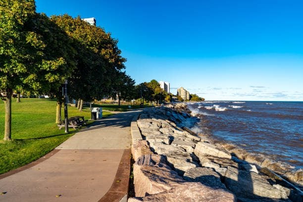
Burlington Waterfront
https://hikes.brucetrail.org/event/burlington-waterfront/Sorry, the registration cut-off time for this hike has been reached.Not a member? Click here to join today!Hosting Club: Iroquoia
Category: General Hike
Location (Google Maps): Brant Street and Lakeshore Road Burlington.Hike Leader(s): Dale Skvereckas Click here to contact Hike Leader(s)
Pace: Medium – 3 to 4 km/hr
Terrain: Easy – Mostly flat and usually good footing
Distance: 6 – 6.5 kmDescription
We will meet at 9:15 a.m. for a 9:30 start. There are several municipal parking lots in the area and some street meter parking allows all day parking. Park near Brant Street and Lakeshore Road. Meet outside (to the right) of the Waterfront Hotel (Brant and Lakeshore) by the stairs leading to the water. We will walk out to the Brant Street Pier then along the waterfront trail, passing Spencer Smith Park, the Naval Veterans Walkway, 1 km of beach (during this hike we will not have time for a swim; perhaps another time), and continue to the Burlington Canal Bridge before turning back. The route along the shoreline of Lake Ontario is lovely. Hiking poles are not necessary however if you use them bring them. Please wear proper footwear (no open toe shoes). Bring a hat, sunglasses, sunscreen, bug spray, water, and a snack. Bring a jacket as it might be cool along the water. If you have a story of Burlington, a joke, or an interesting hiking adventure bring that with you to share with the group. After the hike you can explore the many downtown shops, cafes and restaurants. No dogs please.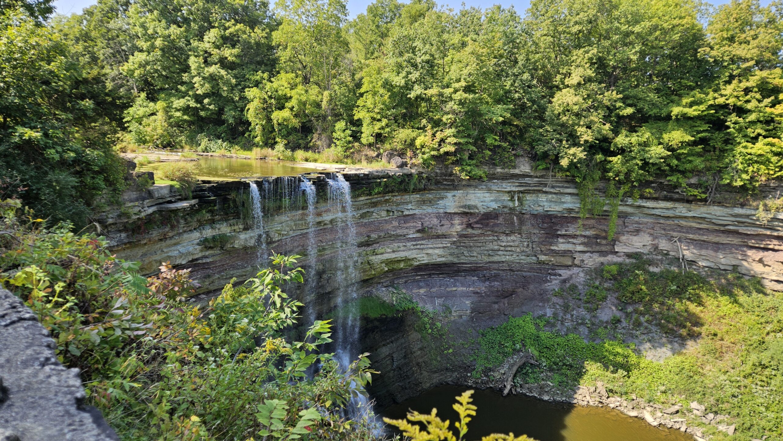
#4/5 Niagara Bruce Trail End-to-End - 18 KM
https://hikes.brucetrail.org/event/4-5-niagara-bruce-trail-end-to-end-18-km/Sorry, the registration cut-off time for this hike has been reached.Not a member? Click here to join today!Hosting Club: Toronto
Category: Car Hike
Location (Google Maps): Parking Area at Louth Conservation AreaHike Leader(s): Alina Lin
Pace: Brisk (4-5 km/hr)
Terrain: Challenging, Hilly, Level 2 (Intermediate – some hills and uneven surfaces, rocks and roots underfoot), Variable
Distance: 18 kmDescription
The Niagara region is one of Canada’s most productive fruit-growing areas. Strolling along country roads lined with farms and orchards, you’ll see ripe peaches, plums, and grapes hanging from the trees and smell the sweet fragrance of the harvest in the air—you’ll truly understand why it’s called a Fruit Paradise. To make the most of the short harvest season, let’s hike the Niagara section of the Bruce Trail and if you are interested, visit local farms afterward—perhaps even enjoy some fruit picking!This is the fourth of a five-hike End-to-End series covering the entire Niagara section of the Bruce Trail. The full section stretches over 80 kilometers from Niagara-on-the-Lake to Grimsby. I am using Map Edition 29, so please note that kilometer markings may not be fully up to date, and actual hiking distances may vary slightly.
Meeting Point:
Roadside parking lot at KM 49.3. Please arrive before 9:15 AM to allow time for car shuttle coordination.
GPS: N43.121706, W79.351235. Parking Area at Louth Conservation Area. Enter from Staff Ave, Louth, 500 m north of Pelham Rd (Regional Rd 69).We will car shuttle to the starting point of the hike at KM66.9
GPS:N43.146108, W79.475609. Enter from Hixon St at the intersection of Kinsmen Rd and Frost Rd.The group will then hike from KM66.9 back to KM49.3.
All drivers are expected to participate in the car shuttle, either before or after the hike.Important Notes:
- Wear sturdy hiking boots and dress appropriately for the weather
- Bring bug spray (mosquitoes may be present)
- Bring snacks, lunch, and at least 2L of water
- No dropouts available.
- No pets .
GO Train Hike: Coote's Paradise/Hamilton Waterfront Trail
https://hikes.brucetrail.org/event/go-train-hike-cootes-paradise-hamilton-waterfront-trail/Sorry, the registration cut-off time for this hike has been reached.Not a member? Click here to join today!Hosting Club: Toronto
Category: GO Train Hike
Location (Google Maps):Hike will start from McMaster University GO Bus Terminal. We will meet at Toronto’s Union Station 8:30 AM to take the 8:47 AM Train to Aldershot where we will transfer to the GO Bus for a short ride to McMaster University. On the return we take the GO Train to Toronto from West Harbour GO Train Station. If you have a smart phone then the return fare is just $10 with GO’s Weekend Pass. Seniors fare return from Union is about $11.44. If meeting us at McMaster you will have to make your way back to start by local transit or Uber and parking fee would apply.
Hike Leader(s): Tom Swales Click here to contact Hike Leader(s)
Pace: Moderate (3-4 km/hr)
Terrain: Hilly, Level 2 (Intermediate – some hills and uneven surfaces, rocks and roots underfoot), Variable
Distance: 12-13 kmDescription
This will be a one way hike through the trails of the RBG’s (Royal Botanical Gardens) South Shore Cootes Paradise Trails to Princess Point and then continuing on Hamilton’s Waterfront Trail along Burlington Bay to Bayfront Park which is a 7 minute walk to the West Harbour GO Station. Cootes Paradise is the largest and most diverse of RBG’s sanctuaries. Nestled between the Niagara Escarpment and Lake Ontario the picturesque area is significant as a migratory bird flyover zone and home to a wide variety of flora and fauna. There will be a few hills including one steeper one.
7:30 pm Sunset & Moonlight Night Hike in Niagara-on-the-Lake
https://hikes.brucetrail.org/event/730-pm-sunset-moonlight-night-hike-in-niagara-on-the-lake/Sorry, the registration cut-off time for this hike has been reached.Not a member? Click here to join today!Hosting Club: Niagara
Category: Night
Location (Google Maps):Veteran’s Memorial Park, park just outside the park on King St.
Hike Leader(s): Robin Garrett Click here to contact Hike Leader(s)
Pace: Medium
Terrain: Easy
Distance: 6-7 kmDescription
Moonlight Night Hike – Take in the magic of the rising moon over Lake Ontario and the Niagara River. This hike includes a stop to connect with your senses – sights, sounds, smells and the rhythm of your breath. Counts towards your night hike badge (5 night hikes).