Categories
- 26July 26, 2025
Sydenham Stained Glass Badge E2E Weekend Hikes
https://hikes.brucetrail.org/event/sydenham-stained-glass-badge-e2e-weekend-hikes/Sorry, the registration cut-off time for this hike has been reached.Not a member? Click here to join today!This is a Multi-Day Hike
You are signing up for the following dates:
2025-07-26, 2025-07-27, 2025-08-02, 2025-08-03, 2025-08-09, 2025-08-10, 2025-08-16, 2025-08-17Hosting Club: Caledon Hills, Sydenham
Category: End-to-End
Location (Google Maps): Parking lot off of 6th Concession Road 6 S. GPS location (44.509124, -80.810665)Hike Leader(s): Lily Li Click here to contact Hike Leader(s)
Pace: Brisk – 4 to 5 km/hour, Medium – 3 to 4 km/hour
Terrain: Moderate – some hills and/or some poor footing, Strenuous – hilly with steep climbs and some poor footing
Distance: 21 kmDescription
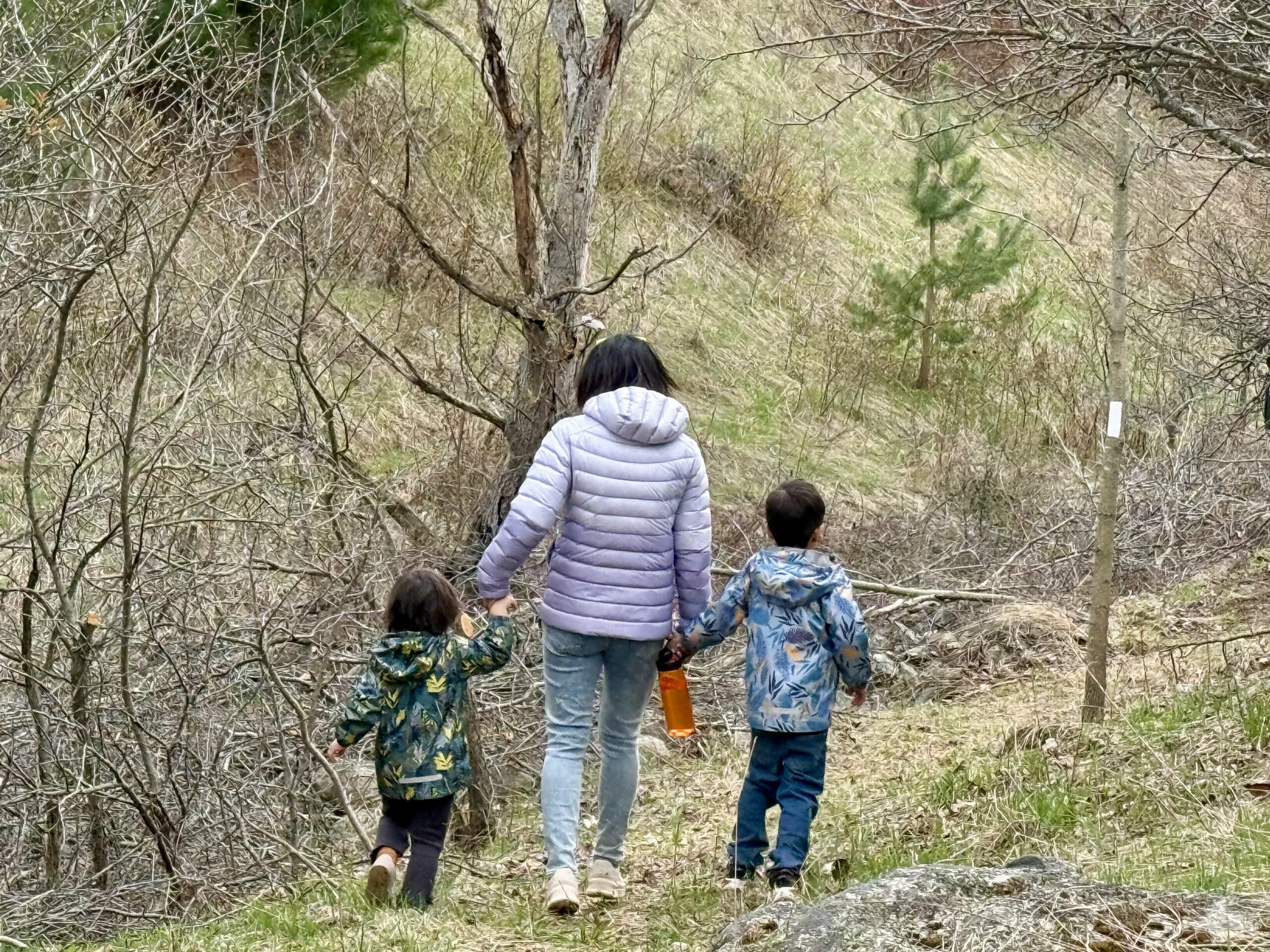
Earn the Hart’s Tongue Stained Glass / Fundraiser badge, which is part of the collectible Bruce Trail Clubs stained glass-themed fundraiser set. This is a special series of 8 hikes in 4 weekends to complete the Sydenham section of 166 km. Hike distances range from 18 to 23 km each day with about a 3-5 km/hour pace. The hike is intended to be moderate to brisk.Please dress according to the weather presented that day. Bring at least 2 litres of water and electrolytes, lunch, snack, hat, sunscreen and bug spray for the long day of hiking.
This is a car shuttle hike. Please have your vehicle ready, as everyone will take a turn either to drive to the start point of our hike or to get our drivers back to the start point at the end of the day.
A detailed hiking plan will be shared with registered hikers later.
Car Hike: Hockley Rd. to 4th Line EHS
https://hikes.brucetrail.org/event/car-hike-hockley-rd-to-4th-line-ehs/Sorry, the registration cut-off time for this hike has been reached.Not a member? Click here to join today!Hosting Club: Caledon Hills
Category: End-to-End
Location (Google Maps): Hockley Rd. parking area, east of km 61.1, located on the north side of Hockley Rd. at the Hockley Rd. Side Trail.Hike Leader(s): Dylan Hubbard Click here to contact Hike Leader(s)
Pace: Brisk – 4 to 5 km/hour
Terrain: Strenuous – hilly with steep climbs and some poor footing
Distance: 13.5 kmDescription
Join me for a grueling summer hike as we hike from the main parking lot on Hockley Rd. to 4th Line EHS and back. This will complete a 14.5 km loop.Pace will be brisk, make sure to pack a lunch, sunscreen and bug repellent, at least 2L of water and good hiking boots.
We will be taking our lunch at 11-11:30 depending on how the group feels.
If the weather permits, I’ll be going to the Hockley Valley Resort for food afterwards. Please feel free to join me for truffle fries and mocktails 🙂
Hike 4 Blue Mountain Series in 6 Hikes
https://hikes.brucetrail.org/event/hike-4-blue-mountain-series-in-6-hikes/Sorry, the registration cut-off time for this hike has been reached.Not a member? Click here to join today!Hosting Club: Dufferin Hi-Land
Category: General Hike
Location (Google Maps): Pretty River Rd just west of where the Bruce Trail crosses Pretty River Rd approximately Km 46.8Hike Leader(s): Patrcia Foley and Tristan Goguen Click here to contact Hike Leader(s)
Pace: Medium
Terrain: Moderate
Distance: 9.4 kmDescription
We will car pool back to the Lime Kiln access side trail parking lot. Today we will hike through the Nottawasaga Lookout Provincial Nature Reserve. We will have the opportunity to explore the Standing Rock and Caves side trails.We may encounter some muddy sections and will definitely be in open fields/roads for some time. Bug spray, sunblock and sturdy hiking shoes/boots are recommended. Bring sufficient water and lunch. Note this is a car pool hike, registration is limited and the hike leaders will have 2 dogs with them.
Car Hike: Boyd Conservation Park Vaughan
https://hikes.brucetrail.org/event/car-hike-boyd-conservation-park-vaughan-8/Sorry, the registration cut-off time for this hike has been reached.Not a member? Click here to join today!Hosting Club: Toronto
Location (Google Maps): Free parking lot before main entrance of park
Hike Leader(s): Mohammad Aghamiri Click here to contact Hike Leader(s)
Pace: Moderate (3-4 km/hr)
Terrain: Hilly, Level 2 (Intermediate – some hills and uneven surfaces, rocks and roots underfoot)
Distance: 14-15 kmDescription
Let’s hike Boyd conservation park trails through beautiful valleys.Please bring lots of water and snacks ,hiking poles are recommended
phone number for the day of hike 289 588 6482
Saturday Shorts at Meltwater Moraine Protected Natural Area
https://hikes.brucetrail.org/event/saturday-shorts-at-meltwater-moraine-protected-natural-area/Sorry, the registration cut-off time for this hike has been reached.Not a member? Click here to join today!Hosting Club: Caledon Hills
Category: General
Location (Google Maps): Meet at 17963 Mountainview Road. Park on the grass beside the driveway. Google Maps GPS Coordinates: 43.90027, -79.93036Directions:
From Highway #10, turn east onto Olde Base Line Road/Peel Regional Road 12. Drive for approximately 7 kilometres. Turn north/left onto Mountainview Road. Drive for approximately 8 kilometres. The driveway is on the right. Don’t be surprised by the old house and farm buildings on the property.Hike Leader(s): Sandy Green Click here to contact Hike Leader(s)
Pace: Leisurely – 3 km/hour or less
Terrain: Easy – mostly flat and usually good footing
Distance: 5 kilometresDescription
Enjoy exploring the newest Bruce Trail Conservancy Protected Natural Area in the Caledon Hills section – Meltwater Moraine. Bring snacks and beverages to keep you energized. Sturdy footwear is highly recommended. All are welcome!
Exploring Inglis Falls Conservation Area- in a Summer
https://hikes.brucetrail.org/event/exploring-inglis-falls-conservation-area-in-a-summer/Sorry, the registration cut-off time for this hike has been reached.Not a member? Click here to join today!Hosting Club: Iroquoia, Sydenham
Category: Good Companions
Location (Google Maps): Harrison Park Conservation Area – passing straight towards the gravel parking lot to far North. Alternatively you can park in the the main parking lot. Meeting point would be the Harrison Park Inn Restaurant -front.Hike Leader(s): Corina Seceleanu Click here to contact Hike Leader(s)
Pace: Medium – 3 to 4 km/hr
Terrain: Moderate – Some hills and/or some poor footing
Distance: 12.5 -13 KmDescription
Hello Fellow HikersPlease join me for a loop hike through Inglis Falls Conservation Area, starting from the parking lot and ending at Harrison Park. Our hike will begin on the side trail, heading clockwise toward Centennial Tower (though the tower is currently closed). Keep in mind that this section is the most challenging part of the loop—but the rewards are well worth the effort! Be prepared, as we will do a back-and-forth stretch for a small section (1.2km) in order to complete the loop.
From there, we’ll continue on the Palisade Side Trail, reconnecting with the Main trail. We’ll also explore the red and yellow Conservation Park trails, leading us to the breathtaking Inglis Falls. After taking in the views, we’ll follow the main trail to 2nd Ave Road, before looping back via the side trail to Harrison Park’s parking lot.
If time permits at the end of our hike, we can treat ourselves to a refreshing drink or an ice cream at Harrison Park Inn Restaurant—a well-deserved indulgence after an amazing adventure.
In my opinion, this section of the Sydenham is one of the most beautiful, secluded, and challenging part of the BTC trail—but ultimately, it’s incredibly rewarding.
Please bring with you – lunch, snack and min 2L of water and your medicine if you required.
Also be prepared for a hot day ( I imagine ) sunscreen, bug repelent, hat and appropiate attire for the hike, mostly sturdy hiking boots.
Just to reiterate – for the first 2.5-3 km hike is strenuous, with an ascent and a rugged terrain featuring boulders and exposed roots. It requires endurance, balance, and careful footing. But with the effort come rewards. After that the hike would be mostly leisurely, except some parts .
GO Train Hike: Nokiidaa Trail/Newmarket
https://hikes.brucetrail.org/event/go-train-hike-nokiidaa-trail-newmarket/Sorry, the registration cut-off time for this hike has been reached.Not a member? Click here to join today!Hosting Club: Toronto
Category: GO Train Hike
Location (Google Maps):East Gwillimbury GO Station (outside station building)
Hike Leader(s): Tom Swales, Felix Wan Click here to contact Hike Leader(s)
Pace: Moderate (3-4 km/hr)
Terrain: Flat, Level 1 (Easy – mostly on flat, well maintained trails with hard-packed surface)
Distance: 9 kmDescription
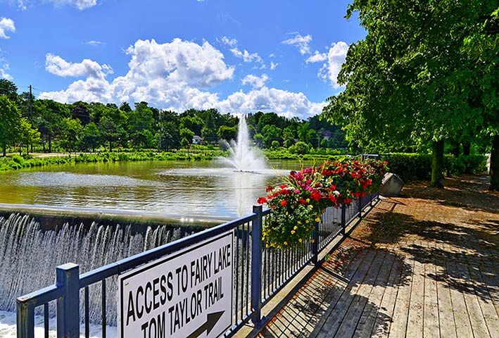
We will hike south from East Gwillimbury GO Station to Fairy Lake and historic Main Street in Newmarket. We will pass the remains of a swing railway bridge, the remains of an abandoned canal, and a diverse landscape. On the way there will be a stop at the Newmarket Farmers Market. The walking is easy south on this Level 1 Hike to Fairy Lake where we loop around the lake with a scenic boardwalk trail on the east side and paved path leading into the historic downtown of Newmarket. We’ll stop in the historic downtown for refreshments at the Old Flame Brewery or alternative establishments and walk up Main Street to get the 2:44 train back towards Toronto’s Union Station.Take advantage of the GO Transit $10 Day Weekend Pass available only on smartphones. Those wishing to travel together will meet at Union Station in the Great Hall by the information desk (with the clock over it) to take the GO Train towards Barrie departing at 8:52 AM. There is a second stop in Toronto at Downsview Park Station.
ROUTE MAP: https://onthegomap.com/s/507cjskh