Categories
- 20July 20, 2025

Steeltown Stomp Practice Session #1 of 10
https://hikes.brucetrail.org/event/steeltown-stomp-practise-session-1-of-10/Sorry, the registration cut-off time for this hike has been reached.Not a member? Click here to join today!Hosting Club: Iroquoia
Category: Steeltown Stomp Practice Session
Location (Google Maps): Meet at the Chedoke Golf Club parking lotHike Leader(s): Ruth Moffatt Click here to contact Hike Leader(s)
Pace: Brisk – 4 to 5 km/hr, Medium – 3 to 4 km/hr
Terrain: Strenuous – Hilly with steep climbs and some poor footing
Distance: VariesDescription
Is the Steeltown Stomp on your bucket list! Come join us! For anyone who has done stair climbing workouts, you will know what calf pain is like, especially when you first start. Want to get in shape of the Steeltown Stomp on October 4, 2025? Practise with us! We will start off easy and gradually build up our strength and stamina over the course of the summer. Climbing Chedoke staircase will be combined with a hike on most days. We will use both Chedoke and Dundurn Stairs as our practise stairs and buildup to at least 2,000 steps.Bring a reusable water bottle (there are fountains at the bottom of both Chedoke and Dundurn) and any snacks you may like. Pace will be moderate, but steady to begin. We will start with a warm up hike and finish with a cool down stretch. Post stomp coffee is optional .
It’ll be fun and will lessen the pain on the day of the event, promise!
Look for the other 9 dates on the schedule.

Car Hike: Exploring Uxbridge Trails (Wilder Forest, Walker Woods, and Glen Major Forest)
https://hikes.brucetrail.org/event/car-hike-exploring-uxbridge-trails-wilder-forest-walker-woods-and-glen-major-forest-13/Sorry, the registration cut-off time for this hike has been reached.Not a member? Click here to join today!Hosting Club: Toronto
Category: Car Hike
Location (Google Maps):2499 Brock Rd, Uxbridge, ON L9P 1R4. We will meet at the East Duffins Headwaters parking lot at the WILDER FOREST trail head. As soon as you got off the Brock Road, passing the horse back riding facility, there is a free designated parking lot 70 meters down the lane to your right. It includes a sign board for East Duffins Headwaters with a map of the trails. Please do not park on the lane or in the horse back riding property.
Hike Leader(s): Amir Alemohammad Click here to contact Hike Leader(s)
Pace: Moderate (3-4 km/hr)
Terrain: Flat, Hilly, Level 2 (Intermediate – some hills and uneven surfaces, rocks and roots underfoot), Variable
Distance: Approx.15-16 KmDescription
Join us for a delightful hike in Uxbridge, as we explore Wilder Forest, Walker Woods, and Glen Major Forest on a scenic loop starting from Brock Road. We’ll pass Concession Road 6, heading west and back, while also venturing onto several side trails for even more stunning views.What to Expect:
•Beautiful scenic views and lookouts facing south
•A mix of hilly and flat terrain
•Frequent 2-minute breaks for hydration and photos, with a 10-20 minute lunch/snack stop
•Stay on designated trails at all time
What to Bring and Wear:
•Hiking Boots and poles (recommended) and be prepared for the bugs
•At least 2 liters of water
•Your favorite snacks and lunch (pack your own refreshments for an outdoor meal)
•Dress according to variable weather conditions!
Important Details:
•Stay on the designated trails
•Be prepared for the elements and enjoy the adventure!
Looking forward to seeing you on the trail!
Don’t forget your camera and a smile as we explore the beauty of the Uxbridge trails!
This is a joint hike with the Oak Ridges Trail Association (ORTA).

Car Hike: Forks of the Credit - Devil's Pulpit
https://hikes.brucetrail.org/event/car-hike-forks-of-the-credit-devils-pulpit/Sorry, the registration cut-off time for this hike has been reached.Not a member? Click here to join today!Hosting Club: Toronto, Caledon Hills
Category: Car Hike
Location (Google Maps):Devil’s Pulpit – Meet at roadside parking, at intersection of Creditview Road and Grange Sideroad. N43.791491, W-79.975229. Map 14 Edition 31. Please arrive fifteen minutes early.
Hike Leader(s): Ross Estrella Click here to contact Hike Leader(s)
Pace: Brisk (4-5 km/hr), Moderate (3-4 km/hr)
Terrain: Hilly, Rocky, Variable
Distance: 12-13 kmsDescription
Hiking beauty is it’s simplicity. You set your destination and start the journey. The most natural way of refueling your body, mind and spirit while savoring the beauty of the landscape around you. You feel the breathe of fresh air and the earth under your feet. So join me and others explore Forks of the Credit – Devil’s Pulpit and nearby Side Trails. A comfortable, sturdy hiking shoe/boot and hiking poles are highly recommended to tackle the rocky section. Please bring sufficient liquid hydration snack and lunch. Bring sunscreen, bug repellent and sun head protection. Always carry your personal medication (if any) and health card at all time. Don’t forget the enthusiasm. Please arrive fifteen minutes early.
NBTC Diversity & Inclusion Committee Open Meeting & Hike (at Malivoire winery!)
https://hikes.brucetrail.org/event/nbtc-diversity-inclusion-committee-open-meeting-hike-at-malivoire-winery/Sorry, the registration cut-off time for this hike has been reached.Not a member? Click here to join today!Hosting Club: Niagara
Category: Event Hikes
Location (Google Maps): Malivoire Winery, BeamsvilleHike Leader(s): Angela Lytle Click here to contact Hike Leader(s)
Pace: Leisurely
Terrain: Moderate
Distance: approx 4 kmDescription
Join the NBTC DEI (diversity, equity and inclusion) committee on a hike followed by our quarterly ‘open meeting’ at which we will explore ways to overcome barriers to more hikers joining our community!Schedule:
9 am: Meet at Malivoire winery to hike through the vineyard and learn about winemaking and escarpment geology with NBTC VP Kristin Hanson. We will cross into Cave Springs Conservation Area if the weather and terrain (it can be muddy) allow.
The hike consists of easy to moderate terrain but could include some hiking up/down the escarpment more appropriate for intermediate+ hikers. Good shoes and hiking poles recommended. Be sure to carry water and bug spray!
10:45 – 12:00 pm: After the hike, we will take a short break and then hold the DEI committee open meeting on the patio at Malivoire.
Wine, non-alcoholic beverages and some light snacks are available at Malivoire for a fee for those who wish to partake. You can look at the website to see if you are interested in pre-ordering any food or a flight of wine: https://malivoire.com/pages/wine-experiences or https://www.exploretock.com/malivoirewine/
Agenda for DEI committee meeting:
Item 1: Overcoming barriers for hikers & hike leaders
– Exploring feedback received in a recent survey on how we can better support more hike leaders to be active in the Niagara region & general discussion about barriers people may face to leading or participating on hikes to gain YOUR input.
Item 2: Promoting inclusion within the Niagara Bruce Trail Club
– Discussion of strategies (our ideas and yours!) as to how the NBTC can promote inclusion and engagement with under-represented groups of hikers
In order to attend the hike, you must also be registering for the DEI committee meeting – your registration here is a commitment for both. That said, if you only can join the meeting and not the hike, we would love to have you.
If you have any questions or feedback, please contact the hike leader.
Merrit island loop
https://hikes.brucetrail.org/event/merrit-island-loop-3/Sorry, the registration cut-off time for this hike has been reached.Not a member? Click here to join today!Hosting Club: Niagara
Category: Loop
Location (Google Maps): merritt island parkHike Leader(s): Sylvia Wheeler Click here to contact Hike Leader(s)
Pace: Medium
Terrain: Easy
Distance: 8kmDescription
Leisurely hike along the Welland canalDodd's Loop and Tumbling Rocks Side Trail
https://hikes.brucetrail.org/event/dodds-loop-and-tumbling-rocks-side-trail/Sorry, the registration cut-off time for this hike has been reached.Not a member? Click here to join today!Hosting Club: Sydenham
Category: General Hike
Location (Google Maps): Roadside Parking end of Kemble Rock RoadHike Leader(s): Danuta Valleau Click here to contact Hike Leader(s)
Pace: Leisurely: 3 km/h or less
Terrain: Moderate: Some hills and/or poor footing
Distance: approx 5 kmDescription
We meet at parking area at 2:15. start on the main trail to the right where it rejoins the escarpment edge and follows it around the bluff. Many crevices and ferns. Option to take the Tumbling Rocks Side Trail that meanders along the slope and rejoins the main trail at the top again. Return to parking area by unpaved road or back along the Main Trail. Walking poles or sticks are a good idea. So is water. sunscreen, and insect repellent. - 21July 21, 2025
8:30 am Hydro Hill Training
https://hikes.brucetrail.org/event/830-am-hydro-hill-training-2/Sorry, the registration cut-off time for this hike has been reached.Not a member? Click here to join today!Hosting Club: Niagara
Category: In and Out
Location (Google Maps):Lockhart Drive, St Catharines, by the large yellow swing gate.
Hike Leader(s): Suzanne Gourluck Click here to contact Hike Leader(s)
Pace: Brisk
Terrain: Strenuous
Distance: 6 kmsDescription
This challenging “hike” is intended for those wishing to train for future challenging hikes. Choose your own pace to go up and down the moderately steep hill in 30 min with a brief flat walk partway through. The terrain is a hard packed gravel surface. Feel free to bring light weights to increase the intensity of your training. Bring water, hiking poles, snack and dress for the weather.Something Familiar and Something New
https://hikes.brucetrail.org/event/something-familiar-and-something-new/Sorry, the registration cut-off time for this hike has been reached.Not a member? Click here to join today!Hosting Club: Caledon Hills
Category: General
Location (Google Maps): Meet at Mono Community Centre Parking Lot, 754483 Mono Centre Road
Coordinates: 44.026195, -80.071516Directions: From Highway 10, turn east on Dufferin Road 8/Mono Centre Road. Drive for approximately 6 kilometres. The community centre is on the right.
Hike Leader(s): Sandy Green Click here to contact Hike Leader(s)
Pace: Medium – 3 to 4 km/hour
Terrain: Moderate – some hills and/or some poor footing
Distance: 10 kilometresDescription
Hike some familiar trails and a brand new trail, too. From Mono Centre, we’ll head south to loop through the Whitetail Refuge Nature Reserve, including the recently built Third Outlier Side Trail, and then head north for a final loop in the Mono Cliffs Provincial Park. Bring snacks and beverages to keep you energized. Sturdy footwear is highly recommended. All are welcome!Toronto End-to-End #1 of 4
https://hikes.brucetrail.org/event/toronto-end-to-end-1-of-4/Sorry, the registration cut-off time for this hike has been reached.Not a member? Click here to join today!Hosting Club: Iroquoia, Toronto
Category: General Hike
Location (Google Maps): Bruce Trail Pear Tree Park, 15 Side Road 200 m southwest of Halton RoadHike Leader(s): Pati Greenwood, Jeff Dowsett Click here to contact Hike Leader(s)
Pace: Medium – 3 to 4 km/hr
Terrain: Moderate – Some hills and/or some poor footing
Distance: 11.9 kmDescription
This is a summer-time End-to-End hike to complete the Toronto section of the Bruce Trail in 4 hikes. Join for all or as many hikes as desired.This first hike will take us from the start of the Toronto Section just south of Hilton Falls Conservation area to the Bruce Trail Pear Tree Park. The terrain is not too hilly, but the footing is tricky with many uneven, rocky sections to navigate.
July weather can be hot, muggy and buggy! So, dress for the weather, keeping in mind that insects, including ticks, will be out in full force. Take appropriate precautions to avoid insect bites, including using repellant and clothing that covers the legs and arms. Hiking boots are required and hiking poles are recommended.
Bring plenty of fluids, including electrolytes, and a snack.
As this is a group hike, please consider your fitness level before registering. We will be walking at a pace of 3km – 4km per hour and everyone is expected to keep up with the person in front of them for the duration of the hike.
Plan to arrive at the meeting place by 8:15 a.m. as we will start the car shuffle to the hike starting point at 8:30 a.m. sharp. Further details will be provided to registered hikers a few days prior to the hike.
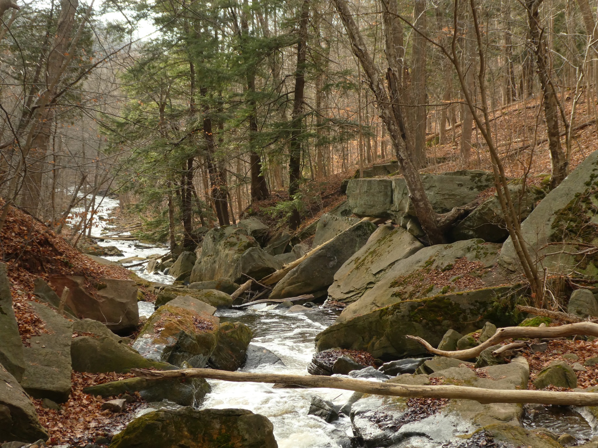
Grindstone Creek (Waterdown)
https://hikes.brucetrail.org/event/grindstone-creek-waterdown/Sorry, the registration cut-off time for this hike has been reached.Not a member? Click here to join today!Hosting Club: Iroquoia
Category: General Hike
Location (Google Maps): Meet in the parking lot on Mill Street in Waterdown at 9:15 am or earlier. This is a small parking lot and fills up quickly.Hike Leader(s): Karen Bergmann Click here to contact Hike Leader(s)
Pace: Medium – 3 to 4 km/hr
Terrain: Strenuous – Hilly with steep climbs and some poor footing
Distance: About 8 kmsDescription
We will hike on the main trail alongside the beautiful Grindstone Creek and around a couple of the bike trails and back to the main trail. There are some steep sections along this trail and possibly some muddy spots. Bring water and bug spray/bug net. - 22July 22, 2025
8:00 Long Hike Wiley Road Short Hills
https://hikes.brucetrail.org/event/800-long-hike-wiley-road-short-hills-5/Sorry, the registration cut-off time for this hike has been reached.Not a member? Click here to join today!Hosting Club: Niagara
Location (Google Maps):
Short Hills Wiley Road Entrance
Pace: Medium
Terrain: Moderate
: 10kmDescription
Explore Short Hills and the majestic side trails of Scarlett Tanager, Hemlock. Swayze Falls and Terrace. Register for each hikeBring Poles, Sun Screen Bug Spray, snack, and dress for the weather
Blue Mountains E2E in 4 (#4) *rescheduled from June 24*
https://hikes.brucetrail.org/event/blue-mountains-e2e-in-4-4-rescheduled-from-june-24/Sorry, the registration cut-off time for this hike has been reached.Not a member? Click here to join today!Hosting Club: Beaver Valley
Location (Google Maps): Roadside parking on the NORTH side of Maple Lane.
Map 24, ED 31Hike Leader(s): Kristina Rettie Click here to contact the hike leader.
Pace: Brisk
Terrain: Some rocky footing, Some steep sections, Strenuous
Length of Hike: 23kmDescription
(Make up hike) Welcome to Blue Mountains E2E in 4! Please register for each hike individually. Together we will wind our way through the varied terrain, rugged escarpment and beautiful vistas. If you choose to participate in all 4 hikes you will cover the 67km distance of this section which runs from Lavender to Swiss Meadows. If you are interested in an E2E badge please keep record of your hikes and submit to the Blue Mountains club upon completion.Each week the hikes will increase in distance starting at 14km. At week 4 we will hike over 20km. This is a great way to build your endurance.
These are shuttle hikes so please have your car passenger ready. Hike #4 – meet @67.3, shuttle to parking located 380m north of the main trail on Pretty River Rd.
Please bring water and snacks. We will do a clothing adjustment break and a short snack break along the way.
Bug spray and sunscreen are recommended, please do not apply before the shuttle.
No dogs!
If you need to get in touch please text @ 519-410-9077
9:15 Short hike - Short Hills Provincial Park, Pelham Road entrance
https://hikes.brucetrail.org/event/915-short-hike-short-hills-provincial-park-pelham-road-entrance-2/Sorry, the registration cut-off time for this hike has been reached.Not a member? Click here to join today!Hosting Club: Niagara
Category: Loop
Location (Google Maps): Short Hill Provincial Park, Pelham Road entranceHike Leader(s): janet davey Click here to contact Hike Leader(s)
Pace: Medium
Terrain: Moderate
Distance: 6 kmsDescription
Hike the main and side trails in Short Hills Provincial Park. Bring hiking boots, water, sunscreen and insect repellent. Please check yourself carefully for ticks following the hike.
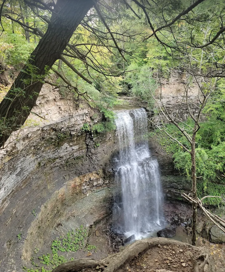
Two Waterfalls Hike - Hogg's Falls to Eugenia Falls return.
https://hikes.brucetrail.org/event/two-waterfalls-hike-hoggs-falls-to-eugenia-falls-return/Sorry, the registration cut-off time for this hike has been reached.Not a member? Click here to join today!Hosting Club: Caledon Hills
Category: Tuesday Hikers
Location (Google Maps): Beaver Valley; Hogg’s Falls Parking Area – km 65.1 on the west side of Lower Valley Rd. roughly 750 m north of East Back Line.Hike Leader(s): Doris Harper Click here to contact Hike Leader(s)
Pace: Medium – 3 to 4 km/hour
Terrain: Moderate – some hills and/or some poor footing
Distance: approximately 12 kmDescription
From the parking lot on Lower Valley Rd. we will hike to Eugenia Falls which will include the Upper Beaver Valley Side Trail and the Eugenia Falls Side Trail.When we reach Eugenia Falls we will take a break, have lunch, explore the area and then return the way we came.
If your plans change and you are no longer able to hike, please cancel so that we can make the space available for another interested hiker; and we don’t wait and wonder if something has happened to you.
If things change and you need to cancel, please log-in to the BTC website, go to ‘my hikes’ and cancel. If you have any questions please contact the Hike Leader.
- 23July 23, 2025
Decew House to Tremont
https://hikes.brucetrail.org/event/decew-house-to-tremont/Sorry, the registration cut-off time for this hike has been reached.Not a member? Click here to join today!Hosting Club: Niagara
Category: In and Out
Location (Google Maps): 2370 Decew Rd, Fonthill, ON L0S 1E6Hike Leader(s): Erin Lyttle Click here to contact Hike Leader(s)
Pace: Brisk
Terrain: Moderate
Distance: 12kmDescription
Meet at Decew House Heritage site. We will head east towards Brock university Note that there are steep and rocky inclines and proper footwear is REQUIRED, poles are RECOMMENDED. This hike has ups and downs and will be mostly in the shade. Bug spray highly recommended. Pace will be Brisk.Beaver Valley Geology Hike Badge Hike #3/8 The Mill Creek Valley
https://hikes.brucetrail.org/event/beaver-valley-geology-hike-badge-hike-3-8-the-mill-creek-valley/Sorry, the registration cut-off time for this hike has been reached.Not a member? Click here to join today!Hosting Club: Blue Mountains
Category: Organized Hike
Location (Google Maps): Tim Horton’s, First Street, CollingwoodHike Leader(s): Annette Sandberg Click here to contact Hike Leader(s)
Pace: Medium – 3 to 4 km/hr
Terrain: Moderate – Some hills and/or some poor footing
Distance: 10.4Description
The Mill Creek Valley: “Castle Ramparts” at Stop 8 (Pages 63/64) The Manitoulin Dolostone layer of the Niagara Escarpment forms a steep edge along the valley of Mill Creek. Over time the thinly bedded rock breaks away from the cliff face and lies scattered along the slope. Many shell and horn coral fossils can be found in these flat, shingle-like rocks. Note that when leaves are fully out in the summer months the “castle ramparts” may be hard to see. A photograph of the talus rock below the cliff will be sufficient for this badge location.WEDNESDAY WALKERS - Around Eugenia
https://hikes.brucetrail.org/event/wednesday-walkers-around-eugenia-3/Sorry, the registration cut-off time for this hike has been reached.Not a member? Click here to join today!Hosting Club: Beaver Valley
Location (Google Maps): Meet at the end of North Street in Eugenia. Km 56.1, map 26, Edition 31. Park on the south side of the street facing east.
143 North St, Flesherton, ON N0C 1E0, Canada
Hike Leader(s): Mike Arkless Click here to contact the hike leader.
Pace: Medium
Terrain: Moderate
Length of Hike: 5.8kmDescription
This hike route quickly enters a wooded area on Valley slope. There will be plenty of up-and-down walking until we reach Eugenia Falls Conservation Area. This is a scenic section of Trail, walking along the side of the Beaver River, crossing the river and walking along more riverside. There are old structures still in place that show some of the early history of development in the area. Hikers will see a good view of the high Eugenia Falls. This hike is a there-and-back route. - 24July 24, 2025
8:00 am Long Hike Cave Spring Conservation Area
https://hikes.brucetrail.org/event/800-am-long-hike-cave-spring-conservation-area-4/Sorry, the registration cut-off time for this hike has been reached.Not a member? Click here to join today!Hosting Club: Niagara
Location (Google Maps):
Cave Spring Conservation Area
Pace: Medium
Terrain: Moderate
: 10kDescription
This will be our permanent Thursday Location until Bridge repairs complete. From Cave Spring Conservation Area explore the trail network on the escarpment towards Kinsman Park and Moyer Road.You must register for each hike. Bring Poles, snack bug spray, sunscreen and a drink. Dress for the weather
Hiking around Jordan and Balls Falls
https://hikes.brucetrail.org/event/hiking-around-jordan-and-balls-falls-5/Sorry, the registration cut-off time for this hike has been reached.Not a member? Click here to join today!Hosting Club: Niagara
Location (Google Maps): Glen Road, Jordan
Hike Leader(s): Bill Russell Click here to contact Hike Leader(s)
Pace: Medium
Terrain: Moderate
Distance: 6-7 kmDescription
Hiking from Glen Road and following Jim Rainforth Trail and trails to Balls Falls and Bailey BridgeCar Hike: Toronto Section E2E (2 of 4)
https://hikes.brucetrail.org/event/car-hike-toronto-section-e2e-2-of-4/Sorry, the registration cut-off time for this hike has been reached.Not a member? Click here to join today!Hosting Club: Toronto
Category: Car Hike
Location (Google Maps): Sixth Line Halton Hills, Bruce Trail Parking Lot, North of Limehouse, South of Highway 7 (26.6k marker, Edition 31)Hike Leader(s): David Rowney Click here to contact Hike Leader(s)
Pace: Moderate (3-4 km/hr)
Terrain: Level 2 (Intermediate – some hills and uneven surfaces, rocks and roots underfoot), Variable
Distance: 15kDescription
This is a summer-time End-to-End hike to complete the Toronto section of the Bruce Trail in 4 hikes. Join for all or as many hikes as desired.This second hike will take us from the Bruce Trail Pear Tree Park to the Sixth Line, north of Limehouse. Once again, the terrain is not too hilly, but the footing is tricky with uneven, rocky sections to navigate.
July weather can be hot, muggy and buggy! So, dress for the weather, keeping in mind that insects, including ticks, will be out in full force. Take appropriate precautions to avoid insect bites, including using repellant and clothing that covers the legs and arms. Hiking shoes/boots are required and hiking poles are recommended.
Bring plenty of fluids, including electrolytes, and a snack and lunch.
As this is a group hike, please consider your fitness level before registering. We will be walking at a pace of 3km – 4km per hour and everyone is expected to keep up with the person in front of them for the duration of the hike.
Plan to arrive at the meeting place by 9:15 a.m. as we will start the car shuffle to the hike starting point at 9:30 a.m. sharp. Further details will be provided to registered hikers a few days prior to the hike.
To the Hollow and back CANCELLED
https://hikes.brucetrail.org/event/to-the-hollow-and-back/Sorry, the registration cut-off time for this hike has been reached.Not a member? Click here to join today!Hosting Club: Iroquoia
Category: Thursday Group
Location (Google Maps): City View Park, Kerns Rd. South Parking LotHike Leader(s): Anne Armstrong Click here to contact Hike Leader(s)
Pace: Leisurely – 3km/hr or less
Terrain: Moderate – Some hills and/or some poor footing
Distance: Approx. 9.5 km.Description
Join for this lovely hike from City View Park to Smokey Hollow and back taking in escarpment views, cool forests and including the Eric Best Side Trail which takes in a lovely valley and the Upper Grindstone Creek. Summer wildflowers should be out. Meet in the south parking lot of City View Park, on the east side of Kerns Rd. at 9:15 am. for a 9:30 am. start. Bring water, sunscreen, insect repellent and a snack. Hiking poles may be useful. An email will be sent out ahead of time with my contact information. Optional refreshment stop afterwards.Leader: Anne Armstrong
WEEKNIGHT RAINBOW HIKE: To Felker's Falls & Beyond
https://hikes.brucetrail.org/event/weeknight-rainbow-hike-to-felkers-falls-beyond/Sorry, the registration cut-off time for this hike has been reached.Not a member? Click here to join today!Hosting Club: Iroquoia
Category: Rainbow Hike
Location (Google Maps): Red Hill Valley South Parking Lot, Mud StreetHike Leader(s): Doug O’Neill Click here to contact Hike Leader(s)
Pace: Medium – 3 to 4 km/hr
Terrain: Easy – Mostly flat and usually good footing, Moderate – Some hills and/or some poor footing
Distance: 10 kmDescription
This 2SLGBTQIA+ friendly Rainbow hike is open to everyone, and is accessible by public transit or car.We’ll start at the Red Hill South Parking Lot (at Mud & Pritchard), the same as our June 25th Rainbow hike—but we’ll be heading east this time to Felker’s Falls and beyond. This is an in-and-out but we may toss in a side trail or two on the way back. Expect a few hills, some paved (unused) roadway and lots of shady parts of the Bruce Trail. We’ll hike past Felker’s but perhaps not all the way to Devil’s Punch Bowl. We’ll aim for a 2.5-hour hike.
Free Parking for drivers.
Coming by transit: The 21 Heritage Greene Terminal bus stops right at Mud and Pritchard. Meet in the parking lot across the road.
Our Rainbow hikers are a friendly bunch!
Please bring at least 750mL (or even a litre) of water—and an energizing snack if you don’t eat beforehand. Also: Insect repellent is a good idea. Hiking boots or sturdy footwear are recommended—as well a cap. We will be walking through patches of long grass so long pants are best (to avoid ticks).
Complimentary Bruce Trail Rainbow badges and/or stickers to all participants!
If it’s your first Rainbow hike and you have any questions, don’t hesitate to reach out to Doug and I’ll get back to you => “Click here to contact Hike Leader” on this form.
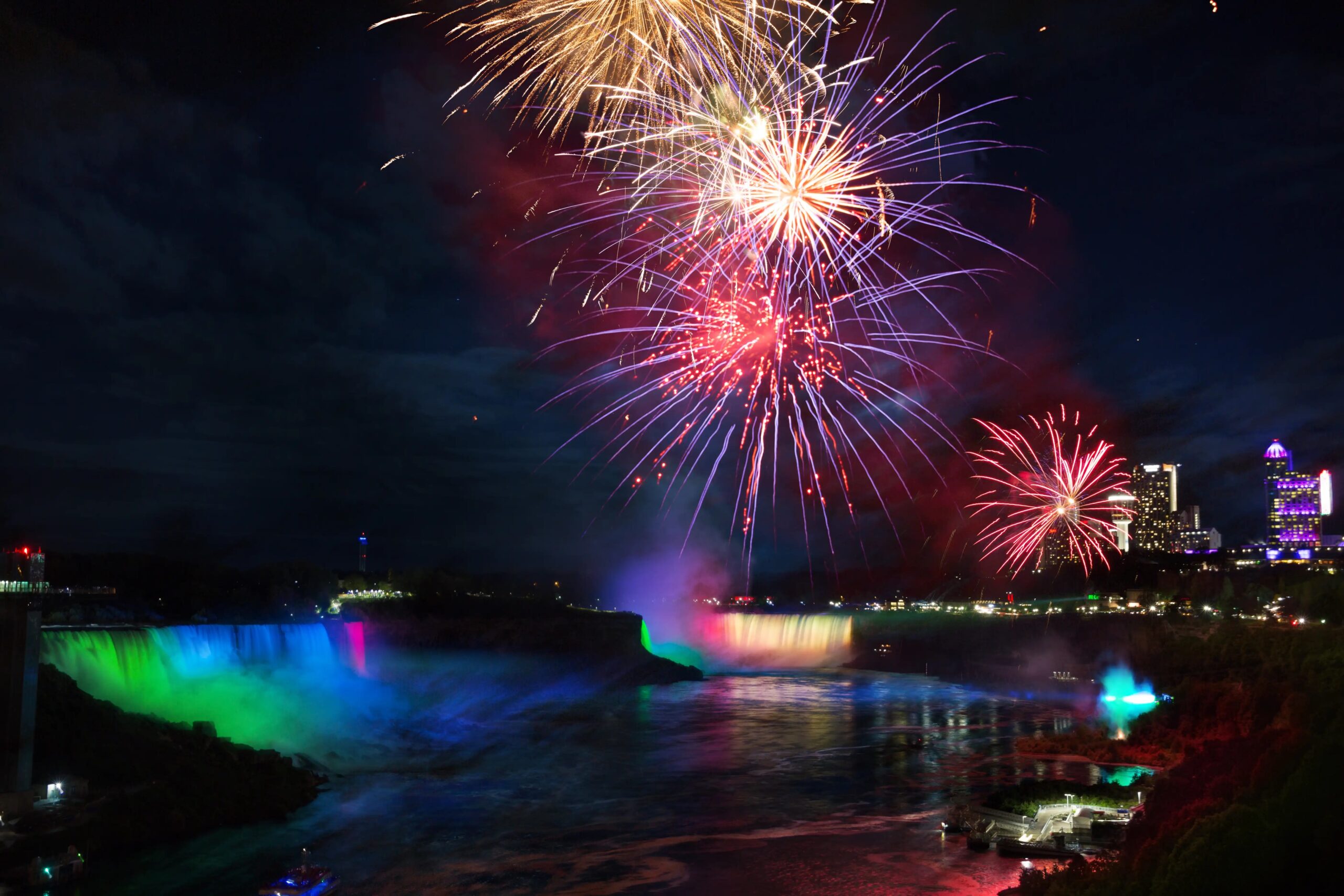
8:30 pm New Moon & Fireworks - Night Hike in Niagara Falls
https://hikes.brucetrail.org/event/830-pm-new-moon-fireworks-night-hike-in-niagara-falls/Sorry, the registration cut-off time for this hike has been reached.Not a member? Click here to join today!Hosting Club: Niagara, Beaver Valley
Category: Night
Location (Google Maps): Niagara Falls Floral Showhouse Parking Lot BHike Leader(s): Robin Garrett Click here to contact Hike Leader(s)
Pace: Medium
Terrain: Easy
Distance: 6 kmDescription
New Moon & Fireworks – The night sky is darkest when there’s a new moon. Watch the stars appear as we hike along the mighty Niagara River and enjoy the fireworks over Niagara Falls. Counts towards your night hike badge (5 night hikes). - 25July 25, 2025
Steeltown Stomp Practice Session #2 of 10
https://hikes.brucetrail.org/event/steeltown-stomp-practise-session-1-of-10-2/Sorry, the registration cut-off time for this hike has been reached.Not a member? Click here to join today!Hosting Club: Iroquoia
Location (Google Maps): Meet at the Chedoke Golf Club parking lot
Hike Leader(s): Ruth Moffatt Click here to contact Hike Leader(s)
Pace: Brisk – 4 to 5 km/hr, Medium – 3 to 4 km/hr
Terrain: Strenuous – Hilly with steep climbs and some poor footing
Distance: VariesDescription
Is the Steeltown Stomp on your bucket list! Come join us! For anyone who has done stair climbing workouts, you will know what calf pain is like, especially when you first start. Want to get in shape of the Steeltown Stomp on Oct 4, 2025? Practise with us! We will start off easy and gradually build up our strength and stamina over the course of the summer. Climbing Chedoke staircase will be combined with a hike on most days. We will use both Chedoke and Dundurn Stairs as our practise stairs and buildup to at least 2,000 steps.Bring a reusable water bottle (there are fountains at the bottom of both Chedoke and Dundurn) and any snacks you may like. Pace will be moderate, but steady to begin. We will start with a warm up hike and finish with a cool down stretch. Post stomp coffee is optional .
It’ll be fun and will lessen the pain on the day of the event, promise!
Look for the other 9 dates on the schedule.
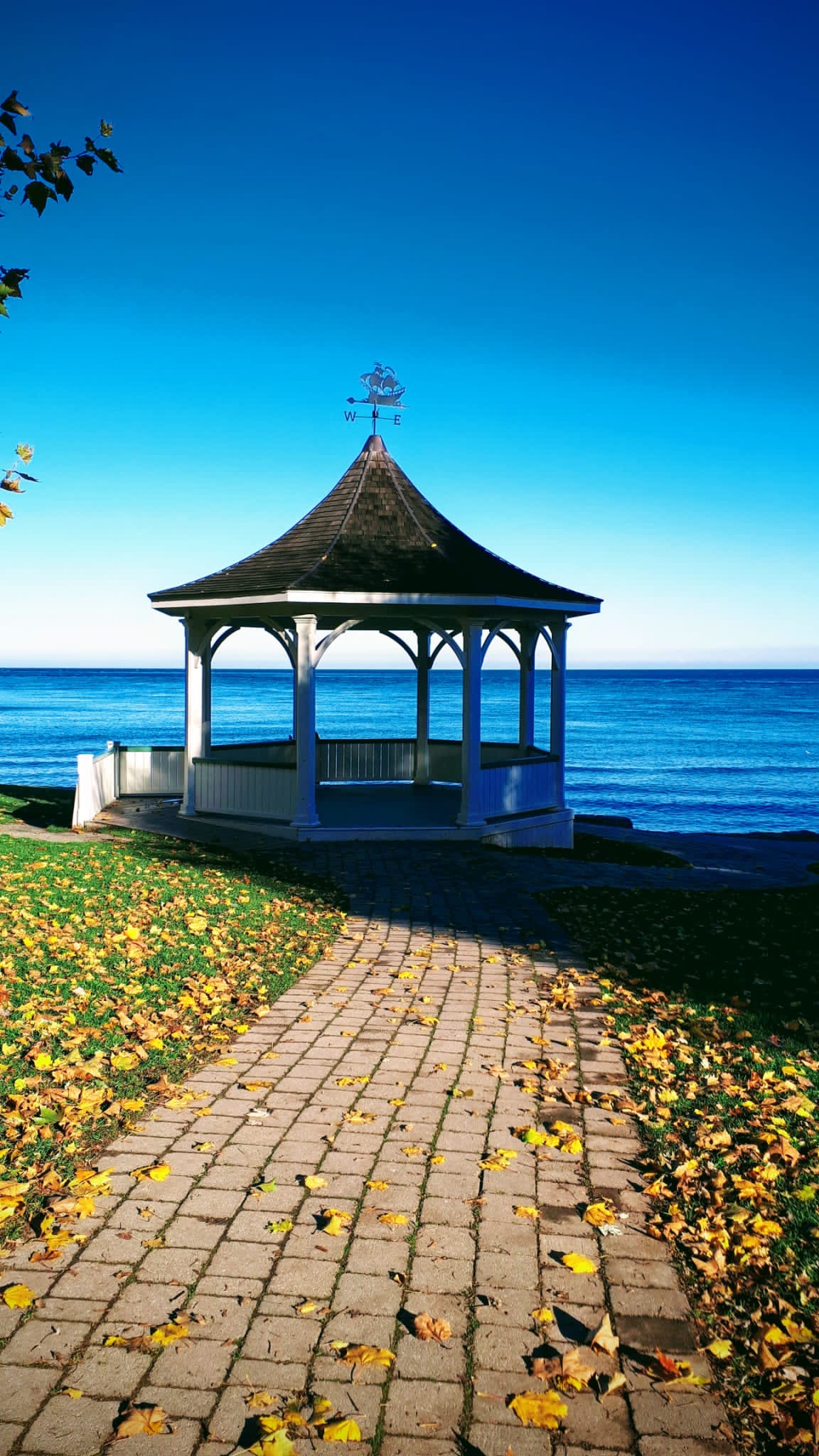
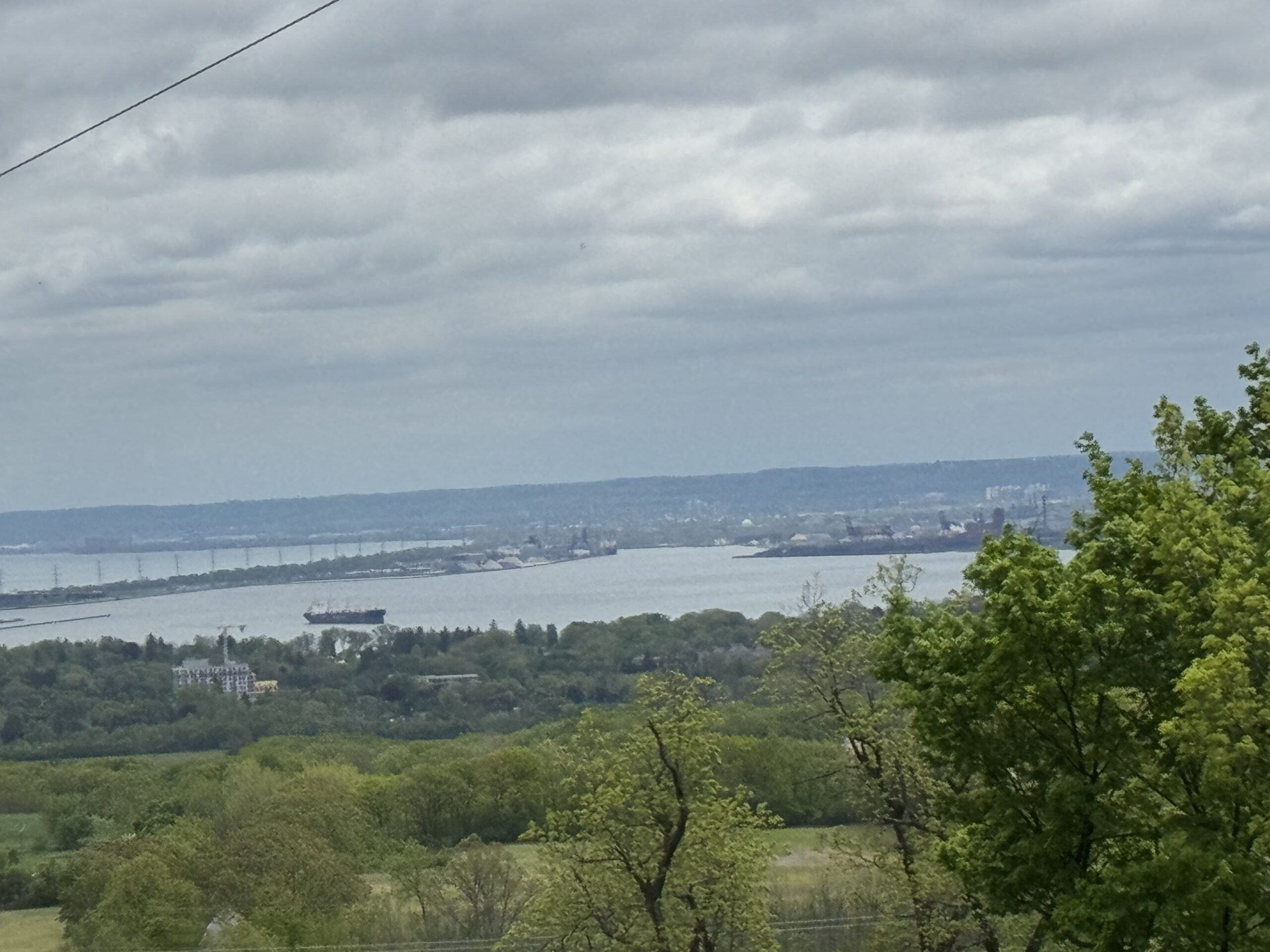
Niagara-on-the-Lake Tour
https://hikes.brucetrail.org/event/niagara-on-the-lake-tour-12/Sorry, the registration cut-off time for this hike has been reached.Not a member? Click here to join today!Hosting Club: Niagara
Location (Google Maps): Meet on King St near Centre St at the entrance to Veteran’s Memorial Park, Niagara-on-the-Lake
Hike Leader(s): Margaret Northfield Click here to contact Hike Leader(s)
Pace: Medium
Terrain: Easy
Distance: 6-7kmDescription
Discover where the Niagara River meets Lake Ontario. Experience the Heritage District, woods and the Niagara Parkway.Some weeks may be totally on sidewalks and roads while others may include a mix of trail and paved pathways.
Great way to build up endurance for longer more strenuous hikes.
Plan to stay for conversation and a coffee at Sweets & Swirls, Community Centre, Niagara Stone Rd., NOTL
Margaret & Robin
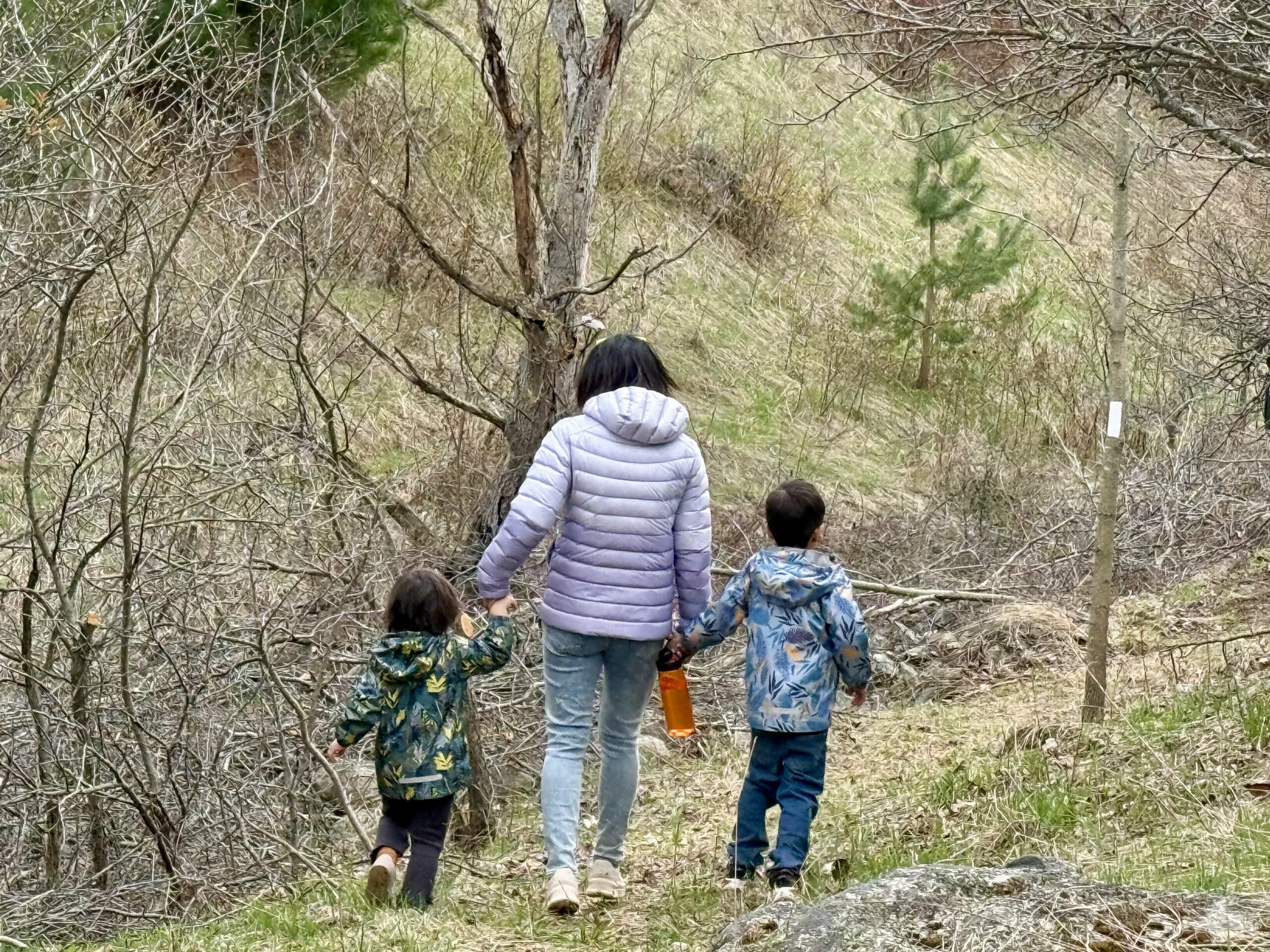
Quarry to Mountain YOUTH 12+ WELCOME
https://hikes.brucetrail.org/event/quarry-to-mountain-youth-12-welcome/Sorry, the registration cut-off time for this hike has been reached.Not a member? Click here to join today!Hosting Club: Niagara
Category: Youth Hike
Location (Google Maps): Quarry Road parking lot (Google Maps-“Parking for Cave Springs Conservation Area”) 3768 Quarry Rd, Lincoln, ON L0R 1B2Hike Leader(s): Erin Lyttle Click here to contact Hike Leader(s)
Pace: Leisurely
Terrain: Moderate
Distance: 5 kmDescription
We will be starting at Quarry road, hiking to Mountain road and then back.This is an age 12+ hike. A responsible adult must accompany youth 12-18 in a max ratio of 2 youth per adult. This hike has little road and lots of shade! Waivers must be completed for everyone in attendance (adults and youth). Bug spray, sunscreen, water and a snack are encouraged. Must wear appropriate footwear. For hikers 15 and under interested in earning a youth badge, they will be available on the hike for $6 please bring cash.
The Young Trail Blazer Badge requires the completion of one hike (at least 3km in length) conducted on the Niagara Bruce Trail. Hikes can be completed with the club on an official scheduled hike or with family on their own.
To earn the Young Nature Blazers Badge you must complete a 90 minute hike on the Niagara Bruce Trail. Afterwards, chat with the hike leader describing how you used one or more of your five senses on the hike – what did you see, touch, taste, smell or hear during your hike?
- 26July 26, 2025
Sydenham Stained Glass Badge E2E Weekend Hikes
https://hikes.brucetrail.org/event/sydenham-stained-glass-badge-e2e-weekend-hikes/Sorry, the registration cut-off time for this hike has been reached.Not a member? Click here to join today!This is a Multi-Day Hike
You are signing up for the following dates:
2025-07-26, 2025-07-27, 2025-08-02, 2025-08-03, 2025-08-09, 2025-08-10, 2025-08-16, 2025-08-17Hosting Club: Caledon Hills, Sydenham
Category: End-to-End
Location (Google Maps): Parking lot off of 6th Concession Road 6 S. GPS location (44.509124, -80.810665)Hike Leader(s): Lily Li Click here to contact Hike Leader(s)
Pace: Brisk – 4 to 5 km/hour, Medium – 3 to 4 km/hour
Terrain: Moderate – some hills and/or some poor footing, Strenuous – hilly with steep climbs and some poor footing
Distance: 21 kmDescription
Earn the Hart’s Tongue Stained Glass / Fundraiser badge, which is part of the collectible Bruce Trail Clubs stained glass-themed fundraiser set. This is a special series of 8 hikes in 4 weekends to complete the Sydenham section of 166 km. Hike distances range from 18 to 23 km each day with about a 3-5 km/hour pace. The hike is intended to be moderate to brisk.Please dress according to the weather presented that day. Bring at least 2 litres of water and electrolytes, lunch, snack, hat, sunscreen and bug spray for the long day of hiking.
This is a car shuttle hike. Please have your vehicle ready, as everyone will take a turn either to drive to the start point of our hike or to get our drivers back to the start point at the end of the day.
A detailed hiking plan will be shared with registered hikers later.
Car Hike: Boyd Conservation Park Vaughan
https://hikes.brucetrail.org/event/car-hike-boyd-conservation-park-vaughan-8/Sorry, the registration cut-off time for this hike has been reached.Not a member? Click here to join today!Hosting Club: Toronto
Location (Google Maps): Free parking lot before main entrance of park
Hike Leader(s): Mohammad Aghamiri Click here to contact Hike Leader(s)
Pace: Moderate (3-4 km/hr)
Terrain: Hilly, Level 2 (Intermediate – some hills and uneven surfaces, rocks and roots underfoot)
Distance: 14-15 kmDescription
Let’s hike Boyd conservation park trails through beautiful valleys.Please bring lots of water and snacks ,hiking poles are recommended
phone number for the day of hike 289 588 6482
Hike 4 Blue Mountain Series in 6 Hikes
https://hikes.brucetrail.org/event/hike-4-blue-mountain-series-in-6-hikes/Sorry, the registration cut-off time for this hike has been reached.Not a member? Click here to join today!Hosting Club: Dufferin Hi-Land
Category: General Hike
Location (Google Maps): Pretty River Rd just west of where the Bruce Trail crosses Pretty River Rd approximately Km 46.8Hike Leader(s): Patrcia Foley and Tristan Goguen Click here to contact Hike Leader(s)
Pace: Medium
Terrain: Moderate
Distance: 9.4 kmDescription
We will car pool back to the Lime Kiln access side trail parking lot. Today we will hike through the Nottawasaga Lookout Provincial Nature Reserve. We will have the opportunity to explore the Standing Rock and Caves side trails.We may encounter some muddy sections and will definitely be in open fields/roads for some time. Bug spray, sunblock and sturdy hiking shoes/boots are recommended. Bring sufficient water and lunch. Note this is a car pool hike, registration is limited and the hike leaders will have 2 dogs with them.
Car Hike: Hockley Rd. to 4th Line EHS
https://hikes.brucetrail.org/event/car-hike-hockley-rd-to-4th-line-ehs/Sorry, the registration cut-off time for this hike has been reached.Not a member? Click here to join today!Hosting Club: Caledon Hills
Category: End-to-End
Location (Google Maps): Hockley Rd. parking area, east of km 61.1, located on the north side of Hockley Rd. at the Hockley Rd. Side Trail.Hike Leader(s): Dylan Hubbard Click here to contact Hike Leader(s)
Pace: Brisk – 4 to 5 km/hour
Terrain: Strenuous – hilly with steep climbs and some poor footing
Distance: 13.5 kmDescription
Join me for a grueling summer hike as we hike from the main parking lot on Hockley Rd. to 4th Line EHS and back. This will complete a 14.5 km loop.Pace will be brisk, make sure to pack a lunch, sunscreen and bug repellent, at least 2L of water and good hiking boots.
We will be taking our lunch at 11-11:30 depending on how the group feels.
If the weather permits, I’ll be going to the Hockley Valley Resort for food afterwards. Please feel free to join me for truffle fries and mocktails 🙂
Saturday Shorts at Meltwater Moraine Protected Natural Area
https://hikes.brucetrail.org/event/saturday-shorts-at-meltwater-moraine-protected-natural-area/Sorry, the registration cut-off time for this hike has been reached.Not a member? Click here to join today!Hosting Club: Caledon Hills
Category: General
Location (Google Maps): Meet at 17963 Mountainview Road. Park on the grass beside the driveway. Google Maps GPS Coordinates: 43.90027, -79.93036Directions:
From Highway #10, turn east onto Olde Base Line Road/Peel Regional Road 12. Drive for approximately 7 kilometres. Turn north/left onto Mountainview Road. Drive for approximately 8 kilometres. The driveway is on the right. Don’t be surprised by the old house and farm buildings on the property.Hike Leader(s): Sandy Green Click here to contact Hike Leader(s)
Pace: Leisurely – 3 km/hour or less
Terrain: Easy – mostly flat and usually good footing
Distance: 5 kilometresDescription
Enjoy exploring the newest Bruce Trail Conservancy Protected Natural Area in the Caledon Hills section – Meltwater Moraine. Bring snacks and beverages to keep you energized. Sturdy footwear is highly recommended. All are welcome!
Exploring Inglis Falls Conservation Area- in a Summer
https://hikes.brucetrail.org/event/exploring-inglis-falls-conservation-area-in-a-summer/Sorry, the registration cut-off time for this hike has been reached.Not a member? Click here to join today!Hosting Club: Iroquoia, Sydenham
Category: Good Companions
Location (Google Maps): Harrison Park Conservation Area – passing straight towards the gravel parking lot to far North. Alternatively you can park in the the main parking lot. Meeting point would be the Harrison Park Inn Restaurant -front.Hike Leader(s): Corina Seceleanu Click here to contact Hike Leader(s)
Pace: Medium – 3 to 4 km/hr
Terrain: Moderate – Some hills and/or some poor footing
Distance: 12.5 -13 KmDescription
Hello Fellow HikersPlease join me for a loop hike through Inglis Falls Conservation Area, starting from the parking lot and ending at Harrison Park. Our hike will begin on the side trail, heading clockwise toward Centennial Tower (though the tower is currently closed). Keep in mind that this section is the most challenging part of the loop—but the rewards are well worth the effort! Be prepared, as we will do a back-and-forth stretch for a small section (1.2km) in order to complete the loop.
From there, we’ll continue on the Palisade Side Trail, reconnecting with the Main trail. We’ll also explore the red and yellow Conservation Park trails, leading us to the breathtaking Inglis Falls. After taking in the views, we’ll follow the main trail to 2nd Ave Road, before looping back via the side trail to Harrison Park’s parking lot.
If time permits at the end of our hike, we can treat ourselves to a refreshing drink or an ice cream at Harrison Park Inn Restaurant—a well-deserved indulgence after an amazing adventure.
In my opinion, this section of the Sydenham is one of the most beautiful, secluded, and challenging part of the BTC trail—but ultimately, it’s incredibly rewarding.
Please bring with you – lunch, snack and min 2L of water and your medicine if you required.
Also be prepared for a hot day ( I imagine ) sunscreen, bug repelent, hat and appropiate attire for the hike, mostly sturdy hiking boots.
Just to reiterate – for the first 2.5-3 km hike is strenuous, with an ascent and a rugged terrain featuring boulders and exposed roots. It requires endurance, balance, and careful footing. But with the effort come rewards. After that the hike would be mostly leisurely, except some parts .
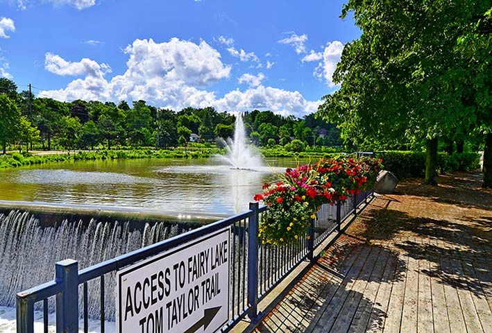
GO Train Hike: Nokiidaa Trail/Newmarket
https://hikes.brucetrail.org/event/go-train-hike-nokiidaa-trail-newmarket/Sorry, the registration cut-off time for this hike has been reached.Not a member? Click here to join today!Hosting Club: Toronto
Category: GO Train Hike
Location (Google Maps):East Gwillimbury GO Station (outside station building)
Hike Leader(s): Tom Swales, Felix Wan Click here to contact Hike Leader(s)
Pace: Moderate (3-4 km/hr)
Terrain: Flat, Level 1 (Easy – mostly on flat, well maintained trails with hard-packed surface)
Distance: 9 kmDescription
We will hike south from East Gwillimbury GO Station to Fairy Lake and historic Main Street in Newmarket. We will pass the remains of a swing railway bridge, the remains of an abandoned canal, and a diverse landscape. On the way there will be a stop at the Newmarket Farmers Market. The walking is easy south on this Level 1 Hike to Fairy Lake where we loop around the lake with a scenic boardwalk trail on the east side and paved path leading into the historic downtown of Newmarket. We’ll stop in the historic downtown for refreshments at the Old Flame Brewery or alternative establishments and walk up Main Street to get the 2:44 train back towards Toronto’s Union Station.Take advantage of the GO Transit $10 Day Weekend Pass available only on smartphones. Those wishing to travel together will meet at Union Station in the Great Hall by the information desk (with the clock over it) to take the GO Train towards Barrie departing at 8:52 AM. There is a second stop in Toronto at Downsview Park Station.
ROUTE MAP: https://onthegomap.com/s/507cjskh