Categories
- 14October 14, 2025
Heather & Steve's 3rd Annual Fall Cairn2Cairn - Beaver Valley section, Oct 14,15,16,21,22,23
https://hikes.brucetrail.org/event/heather-steves-3rd-annual-fall-cairn2cairn-beaver-valley-section-oct-141516212223/Sorry, the registration cut-off time for this hike has been reached.Not a member? Click here to join today!This is a Multi-Day Hike
You are signing up for the following dates and times:
2025-10-14 at 07:45
2025-10-15 at
2025-10-16 at
2025-10-21 at
2025-10-22 at
2025-10-23 atHosting Club: Iroquoia, Beaver Valley
Category: General Hike
Location (Google Maps): We will meet at Sideroad 22B, south side west of Fairmount SIde trail and shuttle to our first trail head at Blantyre BTC LotHike Leader(s): Steven White Click here to contact Hike Leader(s)
Pace: Brisk – 4 to 5 km/hr
Terrain: Strenuous – Hilly with steep climbs and some poor footing
Distance: 21.7Description
Enjoy the fall colours of Beaver Valley section 117 kms over 6 days. We will meet each morning at 7:45 and be ready to shuttle at 8:00. Hikers will take turns shuttling and taking drivers to their cars each day.Hikers should wear layered clothing, hiking boots, poles, hat, sunscreen, bug spray, rain gear and bring plenty of water, snacks and lunch. We will hike rain or shine.
Full itinerary will be emailed to hikers the week before the first hike.
Bognor Marsh to Silent Valley
https://hikes.brucetrail.org/event/bognor-marsh-to-silent-valley/Sorry, the registration cut-off time for this hike has been reached.Not a member? Click here to join today!Hosting Club: Sydenham
Category: General Hike
Location (Google Maps): Meet at the Silent Valley side trail parking area, at the north end of 2nd Concession South – see Map 30. From Grey Road 18, turn north at the intersection of Grey Road 29. Grey Road 29 is to the south and 2nd Concession South is to the north. Follow 2nd Concession South for 1.5 km to the parking area at the north end of the road. Please meet here at 8:30 – we will then do a short car shuttle to the Bognor Marsh parking area to start our hike by 9 am.Hike Leader(s): Fran Turner Click here to contact Hike Leader(s)
Pace: Medium: 3 to 4 km/h
Terrain: Strenuous: Hilly with steep climbs and some poor footing.
Distance: 10 kmDescription
We start by walking the boardwalk around Bognor Marsh, where we will hopefully see some interesting birds. After several km in the woods, we climb a short, steep, rocky slope to the top of the escarpment where we hike through open deciduous forest until our descent into Silent Valley.Pretty River Valley Provincial Park/Petun Conservation Area
https://hikes.brucetrail.org/event/pretty-river-valley-provincial-park-petun-conservation-area/Sorry, the registration cut-off time for this hike has been reached.Not a member? Click here to join today!Hosting Club: Dufferin Hi-Land
Category: Tuesday Hike
Location (Google Maps): Blue Mountains Section, Map 23. Meet at SuperBurger (north-west corner of Hwy 10/Hwy 89 intersection) at 8:30 for car pooling or at Petun Conservation Area parking area on the east side of 2nd Line, 320 metres north of 6th Sideroad (Km 55.7) at 9:30.Hike Leader(s): Les Babbage, Inge Eckerich, Julie Daley, Tony Evangelista Click here to contact Hike Leader(s)
Pace: Leisurely
Terrain: Moderate, Slippery Sections Likely
Distance: 8.4 km. Short hike: 4.2 kmDescription
After car pooling to the start of the hike in Petun CA, we will take Black Ash Side Trail to the Main Trail, then hike east, south and west to the John Haigh Side Trail, which will take us back to parking. The short hike will turn back where the Main Trail turns onto 6th Sideroad road allowance. Bring water and snacks. Hiking poles recommended.Urban Walk: Valley View Park Thornhill
https://hikes.brucetrail.org/event/urban-walk-valley-view-park-thornhill-110/Sorry, the registration cut-off time for this hike has been reached.Not a member? Click here to join today!Hosting Club: Toronto
Location (Google Maps): Parking lot is off Sycamore Drive East of Bayview , across Starbucks plaza
Bus 91 from Finch east station stops at Sycamore station.Hike Leader(s): Mohammad Aghamiri Click here to contact Hike Leader(s)
Pace: Moderate (3-4 km/hr)
Terrain: Hilly, Level 2 (Intermediate – some hills and uneven surfaces, rocks and roots underfoot), Variable
Distance: 7-8 kmDescription
We will explore Valleyview and Maple View parks, and walk along German Mill Creak, in return we stop in Huntington park and have snack under beautiful shed ,Even it is considered Urban walk, it is urban hike as we have some up and down hills and tree roots, please bring your hiking poles, water and snacks,
phone number for the day of hike 289 588 6482
9:00 Long Hike Wiley Road Short Hills NEW TIME
https://hikes.brucetrail.org/event/900-long-hike-wiley-road-short-hills-new-time/Sorry, the registration cut-off time for this hike has been reached.Not a member? Click here to join today!Hosting Club: Niagara
Category: Loop
Location (Google Maps):Short Hills Wiley Road Entrance
Hike Leader(s): Alan Laver Click here to contact Hike Leader(s)
Pace: Medium
Terrain: Moderate
Distance: 10kmDescription
Explore Short Hills and the majestic side trails of Scarlett Tanager, Hemlock. Swayze Falls and Terrace. Register for each hikeBring Poles, , snack, and dress for the weather
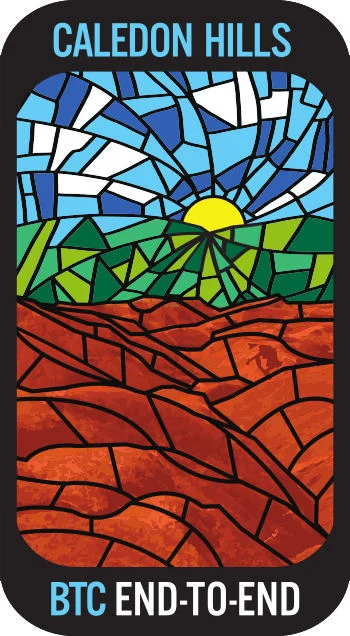
Caledon Hills Fundraising E2E in 8 Hikes
https://hikes.brucetrail.org/event/caledon-hills-fundraising-e2e-in-8-hikes/Sorry, the registration cut-off time for this hike has been reached.Not a member? Click here to join today!Hike open to BTC Members only.
This is a Multi-Day Hike
You are signing up for the following dates and times:
2025-10-14 at 09:00
2025-10-15 at 09:00
2025-10-16 at 09:00
2025-10-17 at 09:00
2025-10-21 at 09:00
2025-10-22 at 09:00
2025-10-23 at 09:00
2025-10-24 at 09:00Hosting Club: Caledon Hills
Category: End-to-End
Location (Google Maps): For the first hike, meet at the Hockley Road Parking Area, east of km 61.1. Please aim to arrive for 9 am, so we can begin shuttling north to the Mono Community Centre parking lot at 9:15 am. Hikers will be notified by email about the remaining seven hikes.Hike Leader(s): Elizabeth Ganong Click here to contact Hike Leader(s)
Pace: Leisurely – 3 km/hour or less, Medium – 3 to 4 km/hour
Terrain: Moderate – some hills and/or some poor footing
Distance: Approximately 11.3 kmDescription
This series of hikes starts at the north end of the Caledon section and heads south. By dividing the section into eight hikes, the average hike is about 10 km, but of course the distance varies due to available parking. The intent of this offering is to provide an opportunity for hikers to attain the beautiful stained glass end-to-end badge and to enjoy their time out on the Trail at a more relaxed pace. An added bonus is that funds are raised to support the BTC!By registering, you are signing up for eight hikes on the following dates: Oct 14, Oct 15, Oct 16, Oct 17, Oct 21, Oct 22, Oct 23, and Oct 24
To qualify for the badge, you need to complete all eight hikes with our group. If you miss a hike, you can make it up on your own by the end of Oct 2025 and still qualify. When making individual requests, keep in mind that everyone supporting you on your hiking journey is a volunteer.
Please be prepared to help with shuttling hikers at the beginning and at the end of each hike. Thanks in advance to Jennie for taking on the role of sweep for this series. Consider the following in your preparations: sunscreen, a hat, a jacket, insect repellent, hiking boots/shoes, poles, water, and a lunch/snack. No dogs please.
For the first hike, we will meet at the Hockley Road Parking Area, east of km 61.1. Then, we will shuttle north to the Mono Community Centre parking lot and hike south. Hikers will receive information about upcoming hikes through emails.
9:15 Short hike - Pelham Road, Short Hills
https://hikes.brucetrail.org/event/915-short-hike-pelham-road-short-hills-15/Sorry, the registration cut-off time for this hike has been reached.Not a member? Click here to join today!Hosting Club: Niagara
Location (Google Maps): Pelham Road entrance, Short Hills Provincial Park
Hike Leader(s): janet davey Click here to contact Hike Leader(s)
Pace: Medium
Terrain: Moderate
Distance: 6 kmsDescription
Hike the main and sidetrails in Shorthills Provincial Park. Please wear hiking boots, bring water and insect repellant. Check yourself for ticks following the hike.
Mono Cliffs Provincial Park
https://hikes.brucetrail.org/event/mono-cliffs-provincial-park-3/Sorry, the registration cut-off time for this hike has been reached.Not a member? Click here to join today!Hosting Club: Iroquoia
Category: General Hike
Location (Google Maps): Meet at 9:15 am on Second Line EHSHike Leader(s): Karen Bergmann Click here to contact Hike Leader(s)
Pace: Medium – 3 to 4 km/hr
Terrain: Moderate – Some hills and/or some poor footing
Distance: 10 kmsDescription
Mono Cliffs is a gem in the Autumn! Come prepared to take photos of the beautiful leaf colours. We will hike the main trail, down the loop to the South Outlier Trail and down the switchback to the Walter Tovell Side Trail and Lookout ST to the main trail. Bring a snack, as needed.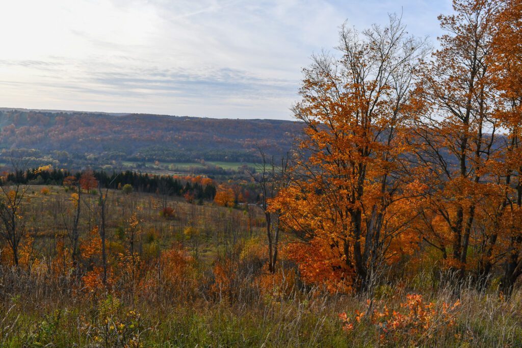
Fall Colours in Beaver Valley
https://hikes.brucetrail.org/event/fall-colours-in-beaver-valley/Sorry, the registration cut-off time for this hike has been reached.Not a member? Click here to join today!Hosting Club: Caledon Hills
Category: Tuesday Hikers
Location (Google Maps): Beaver Valley Lookout: on the west side of Grey Rd. 13Hike Leader(s): Barbara Euler Click here to contact Hike Leader(s)
Pace: Medium – 3 to 4 km/hour
Terrain: Moderate – some hills and/or some poor footing
Distance: 12 kmDescription
The Beaver Valley Bruce Trail Club has completed a major reroute of the main Bruce Trail onto the newly secured Eagle’s Summit Nature Reserve and created a new East Mountain Side Trail to make a beautiful loop with the main Trail. They have also created a network of side trails on the property to showcase its many features and to provide direct access to the parking area. We will combine the main loop with another at Old Baldy.
Most of the trail is along the top of the escarpment with great views.
A leisurely hike to enjoy fantastic views of the fall colours at their peak. Bring your cameras, a mid-morning snack, a packed lunch and lots of water.