Categories
- 26January 26, 2025

Hamilton Waterfront Urban Hike
https://hikes.brucetrail.org/event/hamilton-waterfront-urban-hike-2/Sorry, the registration cut-off time for this hike has been reached.Not a member? Click here to join today!Hosting Club: Iroquoia
Category: General Hike
Location (Google Maps):Meet DUNDURN CASTLE 610 York St Hamilton Parking Lot
Hike Leader(s): Cathie Green Click here to contact Hike Leader(s)
Pace: Medium – 3 to 4 km/hr
Terrain: Easy – Mostly flat and usually good footing
Distance: Approximately 8 kmsDescription
Meet at 10 am at Dundurn Castle Parking Lot(no fees) off York St Hamilton-easy access from 403We will hike along the ridge(flat) to the stairs leading us down to Hamilton Bay Waterfront and walk the paved path to Bayfront Park and hike along some of their
bayfront trails-all paved paths over to the foot of James street to view the new Indigenous Art Installation -there will be a bathroom on the way
We will return along city side streets -Please wear suitable clothing and footwear for the weather/poles/ water, snack/Icers
OPTIONAL Social afterwards to have lunch at the Admiral Inn across the street from parking lot-
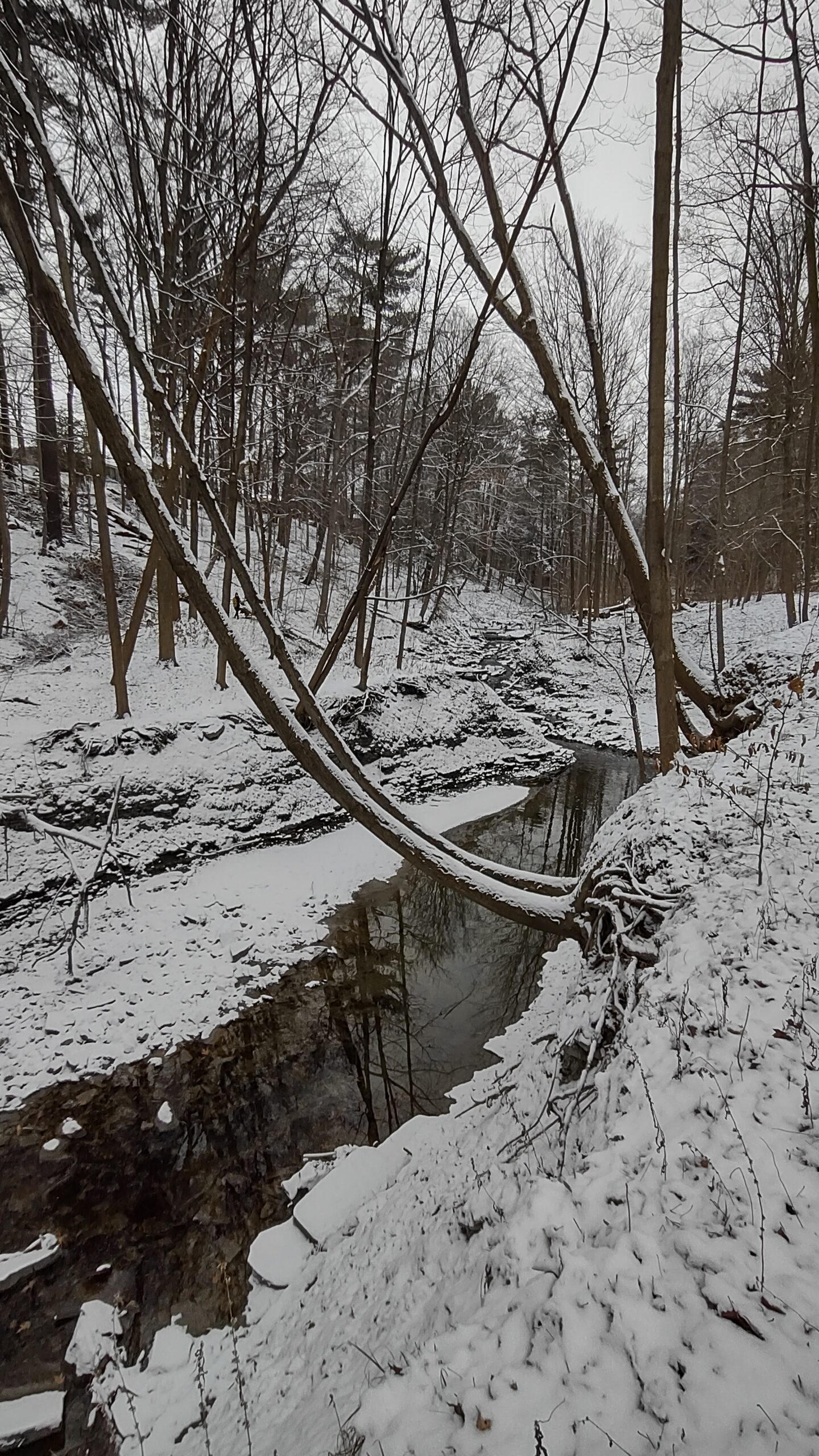
Humber Creek - Islington Ave. & Dixon Road to Historic Lambton House on the Humber
https://hikes.brucetrail.org/event/humber-creek-islington-ave-dixon-road-to-historic-lambton-house-on-the-humber/Sorry, the registration cut-off time for this hike has been reached.Not a member? Click here to join today!Hosting Club: Toronto
Category: Urban Walk
Location (Google Maps): Meet me at the Tim Hortons inside the No Frills Plaza SE corner of Islington and Dixon Rd at 9:40 am to use the washrooms and to stay warm. We will leave the Tim Hortons by 10 am to cross over to the ravine on the west side of Islington where we will begin the hike.. If driving to the hike, park on Northcrest Road, on the south side of Wincott Park and follow the path around the pond to the entrance of the park at Dixon Road and proceed east to meet the group at the intersection for 10. Transit users can come either via Islington Bus 37 from Islington Subway running every 11 minutes or via Lawrence West Bus 52 to Pearson Airport running every 12 minutes.Hike Leader(s): Andrew Proczek Click here to contact Hike Leader(s)
Pace: Moderate (3-4 km/hr)
Terrain: Flat, Level 2 (Intermediate – some hills and uneven surfaces, rocks and roots underfoot), Variable
Distance: 9.5 to 10 kmDescription
Join me for a pleasant winter hike along the little known Humber Creek tail running eastward to the Humber River. Once we reach the river we will follow the Humber River trail south to just past Dundas St and our destination, the historic Lambton House where at 2 pm you will be treated to a lecture on the indigenous peoples and the Humber by Darin Wybenga, Heritage Interpreter for the Mississaugas of the Credit First Nation. Those of you not wanting to attend the lecture can drop out there or continue to Old Mill Subway for an additional 3 km.Public Washrooms and warm-up facilities available at Tim Hortons at 0 km; Valleyfield Rink (The West Way) at 2.5 km; James Gardens (7 km); and Lampton House (9.5 km)
Please bring your icers as the trails may be icy and dress appropriately for the winter conditions. Pack snacks or a lunch and sufficient water or a Thermos of your favorite hot drink.
Poles will be of help to you on a wilderness section of trail east of Royal York Road where if conditions permit we may attempt a creek crossing.

Sunday Ramble - Crawford Lake
https://hikes.brucetrail.org/event/sunday-ramble-crawford-lake/Sorry, the registration cut-off time for this hike has been reached.Not a member? Click here to join today!Hosting Club: Iroquoia
Category: General Hike
Location (Google Maps): Crawford Lake Conservation AreaHike Leader(s): Carol Swanson Click here to contact Hike Leader(s)
Pace: Medium – 3 to 4 km/hr
Terrain: Easy – Mostly flat and usually good footing, Moderate – Some hills and/or some poor footing
Distance: approx 6.5kmDescription
Please register for parking before the hike with conservation halton. Meet in first parking lot near gatehouse.Bring water, snack and icers.
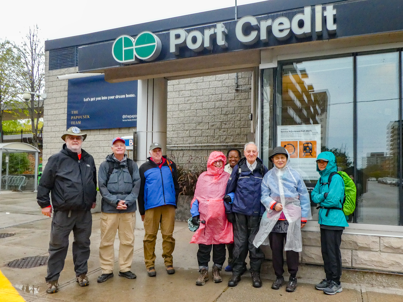
Urban Walk; Waterfront Trail 2/11 - Mississauga Waterfront
https://hikes.brucetrail.org/event/urban-walk-waterfront-trail-2-11-mississauga-waterfront/Sorry, the registration cut-off time for this hike has been reached.Not a member? Click here to join today!Hosting Club: Toronto
Category: Urban Walk
Location (Google Maps): Mississauga Waterfront TrailHike Leader(s): Brian Rideout Click here to contact Hike Leader(s)
Pace: Moderate (3-4 km/hr)
Terrain: Flat
Distance: 8.9 kmDescription
Please join me at Union Station under the clock inside the Great Hall no later than 9:00 am. We will take the Lakeshore West train departing 9:14 am, arriving 9:42 am (subject to GO Transit schedule changes). If you want to meet us in Port Credit, please be there by 9:42 am. We start hiking no later than 10:00 am. Consider purchasing the $10 day pass for the GO train for use with your smart phone. Some of you may find the regular senior rate is cheaper. Purchase your ticket / pass in advance.We will hike from Port Credit to Long Branch along the shoreline. The estimated distance is 8.9 km. Here is an online map of our route – Port Credit to Long Branch
Bring a snack, at least 2 liters of water, and icers. Dress for cold weather.
Urban Walk: Scarborough History Hike, Birkdale Ravine/Thomson Memorial Park
https://hikes.brucetrail.org/event/urban-walk-scarborough-history-hike-birkdale-ravine-thomson-memorial-park-3/Sorry, the registration cut-off time for this hike has been reached.Not a member? Click here to join today!Hosting Club: Toronto
Category: Urban Walk
Location (Google Maps):Kennedy Subway Station – Meet by the station attendant’s booth to depart at 10:10. Express buses towards Scarborough Centre depart from platform “B” which is separate from the regular bus platform.
If driving, you may park at the Birkdale Community Centre 1299 Ellesmere Road (south side of Ellesmere west of Brimley) and we will meet you at the doors at about 10:40 AM.Hike Leader(s): Tom Swales Click here to contact Hike Leader(s)
Pace: Moderate (3-4 km/hr)
Terrain: Flat, Level 2 (Intermediate – some hills and uneven surfaces, rocks and roots underfoot)
Distance: 12 kmDescription
Join us for a hike through serene Birkdale Ravine after which we will walk on St. Andrews Road, a street that time left behind, with historical buildings including an 1849 church, the sexton’s house, and Scarborough’s first public library. We’ll hike some more, distance depending on the conditions of the day, and return by way of the Scarborough Museum comprised of four heritage buildings moved to Thomson Memorial Park. The fire in the old hearth and is welcoming at the end of a Winter’s Day hike on the park trails and adjacent heritage neighborhood. Admission to the museum is freeSnowshoe Exploring Sydenham Hike 28
https://hikes.brucetrail.org/event/snowshoe-exploring-sydenham-hike-28/Sorry, the registration cut-off time for this hike has been reached.Not a member? Click here to join today!Hosting Club: Sydenham
Category: Snowshoe Hike
Location (Google Maps): The Owen Sound Galaxy Cinema parking lot. Meet at the tall “Galaxy Centre” sign next to the traffic lights.Hike Leader(s): Bill Snel Click here to contact Hike Leader(s)
Pace: Leisurely: 3 km/h or less
Terrain: Moderate: Some hills and/or poor footing
Distance: 2.3 kmDescription
We will carpool to do a snowshoe hike of the Merle Gunby Loop. This is hike 28 in the book, Exploring Sydenham. There is one secret to locate. If you do not have a book and would like one ($30) let me know by using the “Contact hike leader” link.