Categories
- 29June 29, 2024

Mulmur and Boyne Valley Provincial Park
https://hikes.brucetrail.org/event/mulmur-and-boyne-valley-provincial-park/Sorry, the registration cut-off time for this hike has been reached.Not a member? Click here to join today!Trip Information
Departure Time: 08:00
Return to City Time: 18:00
Departure Point: York Mills Bus PickupOptional Items
Major Mackenzie and 400 Park and Ride Parking lot ($0.01)Hosting Club: Toronto, Dufferin Hi-Land
Category: Bus Hike
Location (Google Maps): Boyne Valley Provincial Park and Mulmur (map 20)Hike Leader(s): Amir Alemohammad, Mohammad Aghamiri, Mehrnoush Ahmadi Click here to contact Hike Leader(s)
Pace: Moderate (3-4 km/hr)
Terrain: Variable
Distance: 16-18 kmDescription
Bus departs 10 York Mills Rd at 8:00 AM and Major Mackenzie Dr and HWY 400 Park and Ride at 8:30 AM. If you wish to be picked up at the Major Mackenzie Dr and HWY 400 Park and Ride, type ‘yes’ in the additional information field. Please arrive 15 minutes before departure. The bus waits for no oneThis is a fantastic hike to explore Mulmur and the Boyne Valley provincial park. Entering from 10 Sideroad (Road 17) into the main trail (km 30.5, Map 20) we will go south to enter the Boyne Valley on km 20.6. Beautiful side trails, some lookouts and creeks are along the way including Murphy’s Pinnacle Lookout point and Mulmur Lookout side trail. The Boyne valley is always a piece of gem in the Bruce trail. We will end up in the Primrose Bruce Trail parking lot. Drop outs at Km 23.9, 20.6 and First Line E Rd. Please dress according to weather conditions. Boots mandatory poles recommended. Bring at least 4 lit of water, snacks/lunch and be prepared for bugs. Access to the bus is available on the drop out locations. We will have frequent stops to have water and bio breaks and also a 30 min stop for lunch. On the way back we will have a short stop at the nearby local burger shop for refreshments, if there is enough time. We will be back to the York Mills Bus stop by 6:00 pm. We love pets but they are not allowed in this hike.
Car Hike: Hike the Main Trail from Limehouse CA to Speyside Resource Management Area
https://hikes.brucetrail.org/event/car-hike-hike-the-main-trail-north-of-limehouse-ca-to-speyside-resource-management-area/Sorry, the registration cut-off time for this hike has been reached.Not a member? Click here to join today!Hosting Club: Toronto
Category: Car Hike
Location (Google Maps): Meeting Location: Roadside parking at Limehouse at the intersection of 22 Sideroad and Fifth Line. Please do not block driveway or access to the bridge. GPS N43.636859, W-79.979818. Map 12Hike Leader(s): Ross Estrella Click here to contact Hike Leader(s)
Pace: Brisk, Moderate
Terrain: Hilly, Rocky, Variable
Distance: 14 kmsDescription
We will hike the main trail from Limehouse Conservation Area to Speyside Resource Mangement Area. We’ll make this outing a (Hike4Health-Hike4Fun) which allowed us ample time for fun activities and photograhy of the sceneries that catches our eyes along the way. Please bring snacks, lunch and enough water for hydration. Make handy of sunscreen, sun head protection and bug spray as we may be greeted by our friendly mosquitoes. Comfortable/sturdy hiking shoe/boot and poles are strongly recommended. Check weather forecast and dress accordingly. Strongly suggest to bring your personal medication and health ID. Please arrive fifteen minutes early to allow for car shuttling. No drop out allowed.Car Hike: Happy Valley - CANCELLED
https://hikes.brucetrail.org/event/car-hike-happy-valley-3/Sorry, the registration cut-off time for this hike has been reached.Not a member? Click here to join today!Hosting Club: Toronto
Location (Google Maps): Happy Valley, Oak Ridges Trail 16th Sideroad and Weston Road
Hike Leader(s): Mohammad Aghamiri Click here to contact Hike Leader(s)
Pace: Moderate
Terrain: Variable
Distance: 14-17 kmDescription
Come and join the group to view nice sceneries and look out of Happy valleySome safety procedures during the hike:
1-Hikers must stay between the leader and the sweep.
2-Hikers must advise the leader or the sweep if they wish to leave the group.
3- Hikers must follow the whistle instructions: 1 blast- stay where you are; 2 blasts come to the leader; 3 blasts – come to the leader quickly.
4-Hike leader may request volunteers to stop at trail intersections, they need to help hikers to the direction the group walk and wait till they see the sweep .
5-Hikers have to make sure they can see the persons behind and in front of them.
Car Hike: Bethesda Trail Richmond Hill
https://hikes.brucetrail.org/event/car-hike-bethesda-trail-richmond-hill-28/Sorry, the registration cut-off time for this hike has been reached.Not a member? Click here to join today!Hosting Club: Toronto
Location (Google Maps): Free parking lot at the head of trail Bethesda Side Road off Bayview Ave. across Wilcox lake
Hike Leader(s): Mohammad Aghamiri Click here to contact Hike Leader(s)
Pace: Moderate (3-4 km/hr)
Terrain: Hilly, Level 2 (Intermediate – some hills and uneven surfaces, rocks and roots underfoot)
Distance: 14-15 kmDescription
Join us to explore the trails of York Regional Forest and the Oak Ridges Corridor at Jefferson Forest and Bond lake,From parking lot we hike thought Jefferson forest and continue to Bond Lake and have snack beside the lake and return to parking around 13 to 13.30
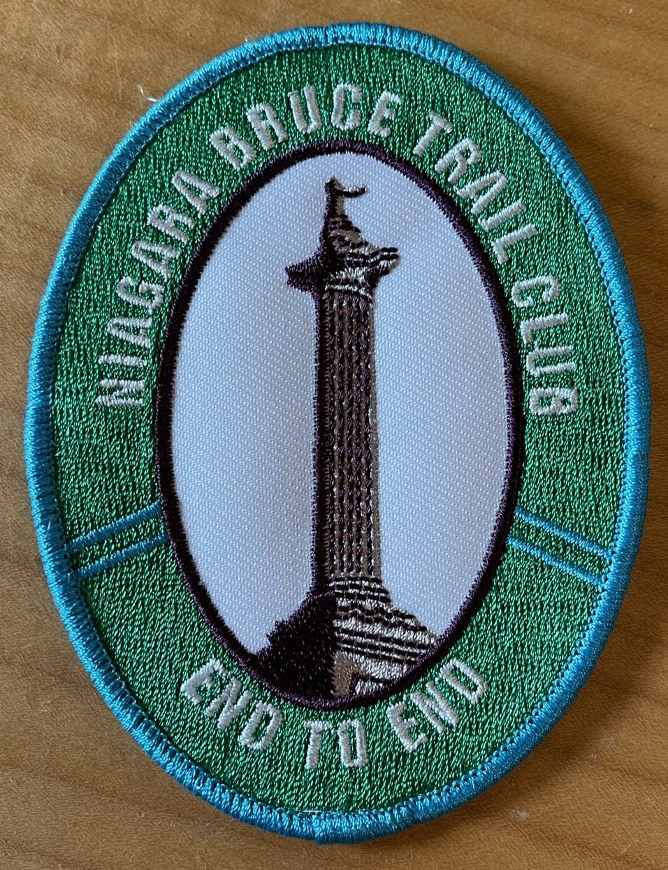
New Badge! Niagara E2E Hike #1
https://hikes.brucetrail.org/event/new-badge-niagara-e2e-hike-1/Sorry, the registration cut-off time for this hike has been reached.Not a member? Click here to join today!Hike open to BTC Members only.
Hosting Club: Niagara
Category: Car Pool
Location (Google Maps): Meet at Grimsby Lions Community Pool, 1 Elm St., Grimsby N43.193201 W79.565301
Carpool to Quarry Rd km 66.7 N43.142846 W79.458913Hike Leader(s): Lauren Doig Click here to contact Hike Leader(s)
Pace: Medium
Terrain: Strenuous
Distance: 15.2Description
Hike the entire Niagara section in 5 hikes from Grimsby to Queenston to receive the NEW BADGE! Please bring snacks and plenty of water. Be prepared for the weather. Poles are recommended. Bring $10 for the new badge on the final day if you have completed all 5 hikes.Duncan Crevice Caves - loop
https://hikes.brucetrail.org/event/duncan-crevice-caves-loop/Sorry, the registration cut-off time for this hike has been reached.Not a member? Click here to join today!Hosting Club: Sydenham
Category: General Hike
Location (Google Maps): Meet in the north-east corner of the parking lot at Home Depot on Highway 26 on the east side of Owen Sound.Hike Leader(s): Ian Mills Click here to contact Hike Leader(s)
Pace: Medium: 3 to 4 km/h
Terrain: Strenuous: Hilly with steep climbs and some poor footing., There might be muddy sections., There might be sections with water on the trail.
Distance: 10+kmDescription
We will be doing a loop at Duncan Crevice Caves Provincial Nature Reserve (BTC Map # 25) via the Main Trail and Chuck & Pat Grant Side Trail. Wonderful elevations and scenery including Metcalfe Rock via Metcalfe Crevice Side Trail. Closer to the hike date we can investigate if folks would like to do lunch at (Hearts Tavern) Kimberley – please advise the Hike Leader if you are interested. Please advise the Hike Leader if you would prefer to meet at the trail head vs. Car Pool location.Seven Rivers Hike Series - # 7 of 7 - Pretty River
https://hikes.brucetrail.org/event/seven-rivers-hike-series-7-of-7-pretty-river/Sorry, the registration cut-off time for this hike has been reached.Not a member? Click here to join today!Hosting Club: Dufferin Hi-Land
Category: General Hike
Location (Google Maps): Meet at the Snowmobile Parking Lot, 63597 Pretty River Rd north of Duntroon.Hike Leader(s): Margery Cruise,Susan Ford Click here to contact Hike Leader(s)
Pace: Medium
Terrain: Moderate
Distance: 9.9Description
We will walk 380 meters on Pretty River road to catch the main trail, take it to the John Haigh Side Trail reaching the highest point of the Bruce trail. Then we turn around, retrace our steps and follow Pretty River Side Trail. When it joins the main trail, we will follow it back to Pretty River Road and walk east to the parking lot.Directions: From CR 124 and HW 89, north on CR 124 to Singhampton, continue east on CR 124 and then north to Sideroad 33 and 34 Nottawasaga. Turn left and look for Snowmobile Parking Lot.
This is Seven Rivers (aka Headwaters) series consists of 7 hikes: 3 North and 4 South. Hikers completing all 7 hikes in this series will be eligible to purchase a Seven Rivers Hike Series Badge from Dufferin Hi-Land BTC.