Description Hike #5 of 6 Dyers Bay to Halfway Log Dump
Peninsula in 6 Challenger Series Complete 162.4 km section from Wiarton to Tobermory in 6 hikes.
You must sign up for EACH hike individually. The series is spread-out over 2 weeks, and 3 weekends. You are not automatically accepted into either series as a whole.
This hike series is intended for experienced distance hikers only. Hikers must demonstrate recent experience completing hikes exceeding 25 km over difficult terrain and at a brisk pace;
If a hiker is unable to keep pace with the group, or finds the distance too challenging, their future hike registrations may be canceled by the hike leader.
Be very aware of your ability to join this series.
Hikes will average 4.5 km per hour including breaks, moving pace is 5 km per hour;
Expect to be on-trail for 7 – 9 hours;
Meeting time is scheduled for 7:00am; arrive no later than 15 minutes prior to the meeting time;
Hikers must carry sufficient hydration, accessible snacks, lunch, first-aid kit, rain gear, extra socks, and possibly protective boot covers (i.e. bags);
Hikers will be expected to participate in shuttling hikers to the start and to drive shuttlers back to their car. Responsibility will be shared equally;
Any applicable parking fees will be shared within the group.
Hosting Club: Blue Mountains Category: Register in person the morning of hike. Location (Google Maps): Hike meets in the parking lot behind Tim Hortons on First St. in Collingwood.
Pace: Medium – 3 to 4 km/hr Terrain: Moderate – Some hills and/or some poor footing Distance: 13 km
Description We will park at Lavender Cemetery roadside parking about 0.5 km east of Lavender Hill Road on Mulmur-Nottawasaga Townline. We begin hiking from the cemetery over to the start of the Blue Mountains section, up to County Road 9 and back. This hike offers a variety of terrain as we travel along crevices and through forest and fields at times following alongside the Noisy River and a beautiful wetland. Bring a snack or lunch and water.
Description This hike will be a there-and-back walk. Views from the edge of the Escarpment will show Collingwood and Nottawasaga Bay. We’ll pass Craigleith Ski Club and head towards a deep valley but then it is time to return. Often, views look different when walking in the opposite direction, promising another chance to experience wide open views of the shores of Nottawasaga Bay. Please bring water and a snack
COVID-19 Precautions Before, During and After your Hike
Each hiker joining a Bruce Trail Club organized hike must perform a self-screening check before hiking. Find Ontario’s self-assessment tool here: https://covid-19.ontario.ca/self-assessment/
If you are experiencing COVID-19 symptoms, stay home.
Other Guidelines
Arrive 15 minutes before the start of the hike.
Wear sturdy footwear and appropriate attire for the weather and the terrain. Hiking poles are a good idea in any season, especially if the terrain is rocky or slippery. In winter, snowshoes or icers/crampons are needed when conditions dictate. Wearing appropriate clothing and footwear prevents injuries and shows consideration for a safe and positive group hiking experience.
Always carry I.D. and your health card.
Bring sufficient water and snacks (or lunch if indicated). A minimum of 1L of water is recommended on all hikes, and 3L is recommended for long, challenging hikes in the heat of the summer.
Bring sunscreen and insect repellent (for spring and summer hikes).
Hosting Club: Toronto Category: Car Hike Location (Google Maps): Terra Cotta Conservation Area Winston Churchill Blvd. North of the King Rd Parking on the side of the road where the Caledon Rail Trail crosses Winston Churchill Blvd.
Description This leisurely hike through the conservation area will give us an opportunity to see a variety of spring wild flowers and other local flora. Maybe even a few invasive species. If you are interested in starting to collect the requirements for your TBTC Biodiversity Naturalist badge this is a great way to get going. There’s lots to see along the trails. The terrain shifts as we walk through the area and so do the plants we will see. Download I naturalist , Merlin or Seek on your phone to help with identification. There are some interesting sites within the conservation area too, including old brick works, a sugar shack, and a waterfall. Please dress for the weather, this is a rain or shine hike but I am hoping for sunshine! Bring your camera or phones, snacks, water, sunscreen and bug spray You never know what the the beginning of May will bring.
Pace: Medium – 3 to 4 km/hr Terrain: Moderate – Some hills and/or some poor footing Distance: 6-7k (approximate)
Description Loop hike in beautiful Niagara Glen, NOT using Whirlpool Trail. We meet in between Niagara Glen parking lot and building near lot. Pay parking or Niagara parks pass. Trail ranges from moderate to quite rocky, has hills and stairs. Watch footing. Lots of boulders and great views close to Niagara River. We descend steel stairs before and after hike. Wear hiking boots or shoes. Bring water, snack, appropriate layered clothing for the weather and rain gear. Optional beverage/food after. Niagara Glen is close to both Butterfly Conservatory and Floral Clock.
Pace: Brisk: 4 to 5 km/h Terrain: Easy: Mostly flat and good footing.
Description Join us for an evening hike exploring Owen Sound paths and neighbourhoods, followed by an opportunity for refreshments. There is no need to arrive 15 minutes early, but this hike will start promptly at 7:00 pm.
Description Hike #6 of 6 Halfway Log Dump to Peninsula Terminus
Peninsula in 6 Challenger Series Complete 162.4 km section from Wiarton to Tobermory in 6 hikes.
You must sign up for EACH hike individually. The series is spread-out over 2 weeks, and 3 weekends. You are not automatically accepted into either series as a whole.
This hike series is intended for experienced distance hikers only. Hikers must demonstrate recent experience completing hikes exceeding 25 km over difficult terrain and at a brisk pace;
If a hiker is unable to keep pace with the group, or finds the distance too challenging, their future hike registrations may be canceled by the hike leader.
Be very aware of your ability to join this series.
Hikes will average 4.5 km per hour including breaks, moving pace is 5 km per hour;
Expect to be on-trail for 7 – 9 hours;
Meeting time is scheduled for 7:00am; arrive no later than 15 minutes prior to the meeting time;
Hikers must carry sufficient hydration, accessible snacks, lunch, first-aid kit, rain gear, extra socks, and possibly protective boot covers (i.e. bags);
Hikers will be expected to participate in shuttling hikers to the start and to drive shuttlers back to their car. Responsibility will be shared equally;
Any applicable parking fees will be shared within the group.
Hosting Club: Toronto, Dufferin Hi-Land Category: Car Hike Location (Google Maps): Mono Community Centre, west of km 72.2 Caledon. Coordinates N 44.026195,W 80.071516
Pace: Brisk Terrain: Hilly, Variable Distance: 14.1 km
Description This is a fundraiser hiking series of 4 hikes. The funds will be collected by the Toronto Club and will be moved to the Dufferin Club. Registered hikers will earn the new Stain Glass Badge. The registration is for all 4 days. May 2, 3, 9, 10. The badges will be given by the hike leader on the last day. you will be allowed to miss one hike. Please let the leader know before the day that you will be missing the hike, keep a log of the hike. It needs to be completed before the May 9, 2024.
the hike is marked as BRISK- expected moving pace is 4.5 km per hours.
the fees will go to support the Dufferin Club which supports the the Bruce Trail Conservancy “ preserving a ribbon of wilderness for everyone for ever״.
At this hike the registration is limited to Bruce Trail Conservancy members. hikers are expected to follow all Covid 19 guidelines and stay home if they have symptoms. arrive 15 minutes early, bring 2 litres of water. We will have one break for snack/ lunch. meeting points will be sent to the participants of these hikes. Everyone is expected to take part in the car shuttle.
Hosting Club: Toronto, Dufferin Hi-Land Category: Car Hike Location (Google Maps): On Mulmur-Nottawasaga Townline, 550m east of Lavender Hill Rd., at the cemetery. Do NOT block cemetery gate. GPS N44.268777, W80.156810
Description This is an E2E Dufferin fundraiser Stained Glass series in 4 hikes. The hikes vary in distance 12 – 14km and will be hiked at a moderate pace. The funds will be collected by the Toronto Club and will be moved to the Dufferin Club. The registration date, beginning March 2 at 8:30am, will be for all hikes (May 2, 9, 16, 23). Hikers who qualify for the Stained Glass badge will received it from the hike leader at the end of the last hike. You can miss one hike but please let the hike leader know ahead of time and ensure it is made up before May 23.
Hikers are expected to follow all Covid 19 guidelines and stay home if they have symptoms.
Please arrive at least 15 minutes early (by 8:30am) to ensure you’re organized and ready to leave at 8:45am. Please bring a minimum of 2L of water, enough food to last the hike, and bug repellent.
Everyone is expected to participate in the car shuttles.
From Jordan Hollow Hike the main trail to Upper and Lower Balls Falls, Moyer Road or Louth and Return. You must register for each hike. Bring Poles, sunscreen, bug spray , snack and a drink and dress for the weather
You are signing up for the following dates and times: 2024-05-02 at 09:00 2024-05-03 at 09:00 2024-05-16 at 09:00 2024-05-17 at 09:00 2024-05-30 at 09:00 2024-05-31 at 09:00 2024-06-13 at 09:00 2024-06-14 at 09:00 2024-06-27 at 09:00 2024-06-28 at 09:00 2024-09-05 at 09:00 2024-09-06 at 09:00 2024-09-19 at 09:00 2024-09-20 at 09:00 2024-10-04 at 09:00 2024-10-17 at 09:00 2024-10-18 at 09:00
Hosting Club: Caledon Hills Category: End-to-End Location (Google Maps): Meet at Windy Lane parking, km 78.5, Map 26 (Ed. 31) at the Beaver Valley Ski Club. Shuttle to start at Sideroad 19.
Pace: Medium – 3 to 4 km/hour Terrain: Moderate – some hills and/or some poor footing, Strenuous – hilly with steep climbs and some poor footing Distance: 92.3 – 78.5 = 13.8 km total
Description This is the third hike of the series and takes us along the top of Beaver Valley Ski hills on the west side of the valley. It includes Kimberley Springs Nature Reserve, views of Beaver Valley, Old Baldy, Kimberley Rock and Nottawasaga Bay.
Pace: Medium – 3 to 4 km/hr Terrain: Moderate – Some hills and/or some poor footing Distance: 9km
Description From the dog park we will take the Ray Lowes ST to the main trail to make our way to RBG Rock Chapel. There is a steep hill and stairs to climb, and to descend on the return. Bring water & snacks.
Description Let’s take a local hike starting in a Beamsville neighbourhood after work or school!
This neighbourhood loop hike starts in Beamsville’s local Ashby park, goes up Hillside trail (past the monarch way station), across Hillside and up Hixon to join the Bruce trail. From there we will hike east on the Bruce Trail towards Quarry road, and then loop back to Ashby park.
The pace of the hike will be moderate. The terrain is mixed with some paved paths, street and sidewalk, as well as the trail. There are some rocky sections of the trail.
Meet at 5:15 by the playground in the park to depart at 5:30. Limited street parking available next to the park, or walk if you live nearby! The full loop should take around 1.5 hours (max 2 hours) depending on our collective pace.
Hiking shoes are needed, poles are recommended. Carry water and some snacks.
Hosting Club: Toronto Category: Urban Walk Location (Google Maps): Jack Layton Ferry Terminal, near the gates to Wards Island Ferry. Arrive 20 minutes prior to departure to check in with hike leader.
From Union Station take the LRT and get off at the stop Ferry Docks.Walk up to the Ferry Docks on Queens Quay West, street level. at the foot of Bay Street.
Description After a day’s work come and “cool off” on the Toronto Islands free of fumes and traffic. Enjoy the view of the city skyline and Toronto’s beautiful island parkland. Pack a dinner for a sit down picnic. Food is not available for purchase on the Islands early in the season. Also bring a warm jacket and flashlight. Return fare ticket for the ferry approx $10.00 less for seniors. Hikes will take place rain or shine. Toronto Island evening hikes will take place every THURSDAY in MAY and JUNE 2024. Same time and same meeting place. No preregistration is required – just show up at the ferry docks at 5:40 PM and sign with the hike leader.
Hosting Club: Iroquoia, Toronto Category: General Hike Location (Google Maps): We will meet at km 12.1 of Map 12, on the southeast side of 15 Sideroad. Coordinates N43.5847586130601, W-79.9696086643468. Click on the Google link for personalized directions.
Pace: Medium – 3 to 4 km/hr Terrain: Moderate – Some hills and/or some poor footing Distance: 12 km
Description This is a four-series hike for the complete Toronto section of the Bruce Trail. Hike days are May 3, May 10, May 17 and May 24.
For the potential of slippery mud, bring gaiters and poles. Also bring 1.5 – 2 litres of water, snacks, bug spray and sunscreen. Hiking boots/shoes are mandatory.
We will meet at km 12.1 and two cars will shuttle to Hilton Falls Conservation Area parking lot. Please note that there is a fee for parking at Hilton Falls Conservation area, unless the person is a Halton Conservation Area passholder. If any hiker is a passholder, please let me know. If there are no passholders, hikers will share in the cost of parking fees.
Please arrive by 8:00 am so we can begin our shuttle at 8:15 am.
This is a series of 4 hikes to complete the Toronto section. You must sign up for all 4 hikes if you wish an ETE badge at a cost of $5 members/$15 non-members.
Hosting Club: Toronto, Caledon Hills Category: Car Hike Location (Google Maps): Hike #2 – Meet along the southwest shoulder of the Willoughby Rd and Escarpment Sideroad intersection GPS N43.831244, W79.980588
Pace: Moderate Terrain: Flat, Other (Refer to Description) Distance: 16km with a LOT of road walking today
Description Come to one, a few, or all of these hikes to celebrate Caledon’s 60th anniversary! By completing all 5 of these hikes, you’ll qualify for BOTH of Caledon’s NEW badges. On this second of five hikes, we’ll meet on the corner of Willoughby Rd/Escarpment Sideroad and shuttle to our starting point. There will be lots of walking along Escarpment Sideroad and Airport Rd. today with periodic jaunts into the forest where we’ll hopefully see signs of spring growth.
We’ll stop for a short snack break and also a lunch break, so please bring enough food to last the hike, 2L of water, bug repellent, and proper hiking attire. Hiking boots/shoes are mandatory. It may be rainy so ensure you have rain gear with you.
Each Friday we will explore different neighbourhoods, trails and parkland throughout Historic Niagara-on-the-Lake.
Moderate pace with some weeks entirely on sidewalks and roads while others may include a mix of trails and paved pathways. Great way to build up endurance for longer more strenuous hikes.
Prepare for cooler windy conditions on open parkland and along Lake Ontario and Niagara River trails.
Plan to stay for conversation and a warm cup of coffee or tea at Sweets & Swirls, Community Centre, Niagara Stone Road, NOTL
You are signing up for the following dates and times: 2024-05-04 at 08:00 2024-05-12 at 08:00 2024-05-18 at 08:00 2024-05-25 at 08:00 2024-06-01 at 08:00 2024-06-08 at 08:00 2024-06-15 at 08:00 2024-06-22 at 08:00 2024-06-29 at 08:00
Pace: Medium Terrain: Difficult, Moderate Distance: Varies by hike
Description Event Type: Multi-Day Hike Open to Bruce Trail Conservancy (BTC) Members Only. Non-members can join by signing up for a one-year BTC membership [$75] before registering at Bruce Trail Conservancy Memberships. Participant Limit: Maximum of 17 participants, including the hike leader and sweep. Scheduled Dates:
May 4, 12, 18, 25, 2024
June 1, 8, 15, 22, 29, 2024
Registration Fees:
BTC Members: $50
Includes Badge Fee
To Confirm Your Registration E-transfer $50 to HikeWithPBTC@gmail.com
Note: No refunds, hiker substitutions, or guest hikers. Registration fee does not include BPNP entry fee. Parking charges will be shared equally among participants.
Hike Leadership:
Led by PBTC Certified Hike Leader(s) and Sweep(s).
Pace: Medium
Terrain: Moderate/Difficult
Average Hike Distance: Approximately 16-21 KM per day
Hike Overview:
Complete the Peninsula section of the Bruce Trail over 9 hikes.
Direction: Northbound from Wiarton to Tobermory.
Group Hike Format: Participants commit to the entire series.
Intermediate/experienced hikers comfortable with challenges, including longer distances and elevation gains.
Expected Pace: 3 – 4 km/hr over 16-21 km
Total Distance: Approximately 165km with no dropout points.
Time allocated for photography and appreciating the local flora and fauna.
Participant Requirements:
Assess and ensure physical fitness for group hiking.
Attire: Proper hiking boots, layered clothing for varying weather, and wet weather gear. Hiking poles recommended.
Essentials: Sufficient food [lunch], snacks and water for a full day, bug spray.
Breaks: Morning, 15-30 minute on-trail lunch, and afternoon breaks, weather-dependent.
Participant is required to sign a BTC Waiver of Liability
Fee:
Covers badge fee.
Surplus supports Peninsula Bruce Trail Club’s hike program
Transportation:
Each hike in this series will involve a car shuttle, and all participants will take their turn as a shuttle driver. Ensure your vehicle is passenger ready for the shuttle.
Typical Meeting Time: 8 AM
Schedule will be based on daily hiking distance
Environmental Responsibility:
Adherence to Leave No Trace principles.
Collective effort in trail cleanliness.
Note: Dogs are not permitted on this hike.
Accommodations:
Early reservations recommended.
Suggested locations: Near meeting points or centrally in Lion’s Head.
Options include motels, campgrounds, hostels, and B&Bs.
Schedule and Communication:
Detailed itinerary sent prior to each hike.
Schedule subject to change.
Join us for this memorable hiking adventure and be part of a community dedicated to preserving and enjoying the natural beauty of the Bruce Trail.
Location (Google Maps): Meet at Bethesda Trail Head Parking on Bethesda Sideroad off Bayview Avenue, across from Lake Wilcox. This parking lot is free.
Pace: Moderate Terrain: Hilly, Variable Distance: 14-17 km
Description Join us to explore Jefferson Forest and Bond lake and thousands of trillium flowers
Please bring hiking poles, proper closing and shoes and lots of water,
Please carefully read safety procedures during the hike:
1-Hikers must stay between the leader and the sweep.
2-Hikers must advise the leader or the sweep if they wish to leave the group.
3- Hikers must follow the whistle instructions: 1 blast- stay where you are; 2 blasts come to the leader; 3 blasts – come to the leader quickly.
4-Hike leader may request volunteers to stop at trail intersections, they need to help hikers to the direction the group walk and wait till they see the sweep .
5-Hikers have to make sure they can see the persons behind and in front of
Description We will begin the hike at km 34.2 by winding our way through forest and farmland to the entrance of Devil’s Glen Provincial Park. We will walk to the nearby lookout platform to admire the steep bedrock gorge at the edge of the escarpment. The lower valley walls are steep and covered with dense deciduous forest. Rare harts tongue and smooth cliff brake ferns grow on these steep cliffs. We will descend a series of natural steps down to the Mad River. Then we climb uphill switchbacks to reach the junction with the Ganaraska Trail that stretches from here to Port Hope. The Bruce Trail continues along the Escarpment edge to McKinney’s Hill and its superb view to the east. The trail passes Freedom Rock and the Nottawasaga Bluffs Lookout. Some white cedar trees in this park are well over 1,000 years old. We will end the day’s hike at km 21.9, and then head for Shelburne for refreshments before our return to Toronto.
Pace: Medium – 3 to 4 km/hour Terrain: Moderate – some hills and/or some poor footing Distance: 10 km
Description This is the first of two hikes that focus on the intersection of nature, history, and art in the beautiful dingle of the Caledon Hills.
“Dingle” is an ancient word that means “wooded valley”. The dingle of the Caledon Hills runs through Glen Haffy Conservation Area. In the mid-1800s, pioneers built a rough log school in the dingle. In 1872 they built a larger school – the Dingle Schoolhouse – that still stands today. As we hike along the Bruce Trail, we will follow the path that children took to school more than a hundred years ago, and we will hear stories of the children and teachers of the Dingle Schoolhouse.
The second hike on May 23rd (which requires a separate registration) will focus on world famous Canadian artist Rosemary Kilbourn. She bought the Dingle Schoolhouse after it closed as a school, and for over sixty years she made this beautiful place deep in the woods her home and studio. We will be joined on this hike by Ms. Kilbourn’s archivist and niece, who will share stories about this remarkable woman. Our walk through the dingle will help us appreciate how Ms. Kilbourn’s work was inspired by the living presence of the land around her beloved home.
Pace: Medium Terrain: Dependent on Conditions, Slippery and Steep Sections, Strenuous Distance: 10-22 kms
Description Join us on a five-day odyssey from Cape Chin South to Tobermory on the most challenging and remote terrain on the Bruce Trail. On a clear day the views are breathtaking. Hikes range from 10 to 22km a day. One hike even may involve wading through water over your knees. These are difficult rain or shine hikes and not for the inexperienced or faint of heart. Itinerary will be shared with participants closer to departure date. Hopefully you will be able to join us for the whole five days but less than that may be an option depending on registrations.
Hosting Club: Toronto Category: Car Hike Location (Google Maps): 17th side road, coordinates N 43.592859,W 79.980456 provides access to Vanderleck Side Trail.
Pace: Leisurely Terrain: Rocky, Variable Distance: 3-4 k
Description This is a special memorial and life celebration of the legendary Doug Sloan that so many people knew and were inspired by his love and dedication to the Bruce Trail. He is also the famous person that hiked the trail E2E 50 times. There will be a meet and greet, a short hike to the interactive plaque named after him, the unveiling and a toast. People that want to remark and reflect about Doug are welcome to do so, please email me ahead of time and let me know. we will continue with a 45 minutes hike led by Adam. Adam is an ecologist that will share with us his knowledge of the echo system of the area. We will go back to the parking for a reception and a light snack. Please carpool to get to the hike if possible due to a shortage of parking spaces.
Hosting Club: Blue Mountains Category: Register in person the morning of hike. Location (Google Maps): Hike meets in the parking lot behind Tim Hortons on First St. in Collingwood.
Pace: Leisurely – 3 km/hr. or less Terrain: Easy – Mostly flat and usually good footing, Moderate – Some hills and/or some poor footing Distance: 5 km
Description We will drive via Grey Road 119 to the end of the 6th Line in the Beaver Valley section. We will hike along the white blazed trail to km 11.3 where it joins up with the Margaret Paull Side Trail. We will follow the side trail back to the main trail, then return to the cars. Bring a snack or lunch and water.
Hosting Club: Sydenham, Peninsula Category: General Hike Location (Google Maps): The Owen Sound Galaxy Cinema parking lot. Meet at the tall “Galaxy Centre” sign next to the traffic lights.
Pace: Medium: 3 to 4 km/h Terrain: Strenuous: Hilly with steep climbs and some poor footing., There might be muddy sections., There might be sections with water on the trail. Distance: 12.3km
Description Starting at the end of Pitt Road (Map 36 – south of 38.5km) on the Boundary Bluffs Side Trail north to the Main Trail overlooking Sydney Bay until Hart’s Tongue Side Trail then following the Boundary Bluff Side Trail south to our starting area. This is a 4 hour hike excluding stops – we will be taking a lunch break half way. While the pace is medium expect a challenging hike with lots of ups and downs. Good hiking shoes mandatory and a walking stick is recommended. We should get the opportunity to see a field of daffodils blooming and enjoy some beautiful views.
Pace: Leisurely Terrain: Variable Distance: Several hikes will be offered throughout the day. Approx 3 to 5 km each
Description CANCELLED DUE TO LOW REGISTRATION
Sometimes hikers who are focusing on getting from A to B may not take the time to appreciate the abundance of living things to be found along the trail.
This hike aims to address that! We’ll break into smaller groups, each with a hike leader and a nature expert. We’ll focus on stopping regularly to look and listen. Birds, wildflowers, ferns, trees and fungi will all be observed and identified. Join us as we spend the day exploring the Bruce Trail and side trails near Georgetown.
Have you earned your Naturalist badge? This will be a great opportunity to “collect” the requirements!
Bring water, snack and lunch, sunscreen, insect repellent, and your camera. Please wear sturdy boots or hiking shoes.
If you are interested in documenting what you see, we’ll share our knowledge of these phone apps: iNaturalist, e-Bird and Merlin. Please download them before you leave home.
This outing is brought to you by the TBTC Biodiversity Team.
Join us for the NBTC Nature Hike series to learn more about the biodiversity along the Niagara Escarpment. We will explore the trails throughout Louth Conservation area which offer beauty in all four seasons. Hikes will be held January, May, August & October – it will be amazing to see all the changes throughout the seasons. Your hike leaders, members of the NBTC Biodiversity Committee, will share their knowledge of the amazing flora & fauna along the trail as well as any biodiversity projects in the works for this year.
Parking is at the Louth Conservation Area Parking Lot on Staff Ave. Hiking boots and poles are recommend as the terrain is rocky in sections.
Note that he hike will be rescheduled in the event of heavy rains or heavy snow.
Pace: Moderate Terrain: Variable Distance: 15.2 km
Description This is the first of a Dufferin Hi-Land four part end to end car hike. For the first hike we start in Mono Cliffs Provincial Park and proceed north across rolling farmlands to finish at Km 15.2.
To get to the meeting point drive north on Hwy 10 past Orangeville to Mono Centre Road (crossroads name is Camilla). Turn right and go about 8 km to Mono Centre. Before you reach the T intersection you will see a community centre and tennis court on your right. The entrance to the parking area is just before the tennis court.
Those completing the four hikes may get a badge to recognize their achievement (cost is $10).
Description Please join me at the south west corner of Lakeshore Blvd West and Ellis by 10 AM. We will hike east along the Waterfront Trail to the Distillery District (km 8.3 to km 71.4). Here is an online map with km markings of our route for all 7 hikes for the Toronto Urban Badge.
Please make sure you bring at least 2 liters of water, a lunch, bug spray and sunscreen.
Hosting Club: Toronto Category: Cancelled Location (Google Maps): 6th line. Km 26.6, where main trail exits to the forest. Map 13. Coordinates N 43.658281,W 79.985371
Hosting Club: Iroquoia Category: Hike Leader’s Hike Location (Google Maps): We will meet at the back of the Kilbride School on Panton Street at 08:30 sharp. From here we will carpool to the roadside parking at Twiss Road, (just south of Camp Manitou- Boy Scout camp and just north of Derry Rd.) See link below for directions. As this roadside parking area has limited room for cars and does tend to fill up quickly and early on weekends we will carpool to this location. As there is plenty of parking at the nearby Kilbride Park, behind Kilbride School at the end of Panton St we will shuttle from there to Twiss road.
Pace: Medium – 3 to 4 km/hr Terrain: Moderate – Some hills and/or some poor footing Distance: Approx 10km
Description This is a rescheduled hike from April 13 that was cancelled due to weather. I am changing the format slightly from a Iroquoia hike leader social to a meet & greet the Iroquoia hike leaders. Everyone is welcome on this hike and it will be a great opportunity for non-leaders to meet our team and to learn what being a BT hike leader is all about. After we carpool to the Twiss road parking area we will hike toward the Guelph Line where we will cross the road and enter the Crawford Lake Conservation Area and make our way to the Nassagawaya Canyon lookout where we will take a short break. From the lookout we will retrace our steps back to the Guelph Line and back to Twiss road. All hikers will be carpooled back to Panton Street where most cars will be parked behind the Kilbride school. If the weather allows we can have an optional social afterwards for additional conversations.
Please dress for the weather. Bring water and snacks in addition to a lunch. Please bring suntan lotion and bug spray if you are partial to that as we may be in the early timing for blackfly season.
Pace: Medium Terrain: Strenuous Distance: Approximately 10
Description This hike is very scenic with hills up the escarpment along the way. We cross the Laura Secord Bridge and continue to Morningstar Mill. If volunteers are there, we can see how the mill operates and possibly get a chance to go through the historic house. Then we continue walking a rocky path along Lake Moodie where we end up at Decew House. From there we walk over to the First Nations Peace Monument returning by the same trails back to Rotary Park. If you have any questions email smassey449@gmail.com
Description Description: Join us for a pleasant walk and some Yoga along Highland Creek and the Waterfront Trail to Port Union. We will meet outside Guildwood Go Train Station, and head to Highland Creek Community Park to hike along the Highland Creek Trail. If weather allows, we will find a flat area along the way to pause and do some gentle Yoga standing poses- no Yoga mat is required. We will continue our hike and reach the Waterfront Trail, ending in Rouge Hill Go Station. Those interested can join us for an after-hike coffee/tea at a local coffee shop.
Route map: https://onthegomap.com/s/j7htp3e6
How to get there and get home: We will meet as a group no later than 09:30 outside the Guildwood Go Station. GO trains run eastbound approximately every 30 minutes from Union Station. Bus 86 from Kennedy Station is an alterantive to get there using TTC transit. If you are driving, there is free parking outside the station. To go back, you can take the westbound GO train to Union Station and beyond. If you parked at Guildwood, you can take the westbound train for 1 station to retrieve the car.
What to bring: Proper walking /hiking shoes, at least 1.5 litres of water and a packed lunch. Appropriate clothing for the weather. No Yoga mats required. No dogs allowed.
Description Please join me at the north east corner of Bathurst and Finch by 10 AM. We will hike east on the Finch Hydro Corridor Trail and south along East Don Parklands to Sheppard and Leslie (km 41.6 to km 51.2). Here is an online map with km markings of our route for all 7 hikes for the Toronto Urban Badge.
Please make sure you bring at least 2 liters of water, a lunch, bug spray and sunscreen.
Hosting Club: Sydenham Category: General Hike Location (Google Maps): Meet at Walter’s Falls Community Centre at 1:30 and we will shuttle to the start of the hike from there.
Pace: Medium: 3 to 4 km/h Terrain: Strenuous: Hilly with steep climbs and some poor footing. Distance: 4.3 km
Description We’ll meet at the Walter’s Falls Community Centre at 1:30. After a very short car shuttle, our hike begins at Deviation Road. We will hike west along the top of the escarpment for 3 km, enjoying the scenic vistas and the beautiful forest for 3 km, then descend into the Rocklyn Creek valley and follow the waterfalls out to the road. The creek portion is muddy at this time of year, so waterproof footwear is strongly advised. This is a very pretty hike, but there are several steep ascents and descents with rocky terrain and uneven footing. Hiking poles are helpful.
Pace: Leisurely: 3 km/h or less Terrain: Moderate: Some hills and/or poor footing Distance: 4.8 km
Description Walk or carpool to Walters Falls Inn crossing the bridge on main trail which traverses the escarpment and follows the river upstream, returning on the other side of the river via the Walters Creek Side Trail. Walking poles or sticks are helpful for downhill sections. Some areas by the river may be muddy.
This is a beautiful hike in any season through mixed forest, and close to a running stream, with low and high sections.
Pace: Leisurely: 3 km/h or less Terrain: Moderate: Some hills and/or poor footing Distance: 2.5 km
Description A wonderful opportunity to discover this very interesting newly acquired BTC property. A rough trail has been marked, but hikers must be able to step over branches and walk on uneven ground. The hike will include views of large maple trees and a hike up the Gorge! We will make several stops to look at features.
We will meet outside the Community Hall 1:00-1:15 for instructions and to arrange car pooling the 5 kilometres to the start of the hike.
Hosting Club: Iroquoia, Toronto Category: Special Event Location (Google Maps): A new hike and badge will be available this spring! – promoted by Friends of the Frontenac Provincial Park – Frontenac Provincial Park is about 3-4 hours away depending on traffic from the GTA. Overnight, nearby accommodation is strongly recommended. – 50 km to complete the perimeter of Frontenac Provincial Park – 3 hikes which we will complete over 2 days – registration for the Perimeter Challenge opens April 1, 2024 – registration to participate in this challenge as organized by Steve and Smadar opens January 2, 2024 at 9am – hikes to be completed May 6&7, 2024 – please note we are meeting at 9am the first day and 7:30am the second day.
Smadar Junkin and I will lead hikes over 2 days, Monday May 6 and Tuesday May 7. May 6 – meet at 9:00, shuttle and be hiking by 10:00; 23.6 kms May 7 – meet at 7:30, shuttle and be hiking by 8:30; 27 kms
Both days we will meet at Kingsford Dam (44.5775331, -76.5221817) and shuttle to 6767 Perth Rd (44.5048042, -76.4739223)
Pace: Brisk – 4 to 5 km/hr, Medium – 3 to 4 km/hr Terrain: Moderate – Some hills and/or some poor footing, Strenuous – Hilly with steep climbs and some poor footing Distance: May 6 -23.6kms; May 7 – 27kms
Description Register for this hike on BTC Calendar on January 2/24 @9am.
Register with Friends of the Frontenac when registration opens April 01, 2024. All hikers must register themselves to be eligible for the badge. https://www.friendsofrontenac.com/perimeter-challenge. The cost is $10. This special event hike is intended for those who wish to obtain the badge.
Hikers are to bring snacks, lunch, 2 litres of water, hat, BUG SPRAY as May can bring black flies/mosquitos, rainwear, hiking shoes/boots, hiking poles, first aid kit. We will take turns to shuttle to trail head and at end of day, both days. Please ensure your vehicle is shuttle-ready.
For those hikers staying at Snug Harbour, we hope you will join us for a potluck dinner on May 6. Let Smadar know what you’d like to bring at smadarjunkin@hotmail.com
Description New to hiking? Not sure what to wear, what to bring and where to go? the Toronto Bruce Trail Club’s popular Hiker Initiation Program is back for you! The 2024 Hiker Initiation Program offers an information webinar followed by Introductory hikes, and both members and non-members are welcome!
Our Hiker Initiation Program (affectionately named HIP) has introduced over 1000 people to hiking since its inception in 2009. Learn the ins-and-outs of hiking, and the benefits of hiking presented by experienced hike leaders from the Toronto Club. You’ll also learn about the Bruce Trail, our hiking programs, biodiversity, and etc. The information session will talk about:
The Bruce Trail and its wonders;
Hiking basics, safety and tips;
Organized hiking programs with the Bruce Trail Club;
Unique winter coach program.
Please register for the webinar at: https://us02web.zoom.us/webinar/register/WN_h9HhmurgRriVX4TFlBM6Xg#/registration
Pace: Leisurely – 3km/hr or less Terrain: Moderate – Some hills and/or some poor footing Distance: 3-4km
Description This is an Adopt-a-Road event and is inspired by the Peninsula Club who have a similar event along Hwy 6. We will be supplied with vests, bags and gloves. You will only need to bring water. It will involve cleaning up the trash from both sides of Regional Rd 81 in Grimsby from Casablanca to Kelson Rd on both sides of Regional Rd 81. This event, while not a hike, will involve a lot of bending over along the roadside. All instructions and safety precautions will be provided to all participants.
A complimentary breakfast or lunch will follow this inaugural event. This is a group activity and is intended to foster community involvement and awareness for the Iroquoia Bruce Trail Club. Signage will be installed and there will be publicity and promotion on social media with both the Niagara Region and Iroquoia Bruce Trail Club.
Dufferin Hi-Land Section, Map 20. Meet at north end of 2nd Line EHS off 8 Sideroad where the road ends and the 2nd Line EHS Side Trail begins (near Km 24.3). Park on the west side of 2nd Line south of the first driveway.
Pace: Leisurely Terrain: Moderate Distance: 6 km; Short hike: 3 km
Description Brenda Carling will lead us as we explore and identify the trees and blooming wildflowers along the Oliver Creek Side Trail and the Main Trail through Walker’s Woods. Bring a camera, snacks and water.
Hosting Club: Caledon Hills Category: Tuesday Hikers Location (Google Maps): Parking loop on north side of River Road just east of Prince of Wales Road. The directions are as follows: -find your way to Orangeville -follow Hwy 10 north to Primrose -continue straight through the stop light at Hwy 89 on to Prince of Wales Road. -follow Prince of Wales Road until it ends at the bottom of a long winding hill -turn right on to River Road -follow River Road approximately 500M -the Pine River Fishing Area parking is on the left
Pace: Medium – 3 to 4 km/hour Terrain: Strenuous – hilly with steep climbs and some poor footing Distance: 11 km
Description This will be a hilly and potentially muddy hike. We start and finish with a short walk on River Road. After connecting with the main section of the Bruce Trail the rest of the hike will be in the forest. Walking poles recommended and a lunch. Parking is limited so please consider car pooling.
Hosting Club: Blue Mountains Category: Register in person the morning of hike. Location (Google Maps): Hike meets in the parking lot behind Tim Hortons on First St. in Collingwood.
Pace: Medium – 3 to 4 km/hr Terrain: Moderate – Some hills and/or some poor footing, Strenuous – Hilly with steep climbs and some poor footing Distance: 12 km
Description We will drive to the Wodehouse Karst parking lot on the 7th Line south of Sideroad 7A in the Beaver Valley section. We will hike along the Wodehouse Karst Side Trail to the white blazed trail at km 83.6 and hike south to km 79.5. Here we will meet up with the Valley Crossover Side Trail and hike north to meet up with the Kimberley Side Trail. Continuing north on the Kimberley Side Trail we meet up with the white blazed trail at km 83.1 and retrace our steps back to the cars. Bring a snack or lunch and water.
Location (Google Maps): Meet at the corner of Sideroad 21 and the 4th Line. By the entrance of the Intercept Side Trail, km 2.3 The Bruce Trail Reference, Edition 31
Pace: Medium Terrain: Moderate, Some rocky footing, Some steep sections Length of Hike: 7 km
Description This hike is in the Loree area. We’ll walk a step creekside section to reach the lookout over Nottawasaga Bay. From there, we’ll head out of Sideroad 21 to an area with a beautiful glowing stream. After crossing Sideroad 21 again, we’ll enter the Len Gentler Memorial Forest but we’ll only use the Len Gentler Side Trail to make our way back to our trailhead. A little bit of road walking finishes our hike.
COVID-19 Precautions Before, During and After your Hike
Each hiker joining a Bruce Trail Club organized hike must perform a self-screening check before hiking. Find Ontario’s self-assessment tool here: https://covid-19.ontario.ca/self-assessment/
If you are experiencing COVID-19 symptoms, stay home.
Other Guidelines
Arrive 15 minutes before the start of the hike.
Wear sturdy footwear and appropriate attire for the weather and the terrain. Hiking poles are a good idea in any season, especially if the terrain is rocky or slippery. In winter, snowshoes or icers/crampons are needed when conditions dictate. Wearing appropriate clothing and footwear prevents injuries and shows consideration for a safe and positive group hiking experience.
Always carry I.D. and your health card.
Bring sufficient water and snacks (or lunch if indicated). A minimum of 1L of water is recommended on all hikes, and 3L is recommended for long, challenging hikes in the heat of the summer.
Bring sunscreen and insect repellent (for spring and summer hikes).
Description The Bruce Trail Conservancy is dedicated to the biodiversity of the lands adjacent ot he trail. For the first 1 1/2 hours the focus will be on removing invasives in the area, likely garlic mustard and English Ivy. An optional hour hke will follow with the focus being on learning more about biodiversity and the plant matter along the trail.
Hosting Club: Iroquoia Category: Good Companions Location (Google Maps): Christie Lake. First parking lot on your RIGHT as you enter the Christie Lake Conservation area off Hwy 5, Dundas Road.
Pace: Medium – 3 to 4 km/hr Terrain: Moderate – Some hills and/or some poor footing Distance: 8 km
Description We will hike around Christie Lake, a lovely area. The terrain varies from open fairly flat paths to some hilly sections through forest. The length of the hike may vary slightly depending on weather and conditions. If you do not have a Hamilton Conservation Authority pass, there is an entry fee. Bring the usual – hiking boots, water, snack, clothing layers, poles if using.
Hosting Club: Iroquoia Category: Afternoon/Evening Hikes Location (Google Maps): Parking lot on 6th Line, about 3 kms up from Campbellville Rd. Small parking lot so plan to arrive between 4 and 4:15 pm.
From Jordan Hollow Hike the main trail to Upper and Lower Balls Falls, Moyer Road or Louth and Return. You must register for each hike. Bring Poles, sunscreen, bug spray , snack and a drink and dress for the weather
Location (Google Maps): Parking lot at the corner of Bayview Ave, and Sycamore Dr. South of Highway 7 Sycamore Dr. is 2 blocks south of highway 7,parking lot is across plaza of Dollarama and Star box
Pace: Medium – 3 to 4 km/hour Terrain: Moderate – some hills and/or some poor footing, Strenuous – hilly with steep climbs and some poor footing Distance: 78.5 – 65.1 = 13.4 km total
Description This is the fourth hike in the series and continues along the west side of Beaver Valley and the ski club. The trail takes us through a pine plantation, past waterfalls and the Boyne River, over boardwalks to Hogg’s Falls.
Hosting Club: Caledon Hills Category: Nature Walks Location (Google Maps): Hemlock Ridges – Hockley Road and 5th Line EHS Mono. Parking area north of km 51.8 on the east side of 5th Line.
Pace: Leisurely – 3 km/hour or less Terrain: Moderate – some hills and/or some poor footing Distance: 3 km
Description This Nature Walk will take place on the BTC’s beautiful Hemlock Ridges property. This is a good time of year to observe migrating birds before the leaves come out. We’ll stop regularly to listen to birds and admire spring flowers. Bring binoculars, camera and cell phone. Cell phone apps like Merlin, Seek and iNaturalist can help in identification of flora and fauna along the route.
Hosting Club: Iroquoia Category: Thursday Group Location (Google Maps): Meet at Crawford Lake Conservation Area at the first parking lot on the left in time for a 9:30 departure. Registration through Conservation Halton is strongly recommended. We hike over to Rattlesnake point and do the loop through the canyon and return. Trails could be wet. Bring snack and water. Optional snack or coffee in Campbellville.
Location (Google Maps): Jack Layton Ferry Terminal, near the gates to Wards Island Ferry. Arrive 20 minutes prior to departure to check in with hike leader.
From Union Station take the LRT and get off at the stop Ferry Docks.Walk up to the Ferry Docks on Queens Quay West, street level. at the foot of Bay Street.
Description After a day’s work come and “cool off” on the Toronto Islands free of fumes and traffic. Enjoy the view of the city skyline and Toronto’s beautiful island parkland. Pack a dinner for a sit down picnic. Food is not available for purchase on the Islands early in the season. Also bring a warm jacket and flashlight. Return fare ticket for the ferry approx $10.00 less for seniors. Hikes will take place rain or shine. Toronto Island evening hikes will take place every THURSDAY in MAY and JUNE 2024. Same time and same meeting place. No preregistration is required – just show up at the ferry docks at 5:40 PM and sign with the hike leader.
Hosting Club: Iroquoia, Toronto Category: General Hike Location (Google Maps): Meet at km 12.1 (Map 12), southeast side of 15 Sideroad, in Acton (same as for hike 1). Coordinates N43.584721364546816, W-79.96933398937986. Click on the Google link for personalized driving instructions.
Pace: Medium – 3 to 4 km/hr Terrain: Moderate – Some hills and/or some poor footing Distance: 14 km
Description This is the second of a four-series hike of the complete Toronto Club section of the Bruce Trail.
Please bring gaiters and poles for the slippery mud. Bring 1.5 to 2 litres of water, bug spray, sunscreen and a snack. Hiking boots/shoes are mandatory. For further details, refer to hike 1 of 4 on May 3.
Please arrive by 8 am, so we can leave at 8:15 am to shuttle to our starting point (km 26.5).
This is a series of 4 hikes to complete the Toronto section. You must sign up for all 4 hikes if you wish an ETE badge at a cost of $5 members/$15 non-members.
Hosting Club: Toronto, Caledon Hills Category: Car Hike Location (Google Maps): Hike #3 – Meet at km 31.5 on Innis Lake Rd, north of Finnerty Sideroad. Additional parking is available on the south shoulder of Finnerty Sideroad east of Innis Lake Rd. GPS N43.918917, W79.909387
Description Come to one, a few, or all of these hikes to celebrate Caledon’s 60th anniversary! By completing all 5 of these hikes, you’ll qualify for BOTH of Caledon’s NEW badges. On this third of five hikes, we’ll meet on Innis Lake Rd and shuttle to our starting point. We’ll hike through a lot of forested areas today – including The Dingle, Glen Haffy CA, and part of the Humber Valley. We’ll also pass the point where the Oak Ridges Moraine Trail (ORTA) meets the Bruce Trail.
We’ll stop for a short snack break and also a lunch break, so please bring enough food to last the hike, 2L of water, bug repellent, and proper hiking attire. Hiking boots/shoes are mandatory. It may be rainy so ensure you have rain gear with you.
Description Robin Garrett & Margaret Northfield are a team! Each Friday one of us will lead our group through different neighbourhoods, trails and parkland throughout Historic Niagara-on-the-Lake.
Moderate pace with some weeks entirely on sidewalks and roads while others may include a mix of trails and paved pathways. Great way to build up endurance for longer more strenuous hikes.
Prepare for cooler windy conditions on open parkland and along Lake Ontario and Niagara River trails.
Plan to stay for conversation and a warm cup of coffee or tea at Sweets & Swirls, Community Centre, Niagara Stone Road, NOTL
Hosting Club: Sydenham Category: General Hike Location (Google Maps):
Meet at 9:45 am at Kemble Arena parking lot (319897 Kemble Rock Road) to carpool to trail head. Limited parking at trail head. 5 minute drive from Kemble.
Pace: Leisurely: 3 km/h or less, Medium: 3 to 4 km/h Terrain: Easy: Mostly flat and good footing., Moderate: Some hills and/or poor footing, Strenuous: Hilly with steep climbs and some poor footing. Distance: 6 km. approx
Description We will hike 2 loops : Tumbled Rocks Sidetrail loop and then main trail to Dodd’s Hill loop. Beautiful views, spring flowers and ferns! Also, a walk through the Porcupine Crevice. Bring water and snacks and poles are recommended. If you are unable to register, please call or text the leader at 226-787-8804.
Description Let’s take a local hike starting in a Beamsville neighbourhood after work or school!
This neighbourhood loop hike starts in Beamsville’s local Ashby park, goes up Hillside trail (past the monarch way station), across Hillside and up Hixon to join the Bruce trail. From there we will hike east on the Bruce Trail towards Quarry road, and then loop back to Ashby park.
The pace of the hike will be moderate. The terrain is mixed with some paved paths, street and sidewalk, as well as the trail. There are some rocky sections of the trail.
Meet at 5:15 by the playground in the park to depart at 5:30. Limited street parking available next to the park, or walk if you live nearby! The full loop should take around 1.5 hours (max 2 hours) depending on our collective pace.
Hiking shoes are needed, poles are recommended. Carry water and some snacks.
Hosting Club: Dufferin Hi-Land Category: Special Events Location (Google Maps): 586387 10th Sideroad, Mulmur. GPS Coordinates: N 44 13849 W 080 13649. This is the first farm 200m west of Center Rd on 10th (also called 17 when west of Center rd) There is a church on the corner. Please arrive by 7:45 latest to allow time for check in. Buses depart at 8:00 am. BTC Map 20 just west of km 30.4 (Whitfield). Directions to Parking Location: If coming by Hwy 10 from Orangeville: – follow 10 north to Primrose – proceed straight through the intersection onto Dufferin County Road 19, also called Prince of Wales Road – follow this road for 6 km to first stop sign – turn right, proceed approx 1 km – the church is highly visible on the left side, parking is 200m west of the church.
Pace: Brisk Terrain: Dependent on Conditions, Slippery and Steep Sections, Slippery Sections Likely, Strenuous Distance: 55km (29km & 26km)
Description Join us for two days of hiking the rolling hills of Dufferin County. Enjoy the spring flowers while earning your Red Trillium Badge. Hike distances are approximately 29km on Day 1 and 26km on Day 2. There will be checkpoints along the hike with volunteers providing assistance, refreshments and snacks. Registration is $65 for members and $75 for non-members, which includes shuttle bus service, checkpoint snacks and refreshments, Red Trillium Badge (must complete full hike to earn badge), and post-hike refreshments. Space is limited so register early! No dogs. No children under twelve. No refunds. Further details to be provided to participants upon registration.
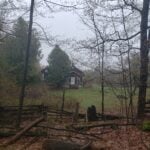
Description Hike #5 of 6 Dyers Bay to Halfway Log Dump
Peninsula in 6 Challenger Series Complete 162.4 km section from Wiarton to Tobermory in 6 hikes.
You must sign up for EACH hike individually. The series is spread-out over 2 weeks, and 3 weekends. You are not automatically accepted into either series as a whole.
This hike series is intended for experienced distance hikers only. Hikers must demonstrate recent experience completing hikes exceeding 25 km over difficult terrain and at a brisk pace;
If a hiker is unable to keep pace with the group, or finds the distance too challenging, their future hike registrations may be canceled by the hike leader.
Be very aware of your ability to join this series.
Hikes will average 4.5 km per hour including breaks, moving pace is 5 km per hour;
Expect to be on-trail for 7 – 9 hours;
Meeting time is scheduled for 7:00am; arrive no later than 15 minutes prior to the meeting time;
Hikers must carry sufficient hydration, accessible snacks, lunch, first-aid kit, rain gear, extra socks, and possibly protective boot covers (i.e. bags);
Hikers will be expected to participate in shuttling hikers to the start and to drive shuttlers back to their car. Responsibility will be shared equally;
Any applicable parking fees will be shared within the group.
Hosting Club: Blue Mountains Category: Register on-line or sign-in morning of hike Location (Google Maps): Hike meets in the parking lot behind Tim Hortons on First St. in Collingwood.
Pace: Brisk – 4 to 5 km/hr Terrain: Strenuous – Hilly with steep climbs and some poor footing Distance: Long
Description This will be a surprise. Guaranteed to be super challenging and strenuous. Come prepared for a workout. You should be a hiker experienced in longer distance hikes as well as managing various terrains. Bring lots of water, snacks and lunch and maybe even dinner.
Location (Google Maps): Meet at Bethesda Trail Head Parking on Bethesda Sideroad off Bayview Avenue, across from Lake Wilcox. This parking lot is free.
Pace: Moderate Terrain: Hilly, Variable Distance: 14-17 km
Description Join us to explore Jefferson Forest and Bond lake and thousands of trillium flowers
Please bring hiking poles, proper closing and shoes and lots of water,
Please carefully read safety procedures during the hike:
1-Hikers must stay between the leader and the sweep.
2-Hikers must advise the leader or the sweep if they wish to leave the group.
3- Hikers must follow the whistle instructions: 1 blast- stay where you are; 2 blasts come to the leader; 3 blasts – come to the leader quickly.
4-Hike leader may request volunteers to stop at trail intersections, they need to help hikers to the direction the group walk and wait till they see the sweep .
5-Hikers have to make sure they can see the persons behind and in front of
Hosting Club: Caledon Hills Category: Prediction Hike Fundraiser Location (Google Maps): Akela and Scouters Heather and Ross Hamlin Nature Reserve at Riverside Woods
Meet at the BTC Parking Lot, 713377 1st Line EHS, Mono, 43.959916, -80.070494
Directions: From ON-9, head north onto 2nd Line EHS for 3 km. Turn left/west onto Side Road 5 for 1.5 km. Turn right onto 1st Line EHS for approximately 1 km. Continue straight into the parking lot.
From ON-10, head east on Hockley Road/Dufferin County Road 7 for 1 km. Continue straight onto Side Road 5 for 1.5 km. Turn left onto 1st Line EHS for approximately 1 km. Continue straight into the parking lot.
Terrain: Moderate – some hills and/or some poor footing Distance: 4.5 kilometres or 15.0 kilometres
Description Plan to attend our fourth and final organized Prediction Hike Challenge. Choose one of two predetermined hikes – 4.5 km or 15.0 km. Provide a personal to-the-second prediction of how long it will take you to complete the distance on event day. Registration fees are $30.00 for adults and $10.00 for children and students.
Light refreshments and beverages will be served at mid location checkpoints and as part of a celebration at the end. Take lots of pictures, but NO peeking at time, pace, or distance technology during the hike. Trail Marshalls will be situated along the trail to help with directions.
Everyone will receive a spectacular collectible badge. The hikers in each distance category with the closest prediction to their actual time will be awarded a fabulous prize. If you wish to reserve a particular limited edition badge, register early. In addition to the actual three badges, there is a “blooper/printing oops” badge.
Proceeds from the event will go towards trail development projects.
For further details visit https://caledonbrucetrail.ca/hiking/hikes/prediction-hike-challenge-2024/.
Hosting Club: Toronto Category: Bus Hike Location (Google Maps):
Scotsdale Heritage Farm
The Bus will depart from the north side of York Mills Road just east of Yonge Street in front of the York Mills Centre opposite the Shell gas station. Look for the yellow school bus. Several other groups depart from this location so verify that it is the Bruce Trail Bus before boarding.
Pace: Moderate Terrain: Variable Distance: 7 – 10 km
Description Join us for an introductory hike suitable for beginners at scenic Scottsdale Farm near Georgetown. We will hike on the Bruce Trail and side trails in the area for a distance of 7-10 km. Bruce Trail Reference Guide Map # 13
We will be on the trail for around 4 hours, so bring lunch, snack and at least 1.5 L of water. We’ll hike a circular route on trails which include the main Bruce Trail and side trails. Expect variable terrain with a few hills, rocky spots. Hiking Boots are strongly recommended. Bring gear appropriate for the weather conditions of the day. Toronto Bruce Trail Club hikes go rain or shine.
Please note that masks are recommended while on the bus and there is no eating on the bus.
This introductory hike compliments the 2024 Hiker Initiation Program webinar hosted by Toronto Bruce Trail Club (TBTC). The information webinar will be held Monday May 6th at 6:30 PM where TBTC hike leaders will speak on reasons to hike, the Bruce Trail, our hiking activity program, biodiversity, and how to enjoy the trail responsibly. If you are new to hiking and/or the Bruce Trail consider registering for this presentation.
Members are encouraged to bring a friend that have expressed interest in hiking but haven’t had the chance to hike with the club.
We’ll have a refreshment stop in Georgetown with a choice of pubs or cafes before heading back to the city. We expect to arrive back at York Mills Subway by 4:30 depending on the traffic.
Pace: Medium – 3 to 4 km/hr Terrain: Easy – Mostly flat and usually good footing, Moderate – Some hills and/or some poor footing, Strenuous – Hilly with steep climbs and some poor footing, Dependent on Conditions Distance: Less than 10km
Description Please join us for a pre-AGM hike to and from the location of the Iroquoia Bruce Trail Club AGM. The hike will proceed over to Great Falls along Mill St, main trail to the Eric Best ST, back on the main trail to Norman Pearson ST, back through Grindstone Creek along the main trail and then to Rockcliffe ST, backout to Dundas St E and return to the parking lot just in time for the AGM to begin. Please bring enough water and snacks for your hike. Trails may be muddy, so gaiters would be useful.
Description This hike follows the Don River south from Steeles Ave East at Leslie St through Toronto to the Distillery District, through a series of ravines and several parks. We will detour to street level when we cross the 401 (trail closed due to construction) and again south of Pottery Rd where we take the Bayview Ave Extension (trail closed due to construction).
Please bring a lunch and at least two liters of water. Be prepared for cool / wet weather.
Here is an online map of our route: Don Valley to The Distillery
Hosting Club: Dufferin Hi-Land Category: Special Events Location (Google Maps): 586387 10th Sideroad, Mulmur. GPS Coordinates: N 44 13849 W 080 13649. This is the first farm 200m west of Center Rd on 10th (also called 17 when west of Center rd) There is a church on the corner. Please arrive by 7:45 latest to allow time for check in. Buses depart at 8:00 am. BTC Map 20 just west of km 30.4 (Whitfield). Directions to Parking Location: If coming by Hwy 10 from Orangeville: – follow 10 north to Primrose – proceed straight through the intersection onto Dufferin County Road 19, also called Prince of Wales Road – follow this road for 6 km to first stop sign – turn right, proceed approx 1 km – the church is highly visible on the left side, parking is 200m west of the church.
Pace: Brisk Terrain: Dependent on Conditions, Slippery and Steep Sections, Slippery Sections Likely, Strenuous Distance: 55km (29km & 26km)
Description Join us for two days of hiking the rolling hills of Dufferin County. Enjoy the spring flowers while earning your Red Trillium Badge. Hike distances are approximately 29km on Day 1 and 26km on Day 2. There will be checkpoints along the hike with volunteers providing assistance, refreshments and snacks. Registration is $65 for members and $75 for non-members, which includes shuttle bus service, checkpoint snacks and refreshments, Red Trillium Badge (must complete full hike to earn badge), and post-hike refreshments. Space is limited so register early! No dogs. No children under twelve. No refunds. Further details to be provided to participants upon registration.
Description Hike #5 of 6 Dyers Bay to Halfway Log Dump
Peninsula in 6 Challenger Series Complete 162.4 km section from Wiarton to Tobermory in 6 hikes.
You must sign up for EACH hike individually. The series is spread-out over 2 weeks, and 3 weekends. You are not automatically accepted into either series as a whole.
This hike series is intended for experienced distance hikers only. Hikers must demonstrate recent experience completing hikes exceeding 25 km over difficult terrain and at a brisk pace;
If a hiker is unable to keep pace with the group, or finds the distance too challenging, their future hike registrations may be canceled by the hike leader.
Be very aware of your ability to join this series.
Hikes will average 4.5 km per hour including breaks, moving pace is 5 km per hour;
Expect to be on-trail for 7 – 9 hours;
Meeting time is scheduled for 7:00am; arrive no later than 15 minutes prior to the meeting time;
Hikers must carry sufficient hydration, accessible snacks, lunch, first-aid kit, rain gear, extra socks, and possibly protective boot covers (i.e. bags);
Hikers will be expected to participate in shuttling hikers to the start and to drive shuttlers back to their car. Responsibility will be shared equally;
Any applicable parking fees will be shared within the group.
Hosting Club: Blue Mountains Category: Register on-line or sign-in morning of hike Location (Google Maps): Hike meets in the parking lot behind Tim Hortons on First St. in Collingwood.
Pace: Brisk – 4 to 5 km/hr Terrain: Strenuous – Hilly with steep climbs and some poor footing Distance: Long
Description This will be a surprise. Guaranteed to be super challenging and strenuous. Come prepared for a workout. You should be a hiker experienced in longer distance hikes as well as managing various terrains. Bring lots of water, snacks and lunch and maybe even dinner.
Location (Google Maps): Meet at Bethesda Trail Head Parking on Bethesda Sideroad off Bayview Avenue, across from Lake Wilcox. This parking lot is free.
Pace: Moderate Terrain: Hilly, Variable Distance: 14-17 km
Description Join us to explore Jefferson Forest and Bond lake and thousands of trillium flowers
Please bring hiking poles, proper closing and shoes and lots of water,
Please carefully read safety procedures during the hike:
1-Hikers must stay between the leader and the sweep.
2-Hikers must advise the leader or the sweep if they wish to leave the group.
3- Hikers must follow the whistle instructions: 1 blast- stay where you are; 2 blasts come to the leader; 3 blasts – come to the leader quickly.
4-Hike leader may request volunteers to stop at trail intersections, they need to help hikers to the direction the group walk and wait till they see the sweep .
5-Hikers have to make sure they can see the persons behind and in front of
Hosting Club: Caledon Hills Category: Prediction Hike Fundraiser Location (Google Maps): Akela and Scouters Heather and Ross Hamlin Nature Reserve at Riverside Woods
Meet at the BTC Parking Lot, 713377 1st Line EHS, Mono, 43.959916, -80.070494
Directions: From ON-9, head north onto 2nd Line EHS for 3 km. Turn left/west onto Side Road 5 for 1.5 km. Turn right onto 1st Line EHS for approximately 1 km. Continue straight into the parking lot.
From ON-10, head east on Hockley Road/Dufferin County Road 7 for 1 km. Continue straight onto Side Road 5 for 1.5 km. Turn left onto 1st Line EHS for approximately 1 km. Continue straight into the parking lot.
Terrain: Moderate – some hills and/or some poor footing Distance: 4.5 kilometres or 15.0 kilometres
Description Plan to attend our fourth and final organized Prediction Hike Challenge. Choose one of two predetermined hikes – 4.5 km or 15.0 km. Provide a personal to-the-second prediction of how long it will take you to complete the distance on event day. Registration fees are $30.00 for adults and $10.00 for children and students.
Light refreshments and beverages will be served at mid location checkpoints and as part of a celebration at the end. Take lots of pictures, but NO peeking at time, pace, or distance technology during the hike. Trail Marshalls will be situated along the trail to help with directions.
Everyone will receive a spectacular collectible badge. The hikers in each distance category with the closest prediction to their actual time will be awarded a fabulous prize. If you wish to reserve a particular limited edition badge, register early. In addition to the actual three badges, there is a “blooper/printing oops” badge.
Proceeds from the event will go towards trail development projects.
For further details visit https://caledonbrucetrail.ca/hiking/hikes/prediction-hike-challenge-2024/.
Hosting Club: Toronto Category: Bus Hike Location (Google Maps):
Scotsdale Heritage Farm
The Bus will depart from the north side of York Mills Road just east of Yonge Street in front of the York Mills Centre opposite the Shell gas station. Look for the yellow school bus. Several other groups depart from this location so verify that it is the Bruce Trail Bus before boarding.
Pace: Moderate Terrain: Variable Distance: 7 – 10 km
Description Join us for an introductory hike suitable for beginners at scenic Scottsdale Farm near Georgetown. We will hike on the Bruce Trail and side trails in the area for a distance of 7-10 km. Bruce Trail Reference Guide Map # 13
We will be on the trail for around 4 hours, so bring lunch, snack and at least 1.5 L of water. We’ll hike a circular route on trails which include the main Bruce Trail and side trails. Expect variable terrain with a few hills, rocky spots. Hiking Boots are strongly recommended. Bring gear appropriate for the weather conditions of the day. Toronto Bruce Trail Club hikes go rain or shine.
Please note that masks are recommended while on the bus and there is no eating on the bus.
This introductory hike compliments the 2024 Hiker Initiation Program webinar hosted by Toronto Bruce Trail Club (TBTC). The information webinar will be held Monday May 6th at 6:30 PM where TBTC hike leaders will speak on reasons to hike, the Bruce Trail, our hiking activity program, biodiversity, and how to enjoy the trail responsibly. If you are new to hiking and/or the Bruce Trail consider registering for this presentation.
Members are encouraged to bring a friend that have expressed interest in hiking but haven’t had the chance to hike with the club.
We’ll have a refreshment stop in Georgetown with a choice of pubs or cafes before heading back to the city. We expect to arrive back at York Mills Subway by 4:30 depending on the traffic.
Pace: Medium – 3 to 4 km/hr Terrain: Easy – Mostly flat and usually good footing, Moderate – Some hills and/or some poor footing, Strenuous – Hilly with steep climbs and some poor footing, Dependent on Conditions Distance: Less than 10km
Description Please join us for a pre-AGM hike to and from the location of the Iroquoia Bruce Trail Club AGM. The hike will proceed over to Great Falls along Mill St, main trail to the Eric Best ST, back on the main trail to Norman Pearson ST, back through Grindstone Creek along the main trail and then to Rockcliffe ST, backout to Dundas St E and return to the parking lot just in time for the AGM to begin. Please bring enough water and snacks for your hike. Trails may be muddy, so gaiters would be useful.
Description This hike follows the Don River south from Steeles Ave East at Leslie St through Toronto to the Distillery District, through a series of ravines and several parks. We will detour to street level when we cross the 401 (trail closed due to construction) and again south of Pottery Rd where we take the Bayview Ave Extension (trail closed due to construction).
Please bring a lunch and at least two liters of water. Be prepared for cool / wet weather.
Here is an online map of our route: Don Valley to The Distillery
Description Hike #6 of 6 Halfway Log Dump to Peninsula Terminus
Peninsula in 6 Challenger Series Complete 162.4 km section from Wiarton to Tobermory in 6 hikes.
You must sign up for EACH hike individually. The series is spread-out over 2 weeks, and 3 weekends. You are not automatically accepted into either series as a whole.
This hike series is intended for experienced distance hikers only. Hikers must demonstrate recent experience completing hikes exceeding 25 km over difficult terrain and at a brisk pace;
If a hiker is unable to keep pace with the group, or finds the distance too challenging, their future hike registrations may be canceled by the hike leader.
Be very aware of your ability to join this series.
Hikes will average 4.5 km per hour including breaks, moving pace is 5 km per hour;
Expect to be on-trail for 7 – 9 hours;
Meeting time is scheduled for 7:00am; arrive no later than 15 minutes prior to the meeting time;
Hikers must carry sufficient hydration, accessible snacks, lunch, first-aid kit, rain gear, extra socks, and possibly protective boot covers (i.e. bags);
Hikers will be expected to participate in shuttling hikers to the start and to drive shuttlers back to their car. Responsibility will be shared equally;
Any applicable parking fees will be shared within the group.
Pace: Leisurely: 3 km/h or less Terrain: Moderate: Some hills and/or poor footing Distance: 5.1 km
Description We will carpool to do a loop hike of the Bognor Marsh trails. This is hike 3 in the book Exploring Sydenham. It has a secret to be located.
Location (Google Maps): Meet at Crooked Toe Road and Boundary Road (Neyaashiinigmiing). GPS Coordinates: N 44.873790, W 81.075044 (Bruce Trail Reference Guide Edition 31, Map 36. Carpool if possible. Parking courtesy of Chippewas of Nawash.
Pace: Leisurely Terrain: Easy, Moderate Distance: ~3 KM
Description Join Brian Popelier, BTC Ecologist, for a birding adventure at the Glassford Wetland to observe the early Spring arrival of some of our feathered friends.This property consists of a variety of habitats including forested areas, open meadows, hay fields and wetlands. A large pond is surrounded by well-developed open aquatic, marsh and willow-dogwood thickets which provide a diverse array of migratory and breeding birds, including waterfowl and marsh birds. At least 94 bird species have been recorded on the property. Notable species include Sandhill Crane, Sora, Osprey, Bobolink and Virginia Rail. At least 13 warbler species have been observed during spring and fall migration.
Bring a light backpack to carry your water bottle, snacks, camera and binoculars. Weather at this time of year can still be unpredictable – dress according to the weather conditions. Sturdy hiking shoes or boots and long sleeved protective clothing are recommended.
The terrain is generally flat with uneven terrain. There may be some wet areas on the trail.
Hosting Club: Sydenham Category: General Hike Location (Google Maps): We’ll meet at the Bruce Trail parking on the South side of Grey Road 40, just East of Grey Rd 7. We will do a quick car shuttle to our starting point on Deviation Road.
Pace: Brisk: 4 to 5 km/h Terrain: Moderate: Some hills and/or poor footing Distance: 14.5 km
Description This is the perfect hike for those who seek a lesser travelled route and a longer hike. We will hike through quiet forests and across creeks and waterfalls. We should see lots of trilliums carpeting the forest floor. There are numerous scenic lookouts from the escarpment cliffs. The terrain is not steep but there are many uneven rocky spots. Please bring a snack and lots of water.
(Google Maps): Beaver Valley Section Map 25. We will meet at the SuperBurger parking lot (north-west corner of Hwy 89/Hwy 10 intersection) for carpooling at 8:30 am. Otherwise meet at the parking area at km 27.9, 100 meters south of where the Main Trail crosses the 10th Line on the east side for a 9:30 start.
Pace: Leisurely Terrain: Moderate Distance: Long Hike 10 km Short Hike 5 km
Description We will hike through the Duncan Cave Provincial Nature Reserve and the Chuck Grant Side Trail/Main Trail Loop. The short hike will end at the parking area at km 33.3 and car shuttle back to Metcalfe Rock parking.
Bring lunch, water and snacks. Sunscreen, insect repellant and hiking poles are recommended.
Location (Google Maps): Meet in the South end of the Beaver Valley Ski Club lower parking lot off Grey Road 30 both days. We will shuttle to our starting point at Hoggs Falls.
Pace: Brisk Terrain: Some rocky footing, Some steep sections, Strenuous Length of Hike: Approx 30k over 2 days
Description 2 day Falling Water Badge
Over the course of two days we will hike this challenging loop that takes us on both the east and west sides of the Beaver Valley.
These hikes are intended for experienced hikers that are able to hike 4-5km per hour for a minimum of 18k. Please be honest about your pace before signing up.
Bring lots of water and a snacks
Please no dogs
Please text Kristina @ 519-410-9077 for morning of cancellations
COVID-19 Precautions Before, During and After your Hike
Each hiker joining a Bruce Trail Club organized hike must perform a self-screening check before hiking. Find Ontario’s self-assessment tool here: https://covid-19.ontario.ca/self-assessment/
If you are experiencing COVID-19 symptoms, stay home.
Personal Protective Equipment:
Hikers may choose to wear masks
Transportation
It is the Bruce Trail Conservancy’s current policy that car shuttles are allowed. It is at the discrepancy of individual hike leaders to make that decision.
Other Guidelines
Arrive 15 minutes before the start of the hike.
Wear sturdy footwear and appropriate attire for the weather and the terrain. Hiking poles are a good idea in any season, especially if the terrain is rocky or slippery. In winter, snowshoes or icers/crampons are needed when conditions dictate. Wearing appropriate clothing and footwear prevents injuries and shows consideration for a safe and positive group hiking experience.
Always carry I.D. and your health card.
Bring sufficient water and snacks (or lunch if indicated). A minimum of 1L of water is recommended on all hikes, and 3L is recommended for long, challenging hikes in the heat of the summer.
Bring sunscreen and insect repellent (for spring and summer hikes).
Hosting Club: Caledon Hills Category: Tuesday Hikers Location (Google Maps): CANCELLED – Split Rock Narrows parking lot. Northeast of km 8.9 off of 2nd Line EHS at the beginning of the Splitrock Side Trail. From Hwy 10, turn east on 25 Sideroad then north on 2nd line EHS.
Pace: Medium – 3 to 4 km/hour Terrain: Easy – mostly flat and usually good footing Distance: 11 km
Description Since Mono Cliffs is often very busy, we will start and end our hike outside the boundaries of the provincial park. There is a variety of terrain and viewpoints and we hope to see some spring wildflowers. Lunch at McCarston’s Lake.
Pace: Brisk Terrain: Challenging, Hilly Distance: 25 km
Description Second hike in the Blue Mountain E2E series. This is the longest hike of the series. Beautiful, hilly and challenging. Please bring 2litres of water. Follow the Covid 19 protocols. Arrive 15 minutes early. The meeting place parking is a paid parking, everyone is expected to pay thief share of the parking fees. We will shuttle to km 46.8 and hike back.
Hosting Club: Blue Mountains Category: Register in person the morning of hike. Location (Google Maps): Hike meets in the parking lot behind Tim Hortons on First St. in Collingwood.
Pace: Medium – 3 to 4 km/hr Terrain: Moderate – Some hills and/or some poor footing Distance: 13 km
Description We will park at Lavender Cemetery roadside parking about 0.5 km east of Lavender Hill Rd. on Mulmur-Nottawasaga Townline. We will hike from the cemetery over to the start of the Blue Mountains section and continue up to County Road 9. We will then retrace our steps back to the cars. This hike offers a variety of terrain, along crevices, through forest, fields and alongside the Noisy River and a beautiful wetland. Bring a snack or lunch and water.
Location (Google Maps): Paid parking on the shoulder of the 21st Side Road. Map 24, Edition 31 (Arrangements can be made in advance to shuttle to the trailhead.)
Pace: Medium Terrain: Easy Length of Hike: 6.5 kms
Description We will take the access road into Loree Forest where we will then walk a loop. Most of the Trail is flat. There will be views of Nottawasaga Bay and a walk through a mature deciduous forest. Then we take the access road back to our parking area. A popular well-enjoyed route. Please bring water and a snack.
COVID-19 Precautions Before, During and After your Hike
Each hiker joining a Bruce Trail Club organized hike must perform a self-screening check before hiking. Find Ontario’s self-assessment tool here: https://covid-19.ontario.ca/self-assessment/
If you are experiencing COVID-19 symptoms, stay home.
Other Guidelines
Arrive 15 minutes before the start of the hike.
Wear sturdy footwear and appropriate attire for the weather and the terrain. Hiking poles are a good idea in any season, especially if the terrain is rocky or slippery. In winter, snowshoes or icers/crampons are needed when conditions dictate. Wearing appropriate clothing and footwear prevents injuries and shows consideration for a safe and positive group hiking experience.
Always carry I.D. and your health card.
Bring sufficient water and snacks (or lunch if indicated). A minimum of 1L of water is recommended on all hikes, and 3L is recommended for long, challenging hikes in the heat of the summer.
Bring sunscreen and insect repellent (for spring and summer hikes).
Pace: Medium – 3 to 4 km/hr Terrain: Strenuous – Hilly with steep climbs and some poor footing Distance: 8 – 10 km depending on whether we follow the Headwaters Trail to the end or not
Description We will follow the Spring Valley Trail, Martins Road, Headwaters Trail etc. in the western part of the Dundas Valley . Bring sunscreen, bug repellant, water and a snack (poles would also be useful). If I cancel due to rain I will notify you by email no later than the night before, so please check your emails before you leave for the hike. Please arrive 10 minutes before the 10:00am time since I will be leaving promptly at 10:00.
I will send contact info the day before the hike for those who cancel after 4:00 pm the day before the hike.
From Jordan Hollow Hike the main trail to Upper and Lower Balls Falls, Moyer Road or Louth and Return. You must register for each hike. Bring Poles, sunscreen, bug spray , snack and a drink and dress for the weather
Hosting Club: Toronto, Blue Mountains Category: Car Hike Location (Google Maps): Map # 23- North of km 46.8, 380 meters north of the main trail crossing on Pretty River Rd. Coordinated N 44.430927,W 80.275390
Pace: Brisk Terrain: Challenging, Hilly Distance: 23 km
Description Hike #3 of 3. Badge day! Beautiful and hilly. This is a brisk pace hike. The pace is expected to be 4 to 4.5 km per hour. Hikers are expected to follow the Covid 19 protocols. Bring 2 litres of water. Aim to get there 15 minutes early. We will shuttle to km 67.3 and walk back.
Hosting Club: Caledon Hills Category: End-to-End Location (Google Maps): Meet at Beaver Valley Lookout, north of km 50, Map 26 (Ed. 31) on the west side of Grey Rd. 13. Shuttle to start at Hogg’s Falls.
Pace: Medium – 3 to 4 km/hour Terrain: Moderate – some hills and/or some poor footing, Strenuous – hilly with steep climbs and some poor footing Distance: 65.1 – 50.0 +0.8 to parking = 15.9 km total
Description This is the fifth hike of the series and takes us on our way up the east side of the valley. This falling waters section includes Boyne and Beaver Rivers, Hogg’s Falls, Eugenia Falls, views over Cuckoo Valley, penstocks.
Pace: Leisurely – 3km/hr or less Terrain: Moderate – Some hills and/or some poor footing Distance: Approx. 10 km.
Description Sixteen Mile Creek Valley is home to many wildflowers, especially the beautiful Virginia Bluebells. Please join us for a hike into the valley in search of these gorgeous wildflowers plus others. Meet in the parking lot next to the playing fields on the southeast corner of River Glen Blvd. and Neyagawa Blvd. Please arrive by 9:45 am. for a 10:00 am. start. Bring water, sunscreen, insect repellent and a snack. Hiking poles might be useful. Leader: Anne Armstrong
Location (Google Maps): Jack Layton Ferry Terminal, near the gates to Wards Island Ferry. Arrive 20 minutes prior to departure to check in with hike leader.
From Union Station take the LRT and get off at the stop Ferry Docks.Walk up to the Ferry Docks on Queens Quay West, street level. at the foot of Bay Street.
Description After a day’s work come and “cool off” on the Toronto Islands free of fumes and traffic. Enjoy the view of the city skyline and Toronto’s beautiful island parkland. Pack a dinner for a sit down picnic. Food is not available for purchase on the Islands early in the season. Also bring a warm jacket and flashlight. Return fare ticket for the ferry approx $10.00 less for seniors. Hikes will take place rain or shine. Toronto Island evening hikes will take place every THURSDAY in MAY and JUNE 2024. Same time and same meeting place. No preregistration is required – just show up at the ferry docks at 5:40 PM and sign with the hike leader.
Description We continue Greg Vincent’s legacy of weekends away. Please join Jeanette Vincent, Brenda Menezes and David Royle as we explore the Lower Bruce Peninsula. The spring flowers will welcome us to the trails. We stay and have our meals at a comfortable resort at Red Bay. Each day we will hike the Bruce Trail and its side trails to form loops with great views of Georgian Bay and its islands. The carpet of trilliums is the best along the length of the Bruce Trail along with other spring ephemerals. Approximately 15km/day.
This outing is restricted to those staying with us at Evergreen Resort for the weekend. You will need a car to access this outing. Please contact Evergreen for a reservation 1-519-534-1868 or frontdesk.evergreenresort@gmail.com and mention Vincent Victoria Day weekend.
Before registering at Evergreen Contact: please contact Jeanette vincentjeanette1604@gmail.com | 519-588-5916 For prices and more details.
Hosting Club: Iroquoia, Toronto Category: General Hike Location (Google Maps): Meet at km 26.5 (Map 13), on the Sixth Line, north of 22nd Sideroad, where the main trail exits the forest on the west side of Sixth Line. Coordinates N43.658244480690115, W-79.98546157653041. Click on the Google link for personalized driving instructions.
Pace: Medium – 3 to 4 km/hr Terrain: Moderate – Some hills and/or some poor footing Distance: 12k
Description This is the third of a four-series hike of the complete Toronto Club section of the Bruce Trail.
Please bring gaiters and poles for the slippery mud. Bring 1.5 to 2 litres of water, bug spray, sunscreen and a snack. Hiking boots/shoes are mandatory. For further details, refer to hike 1 of 4 on May 3.
Please arrive by 8 am at km 26.5, so we can leave at 8:15 am to shuttle to our starting point (km 38.7).
This is a series of 4 hikes to complete the Toronto section. You must sign up for all 4 hikes if you wish an ETE badge at a cost of $5 members/$15 non-members.
Hosting Club: Toronto, Caledon Hills Category: Car Hike Location (Google Maps): Hike #4 – We’ll meet at km 45.4 on the north side of Mono 5 Sideroad where the trail crosses. GPS N43.974055, W79.984988
Description Come to one, a few, or all of these hikes to celebrate Caledon’s 60th anniversary! By completing all 5 of these hikes, you’ll qualify for BOTH of Caledon’s NEW badges. On this fourth of five hikes, we’ll meet in the parking lot on Mono 5 Sideroad and shuttle to our starting point. There will be a great deal of up and down hills today so please be prepared!
We’ll stop for a short snack break and also a lunch break, so please bring enough food to last the hike, 2L of water, bug repellent, and proper hiking attire. Hiking boots/shoes are mandatory. It may be rainy so ensure you have rain gear with you.
Pace: Brisk: 4 to 5 km/h Terrain: Strenuous: Hilly with steep climbs and some poor footing. Distance: 13.5 km
Description We will car pool to the Grey Bruce Tourist Information Centre (west of km 101.8 Ed 31) where we will start our hike. We will follow the main trail from Springmount to the Ingis Falls Conservation. We will pass by both Jones Falls and Inglis Falls where we will have a short break and witness the power of water. From the conservation we will take the Harrison Park Side Trail to the Inn were we will stop for a well deserved lunch .
Each Friday we will explore different neighbourhoods, trails and parkland throughout Historic Niagara-on-the-Lake.
Moderate pace with some weeks entirely on sidewalks and roads while others may include a mix of trails and paved pathways. Great way to build up endurance for longer more strenuous hikes.
Prepare for cooler windy conditions on open parkland and along Lake Ontario and Niagara River trails.
Plan to stay for conversation and a warm cup of coffee or tea at Sweets & Swirls, Community Centre, Niagara Stone Road, NOTL
Description Let’s take a local hike starting in a Beamsville neighbourhood after work or school!
This neighbourhood loop hike starts in Beamsville’s local Ashby park, goes up Hillside trail (past the monarch way station), across Hillside and up Hixon to join the Bruce trail. From there we will hike east on the Bruce Trail towards Quarry road, and then loop back to Ashby park.
The pace of the hike will be moderate. The terrain is mixed with some paved paths, street and sidewalk, as well as the trail. There are some rocky sections of the trail.
Meet at 5:15 by the playground in the park to depart at 5:30. Limited street parking available next to the park, or walk if you live nearby! The full loop should take around 1.5 hours (max 2 hours) depending on our collective pace.
Hiking shoes are needed, poles are recommended. Carry water and some snacks.
Hosting Club: Toronto, Caledon Hills Category: Car Hike Location (Google Maps): Meet at roadside parking on Innis Lake Rd. North of Finnerty SideRoad. GPS N43.918917, W-79.909387
Description We’ll hike section of Hockley Valley thru Glen Haffy Conservation Area with brief stop at The Dingle Schoolhouse and learn more of it’s century old history. Please equip yourself with proper hike clothing appropriate for the weather. Hockley Valley is one the most hilly section of the Bruce Trail so comfortable and sturdy hiking shoe is suggested. Hiking poles and gaiters is highly recommended. Bring enough water for hydration, lunch and trail foods for energy. Avail yourself with sunscreen, bug spray ,sun head protection and emergency medical kit and personal medication including your Ohip information.
Description We will hike along the waterfront trail, watch birds singing and more
1-Hikers must stay between the leader and the sweep.
2-Hikers must advise the leader or the sweep if they wish to leave the group.
3- Hikers must follow the whistle instructions: 1 blast- stay where you are; 2 blasts come to the leader; 3 blasts – come to the leader quickly.
4-Hike leader may request volunteers to stop at trail intersections, they need to help hikers to the direction the group walk and wait till they see the sweep .
5-Hikers have to make sure they can see the persons behind and in front of them.
Hosting Club: Blue Mountains Category: Register in person the morning of hike. Location (Google Maps): Hike meets in the parking lot behind Tim Hortons on First St. in Collingwood.
Pace: Medium – 3 to 4 km/hr Terrain: Moderate – Some hills and/or some poor footing Distance: 8 km
Description We will begin the hike at the parking lot at Eugenia Falls, km 60.8. We will hike south on the white blazed trail to Hoggs Falls Upper Side Trail at km 64.8 and return. Lovely views of the waterfalls. Bring a snack or lunch and water. Parking $8.
Hosting Club: Dufferin Hi-Land Category: General Hike Location (Google Maps): Parking lot at the south end of Centre Road from Sideroad 5, north of Primrose.
We will hike east on the main trail, then north to the road, continue to Mulmur Lookout. Next, we retrace our steps. Then, we follow the Boyne Valley Side Trail south which leads us to 1st Line EHS where we walk south along the road until we reach the Boyne Valley Side Trail which we follow west. We will join the main trail again and hike north with a short climb to mount Murphy’s Pinnacle, then head east on the main trail to the parking area.
This a badge hike – if you have done all 7 hikes, you have earned a badge.
Description This will be the second hike in this end to end series. Starting at km 15.1 we will car pool to km 31.7 and hike back. The route follows the Boyne River and its tributary. We will climb Murphy’s Pinnacle for great views of the surrounding countryside.
To get to the meeting point drive north on Hwy 10 past Orangeville to Primrose. Turn right and go about 1.5 km to Hurontario Street.
Hosting Club: Sydenham Category: General Hike Location (Google Maps): Roadside Parking on St Vincent-Sydenham Townline (3.2 km north of Hwy 26) at the entrance to the River Kwai Side Trail. Just south of Sideroad 24.
Pace: Medium: 3 to 4 km/h Terrain: Strenuous: Hilly with steep climbs and some poor footing. Distance: 12.5 kms
Description We will hike along the blue River Kwai Side Trail to the main trail, follow the escarpment all the way to the Bayview Escarpment Side Trail, then walk the road section south back to our cars. This is a long hike (4-5 hrs), please bring a light lunch and water, poles are advised. Map 30. For those interested, we might stop in at Kilannan Brewing / Coffin Ridge Winery after the hike. For further questions, connect with the hike leader on the hike calendar site, where you register.
Pace: Leisurely, Medium Terrain: Moderate Distance: 4km
Description Join us to HELP REMOVE GARLIC MUSTARD!!
We will hike in from 1st Line EHS picking invasive garlic mustard (reusable grocery bags or garbage bags work well). We will pick garlic mustard in that area for a while, dump it, then hike back out. Plenty of native spring plants to admire along the way – reducing invasive species will give these species a chance to thrive!
students under 16 must be accompanied by a parent/guardian on this hike ( please refer to the BTC link https://brucetrail.org/wp-content/uploads/2024/02/VOL.05.01-Minors-Volunteering-Policy-Approved-February-2016-Reviewed-Oct-2020.pdf )
students wishing to receive community service hours (3Hours) MUST bring service forms from school
you must register and submit a completed waiver for this hike
Please wear clothes for work – long pants tucked into socks, appropriate footwear (no sandals), long sleeves and work gloves
Description Please join me at the north west corner of Finch and Weston by 10 AM. We will hike east along the Finch Hydro Corridor Trail to Bathurst St (N of Finch) (km 30.2 to km 41.6). Here is an online map with km markings of our route for all 7 hikes for the Toronto Urban Badge.
Please make sure you bring at least 2 liters of water, a lunch, bug spray and sunscreen.
Location (Google Maps): Parking lot at Black Creek Provincial Park. 81 Old Womans River Rd, Lion’s Head, ON N0H 1W0 What3Words Address: ///suggestive.ledges.yellowing.
Pace: Leisurely, Medium Terrain: Easy, Moderate Distance: ~3-3 1/2 km
Description Join local Bird Enthusiast – Rod Sein – for a “ Birding Discovery Hike” at Black Creek Provincial Park. What will we see? Recent sightings include a wide variety of Ducks and Geese, Shorebirds, Warblers, Tree Swallows and Sparrows.This is a “walk-stop-listen” pace. No dogs please. No birding experience necessary. Bring your “listening ear” to help identify our feathered friends at the shore and in the nearby forest. Carry a backpack for your waterbottle, light snacks, any bird ID that you might have and binoculars. Dress according to the weather – it can be unpredictable at this time of year. Optional: bug net hat, gators, insect repellent.
Pace: Moderate Terrain: Hilly, Variable Distance: 12-14 Km
Description Bus departs 10 York Mills Rd at 830 AM and HWY 7 and HWY 400 MTO Car Pool Lot at 8:50 AM. If you wish to be picked up at the HWY 7 and HWY MTO Car Pool Lot, select this option when registering. Please arrive 15 minutes before departure. The bus waits for no one.
Join us for a wonderful hike in the Forks of the Credit Provincial Park when the lilac blossoms are blooming everywhere. We will hike main and sidetrails to explore the Credit river and it’s beautiful surroundings. Bring your snack/lunch for a wonderful by the river stop. Dress according to the weather conditions and bring at least 2L of water. Refreshments/ice cream after the hike in the village of Belfountain if there is enough time. Bus departs 10 York Mills Rd at 8:3o AM, and should be back in the city by 6 PM.
Hosting Club: Toronto Category: Urban Walk Location (Google Maps): Power House Recreation Centre, Colonel Samuel Smith Park Dr. Coming by transit you can take TTC bus# 44 from Kipling Station at 9:21 (scheduled every 9 minutes) to the end. Look for the tall Powerhouse Smokestack. It is about 50 metres from the stop. Coming by car follow Kipling Avenue to Lake Shore Blvd and keep straight. Kipling Avenue becomes Colonel Samuel Smith Park Drive. Follow to the end parking lot which has free parking. On the way you will pass the Powerhouse smokestack on the left. After parking your car walk back to the Powerhouse meetup spot. Please arrive 15 minutes early.
Description Please join me and foremost local birder, Peter Sproule, for an enjoyable walk through Colonel Sam Smith Park and westward to Marie Curtis Park and the former Arsenal Lands. Peter won’t know exactly what birds are arriving or migrating through until the day before, but we can expect Warblers, Swallows and a variety of shore birds. Peter will be photographing them and so you will be able to see them up close on his camera. You can see the birds with the naked eye but a pair of binoculars will certainly enhance your experience.
Invited to the hike are the former TBTC Bus Hike team of Monica Feran and Tessa Shelvey. If you ever joined their hikes in the years prior to Covid please attend this event for a meet and greet opportunity. They will be happy to see you.
In case you cannot do a lot of walking and you will have your car, you can chose to return to your car when we will be leaving Colonel Sam Smith Park with the option of meeting the group at Marie Curtis Park. There is one small park in between but most of the birding will take place at Sam Smith and Marie Curtis Parks including the former Arsenal Lands. Driver’s instructions will be given.
Public washrooms: Ken Cox Community Centre (open from 9 am) opposite the #44 Bus Loop stop; The Powerhouse Recreation Centre will likely be open and there is also a Porta Potty in front; Marie Curtis Park by the boardwalk.
Hosting Club: Toronto Category: Car Hike Location (Google Maps): We will meet at the parking lot of the Silver Creek Outdoor Education Centre located at 13500 Fallbrook Trail, Georgetown. (Map 13 of the Bruce Trail Reference Guide, Edition 31)
Pace: Leisurely, Moderate Terrain: Rocky, Variable Distance: 6.5 km
Description Calling all youth who are 25 years old and younger! Celebrate the May long weekend with a trek, a token, and a treat in the Toronto section of the Bruce Trail!
First, we’ll do an out-and-back trek (approximately 6.5 km total) to explore Silver Creek Conservation Area, including the Irwin Quarry and Roberts side trails as well as the main trail atop the escarpment.
While on our hike, I will provide assistance to participants who are 25 years old and younger who are interested in earning a token: the BTC Youth Council Scavenger Hunt Badge (https://brucetrail.org/2024-youth-council-scavenger-hunt/)! Together we will strive to find and photograph at least 10 out of the 16 required plants, animals, and fungi. After the hike, participants will need to share their photographs with the Bruce Trail Conservancy’s iNaturalist project and then they’ll be eligible for a FREE badge!!!
Afterwards, we’ll make the short 10-minute drive to Whimsy Street Treats (90 Main Street South, Georgetown) in order to treat ourselves to some delicious soft serve ice cream or donuts (or both!) before we head home.
You should bring enough water and food for a 2-hour hike, comfortable hiking shoes, sun and bug protection, appropriate clothing for the weather, a camera or smartphone if you are a youth who wants to work on the BTC Youth Council Scavenger Hunt Badge, and money if you intend to join us at Whimsy Street Treats after the hike.
Description Please read carefully. Some details have changed since the original posting.
On Sunday May 19, 2024, please join me by 9:05 am under the clock in the Great Hall of Union Station. We will take the 9:20 am eastbound train to Whitby. We will hike a loop that will take us south to Lake Ontario, west and north to Victoria St, west to Lynde Shores Conversation where we will do a loop down to Lake Ontario and back, and then to the pub stop before returning to Whitby GO and back for a distance of (new) 12.5 km. There are washrooms at Union Station, Whitby GO and on the train. Bring at least two liters of water and a light snack. Our pub stop will be The Royal Oak – Whitby Shores at km 11.7.
Here is an online map (new) of our route: Whitby Shores and Lynde Shores
You can buy a GO Transit day pass for $10 here https://tickets.gotransit.com/en-us/?&ticket_adult=1&start_address=UN&end_address=WH
Description Let’s get started on the right (hiking) foot!
Please join us for a workshop on hiking tips and basic survival skills. Topics covered include proper gear/clothing/footwear, essentials to carry in your backpack, priority survival skills (water, fire, shelter), First Aid, communication, navigation, and more. Please note that this is a hands-on workshop. Children 9 and over are welcome. A one-hour hike will follow the workshop in beautiful High Park.
Pace: Leisurely – 3km/hr or less Terrain: Moderate – Some hills and/or some poor footing Distance: 10 – 11 km.
Description Please join us for this hike as we search for wildflowers on the wonderful trails of this beautiful conservation area. We will be looking for newer wildflowers as the season progresses. Please meet in the main parking lot at 9:45 am. for a 10:00 am. start. Bring water, a snack, sunscreen and insect repellent. Poles might be helpful. I will contact you a couple of days before the hike to give contact details. Leader: Anne Armstrong
Hosting Club: Dufferin Hi-Land Category: Tuesday Hike Location (Google Maps): (Google Maps) Dufferin Highland Section, Map 20. For carpooling meet at Superberger (Hwy 10 & 89) at 9:00 am. Otherwise, meet at roadside parking (km33.8) on Centre Rd (Kilgorie) 30 m south of River Rd. for a 9:30 am start.
Pace: Medium Terrain: Slippery and Steep Sections Distance: Long hike: 6.5 Km Short hike 3.4 Km
Description From Kilgorie we will hike on the Main Trail along the riverbank past the ruins of a hydro generating station. Next, the Bell Lookout Side Trail will provide a scenic view of the Pine River Valley. We will then travel through the Pine River Valley Side Trail and The Carl Alexander Side Trail. Returning to the Main Trail, we will then take the Kilgorie Side Trail back to the parking area. The short hike will exclude the Pine River Valley and Carl Alexander Side Trails and return the the parking at Kilgorie via Main Trail and Kilgorie Side Trail.
Hosting Club: Caledon Hills Category: Tuesday Hikers Location (Google Maps): Beaver Valley Section, Map 25 of the BTC Guide Meet at 10 am in the parking area (Metcalfe Parking) 100 m south of where the main trail crosses the 10th Line on the east side. If lot is full, roadside parking is available in specific areas on the west side of the 10th Line.
Pace: Medium – 3 to 4 km/hour Terrain: Moderate – some hills and/or some poor footing Distance: 9 km
Description This 9 km scenic loop hike has interesting and varied terrain and can include an exploration of the interesting but challenging short Metcalfe Crevice Side Trail.
Bring water/ beverage of choice, snacks/lunch; hiking poles optional, hiking boots recommended.
Parking may be limited, car pool recommended if possible.
Pace: Medium – 3 to 4 km/hr Terrain: Moderate – Some hills and/or some poor footing Distance: 7 kms
Description We will hike around the main and side trails and see the Falls. Reserve your time at conservationhalton.ca Bring your camera as I expect we’ll see some spring wildflowers. And bring bug spray.
Description Moonlight Night Hike – Take in the magic of the rising moon over Lake Ontario and the Niagara River. This hike includes a stop to connect with your senses – sights, sounds, smells and the rhythm of your breath. Counts towards your night hike badge (5 night hikes).
Hosting Club: Blue Mountains Category: Register in person the morning of hike. Location (Google Maps): Hike meets in the parking lot behind Tim Hortons on First St. in Collingwood.
Pace: Medium – 3 to 4 km/hr Terrain: Moderate – Some hills and/or some poor footing Distance: 14 km
Description We will drive to the parking area on Centre Road, south of the 5 Sideroad, at the edge of the forest in Dufferin Hi-Land section. We will proceed to make a two loop hike through the Boyne Valley Provincial Park. The hike will include great views from Murphy’s Pinnacle. Bring a snack or lunch and water.
Pace: Medium Terrain: Moderate Length of Hike: 3.9 km
Description An enjoyable walk with lots of opportunities for stops and photos. We’ll walk by a creek, view a flowerpot and a waterfall, and see the E.C. Carr Observatory buildings along our route. Country laneways with farm views, as well. Please bring water and a snack.
COVID-19 Precautions Before, During and After your Hike
Each hiker joining a Bruce Trail Club organized hike must perform a self-screening check before hiking. Find Ontario’s self-assessment tool here: https://covid-19.ontario.ca/self-assessment/
If you are experiencing COVID-19 symptoms, stay home.
Other Guidelines
Arrive 15 minutes before the start of the hike.
Wear sturdy footwear and appropriate attire for the weather and the terrain. Hiking poles are a good idea in any season, especially if the terrain is rocky or slippery. In winter, snowshoes or icers/crampons are needed when conditions dictate. Wearing appropriate clothing and footwear prevents injuries and shows consideration for a safe and positive group hiking experience.
Always carry I.D. and your health card.
Bring sufficient water and snacks (or lunch if indicated). A minimum of 1L of water is recommended on all hikes, and 3L is recommended for long, challenging hikes in the heat of the summer.
Bring sunscreen and insect repellent (for spring and summer hikes).
From Jordan Hollow Hike the main trail to Upper and Lower Balls Falls, Moyer Road or Louth and Return. You must register for each hike. Bring Poles, sunscreen, bug spray , snack and a drink and dress for the weather
Hosting Club: Caledon Hills Category: General Location (Google Maps): We will meet at roadside parking on Centreville Creek Road, next to one of the entrances of the Oak Ridges Trail.
Pace: Medium – 3 to 4 km/hour Terrain: Moderate – some hills and/or some poor footing Distance: Approximately 10 km
Description This is the second of two hikes in The Dingle of the Caledon Hills. The first hike, on May 4, covers the adventures of the children and teachers who attended the historic 1872 Dingle Schoolhouse when it was used as a school.
The second hike will focus on world famous Canadian artist Rosemary Kilbourn. She bought the Dingle Schoolhouse after it closed as a school, and for over sixty years she made this beautiful place deep in the woods her home and studio. Ms. Kilbourn’s archivist and niece will join us on this hike, and will share stories about this remarkable, talented, and deeply spiritual woman. Our walk through the dingle will help us appreciate how Ms. Kilbourn’s work was inspired by the living presence of the land around her beloved home.
Location (Google Maps): Parking lot at the corner of Bayview Ave, and Sycamore Dr. South of Highway 7 Sycamore Dr. is 2 blocks south of highway 7,parking lot is across plaza of Dollarama and Star box
Pace: Medium – 3 to 4 km/hr Terrain: Moderate – Some hills and/or some poor footing Distance: 8-10km
Description Beautiful views of farmland from escarpment. A lovely hike, quite rocky at times, some hills. Wear hiking boots or shoes with good tread. Dress in layers according to weather, including rain gear. Bring water and snack. Optional outing for beverage/food after.
Location (Google Maps): Jack Layton Ferry Terminal, near the gates to Wards Island Ferry. Arrive 20 minutes prior to departure to check in with hike leader.
From Union Station take the LRT and get off at the stop Ferry Docks.Walk up to the Ferry Docks on Queens Quay West, street level. at the foot of Bay Street.
Description After a day’s work come and “cool off” on the Toronto Islands free of fumes and traffic. Enjoy the view of the city skyline and Toronto’s beautiful island parkland. Pack a dinner for a sit down picnic. Food is not available for purchase on the Islands early in the season. Also bring a warm jacket and flashlight. Return fare ticket for the ferry approx $10.00 less for seniors. Hikes will take place rain or shine. Toronto Island evening hikes will take place every THURSDAY in MAY and JUNE 2024. Same time and same meeting place. No preregistration is required – just show up at the ferry docks at 5:40 PM and sign with the hike leader.
Hosting Club: Toronto Category: Urban Walk Location (Google Maps): Parking Lot #2 Wilket Creek Park,
Hike Leader(s): Alina Lin
Pace: Moderate Terrain: Flat, Variable Distance: 6 km -8km
Description 🌕✨ Join Us for a Magical Full Moon Hike at Edward Gardens! ✨🌕
Meet at the Parking Lot #2 Wilket Creek Park, nearby the intersection of Leslie St & Eglinton Ave, GPS ( 43.716342, -79.350592)
Embark on an enchanting journey under the glow of the Flower Moon. Known also as the Planting Moon, Milk Moon, and Hare Moon, this May full moon has been celebrated across cultures for its beauty and significance.
As we wander through the lush landscapes of Edward Gardens, bathed in moonlight, we’ll connect with nature and each other, embracing the tranquility and wonder of the night. The Flower Moon symbolizes growth and new beginnings, making it the perfect time to plant the seeds of new friendships and nurture our connection to the natural world.
Whether you are an avid hiker, a nature lover, or simply looking for a unique way to spend your evening, this hike promises to be an unforgettable experience. Together, we’ll witness the moon’s radiant beauty, share stories, and maybe even spot some nocturnal wildlife.
🌕 What to Bring:
Comfortable walking shoes
mosquitos proof cloth
Bug spray in case the mosquitos are heavy
A flashlight or headlamp
Water and snacks
A sense of adventure and wonder
Let the magic of the Flower Moon guide our steps and inspire our hearts. We look forward to sharing this special night with you.
RSVP now and join us for a night of lunar enchantment! 🌕🌸
Hosting Club: Iroquoia, Toronto Category: General Hike Location (Google Maps): Meet at 866 Boston Mills Rd, Terra Cotta, southwest of km 48.3 at Boston Mills Rd just west of the Mississauga Rd intersection. Coordinates N43.75089458147345, W-79.9514382908325. Click on the Google link for personalized driving instructions.
Pace: Medium – 3 to 4 km/hr Terrain: Moderate – Some hills and/or some poor footing Distance: 12 km
Description This is the fourth of a four-series hike of the complete Toronto Club section of the Bruce Trail.
Please bring gaiters and poles for the slippery mud. Bring 1.5 to 2 litres of water, bug spray, sunscreen and a snack. Hiking boots/shoes are mandatory. For further details, refer to hike 1 of 4 on May 3.
Please arrive by 8 am at km 48.3, so we can leave at 8:15 am to shuttle to our starting point (km 38.7).
This is a series of 4 hikes to complete the Toronto section. You must sign up for all 4 hikes if you wish an ETE badge at a cost of $5 members/$15 non-members.
Hosting Club: Toronto, Caledon Hills Category: Car Hike Location (Google Maps): Hike #5 – Badge Day!! We’ll meet 200m south of the Mono Centre, west of km 72.2. Please park in the gravel surface lot GPS N44.026195, W80.071516
Pace: Moderate Terrain: Variable Distance: 12km plus a short side trail
Description Come to one, a few, or all of these hikes to celebrate Caledon’s 60th anniversary! It’s badge day for those completing all 5 of these hikes who have had a good chance to qualify for BOTH of Caledon’s NEW badges. Today, on the last of these five hikes, we’ll meet 200m south of Mono Centre in the unpaved portion of the parking lot. There usually is a port-a-potty there.
We’ll stop for a short snack break and perhaps a lunch break (depending on speed of hikers), so please bring enough food to last the hike, 2L of water, bug repellent, sunblock, and proper hiking attire. Hiking boots/shoes are mandatory. It may be rainy so ensure you have rain gear with you.
Description Robin Garrett & Margaret Northfield are a team! Each Friday one of us will lead our group through different neighbourhoods, trails and parkland throughout Historic Niagara-on-the-Lake.
Moderate pace with some weeks entirely on sidewalks and roads while others may include a mix of trails and paved pathways. Great way to build up endurance for longer more strenuous hikes.
Prepare for cooler windy conditions on open parkland and along Lake Ontario and Niagara River trails.
Plan to stay for conversation and a warm cup of coffee or tea at Sweets & Swirls, Community Centre, Niagara Stone Road, NOTL
Pace: Brisk – 4 to 5 km/hr Terrain: Moderate – Some hills and/or some poor footing Distance: 69 km -Day 1: 37km Day 2: 32km
Description
Join us this spring for the Blue Mountains Bruce Trail Club annual End-to-End hike event. This 2 Day Hike is for those hikers keen on a great big challenge You will wind your way through the beautiful and varied terrain of the Blue Mountains Club trails. Enjoy the early signs of nature awakening at this time of the year, the beautiful vistas and the rugged escarpment. You will cover the 69 km distance of our section which runs from Lavender to Swiss Meadows. Checkpoint stations will be offered approximately every 10 kms offering snacks, water refill and assistance along the way. A BBQ at Highlands Nordic is included at the end of Saturday Hike commencing at 2:00 pm. Hike details will be emailed to participants shortly after registration is received. Note, this event consists of longer distances and is generally not suitable for beginning hikers.
Hosting Club: Blue Mountains Category: End-to-End Location (Google Maps): Day 1 Parking/Meeting location is at Nottawasaga Bluffs Conservation Area. Day 2 & 3 parking will be near Pretty River Valley Provincial Park. Details will follow after registration
Pace: Brisk – 4 to 5 km/hr Terrain: Moderate – Some hills and/or some poor footing Distance: 67 km
Description
Join us this spring for the Blue Mountains Bruce Trail Club THREE DAY End-to-End hike event. This 3 Day hike is for those hikers wanting to complete our section over three days. Approximate Daily Hike Lengths: Day 1–22Km, Day 2–20Km, Day 3–25Km. You will wind your way through the beautiful and varied terrain of the Blue Mountains Club trails. Enjoy the early signs of nature awakening at this time of the year, the beautiful vistas and the rugged escarpment. You will cover the 67 km distance of our section which runs from Lavender to Swiss Meadows. Checkpoint stations will be offered approximately every 10 kms with snacks, water refill and assistance. A BBQ is included on the Saturday at the end of the hike day, at Highlands Nordic, and will commence at 2:00 pm. Details will be emailed to participants shortly after registration is received. Note, this event consists of longer distances and is generally not suitable for beginning hikers.
Hosting Club: Niagara Category: In and Out Location (Google Maps): https://www.google.com/maps/place/5+St+Paul+Crescent,+St.+Catharines,+ON+L2R+3P7/@43.1547593,-79.2493514,16z/data=!3m1!4b1!4m6!3m5!1s0x89d3504cabc1ff5f:0x22bf383a2aafe1cd!8m2!3d43.1547594!4d-79.244738!16s%2Fg%2F11c5fkv8dp?entry=ttu
Description Join us for a brisk hike or slow run along the 12-Mile Creek, before the festivities of St. Catharines “Go Green Event” begins. You are also welcome to join the Nature Hike immediately following your early morning workout, to learn how we can ensure that this ribbon of natural paradise remains intact.
We will meet at the “Gateway to St. Catharines”, which is at the corner of Ontario and St. Paul Streets. The hike leader will be wearing a bright yellow coat.
Everyone is welcone, but this is an indepedent hike with limited support. Bring water and other fuel as required.
This is part of St. Catharines’ Go Green Event, so please leave your car at home, if you can. There is free parking in downtown St. Catharines on Saturdays.
Pace: Moderate Terrain: Rocky, Variable Distance: 14-17 km
Description Come and join the group to view nice scenery and look out of Happy valley
Some safety procedures during the hike:
1-Hikers must stay between the leader and the sweep.
2-Hikers must advise the leader or the sweep if they wish to leave the group.
3- Hikers must follow the whistle instructions: 1 blast- stay where you are; 2 blasts come to the leader; 3 blasts – come to the leader quickly.
4-Hike leader may request volunteers to stop at trail intersections, they need to help hikers to the direction the group walk and wait till they see the sweep .
5-Hikers have to make sure they can see the persons behind and in front of them.
Pace: Moderate Terrain: Flat, Variable Distance: 16 Km
Description Maps 14-15, km 0.0 – km 16.0 (16.0 km)
Starting Point: Bruce Trail Entrance – km 0.0 (on Creditview Rd) (43.768001°N 79.943125°W) Drop-out Point: – km 8.4 (McLaren Road and Puckering Lane) End Point: Roadside Parking – km 16.0 (along the southwest shoulder of the Willoughby Rd and Escarpment Sideroad intersection) (43.831244°N 79.980588°W)
Description We will have a casual walk on city sidewalks and hiking paths. Rain or Shine. Wear sturdy footwear, optional: a hat, sun glasses and poles if you have them.
Alternate parking available @ 37 Ontario St., St Catharines.
Description Experience the colours and scents of this unique garden on the north side of the Floral Clock, featuring over 200 varieties. Then walk along the Niagara River Parkway to loop through the Botanical Gardens while enjoying the spring blossoms.
We will hike north on Centre Road to a fork in the road, then take the left road and west. Then, we follow the main trail into the woods along the Pine River until we get to where the trail crosses the road. Then, we will continue west and north along to main trail with a detour to climb to Bell Lookout and back. Then we continue to hike along the Pine River Fishing Pond to 15 Sideroad. We turn right and follow the main trail to Prince of Wales Road. From here we hike east on the Kilgorie Side Trail and come out to River Road. We will cross the road and hike along the Pine River retracing our steps, heading up the gravel road to the parking area.
This is a badge hike so if you have done all 7 hikes, you have earned a badge!
Hosting Club: Sydenham Category: General Hike Location (Google Maps): The Owen Sound Galaxy Cinema parking lot. Meet at the tall “Galaxy Centre” sign next to the traffic lights.
Pace: Medium: 3 to 4 km/h Terrain: Moderate: Some hills and/or poor footing, There might be muddy sections., There might be sections with water on the trail. Distance: 9km
Description Starting at 142.6 (Map 34) and taking the Main Trail south and looping with Side Trails – Mystery Cabin & Coles & Maple Cross Ridge & Nels Maher. Pack a snack along with water. Proper hiking footwear highly recommended.
Description Please join me at the north east corner of Bathurst and Finch by 10 AM. We will hike east on the Finch Hydro Corridor Trail and south along East Don Parklands to Sheppard and Leslie (km 41.6 to km 51.2). Here is an online map with km markings of our route for all 7 hikes for the Toronto Urban Badge.
Please make sure you bring at least 2 liters of water, a lunch, bug spray and sunscreen.
Pace: Leisurely – 3 km/hr. or less Terrain: Easy – Mostly flat and usually good footing Distance: 1 km
Description We’re firing up the Grill with hot dogs and hamburgers! Blue Mountain Club Members and friends are invited to join in at the E2E BBQ. Come on out to socialize and welcome our hikers in after their first day.
Please note if you are registered for either the 2 Day or 3 Day E2E you are already registered for the BBQ. No need to register and pay for this.
There is no badge for this event other than the coveted mustard and ketchup stain!
Registration will be open until Friday, May 24. BBQ will be held Saturday 25 May 1 pm to 4 pm at Highlands Nordic
Hosting Club: Iroquoia, Dufferin Hi-Land Category: General Hike Location (Google Maps): Mono Cliffs Provincial Park parking lot ( 3rd Line and regional Rd 8 to Boyne Valley Provincial Park parking lot ( Centre Rd and 5 Sideroad) – 19.3kms Boyne Valley Provincial Park parking lot ( Centre Rd and 5 Sideroad) to Kilgore Side Trail ( Prince of Wales Rd -Deadend) – 18.4kms Kilgore Side Trail ( Prince of Wales Rd -Deadend) to Mulmur-Nottawasaga Townline/Lavender Rd – 18.6kms
Pace: Medium – 3 to 4 km/hr Terrain: Strenuous – Hilly with steep climbs and some poor footing Distance: 18ish per day
Description Join us for this 3 day Dufferin-Hi End to End on May 26, June 2 and 9th 2024. The hikes will be at a moderate pace 3-4km per hour. This is suitable for intermediate to advanced hikers.
We will be using hiker’s vehicles to shuttle between to our start from our meeting point.
Proper hiking boots is a must! Bring hiking poles (if you use them), food, snacks, 2l of water, hat, sun screen, bug repellent, and rain gear. Please check the weather forecast each day before heading out.
Arrive by 9:00 am to check in. Once everyone has arrived, we will proceed and drive to the starting point.
Your fee includes the guidance and organization of a volunteer hike leader. I will try to make arrangements for everyone to receive their Yellow Lady Slipper End to End badge upon completion.
If you must miss a day but can make it up before the last scheduled hike, you will still qualify for this special badge. This is a fundraising hike for the Bruce Trail Club. Proceeds go to the Dufferin-Hi Club to support the trail infrastructure and to the Bruce Trail Conservancy mission “Protecting this ribbon of wilderness, for every one, forever.”
Please, no dogs or children.
There are no refunds for this hike series. Please ensure you are physically capable of these distances before signing up for this hike.
If you have any questions, please enquire to the hike leader through this form.
Description We continue the end to end from Km 31.5 to 45.6. The trail passes through a mix of forest and farmland, crossing the Pine River at Kilgorie. This section has a few good hills.
To get to the meeting point drive north on Hwy 10 to primrose. Continue north on County Road 19 (Prince of Wales Rd) to County Rd 17. Turn right and go about 1.5 km to the Whitfield cross road. There is a church and parking area at the north west corner of the intersection.
Description Please join me at the south east corner of Sheppard Ave East and Leslie by 10 AM. We will hike south through several parks to Don Mills (S of Overleigh) (km 51.7 to km 62.4). Here is an online map with km markings of our route for all 7 hikes for the Toronto Urban Badge.
Please make sure you bring at least 2 liters of water, a lunch, bug spray and sunscreen.
Hosting Club: Toronto, Caledon Hills, Dufferin Hi-Land Category: Car Hike Location (Google Maps): We will meet at roadside parking on 2nd Line EHS north of 20 Sideroad (Map 19 of the Bruce Trail Reference Guide, Edition 31).
Pace: Leisurely Terrain: Variable Distance: 8.4 km
Description Calling all families with children who love hiking and earning badges!!!
This is the fifth in a series of ten hikes that will be offered throughout 2024 on a roughly monthly basis so that children who are 15 years of age and younger can earn the Dufferin Hi-Land Adventurer Youth Badge and their parents/guardians can earn the Dufferin Hi-Land Side Trails Badge at the same time!!! Details regarding the requirements for each badge can be found here: https://dufferinbrucetrailclub.org/dufferin-bruce-trail-club-badges/ Each of the ten hikes will be a loop hike so no car shuttles will be needed, and each hike will cover a distance of approximately 6-9 km hiked at a leisurely pace (2-3 km/h) so children and adults alike can participate.
This fifth hike will be a spring hike to explore some side trails within and south of Mono Cliffs Provincial Park, specifically the Carriage Side Trail, the Walter Tovell Side Trail, the Springwater Side Trail, the Turnbull Side Trail, and the Laidlaw Side Trail (these last three side trails are part of the Caledon Hills section of the Bruce Trail). Please dress appropriately for a spring hike by dressing in layers (wear an inner layer that wicks sweat away from your skin, a middle layer that keeps you warm, and an outer layer that protects you from wind and rain), wearing a sunhat, and wearing comfortable footwear that has good traction. Hiking poles or walking sticks are an asset since they will help keep you balanced if the ground is muddy/slippery. As well, make sure you bring enough water and food for a 3-4 hour hike since we’ll be covering a total distance of approximately 8.4 km.
Hopefully you’ll be able to join me on Sunday, May 26th! Until then, happy hiking, everyone!
Description Meet just north of the Falls on the Niagara Parkway in the Floral Showhouse parking lot. (paid parking – look into Niagara Parks annual pass for a deal)
Hike on both sides of the beautiful Niagara River. Bring $1 cash to walk cross the Rainbow Bridge. This hike usually takes 3 hours and has plenty of time for photos. Allow for extra time due to bridge crossing and customs. BRING A PASSPORT OF NEXUS CARD TO GO THROUGH CUSTOMS.
Pace: Leisurely: 3 km/h or less Terrain: Moderate: Some hills and/or poor footing, Strenuous: Hilly with steep climbs and some poor footing. Distance: ~5 km
Description We will carpool to do a loop hike of 3 of the Silent Valley trails. This will be hikes 4, 5 & 6 in the book Exploring Sydenham.
Pace: Leisurely: 3 km/h or less Terrain: Easy: Mostly flat and good footing. Distance: 3km
Description Join the Sydenham and Peninsula Bruce Trail Clubs for a hike series focusing on fens. Fens are unique coastal wetlands occurring along the escarpment, meadow marshes that have conditions that are favourable for a variety of interesting species including orchids.
This easy hiking series will begin at Oliphant Fen, with a participant carpool to Petrel Point, returning to Oliphant thereafter. Observations count towards the PBTC Orchid Badge.
Come to one of the hikes or several to see how the fens change through the seasons. Carpooling encouraged – contact the hike leader if you are in need of a ride (no guarantees, but attempts will be made to help coordinate). Please plan to arrive 15 minutes in advance of the hike start time.
Please contact Jeannine, the hike leader, if you have any questions or concerns (link on this page).
Hosting Club: Caledon Hills Category: Tuesday Hikers Location (Google Maps): Parking at: 10 Side Road and 4th Line Nassagaweya (trail entrance to Halton Regional Forest). From Highway 401 West, turn right (north) on Guelph Line, right on 10 Side Rd. The road bends northwards and becomes 4th Line Nassagaweya; roadside parking at the bend.
Pace: Medium – 3 to 4 km/hour Terrain: Moderate – some hills and/or some poor footing Distance: 12 km
Description Will hike trails in Halton Regional Forest and Hilton Falls Conservation Area; beautiful and winding trails are relatively flat with some rocky parts. Snack break at Hilton Falls, possibly around fire pit. Bring water and snack of your choice. Dress according to weather, poles are recommended, bring sunscreen and bugs spray. Hike leader cell phone: 416-566-0503 (note that reception in hiking area is usually poor, leave a messages to callback).
Hosting Club: Caledon Hills Category: General Location (Google Maps): Roadside parking on the south side of Dunby Rd. at the trail entrance; km 67.8, Map 18. On Hockley Rd. turn left (north) on the 3rd Line to Dunby Rd.
Pace: Leisurely – 3 km/hour or less Terrain: Moderate – some hills and/or some poor footing Distance: 6 km
Description Join Louise, Marilyn and Joyce on this 2 hour, 6 km hike which is the 4th in the series of hikes for the new “60 for the 60th Anniversary” badge. We will hike south through the Hockley Valley Provincial Nature Reserve and back. Hike one, a few, or all 10 hikes. Join any hike and make up the rest on your own as long as a record is kept of their hikes to submit on completion to obtain their badge. Participants who complete all 10 hikes will be eligible to purchase the “60 for the 60th” badge. Bring poles, and hydration.
Hosting Club: Blue Mountains Category: Register in person the morning of hike. Location (Google Maps): Hike meets in the parking lot behind Tim Hortons on First St. in Collingwood.
Pace: Leisurely – 3 km/hr. or less, Medium – 3 to 4 km/hr Terrain: Moderate – Some hills and/or some poor footing Distance: 6 km
Description We will drive to the junction of the 2nd Line and the 6th Sideroad, then commence a loop hike through the upper level of the Pretty River Provincial Park. Following the John Haigh Side Trail, we will hike south to join the white blazed trail, then head north to km 52.6. From here we will head west along the 6th Sideroad back to the cars. Bring a snack and water.
Pace: Medium Terrain: Moderate Length of Hike: 4.7 kms + 650 m of road
Description We will walk south from 12th Sideroad and as we walk through deciduous forest, we’ll cross a piece of history, remnants of The Old Mail Road. We continue south, crossing Grey Road 19, through property that is managed by the BTC, until we return to our cars. Please bring water and a snack.
COVID-19 Precautions Before, During and After your Hike
Each hiker joining a Bruce Trail Club organized hike must perform a self-screening check before hiking. Find Ontario’s self-assessment tool here: https://covid-19.ontario.ca/self-assessment/
If you are experiencing COVID-19 symptoms, stay home.
Other Guidelines
Arrive 15 minutes before the start of the hike.
Wear sturdy footwear and appropriate attire for the weather and the terrain. Hiking poles are a good idea in any season, especially if the terrain is rocky or slippery. In winter, snowshoes or icers/crampons are needed when conditions dictate. Wearing appropriate clothing and footwear prevents injuries and shows consideration for a safe and positive group hiking experience.
Always carry I.D. and your health card.
Bring sufficient water and snacks (or lunch if indicated). A minimum of 1L of water is recommended on all hikes, and 3L is recommended for long, challenging hikes in the heat of the summer.
Bring sunscreen and insect repellent (for spring and summer hikes).
Pace: Medium – 3 to 4 km/hr Terrain: Strenuous – Hilly with steep climbs and some poor footing Distance: 7.5 km
Description We will walk, following city streets, to the Tews Falls Side trail. We will ascend the escarpment and onwards to view Tews Falls. We will then return with a stop at the Dundas Peak Viewpoint and retrace our steps back to the Dundas Driving Park. Bring water, sunscreen, bug repellant and a snack. Hiking poles recommended. Please arrive at the car park by 9:45 am in order to be walking by 10:00 am. I will send contact info a day or two before the hike with contact info should you need to cancel after 4:00 pm on Tuesday May 28. I will inform you if the hike is cancelled due to rain. Please check your email the evening before the hike.
From Jordan Hollow Hike the main trail to Upper and Lower Balls Falls, Moyer Road or Louth and Return. You must register for each hike. Bring Poles, sunscreen, bug spray , snack and a drink and dress for the weather
Hosting Club: Caledon Hills Category: End-to-End Location (Google Maps): Meet at 3rd Line off of Fox Ridge Rd. km 39.3, Map 27 (Ed. 31). Shuttle to start at Beaver Valley Lookout.
Pace: Medium – 3 to 4 km/hour Terrain: Moderate – some hills and/or some poor footing, Strenuous – hilly with steep climbs and some poor footing Distance: 39.3 – 50.0 + 0.8 from parking = 11.5 km total
Description This is the sixth hike in the series and includes Old Baldy Lookout and McCluskey’s Rock.
Hosting Club: Caledon Hills Category: Introductory Location (Google Maps): Meet at the Bruce Trail Parking Lot on Mono 5 Sideroad on the north side of the road where the Trail crosses. Google GPS Coordinates: 43.974055, -79.984988
Directions: From Airport Road turn east onto 5 Sideroad and drive for 600 metres. The parking lot is on the left hand side.
Pace: Leisurely – 3 km/hour or less Terrain: Moderate – some hills and/or some poor footing Distance: 5.5 kilometres
Description Loop through the Hockleycrest area on main and side trails. Bring your choice of hydration and snacks. Sturdy footwear is highly recommended. This hike can be counted towards your 60 for the 60th Connecting People With Nature badge.
Location (Google Maps): Jack Layton Ferry Terminal, near the gates to Wards Island Ferry. Arrive 20 minutes prior to departure to check in with hike leader.
From Union Station take the LRT and get off at the stop Ferry Docks.Walk up to the Ferry Docks on Queens Quay West, street level. at the foot of Bay Street.
Description *** Cancelled – Toronto Island Evening Walks will resume Thursday June 6th. **
After a day’s work come and “cool off” on the Toronto Islands free of fumes and traffic. Enjoy the view of the city skyline and Toronto’s beautiful island parkland. Pack a dinner for a sit down picnic. Food is not available for purchase on the Islands early in the season. Also bring a warm jacket and flashlight. Return fare ticket for the ferry approx $10.00 less for seniors. Hikes will take place rain or shine. Toronto Island evening hikes will take place every THURSDAY in MAY and JUNE 2024. Same time and same meeting place. No preregistration is required – just show up at the ferry docks at 5:40 PM and sign with the hike leader.
** As of the publication of the hike entry the start date of the Spring schedule is not available – current departure time to Wards Island is 6:00 PM, check back closer to the date to confirm the time **
Each Friday we will explore different neighbourhoods, trails and parkland throughout Historic Niagara-on-the-Lake.
Moderate pace with some weeks entirely on sidewalks and roads while others may include a mix of trails and paved pathways. Great way to build up endurance for longer more strenuous hikes.
Prepare for cooler windy conditions on open parkland and along Lake Ontario and Niagara River trails.
Plan to stay for conversation and a warm cup of coffee or tea at Sweets & Swirls, Community Centre, Niagara Stone Road, NOTL
Hosting Club: Iroquoia, Peninsula Category: Special Event Location (Google Maps): Plan to arrive by 8:45am at the Bruce Peninsula National Park Visitor’s Centre 120 Chi sin tib dek Rd, Tobermory. Parking fees apply. We will then car shuttle to the Bruce Alvar, Singing Sands, Crane River and return to the Visitor’s Centre for a hike out to Burnt Point Loop and return. This hike will be open to 20 registrants.
Pace: Leisurely – 3km/hr or less, Medium – 3 to 4 km/hr Terrain: Easy – Mostly flat and usually good footing, Moderate – Some hills and/or some poor footing Distance: Less than 15km in total
Description Please join Brian Popelier, Land Stewardship Coordinator and Ecologist, Bruce Trail Conservancy Staff and Ruth Moffatt for a leisurely, but steady hike to 4 different spots on the Saugeen Bruce Peninsula in a search for unusual wildflowers and orchids. All orchids can count toward your Peninsula Club Orchid Badge. After meeting at the Visitor’s Centre at 8:45am we will proceed to the Bruce Alvar at 9:00am where we will park alongside Hwy 6 – be very careful getting in and out of your vehicles here as it is a busy highway.
From there we will proceed to Crane River Picnic Grounds 5739 Hwy 6 in search of the nodding trillium and other wildflowers.
After this, we will visit Singing Sands 126 Dorcas Bay Rd, Tobermory to look for orchids that thrive in this sandy environment.
Returning to the Visitor’s Centre for a hike out to Burnt Loop in search of a few more elusive orchids.
Please bring lunch, snacks, plenty of water as well as sun screen, a brimmed hat and bug spray. This hike will go rain or shine.
Kindly let Ruth know if you can be a driver for the car shuttle. We will need at least 3-4 vehicles.
Donations after the outing will be gratefully accepted for the Bruce Trail Conservancy.