Categories
- 21December 21, 2024
Car Hike: Haliburton Exploratory Hike
https://hikes.brucetrail.org/event/car-hike-haliburton-exploratory-hike-2/Sorry, the registration cut-off time for this hike has been reached.Not a member? Click here to join today!Hosting Club: Toronto
Category: Car Hike
Location (Google Maps):Haliburton
Hike Leader(s): Glynn Richardson Click here to contact Hike Leader(s)
Pace: Leisurely (2-3 km/hr), Moderate (3-4 km/hr)
Terrain: Challenging, Hilly, Level 3 (Advanced – steep hills and some scrambling over boulders), Rocky, Variable
Distance: 14 kmDescription
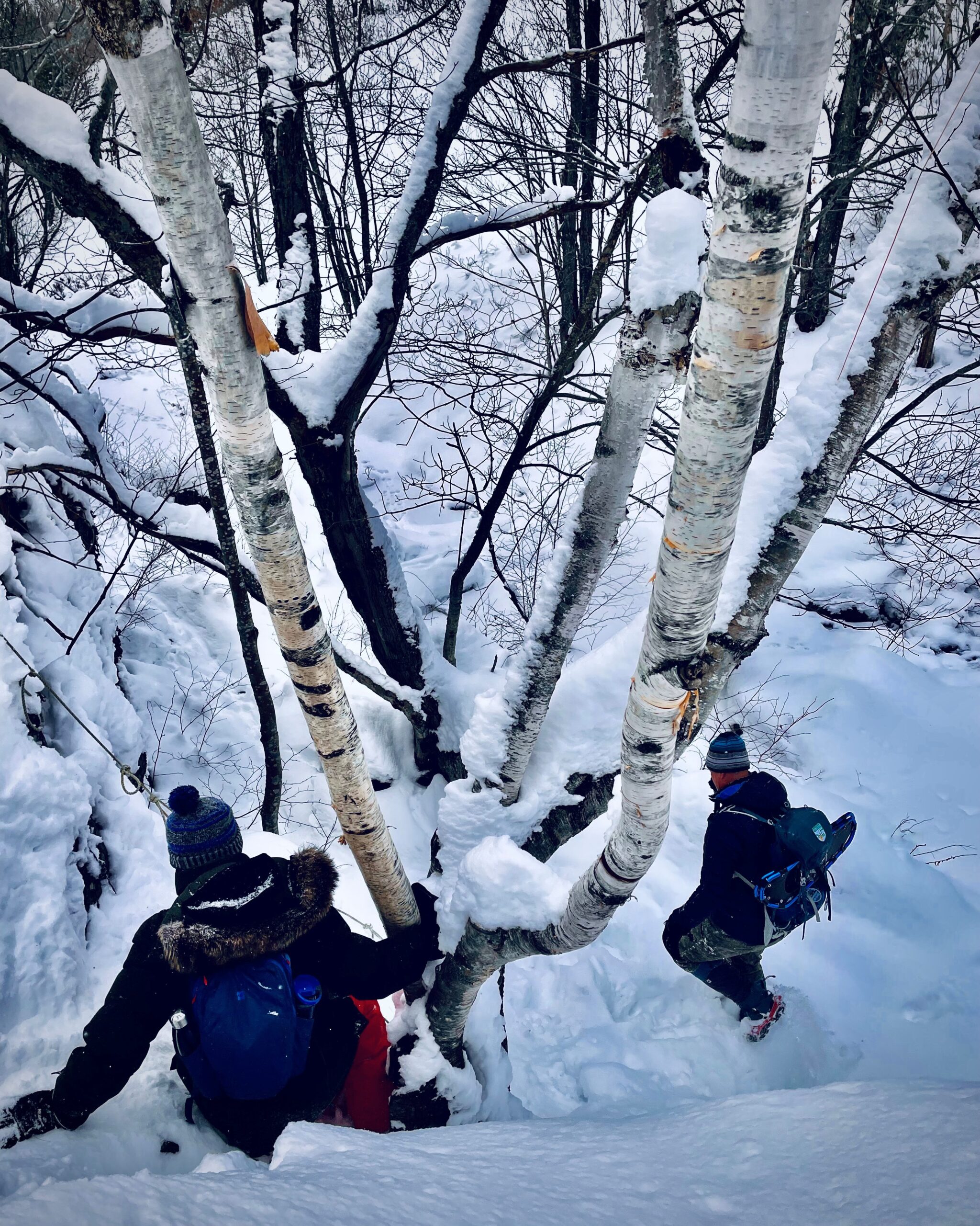
Let’s explore on this advanced hike!We’ll spend 6-8 hrs hiking 14 km, on and off the trail over rugged topography. Time and distance parameters will be flexible based upon the conditions and the group’s ability. We’ll pass through forests, travel over rock barrens and view amazing landscapes. Bring extra socks as our feet may get a little wet as we navigate our way around lakes (we will not be travelling on ice), over ponds (we will cross beaver dams), and creeks (jumping across, travelling over rocks and logs), There will be lots of elevation change and challenges.
Hiking boots, trail crampons, snowshoes and headlamps are MANDATORY. DO NOT show up without these items, you will not be allowed to participate. At the trailhead we will evaluate conditions and determine whether we will wear, carry (bring paracord, bungie cord(s) or your preferred strapping mechanism) or leave behind our snowshoes. Hiking poles and gaiters are highly recommended.
Bring lunch, snacks and water, or a favorite beverage. 2L recommended.
Check the weather in advance and dress in layers accordingly.
There will be no dropouts, and no dogs allowed.
Registered participants are to arrive 15 minutes prior to the hike to be briefed.
Register now, space is limited.
8:30 Merritt Trail Series #3
https://hikes.brucetrail.org/event/830-merritt-trail-series-3/Sorry, the registration cut-off time for this hike has been reached.Not a member? Click here to join today!Hosting Club: Niagara
Category: Car Pool
Location (Google Maps): Meet at Port Dalhousie Parking lot . Carpool to Book Depot Parking lot, 67 Front Street North, Thorold.Hike Leader(s): Lauren Doig Click here to contact Hike Leader(s)
Pace: Brisk
Terrain: Easy
Distance: 15kmDescription
Hike 3 of the Merritt Trail Series. Bring water and a snack. Dress for the weather. If completed all three hikes, bring $10 for the badge.
Wilder Forest Uxbridge
https://hikes.brucetrail.org/event/wilder-forest-uxbridge/Sorry, the registration cut-off time for this hike has been reached.Not a member? Click here to join today!Hosting Club: Toronto
Location (Google Maps): 2499 Brock Road, Uxbridge, ON there is a free parking when you enter the road off brock road beside Horse training facility
Hike Leader(s): Mohammad Aghamiri Click here to contact Hike Leader(s)
Pace: Moderate (3-4 km/hr)
Terrain: Hilly, Variable
Distance: 14-15 kmDescription
We will explore Wilder forest and the beautiful scenery of Uxbridge forests.
9:00 am Welcome the Winter Solstice with Tai Chi at Woodend
https://hikes.brucetrail.org/event/900-am-welcome-the-winter-solstice-with-tai-chi-at-woodend/Sorry, the registration cut-off time for this hike has been reached.Not a member? Click here to join today!Hosting Club: Niagara
Category: Loop
Location (Google Maps):Woodend Conservation Area – km 15.5; Enter from Taylor Rd., 140 north of Warner Rd.
Hike Leader(s): Karen Couch Click here to contact Hike Leader(s)
Pace: Medium
Terrain: Moderate
Distance: 6 kmDescription
Usher in the Winter of 2024/2025 with a hike that includes intermittent simple Tai Chi movement breaks led by Mike VanNatter. Hiking poles and hydration are recommended.Get it on the 1st hike towards your 2024/2025 Winter badge!
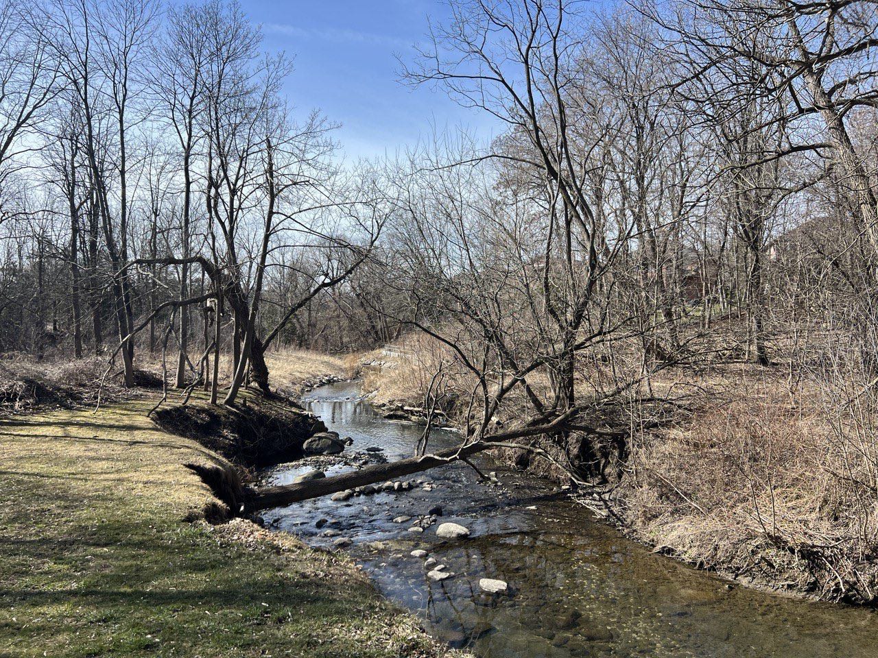
German Mills Creek
https://hikes.brucetrail.org/event/german-mills-creek/Sorry, the registration cut-off time for this hike has been reached.Not a member? Click here to join today!Hosting Club: Niagara, Toronto
Category: Hike
Location (Google Maps):Willowbrook Public School, 45 Willowbrook Rd, Thornhill, ON L3T 4X6
Hike Leader(s): Mehrnoush Ahmadi Click here to contact Hike Leader(s)
Pace: Medium
Terrain: Moderate
Distance: 8-10 kmDescription
A great place for a short outdoor escape, offering a quiet, natural setting with some gentle elevation changes. The trail connects to the Don River Trail, allowing for extended exploration.
• Please dress appropriately for the weather. Waterproof hiking boots, ice cleats, and trekking poles are required. A windproof jacket and gaiters are recommended.
• We will have short water breaks and a 10-minute snack break.
Everyone is welcome!
See you there!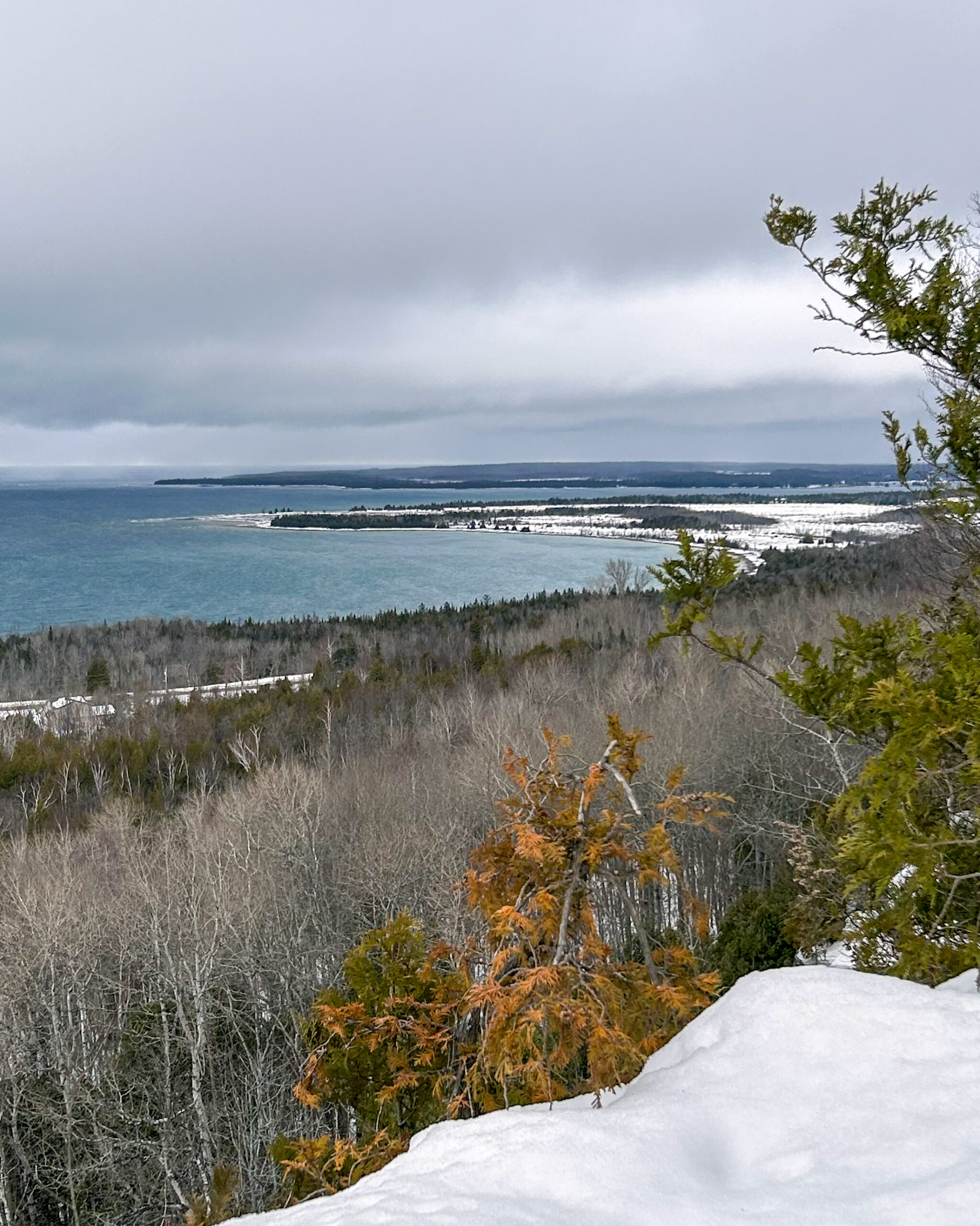
Peninsula Blue Series: Welcoming Winter from the top of Jones Bluff
https://hikes.brucetrail.org/event/peninsula-blue-series-welcoming-winter-from-the-top-of-jones-bluff/Sorry, the registration cut-off time for this hike has been reached.Not a member? Click here to join today!Hosting Club: Peninsula
Category: Peninsula Blue Series
Location (Google Maps): Boundary Road Roadside Parking where the Jones Bluff Side Trail meets the Main TrailHike Leader(s): Kathleen Stahlbaum Click here to contact Hike Leader(s)
Pace: Leisurely (2.0 – 3.0 km/h): A relaxed pace with frequent breaks and a focus on enjoyment., Medium (3.0 – 4.5 km/h): A comfortable pace for most hikers with steady progress.
Terrain: Easy: Flat forested sections or lowland trails., Moderate: Rolling hills, mild slopes and rocky paths.
Distance: 7.12 kmDescription
Join us in celebrating winter solstice with a hike along the beautiful Jones Bluff! This hike offers panoramic views of Neyaashiinigmiing (Cape Croker) and the beautiful sparkling turquoise waters of Sydney Bay and Colpoys Bay. We’ll look over MacGregor Harbour where Cape Croker juts into the water, Sydney Bay Bluff, Cape Dundas, and Barrier Island on the North side, with glimpses of Hay, White Cloud and Griffith Islands on the South side.We’ll be spending most of our hike on the Main Trail as we round the entirety of the Bluff, with a short jaunt along the whole of Jones Bluff Side Trail. While Jones Bluff offers a relatively easy hike with minimal ups and downs, there are still plenty of rocks, roots, and crevices which may or may not be visible if there has been a recent snowfall. We’ll spend some time hiking close to the Escarpment edge, and some time hiking through the woods. There are plenty of incredible lookouts and we’ll be sure to stop for breaks and photo ops! Depending on snow and ground conditions, this hike will take approximately 3-4 hours with no bailout points.
Be prepared for rocky, slippery and potentially snowy conditions. In the event of snowy conditions, icers/crampons are strongly advised for added traction on slippery terrain. Consider bringing along trekking poles or a walking stick to provide additional balance on icy spots and areas with deep snow. Snowshoes may also come in handy depending on conditions. Wear insulated footwear and layer up! Weather conditions change quickly on the Peninsula, particularly during the winter months, so we will have a better idea what to expect as the date draws nearer (stay tuned to your email in the 48 hours prior to the hike for updates!)
Pace will be leisurely to moderate and adjusted for snowy, slushy or icy conditions, if needed. Bring plenty of water, a snack and light lunch.
This ~7 km, 3-4 hour hike counts towards the coveted side trail badge and you can check it out on Map 36 of the newest edition of the Bruce Trail guidebook!
Map 36, Edition 31

Beaver Valley Winter End to End Badge
https://hikes.brucetrail.org/event/beaver-valley-winter-end-to-end-badge/Sorry, the registration cut-off time for this hike has been reached.Not a member? Click here to join today!This is a Multi-Day Hike
You are signing up for the following dates and times:
2024-12-21 at 09:30
2024-12-22 at 09:30
2025-01-11 at 09:30
2025-01-12 at 09:30
2025-01-25 at 09:30
2025-01-26 at 09:30
2025-02-08 at 09:30
2025-02-09 at 09:30
2025-02-22 at 09:30
2025-02-23 at 09:30Hosting Club: Beaver Valley
Location (Google Maps): Meet at the Metcalfe Rock parking lot on 10th Line, just south of km 27.9, Map 25, Edition 30 44.4158524 -80.4434053
Hike Leader(s): Glenda Collings Click here to contact the hike leader.
Pace: Medium
Terrain: Moderate, Some rocky footing, Some steep sections, Strenuous
Length of Hike: 15.6 kmDescription
You are registering for a series of 10 hikes to earn the BV Winter End to End badge. This E2E is intended for strong hikers/experienced snowshoers only. We will be hiking at a steady medium pace with a few short breaks to be sure we keep warm. Deep snow may slow the pace down a bit. As we need to be prepared for variable weather conditions, please have your icers and snowshoes in your car for each hike. Although the snow may seem okay in parts of the hike, there may be deep drifts in other areas. The leader will advise if we need to carry our snowshoes. It may be tough hiking so be sure of your physical ability before signing up for this hike. If the snow is deep, please be prepared to take a turn blazing trail. Please dress accordingly with the weather conditions presented on hike day and bring sufficient water and snacks. This will be a team effort from start to finish!As we all know Mother Nature can throw us curve balls at times. The hike leader may need to adjust our meeting location and possibly postpone the hike in the case of inclement weather or road/parking conditions. The hikes will not all be in sequential order. Hikers will be advised of conditions and possible changes the night before each hike. The hike schedule will be sent to the group upon registration.
All hikes in this series will include a car shuttle and everyone is expected to take a turn at shuttling, so please have your car ready to carry passengers.
If you have any questions feel free to contact me using the Contact Hike Leader option in the hike posting. Let’s have fun in the snow!
For the safety of all, the Beaver Valley Winter E2E is a series that can only be completed with a club leader who is very familiar with the Beaver Valley section.
COVID-19 Precautions Before, During and After your Hike
- Each hiker joining a Bruce Trail Club organized hike must perform a self-screening check before hiking.
Find Ontario’s self-assessment tool here: https://covid-19.ontario.ca/self-assessment/ - If you are experiencing COVID-19 symptoms, stay home.
Other Guidelines
- Arrive 15 minutes before the start of the hike.
- Wear sturdy footwear and appropriate attire for the weather and the terrain.
Hiking poles are a good idea in any season, especially if the terrain is rocky or slippery. In winter, snowshoes or icers/crampons are needed when conditions dictate.
Wearing appropriate clothing and footwear prevents injuries and shows consideration for a safe and positive group hiking experience. - Always carry I.D. and your health card.
- Bring sufficient water and snacks (or lunch if indicated). A minimum of 1L of water is recommended on all hikes, and 3L is recommended for long, challenging hikes in the heat of the summer.
- Bring sunscreen and insect repellent (for spring and summer hikes).
- Bring your own first aid kit.
- Please leave dogs at home.
Harrison Park Loop
https://hikes.brucetrail.org/event/harrison-park-loop/Sorry, the registration cut-off time for this hike has been reached.Not a member? Click here to join today!Hosting Club: Sydenham
Category: General Hike
Location (Google Maps): Harrison Park past the restaurantHike Leader(s): Ian Mills Click here to contact Hike Leader(s)
Pace: Medium: 3 to 4 km/h
Terrain: Moderate: Some hills and/or poor footing, There might be icy and slippery sections., There might be sections with water on the trail.
Distance: 10kmDescription
We will meet at Harrison Park, Parking Area just past the restaurant (east) and follow the Harrison Park Side Trail north to the Main Trail. We will follow the Main Trail south to Inglis Fall. Pack a light snack to enjoy the amazing view of the falls. We will follow the Main Trail north to Creamery Side Trail and circle back to our parking area. Interesting terrain, lovely views and good exercise will be provided by this loop. BTC Map # 32. A walking stick is recommended and proper footwear is required. Dependant on weather conditions I will advise if icers are recommended. - Each hiker joining a Bruce Trail Club organized hike must perform a self-screening check before hiking.