Categories
- 25May 25, 2023
8:00 am Long Hike Jordan to Moyer / Louth NEW TIME
https://hikes.brucetrail.org/event/800-am-long-hike-jordan-to-moyer-louth-new-time-4/Sorry, the registration cut-off time for this hike has been reached.Not a member? Click here to join today!Hosting Club: Niagara
Location (Google Maps):
Jordan Hollow Park 3039 King St Jordan
Pace: Medium
Terrain: Moderate
: 10kDescription
From Jordan Hollow Hike the main trail to Upper and Lower Balls Falls, Moyer Road or Louth and Return. You must register for each hike. Bring Poles, sunscreen, bug spray , snack and a drink ices and dress for the weather
Woodford to Bognor Marsh
https://hikes.brucetrail.org/event/woodford-to-bognor-marsh/Sorry, the registration cut-off time for this hike has been reached.Not a member? Click here to join today!Hosting Club: Sydenham
Category: General Hike
Location (Google Maps): Bognor Marsh Conservation Area parking lot, northwest corner of County Road 18 and 4th Concession S, at km 29.4 (Map 30)Hike Leader(s): Maureen McFarland Click here to contact Hike Leader(s)
Pace: Medium: 3 to 4 km/h
Terrain: Moderate: Some hills and/or poor footing, Strenuous: Hilly with steep climbs and some poor footing.
Distance: 12.5 kmsDescription
We meet at Bognor Marsh and carpool to Woodford Community Centre. From there we hike south back to Bognor Marsh. Much of this hike is along the escarpment edge, with good views off to the east. It is a rugged section, with lots of crevices and a few climbs up and down the excarpment. We end at Bognor Marsh with views over the marsh and of the shore birds who make the marsh their home. Bognor Marsh may be quite wet in springtime. Bring a lunch or snack, and plenty of water. If you have a Grey Sauble Conservation Authority Parking Pass bring it too. Parking at Bognor Marsh is not free. If you are unable to register, please call or text Maureen McFarland at 647-918-4180 to let her know you are coming.9:15 Short hike - Jordan Hollow
https://hikes.brucetrail.org/event/915-short-hike-jordan-hollow-58/Sorry, the registration cut-off time for this hike has been reached.Not a member? Click here to join today!Hosting Club: Niagara
Location (Google Maps): Jordan Hollow Park
Hike Leader(s): Bill Russell Click here to contact Hike Leader(s)
Pace: Medium
Terrain: Strenuous
Distance: 6 kmsDescription
Hike the main trail and side trails around Jordan and Balls Falls. Bring hiking boots, water and bug spray.Sydenham E2E Hike 6 of 14
https://hikes.brucetrail.org/event/sydenham-e2e-hike-6-of-14/Sorry, the registration cut-off time for this hike has been reached.Not a member? Click here to join today!Hosting Club: Caledon Hills
Category: End-to-End
Location (Google Maps): Meet in parking lot at Grey-Bruce Tourist Information Office west of km 104.4. Enter from Hwy 6, just north of the junction of Hwys 6 and 21. Shuttle to start at km 115.5.Hike Leader(s): Nancy Mooney Click here to contact Hike Leader(s)
Pace: Medium – 3 to 4 km/hour
Terrain: Easy – mostly flat and usually good footing, Moderate – some hills and/or some poor footing
Distance: From km 115.5 – 104.4 plus a bit of side trail. Total distance 11.5 km.Description
This hike is relatively easy as we leave the Georgian Bluffs area and approach Owen Sound via rail trail and roads. There are some areas with crevices and nice views along the way. Lunch or ice cream after!
Spring Interpretive Hike
https://hikes.brucetrail.org/event/spring-interpretive-hike/Sorry, the registration cut-off time for this hike has been reached.Not a member? Click here to join today!Hosting Club: Peninsula
Location (Google Maps): Meet at the intersection of Crooked Toe Road and Boundary Road at 24.4 KM. Arrive a few minutes early so that we can begin the hike at 10 a.m.
Hike Leader(s): Marg Glendon Click here to contact Hike Leader(s)
Pace: Leisurely, Medium
Terrain: Easy, Moderate
Distance: ~5 kmDescription
Spring is here! Let’s explore the signs of Spring at the McIver Wetland and adjoining hardwood forest with Bob Knapp, a PBTC Land Steward. Bob will provide interpretation for this Spring hike. This wetland is a popular site for migrating birds, amphibians and reptiles. The hardwood forest will be coming alive with an unfurling of new green leaves, while fern and mossy rocks frame early Spring wildflowers. We will finish our hike with lunch on the cabin deck together.Bring a light backpack with a snack, water and lunch. Wear a hat, long sleeved protective clothing. Bring insect repellent. At this time of year, there may be some wet spots, please wear waterproof hiking boots. A camera, binoculars and gators might be helpful, but not essential.
This hike will be about 3 hours in duration.

Hilton Falls Wildflower Treasures
https://hikes.brucetrail.org/event/hilton-falls-wildflower-treasures/Sorry, the registration cut-off time for this hike has been reached.Not a member? Click here to join today!Hosting Club: Iroquoia
Category: Thursday Group
Location (Google Maps): Hilton Falls Conservation Area, 4985 Campbellville Rd. MiltonHike Leader(s): Anne Armstrong Click here to contact Hike Leader(s)
Pace: Leisurely – 3km/hr or less
Terrain: Easy – Mostly flat and usually good footing
Distance: 10 – 11 Km.Description
Hilton Falls Beaver Meadow route has some areas of a large concentration of wildflowers including variegated Trilliums and Perfoliate Bellwort. There are also some unusual ferns. Join us for this lovely circular route to search for wildflowers. We will stop at the falls for our snack. Bring water, a snack, sunscreen, insect repellent and poles if using.
Leader: Anne Armstrong 905 617 3937 hikingrandma@gmail.com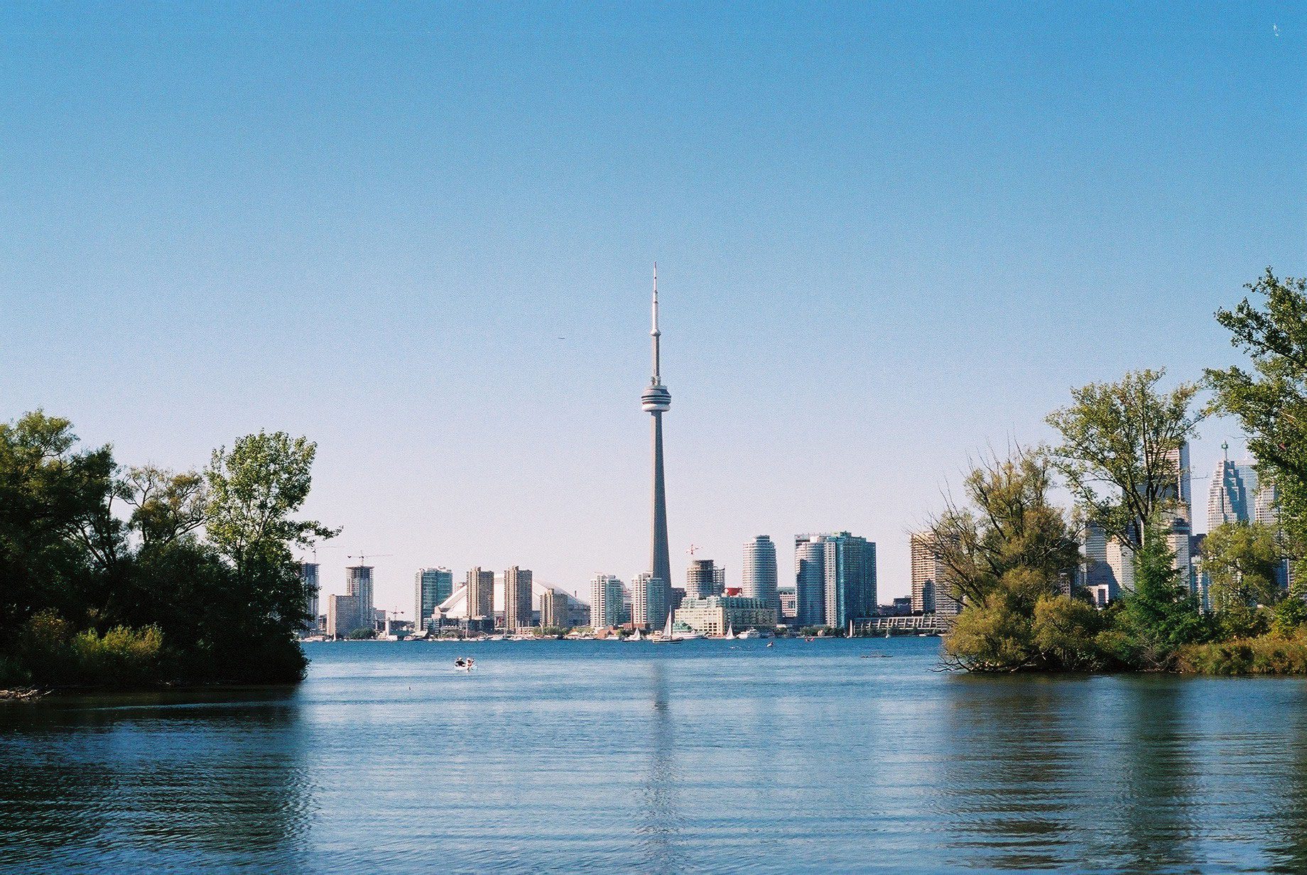
Toronto, Toronto Islands
https://hikes.brucetrail.org/event/toronto-toronto-islands-16/Sorry, the registration cut-off time for this hike has been reached.Not a member? Click here to join today!Hosting Club: Toronto
Location (Google Maps): Meet inside the Jack Layton Ferry Terminal, foot of Bay Street, beyond the cashiers selling the ferry tickets, in the open area with the benches and Muskoka chairs. From Union Station take the LRT one stop to “Ferry Docks” or take bus number #19 or #72 on Bay Street southbound to the Queens Quay. Walk across Queen Quay south through the park to the ferry terminal.
Hike Leader(s): Miriam Stevens, Tom Swales Click here to contact Hike Leader(s)
Pace: Leisurely
Terrain: Flat
Distance: 8-12 kmDescription
After a day’s work, come and “cool off” on the Toronto Islands free of fumes and traffic to enjoy the view of the city skyline and Toronto’s own beautiful island parkland oasis away from the city. Pack a dinner for a sit-down picnic. Note that food is not available for purchase on the islands early in the season. Bring a warm jacket and flashlight. Return ticket for the ferry is approximately $8.70, $5.60 for seniors. The hike will take place rain or shine. Toronto Island Evening Hikes will take place every Thursday in May and June, same time and meeting place. The route and time we return to the city may vary depending if the ferries are running on the Spring or Summer (starts in May) schedule. Contact Hike Leaders via the Contact form for further information or to confirm the current ferry schedule that will be in place the week of the hike. Registration is not required for this hike – just meet the Hike Leader at the above location.