Hosting Club: Niagara Category: Urban Location (Google Maps): Meet in Queenston Heights Park, near the Bruce Trail cairn. Niagara Parkway. From the roundabout turn left and another immediate left.
Description Hike around Queenston Heights and down into the village of Queenston. You will be going down the escarpment and back up. Poles recommended.
Hosting Club: Sydenham Category: General Hike Location (Google Maps): The Owen Sound Galaxy Theatre parking lot. Meet at the tall “Galaxy Centre” sign next to the traffic lights.
Pace: Medium: 3 to 4 km/h Terrain: Moderate: Some hills and/or poor footing Distance: 9 kms
Description We start at the end of Concession 14 and hike through cedar and hardwood forest on the new Lindenwood Pond property on the Gap Side Trail. From there we head north on the main trail along the escarpment to meet the Lindenwood Side Trail. We return via the main trail and the Lindenwood Pond Side Trail. Map 33, Edition 31. If you have difficulty with registration, please call the hike leader at 647-918-4180.
Pace: Leisurely, Medium Terrain: Easy, Moderate Distance: 3-4 km
Description Wonder why this property is called “Vanishing Streams”? Learn the answer to this and more on today’s hike! This hike will include an introduction to the Vanishing Streams Nature Reserve. PBTC Conservation and Land Stewardship Director, Laura Pisko, will join us to describe the restoration plan for this 100 acre property – invasive species removal, the “burn”, planting of native shrubs and trees .
For those wishing to warm up before returning home – we will finish up with a “tail gate party” featuring locally roasted coffee and holiday treats.
Terrain: Field walking, uneven terrain, generally flat with some crevices. Hiking poles are beneficial, but not required.
If weather cooperates, we will finish up with a “tail gate party” featuring locally roasted coffee and holiday treats, for those who wish to stretch, cool down and socialize a bit before jumping in the car.
Description Join us for a fun hike with great views in Nottawasaga Bluffs Conservation Area. We will hike for about four hours at a 3.5 km/hr pace, explore the Key Hole Side Trail and enjoy the view from the Nottawasaga Bluffs Lookout. After the hike we will go to Mylar and Loreta’s for a holiday luncheon. When you register, please select one of the lunch choices listed under optional items. All regular entrées include fries, dessert bar and non-alcoholic beverage. Vegetarian entrées include salad, dessert bar and non-alcoholic beverage. Tax and gratuity are included in the prices. Beer and wine are extra. You will need to pay your bus fare when you register. E-transfer you lunch money ($33 per person) to martinabeatrice@gmail.com.
Important:Please register by Sat Nov 25.
Bus departs from 10 York Mills Rd at 8 AM. We hope to be back in Toronto around 7 PM.
Hosting Club: Toronto Category: Car Hike Location (Google Maps): Glasgow Trail, Concession Road 2 Park in parking lot at the trail head.
From Highway 404 turn right to Stouffville Rd, till to the end of road and turn left on York Durham Line. In About 1km turn right to Webb Rd. and turn right to Concession Road 2 ,you will see parking lot in 500 metres,
Description Approximately 5-hour hike, mostly flat, in the Uxbridge area
It is wintertime, please bring your icers, hiking poles, warm layers of clothing, boots, and hot drinks.
Some safety procedures during the hike:
1-Hikers must stay between the leader and the sweep.
2-Hikers must advise the leader or the sweep if they wish to leave the group.
3- Hikers must follow the whistle instructions: 1 blast- stay where you are; 2 blasts come to the leader; 3 blasts – come to the leader quickly.
4-Hike leader may request volunteers to stop at trail intersections, they need to help hikers to the direction the group walk and wait till they see the sweep .
5-Hikers have to make sure they can see the persons behind and in front of them.
Hosting Club: Niagara Category: Register Location (Google Maps): Meet at the Niagara Glen Nature Centre parking lot, 3050 Niagara Parkway, Niagara Falls. This is located between the Whirlpool Golf Course and the Niagara Botanical Gardens, on the river side of the Niagara Parkway. Parking fees may apply.
Description Hike deep in the Niagara Gorge, along stairways cut into the rock and rugged paths that wind through this pristine pocket of Carolinian Forest. View ancient geological formations and fossils dating back millions of years, while hiking along the turbulent rapids of the Niagara River. This is a strenuous hike and there is a chance hikers will get wet. Bring icers, gaiters and hiking poles, if necessary. Dress appropriately.
Hosting Club: Blue Mountains Category: Register in person the morning of hike. Location (Google Maps): Hike meets in the parking lot behind Tim Hortons on First St. in Collingwood.
Pace: Leisurely – 3 km/hr. or less Terrain: Moderate – Some hills and/or some poor footing Distance: 6 km
Description We will park the most easterly end of the 6th Sideroad. Hike with me on the Path of the Petun and learn about a great battle that was fought between the Iroquois and the Petun at the Petun Village of Etharita, also known as the “St. Jean”. As we hike along the escarpment ridge, we will use our imaginations to see the Battle Ground and what this beautiful area was like in the mid 1600’s. We will then take the Russ McConnell Sidetrail back to our cars.
Pace: Brisk Terrain: Some rocky footing, Strenuous Length of Hike: 24.2
Description Please join us as we chip away through the Sydenham section. This will be a series of 11 hikes that range between 13-19kms with one longer hike of 24km. We will begin our journey at the northern end of Sydenham and work our way south to try and avoid the dangers the falling leaves and snow will bring.
If you complete the 11 hikes in this series you will qualify for Sydenham’s new independent badge. Please keep track of your hikes as each hiker will be submitting their own badge request.
All hikes in this series will include a car shuttle and everyone will take a turn as a shuttle driver. Please have your vehicle passenger ready.
Nov 28 hike – meet@km44.2 carpool to 68.4 (ED 30) (km41.7-65.8ED 31)
If you have any questions please text me @ 519-410-9077 (this is the most efficient way)
Please bring plenty of water and snacks/lunch
No dogs
Please text Kristina @ 519-410-9077 for morning of cancelations
COVID-19 Precautions Before, During and After your Hike
Each hiker joining a Bruce Trail Club organized hike must perform a self-screening check before hiking. Find Ontario’s self-assessment tool here: https://covid-19.ontario.ca/self-assessment/
If you are experiencing COVID-19 symptoms, stay home.
Transportation
It is the Bruce Trail Conservancy’s current policy that car shuttles are allowed. It is at the discrepancy of individual hike leaders to make that decision.
Other Guidelines
Arrive 15 minutes before the start of the hike.
Wear sturdy footwear and appropriate attire for the weather and the terrain. Hiking poles are a good idea in any season, especially if the terrain is rocky or slippery. In winter, snowshoes or icers/crampons are needed when conditions dictate. Wearing appropriate clothing and footwear prevents injuries and shows consideration for a safe and positive group hiking experience.
Always carry I.D. and your health card.
Bring sufficient water and snacks (or lunch if indicated). A minimum of 1L of water is recommended on all hikes, and 3L is recommended for long, challenging hikes in the heat of the summer.
Bring sunscreen and insect repellent (for spring and summer hikes).
Description Let’s explore the city in winter and build up our appetites for the holiday season while earning the unique Toronto Urban Hike Badge.
To qualify for the badge, we will embark on a 74 KM loop (map: https://onthegomap.com/s/c2c1hf3n ) through a series of four Saturday hikes scheduled for Nov 25 (18 KM), Dec 2 (17 KM), Dec 9 (23 KM), and Dec 16 (20 KM). On both Nov 25 and Dec 2, we will conclude our hikes at Leslie & Sheppard, with the option to visit the Mountain Equipment Company North York store for an introduction to winter hiking gear.
Please bring hot beverage and snacks/light lunch for our journey. We will take short breaks for restroom stops and lunch at suitable locations along the trails. The majority of the route consists of paved paths, so running shoes are recommended if it’s dry and water proof shoes if it’s rain or snow.
Badges by request will be presented at the last hike. The cost of the badge is $5 for members and $15 for non-members.
On Dec 2, we will start from Finch West Station and end at Leslie Station at Sheppard & Leslie.
Description We will hike part of the Elora- Cataract Trailway from Erin to Forks of the Credit Provincial Park. This is an easy hike along a former railway corridor. In the Park we will have a a few hills. Parking at the meeting point is along Mississauga Road. Restrictions apply, watch for no parking signs. From this location we will car pool to the start point.
After the hike those interested are invited to meet for refreshments at a location TBA.
Hosting Club: Sydenham Category: General Hike Location (Google Maps): Roadside parking on the east side of 11 Line, approxinately 3 km north of Highway 26, at the entrance to the Cottonwood Side Trail, Map 30, Edition 31
Pace: Leisurely: 3 km/h or less Terrain: Easy: Mostly flat and good footing., Moderate: Some hills and/or poor footing Distance: 2.1km
Description Given the active Freezing Rain warning for the region and upcoming radar indicating mixed precipitation, this hike will be canceled/postponed.
—–
This hike will be a discovery hike along the Cottonwood Loop – we’ll take our time, and see what we can find. This trail is a stand-alone trail, separate from the rest of the Bruce Trail. We’ll hike through forests, past a particularly large cottonwood tree, and to a lookout along a ridge. This property is the original location of the Rows homestead – their farmhouse can be seen at Moreston Village at Grey Roots.
The Cottonwood Loop is also featured in Ron Savage’s new book, Exploring Sydenham. There will be sufficient time to find the related code en route.
As we’ll be taking our time, this hike is suitable for families and new hikers. We’ll plan to take upwards of a couple of hours – dress in layers, bring a snack, and wear good footwear. Given that December can be variable, an email re: trail conditions to expect will be sent out prior to our hike together.
If you are unable to register, please contact the hike leader via the link above.
Description Carpool to the southern cairn. This hike follows the Niagara River from Queenston Heights, down the escarpment and all the way to Butler’s Barracks in Niagara on the Lake. Mainly paved trail with a small portion through a wooded area. Required photos include: Brock’s War Monument, view of Lewiston Bridge, Niagara River, War Memorial, McFarland House. Participate in all 9 scheduled hikes in the NBTC Side Trail Challenge or hike the side trails on your own. Submit your photos to collect the NBTC Side Trail badge.
Hosting Club: Caledon Hills Category: Tuesday Hikers Location (Google Maps): Bruce Trail Parking Lot – 7th Line Access Airport Road North of Highway 9 Right on 7th Line, parking lot immediately on the right (east) of Airport Road
Pace: Medium – 3 to 4 km/hour Terrain: Moderate – some hills and/or some poor footing Distance: 10.5 km
Description Come on out and burn off a few calories before the holidays!
We will hike the Main Trail north from 7th Line to 5 Side Road then loop through the beautiful Hockleycrest property on a combination of the Main Trail and Darcy, Hockleycrest and Harmony Side Trails before returning to 7th Line on the Main Trail. The terrain varies from rolling hills and open hilltops, hardwood bush and pine plantations. There will be a few ups and downs including one steep valley that we will ascend and descend on both the way out and back!
The leaves are down and can be slippery – hiking boots required, hiking poles are recommended.
There will be stops for water along the way and a longer snack / lunch break later in the hike. Bring plenty of water, and dress in layers appropriate for the cooler weather.
Pace: Medium Terrain: Moderate, Slippery and Steep Sections Distance: 7 km, short hike 4km
Description
From the parking lot on Dunby Rd, we will hike south 2 km (short hike returns from here), follow the Cam Snell Side Trail loop, and return on the main trail. Please bring a snack, appropriate clothing and equipment for the weather (ie poles and icers).
Pace: Brisk Terrain: Some rocky footing, Some steep sections, Strenuous Length of Hike: 14.8km
Description Please join us as we chip away through the Sydenham section. This will be a series of 11 hikes that range between 13-19kms with one longer hike of 24km. We will begin our journey at the northern end of Sydenham and work our way south to try and avoid the dangers the falling leaves and snow will bring.
If you complete the 11 hikes in this series you will qualify for Sydenham’s new independent badge. Please keep track of your hikes as each hiker will be submitting their own badge request.
All hikes in this series will include a car shuttle and everyone will take a turn as a shuttle driver. Please have your vehicle passenger ready.
Dec 5 hike – meet @km44.2 carpool to 29.4
** the meeting point/hike direction of this hike might flip depending on conditions of Bognor Marsh**
If you have any questions please text me @ 519-410-9077 (this is the most efficient way)
Please bring plenty of water and snacks/lunch
No dogs
Please text Kristina @ 519-410-9077 for morning of cancelations
COVID-19 Precautions Before, During and After your Hike
Each hiker joining a Bruce Trail Club organized hike must perform a self-screening check before hiking. Find Ontario’s self-assessment tool here: https://covid-19.ontario.ca/self-assessment/
If you are experiencing COVID-19 symptoms, stay home.
Transportation
It is the Bruce Trail Conservancy’s current policy that car shuttles are allowed. It is at the discrepancy of individual hike leaders to make that decision.
Other Guidelines
Arrive 15 minutes before the start of the hike.
Wear sturdy footwear and appropriate attire for the weather and the terrain. Hiking poles are a good idea in any season, especially if the terrain is rocky or slippery. In winter, snowshoes or icers/crampons are needed when conditions dictate. Wearing appropriate clothing and footwear prevents injuries and shows consideration for a safe and positive group hiking experience.
Always carry I.D. and your health card.
Bring sufficient water and snacks (or lunch if indicated). A minimum of 1L of water is recommended on all hikes, and 3L is recommended for long, challenging hikes in the heat of the summer.
Bring sunscreen and insect repellent (for spring and summer hikes).
Hosting Club: Niagara, Dufferin Hi-Land Category: Urban Location (Google Maps): Meet in the parking lot of Floral Showhouse, 7145 Niagara River Pkwy, Niagara Falls
Description Get into the holiday spirit with the Annual Winter Festival of Lights. Hot apple cider & tea will be provided. Bring a holiday treat to share.
Hosting Club: Blue Mountains Category: Register in person the morning of hike. Location (Google Maps): Hike meets in the parking lot behind Tim Hortons on First St. in Collingwood.
Pace: Medium – 3 to 4 km/hr Terrain: Moderate – Some hills and/or some poor footing Distance: 6-8 km
Description From Tim’s in Collingwood we will proceed to the NVCA parking area at km 21.9 for a 6 to 8 km loop hike. Depending on the weather we may be wearing boots, icers or snowshoes, please come prepared. We will hike west from the start, make the big loop past the Keyhole Side Trail to the lookout and return via either the Betty Carter Side Trail or the Hamilton Bros. Side Trail. We will pass through the newly acquired Maplecross property. A stop for hot soup in Singhampton may be a desirable option. Bring a snack and water.
Hosting Club: Niagara Category: Loop Location (Google Maps): Park at Queenston Heights parking near the washrooms. The main parking lot by the cairn is closed for winter.
Description Take the main trail until it meets Major Tetoninhokarawen/John Norton ST. Take side trail until it meets Upper Canada ST. Take it until it meets the main trail. Go left on the main trail, up the switchback and along Main Trail until it meets Alfred’s Trot ST. Take the side trail until it, once again meets the Main trail. Take the Main trail back to the cairn. Photos: Major T Side Trail sign, rock wall and kiln on Upper Canada ST, Alfred’s Trot ST sign
Participate in all 9 scheduled hikes in the NBTC Side Trail Challenge or hike the side trails on your own. Submit your photos to collect the NBTC Side Trail badge.
Pace: Medium Terrain: Moderate Length of Hike: 4.6 km
Description We gather in the somewhat new BTC parking lot on Grey Road 40. Our Trail takes us a short distance across a field and then into a forest. Then it’s a country walk beside farm fields towards Webwood Falls. We will view the Falls and poke around the old Harwood Farm to see features left behind from farmstead days. They we return back to our vehicles.
Pace: Leisurely – 3km/hr or less Terrain: Dependent on Conditions, Moderate – Some hills and/or some poor footing Distance: Approx. 8 km.
Description Enjoy a hike to Hilton Falls, across the creek and beyond. The trail is flat with some rocky sections. We will pass a beautiful flooded area to our turn around spot which has a lovely patch of Walking Fern. Meet at 9:45 am. for a 10:00 am. start in the main parking lot. Bring water, a snack and walking poles if using. Icers may be necessary. Who knows what Mother Nature has in store for us. Registration required with Halton Parks. If cancelling the morning of the hike please text hike leader. Leader: Anne Armstrong 905 617 3937
Hosting Club: Sydenham Category: An evening walk. Location (Google Maps): Meet in the municipal parking lot by the river on the west side of 1st Ave. E between 7th St. E and 8th St. E in Owen Sound.
Pace: Brisk: 4 to 5 km/h Terrain: Moderate: Some hills and/or poor footing, There might be icy and slippery sections. Distance: Approx 5 km
Description Join us for an evening hike to view the Festival of Northern Lights displays in the River District and Harrison Park in Owen Sound. Bring icers to wear if it is icy. There will be an opportunity for refreshments following the hike. There is no need to show up 15 minutes early, but the hike will start at 7:00 pm promptly. For further information contact Hike Leader Harriet Nixon at 519-373-6598 or harrietnixon@bmts.com
From Jordan Hollow Hike the main trail to Upper and Lower Balls Falls, Moyer Road or Louth and Return. You must register for each hike. Bring Poles, sunscreen, bug spray , snack and a drink and dress for the weather
Hosting Club: Sydenham Category: General Hike Location (Google Maps):
Roadside parking on Gleason Lake Rd at the corner of Colpoy’s Range Rd (where the Curly Harnden and Len Holley Side Trails meet), south of km 163.1 (Map 35)
Pace: Medium: 3 to 4 km/h Terrain: Moderate: Some hills and/or poor footing Distance: 6 km
Description This loop hike begins with the Len Holley Side Trail, then follows the snowmobile trail to the Skinner’s Woods Side Trail. We will return to our cars via the Len Holley Side Trail. Bring a snack. Approx. 3 hours. If you have difficulty registering, please call or text 647-918-4180.
Hosting Club: Iroquoia Category: Thursday Group Location (Google Maps): Meet at the start of the Lewis Road Side Trail km 11.1, Map 6 of the BTC guide. Please do not block driveways. We will hike from Lewis Road to Dewitt Road and back. Great views from Dewitt road. Conditions could be a mix so have icers ready. Bring water and snack. There will be an optional lunch at the Menphis BBQ nearby after the hike.
Pace: Leisurely – 3km/hr or less Terrain: Dependent on Conditions, Easy – Mostly flat and usually good footing Distance: Approx. 8 – 9 km.
Description Join in for a meander down to Lake Ontario, following Joshua Creek. We will return to our start using mostly the same route. Meet at 9:45 am. for a 10:00 am.start in the parking lot of Maplegrove Mall at the corner of Maplegrove and Cornwall Rd. Park near Tim Horton’s. Bring water and a snack. Icers may be necessary. This will be a leisurely pace hike, suitable for new hikers and those wanting a slower pace. If cancelling the morning of the hike please let the leader know by email or text. Leader: Anne Armstrong 905 617 3937 hikingrandma@ gmail.com.
Description Shining Rainbow Deer Sanctuary – 3 ½ km boardwalk and forest path – teardrop shaped hike. This is a very pretty hike which meanders through a thriving marsh ecosystem and cedar forest. You feel immersed in the marsh – without getting wet! We will stop at the birding platform to enjoy the soft colours of late Fall and early Winter, in its peace and solitude at this time of year. If you wish to remain here to take in the quiet of the marsh, the hike sweep will keep you company. The rest of the hiking group will continue our adventure through the woods, returning to join you at the birding platform. The hike includes some boardwalk walking which can be slippery in spots. The rest of the hike is on generally flat forest floor terrain.
NCC hike interpreter, Justin Johnson will join us for the hike – what a special treat. Thank you Justin! Nature Conservancy Canada protects and cares for this property. We are grateful for their stewardship.
Parking: Roadside parking. Park on the east side of Cape Hurd Road near the entrance to Shining Rainbow Deer Sanctuary.
No washrooms onsite.
Wear layers, hat and warm mittens and boots. Bring a light back pack with water and snack.
Hosting Club: Toronto Category: TBTC Special Events Location (Google Maps):
Virtual on Zoom.
Hike Leader(s): Alina Lin, Tom Swales
Distance: 0
Description “If you choose not to find joy in the snow, you will have less joy in your life but still the same amount of snow” – so why don’t give yourself a try of winter hiking? If you are new to hiking, or have hiked a lot in spring, summer and fall but never in winter, and want to know how to enjoy the winter hiking with the Toronto Bruce Trail Club, or by yourself in a safe style, welcome to join this online information session. This virtual information session will provide all answers to questions that you would want to ask, including:
The Bruce Trail and the Club;
Different types of hiking programs;
How to join a group hike organized by the Bruce Trail Club;
How to prepare for winter hikes;
Winter Hiking Badge;
Our Winter Coach Program.
Zoom invitation will be sent to your at noon on Dec 7. Please check your primary folder as well as the Spam folder just in case.
Each Friday we will explore different neighbourhoods, trails and parkland throughout Historic Niagara-on-the-Lake.
Moderate pace with some weeks entirely on sidewalks and roads while others may include a mix of trails and paved pathways. Great way to build up endurance for longer more strenuous hikes.
Prepare for cooler windy conditions on open parkland and along Lake Ontario and Niagara River trails.
Plan to stay for conversation and a warm cup of coffee or tea at Sweets & Swirls, Community Centre, Niagara Stone Road, NOTL
Hosting Club: Iroquoia Category: Good Companions Location (Google Maps): 101 Osler Dr in Dundas, behind the Shoppers Drug Mart, in the parking area adjacent to the trailhead
Pace: Medium – 3 to 4 km/hr Terrain: Easy – Mostly flat and usually good footing Distance: 9
Description
This leisurely hike is on a wide path, mostly flat but with a slight ascent to the train station. We will stop at the station for washrooms and snack before heading back. Please arrive at 9:45 in the parking lot for a 10:00 sharp start. Dress warmly and wear good footwear in case there is some ice on the path. Sometimes we need encouragement to get out in the winter, so join in this social walk. The hike will be cancelled if the weather is poor weather. Please text Gayle at 905 270 8588 if you need to cancel shortly before the hike commences.
Location (Google Maps): Meet up location: We will meet at The Meeting Place – 20 Centennial Dr,Tobermory. Leave some cars here and drive to our starting point at the Bruce Peninsula National Park Visitor’s Centre. Map 42
Pace: Leisurely, Medium Terrain: Easy, Moderate Distance: ~3 KM
Description Holiday season brings joy and sometimes a little stress. Take a hike with us to find the balance you need to embrace the festive season.
Our final hike of the Easy Hike series is a carpool hike. Meet at the Meeting Place, 20 Centennial Drive, Tobermory. We will leave some cars here and carpool to our starting point – Northern Cairn in the village of Tobermory. We will hike along the Bruce Trail to Dunks Bay Road and return to the Meeting Place via Dunks Bay Road. The trail includes some short inclines and uneven terrain with roots and rocks.
We are grateful to Laura Stevenson, Registered Massage Therapist for joining us today, as we learn about the role of a Registered Massage Therapist and the benefits of stretching and cooling down after exercise. Laura will share some tips which can be integrated into your routine hike practice, helping to reduce the risk of injury on the Bruce Trail!
Celebrate the completion of our hike series and the upcoming holiday season. Holiday cider and shortbread awaits at the Meeting Place!
Please consider bringing a canned good donation for the Tobermory Food Bank.
Hosting Club: Toronto Category: Car Hike Location (Google Maps): Boyd Conservation Park, Islington Avenue, Vaughan, ON free parking at the entrance of the park
Description Explore the trails that wind through the beautiful valley at Boyd Conservation Area and the William Grainger Greenway. We will have lunch/snack in shelter with seated area,
It is winter time all participants are required to have Ice cleats with them, have proper shoes, warm clothing and hot drinks with you.
Please carefully read safety procedures during the hike:
1-Hikers must stay between the leader and the sweep.
2-Hikers must advise the leader or the sweep if they wish to leave the group.
3- Hikers must follow the whistle instructions: 1 blast- stay where you are; 2 blasts come to the leader; 3 blasts – come to the leader quickly.
4-Hike leader may request volunteers to stop at trail intersections, they need to help hikers to the direction the group walk and wait till they see the sweep .
5-Hikers have to make sure they can see the persons behind and in front of them.
Hosting Club: Toronto Category: Car Hike Location (Google Maps): N43.330803, W79.886980 BTC Map 9. We’ll meet at Smokey Hollow Side Trail parking lot beside Mill St. at 8:30 am. Please arrive fifteen minutes early for car shuttle. As the colder temperature is upon us please layer your outfit. Hiking poles are highly recommended and please have icers handy in the event of icy trail. Bring enough water for hydration, lunch and snacks.
Description Starting from Sydenham/Clara Hughes Lookout where you’ll find the great views of City of Hamilton and Town of Dundas . We’ll hike along the Royal Botanical Garden, Rock Chapel Sanctuary area paralleling the Escarpment where you have a view of City of Hamilton and Burlington Skyway. Take a snap photo of Borer’s Falls before it gradually climb rocky sections, followed by a long and gradual descent to the forested slopes of the fast flowing Grindstone Creek. An unstable valley slopes of rock formation lead to the Great Falls at Smokey Hollow. Here we’ll have our lunch and photo shoots.
Hosting Club: Niagara Category: Car Pool Location (Google Maps): Gateway Park Lock 8 Port Colborne. 42.900000, -79.246494 Car Pool to Port Robinson 43.039122, -79.213637
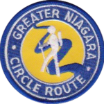
Description This Hike Series will be at a brisk pace between 5 and 6kph. If you are unable to maintain for the duration please do not sign up. The Greater Niagara Circle Route badge is awarded to walkers who independently complete the Circle Route Trail i.e. Lock 1 Port Weller, along the Welland Canal to Port Colborne , following the Friendship Trail to Fort Erie, following the Niagara Recreational Parkway Trail to Niagara-on-the-Lake and following the Waterfront Trail to Port Weller.
Pace: Medium – 3 to 4 km/hr Terrain: Moderate – Some hills and/or some poor footing Distance: 12 km
Description We will park in the parking lot east of km 61.3 on Hockley Valley Road in the Dufferin Hi-Lands section. Starting on the white blazed trail we will climb, climb and climb until we reach the Glen Cross Side Trail. We will take this blue blazed trail and loop around until we connect back up with the white blazed trail. Continuing down we will join the Tom East Side Trail, taking this loop back around to the end of the trail, out and to the cars. Bring a snack or lunch and water.
Pace: Leisurely Terrain: Variable Distance: 4.1 km
Description Enjoy two fantastic farms in one day: Scottsdale Farm for some hiking, and then Elliott Tree Farm to purchase a tree for the holidays! First we’ll do a 4.1 km loop hike of the Bennett Heritage Trail, main Bruce trail, and Maureen Smith Side Trail, enjoying the peaceful beauty of hiking in the forest in December. After returning to our cars, those who would like to join me in extending their day of fun will make the 25-minute drive to reach Elliott Tree Farm where people can hike along the trails throughout the farm, make their way through the hay bale maze, warm up by a bonfire, enjoy a snack in the Horse Barn Canteen, visit the barn gift shop to purchase small-batch maple syrup or a homemade wreath, and/or purchase a tree to take home for the holidays (both fresh-cut trees and cut-your-own trees are available). More information about Elliott Tree Farm can be found here: https://www.elliotttreefarm.ca/
Children under 13 years of age are encouraged to join their parents/guardians on this hike so they can fulfill the requirements for the Toronto Bruce Trail Club’s Youth Badge (https://torontobrucetrailclub.org/the-trail/badges) – all family members who are planning on joining us should register for the hike, including children. You should bring enough water and food for a 2-hour hike, comfortable hiking shoes, appropriate clothing for the weather, and money if you intend to join us at Elliott Tree Farm after the hike.
Description Let’s explore the city in winter and build up our appetites for the holiday season while earning the unique Toronto Urban Hike Badge.
To qualify for the badge, we will embark on a 74 KM loop (map: https://onthegomap.com/s/c2c1hf3n ) through a series of four Saturday hikes scheduled for Nov 25 (18 KM), Dec 2 (17 KM), Dec 9 (24 KM, Finch West Station – Old Mill Station ), and Dec 16 (20 KM, Old Mill Station – Evergreen Works).
Please bring hot beverage and snacks/light lunch for our journey. We will take short breaks for restroom stops and lunch at suitable locations along the trails. The majority of the route consists of paved paths, so running shoes are recommended over hiking boots.
Badges by request will be presented at the last hike. The cost of the badge is $5 for members and $15 for non-members.
Hosting Club: Caledon Hills Category: Nature Walks Location (Google Maps): Meet at the Bruce Trail Parking Lot, 713377 1st Line EHS, Mono, 43.959720, -80.070870
Directions: From ON-9, head north onto 3rd Line EHS for 3 km. Turn left/west onto Side Road 5 for 2.7 km. Turn right onto 1st Line EHS for approximately 1 km. Continue straight into the parking lot.
From ON-10, head east on Hockley Road/Dufferin County Road 7 for 1 km. Continue straight onto Side Road 5 for 1.5 km. Turn left onto 1st Line EHS for approximately 1 km. Continue straight into the parking lot.
Pace: Leisurely – 3 km/hour or less Terrain: Moderate – some hills and/or some poor footing Distance: 5 km
Description Explore the new Riverside Woods Nature Reserve in the Caledon Hills. Bring your choice of hydration and snacks. Sturdy footwear is highly recommended. After the hike, you can head over to the Club’s Winter Market located at 933445 Airport Road, if you wish. It’s less than a 10minute drive.
Hosting Club: Toronto Category: Urban Walk Location (Google Maps): Jack Layton Ferry Terminal, foot of Bay Street. Take any streetcar from Union Subway Station one stop to Ferry Docks Station, cross Queen Quay at lights and walk south.
Join us for a leisurely walk on The Toronto Islands from Ward Island to the Gibraltar Point Lighthouse, returning via the paths and trails along the northern side with great views of the city at night. Route:https://onthegomap.com/s/rdt1vns0
Please bring a headlamp or flashlight. Icers are strongly recommended but keep an eye on the weather forecast. The lake side of the island is generally breezy so dress in layers. Bring a litre of water and possibly snacks.
After the walk we’ll head to a restaurant/pub near the ferry terminal for refreshments and fellowship.
We will take the Ward Island Ferry scheduled for 4 pm, please arrive at the Jack Layton Terminal by 3:45.
Our aim will be to catch the 6:45 return ferry from Ward Island so we can be at the Fox on Bay Pub by about 7:15. Please email Tom at tjswales@gmail.com if you want to join us at the restaurant so we can provide them with an accurate count.
Hosting Club: Toronto Category: Car Hike Location (Google Maps): Boyd Conservation Park, Islington Avenue, Vaughan, ON free parking at the entrance of the park
Description Explore the trails that wind through the beautiful valley at Boyd Conservation Area and the William Grainger Greenway. We will have lunch/snack in shelter with seated area,
It is winter time all participants are required to have Ice cleats with them, have proper shoes, warm clothing and hot drinks with you.
Please carefully read safety procedures during the hike:
1-Hikers must stay between the leader and the sweep.
2-Hikers must advise the leader or the sweep if they wish to leave the group.
3- Hikers must follow the whistle instructions: 1 blast- stay where you are; 2 blasts come to the leader; 3 blasts – come to the leader quickly.
4-Hike leader may request volunteers to stop at trail intersections, they need to help hikers to the direction the group walk and wait till they see the sweep .
5-Hikers have to make sure they can see the persons behind and in front of them.
Hosting Club: Toronto Category: Car Hike Location (Google Maps): N43.330803, W79.886980 BTC Map 9. We’ll meet at Smokey Hollow Side Trail parking lot beside Mill St. at 8:30 am. Please arrive fifteen minutes early for car shuttle. As the colder temperature is upon us please layer your outfit. Hiking poles are highly recommended and please have icers handy in the event of icy trail. Bring enough water for hydration, lunch and snacks.
Description Starting from Sydenham/Clara Hughes Lookout where you’ll find the great views of City of Hamilton and Town of Dundas . We’ll hike along the Royal Botanical Garden, Rock Chapel Sanctuary area paralleling the Escarpment where you have a view of City of Hamilton and Burlington Skyway. Take a snap photo of Borer’s Falls before it gradually climb rocky sections, followed by a long and gradual descent to the forested slopes of the fast flowing Grindstone Creek. An unstable valley slopes of rock formation lead to the Great Falls at Smokey Hollow. Here we’ll have our lunch and photo shoots.
Hosting Club: Niagara Category: Car Pool Location (Google Maps): Gateway Park Lock 8 Port Colborne. 42.900000, -79.246494 Car Pool to Port Robinson 43.039122, -79.213637
Description This Hike Series will be at a brisk pace between 5 and 6kph. If you are unable to maintain for the duration please do not sign up. The Greater Niagara Circle Route badge is awarded to walkers who independently complete the Circle Route Trail i.e. Lock 1 Port Weller, along the Welland Canal to Port Colborne , following the Friendship Trail to Fort Erie, following the Niagara Recreational Parkway Trail to Niagara-on-the-Lake and following the Waterfront Trail to Port Weller.
Pace: Medium – 3 to 4 km/hr Terrain: Moderate – Some hills and/or some poor footing Distance: 12 km
Description We will park in the parking lot east of km 61.3 on Hockley Valley Road in the Dufferin Hi-Lands section. Starting on the white blazed trail we will climb, climb and climb until we reach the Glen Cross Side Trail. We will take this blue blazed trail and loop around until we connect back up with the white blazed trail. Continuing down we will join the Tom East Side Trail, taking this loop back around to the end of the trail, out and to the cars. Bring a snack or lunch and water.
Pace: Leisurely Terrain: Variable Distance: 4.1 km
Description Enjoy two fantastic farms in one day: Scottsdale Farm for some hiking, and then Elliott Tree Farm to purchase a tree for the holidays! First we’ll do a 4.1 km loop hike of the Bennett Heritage Trail, main Bruce trail, and Maureen Smith Side Trail, enjoying the peaceful beauty of hiking in the forest in December. After returning to our cars, those who would like to join me in extending their day of fun will make the 25-minute drive to reach Elliott Tree Farm where people can hike along the trails throughout the farm, make their way through the hay bale maze, warm up by a bonfire, enjoy a snack in the Horse Barn Canteen, visit the barn gift shop to purchase small-batch maple syrup or a homemade wreath, and/or purchase a tree to take home for the holidays (both fresh-cut trees and cut-your-own trees are available). More information about Elliott Tree Farm can be found here: https://www.elliotttreefarm.ca/
Children under 13 years of age are encouraged to join their parents/guardians on this hike so they can fulfill the requirements for the Toronto Bruce Trail Club’s Youth Badge (https://torontobrucetrailclub.org/the-trail/badges) – all family members who are planning on joining us should register for the hike, including children. You should bring enough water and food for a 2-hour hike, comfortable hiking shoes, appropriate clothing for the weather, and money if you intend to join us at Elliott Tree Farm after the hike.
Description Let’s explore the city in winter and build up our appetites for the holiday season while earning the unique Toronto Urban Hike Badge.
To qualify for the badge, we will embark on a 74 KM loop (map: https://onthegomap.com/s/c2c1hf3n ) through a series of four Saturday hikes scheduled for Nov 25 (18 KM), Dec 2 (17 KM), Dec 9 (24 KM, Finch West Station – Old Mill Station ), and Dec 16 (20 KM, Old Mill Station – Evergreen Works).
Please bring hot beverage and snacks/light lunch for our journey. We will take short breaks for restroom stops and lunch at suitable locations along the trails. The majority of the route consists of paved paths, so running shoes are recommended over hiking boots.
Badges by request will be presented at the last hike. The cost of the badge is $5 for members and $15 for non-members.
Hosting Club: Caledon Hills Category: Nature Walks Location (Google Maps): Meet at the Bruce Trail Parking Lot, 713377 1st Line EHS, Mono, 43.959720, -80.070870
Directions: From ON-9, head north onto 3rd Line EHS for 3 km. Turn left/west onto Side Road 5 for 2.7 km. Turn right onto 1st Line EHS for approximately 1 km. Continue straight into the parking lot.
From ON-10, head east on Hockley Road/Dufferin County Road 7 for 1 km. Continue straight onto Side Road 5 for 1.5 km. Turn left onto 1st Line EHS for approximately 1 km. Continue straight into the parking lot.
Pace: Leisurely – 3 km/hour or less Terrain: Moderate – some hills and/or some poor footing Distance: 5 km
Description Explore the new Riverside Woods Nature Reserve in the Caledon Hills. Bring your choice of hydration and snacks. Sturdy footwear is highly recommended. After the hike, you can head over to the Club’s Winter Market located at 933445 Airport Road, if you wish. It’s less than a 10minute drive.
Hosting Club: Toronto Category: Urban Walk Location (Google Maps): Jack Layton Ferry Terminal, foot of Bay Street. Take any streetcar from Union Subway Station one stop to Ferry Docks Station, cross Queen Quay at lights and walk south.
Join us for a leisurely walk on The Toronto Islands from Ward Island to the Gibraltar Point Lighthouse, returning via the paths and trails along the northern side with great views of the city at night. Route:https://onthegomap.com/s/rdt1vns0
Please bring a headlamp or flashlight. Icers are strongly recommended but keep an eye on the weather forecast. The lake side of the island is generally breezy so dress in layers. Bring a litre of water and possibly snacks.
After the walk we’ll head to a restaurant/pub near the ferry terminal for refreshments and fellowship.
We will take the Ward Island Ferry scheduled for 4 pm, please arrive at the Jack Layton Terminal by 3:45.
Our aim will be to catch the 6:45 return ferry from Ward Island so we can be at the Fox on Bay Pub by about 7:15. Please email Tom at tjswales@gmail.com if you want to join us at the restaurant so we can provide them with an accurate count.
Hosting Club: Dufferin Hi-Land Category: General Hike Location (Google Maps): Mono Community Centre gravel parking lot off 2nd Line EHS just south of CR 8.
Pace: Medium Terrain: Moderate, Slippery and Steep Sections, Slippery Sections Likely Distance: 18 kms.
Description Join us on a shuttle hike taking in the southern third of the magnificent Dufferin Hi-Land section. We will descend into the Boyne Valley then head south to Mono Centre passing through Mono Cliffs Provincial Park. Some road walking. Icers essential. Please also bring a warm drink, water, a snack and a lunch. Please bring a garbage bag and change of footwear for the shuttle. Possible optional pub stop after.
Hosting Club: Sydenham Category: Snowshoe Hike Location (Google Maps): The Owen Sound Galaxy Theatre parking lot. Meet at the tall “Galaxy Centre” sign next to the traffic lights.
Pace: Leisurely: 3 km/h or less Terrain: Moderate: Some hills and/or poor footing Distance: approx 4 km
Description We’ll carpool to top of Kemble Mountain and take the Edmonston Side Trail east to meet the main trail and turn to the north following the escarpment edge to the Tumbling Rocks Side Trail that descends and forms a loop with the main trail. If conditions permit, this will be a snow shoe hike. Poles are recommended. If you have difficulty registering please call or text the hike leader at 519-378-5630.
Description Meet at Woodend Conservation Area and carpool to Sobey’s and pick up the main trail at Glendale & Mountain Street. Hike to Lock 24 First Welland Canal side trail; continue on the Main Trail to the Wetland Ridge side trail, in and out along the Niagara College side trail; back along the Wetland Ridge side trail until it meets the main trail; Margaret Kalogeropoulos side trail and back to the main trail. Bring poles and prepare for muddy conditions. Required photos include: plaque commemorating Lock 24, outdoor classroom, First Nations, Métis & Inuit garden, constant gardener bench, wood duck nesting box, lime kiln ruins, and Margaret Kalogeropoulos side trail sign. Participate in all 9 scheduled hikes in the NBTC Side Trail Challenge or hike the side trails on your own. Submit your photos to collect the NBTC Side Trail badge.
Hosting Club: Caledon Hills Category: Tuesday Hikers Location (Google Maps): BTC Ref Guide, Edition 31, Map 12, km 21.6. Roadside Parking on north side of 22nd Side Road, just west of 5th Line, in Limehouse.
Pace: Leisurely – 3 km/hour or less Terrain: Moderate – some hills and/or some poor footing Distance: 8.5 km
Description We will begin our hike by heading south on the Bruce Trail, observing the ruins of lime kilns and then enjoying the forest and stream of the Black Creek Side Trail, returning on the most suitable trail, depending on trail/weather conditions. We next head north on the Bruce Trail and Ridge Side Trail to see a magnificent tree specimen at km 24.1 before returning on the Bruce Trail to our cars. Will share knowledge of the industrial history of Limehouse, formerly called “Fountain Green”!
Hosting Club: Dufferin Hi-Land Category: Tuesday Hike Location (Google Maps): Toronto Section, Map 14, 47.4, Roadside Parking at the end of Boston Mills Rd
Pace: Medium Terrain: Moderate, Slippery Sections Likely Distance: 6 km
Description We will hike along the main trail to Heritage Rd, turn north, returning on the Rockside Side Trail. Please bring a snack and appropriate clothing and equipment (poles and icers).
Location (Google Maps): Bognor Marsh parking lot off of County Rd 18. Parking fees at this location (bring pass if you have one) (passes are available to borrow at the library) Map 30 ED 30 Km29.4
Pace: Brisk Terrain: Some rocky footing, Some steep sections, Strenuous Length of Hike: 19.1
Description Please join us as we chip away through the Sydenham section. This will be a series of 11 hikes that range between 13-19kms with one longer hike of 24km. We will begin our journey at the northern end of Sydenham and work our way south to try and avoid the dangers the falling leaves and snow will bring.
If you complete the 11 hikes in this series you will qualify for Sydenham’s new independent badge. Please keep track of your hikes as each hiker will be submitting their own badge request.
All hikes in this series will include a car shuttle and everyone will take a turn as a shuttle driver. Please have your vehicle passenger ready.
Dec 12 hike – meet @km29.4 carpool to 10.3
If you have any questions please text me @ 519-410-9077 (this is the most efficient way)
Please bring plenty of water and snacks/lunch
No dogs
Please text Kristina @ 519-410-9077 for morning of cancelations
COVID-19 Precautions Before, During and After your Hike
Each hiker joining a Bruce Trail Club organized hike must perform a self-screening check before hiking. Find Ontario’s self-assessment tool here: https://covid-19.ontario.ca/self-assessment/
If you are experiencing COVID-19 symptoms, stay home.
Transportation
It is the Bruce Trail Conservancy’s current policy that car shuttles are allowed. It is at the discrepancy of individual hike leaders to make that decision.
Other Guidelines
Arrive 15 minutes before the start of the hike.
Wear sturdy footwear and appropriate attire for the weather and the terrain. Hiking poles are a good idea in any season, especially if the terrain is rocky or slippery. In winter, snowshoes or icers/crampons are needed when conditions dictate. Wearing appropriate clothing and footwear prevents injuries and shows consideration for a safe and positive group hiking experience.
Always carry I.D. and your health card.
Bring sufficient water and snacks (or lunch if indicated). A minimum of 1L of water is recommended on all hikes, and 3L is recommended for long, challenging hikes in the heat of the summer.
Bring sunscreen and insect repellent (for spring and summer hikes).
Hosting Club: Blue Mountains Category: Register in person the morning of hike. Location (Google Maps): Hike meets in the parking lot behind Tim Hortons on First St. in Collingwood.
Pace: Medium – 3 to 4 km/hr Terrain: Moderate – Some hills and/or some poor footing Distance: 10 km
Description We will park the cars on 4th Concession S in the Sydenham section and hike west to Massie Forest and return. Trail passes through fields, bush and forest areas. The trail climbs to a high point near Bighead Campsite with views to the south. Bring a snack or lunch and water.
Hosting Club: Niagara Category: Car Pool Location (Google Maps): Park at Sobey’s, Glendale Ave and carpool to Decew House Heritage Park km 31.2 Main Trail
Description Park at Sobey’s, Glendale Ave and carpool to Decew House Heritage Park km 31.2 Main Trail (N 43.107568º, W 79.249598º) Cross the road and follow Bert Lowe ST until it reaches Main Trail at km 20.8 Take the Main Trail back to Sobey’s at km 21.9
Photos: Murals painted on the back walls of buildings going uphill by flight locks, City of Thorold Water Tower, Hiking Tunnel under 406
Participate in all 9 scheduled hikes in the NBTC Side Trail Challenge or hike the side trails on your own. Submit your photos to collect the NBTC Side Trail badge.
Pace: Medium Terrain: Moderate Length of Hike: 7.2
Description It’s time for a pleasant walk in the woods, a fairly easy walk. We begin at the parking lot on Grey Road 40, crossing the highway and walking into a BTC Nature Reserve. After reaching Grey Road 7, we return on the same route.
Pace: Medium – 3 to 4 km/hr Terrain: Strenuous – Hilly with steep climbs and some poor footing Distance: 7.5 km
Description We will do a loop on the East side of Kerns Road including the Ian Reid Side Trail and then do a loop using the main Bruce Trail and King Road Side Trail on the West side of Kerns. A couple of the hills will be steep and may be slippery. We will stop for a snack between the two loops. If it is snowy/icy then icers will be needed. Poles are essential as well. If you need to cancel after 4:00 pm on the Tuesday, please email me at tedbossence@sympatico.ca on Tuesday or text me at 905 334-8752 on Wednesday morning. Please arrive a 10 minutes before the start time. I will be leaving promptly at 10:00 am.
Please check your email the evening before the hike as I will cancel the hike if weather conditions are not suitable.
Description Join us for our annual Christmas celebration after the hike or just show up at 10:30. Bring a snack for the table and Dress for the weather
Description Join us for a holiday hike followed by our annual Christmas Celebration. Join us for the Celebration at 10:30 or after the 9:15 hike. Bring something to share
Hike the main and side trails around Jordan and Ball’s Falls. Bring water and hiking boots.
Hosting Club: Caledon Hills Category: Nature Walks Location (Google Maps): Meet at the Bruce Trail Parking Lot, 713377 1st Line EHS, Mono, 43.959720, -80.070870
Directions: From ON-9, head north onto 3rd Line EHS for 3 km. Turn left/west onto Side Road 5 for 2.7 km. Turn right onto 1st Line EHS for approximately 1 km. Continue straight into the parking lot.
From ON-10, head east on Hockley Road/Dufferin County Road 7 for 1 km. Continue straight onto Side Road 5 for 1.5 km. Turn left onto 1st Line EHS for approximately 1 km. Continue straight into the parking lot.
Pace: Leisurely – 3 km/hour or less Terrain: Moderate – some hills and/or some poor footing Distance: 5 km
Description Explore the new Riverside Woods Nature Reserve in the Caledon Hills. Bring your choice of hydration and snacks. Sturdy footwear is highly recommended. After the hike, you can head over to the Club’s Winter Market located at 933445 Airport Road, for an exclusive weekday shopping experience. It’s less than a 10minute drive.
Description Enjoy the winter forest and Georgian Bay in all their beauty. From the Forty Hills Rd parking lot we will hike the Main Trail to Reeds Dump, enjoying the look outs over Georgian Bay. We’ll stop at Reeds Dump for a short lunch break (unless it’s cold and windy and then we may stop in the protection of the forest). We will return along the David Blasing, Walter Brewer and Whippoorwill Side Trails.
Be prepared for variable weather and dress for the conditions on the day of the hike. Depending on the weather, icers may be required. As with all winter hikes, we will adjust or postpone the hike if required due to inclement conditions.
Hosting Club: Niagara Category: Urban Location (Google Maps): Meet on King St near Centre at the entrance to Veteran’s Memorial Park, Niagara-on-the-Lake
Each Friday we will explore different neighbourhoods, trails and parkland throughout Historic Niagara-on-the-Lake.
Moderate pace with some weeks entirely on sidewalks and roads while others may include a mix of trails and paved pathways. Great way to build up endurance for longer more strenuous hikes.
Prepare for cooler windy conditions on open parkland and along Lake Ontario and Niagara River trails.
Plan to stay for holiday celebration and treats at Sharon & Graham Summerhayes, #11-450 Nassau St, NOTL
Hosting Club: Sydenham Category: General Hike Location (Google Maps): Meet in the parking lot behind the Grey-Sauble Conservation Authority head office. 237897 Inglis Falls Road, Owen Sound
Pace: Leisurely: 3 km/h or less Terrain: Moderate: Some hills and/or poor footing, There might be icy and slippery sections., There might be muddy sections. Distance: approx 5 km.
Description We will hike a loop starting from the Conservation office parking lot, combining Bruce trail sections (main trail and Keeling side trail) and Conservation trails, with a stop at the magnificent Inglis Falls lookout. Please dress appropriately and be prepared to use snowshoes, icers, poles, depending on the weather that day. Water and snacks suggested. If you have difficulty registering, please contact the hike leader at 226-787-8804.
Pace: Brisk Terrain: Challenging, Hilly Distance: 17.3 KM
Description Enjoy the cold weather and great hiking conditions. We will car shuttle to the BTC Hemlock Ridges Nature Reserve parking lot. We will hike the Hemlock Ridge Side Trail (0.6 KM) to join the Main Trail at Map 18, 51.7 KM (Ed 31). We will continue south hiking the hilly sections of Hockley Valley and Glen Haffy back to the parking on Coolihans Sideroad.
This hike is for experienced hikers. Hiking boots are required. No dogs please. Bring 1.5 – 2 liters of water and your lunch. Please dress for the weather.
Hosting Club: Toronto Category: Car Hike Location (Google Maps): Meeting Location Map 18 GPS N43.972857, W80.056330 North Side of Hockley Rd at Hockley Rd Side Trail. Please arrive fifteen minutes early for car shuttle. We’ll car shuttle to the boundary between DHBTC and CHBTC at Mono Center area.
Description Now that the colder temperature is upon us, don’t freeze your self. Hockley Valley Provincial Nature Reserve hills and valleys will surely warm up your body and soul. Layered clothing is recommended on this fast approaching winter season so please dress accordingly. Bring food for snack, lunch and ample cold/hot drinks for hydration. Hiking poles is highly recommended, bring icers and gaters in case we need it. Depending on trail condition we’ll be at moderate to brisk pace for approximately 13 kms. We’ll occasionaly stop for photo shoots while maintaining the pace. Please monitor weather forecast and if you live in the city, country side is always several degress colder.
Beginning at the Port Colborne Border, this trail takes us through farmlands, villages, watersheds on our way to old Fort Erie The Greater Niagara Circle Route badge is awarded to walkers who independently complete the Circle Route Trail i.e. Lock 1 Port Weller, along the Welland Canal to Port Colborne , following the Friendship Trail to Fort Erie, following the Niagara Recreational Parkway Trail to Niagara-on-the-Lake and following the Waterfront Trail to Port Weller.
Hosting Club: Toronto Category: Car Hike Location (Google Maps): 2499 Brock Road, Uxbridge, ON there is a free parking when you enter the road off brock road beside Horse training facility
Hosting Club: Toronto Category: Urban Walk Location (Google Maps): We will take the Niagara Falls GO Train departing Toronto’s Union Station departing at 9:03 AM Meet in the Great Hall Of Union Station by the information desk (with the clock over it) by 8:40 or find us on the upper level of the Accessibility Coach. This train only stops at Exhibition GO, Port Credit, Oakville, and Burlington. If you have a smart phone purchase the GO Day Pass for just $10.00. The regular return Presto Fare is $35.58 ($17.79 for seniors). If you don’t have a smart phone you may purchase the pass from Tom (must travel both ways together).
Description We will wak from the Niagara Falls GO/Via station to the Rainbow Bridge, cross over the the USA side, and around Goat Island (Niagara Falls State Park) to view the American, Bridal Veil, and Horseshoe falls. We will around the perimeter of Goat Island passing by the rapids of the Niagara River and the Three Sisters Islands. We will have our lunch before crossing over to the US (consume any fruit or meat products you have at that time). As the daylight hours are getting shorter there will be the opportunity to view some of the Festival Of Lights displays in Queen Victoria Park on the Canadian side. You will need a valid Canadian Passport and $1.00 Cdn for the bridge toll. The return trip to Toronto will be via GO Bus to Burlington connecting to the GO Train (the bus departs the bus station opposite the train station hourly at approximately 10 minutes to the hour). The time of return will depend on how long the border crossings take, Dress warmly. We will stop at a coffee shop along the way to warm up. This hike will be open to members only due to the limited number of participants.
Hosting Club: Dufferin Hi-Land Category: General Hike Location (Google Maps): Meeting at the corner of Centre Rd (Kilgore) and River Road. Parking is road side and limited to 7 cars.
Pace: Medium Terrain: Slippery and Steep Sections Distance: approximately 12 km
Description Hike will be a loop covering the main trail and including on return the Meladonna Side Trail, the Pine River Valley Side Trail and the Carl Alexander Side Trails with a possible snack/lunch stop at the Bell Look Out Side Trail weather permitting. Dress for the weather, proper foot wear and possibly icers maybe necessary. Please be sure you have enough water and snacks/lunch.
Please note hike leaders have dogs who will accompany this hike, no other dogs will be permitted.
Hosting Club: Blue Mountains Category: Register in person the morning of hike. Location (Google Maps): Hike meets in the parking lot behind Tim Hortons on First St. in Collingwood.
Pace: Leisurely – 3 km/hr. or less Terrain: Easy – Mostly flat and usually good footing Distance: 5 km
Description We will drive to the parking area on the 21st Sideroad at the Loree Forest. This is a circular hike that proceeds north along the access road to the Loree Forest. We then hike east along a forest trail and then west to arrive at the top of the Georgian Peaks ski club. We proceed west to arrive at the start point. There are several views of the Bay along the way. Bring a snack or lunch and water.
Hosting Club: Toronto Category: Urban Walk Location (Google Maps):
Erindale Park, 1695 Dundas St West. — From QEW take Erin Mills Parkway north to Dundas St. Turn right and after about one km (just after passing lights at Mississauga Rd) turn left into Erindale Park. From Hwy 401 or 403 come south on Erin Mills Pkwy to Dundas and turn left. Note: The exit from 401 is called “Mississauga Rd”. Two km south of 401 Mississauga Rd goes to the left but keep right to stay on “Erin Mills Pkwy”.
Description An urban walk from Erindale Park up the Sawmill Valley Trail then across on Burnhamthorpe Rd. to the Credit River (Culham Trail) and return to Erindale Park.
Description Let’s explore the city in winter and build up our appetites for the holiday season while earning the unique Toronto Urban Hike Badge.
To qualify for the badge, we are embarking on a 75 KM loop (map:https://onthegomap.com/s/rmtm1nhv ) through a series of four Saturday hikes scheduled for Nov 25 (18 KM), Dec 2 (17 KM), Dec 9 (24 KM ), and Dec 16 (21KM, from Old Mills Subway Station to Evergreen Brick Works Lookout).
Please bring hot beverage and snacks/light lunch for our journey. We will take short breaks for restroom stops and lunch at suitable locations along the trails. The majority of the route consists of paved paths, so running shoes are recommended over hiking boots on dry day.
Badges by request will be presented at the last hike. The cost of the badge is $5 for members and $15 for non-members.
Pace: Leisurely – 3km/hr or less Terrain: Dependent on Conditions, Moderate – Some hills and/or some poor footing, Slippery and Steep Sections Distance: Approx 9 km.
Description Join me for a hike in the lovely Dundas Valley Conservation Area with its ravines, valleys and hills. We will do a number of loops using main Bruce Trail, blue side trails and Conservation Area trails. The trails will be hilly with some rocky sections. Meet at 9:45 am. for a 10:00 am. start. Park in the last parking lot and then walk up to the Trail Centre where we will begin the hike. Bathrooms at the centre. Bring water, a snack and poles if using. Icers might be necessary. (Parking fee or Conservation Area pass.) Leader: Anne Armstrong 905 617 3937 hikingrandma@gmail.com
Hosting Club: Toronto Category: Urban Walk Location (Google Maps): Meet at Brampton Gateway at 10-30 am or if coming from Kipling Station, Meet at Kipling Terminal Platform 14 at 9 am , to catch bus 109 to square one From square on we will catch the bus to Brampton Gateway terminal to the start of the walk
Description This is a good hike to practice winter hiking and learn about the wildlife we may encounter on the trail. We will be heading to wards Dixie Road and Derry Area, Which is located South East of our starting point
Hosting Club: Sydenham Category: General Hike Location (Google Maps): Roadside Parking on County Rd 18, just East of Rockford, where it meets the Keeling Side Trail ( rail trail ). East of km 94.5.
Pace: Medium: 3 to 4 km/h Terrain: Easy: Mostly flat and good footing., There might be muddy sections. Distance: 3.6 kms
Description This beautiful Property was donated to the BTC several years ago. We will start our hike, or snowshoe, on County Rd 18, follow the Keeling Side Trail first, (rail trail), then access the loop on the Nature Reserve. It is a pretty hike, offering a nice variety of trees, a big field, a little creek. The trail is fairly flat and easy, but it will still take us 1.5 hrs to complete, especially with snow shoes. For more info, please call or text the leader at 519 379 2572.
Hosting Club: Dufferin Hi-Land Category: General Hike Location (Google Maps): Limehouse Conservation Area parking at the baseball diamonds. Access from the Fifth Line just southeast of the village of Limehouse.
Pace: Medium Terrain: Moderate, Slippery and Steep Sections, Slippery Sections Likely Distance: 18 kms
Description Join us on a shuttle hike from Silver Creek and Scotsdale Farm to Limehouse. Beautiful quiet Halton countryside. Streams, woods, wetlands and the biggest tree on the Bruce Trail. We might even be lucky enough to do the Hole in the Wall. Please bring a garbage bag and change of footwear for the shuttle. Please also bring icers, a warm drink, water, a snack, lunch and hiking boots. Poles and gaiters recommended. Please dress in layers for the weather. It’s the time of year to have mitts and hand-warmers in your backpack. Please meet at 8:30 to be ready to shuttle at 8:45. Optional pub stop after.
Description This is an in and out hike. We will meet at the Little Cove parking and hike south on the main trail to Driftwood Cove. Along the way, we will explore the Sink hole side trail and also enjoy gorgeous views of the Georgian bay.
Our lunch stop will be at the Driftwood Cove beach before hiking back to the Little Cove parking.
Bring water, snacks, and lunch, and most importantly, dress for the weather.
Hosting Club: Caledon Hills Category: General Location (Google Maps): Meet at the Bruce Trail Parking Lot, 713377 1st Line EHS, Mono, 43.959720, -80.070870
Directions: From ON-9, head north onto 3rd Line EHS for 3 km. Turn left/west onto Side Road 5 for 2.7 km. Turn right onto 1st Line EHS for approximately 1 km. Continue straight into the parking lot.
From ON-10, head east on Hockley Road/Dufferin County Road 7 for 1 km. Continue straight onto Side Road 5 for 1.5 km. Turn left onto 1st Line EHS for approximately 1 km. Continue straight into the parking lot.
Pace: Medium – 3 to 4 km/hour Terrain: Moderate – some hills and/or some poor footing Distance: 10 km
Description Explore the new Riverside Woods Nature Reserve in the Caledon Hills. Bring your choice of hydration and snacks. Sturdy footwear is highly recommended. After the hike, you can head over to the Club’s Winter Market located at 933445 Airport Road, if you wish. It’s less than a 10minute drive.
Pace: Leisurely: 3 km/h or less Terrain: Moderate: Some hills and/or poor footing Distance: 2.3 km
Description Hike a loop near Jones Falls. Contact Bill Snel at w.snel2@gmail.com or landline (519) 470-0584. If unable to register phone the hike leader. For those with the Exploring Sydenham book, this is hike 28 and has a secret to be found.
Description This hike follows the east bank of Twelve Mile Creek to downtown then back and continues on the side trail towards Brock University until it meets the Main Trail and then back. Counts towards the NBTC Side Trail badge. Required photos include: Graffiti under the bridges, Twelve Mile Creek, Pedestrian bridge over Hwy 406. Participate in all 9 scheduled hikes in the NBTC Side Trail Challenge or hike the side trails on your own. Submit your photos to collect the NBTC Side Trail badge.
Island Lake Conservation Area. Meet at Vicki Barron Lakeside Trail Parking at south end of Hurontario Street, about 1 km south of 5 Sideroad, Mono. You can access 5 Sideroad from Hockley Rd, about 1 km east of Hwy 10, where Hockley Road bends to the north. Hurontario is the first turn on the right after the gravel pit.
Description We will hike the Vicki Barron Lakeside Trail loop. The shorter hike will turn back after about 2 km. Optional coffee/lunch stop at the Centre Church Cafe and Gallery on Hansen Blvd, just east of Blind Line, in Orangeville. Dress for the weather and bring icers and poles if we have an early snowfall or icy conditions.
Hosting Club: Caledon Hills Category: Tuesday Hikers Location (Google Maps): Come and enjoy a hike along the Conestogo River on The Health Valley Trail in St. Jacob’s, Region of Waterloo. We will loop hike this trail and pay a visit to ‘Old Man Willow’ who is always happy to pose for a photo with us. As we loop back we can also continue our hike on the Mill Creek Trail and visit the the chickadees who love to eat seeds right out of your hand. Following the hike we can enjoy lunch at one of the restaurants in the area. Reservations will need to be made ahead of time, so please indicate if you would like to enjoy ‘Lunch in the Village.’ St. Jacob’s will be decorated for Christmas! You may want to do some last minute Christmas shopping in the Village. There is a good variety of unique shops to choose rom. FREE PARKING IN THE MUNICIPAL PARKING LOT – 35 Albert St. East. St. Jacob’s. Use Google Maps for directions.
Pace: Medium – 3 to 4 km/hour Terrain: Easy – mostly flat and usually good footing Distance: 8 – 10 km
Description This is an easy, 8 – 10 km hike along the Conestogo River, through the village of St. Jacob’s. Sometimes people will decorate some of the trees in the area. The trail is mostly flat but may be muddy in some places.
Dress for the weather. Bring beverage of choice and snacks. We can enjoy lunch in the village after the hike. Remember to include yes, or no for lunch so I can make reservations ahead of time.
If you are unable to participate, or need to cancel your participation the day of the hike, or you have any questions please call, text or email hike leader.
Pace: Brisk Terrain: Some rocky footing, Some steep sections, Strenuous Length of Hike: 10.3km
Description Please join us as we chip away through the Sydenham section. This will be a series of 11 hikes that range between 13-19kms with one longer hike of 24km. We will begin our journey at the northern end of Sydenham and work our way south to try and avoid the dangers the falling leaves and snow will bring.
If you complete the 11 hikes in this series you will qualify for Sydenham’s new independent badge. Please keep track of your hikes as each hiker will be submitting their own badge request.
All hikes in this series will include a car shuttle and everyone will take a turn as a shuttle driver. Please have your vehicle passenger ready.
Dec 19 hike – meet @km0 & carpool to 10.3. Hike back to km0
If you have any questions please text me @ 519-410-9077 (this is the most efficient way)
Please bring plenty of water and snacks/lunch
No dogs
Please text Kristina @ 519-410-9077 for morning of cancelations
COVID-19 Precautions Before, During and After your Hike
Each hiker joining a Bruce Trail Club organized hike must perform a self-screening check before hiking. Find Ontario’s self-assessment tool here: https://covid-19.ontario.ca/self-assessment/
If you are experiencing COVID-19 symptoms, stay home.
Transportation
It is the Bruce Trail Conservancy’s current policy that car shuttles are allowed. It is at the discrepancy of individual hike leaders to make that decision.
Other Guidelines
Arrive 15 minutes before the start of the hike.
Wear sturdy footwear and appropriate attire for the weather and the terrain. Hiking poles are a good idea in any season, especially if the terrain is rocky or slippery. In winter, snowshoes or icers/crampons are needed when conditions dictate. Wearing appropriate clothing and footwear prevents injuries and shows consideration for a safe and positive group hiking experience.
Always carry I.D. and your health card.
Bring sufficient water and snacks (or lunch if indicated). A minimum of 1L of water is recommended on all hikes, and 3L is recommended for long, challenging hikes in the heat of the summer.
Bring sunscreen and insect repellent (for spring and summer hikes).
Hosting Club: Blue Mountains Category: Register in person the morning of hike. Location (Google Maps): Hike meets in the parking lot behind Tim Hortons on First St. in Collingwood.
Pace: Medium – 3 to 4 km/hr Terrain: Moderate – Some hills and/or some poor footing Distance: 10km
Description Starting at Beaver Valley section km 27.9, we will follow the white blazed trail west toward Duncan Crevice Caves Provincial Nature Reserve. At km 32.6 we will take the Chuck Grant Side Trail to create a loop. This unique and wonderful hike includes a wide variety of terrain, two bridge crossings of Mill Creek, two climbs and descents of the escarpment, all with spectacular views from Metcalfe and Pinnacle Rocks. Optional descents and climbs into the Metcalfe and Duncan Crevices, weather and grip permitting. Bring a snack or lunch and water.
Description Park at Morningstar Mill and take Morningstar ST until it reaches the Main trail. Go left on the Main trail, down the escarpment and cross over Laura Secord Bridge. Continue on Main Trail until you reach Black Walnut Side Trail. Take Black Walnut Side Trail and continue until it rejoins the Main trail at km 37.8. Continue on trail which is also called the Rim of Africa Friendship Trail until it reaches the Black Walnut Trail, forming a loop. Retrace the path along the Main Trail back to where it reaches Morningstar Side Trail. Take Side Trail back to car.
Participate in all 9 scheduled hikes in the NBTC Side Trail Challenge or hike the side trails on your own. Submit your photos to collect the NBTC Side Trail badge.
Location (Google Maps): Park on the south side of Euphrasia St Vincent Townline, Km 111.0 Map 28 Edition 31. Ensure that you are off the pavement, the shoulder is wider a bit east of where the trail crosses.
Pace: Medium Terrain: Moderate Length of Hike: 5.4 kms
Description This hike takes us through a long stretch of forest protected by the Grey Sauble Conservation Authority and by the BTC. There are some crevices in rock to be seen here. A good walk in the woods. This is the last hike in the Wednesday Walks series for 2023.
Pace: Medium – 3 to 4 km/hr Terrain: Moderate – Some hills and/or some poor footing Distance: 8k (approximate)
Description Meet at Dundurn Park parking lot, lot farthest from Dundurn Castle. We will walk toward Princess Point via stairs, then a bit of trails there. Some flat trail and some easy hills. Good views. Bring icers for potential winter conditions. Dress in layers adequate for weather, wear hiking boots, bring water and snack. Up to day before hike contact by email. On day of hike only cell 289-659-0007.
From Jordan Hollow Hike the main trail to Upper and Lower Balls Falls, Moyer Road or Louth and Return. You must register for each hike. Bring Poles, sunscreen, bug spray , snack and a drink and dress for the weather
Hosting Club: Niagara Category: Urban Location (Google Maps): Meet on King St near Centre St just outside of Veteran’s Memorial Park, Niagara-on-the-Lake
Each Friday we will explore different neighbourhoods, trails and parkland throughout Historic Niagara-on-the-Lake.
Moderate pace with some weeks entirely on sidewalks and roads while others may include a mix of trails and paved pathways. Great way to build up endurance for longer more strenuous hikes.
Prepare for cooler windy conditions on open parkland and along Lake Ontario and Niagara River trails.
Plan to stay for conversation and a warm cup of coffee or tea at Sweets & Swirls, Community Centre, Niagara Stone Road, NOTL
Pace: Medium Terrain: Moderate Distance: Min 6km – Max 10km
Description Embrace the spirit of the holiday season with a rejuvenating hike to Cape Chin. Our festive hike offers the perfect opportunity to stay active during the holidays while exploring the MapleCross property acquired by BTC in 2021.
Trail conditions will guide our hike. Whether it be a brisk walk along the driveway, or through the forest, or a snowshoe experience, we’ll make the decision together, ensuring an enjoyable hike for all. Our flexible route will allow us to adapt to the day’s conditions, with the option to either retrace our steps for an ‘out and back’ hike or to complete a scenic loop.
Connect with nature, enjoy the crisp winter air, and create memorable holiday moments. So, lace up your hiking boots, grab your snowshoes [if necessary], and join us for this holiday hike!
We will contact you with updates regarding our hike plan for the day.
Hosting Club: Toronto Category: Car Hike Location (Google Maps): Parking lot at the end of Cherry Street
Hike Leader(s): Mohammad Aghamiri
Pace: Moderate Terrain: Flat Distance: 14-17 km
Description Park in Cherry Beach parking lot
We will explore Tommy Thompson park along Lake Ontario and listen to the birds and visit light house at the end of park.
Some safety procedures during the hike:
1-Hikers must stay between the leader and the sweep.
2-Hikers must advise the leader or the sweep if they wish to leave the group.
3- Hikers must follow the whistle instructions: 1 blast- stay where you are; 2 blasts come to the leader; 3 blasts – come to the leader quickly.
4-Hike leader may request volunteers to stop at trail intersections, they need to help hikers to the direction the group walk and wait till they see the sweep .
5-Hikers have to make sure they can see the persons behind and in front of them.
The Greater Niagara Circle Route badge is awarded to walkers who independently complete the Circle Route Trail i.e. Lock 1 Port Weller, along the Welland Canal to Port Colborne , following the Friendship Trail to Fort Erie, following the Niagara Recreational Parkway Trail to Niagara-on-the-Lake and following the Waterfront Trail to Port Weller.
Description Take a break from the busy holiday season: This hike follows the waterfront trail through Rattray Marsh, Jack Darling and Saddington parks ending in Port Credit for lunch at the Archtop Coffee Bar and Market. Dress for the weather: hiking poles and boot icers may be recommended.
If you are taking the GO Train from Union Station, please board the 8:45 am Lakeshore Westbound train to Clarkson GO Station. Please try to sit in the railway car near the middle of the train on the raised platform. I will meet you on the same raised platform as the train pulls into Clarkson GO Station at 9:20 am. You may also drive to Clarkson GO station and park for free on a first come/first served basis. Drivers can meet us inside the Clarkson Station building near the bathrooms…please arrive by 9:20 am.
Dogs are prohibited on this hike due to an uptick in coyote sightings in this area.
Pace: Moderate Terrain: Flat, Variable Distance: 8 km
Description Join us for a nice Saturday morning walk in North York. We will begin near the North York City Center, go through York Cemetery, and eventually reach Earl Bales Park. We will then return to the starting point along a similar route. Stay around following the walk to enjoy a hot drink and the final day of the Holiday Fair in Mel Lastman Square. An optional skate is also available if that is of interest. Icers are recommended, but not compulsory. Do check weather conditions before heading out.
Hosting Club: Dufferin Hi-Land Category: General Hike Location (Google Maps): Iroquoia Section, Map 8. Dundas Valley Conservation Area Parking Lot P3. Take DVCA Trail Centre Entrance off Governors Road, near km 51.8.
Pace: Medium Terrain: Moderate, Slippery and Steep Sections, Slippery Sections Likely Distance: 17 kms
Description Join us on a lovely loop hike in the Dundas Valley. We take in part of the Bruce Trail and several DVCA trails. Lots of waterfalls like Sherman, Canterbury, and Cascade. Please bring icers, water, a warm drink, snack for “elevensies”, lunch, hiking boots, poles and lots of smiles. Please dress in layers. Entrance fee to DVCA in effect at gate. Consider buying a Hamilton Conservation Area annual pass. It’s well worth it. Please arrive at 8:45 to be ready to hike at 9:00.
Hosting Club: Iroquoia Category: General Hike Location (Google Maps): Orchard Park parking lot off Blue Spruce Ave (not Sutton Drive) in Burlington to the east of Alexander’s Public School. From QEW westbound and eastbound take exit north on Burloak Drive. Blue Spruce Avenues is the immediate right after the bend in the road as Burloak Drive becomes Upper Middle Rd.
Pace: Medium – 3 to 4 km/hr Terrain: Dependent on Conditions, Easy – Mostly flat and usually good footing, Slippery Sections Likely Distance: 10 kms.
Description After the work in Santa’s workshop some of the elves are ready for a fun day outside. Join Anne and Phill (and maybe some other elves) for an easy and fun in and out hike in Bronte Creek Provincial Park. We will take in the woodland trails alongside and down to Bronte Creek, then up to Spruce Lane Farm and the Trillium trail. We will then head north on an old farm track between two fields to enjoy more woods on our way back to our cars. (We many not see any reindeer, but there may be some local species around.) The park amenities will be closed. Please bring icers, a warm drink, some water and a light lunch. Poles recommended. Please arrive at 9:45 am. for a 10:00 am. start. Leaders: Anne and Phill Armstrong 905 617 3937 hikingrandma@gmail.com
Hosting Club: Dufferin Hi-Land Category: General Hike Location (Google Maps): Orchard Park parking lot off Blue Spruce Avenue (not Sutton Drive) in Burlington to the east of Alexander’s Public School. From the QEW westbound take the Burloak exit north on Burloak Drive. Blue Spruce Avenue is the right immediately after the bend in the road as Burloak Drive becomes Upper Middle Road.
Pace: Medium Terrain: Dependent on Conditions, Easy, Slippery Sections Likely Distance: 10 kms
Description Join us with special elves Anne and Phill Armstrong on an easy and fun in and out hike in Bronte Creek Provincial Park. We will take in woodland trails alongside and down to Bronte Creek then up to Spruce Lane Farm and the Trillium Trail. We will then head north on an old farm track between two fields to enjoy more woods on our way back to the cars. The park amenities will be closed. Please bring icers, a warm drink, some water and a light lunch. Poles recommended. Please arrive at 9:45 am to be ready to hike at 10.
Description Embrace the spirit of the holiday season with a rejuvenating hike in the Shouldice Lake area. Our festive hike offers the perfect opportunity to stay active during the holidays while exploring the southern area of the national park. Hike through scenic forest trails that lead to the Crane River.
Trail conditions will guide our hike. Whether it be a brisk walk or a snowshoe experience, we’ll make the decision together, ensuring an enjoyable hike for all. Our flexible route will allow us to adapt to the day’s conditions, with the option to either retrace our steps for an ‘out and back’ hike or to complete a scenic 7km loop.
Connect with nature, enjoy the crisp winter air, and create memorable holiday moments. So, lace up your hiking boots, grab your snowshoes [if necessary], and join us for this holiday hike!
We will update you on our hiking plan as we get closer to the date.
Hosting Club: Caledon Hills Category: Tuesday Hikers Location (Google Maps): City View Park, Burlington. From Highway 403 going west, turn right on Brant Street, left on Dundas Street, left on Kerns Rd., take second turn left into City View Park to the parking lot.
Pace: Leisurely – 3 km/hour or less, Medium – 3 to 4 km/hour Terrain: Moderate – some hills and/or some poor footing Distance: 11 km
Description From City View Park will connect with main Bruce Trail and hike to Smokey Hollow waterfall, also hike Kings ST and Eric Best ST on the way. After snack break will trace back our steps and return to parking. It’s an opportunity to start shedding some weight may have gained during holiday partying. For Boxing Day enthusiasts, there will be still time to spend. Bring icers, gaiters, water and snack. Dress according to weather. There is optional refreshment stop at Copper Kettle Cafe in Waterdown at Dundas St. and Main St. after the hike. As of now the weather forecast looks good, but check your email about 7:30 am for a last minute change, especially during winter hikes. Hike leader phone No. 416-566-0503.
Hosting Club: Toronto Category: Urban Walk Location (Google Maps):
Meet inside Jack Layton Ferry Terminal, foot of Bay Street. TTC – take any streetcar from Union Station one stop south the Ferry Docks stop and walk south.
Description Avoid the Boxing Day shopping crowds and come hike with the TBTC instead. The Toronto Islands are very peaceful in the Winter Season. We will catch the 2:15 or 2:45 pm ferry to be back in the city by 3:00 pm. Bring a lunch, snacks, water, a hot beverage, and icers if the first snow has fallen. Dress in warm layers appropriate to the weather. Heated washrooms available. Dropout anytime by walking back to the Ward’s Island Ferry Dock. We will hike towards Hanlan’s Point and return to Ward’s Island (the only ferry destination served in the Winter) – approximately 5-6 km each way.
Hosting Club: Toronto Category: Car Hike Location (Google Maps): We will meet at the south parking lot of City View Park in Burlington – coordinates are 43.351844, -79.862122. (Map 9 of the Bruce Trail Reference Guide, Edition 31).
Pace: Leisurely Terrain: Variable Distance: 3.5 km
Description Take a break from the hustle and bustle of the holidays by joining me for a short and sweet hike in the Iroquoia section of the Bruce Trail on Boxing Day! First we’ll do a short 3.5 km hike of the main Bruce Trail, City View Park Side Trail, and Ian Reid Side Trail. Upon returning to our cars we’ll enjoy some hot chocolate and cookies (provided by the hike leader). After the sweet pick-me-up, if weather permits then kids can play on the playground at City View Park (supervised by their parents/guardians) before heading home. What a great way to relax and enjoy the outdoors during this busy time of year!
Children under 13 years of age are encouraged to join their parents/guardians on this hike so they can fulfill the requirements for the Iroquoia Bruce Trail Club’s Winter Junior Hiker Badge (https://www.iroquoia.on.ca/index.php/hiking/junior-hiker-program/) – all family members who are planning on joining us should register for the hike, including children.
You should bring enough water and food for a 1-hour hike, comfortable and warm footwear with good traction (which is especially important if it’s icy), appropriate clothing for the weather (dressing in layers is ideal so you can adjust what you wear based on local conditions), and a heat-safe cup if you’d like some hot chocolate after the hike.
Hosting Club: Blue Mountains Category: Register in person the morning of hike. Location (Google Maps): Hike meets in the parking lot behind Tim Hortons on First St. in Collingwood.
Pace: Medium – 3 to 4 km/hr Terrain: Moderate – Some hills and/or some poor footing Distance: 10 km
Description We will drive to Mono Centre (45 minutes from Collingwood south on Airport Rd.) and park in the village parking lot. We will enter the park and pick up the white blazed trail at km 1.2 of the Dufferin Hi-Land section. Climbing up the escarpment, we continue along the white blazed trail past McCarston’s Lake to km 5.1. From here, we proceed up the Lookout Side Trail where we will have our lunch while enjoying the amazing view. We then return down the Spillway Trail and along the valley bottom to exit the park, having completed our circuit. Bring a snack or lunch and water.
Description Take Rockway ST to the end. Hike back to where it meets the Main Trail @ km 47.9 Take Main Trail until it meets Lower Falls Side trail. Take Lower Falls Side Trail until it meets main trail again then continue up Midway Side Trail until it meets the Main trail again. Take Main trail up the hill until it meets Staff Ave Side Trail. Take Staff Ave Side Trail out and back. Then take Louth Side trail until it meets Main Trail at km 51.2. Turn right and follow Main trail back to Rockway.
Participate in all 9 scheduled hikes in the NBTC Side Trail Challenge or hike the side trails on your own. Submit your photos to collect the NBTC Side Trail badge.
Hosting Club: Sydenham Category: General Hike Location (Google Maps): Roadside parking on the east side of 11 Line, approximately 3 km north of Highway 26, at the entrance to the Cottonwood Side Trail, Map 30, Edition 31
Pace: Leisurely: 3 km/h or less Terrain: Easy: Mostly flat and good footing. Distance: 2.1km
Description This hike will be a discovery hike along the Cottonwood Loop – we’ll take our time, and see what we can find. This trail is a stand-alone trail, separate from the rest of the Bruce Trail. We’ll hike through forests, past a particularly large cottonwood tree, and to a lookout along a ridge. This property is the original location of the Rows homestead – their farmhouse can be seen at Moreston Village at Grey Roots.
The Cottonwood Loop is also featured in Ron Savage’s new book, Exploring Sydenham. There will be sufficient time to find the related code en route.
As we’ll be taking our time, this hike is suitable for families, new hikers, and anyone wanting a more leisurely hike. We’ll likely take an hour or two, depending on the group – dress in layers, bring a snack, and wear good footwear. Given that December can be variable, an email re: trail conditions to expect will be sent out prior to our hike together.
If you are unable to register, please contact the hike leader via the link above.
Hosting Club: Caledon Hills Category: End-to-End Location (Google Maps): For Hike One meet at km 13.7, off-road parking on the west side of 6th Line, north of Grey Road 119, 44.484137, -80.386155. The group will then shuttle to km 0.0, roadside parking along the north side of Maple Lane, 44.504972, -80.331780. A detailed schedule for the full series, with dates and meeting locations, will be provided upon registration.
Pace: Medium – 3 to 4 km/hour Terrain: Strenuous – hilly with steep climbs and some poor footing Distance: 13.7 kilometres
Description This Beaver Valley Winter End-to-End Series for the Club’s brand new badge will be completed in 8 hikes. The series will be a test of strength and character, as the group will face varied winter conditions in SNOWBELT COUNTRY. Hikes range in distance from 13 km to 20 km. Pack sufficient water and snacks to boost your energy. Wear appropriate attire for the weather conditions and come prepared with icers and snowshoes. Hikers will be contacted the night before, if a hike must be cancelled due to inclement weather. If you have further questions or concerns email Sandy at sgreenhikes@gmail.com.
From Jordan Hollow Hike the main trail to Upper and Lower Balls Falls, Moyer Road or Louth and Return. You must register for each hike. Bring Poles, sunscreen, bug spray , snack and a drink and dress for the weather
Description Moonlight Night Hike – Take in the magic of the rising moon over Lake Ontario and the Niagara River. This hike includes a stop to connect with your senses – sights, sounds, smells and the rhythm of your breath. Counts towards your night hike badge (5 night hikes).
Hosting Club: Niagara, Peninsula Category: Urban Location (Google Maps): Meet on King St near Centre St, at the entrance to Veteran’s Memorial Park, Niagara-on-the-Lake
Each Friday we will explore different neighbourhoods, trails and parkland throughout Historic Niagara-on-the-Lake.
Moderate pace with some weeks entirely on sidewalks and roads while others may include a mix of trails and paved pathways. Great way to build up endurance for longer more strenuous hikes.
Prepare for cooler windy conditions on open parkland and along Lake Ontario and Niagara River trails.
Plan to stay for conversation and a warm cup of coffee or tea at Sweets & Swirls, Community Centre, Niagara Stone Road, NOTL
The Greater Niagara Circle Route badge is awarded to walkers who independently complete the Circle Route Trail i.e. Lock 1 Port Weller, along the Welland Canal to Port Colborne , following the Friendship Trail to Fort Erie, following the Niagara Recreational Parkway Trail to Niagara-on-the-Lake and following the Waterfront Trail to Port Weller.
Pace: Moderate Terrain: Hilly, Variable Distance: 14-15 km
Description Will explore Toronto part of Rouge park along Rouge river and Little Rouge Creek,
Some safety procedures during the hike:
1-Hikers must stay between the leader and the sweep.
2-Hikers must advise the leader or the sweep if they wish to leave the group.
3- Hikers must follow the whistle instructions: 1 blast- stay where you are; 2 blasts come to the leader; 3 blasts – come to the leader quickly.
4-Hike leader may request volunteers to stop at trail intersections, they need to help hikers to the direction the group walk and wait till they see the sweep .
5-Hikers have to make sure they can see the persons behind and in front of them.
Description Meet at the Southern Terminus cairn in the Queenston Heights parking lot. Please bring hiking poles and icers, in case it’s icy. If the parking lot is blocked off, we will meet at the parking area near the washrooms at Queenston Heights.
Hosting Club: Blue Mountains Category: Register on-line or sign-in morning of hike Location (Google Maps): Hike meets in the parking lot behind Tim Hortons on First St. in Collingwood.
Pace: Leisurely – 3 km/hr. or less Terrain: Easy – Mostly flat and usually good footing Distance: approx 2 hrs
Description We will drive to the Feversham Gorge parking lot south of the bridge on County Road 2. We will hike on the trail under the bridge and through the village of Feversham, cross the bridge then proceed on the Gorge trail. Great views of the Beaver River. The trail continues back to the top of the gorge, returning to the cars. The hike will include historical information. Bring a snack and water.
Description This is a short end of year hike of about 2-3 hours after which all are invited to come to the Sheppard’s Crook in Georgetown for refreshments and to toast the end of the year and beginning of the new one.
Trail conditions will be variable with muddy and frozen ground likely. Bring your icers just in case.
Pace: Leisurely: 3 km/h or less Terrain: Easy: Mostly flat and good footing. Distance: 3 km
Description Meet at the SNELs starting at 5:30 pm. We will eat (potluck) at 6 pm. Supplied will be chili, coffee and tea. After stuffing ourselves we will go out for a 1-2 hour walk to aid digestion. A flashlight would be a good idea. On return we will socialize and enjoy some games while waiting for midnight. If unable to register or for information phone Bill or Audrey at (519) 470-0584.