Join us for a hike! Registration required:
All hikes available to BTC members. Some hikes are open to non-members.
TIP: The calendar view displays up to 7 hikes on a day, but often there are more. Click “More events” to see them all.
- 21June 21, 2026
Caledon Hills E2E in 4 - Hike #4
https://hikes.brucetrail.org/event/caledon-hills-e2e-in-4-hike-4/
Registration Required:
Click here to register for this hike (4 spots remaining)Hosting Club: Caledon Hills
Category: End-to-End
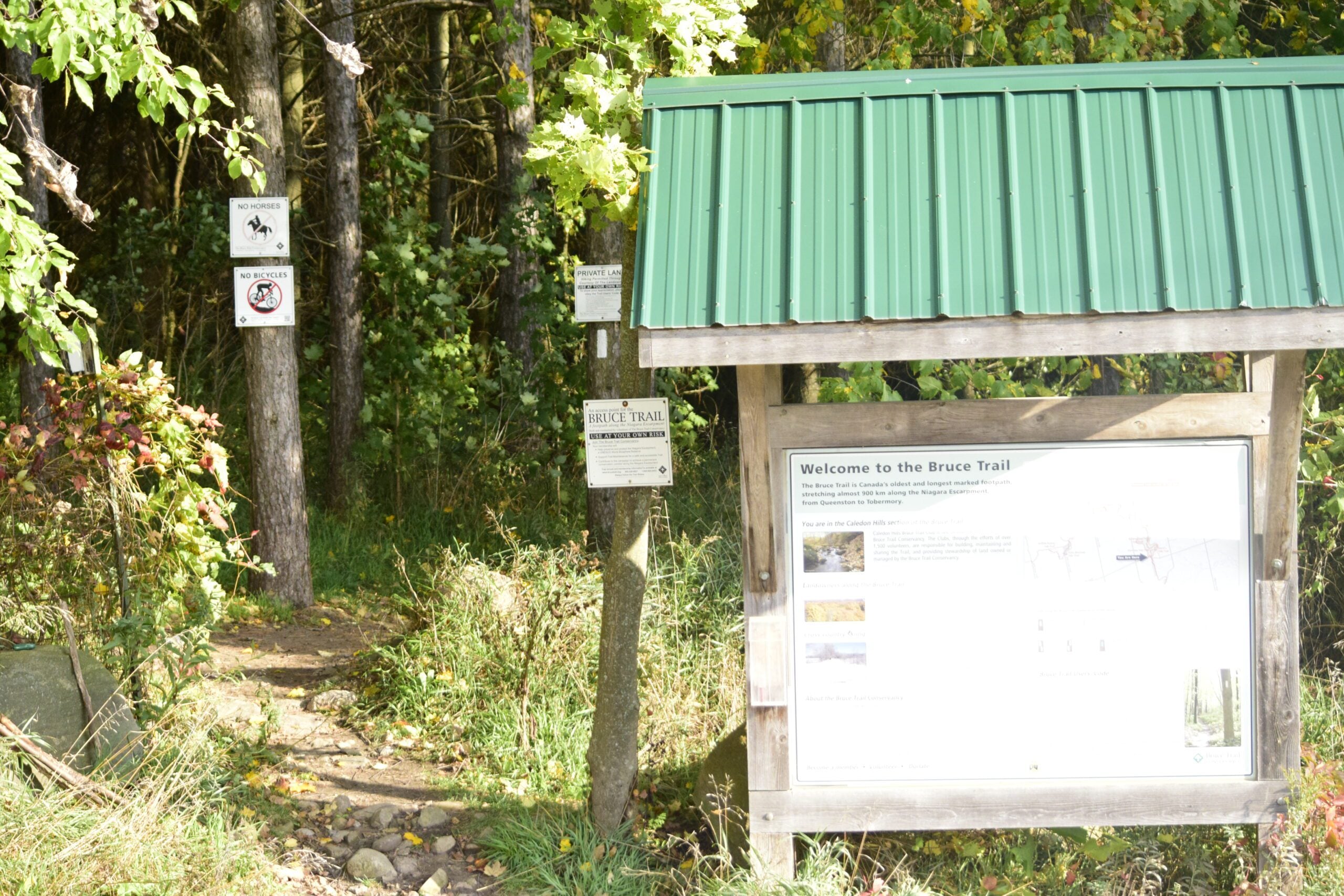
Location (Google Maps): Roadside parking southwest of km 48.4 at Boston Mills Rd. just west of the Mississauga Rd. intersection. 866 Boston Mills Rd., Terra Cotta, ON L7C 0L7, CanadaHike Leader(s): Dan Patterson Click here to contact Hike Leader(s)
Pace: Medium – 3 to 4 km/hour
Terrain: Strenuous – hilly with steep climbs and some poor footing
Distance: 18.34 kmDescription
Meet at Boston Mills Road west of Mississauga Road at 8:45 a.m.. We will shuttle to Willoughby Road at 9:00 a.m. This is an End-to-End hike series to complete the Caledon section of the Bruce Trail in 4 hikes. We will be hiking from the north end to the south end. Join for all or as many hikes as desired – you will need to register for each hike in the series which will take place on the following dates: May 17, 24, June 7, 21 Since this is a group hike, please consider your fitness level before registering. We will be walking at a pace of 3 km – 4 km per hour and hikers will need to keep up with the person in front of them for the duration of the hike. The hike series will also involve car shuttles and every hiker is expected to participate as drivers.Weather conditions can be variable, dressing in layers is recommended. Hiking boots are required and hiking poles are strongly recommended. Bring plenty of fluids, electrolytes and a snack. This section is challenging with many hills.
- 22June 22, 2026No events
- 23June 23, 2026
City View Park, Burlington, Map 9.
https://hikes.brucetrail.org/event/city-view-park-burlington-map-9-8/
Registration Required:
Click here to register for this hike (12 spots remaining)Hosting Club: Caledon Hills
Category: Tuesday Hikers
Location (Google Maps): City View Park South Lot, Burlington.
From Highway 403 going west, turn right on Brant Street, left on Dundas Street, left on Kerns Rd., take second turn left into City View Park to the parking lot.Hike Leader(s): Mohammad Shafiq Click here to contact Hike Leader(s)
Pace: Medium – 3 to 4 km/hour
Terrain: Moderate – some hills and/or some poor footing
Distance: 11 kmDescription
From City View Park will connect with main Bruce Trail and hike to Smokey Hollow waterfall, also hike Kings ST and/or Eric Best ST on the way. After snack break will trace back our steps and return to parking.
Bring water, snack for refreshment break at Smokey Hollow.
Dress for the weather, poles are recommended.
Optional refreshment stop after hike at Kopper Kettle in Waterdown. - 24June 24, 2026

Waterloo Region Wednesday Walks The Hydrocut
https://hikes.brucetrail.org/event/waterloo-region-wednesday-walks-the-hydrocut/
Registration Required:
Click here to register for this hike (11 spots remaining)Hosting Club: Caledon Hills
Category: General
Location (Google Maps): We will meet at the Walmart/Winners parking lot located in the Boardwalk area off of Glasgow Street.Hike Leader(s): Dan Patterson Click here to contact Hike Leader(s)
Pace: Medium – 3 to 4 km/hour
Terrain: Moderate – some hills and/or some poor footing
Distance: 13 kmDescription
Join the Waterloo Wednesday Walkers as we continue to explore Waterloo Region trails. Today is a special treat: The Petersburg Hydrocut. We will meet at the Walmart/Winners parking lot located in the Boardwalk area off of Glasgow Street. We will walk to the Glasgow Street Hydrocut Trailhead, then follow the actual hydrocut on the ultility vehicle road (warning: may be rough in places) where we will connect with the Synder’s Road part of the Hydrocut Mountain Biker complex. We will explore the complex on the main multi-use trail. (Please stay off the narrow side trails. These are reserved for bikers and hiking on them can be dangerous). Bring sturdy boots, snacks, lunch, insect repellent, electrolytes, an explorer’s curiousity and a “can-do” attitude. Poles may be helpful but not required. - 25June 25, 2026No events
- 26June 26, 2026No events
- 27June 27, 2026

Sydenham Graham Hill Road to Bluewater Park
https://hikes.brucetrail.org/event/sydenham-graham-hill-road-to-bluewater-park/
Registration Required:
Click here to register for this hike (6 spots remaining)Hosting Club: Caledon Hills
Category: End-to-End
Location (Google Maps): Meet at Bluewater Park, 502 George St., Wiarton, ON. We will shuttle to Graham’s Hill Rd 44.764911, -80.944925 and hike back.Hike Leader(s): Dan Patterson Click here to contact Hike Leader(s)
Pace: Medium – 3 to 4 km/hour
Terrain: Strenuous – hilly with steep climbs and some poor footing
Distance: 22.2 kmDescription
Experience Skinner’s Bluff, Big Bay and the walk to Bluewater Park on gorgeous Colpoy’s Bay. From our meeting point we will shuttle to Graham’s Hill Road and enjoy one of the most spectacular hikes on the Bruce! Bring sufficient water, lunch, snacks, bug repellent. Hiking poles may be helpful. Note: this section includes Colpoy’s Range Road which is often very wet. I will be wearing high rise boots.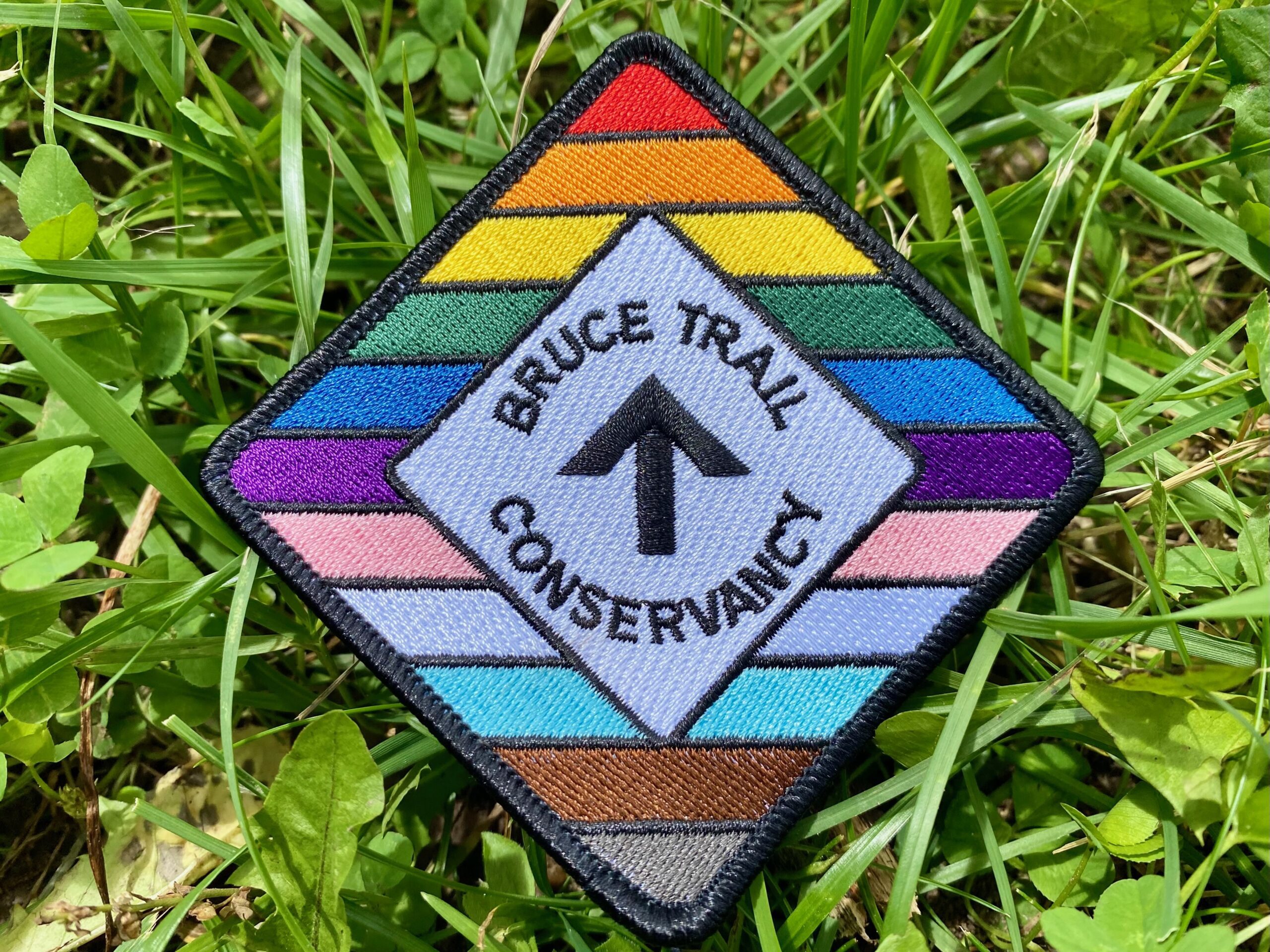
Celebrate Pride Together in Nature
https://hikes.brucetrail.org/event/celebrate-pride-together-in-nature/
Registration Required:
Click here to register for this hike (45 spots remaining)Hosting Club: Caledon Hills
Category: Nature Walks
Location (Google Maps): Bruce Trail parking Lot at Riverside Woods, 713377 1st Line EHS, Mono.
Driving directions:
From Hwy # 10 north of Orangeville, turn east on to Hockley Rd. Drive for 1.1 km. Continue straight onto Side Road 5 for 1.6 km. Turn left onto 1st Line EHS for 900 meters. Continue straight into the parking lot.***DO NOT TAKE 1ST LINE EHS SOUTH FROM HOCKLEY ROAD. It is not maintained. Google maps may suggest this impassable route
Hike Leader(s): Doris Harper Click here to contact Hike Leader(s)
Pace: Leisurely – 3 km/hour or less
Terrain: Moderate – some hills and/or some poor footing
Distance: 5 kmDescription
Celebrate Pride Together in Nature.This community hike will be a leisurely 5 km loop on a well maintained forested trail. Wear comfortable, sturdy shoes. bring sunscreen, bug spray, a picnic lunch and a beverage. Additional light refreshments will also be served.
Everyone will receive a Bruce Trail Conservancy Pride Badge.
This hiking event is a 2SLBGTQIA+ safe space. The CHBTC is committed to providing an inclusive and welcoming environment.
Everyone is invited to join.