Join us for a hike! Registration required:
All hikes available to BTC members. Some hikes are open to non-members.
TIP: The calendar view displays up to 7 hikes on a day, but often there are more. Click “More events” to see them all.
Hosting Club: Caledon Hills
Category: Tuesday Hikers
Location (Google Maps): Hilton Falls; meet at the parking lot off Campbellville Rd. From Hwy 401 go north on Rd. 25 (exit 320), west on 5 Sideroad which becomes Campbellville Rd. The entrance to Hilton Falls Conservation Area is on the right after Appleby Line. There is an entrance fee of $7 per person / $6 for seniors.
Hike Leader(s): Mohammad Shafiq 416-566-0503 Click here to contact Hike Leader(s)
Pace: Medium – 3 to 4 km/hour
Terrain: Moderate – some hills and/or some poor footing
Distance: 10 – 12 km loop
Description
A leisurely hike encompassing parts of Hilton Falls, Red Oak, Beaver Dam, and the Hilton Falls Side Trail.

Hosting Club: Caledon Hills
Category: Nature Walks
Location (Google Maps): Forks of the Credit Provincial Park off McLaren Road in Caledon. Parking fee.
Hike Leader(s): Gary Hall Click here to contact Hike Leader(s)
Pace: Leisurely – 3 km/hour or less
Terrain: Moderate – some hills and/or some poor footing
Distance: 6 km
Description
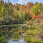
We’ll spend the morning photographing early fall colours in Forks of the Credit Provincial park. Bring your camera (SLR, Mirrorless, Point and Shoot, Cell Phone, etc.) and a small tripod if you have one.
Hosting Club: Caledon Hills
Category: General
Location (Google Maps): Parking lot at km 30.1 Map 22.
Hike Leader(s): Peter Leeney Click here to contact Hike Leader(s)
Pace: Medium – 3 to 4 km/hour
Terrain: Moderate – some hills and/or some poor footing
Distance: 12 km
Description
We will follow the Main Trail south then return on the Mad River Side Trail to our starting point. Leader’s cell phone 905-301-4091.
Hosting Club: Caledon Hills
Category: Tuesday Hikers
Location (Google Maps): Scotsdale Farm Parking lot. Take Hwy 401 west to Trafalgar Rd. (exit 328). Follow Trafalgar Road north to Hwy 7, turn left (West) on Hwy 7 and drive about 4 km to Trafalgar Road. Follow Trafalgar North about 2 km to Scotsdale Farm on the right side of the road.
Hike Leader(s): Tessa Shelvey Click here to contact Hike Leader(s)
Pace: Medium – 3 to 4 km/hour
Terrain: Moderate – some hills and/or some poor footing
Distance: 9 km
Description
Pretty loop hike incorporating a mixture of main and side trails. Some rocky footing.
Hosting Club: Caledon Hills
Category: Nature Walks
Location (Google Maps): Depart: 9:30 a.m. from roadside parking on 2nd Line Mono at entrance to Mono Cliffs Provincial Park.
Directions: Take Hwy 10 north to Dufferin Road 8, about 10 km north of Orangeville. Follow Road 8 to Mono Centre, then continue north on the 2nd Line to the end of the road. Please park on the east shoulder of the road.
Hike Leader(s): Hamish Duthie Click here to contact Hike Leader(s)
Pace: Leisurely – 3 km/hour or less
Terrain: Easy – mostly flat and usually good footing
Distance: 8 km
Description
A scenic photo hike around the loops of the Mono Cliffs Provincial Park, including McCarston`s Lake. We will have ample opportunity to photograph the fall colours, see a variety of forest types and geological features, and with excellent views from lookout points. Bring a camera and a tripod or monopod. Refreshments afterwards. Please register beforehand with Hamish so we can reschedule in case of inclement weather.
Hosting Club: Caledon Hills
Category: Introductory
Location (Google Maps): Km 44.3 Trail Guide Edition 29, Map 18
Airport Road, north of Highway 9, East on 5th Sideroad, approximately 0.5 km to parking area
Hike Leader(s): Louise Carberry Click here to contact Hike Leader(s)
Pace: Leisurely – 3 km/hour or less
Terrain: Easy – mostly flat and usually good footing
Distance: 6 km
Description
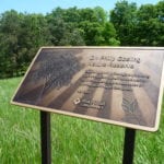
This hike will explore Hockleycrest Side Trail and Harmony Side Trail and the main trail north east of Airport Road and 5 Sideroad. In the winter, some of these trails are groomed for cross country skiing and snowshoeing. We will also pay a visit to the Dr. Philip Gosling Nature Reserve, which is located nearby.
Hosting Club: Caledon Hills
Category: Tuesday Hikers
Location (Google Maps): Meet at dead end of Innis Lake Rd. (km 33.2). From Airport Rd., go east on Finnerty Sideroad 1.5 km, then turn left onto Innis Lake Rd.
Hike Leader(s): Barbara Euler Click here to contact Hike Leader(s)
Pace: Medium – 3 to 4 km/hour
Terrain: Moderate – some hills and/or some poor footing
Distance: 16 km
Description
Celebrate fall on the Main Trail, a side trail and part of the Oak Ridges Trail. The leaves should be starting to turn. Some fairly challenging hills but worth it for the views. If you would like a shorter hike (a loop of approximately 10 km), you can meet us at 10:30 where the trail crosses Coolihan’s Sideroad (km 35.1)
Hosting Club: Caledon Hills
Category: Nature Walks
Location (Google Maps): Quarryside Nature Reserve at the north end of Chinguacousy Road north of Olde Base Line in Caledon.
Hike Leader(s): Gary Hall Click here to contact Hike Leader(s)
Pace: Leisurely – 3 km/hour or less
Terrain: Moderate – some hills and/or some poor footing
Description
We’ll spend the morning photographing the fall colours and interesting features of the Quarryside Nature Reserve. There is no groomed trail on the property. Bring your camera (SLR, Mirrorless, Point and Shoot or cell phone) as well as a small tripod if you have one.
Hosting Club: Caledon Hills
Category: Tuesday Hikers
Location (Google Maps): Trail Guide Edition 29, Map 18
Take Highway 10 or Airport Road north to Hockley Rd. The 3rd line is midway between these two main roads. Meet at the designated parking area on the 3rd Line about 2 km north of Hockley Road.
Hike Leader(s): Louise Carberry Click here to contact Hike Leader(s)
Pace: Leisurely – 3 km/hour or less
Terrain: Moderate – some hills and/or some poor footing
Distance: 10 km
Description
We will hike the Isabel East Side Trail, the Main Trail, The Cam Snell Side Trail and the Glen Cross Side Trail. The terrain is undulating and mostly hardwood forests with several streams flowing in the ravines.
Hosting Club: Caledon Hills
Category: Introductory
Location (Google Maps): Kelso Conservation parking lot is at NW corner of Steeles and Bell School Line.
Directions: Take Hwy 401 west toward Milton. Exit at Regional Rd. 25 South. Turn right (west) on Steeles Ave. Follow for 4 km to Bell School Line and paid parking lot on right.
Hike Leader(s): Peter Leeney, cell phone 905-301-4091 Click here to contact Hike Leader(s)
Pace: Leisurely – 3 km/hour or less
Terrain: Moderate – some hills and/or some poor footing
Distance: 9 km
Description
We will hike along the edge of the Escarpment in Kelso Conservation area. Fine views over the Escarpment.
Hosting Club: Caledon Hills
Category: General
Location (Google Maps): Hockley Road Parking Lot – located on the north side of Hockley Road. From Hwy 10 turn east onto Hockley Road/Dufferin County Road 7 and drive for approximately 5 kilometres to the parking lot.
Hike Leader(s): Sandy Green Click here to contact Hike Leader(s)
Pace: Brisk – 4 to 5 km/hour
Terrain: Strenuous – hilly with steep climbs and some poor footing
Distance: 20 km shuttle hike
Description
Hike Two of the “Discovery Badge Blitz Series” combines Caledon Hill’s Discovery Hikes 3 and 4, exploring Hockley Valley, including the Hockley Heights, Hemlock Ridge, Glacier Valley, and Griffith Ravine Side Trails. Bring your choice of hydration and snacks or lunch. Hiking boots are recommended. See Sunday November 17 for details pertaining to the final hike in the series. Join one or all. Hikers completing all three “Badge Blitz” hikes will receive their Discovery badge on the final hike. (The badge cost is $5.00.)
Hosting Club: Caledon Hills
Category: Tuesday Hikers
Location (Google Maps): Rattlesnake Point Conservation Area Parking lot, lower level. Entrance fee per person $7, seniors $6.
BT map 11.
Directions: From Hwy 401 exit 312, take Guelph Line (Rd. 1) north. Very soon, go right (east) on Campbellville Road 3.5 km, right (south) on Appleby Line 5.5 km, right into Rattlesnake Point Conservation Area.
Hike Leader(s): Bill McDonald Click here to contact Hike Leader(s)
Pace: Medium – 3 to 4 km/hour
Terrain: Moderate – some hills and/or some poor footing
Distance: 15 km loop
Description
From Rattlesnake Point we will hike the Rattlesnake Point Side Trail, the main trail and the Crawford Lake Side Trail to the Visitors’ Centre at Crawford Lake. We will have a rest/lunch stop here before looping back to Rattlesnake Point.
Afterwards: refreshment/pub stop.
There is no dropout point. No dogs please.