
Join us for a hike! Registration required:
All hikes available to BTC members. Some hikes are open to non-members.
TIP: The calendar view displays up to 7 hikes on a day, but often there are more. Click “More events” to see them all.
- 05September 5, 2026
Beaver Valley Geology Hikes Badge Series 2/8 Margaret Paull Side Trail
https://hikes.brucetrail.org/event/beaver-valley-geology-hikes-badge-series-2-8-margaret-paull-side-trail/
Registration Required:
Click here to register for this hike (14 spots remaining)Hosting Club: Blue Mountains
Category: Organized Hike
Location (Google Maps): Tim Horton’s, CollingwoodHike Leader(s): Annette Sandberg Click here to contact Hike Leader(s)
Pace: Leisurely – 3 km/hr. or less
Terrain: Easy – Mostly flat and usually good footing
Distance: 4.3 kmDescription
Flower ports are created by water that exploits cracks and eventually removes the material between the flowerpot and the main rock face. The water smooths and round the rock of the flowerpot. The flowerpots at Indian Brook were created several thousands of years ago when lake levels were significantly higher than they are today. Great Views of Georgian Bay and the Beaver Valley.
See Hike #1 – August 26 for series description - 12September 12, 2026
Six Pack Of Blue – Hike 3 of 6
https://hikes.brucetrail.org/event/six-pack-of-blue-hike-3-of-6/
Registration Required:
Click here to register for this hike (8 spots remaining)Hosting Club: Blue Mountains
Category: End-to-End
Location (Google Maps): Nottawasaga Bluffs parking lot – parking feeHike Leader(s): Rob Johnston Click here to contact Hike Leader(s)
Pace: Medium – 3 to 4 km/hr
Terrain: Moderate – Some hills and/or some poor footing
Distance: 10.1Description
Please join us for the Six Pack Of Blue! This is an End-to-End of the Blue Mountains section of the Bruce Trail completed in 6 hikes – see below for dates. You can do as many of the six hikes as you wish. Hike distances in this six-hike series range from 8 km to 14.6 km. This is Hike #3. The route is from Nottawasaga Bluffs Parking Lot to Conc 10 road crossing, covering approximately 10.1 km. The pace will be 3–4 km/hour, and all hikers must be able to maintain this speed. The terrain is hilly with uneven, rocky footing. Sturdy hiking footwear is required, and hiking poles are recommended. Please bring water and a snack. Due to limited parking at trailheads, this hike will involve a car shuttle. All hikers are expected to carpool and share the associated costs. Arrive at the meeting location by 8:15 a.m. The car shuttle will depart promptly at 8:30 a.m. Further details will be provided to registered hikers a few days before the hike.Please refer to each individual hike date as outlined below for specific details of that hike. Register for each hike you plan to attend.
The hikes are on the following dates:
20 June 2026
27 June 2026
12 Sept 2026
19 Sept 2026
26 Sept 2026
17 Oct 2026
- 13September 13, 2026
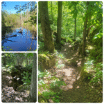
Grandparents Day Hike and Social
https://hikes.brucetrail.org/event/grandparents-day-hike-and-social/
Registration Required:
Click here to register for this hike (30 spots remaining)Hosting Club: Blue Mountains
Category: Organized Hike
Location (Google Maps): Petun Conservation Parking LotHike Leader(s): Claire Pearson Click here to contact Hike Leader(s)
Pace: Leisurely – 3 km/hr. or less
Terrain: Moderate – Some hills and/or some poor footing
Distance: 1.5 kmDescription
Calling all grandparents, parents, grandkids…Join us on Grandparents Day for a short hike and a social. Park at the Petun Conservation Parking Lot (paid parking). We will begin at the Georgian Triangle Anglers Association (GTAA) Clubhouse and complete a loop hike using the Black Ash Creek Side Trail and the Bruce Trail. Then we will return to the Clubhouse for some festivities. There is uneven ground so proper footwear is required. - 16September 16, 2026
Beaver Valley Geology Hikes Badge Series 3/8 Mill Creek Loop
https://hikes.brucetrail.org/event/beaver-valley-geology-hikes-badge-series-3-8-mill-creek-loop/
Registration Required:
Click here to register for this hike (14 spots remaining)Hosting Club: Blue Mountains
Category: Organized Hike
Location (Google Maps): Tim Horton’s, First Street, CollingwoodHike Leader(s): Annette Sandberg Click here to contact Hike Leader(s)
Pace: Medium – 3 to 4 km/hr
Terrain: Moderate – Some hills and/or some poor footing
Distance: 10.4Description
The Mill Creek Valley: “Castle Ramparts” at Stop 8 (Pages 63/64) The Manitoulin Dolostone layer of the Niagara Escarpment forms a steep edge along the valley of Mill Creek. Over time the thinly bedded rock breaks away from the cliff face and lies scattered along the slope. Many shell and horn coral fossils can be found in these flat, shingle-like rocks. Note that when leaves are fully out in the summer months the “castle ramparts” may be hard to see.
See Hike #1 – August 26 for series description - 19September 19, 2026
Six Pack Of Blue – Hike 4 of 6
https://hikes.brucetrail.org/event/six-pack-of-blue-hike-4-of-6/
Registration Required:
Click here to register for this hike (7 spots remaining)Hosting Club: Blue Mountains
Category: End-to-End
Location (Google Maps): Large parking lot behind Tim Hortons First Street CollingwoodHike Leader(s): Claire Pearson Click here to contact Hike Leader(s)
Pace: Medium – 3 to 4 km/hr
Terrain: Easy – Mostly flat and usually good footing, Moderate – Some hills and/or some poor footing
Distance: 10.8kmDescription
Please join us for the Six Pack of Blue—an end-to-end series covering the Blue Mountains section of the Bruce Trail over six hikes. You may participate in as many hikes as you wish; please register for each hike individually. The hike schedule is outlined below.
This is Hike #4. The route is from Conc 10 Crossing to Nottawasaga Lookout (Eagle Cres), covering approximately 10.8 km. The hiking pace will be 3–4 km/hour, and all participants must be able to maintain this pace and keep up with the group. The terrain is hilly with uneven, rocky footing. Proper hiking footwear is required, and hiking poles are recommended. Please bring water and a snack.
This series requires car shuttles, and all hikers are expected to participate as drivers. Please arrive at the meeting location by 8:15 a.m. The car shuttle will begin promptly at 8:30 a.m.
Further details will be provided to registered hikers a few days prior to the hike.
Hike dates:20 June 2026
27 June 2026
12 Sept 2026
19 Sept 2026
26 Sept 2026
17 Oct 2026Hike distances range from 8 km to 14.6 km.