
Join us for a hike! Registration required:
All hikes available to BTC members. Some hikes are open to non-members.
TIP: The calendar view displays up to 7 hikes on a day, but often there are more. Click “More events” to see them all.
- 23August 23, 2026No events
- 24August 24, 2026No events
- 25August 25, 2026No events
- 26August 26, 2026
Beaver Valley Geology Hikes Badge Series #1/8 Len Gertier Memorial Loree Forest
https://hikes.brucetrail.org/event/beaver-valley-geology-hikes-badge-series/This is a Multi-Day Hike
You are signing up for the following dates and times:
2026-08-26 at 08:15
2026-09-05 at 08:30
2026-09-16 at 08:30
2026-10-03 at 09:00
2026-10-14 at 09:00
2026-10-21 at 09:00
2026-11-07 at 09:00
2026-11-14 at 09:00
Registration Required:
Click here to register for this hike (14 spots remaining)Hosting Club: Blue Mountains
Category: Organized Hike
Location (Google Maps): Tim Horton’s First Street, CollingwoodHike Leader(s): Annette Sandberg Click here to contact Hike Leader(s)
Pace: Medium – 3 to 4 km/hr
Terrain: Moderate – Some hills and/or some poor footing
Distance: 7.1Description
This badge is earned by hiking each of 8 hikes outlined in Beth Gilhespy’s first Bruce Trail Geology book, Walking Through Time, and then submitting a log which includes the required photo taken during each of the hikes. This is a great opportunity to boost your knowledge of the geology of the Niagara Escarpment. Gather some hiking buddies and become rock hounds! When you register, it will sign you up for all 8 hikes but if you can’t make it, you can do any of the hikes on your own and still get the badge! It is not Club led required.Hike 1 August 26 – Len Gertier Memorial Loree Forest: Natural Arch at Stop 4 (page 43). Natural arches are created when water pounding against a cliff face exploits crack and crevices, gradually wearing the rock away. Natural arches can become flowerpots if erosion continues. Thousands of years ago, the level of the Great Lakes was significantly higher and lapped up against the promontory of Loree Forest.
For the additional 7 hikes, please go to the dates below for hike description.Hike 2 – Sept 5
Hike 3 – Sept 23
Hike 4 – Oct 3
Hike 5 – Oct 14
Hike 6 – Oct 21
Hike 7 – Nov 7
Hike 8 – Nov 14 - 27August 27, 2026No events
- 28August 28, 2026No events
- 29August 29, 2026
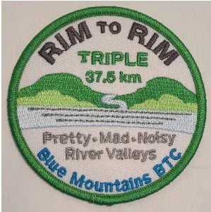
RIM 2 RIM Badge Hike #3 Noisy River (Third in a series of 3 for the Rim2Rim badge)
https://hikes.brucetrail.org/event/rim-2-rim-badge-hike-3-noisy-river-third-in-a-series-of-3-for-the-rim2rim-badge/
Registration Required:
Click here to register for this hike (13 spots remaining)Hosting Club: Blue Mountains
Category: Organized Hike
Location (Google Maps): Noisy River Provincial Park. Park along roadside SImcoe Country Road 9, Clearview, ON L0M 1G0. 6.1Km Map 21 Ed 31Hike Leader(s): Rob Johnston Click here to contact Hike Leader(s)
Pace: Medium – 3 to 4 km/hr
Terrain: Strenuous – Hilly with steep climbs and some poor footing
Distance: 10Description
This is the third of three the Rim-To-Rim hikes required for the Blue Mountain Rim-To-Rim badge. This hikes up and down the Noisy River valley. As such it is hilly and strenuous.About 9 km with almost 400 m elevation gain.
HIKERS MUST contact the hike leader if ON-LINE REGISTRATION has closed. NO morning sign-ins on this series as hikers will meet at trailhead. Park your car on the side of the road near the Noisy River Provincial Park sign [44.27499, -80.20731]. Proceed south on the white blazed trail crossing the Noisy River via the new bridge, for 1.5 km until you come to a small bench overlooking a pond. Turn around and head back to the car. Repeat this twice more for a total of three 3 km trips. Bring lots of water and lunch. Congratulations you’ve completed the NoisyTriple, a fitting end to the Rim 2 Rim Triple Run. Check the other two Rim-To-Rim hikes in the schedule on 8 July 2026 and 5 Aug 2026