
Join us for a hike! Registration required:
All hikes available to BTC members. Some hikes are open to non-members.
TIP: The calendar view displays up to 7 hikes on a day, but often there are more. Click “More events” to see them all.
- 05August 5, 2026
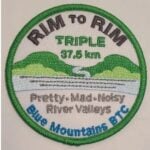
RIM 2 RIM Badge Hike #2 Mad River Rim (Second in a series of 3 for the Rim2Rim badge)
https://hikes.brucetrail.org/event/rim-2-rim-badge-hike-2-mad-river-rim-second-in-a-series-of-3-for-the-rim2rim-badge/
Registration Required:
Click here to register for this hike (7 spots remaining)Hosting Club: Blue Mountains
Category: Organized Hike
Location (Google Maps): Devil’s Glen Provincial Park, Simcoe County Rd 124, Glen Huron, ON L0M 1H0Hike Leader(s): Rob Johnston Click here to contact Hike Leader(s)
Pace: Medium – 3 to 4 km/hr
Terrain: Strenuous – Hilly with steep climbs and some poor footing
Distance: 10Description
This is the second of three the Rim-To-Rim hikes required for the Blue Mountain Rim-To-Rim badge. This hikes starts at the top of a river valley, hikes down and up the other side, then back again. As such these are very hilly and strenuous.About 12 km with almost 800 m elevation gain.
Meet at Devil’s Glen PP parking lot. We will hike south along the white blazed main Bruce Trail down through the Devil’s Glen area, cross the Mad River, then go up the other side to where the trail meets the blue blazed Mad River Side Trail. We will hike down along the sidetrail until it rejoins the main trail, then return to our cars again following the main trail. Bring lots of snacks, lunch and water. Check the other two Rim-To-Rim hikes in the schedule on 8 July 2026 and 29 Aug 2026
- 08August 8, 2026
Passport To Nature -- Lime Kiln Bluffs Yoga Hike!
https://hikes.brucetrail.org/event/passport-to-nature-pretty-river-yoga-hike/
Registration Required:
Click here to register for this hike (16 spots remaining)Hosting Club: Blue Mountains
Category: Organized Hike
Location (Google Maps): Tim Horton’s, First Street, CollingwoodHike Leader(s): Marise Tourigny; Rob Johnston Click here to contact Hike Leader(s)
Pace: Leisurely – 3 km/hr. or less
Terrain: Moderate – Some hills and/or some poor footing
Distance: 5kmDescription
The first of our club’s Passport To Nature series. Rescheduled from 18 July. Namaste! We will meet behind Tim’s on 1st Street in Collingwood. Please be there beforehand so we can leave promptly at 9AM. We will carpool to the Lime Kiln parking lot on County Rd 91. We will hike a moderate trail of 3km through beautiful hardwood forest, accompanied by a qualified Yoga instructor leading us in Yoga stretches and movements. Great views over Georgian Bay! This hike is has some rocky footing, so hiking boots or trail runners are recommended. Bring your yoga mat or equivalent. Bring water. - 20August 20, 2026
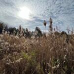
Hockley Valley Provincial Nature Reserve, Glen Cross/Cam Snell Loop Trails
https://hikes.brucetrail.org/event/hockley-valley-provincial-nature-reserve-glen-cross-cam-snell-loop-trails/
Registration Required:
Click here to register for this hike (10 spots remaining)Hosting Club: Blue Mountains
Category: Organized Hike
Location (Google Maps): The Glen Cross Side Trail parking lot on 3rd Line EHS, 1.1 km’s north of Hockley Rd.Hike Leader(s): Gordon Sheppard Click here to contact Hike Leader(s)
Pace: Leisurely – 3 km/hr. or less
Terrain: Moderate – Some hills and/or some poor footing
Distance: 7kmDescription
This hike is a bit further afield but is definitely worth the 1 hour drive to the trailhead. The Glen Cross and Cam Snell side trails are two loop trails located in the Hockley Valley Provincial Nature Reserve. The Reserve was established to protect one of the most unique geological areas along the entire Niagara Escarpment. Here the Escarpment and the western end of the Oak Ridges Moraine meet, creating one of Ontario’s most scenic and ecologically important landscapes. The Reserve is also in the Headwaters area where the two river branches that are the source of the Nottawasaga River join on their journey north. This area is unique in the way it combines glacial topography, mature forests, hydrology, and biodiversity. That combination makes it one of the Niagara Escarpment’s most ecologically valuable and rewarding places to explore.This will be a leisurely paced 2.5 hour hike to enjoy everything the area has to offer. There are some steep but short climbs and descents but footing is generally good. Although there could be some slippery areas if it’s been raining in which case hiking poles would be advised. Please make certain to bring water and snacks. For those that wish, we can organize an optional stop on the drive home at the Mono Centre Brewing Co. to slake our thirst.
- 22August 22, 2026
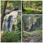
Inglis Falls and Moreston Heritage Village
https://hikes.brucetrail.org/event/inglis-falls-and-moreston-heritage-village/
Registration Required:
Click here to register for this hike (15 spots remaining)Hosting Club: Blue Mountains
Category: Organized Hike
Location (Google Maps): Tim Horton’s, First Street CollingwoodHike Leader(s): Claire Pearson Click here to contact Hike Leader(s)
Pace: Leisurely – 3 km/hr. or less
Terrain: Moderate – Some hills and/or some poor footing
Distance: ~4.5kmDescription
We will meet in the parking lot behind Tim Horton’s. From there we will carpool to Inglis Falls (just outside Owen Sound). It is paid parking ($10 + tax).We will hike a 4 km loop using the Bruce Trail, the Hub Trail, and Pine Loop Trail, taking a few sidetrail extensions to see the Sydenham River at various points and to check out some glacial potholes. When we have completed the loop, we will take in the majestic beauty of Inglis Falls (with lots of photo opportunities), eat the snack/lunch we have brought, and drive to Moreston Heritage Village.
From their website (Moreston Heritage Village), it states, “Moreston is a beautiful 10-acre living history site, home to more than a dozen historic buildings. Costumed interpreters and thousands of artefacts from our collection bring the Village to life, offering visitors a glimpse into Grey County life as it was. From the sight of a 19th century settler tending the garden beside her log cabin home, to the sound of a blacksmith hard at work in the forge – visitors to Moreston are immediately immersed in history.” We will spend ~1.5 hours here walking the grounds, seeing the demonstrations, and visiting the museum. The entry fee to the village for an adult is $12.50 + tax. (Bring your money on the day of the hike.)
- 26August 26, 2026
Beaver Valley Geology Hikes Badge Series #1/8 Len Gertier Memorial Loree Forest
https://hikes.brucetrail.org/event/beaver-valley-geology-hikes-badge-series/This is a Multi-Day Hike
You are signing up for the following dates and times:
2026-08-26 at 08:15
2026-09-05 at 08:30
2026-09-16 at 08:30
2026-10-03 at 09:00
2026-10-14 at 09:00
2026-10-21 at 09:00
2026-11-07 at 09:00
2026-11-14 at 09:00
Registration Required:
Click here to register for this hike (14 spots remaining)Hosting Club: Blue Mountains
Category: Organized Hike
Location (Google Maps): Tim Horton’s First Street, CollingwoodHike Leader(s): Annette Sandberg Click here to contact Hike Leader(s)
Pace: Medium – 3 to 4 km/hr
Terrain: Moderate – Some hills and/or some poor footing
Distance: 7.1Description
This badge is earned by hiking each of 8 hikes outlined in Beth Gilhespy’s first Bruce Trail Geology book, Walking Through Time, and then submitting a log which includes the required photo taken during each of the hikes. This is a great opportunity to boost your knowledge of the geology of the Niagara Escarpment. Gather some hiking buddies and become rock hounds! When you register, it will sign you up for all 8 hikes but if you can’t make it, you can do any of the hikes on your own and still get the badge! It is not Club led required.Hike 1 August 26 – Len Gertier Memorial Loree Forest: Natural Arch at Stop 4 (page 43). Natural arches are created when water pounding against a cliff face exploits crack and crevices, gradually wearing the rock away. Natural arches can become flowerpots if erosion continues. Thousands of years ago, the level of the Great Lakes was significantly higher and lapped up against the promontory of Loree Forest.
For the additional 7 hikes, please go to the dates below for hike description.Hike 2 – Sept 5
Hike 3 – Sept 23
Hike 4 – Oct 3
Hike 5 – Oct 14
Hike 6 – Oct 21
Hike 7 – Nov 7
Hike 8 – Nov 14