|
Sun | Mon | Tue | Wed | Thu | Fri | Sat |
|---|
April | April | April | April | April | 1 | 2 - Wandering amongst the Wildflowers
9:00 AM-12:00 PM 05/02/2026 https://hikes.brucetrail.org/event/wandering-amongst-the-wildflowers/2026-05-02/ Click here for more information or to register Hosting Club: Blue Mountains
Category: Organized Hike
Location (Google Maps): Tim Horton’s, First Street, Collingwood Hike Leader(s): Myra Campbell Click here to contact Hike Leader(s) Pace: Leisurely – 3 km/hr. or less
Terrain: Easy – Mostly flat and usually good footing
Distance: Approximately 4 km Description
We will meet at Tim Hortons on 1st St. in Collingwood & car pool to Nottawasaga Lookout Nature Reserve. We will have a leisurely hike to observe & identify spring ephemerals which are the first spring flowers to emerge. I am not a botanist or expert just a lover of nature & wildflowers. Come along & let’s see what we can find. Due to the nature of the hike this is best with a small group so registration is limited to 12.
|
3 | 4 | 5 | 6 - Signs of Spring
9:00 AM-11:30 AM 05/06/2026 https://hikes.brucetrail.org/event/signs-of-spring/2026-05-06/  Click here for more information or to register Hosting Club: Blue Mountains
Category: Organized Hike
Location (Google Maps): Tim Horton’s First Street, Collingwood Hike Leader(s): Claire Pearson Click here to contact Hike Leader(s) Pace: Leisurely – 3 km/hr. or less
Terrain: Moderate – Some hills and/or some poor footing
Distance: ~4km Description
**Update: As of May 4th, there are still icy sections in the keyhole area. Grippers are highly recommended. Hiking poles are helpful but not required. It is paid parking in the lots, so please bring $4 to help compensate the driver. Enjoy a crisp morning exploring for “Signs of Spring” along the trail. We meet at 8:45am in the large parking lot behind Tim Horton’s on First Street. At 9am, we will carpool to the parking lot on 15/16 Sideroad in Singhampton where we will begin our loop hike of the Nottawasaga Bluffs. We will take in the sites at the Lookout and navigate the crevices to get to the Keyhole.
| 7 | 8 | 9 - Craigleith Community Centre
9:00 AM 05/09/2026 https://hikes.brucetrail.org/event/craigleith-community-centre-4/2026-05-09/ Click here for more information or to register Hosting Club: Blue Mountains
Category: Organized Hike
Location (Google Maps): Tim Hortons, First Street, Collingwood Hike Leader(s): David Little Click here to contact Hike Leader(s) Pace: Leisurely – 3 km/hr. or less
Terrain: Easy – Mostly flat and usually good footing
Distance: 5 km Description
We will follow the Georgian Trail past former Railway Station to the Nippising Ridge Trail and return. This is an easy hike with lots of opportunities to recall the history of Craigleith.
|
10 - Sydenham
8:30 AM-2:30 PM 05/10/2026 https://hikes.brucetrail.org/event/sydenham/2026-05-10/ 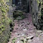 Click here for more information or to register Hosting Club: Caledon Hills, Blue Mountains
Category: General
Location (Google Maps): Meet at Irish Block Line parking north of HWY 26. We will shuttle to Pioneer Tower, HWY 6 at Owen Sound and hike back. Hike Leader(s): Dan Patterson Click here to contact Hike Leader(s) Pace: Medium – 3 to 4 km/hour
Terrain: Moderate – some hills and/or some poor footing
Distance: 18.9 km Description
Sydenham has many hidden gems. This section features amazing crevices. Come prepared for an adventure! Bring sufficient water, lunch, snacks, bug repellent and a smile! We will meet at Irish Block Line and shuttle to Pioneer Tower on HWY 6 at Owen Sound. This is the first of 3 Sydenham Section hikes I am leading. If you are working on the Sydenham section these hikes may help you. I can also provide a plan for the rest of the section. The other hikes are Saturday June 13 and Saturdy June 27. These cover the last 2 stages into Wiarton.
| 11 | 12 | 13 - Wasaga Beach Spring hike
10:00 AM-12:30 PM 05/13/2026 https://hikes.brucetrail.org/event/wasaga-beach-spring-hike/2026-05-13/ Click here for more information or to register Hosting Club: Blue Mountains
Category: Organized Hike
Location (Google Maps): Veterans Drive, Wasaga Beach (see hike description) Hike Leader(s): Arie van Walraven Click here to contact Hike Leader(s) Pace: Medium – 3 to 4 km/hr
Terrain: Moderate – Some hills and/or some poor footing
Distance: 8 km Description
Please join me for a leisure hike through Wasaga Beach Provincial Park. We will meet at the roadside parking on Veterans Way, about 1.4 km south of River Road West. By this time, we will have plenty of leaves and flowers. We will stay on the flat areas as much as possible. This can be modified, depending on the crew. There will be no mud.
| 14 | 15 | 16  Car Hike: Blue Mountains E2E #1/4 Car Hike: Blue Mountains E2E #1/4 8:00 AM-3:30 PM 05/16/2026 https://hikes.brucetrail.org/event/car-hike-blue-mountains-e2e-1-4/2026-05-16/ Click here for more information or to register Hosting Club: Toronto, Blue Mountains
Category: Car Hike
Location (Google Maps): Meet up roadside parking on Mulmur-Nottawasaga Townline, 550 meters east of Lavender Hill Rd in front of the cemetery. GPS N44.268777, W80.156810. Hike Leader(s): Ross Estrella Click here to contact Hike Leader(s) Pace: Brisk (4-5 km/hr), Moderate (3-4 km/hr)
Terrain: Challenging, Hilly, Level 2 (Intermediate – some hills and uneven surfaces, rocks and roots underfoot), Rocky
Distance (km): 22km Description
Day 1/4 of BMBTC E2E. Hikers must complete the entire Blue Mountain section to earn and receive their badge upon completion. Missed segment/s must be made up prior to the completion of the last segment to receive your badge. Hikers who are completing their missed section of BMBTC are welcome to join. This segment will pass thru the Noisy River Provincial Nature Reserve and Nottawasaga Bluffs Conservation Area. Expect some challenging rolling hills, rocks and underfoot trail but you’ll be rewarded with stunning beauty of the surrounding landscape. We’ll be on a moderate to brisk pace. Day hike essentials to bring; lunch/snacks, sufficient liquid hydration of your choice, sun screen, bug spray, head covering for sun protection and dress appropriately for the forecasted weather. As we are in the middle of spring season some section could be muddy/slippery therefore, hiking poles, waterproof hiking shoe and gaiter are strongly recommended. Fifteen minutes early arrival is expected and please make sure your car ready for shuttling. We’ll shuttle to small parking area off 15/16 Sideroad accessible only from Con 10 South. GPS N44.342784, W80.210628 Cost of badge is ten dollars for BTC members and fifteen dollars for non members.
- Birding Hike #1
9:00 AM-1:00 PM 05/16/2026 https://hikes.brucetrail.org/event/birding-hike-1/2026-05-16/ Click here for more information or to register Hosting Club: Blue Mountains
Category: Organized Hike
Location (Google Maps): We will meet at Tim’s and carpool to parking on 9/10 Sideroad Nottawasaga south of Nottawasaga Bluffs CA. Hike Leader(s): Jim Lewis Click here to contact Hike Leader(s) Pace: Leisurely – 3 km/hr. or less
Terrain: Moderate – Some hills and/or some poor footing
Distance: 5km Description
Please join us for this birding hike, led by birding enthusiasts Dick Edwards and Jim Lewis. We will meet at Tim’s on 1st Street in Collingwood and carpool to Conc 10 Nottawasaga and follow the trail east past a beautiful meadow where Bobolinks nest. We will look for singing males defending their territories. There is a mix of hardwoods, cedars, and a sparkling stream that should provide more birds and spring wildflowers. We will loop back to our cars having completed about a 5 km hike. Bring your binoculars!
Spaces will be limited to 15 hikers, so please register in advance.
|
17 - Car Hike: Blue Mountains E2E #2/4
8:00 AM-3:00 PM 05/17/2026 https://hikes.brucetrail.org/event/car-hike-blue-mountains-e2e-2-4/2026-05-17/ Click here for more information or to register Hosting Club: Toronto, Blue Mountains
Category: Car Hike
Location (Google Maps): Meet up location. Parking area off 15/16 Sideroad accessible only from Con 10 South. GPS N44.342784, W80.210628 Hike Leader(s): Ross Estrella Click here to contact Hike Leader(s) Pace: Brisk (4-5 km/hr), Moderate (3-4 km/hr)
Terrain: Challenging, Hilly, Level 2 (Intermediate – some hills and uneven surfaces, rocks and roots underfoot), Rocky
Distance (km): 15.5km Description
Day 2/4 of BMBTC E2E. Hikers must complete the entire Blue Mountain section to earn and receive their badge upon completion. Missed segment/s must be made up prior to the completion of the last segment to receive your badge. Hikers who are completing their missed section of BMBTC are welcome to join. This segment will pass thru Devil’s Glen Provincial Park. Expect some challenging rolling hills, rocks and underfoot trail but you’ll be rewarded with stunning beauty of the surrounding landscape. We’ll be on a moderate to brisk pace. Day hike essentials to bring; lunch/snacks, sufficient liquid hydration of your choice, sun screen, bug spray, head covering for sun protection and dress appropriately for the forecasted weather. As we are in the middle of spring season some section could be muddy/slippery therefore, hiking poles, waterproof hiking shoe and gaiter are strongly recommended. Fifteen minutes early arrival is expected and please make sure your car ready for shuttling. We’ll shuttle to parking area on the North side of County Rd 91, 850 meters west of Concession 10. GPS N44.388871, W80.236727 Cost of badge is Ten dollars for BTC members and Fifteen dollars for non members.
- Fitness hike in the Pretty River Valley Provincial Park (spring flowers and gorgeous lookouts long hike)
10:30 AM-4:30 PM 05/17/2026 https://hikes.brucetrail.org/event/fitness-hike-in-the-pretty-river-valley-provincial-park-spring-flowers-and-gorgeous-lookouts-long-hike/2026-05-17/ Click here for more information or to register Hosting Club: Toronto, Blue Mountains
Category: Car Hike
Location (Google Maps): Pretty River Valley Provincial Park and Petun Conservation Area Hike Leader(s): Natalia Svechnikova Click here to contact Hike Leader(s) Pace: Moderate (3-4 km/hr)
Terrain: Level 3 (Advanced – steep hills and some scrambling over boulders)
Distance (km): about 17 km Description
Please join me for an enjoyable spring flowers hike on the Bruce Trail (main and side trails) in the Pretty River River Provincial Park and the Petun Conservation Area. We will be following a relatevily challenging loop of ca 17 km from the south of the park (the Pretty River Road) moving up north to the north-west following the Bruce Trail main and side trails into the Petun Conservation area and down south passing many gorgeaus lookouts. Please note that this is a long hike and a relatively long day trip if you are coming from the GTA. We will try to keep a moderate pace of about 3 km/h while slowing down uphill. The trail is challenging with a few uphill sections after which we will stop for short water breaks. There will be a lunch break for about 20 min. We should be back to the parking lot around 4:30 pm. Please be dressed for the weather, wear hiking shoes/boots, bring extra layers and pack your rain gear (just in case), at least 2 L of water, light lunch and snacks, your sunglasses and/or hut. We will meet on the dedicated Pretty River PP parking lot on the Pretty River Road (exact map location 44.43147754685496, -80.27512513140113) around 10:30 am and start hiking at 10:40 am. Please note that this hike is not suitable for a rainy/stormy day and will be cancelled in case of inclement weather.
| 18 - Car Hike: Blue Mountains E2E #3/4
8:00 AM-3:00 PM 05/18/2026 https://hikes.brucetrail.org/event/car-hike-blue-mountains-e2e-3-4/2026-05-18/ Click here for more information or to register Hosting Club: Toronto, Blue Mountains
Category: Car Hike
Location (Google Maps): Meet up location. roadside parking along the north side of Maple Lane. Parking is prohibited on the south side of the road. Do not block driveways. GPS N44.504973, W80.331780 Hike Leader(s): Ross Estrella Click here to contact Hike Leader(s) Pace: Brisk (4-5 km/hr), Moderate (3-4 km/hr)
Terrain: Challenging, Hilly, Level 2 (Intermediate – some hills and uneven surfaces, rocks and roots underfoot), Rocky
Distance (km): 12.0km Description
Day 3/4 of BMBTC E2E. Hikers must complete the entire Blue Mountain section to earn and receive their badge upon completion. Missed segment/s must be made up prior to the completion of the last segment to receive your badge. Hikers who are completing their missed section of BMBTC are welcome to join. This segment will pass thru Petun Conservation Area and Blue Mountain corridor. Expect some challenging rolling hills, rocks and underfoot trail but you’ll be rewarded with stunning beauty of the surrounding landscape. We’ll be on a moderate to brisk pace. Day hike essentials to bring; lunch/snacks, sufficient liquid hydration of your choice, sun screen, bug spray, head covering for sun protection and dress appropriately for the forecasted weather. As we are in the middle of spring season some section could be muddy/slippery therefore, hiking poles, waterproof hiking shoe and gaiter are strongly recommended. Fifteen minutes early arrival is expected and please make sure your car ready for shuttling. We’ll shuttle to parking area on the east side of 2nd Line, 320 meters north of km 55.7. GPS N44.449741, W80.307524 Cost of badge is Ten dollars for BTC members and Fifteen dollars for non members.
| 19 | 20 - Birding Hike with David Turner
9:00 AM-1:00 PM 05/20/2026 https://hikes.brucetrail.org/event/birding-hike-with-david-turner/2026-05-20/ Click here for more information or to register Hosting Club: Blue Mountains
Category: Organized Hike
Location (Google Maps): We will meet at Tim’s and carpool to parking on 9/10 Sideroad Nottawasaga south of Nottawasaga Bluffs CA. Hike Leader(s): Jim Lewis Click here to contact Hike Leader(s) Pace: Leisurely – 3 km/hr. or less
Terrain: Moderate – Some hills and/or some poor footing
Distance: 5km Description
Please join us for this birding hike, led by birding expert David Turner. David started birding as a youth in his home town in England, where he was born. He has been actively studying the birds in the Beaver Valley for over 15 years and has spotted over 230 species of the known 240 species. David started the Beaver Valley Birding Club, to bring together birding enthusiasts. It has over 770 members and is still growing. It will be a treat and very educational to spend some time with David as he shares his expertise. We will meet at Tim’s on 1st Street in Collingwood and carpool to Conc 10 Nottawasaga and follow the trail east past a beautiful meadow where Bobolinks nest. We will look for singing males defending their territories. There is a mix of hardwoods, cedars, and a sparkling stream that should provide more birds and spring wildflowers. We will loop back to our cars having completed about a 5 km hike. Bring your binoculars!
Spaces will be limited to 15 hikers, so please register in advance.
| 21 | 22 | 23  Blue Mountains Annual End to End-TWO DAY EVENT. Blue Mountains Annual End to End-TWO DAY EVENT. 6:30 AM-6:30 PM 05/23/2026 https://hikes.brucetrail.org/event/blue-mountains-annual-end-to-end-two-day-event-3/2026-05-23/ This is a Multi-Day HikeYou are signing up for the following dates and times:
2026-05-23 at 06:30
2026-05-24 at 06:30 Click here for more information or to register Hosting Club: Blue Mountains
Category: End-to-End
Location (Google Maps): Meet/park at Highlands Nordic Duntroon Ontario Hike Leader(s): Paul Swindall Click here to contact Hike Leader(s) Pace: Brisk – 4 to 5 km/hr, Medium – 3 to 4 km/hr
Terrain: Moderate – Some hills and/or some poor footing
Distance: 69 km -Day 1: 37km Day 2: 32km Description
Join us this spring for the Blue Mountains Bruce Trail Club annual End-to-End hike event. This 2 Day Hike is for those hikers keen on a great big challenge You will wind your way through the beautiful and varied terrain of the Blue Mountains Club trails. Enjoy the early signs of nature awakening at this time of the year, the beautiful vistas and the rugged escarpment. You will cover the 69 km distance of our section which runs from Lavender to Swiss Meadows. Checkpoint stations will be offered approximately every 10 kms offering snacks, water refill and assistance along the way. A BBQ at Highlands Nordic is included at the end of Saturday Hike commencing at 1:00 pm. Hike details will be emailed to participants shortly after registration is received. Note, this event consists of longer distances and is generally not suitable for beginning hikers. REGISTRATION FOR NON-MEMBERS WILL OPEN 10 MARCH 2026
- Blue Mountains THREE DAY End to End – THREE DAY EVENT
7:00 AM-6:30 PM 05/23/2026 https://hikes.brucetrail.org/event/blue-mountains-three-day-end-to-end-three-day-event-3/2026-05-23/ This is a Multi-Day HikeYou are signing up for the following dates and times:
2026-05-23 at 07:00
2026-05-24 at 07:00
2026-05-25 at 07:00 Click here for more information or to register Hosting Club: Blue Mountains
Category: End-to-End
Location (Google Maps): Day 1 Parking/Meeting location is at Nottawasaga Bluffs Conservation Area. Day 2 & 3 parking will be near Pretty River Valley Provincial Park. Details will follow after registration Hike Leader(s): Robert Johnston Click here to contact Hike Leader(s) Pace: Brisk – 4 to 5 km/hr
Terrain: Moderate – Some hills and/or some poor footing
Distance: 67 km Description
Join us this spring for the Blue Mountains Bruce Trail Club THREE DAY End-to-End hike event. This 3 Day hike is for those hikers wanting to complete our section over three days. Approximate Daily Hike Lengths: Day 1–22Km, Day 2–20Km, Day 3–25Km. You will wind your way through the beautiful and varied terrain of the Blue Mountains Club trails. Enjoy the early signs of nature awakening at this time of the year, the beautiful vistas and the rugged escarpment. You will cover the 67 km distance of our section which runs from Lavender to Swiss Meadows. Checkpoint stations will be offered approximately every 10 kms with snacks, water refill and assistance. A BBQ is included on the Saturday at the end of the hike day, at Highlands Nordic, and will commence at 1:00 pm. Details will be emailed to participants shortly after registration is received. Note, this event consists of longer distances and is generally not suitable for beginning hikers. REGISTRATION FOR NON-MEMBERS WILL OPEN 10 MARCH 2026
- Blue Mountains Annual End to End-BBQ Only
1:00 PM-5:00 PM 05/23/2026 https://hikes.brucetrail.org/event/blue-mountains-annual-end-to-end-bbq-only-2/2026-05-23/ Click here for more information or to register Hosting Club: Blue Mountains
Category: Organized Hike
Location (Google Maps): Hike Leader(s): Robert Johnston Click here to contact Hike Leader(s) Pace: Leisurely – 3 km/hr. or less
Terrain: Easy – Mostly flat and usually good footing
Distance: 0 Description
We’re firing up the Grill with hot dogs and hamburgers! Blue Mountain Club Members and friends are invited to join in at the E2E BBQ. Come on out to socialize and welcome our hikers in after their first day. Please note if you are registered for either the 2 Day or 3 Day E2E your BBQ is included. No need to register and pay for this. If you are a Volunteer for this event your BBQ cost FREE. No need to register and pay for this. There is no badge for this event other than the coveted mustard and ketchup stain! Registration will be open until Friday, May 22.
BBQ will be held Saturday 24 May 1 pm to 5 pm at Highlands Nordic
|
24 | 25 | 26 | 27 | 28 | 29 | 30 - Blue Mountains E2E #4/4
8:00 AM-3:30 PM 05/30/2026 https://hikes.brucetrail.org/event/car-hike-blue-mountains-e2e-4-4/2026-05-30/ Click here for more information or to register Hosting Club: Toronto, Blue Mountains
Category: Car Hike
Location (Google Maps): Meet up location. 320 meters north of km 55.7 a small parking area on the east side of 2nd Line. GPS N44.449741, W80.307524 Hike Leader(s): Ross Estrella Click here to contact Hike Leader(s) Pace: Brisk (4-5 km/hr), Moderate (3-4 km/hr)
Terrain: Challenging, Hilly, Level 2 (Intermediate – some hills and uneven surfaces, rocks and roots underfoot), Level 3 (Advanced – steep hills and some scrambling over boulders), Rocky
Distance (km): 18.5km Description
Day 3/4 of BMBTC E2E. Hikers must complete the entire Blue Mountain section to earn and receive their badge upon completion. Missed segment/s must be made up prior to the completion of the last segment to receive your badge. Hikers who are completing their missed section of BMBTC are welcome to join. This segment will pass thru Pretty River Valley Provincial Park and we’ll take the side trail to the Bruce Trail Highest Point. Expect some challenging rolling hills, rocks and underfoot trail but you’ll be rewarded with stunning beauty of the surrounding landscape. We’ll be on a moderate to brisk pace. Day hike essentials to bring; lunch/snacks, sufficient liquid hydration of your choice, sun screen, bug spray, head covering for sun protection and dress appropriately for the forecasted weather. As we are in the middle of spring season some section could be muddy/slippery therefore, hiking poles, waterproof hiking shoe and gaiter are strongly recommended. Fifteen minutes early arrival is expected and please make sure your car ready for shuttling. We’ll shuttle to parking area on the north side of County Rd 91, 850 meters west of Concession 10. GPS N44.388871, W80.236727. Cost of badge is Ten dollars for BTC members and Fifteen dollars for non members.
- Birding Hike #3
9:00 AM-1:00 PM 05/30/2026 https://hikes.brucetrail.org/event/birding-hike-2/2026-05-30/ Click here for more information or to register Hosting Club: Blue Mountains
Category: Organized Hike
Location (Google Maps): We will meet at Tim’s and carpool to parking on 9/10 Sideroad Nottawasaga south of Nottawasaga Bluffs CA. Hike Leader(s): Jim Lewis Click here to contact Hike Leader(s) Pace: Leisurely – 3 km/hr. or less
Terrain: Moderate – Some hills and/or some poor footing
Distance: 5km Description
Please join us for this birding hike, led by birding enthusiast Kate Jaczko. We will meet at Tim’s on 1st Street in Collingwood and carpool to Conc 10 Nottawasaga and follow the trail east past a beautiful meadow where Bobolinks nest. We will look for singing males defending their territories. There is a mix of hardwoods, cedars, and a sparkling stream that should provide more birds and spring wildflowers. We will loop back to our cars having completed about a 5 km hike. Bring Your binoculars!
Spaces will be limited to 15 hikers, so please register in advance.
|
31 | June | June | June | June | June | June |
